Google Earth Tour Flights Updated · · PAGE 394.
June 14, 2015: The changes to this web site
this week are all about Google Earth Flight Tours. I discovered 3D images on Google
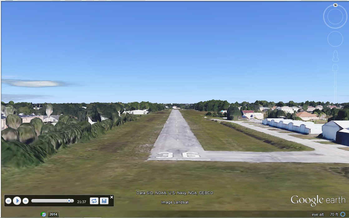
Earth are visible only with the latest GPS files. I figured out that my 2013 flight
needed the dates in the GPS file set to 2015 for the 3D trees and hangars to show up at
the Rockledge Airport as seen here.
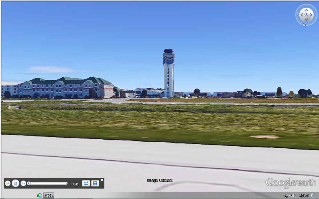
I did the same thing to the Jerrie Mock GPS file for the Columbus to Bermuda
flight and the Bermuda to Santa Maria segment. This date change on segment 01 made a
difference in the 3D objects at the Columbus Airport during the departure. Here is
the control tower with "even lighting" while the Sun option is OFF. This
setting will not black out the ocean in an overnight flight.
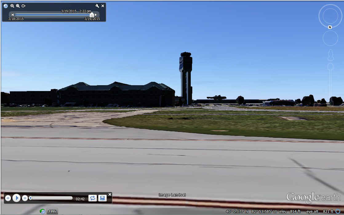
Turn on the Sun option and shadows have extreme contrast on the north side of
the tower and the airport hotel when you compare the image below versus the details that
are seen clearly in the image above.
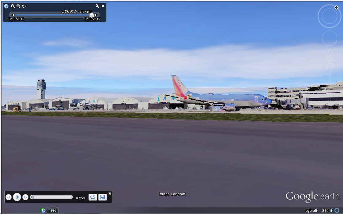
Here is the ramp on the south side of the terminal with the Sun option turned
ON. The cloud patterns are from real-time weather downloads while running Google
Earth. They change with time and location as you make these flights.
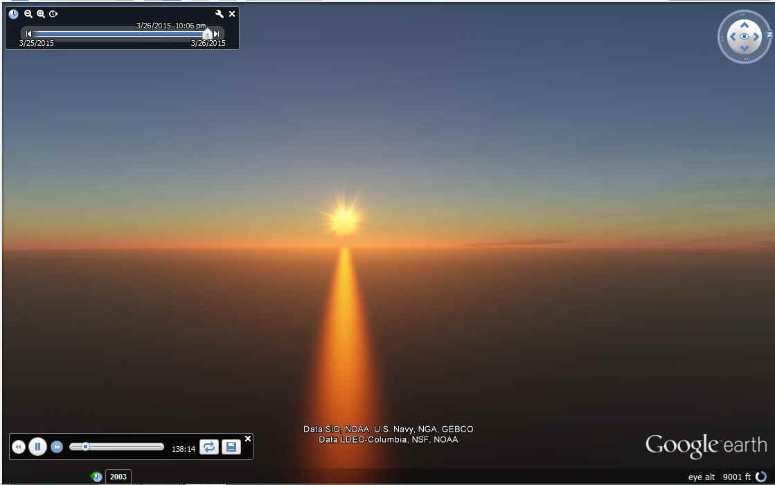
With the SUN option setup and Photorealistic option running, the sunset and
night scenes are great. Here is a look behind the airplane at sunset as seen 2 hours
18 minutes out of Bermuda on the way to Santa Maria.
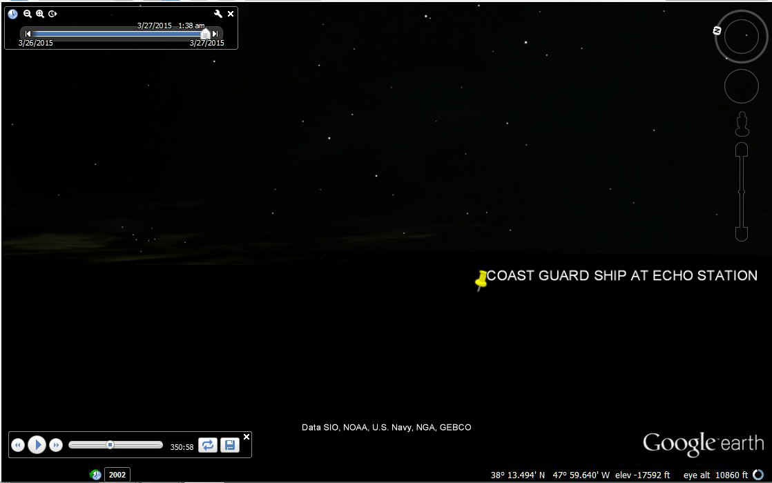
The next 1964 waypoint for communications heading EAST is with the US Coast Guard ship at ECHO Station located near 38 degrees north latitude and 48 degrees west longitude. With the coming of jet airliners, the Coast Guard no longer needed these mid-Atlantic and mid-pacific radio beacon ships and rescue service if needed. I found an old video on You Tube showing a crippled propeller airliner ditching next to one of these ships in the middle of the ocean in the 1950's. Everyone on the airplane survived.
Jerrie mentioned a cloud layer below that eventually forced her up to 11,000
MSL. She was picking up ICE at 9,000 feet MSL. The stars shined bright on top
of the clouds down below. The clouds and stars below have better visibility on LCD
computer monitors if you stand up and look down at the screen. The horizon of the
ocean is shown by the lack of stars on the bottom half of the screen. Now you know
why I urged you to use 89 degrees for the camera angle in the Google Earth options.
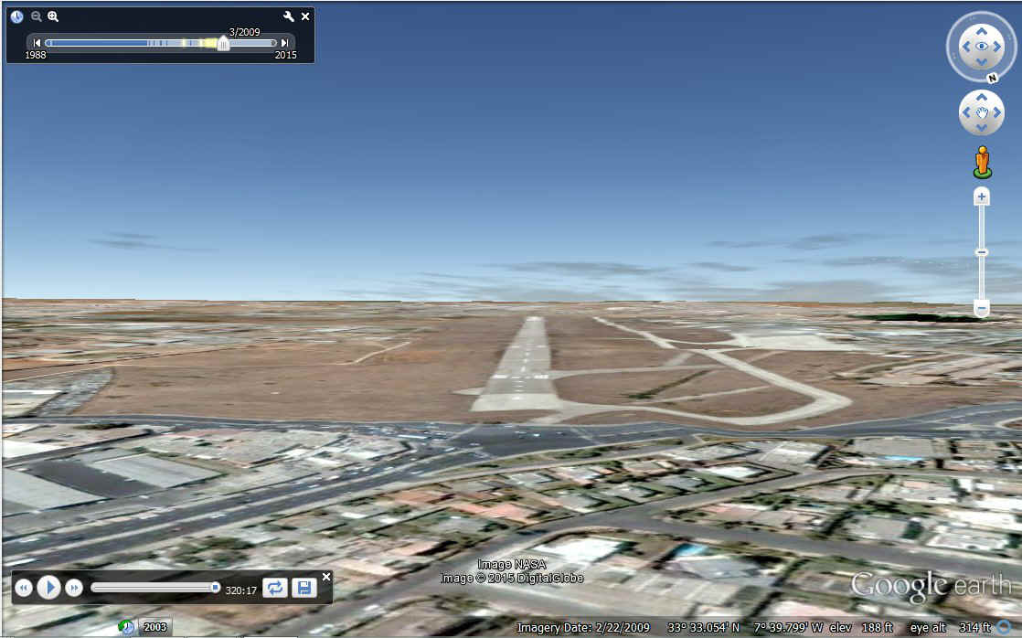
The Santa Maria to Casablanca flight needs an older scenery file active on
Google Earth or the old Anfa Airport will not be there when you complete the flight.
Since the Atlantic Ocean has not changed lately, you won't see anything else out of
place on this flight segment. You can also see the ground elevation errors in this
image along the taxiways. This airport was an old US Air Force Base.
My business trip to California was cancelled for this week. As I write this page, I was supposed to be on a Delta Airlines flight to Sacramento. It is now a typical Sunday with web site updates and the usual weekend chores. I published these pages over an hour ago and found some needed changes and some old typo errors that have been corrected. Please send me an email if you find anything that appears to be wrong. Send email to jerry @ n2prise.org with your suggestions. Removing the spaces on each side of the @ symbol will give the real email address for me.
June 19, 2015: I have updated the Jerrie Mock GPS file for Google Earth with an update to her Casablanca to Bone flight page. New screen capture images were added to that page. I feel I have told her story via what can be seen using Google Earth. I will be creating more GPS files to follow her across Africa to Saudi Arabia in the weeks ahead. This will be long project before she makes it across Asia, the Pacific, and back to Ohio in my Google Earth episodes. I am not doing any flying in the real world right now, so this project gives me some satisfaction. One of the new GPS log files is for a takeoff from the Casablanca Airport. The image above shows her arrival from Santa Maria.
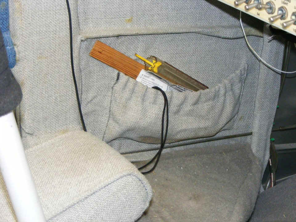
June 27, 2015: This
Saturday saw some simple maintenance to the interior of my airplane. The little side
pockets ahead of the seats needed the contact cement restored after 10 years. These
pockets have elastic that keeps items inside. That elastic pulls on the top corners of the
fabric that is glued to the inside of the fuselage skin. The center part of that
fabric was still very secure. Now all of the fabric is secured as it was 10 years
ago. The pocket on the passenger side has a box of Band-Aids of several sizes.
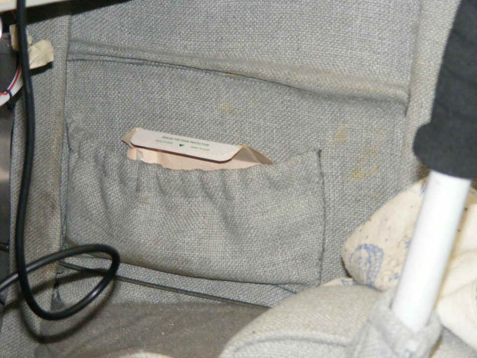
The pocket on the pilot side has the calibrated wooden fuel dipstick, a fuel
sight glass tester, and the rudder gust locks complete with red ribbon to hang down under
the tail when they are installed. I also have a small flashlight in there with
colored night filters. The black string is the lanyard to the light. The
rudder cables are below the pockets on both sides.
July 5: 2015: I have uploaded version FIVE of the Jerrie Mock "GPS" files for use with the Google Earth desktop program. All flights are loaded and have been improved for duration and a few bumps here and there ALL the way to New Delhi, India. There is much to see for those of you with the right stuff to take the flights. Be sure to USE the on-screen COMPASS feature to look around all her flight path. Using the manual controls to get down close to the ground along her flight path will show you some interesting sights as I have done when I created the 15 pages about her trip around the world. When you have finished your close examinations, push the PLAY button on the tour slider bar and the flight will resume right where you left to explore on your own.
Still ahead for Jerrie Mock Google Earth tour flights: Delhi to Calcutta, India is her first domestic flight without the need for customs clearance. Calcutta to Bangkok will be followed by an very long day / night flight from Bangkok to Manila with an overflight of South Viet Nam in 1964. She gets some down time in Manila and much needed repairs. From there, Pacific Ocean crossings to Guam, Wake Island, Hawaii, and back to California before the final flights back to Columbus, Ohio. I have all those Google Earth course lines plotted. All I have to do is put all those waypoint coordinates of latitude and longitude into GPS files I create on my computer.
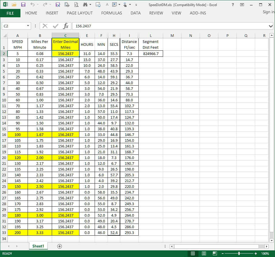
| For each of the GPS flight log files created so far, the process has been the same: |
| 1. When the latitude and longitude map coordinates are entered in a GPS formatted text file, the file is translated to a Garmin GPS file format. That GPS file is loaded into the Garmin MapSource program and all the distances between the waypoints are generated in digital mile format. |
| 2. Each value of distance is manually entered into a spread
sheet I created to get the time between the GPS data points. Now that all those dots
are connected, and with the correct time intervals to match the distances, you have a
flight with a proper SPEED now attached to every data point. This is how Google
Earth knows the rate of animation presented on a computer video monitor. The line of
numbers below shows North Latitude and East Longitude in digital degrees. The Day,
Date, and Time are next. I use the correct month and date of Jerrie's flights to get
the proper sun angles during the passage of time in each flight. Use of the current
year insures that Google Earth will display the most detailed scenery. The line of
code below for a GPS data point shows 7,500 feet for the altitude above sea level and
indicates Statute Miles are in use. This flight segment data point is 156.2437 miles
in length. The time difference from the data point preceding this line of
information defines the speed for this segment which is calculated by the MapSource
program and shows up as 152.432025 miles per hour. The time for the segment is 3,690
seconds, or 61 minutes and 30 seconds. T N25.5200796
E069.7710568 Sun Apr 05 05:16:46 2015 ;7500.348429; 1e25; SM; 156.2437; 170.5163;
170.5163;152.432925; 3690;|1e25 |
| 3. Adding an altitude to each data point gives an "eye elevation" to be used by Google Earth showing the world below during a flight tour. The elevation is entered by hand for each and every data entry of all the files since this "GPS FILE" was never a real file from 1964. Copy and paste helps in the process. |
| 4. The last requirement is to be sure to assign altitude values that do not conflict with the elevation data in Google Earth at all the Airport Locations in this trip around the world. Incorrect values create unwanted effects similar to a bounced landing. A smooth "landing" or takeoff from any runway requires the "eye altitude" to be 6 to 10 feet above the ground elevation at that point in the Google Earth virtual world. That puts the viewer in the virtual airplane 6 to 10 feet above the wheels riding on the virtual runway. Some of the airports you will see are not smooth. For those locations, I have set the clearance to be above the higher points on the runway and you will see the ground going up and down between those points. There are some real world airports that have a change in field elevation along the length of the runway. In those locations, I will adjust the eye elevation value of the data points to follow the real world changes until Google Earth has correct elevation data in their imagery (if ever). |
Here is the look of my spread sheet for calculating TIME and DISTANCE for creating the SPEED of each data point. I choose the desired speed for the current flight segment from column A. The digital distance in miles is entered in cell C2. The spread sheet is protected with only cell C2 accepting input data. All other formula cells update when new data is entered. The speeds were chosen to provide data for all phases of flight and taxi speeds on the ground. Some intermediate processing integer values are in the hidden columns. The results to be entered into the GPS text file come from the HOURS, MIN, SECS columns seen below. I chose the desired speed in column A and received the segment time duration from that row of numbers in columns E, F, and H.
Now you know what I have been doing in my spare time to create flights in the Google Earth virtual world when there are NO GPS files to work with from my Garmin unit. Since Global Positioning Satellites had not been invented in 1964, I had to be creative to convert the Jerrie Mock flights into a GPS file for Google Earth tour flights.
July 8, 2015: The rental car is packed except for me and my computer for a day trip tomorrow down to the Fort Lauderdale, Florida area. Tomorrow night, I will be back at home to finish packing the car for the long road trip that will be a full week going up to Pennsylvania, and New Jersey on business, plus a few stops along the way going north and south. I will have some down time this weekend in Ohio as part of more research on Jerrie Mock. I can see me adding some "post script" pages to the Jerrie Mock part of this web site I published earlier this year.
July 19, 2015: I have published a NEW PAGE 16 in the Jerrie Mock section of this web site with photos and some details about my weekend visit to Jerrie Mock's home town of Newark, Ohio from last weekend.
July 23, 2015: The Avis rental car was returned yesterday as planned. The road trips for the company are over for now. The total mileage driven during the two-week rental was 3,798 miles from Florida to Pennsylvania and New Jersey and back with eight client meetings along the way. Three of the meetings were in Deerfield Beach, Orlando, and Bonita Springs, Florida. Those three meetings were before and after the long trip up north. Now to get back to normal life here near Melbourne, Florida.
August 9, 2015: I have been busy creating more GPS flight files for the Jerrie Mock project. Central Florida has seen plenty of rain lately with flooding in some areas. Being shut in allows me to fly with Jerrie Mock as I create more files. I finished the flight from Oakland, California to Tucson, Arizona last night. I have added that file to the growing ZIP file with all the flights from Columbus, Ohio across the Atlantic Ocean, Africa, Asia and the Pacific Ocean from her 1964 trip around the world. Three more flight segments and the flight simulations will be complete. There were a couple of flights Jerrie could not enjoy because of restricted air space issues. She wished she could fly over the Pyramids and The Taj Mahal. Since these flights are in the Virtual World of Google Earth, I can work some computer tricks to SEE what she could not during her 1964 flights. We can break the rules and "buzz some famous land marks at a slow helicopter speed to see the sights.
I have needed to more closely examine her book in places to confirm runways used at the various airports, and at Oakland, California where she did not say the arrival runway after her overnight flight from Honolulu, Hawaii. It has all worked out so far.
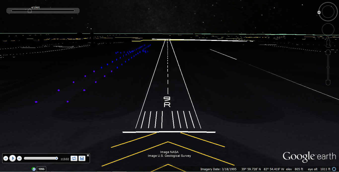
August 16, 2015: The flights for Jerrie Mock
are now completed and compiled into one Garmin data base file for use in Google Earth to
fly along with her and see all that she observed from her Cessna 180 "38
Charlie". I have posted the ZIP file for downloading on the Google Earth Tour page of this web site. I have also been
working on some scenery files to be used for the night operations Jerrie made during her
trip. The arrival back at Columbus now has runway outlines for the original location
of runway NINE RIGHT and where she landed on runway 23 after passing her takeoff point on
runway 9R for the official time keeping record. I will post the scenery files and
how to load them into Google Earth when I transfer them from my main computer to another
computer and test then in Google Earth on that machine. This Google Earth screen
capture shows what Jerrie would have seen as she began the high-speed pass down the runway
where her flight began 29 days earlier. This was a full-speed run to get the
official time for her record-setting flight around the world. The scenery files are
what I used to create this view.
September 13, 2015: Labor Day has come and gone and the official end of summer is coming up next week. My Jerrie Mock project to fly around the world with her via Google Earth touring is now complete including some night scenery at the airports where she had night operations. IF you have been using older files from this project in your Google Earth program, now is the time to delete the old files and download the GPS database file and the Google Earth KML files for the airport enhancements for night operations. See Jerrie Mock PAGE 17 and the Google Earth page on this web site to DOWNLOAD the new files and install them into Google Earth.
| CLICK HERE for PAGE 395 | Return to MAIN MENU |