Wendell Folks Alaska Trip - Page 16.
July 23, 2007: Day 4 - The more I read about
the Alaska Highway, the more fun this project is getting to be. I feel almost like I
was sitting in the back seat of the Cessna 182 on this journey. That would not work
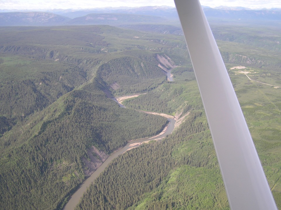
as you will see when we reach the end of these pages. This is the Sikanni Chief
River near mile 173.
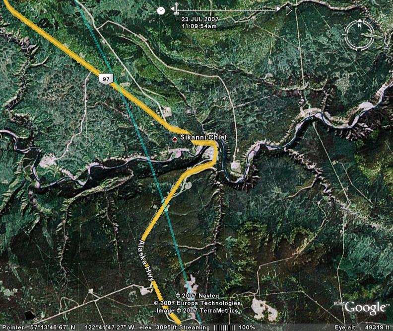
Here is the Google Earth view of this area using a map overlay on satellite
photos. The light green trace line on the photo is the GPS ground track showing the
path of the Cessna 182.
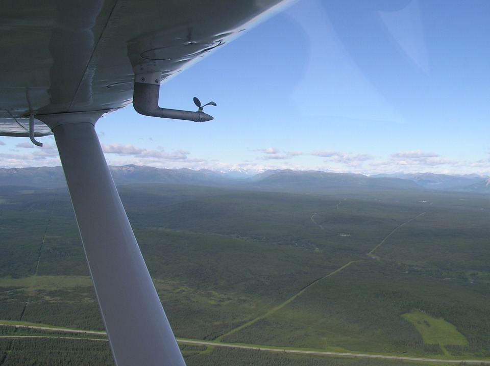
The mountain pass seen in the photo on the previous page turned out to be off
to the left of the Alaska Highway after it turned to the north. From his position on
the left side of the airplane, Terry gets a good shot of the Alaska Highway in the
foreground of this wide-angle shot with the Rocky Mountains in the distance. The
reflections off the flat side window are clearly visible.
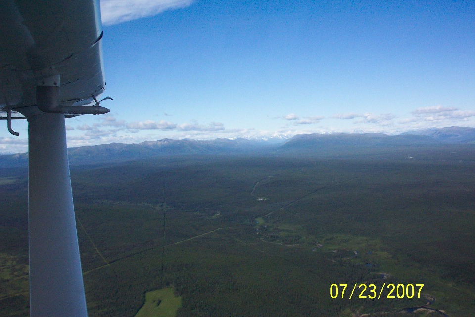
Wendell's photo was taken right after Terry's shot above at about 10:22 AM
Mountain Time. The highway below is not visible. The thing to notice about the
two photos is the appearance that Wendell was either leaning forward in his seat, or just
holding the camera far forward under the windshield and pointing in the desired direction
and pushing the shutter button. The position of the cameras to the leading edge of
the wing and strut provides that clue.
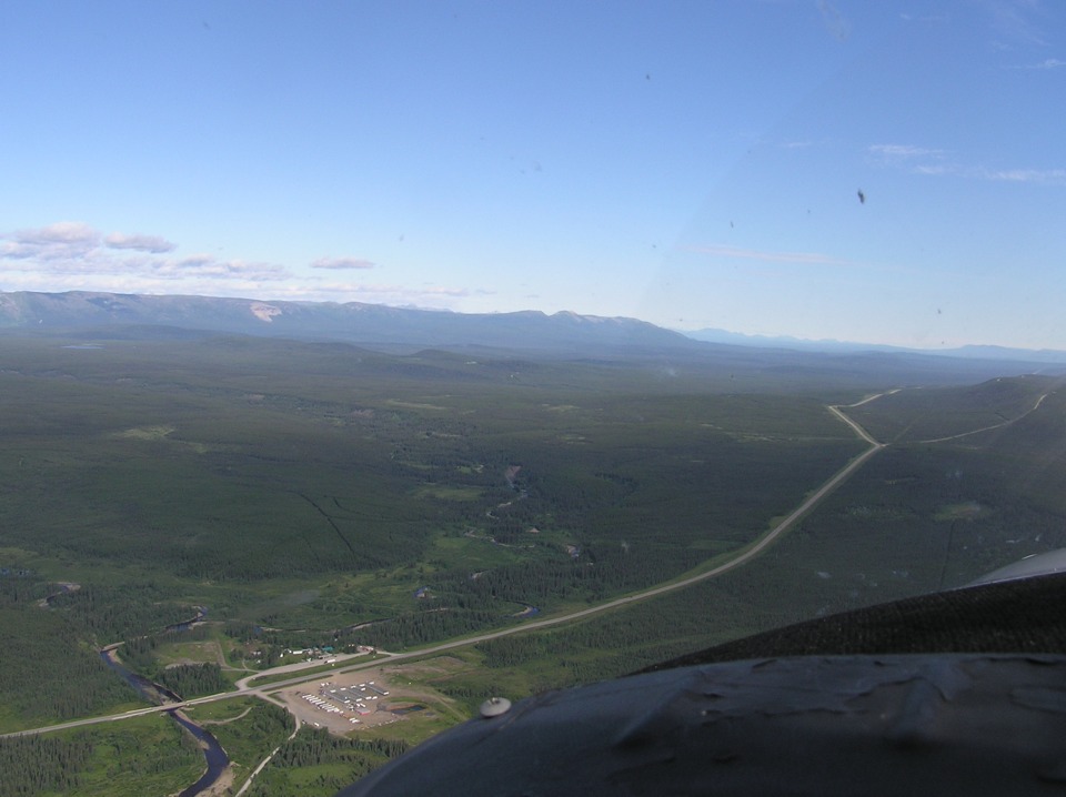
Just a short way ahead is this place known as Buckinghorse River. That
fork in the road up ahead is apparently where a new highway was built to run parallel with
the original roadway that climbs up on the ridge.
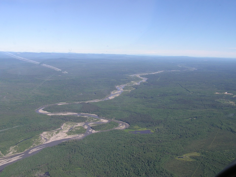
The Prophet River runs parallel to the highway at a point about 55 miles south
of the Fort Nelson Airport. There is another reflection from the inside surface of
the windshield seen at the left side of this photo below.
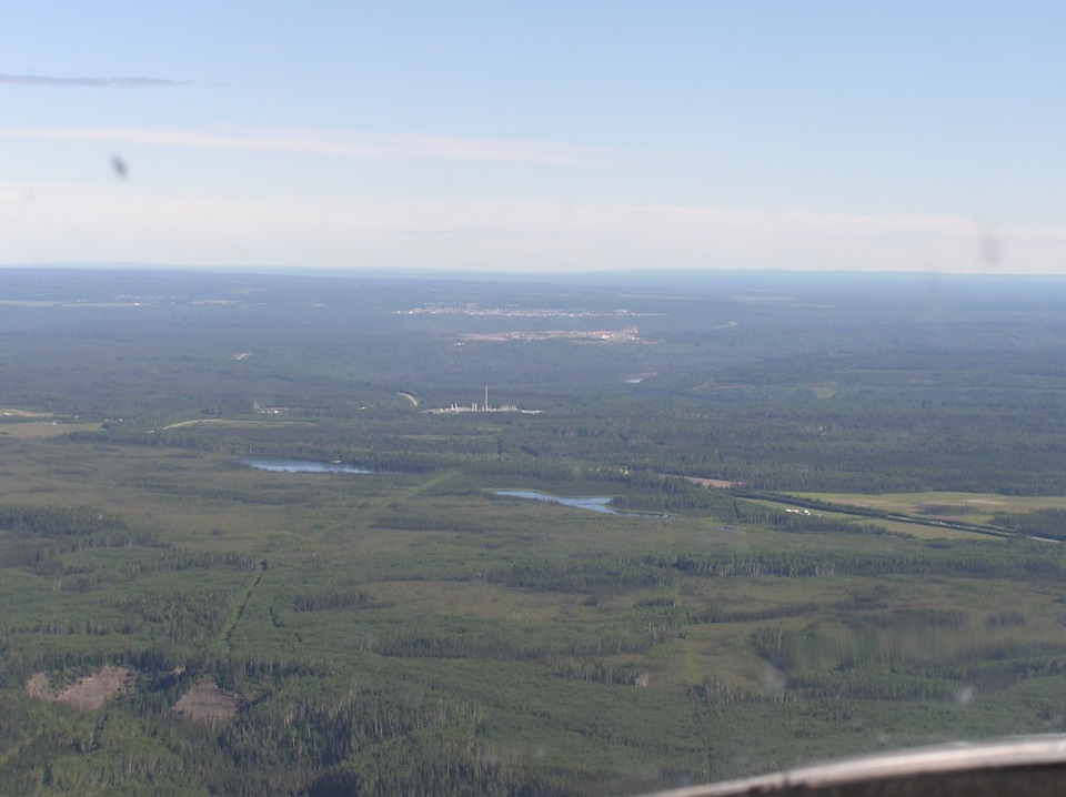
This point on the highway is just about 17 miles from the Fort Nelson Airport
in British Columbia. Those two small lakes show up in the aerial photos from Google
Earth, as does the chemical plant beyond them. The highway comes in from the right
side of the photo, passes the two lakes, then bends around behind the trees. It
passed the plant and is visible going over a hill just beyond and to the left of the tall
chimney at the plant.
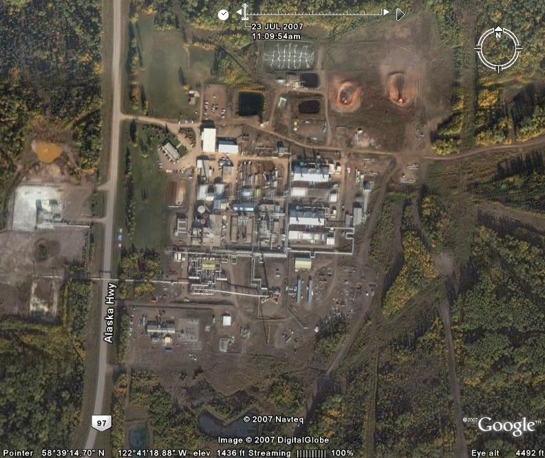
Here is an image from Google Earth showing the plant. The tall chimney is
not visible since the aerial photo is looking straight down at the chimney. The only
way you can tell it is there is by looking at the shadows. The shadows tell a lot
about this plant. There is an overhead pipe going across the highway from the left
side toward the center of the photo. See the shadow just above the words
"Alaska Hwy" as it crossed the highway. Notice the shape of that shadow.
It tells us that the pipe bends UP to cross the highway, then comes back down near
the ground on the other side. That provides an expansion joint for different
temperature ranges. Other pipes in the plant have similar expansion joints.
Last of all, look left of the compass and you will see what appears to be two fire pits to
burn off waste gases. the shadow above the pit on the right tells how high the flame
rises above the ground. I truely am amazed at what can be learned by using Google
Earth when good aerial survey photos are available for a location.
| Alaska Trip - PAGE 17 | ALASKA MENU | MAIN MENU |