Wendell Folks Alaska Trip - Page 17.
July 23, 2007: Day 4 continues with the
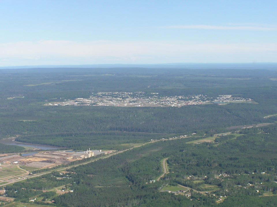
arrival at Fort Nelson, British Columbia. That is the village of Muskwa on this side
of the river with the town in the distance. The Prophet River joins the Muskwa River
not far past the left side of this photo. That is the Alaska Highway passing those
plants with the chimneys and the bend in the river.
Wendell took a similar photo with a wider field of view. The time stamp
on this photo is 11:00 AM Mountain Time. As usual, he does not quite get the camera
aligned with the horizon, but the subject matter is well covered.
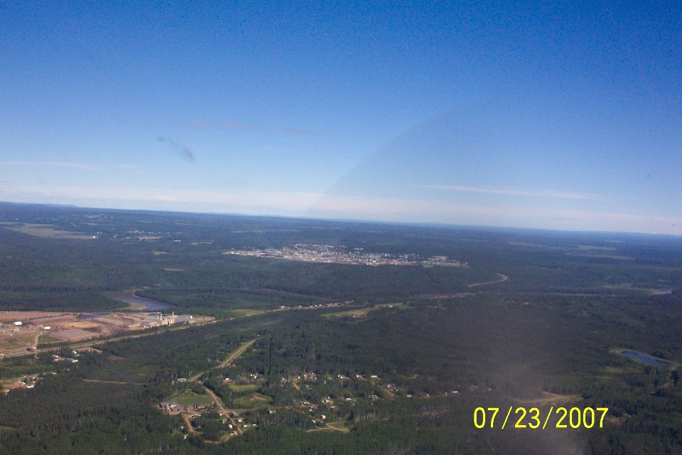
As for covering the details, this shot from Wendell reveals the railroad yards
located here between the river and the Alaska Highway. The Prophet River is still
unseen behind a ridge line. The river joins the Muskwa river just beyond that bridge
crossing the river.

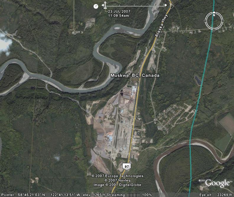
This aerial photo from Google puts things in perspective from the photos above.
Notice the "eye altitude" is shown as 23,269 feet above sea level.
The railroad yards are in the center of the photo above the highway 97 marker superimposed
over the actual aerial photo. The green line is the GPS ground track of the Cessna
182 with Wendell and Terry winging their way to the Fort Nelson Airport.
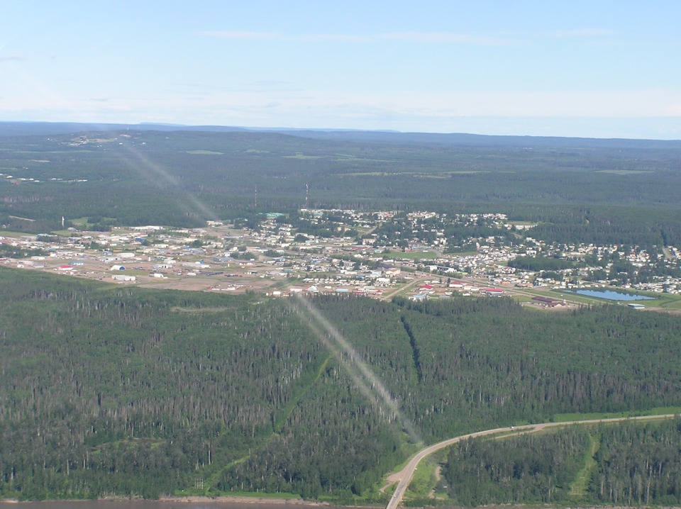
Terry takes this shot of the town of Fort Nelson on the left side of the
airplane as it is on approach to the airport runway. That windshield reflection seen
on page 16 is back again in this photo.
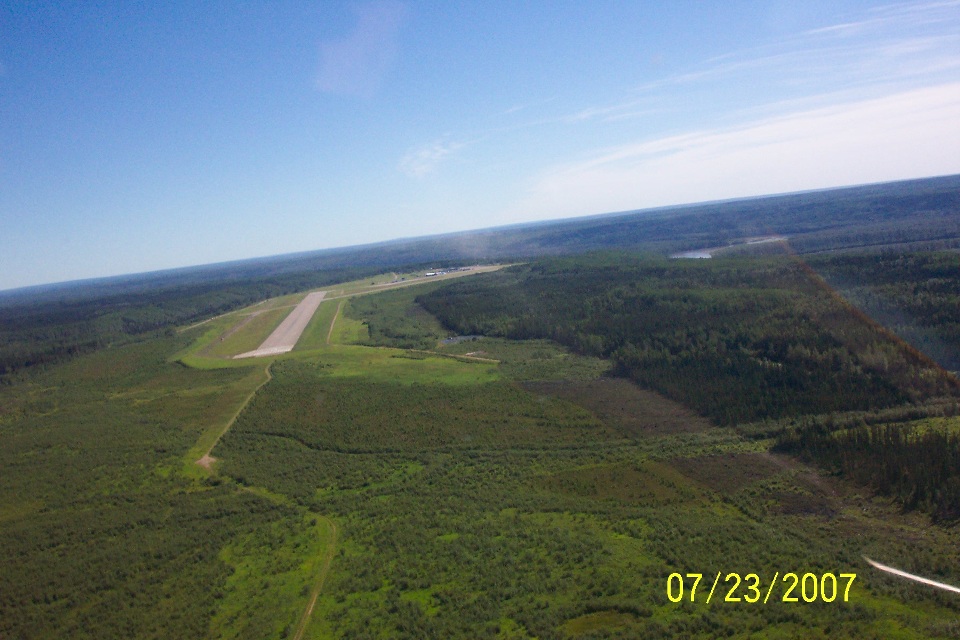
And here is the approach as they turn toward the runway 03 at the Fort Nelson
Airport. A second runway 08/26 is also available. You can see it crossing this
runway to be used for the landing today.
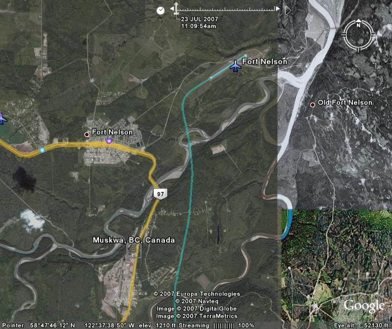
And to give you the "big picture" this last Google Earth shot of the
Fort Nelson, BC area shows everything discussed and photographed above. It also
shows three different types of images used in the map of the Earth that is Google Earth.
The image is mostly a color aerial photo showing Fort Nelson and Muskwa, BC.
A black and white aerial photo shows the confluence of the Muskwa River and the Sikanni
Chief River just east of the airport to become the Fort Nelson River flowing north.
It will eventually flow into the Laird River
| Alaska Trip - PAGE 18 | ALASKA MENU | MAIN MENU |