Denver Trip Preparations · · PAGE 213.
June 15, 2006: I spent the early evening at
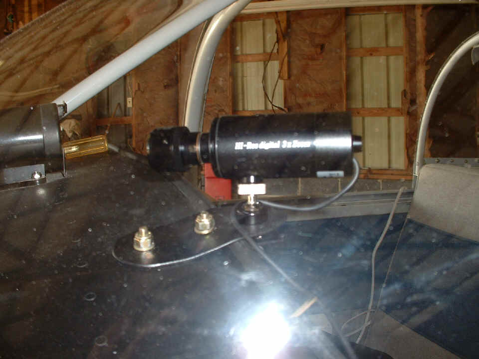
the hangar to work with Wendell and do one final check of the video camera zoom lens
adjustment and focus. Here is a shot looking through the windshield from the pilot's
side at the remote video camera with the varifocal lens exposed for adjustment.
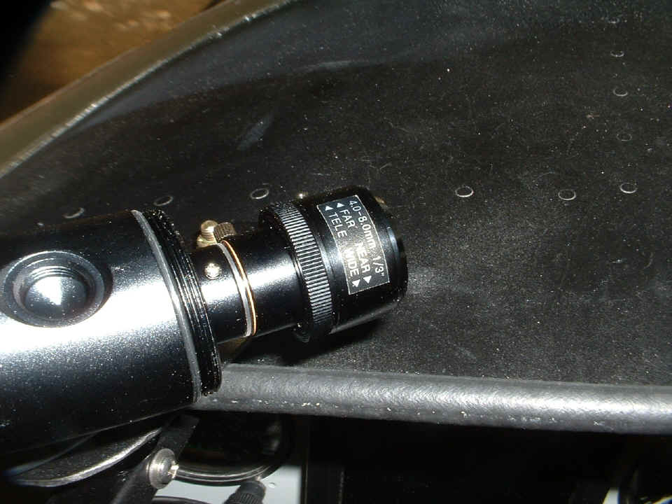
Here is another view showing the details of the lens and the locking ring when
the zoom and focus are completed. I switched to macro mode on my digital snapshot
camera to get a sharp focus on this photo. This lens has two moving parts. The
little "set screw" on the side is really a handle to change the magnification
(zoom) on the lens. The larger "thumb ring" locks the lens mechanical
settings after the front of the lens is turned to set the focus when the zoom adjustment
is completed. That threaded "cup" at the left side of the photo on top of
the camera body is for mounting the camera from an overhead position. A similar cup
is on the bottom side of the camera, and that is the one I am using for this dash-mount
installation.
After completing the adjustments above, I made another short video test to verify the quality of the television picture at various digital zoom settings. I now feel confident I will get the best possible video in my upcoming flights.
A bit of news from Wednesday evening: I changed the 8-32 truss head screws on the cowl to 8-32 flat-head screws with Tinnerman washers to prevent any more peeling of paint around the screw heads. All of the missing paint is now covered by the washers. Of course, the countersink bit was used to prepare the fiberglass cowl screw holes to accept the flat-head screws and washers. The four screws at the front center of the cowl in the air intakes are still truss head types since I could not get my drill and countersink into the confined space.
I also changed the four "motorcycle" spark plugs used by the Light Speed Plasma III ignition. I received new spark plugs Tuesday evening and finally got a chance to change them while working on the cowl screws Wednesday evening.
I have some new photos of Wendell working on his wing tip installations. You can find those photos and text on his new PAGE 21.
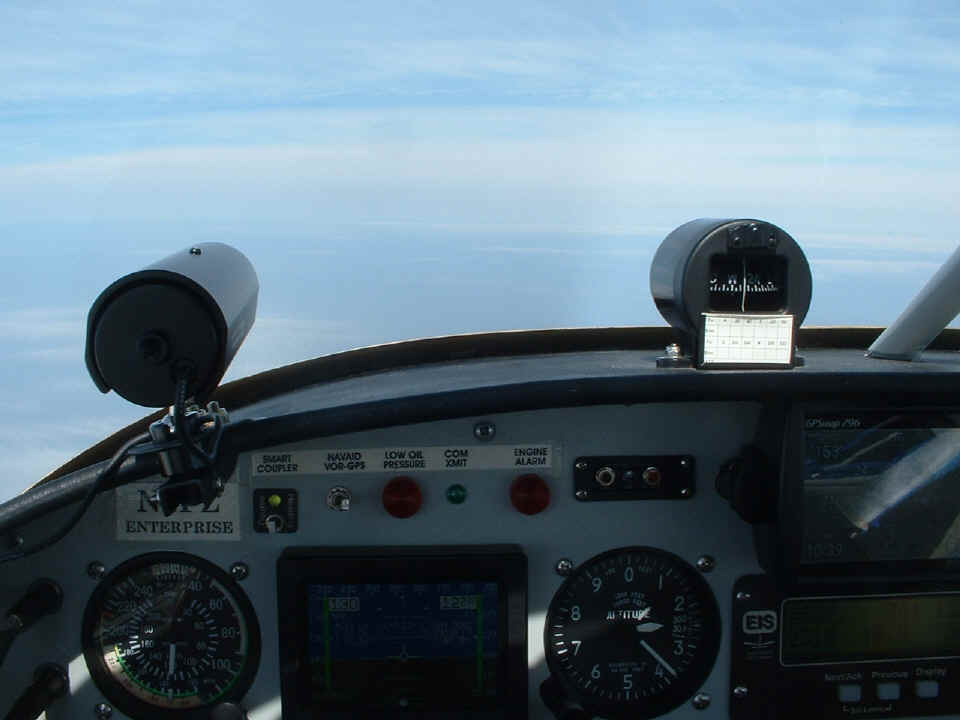
June 18, 2006: Off to Denver on a Sunday, Father's Day. I woke up Sunday morning, checked the Southeast 2100-mile weather radar and realized the way had opened up on the most direct route to Denver, almost. I took off from home at 9:25 AM in clear weather and headed West intending to go directly to Fayetteville, Arkansas for my first fuel stop. I started the video camera on the ramp in front of the hangar and made a recording of the takeoff and climb out to the west of the Chattanooga area. The system worked well except for the strobing of the propeller blades when I would have the camera looking directly forward.
As soon as I got the airplane to a reasonable starting altitude and turned on
the autopilot, I called Nashville Flight Service to get an update on the rain showers
along my intended route. He brought me up-to-date to real time from the changes that
had occurred since I turned off the computer at home and packed it for the trip. He
suggested a route south of Huntsville, Alabama -- then direct Tupelo, and finally, direct
to Fayetteville, Arkansas. As I got closer to Huntsville, I realized that I needed
to be on top of the broken and scattered cloud layers to fly the route. Although I
was in the clear at 10,500 MSL, the flying was better at 12,500 MSL.
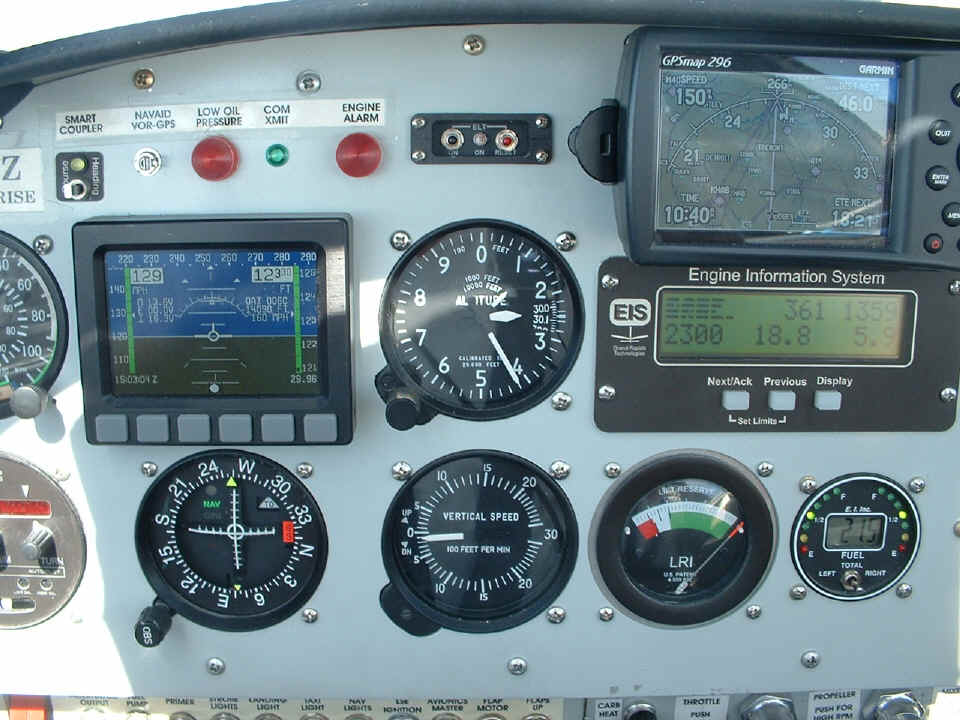
This next photo shows my position on the GPS 296, along with the flight
conditions. I have passed south and west of Huntsville, approaching the Alabama
state line with Mississippi. Comparing the true airspeed on the Dynon D-10A with the
GPS ground speed reveals a 10-MPH head wind on this course to Tupelo, Mississippi as my
next waypoint.
One look out the window shows a day similar to the one when I returned from
York, PA in the summer of 2005. As I got to the Memphis area, I monitored the approach
controllers since I would be overflying their airspace at 12,500 MSL. There were a
lot of airplanes coming and going from Memphis getting long vectors around a front that
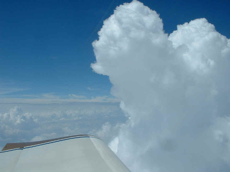
had built-up northwest of the city. Since I was up high already, I could see the
places where I could pick my way around tall clouds like this one and remain in VFR
conditions.
After getting past the front, this broken and scattered cloud layer below
greeted me for my descent toward Fayetteville, Arkansas.
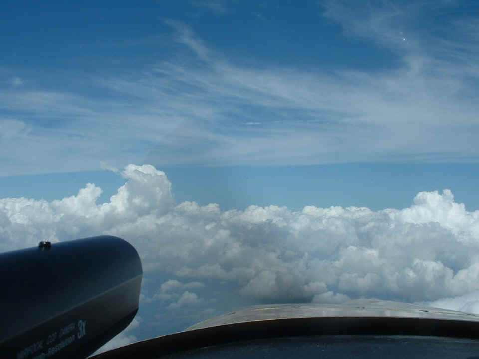
Below the cloud layer, conditions just got better the closer I came to
Fayetteville. Memphis handed me off to Razor Back Approach. The controller
told me ATIS information November was current. I excused myself from the frequency
to listen to the recorded message. It seems that an air show is starting about an
hour from the time I first listened to ATIS at KFYV Drake Field. I had just enough time to land
there, get to the self-service fuel pumps, then get out before the air show started.
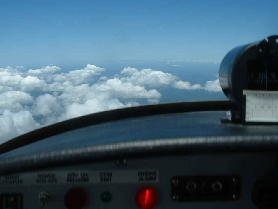
The red warning light below tells me the fuel flow meter thinks I have less than 8 gallons
of fuel aboard.
I had planned to make a video recording of the landing at Fayetteville, but all
things seem to go awry when you are being given quick vectors for landing traffic.
The tower controller was getting into the excitement as the countdown to airport closure
approached. I told him I wanted to go to the East Ramp to the self-service fuel
pumps and was cleared over there. During my stop, one of the staff drove by and told
me they were clearing out that side of the field due to air show regulations. I said
I would be out of there in under ten minutes, and that was about right.
The Google Earth image below I captured on May 12, 2021 shows my departure path
on the north end of runway 34 on June 18, 2006. The fuel pump for AVGAS is
at the bottom of this photo below at the end of the red line.
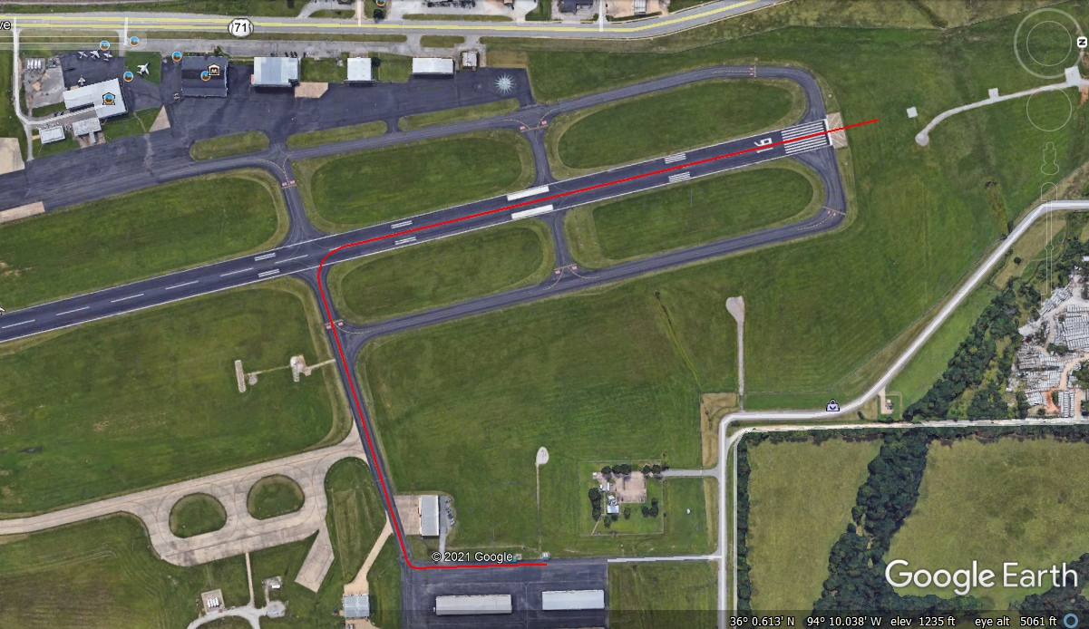
When I got the engine running, the tower cleared me to move to taxiway E and
get ready for an expedited intersection takeoff. I managed to get rolling on the
takeoff while my canopy was still ajar about half an inch. That was a strange noise.
When I got up and started my turn out of the pattern, I took a minute to secure and
latch the canopy closed, making the normal cabin noises return. I departed the area
staying clear of the Class C airspace and headed in the direction of Wichita going across
NE Oklahoma.
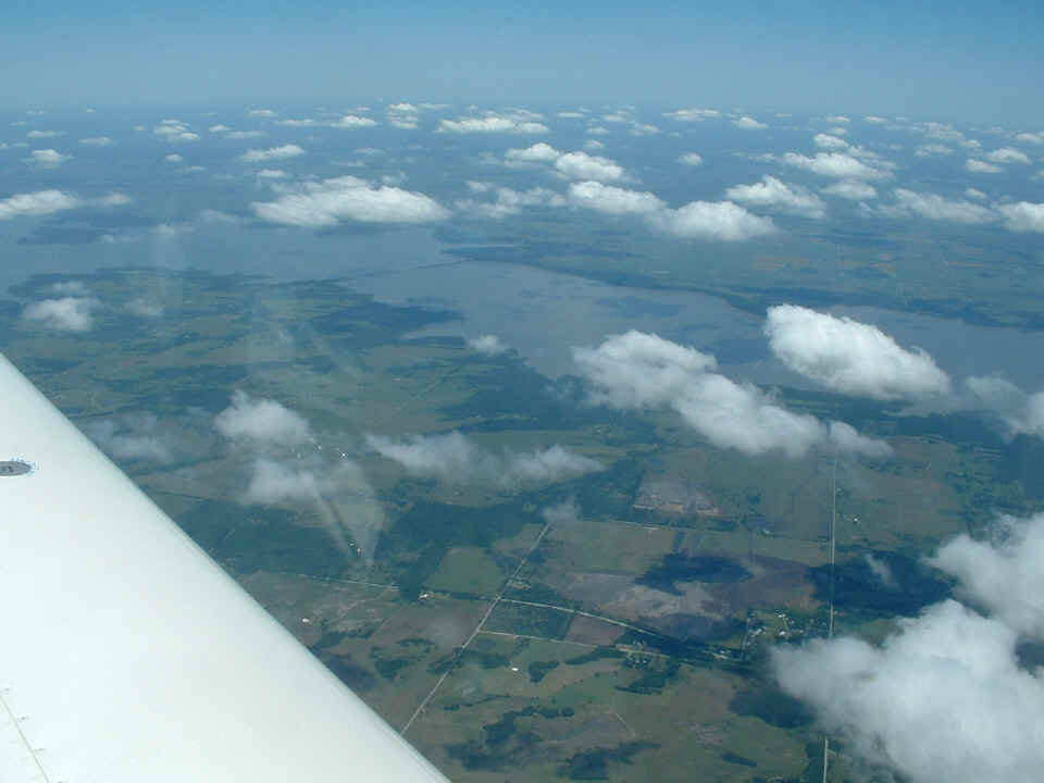
That is Oolagah Lake in northeast Oklahoma as I head for a crossing of Nowata Municipal Airport. Those are Indian names. I grew up in North Georgia where a lot of places have Indian names.
| CLICK HERE for PAGE 214 | Return to MAIN MENU. |