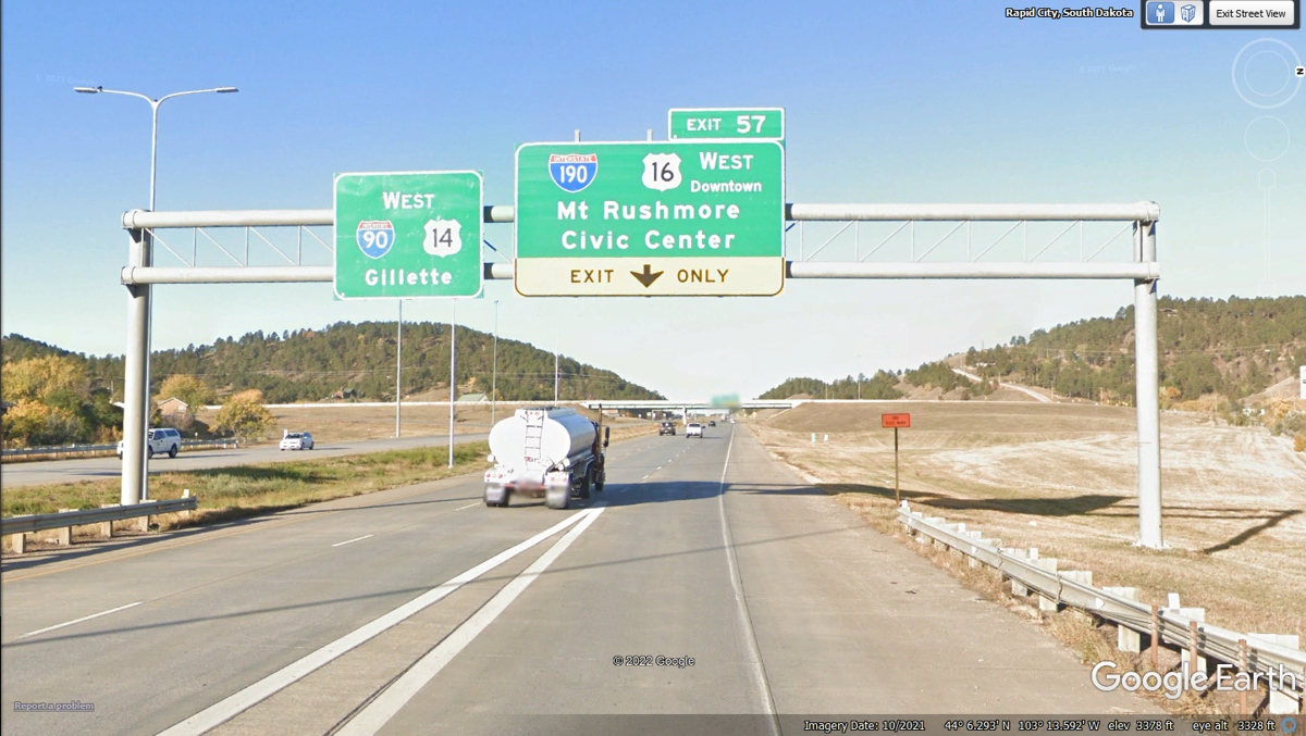
June 10, 2022: The motel breakfast was good and we headed south to Mount Rushmore to get there around 10 AM. This sign pointing to our first stop today is directly in front of the motel we used here in Rapid City.
June 2022 Vacation Day 19, Mount
Rushmore, Rapid City · · PAGE 48.
June 10, 2022: The motel breakfast
was good and we headed south to Mount Rushmore to get there around 10 AM.
This sign pointing to our first stop today is directly in front of the motel we
used here in Rapid City.
Interstate 190 is a short stub from I-90 that goes into
downtown Rapid City and connects to US 16, the route that goes toward Mount
Rushmore.
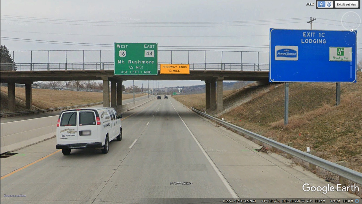
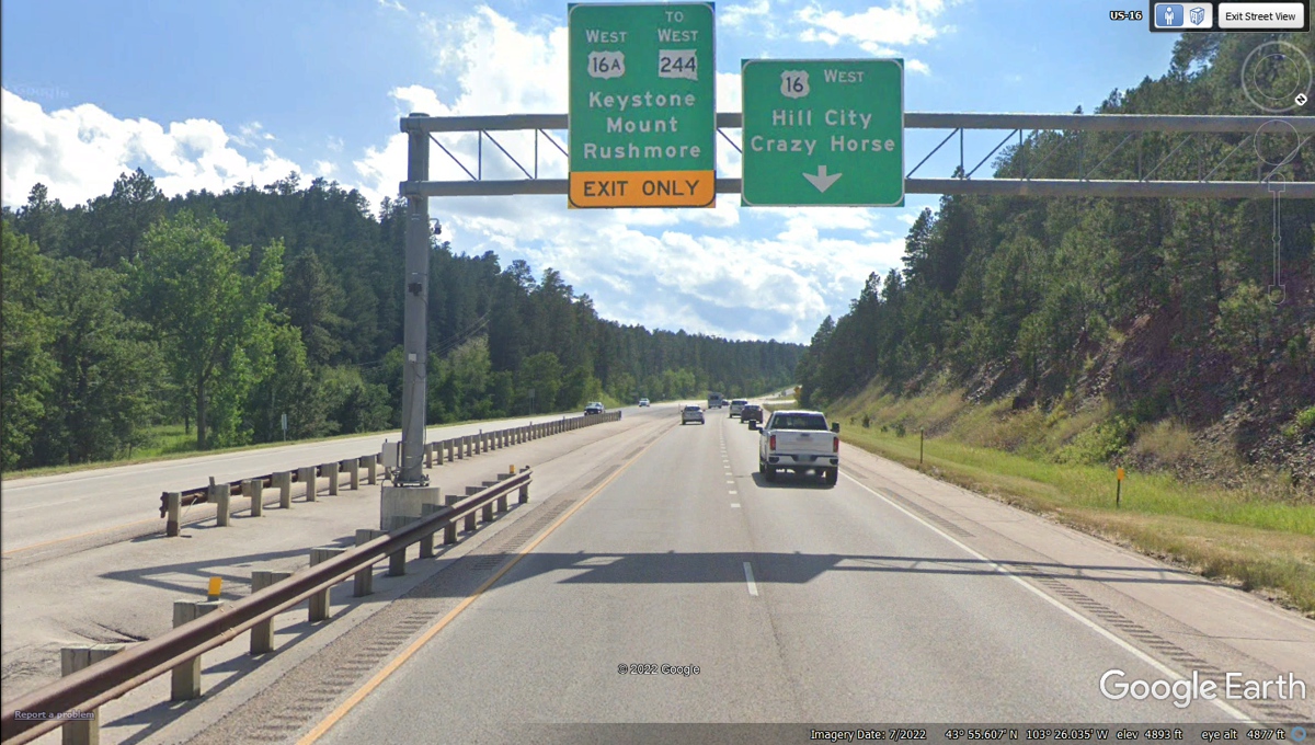
This is the end of Interstate 190 where we follow US 16 and
the Mount Rushmore signs. AFTER you turn LEFT ahead, get in the RIGHT LANE
as US 16 will turn right at the next intersection where the sign says Mount
Rushmore.
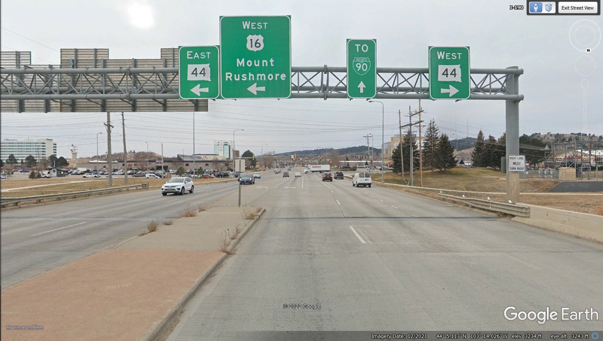
If you are looking at the compass rose in the upper right
corner of this Google Earth image, it indicates we will be going SOUTH on US 16
after making this RIGHT TURN here on Mount Rushmore Road.. As for the US
16 signs indicating WEST, that happens later after Mount Rushmore when US 16
will go West into Wyoming and toward Cody, Wyoming.
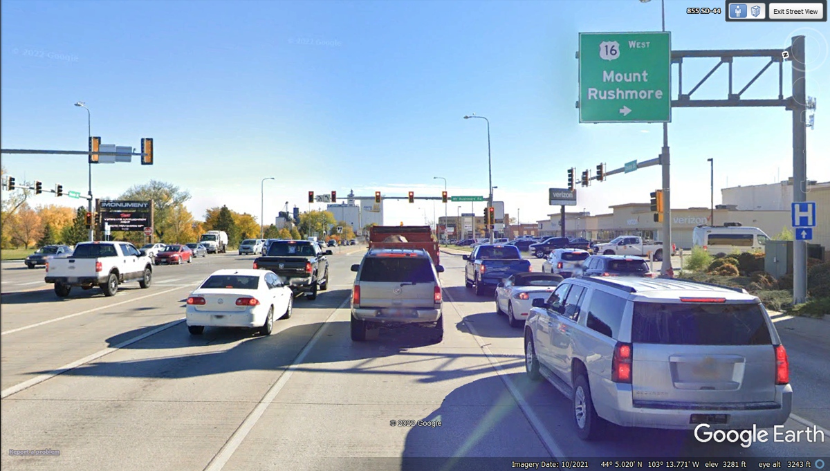
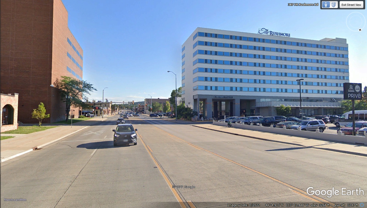
A big hotel on Mount Rushmore Avenue (US 16) near the
center of town is a good way to get the tourists to spend their money with the
local business establishments. The monument to the four US presidents at Mount
Rushmore is
about 23 miles south of this location.
The South Dakota DOT has put this mileage sign here to be
sure the tourists know there are TWO big mountain carvings to see ahead.
This is also here for the mom or dad to answer the kids when they ask "Are
we there yet?" or "When will be get there?".
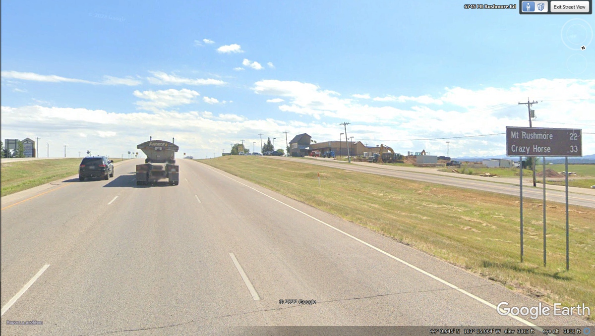
The LEFT LANE will get us to Mount Rushmore.
This is the US 16A sign where we have come so far to make
the left turn.
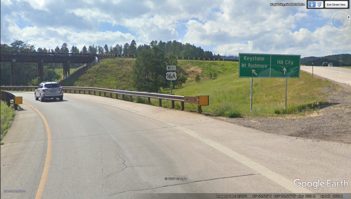
The last route up the mountain is South Dakota 244 to see
the classic figures of Mount Rushmore. 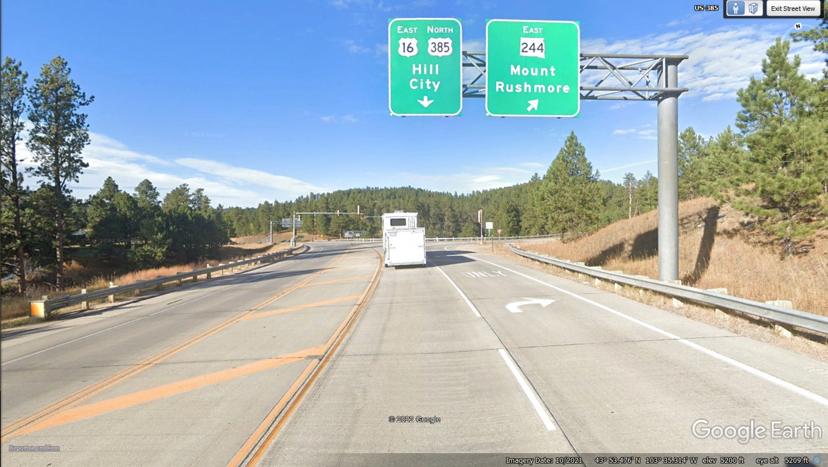
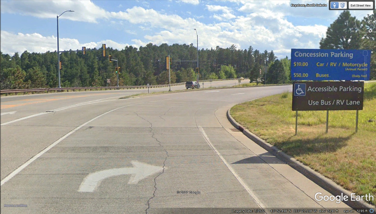
This is the entrance to the parking lot for Mount Rushmore.
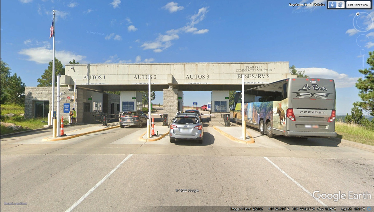
This is where you pick up a magnetic ticket to pay when you
depart. I found out my status as a US Army Veteran reduced the charge for
parking from $10 to $5 when we left.
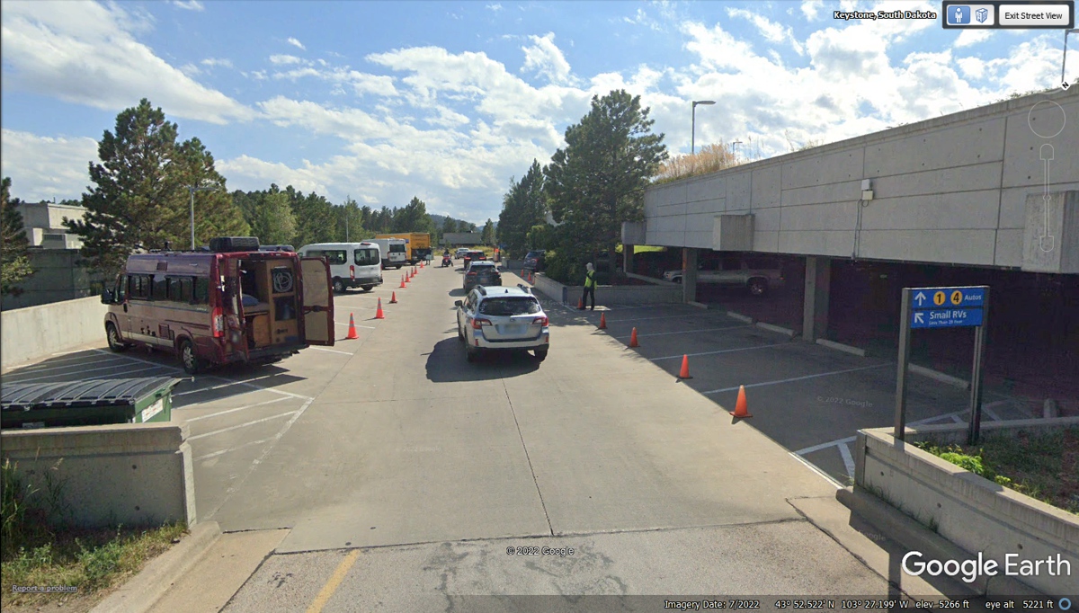
The covered parking was a pleasant surprise. We did not have
to come back to a hot car when we departed. We used the elevator to the roof
level since we have Chase with us. We did not have to climb any steps or
worry about Chase dealing with the escalator.
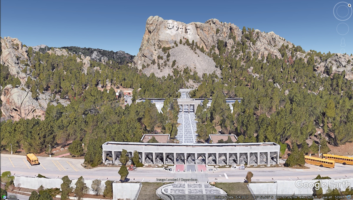
This Google Earth aerial front view puts things in
perspective. I have a couple of photos from the viewing area that follow
this image.
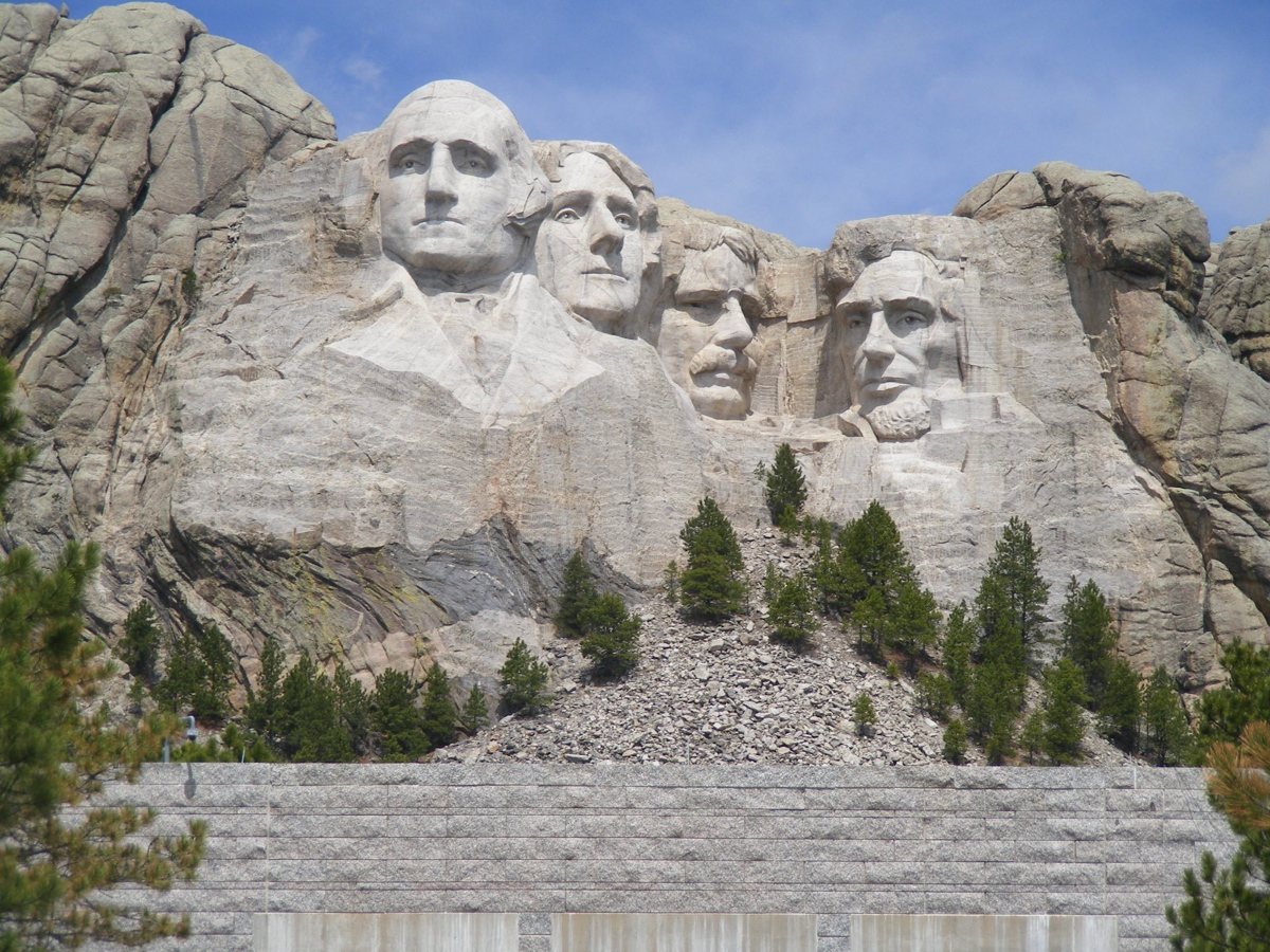
This photo was taken from an elevated location inside the
"gallery" to be above the crowd in there with a clear line of sight
to the carvings. I used my 10-X zoom lens setting and the anti-shake
exposure setting for this photo.
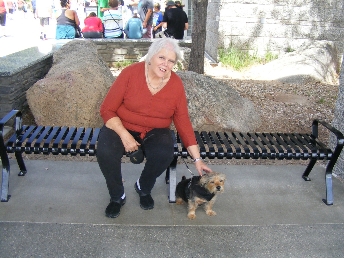
Linda and I took turns holding on to Chase at this bench
just outside the "NO PETS" area beyond this location.
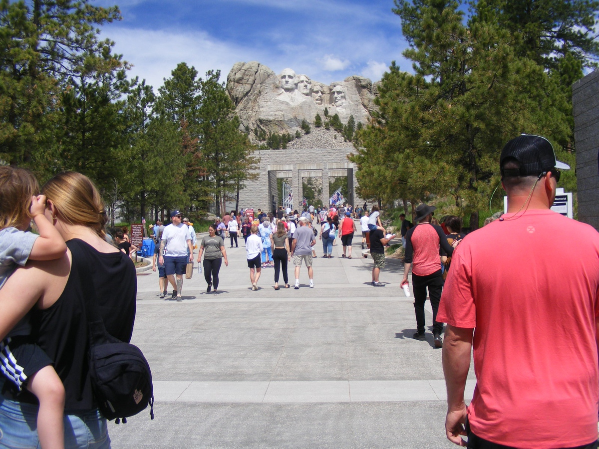
This photo is taken on the ground level with the other
visitors and not using the telephoto lens setting.
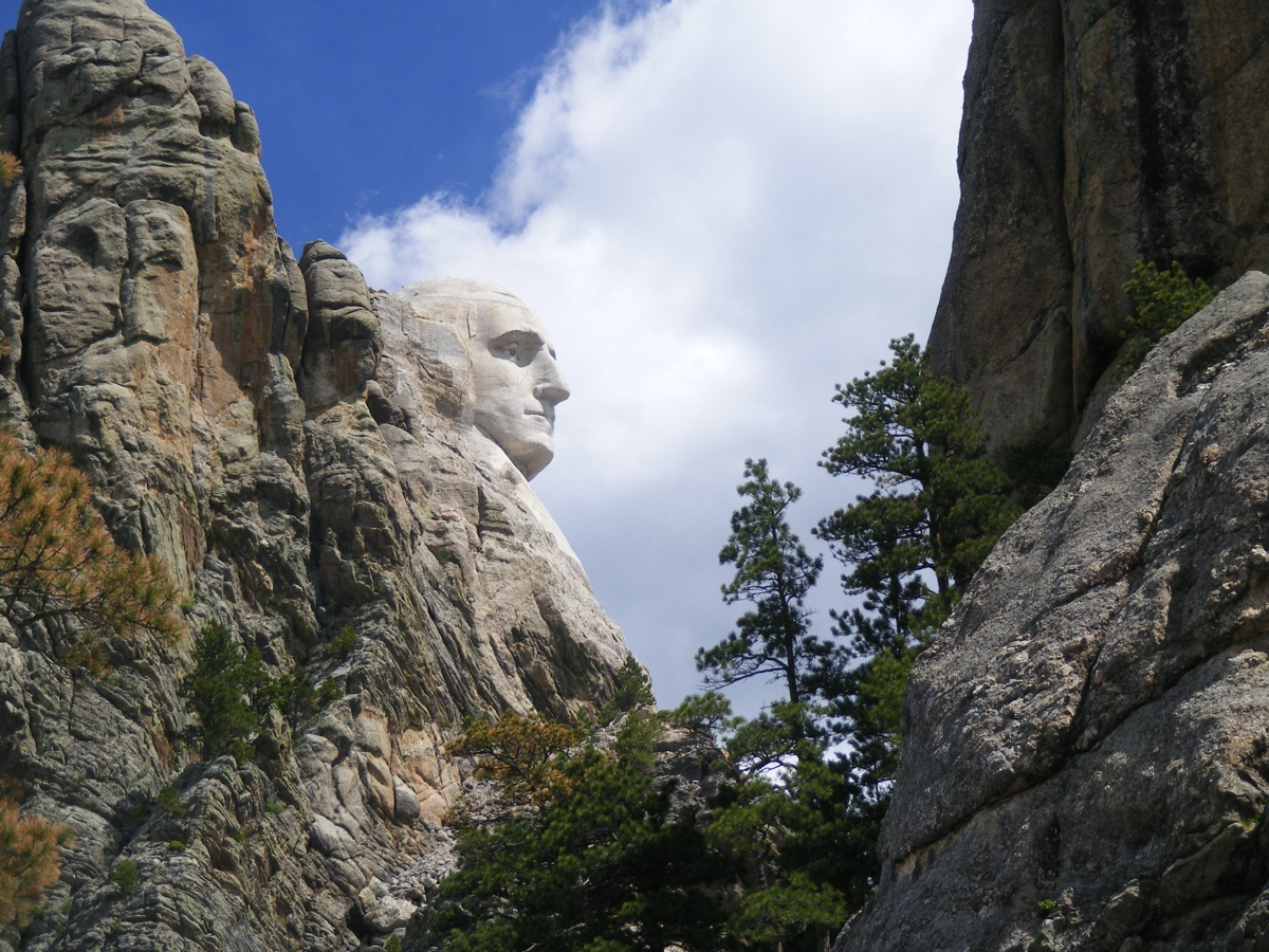
Here is the profile photo of George Washington I took with
my zoom lens setting before we left Mount Rushmore.
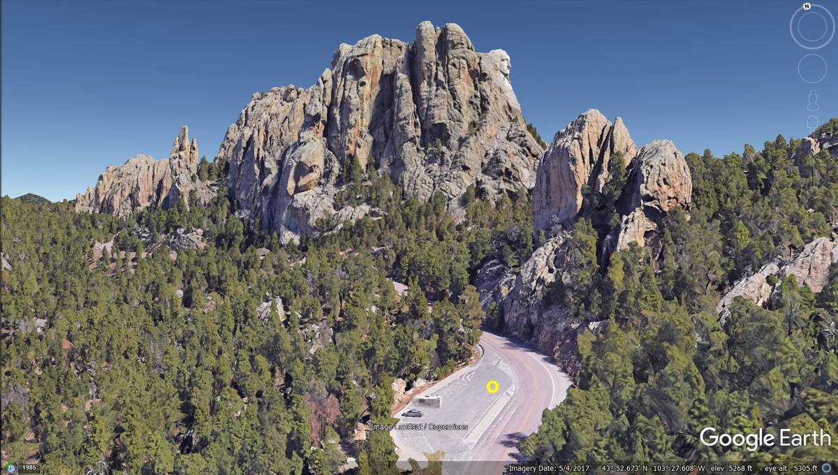
I was able to show the George Washington profile and mark
the spot with the YELLOW letter "O" where I stood in the parking lot
to take the photo seen above.
Here is the Google Earth photo vehicle view of the George
Washington profile as they drive past it on South Dakota route 244 that started
at the "Front Side" of the monument and wraps around behind it to get
this view.
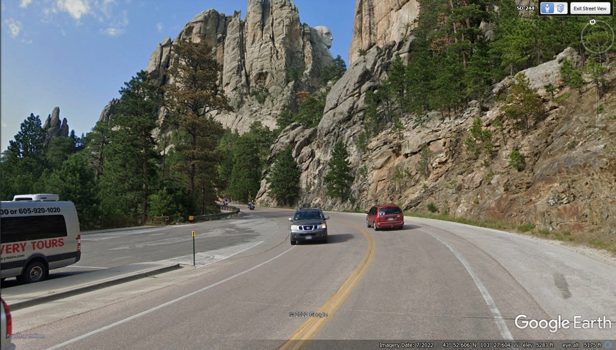
The RED car seen in the image above is taking the
"back way out" of the national monument, and so are we following South
Dakota Route 244 to where it ends seen in the image below. This is where
we turn LEFT to pass by the Crazy Horse monument that is still under
construction and will be for many years to come.
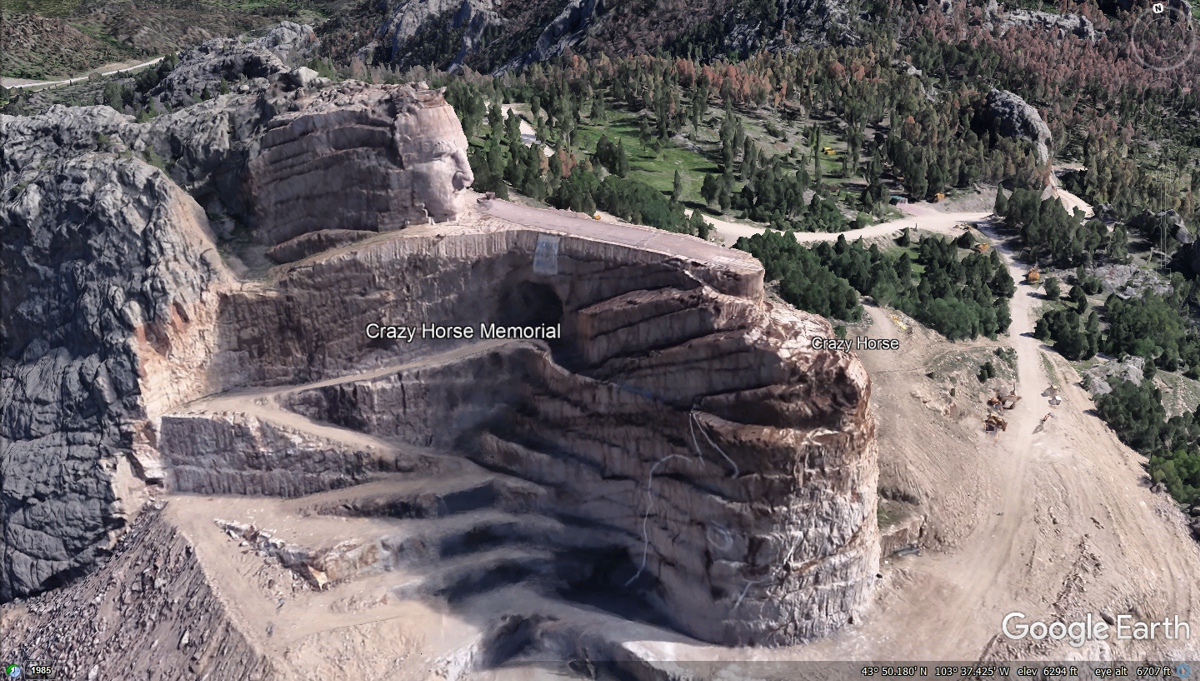
This is the side of the Crazy Horse memorial facing US 16 and US 385.
I was glad to see Google Earth had enough data of this image to show it in
somewhat of a 3-D rendering.
Here is the other side of the memorial away from the
highway. I was surprised Google Earth had enough imagery data to show
these two sides of the project and the tunnel under the out-stretched arm to be
revealed when the monument is completed.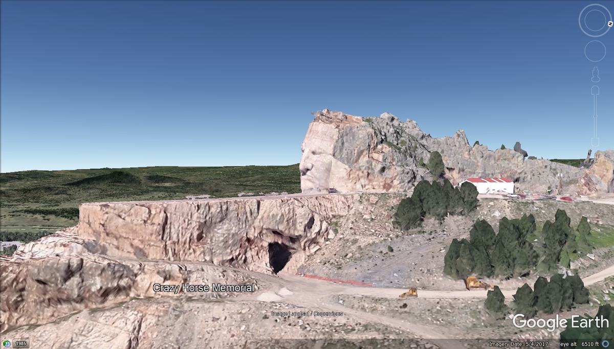
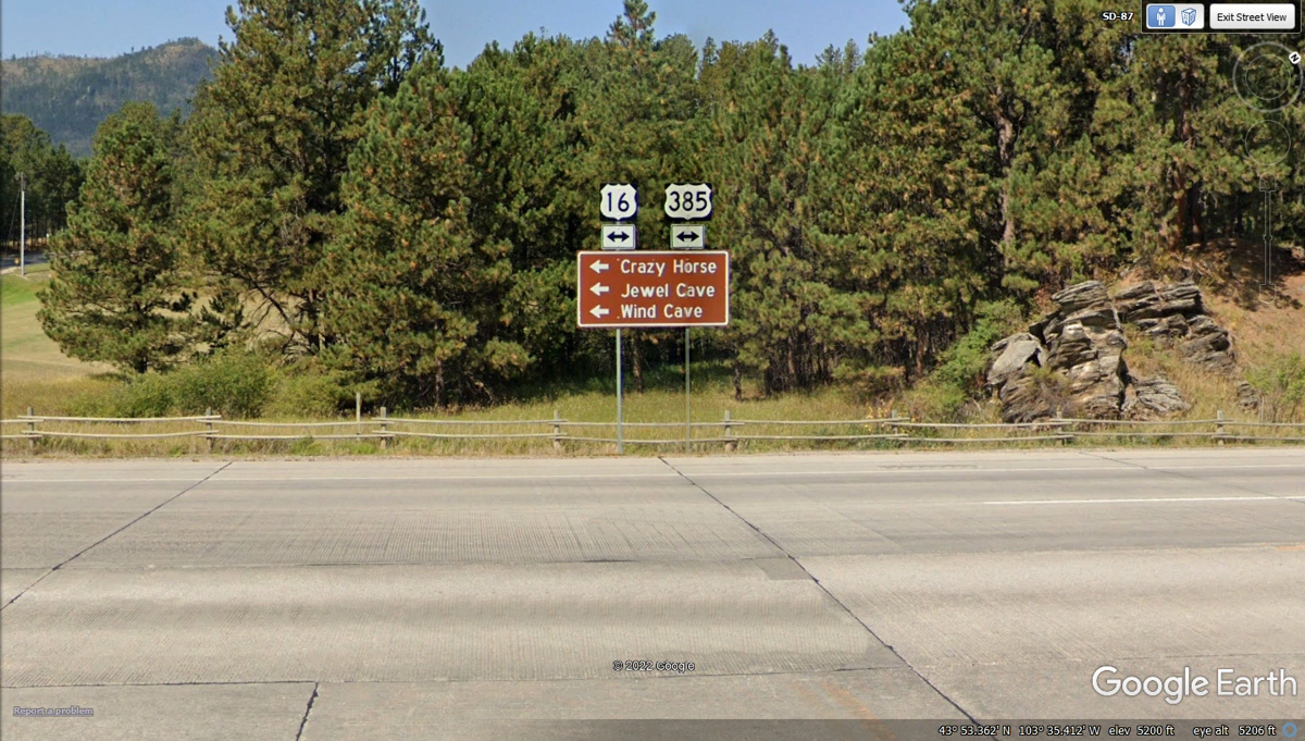
This junction at Custer, South Dakota shows US 385 going south.
It will take us through a portion of
Nebraska for Lunch. There is much more to see along this route today.
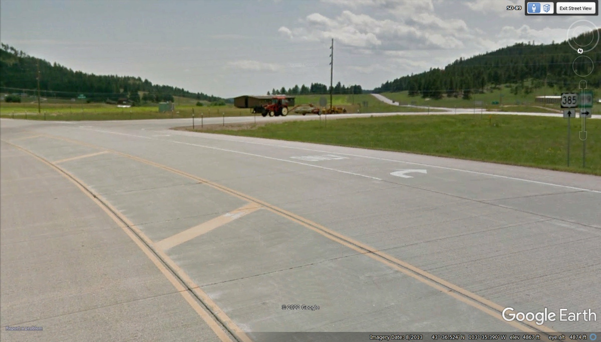
US 16 has separated from US 385 and South Dakota route 89
that are now going south from Custer, South Dakota.
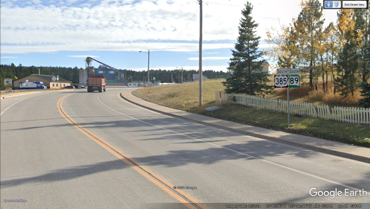
About 10 miles south of Custer is the community of Pringle,
South Dakota. US 385 and SD 89 go their separate ways at this
junction. US 385 turns East for about 3.6 miles, then goes southeast about
5 miles before turning southwest 2 miles, finally winding another 8 miles to the
town of Hot Springs, SD.
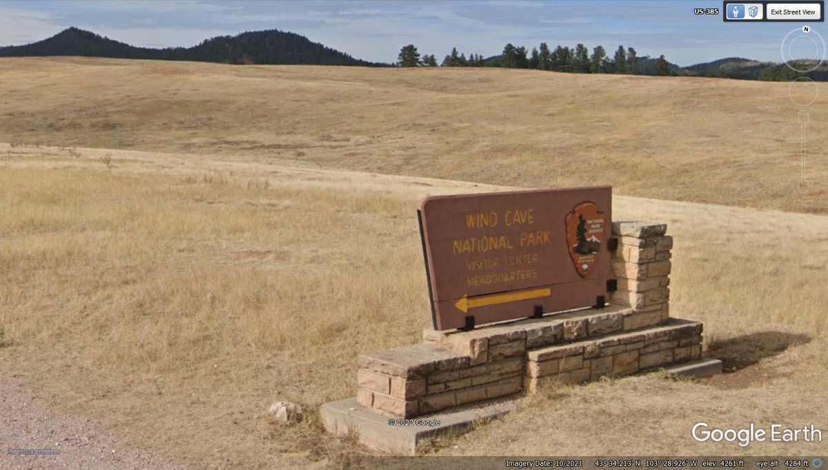
This is the southern entrance sign to Wind Cave National
Park from US 385. It had better lighting from the south side than looking
at it from the north side which was in shadow when the Google Earth vehicle
passed this way.
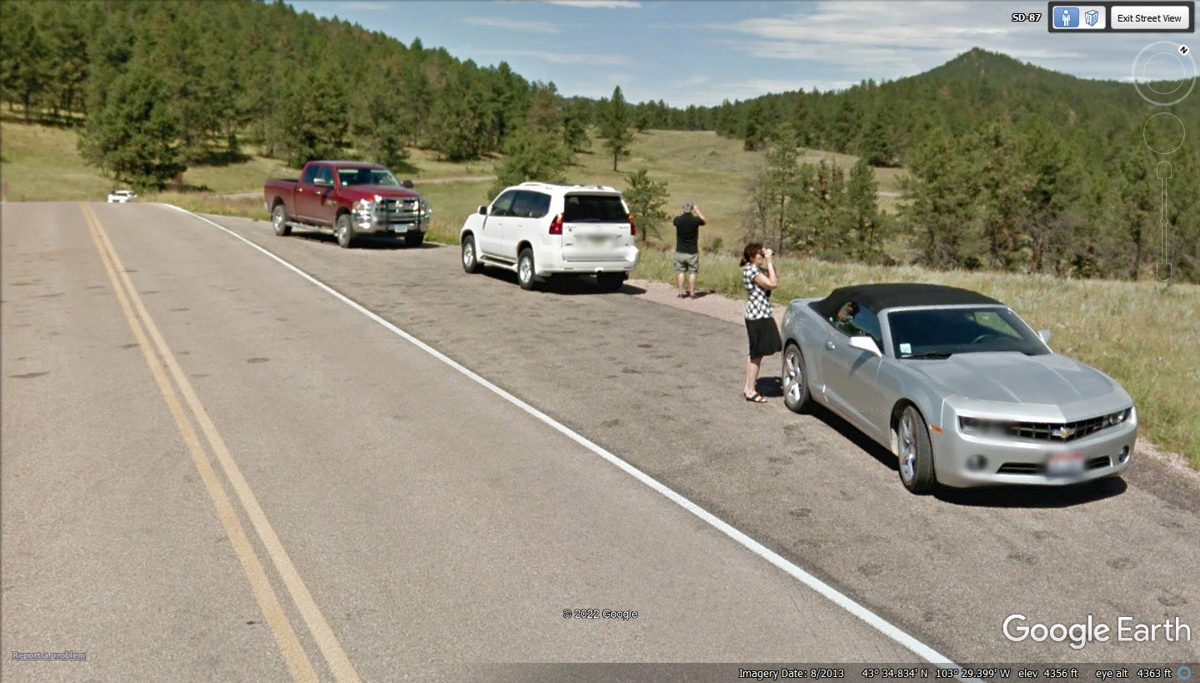
While I was searching for the Bison Herd, I noticed these
three cars parked in a turnout for taking photos of the sights nearby. The
people seen below were looking in two directions. I used Google Earth
controls to look in those directions and the results were the three images seen
below.
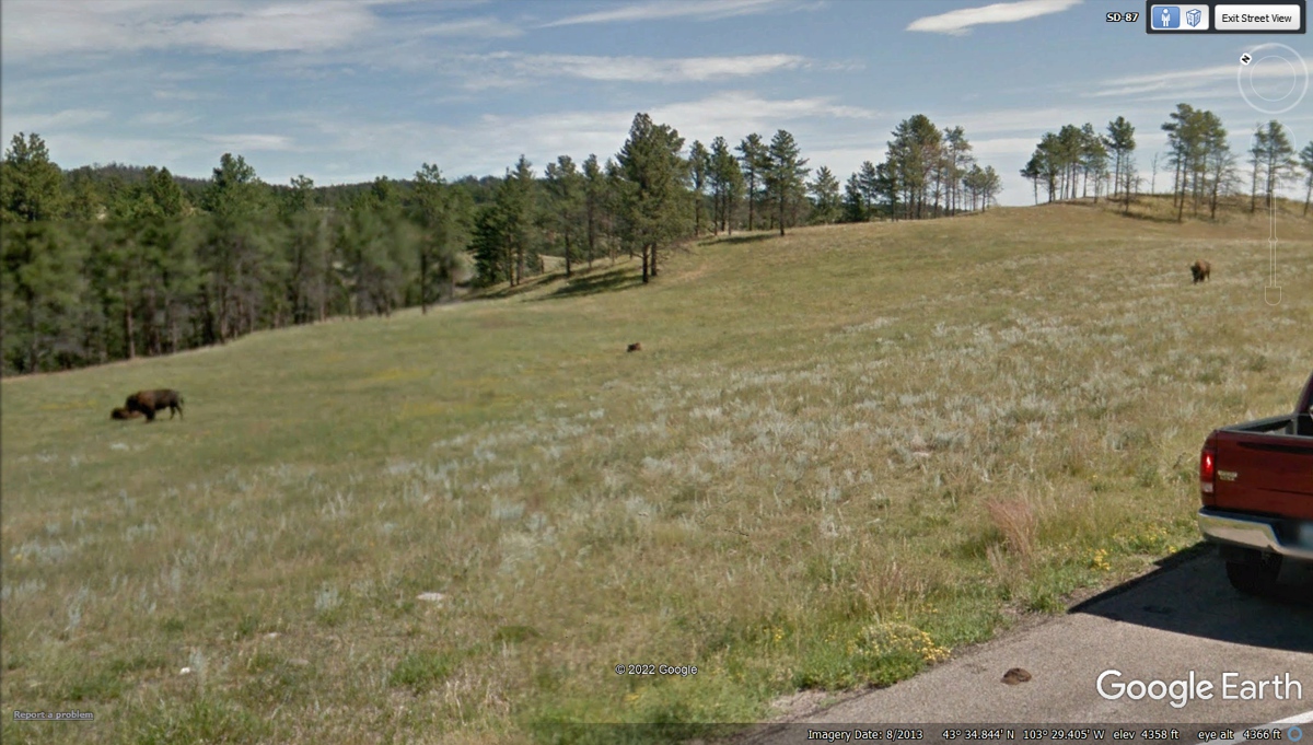
When we drove through a part of Wind
Cave National Park on US 385, we stopped to watch a herd of North
American Bison. We took some photos where we stopped. While I was
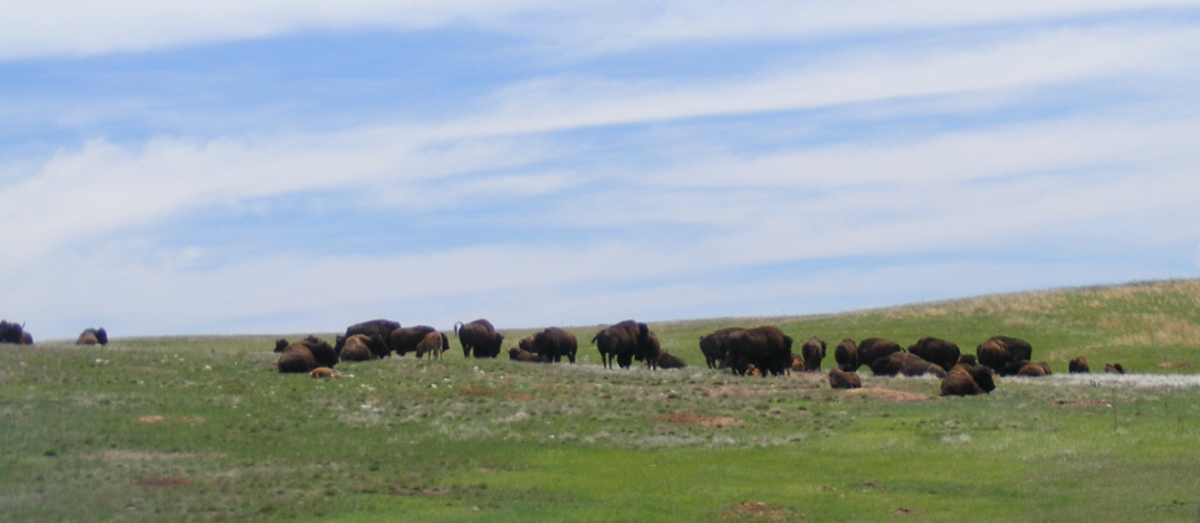
preparing this web page with some Google Earth images, it appears the same herd
of Bison were seen in August 2013 by one of their imaging vehicles as seen in
the images below. CLICK on
the National Park web site link in this paragraph.
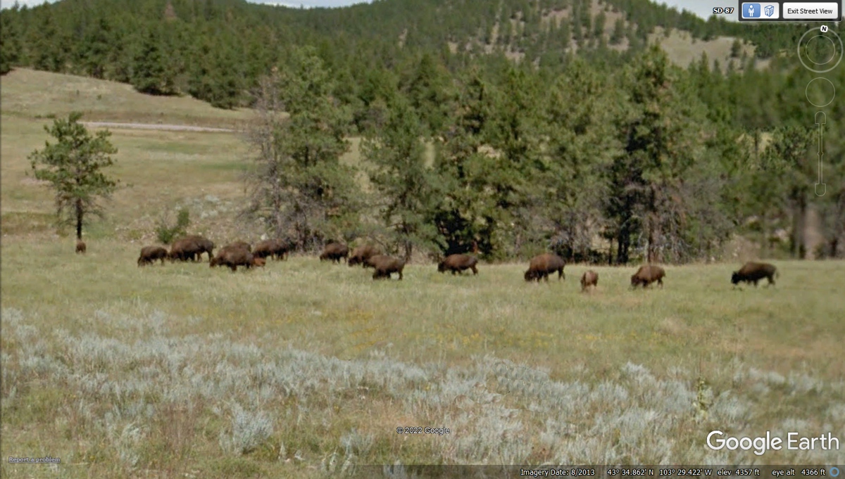
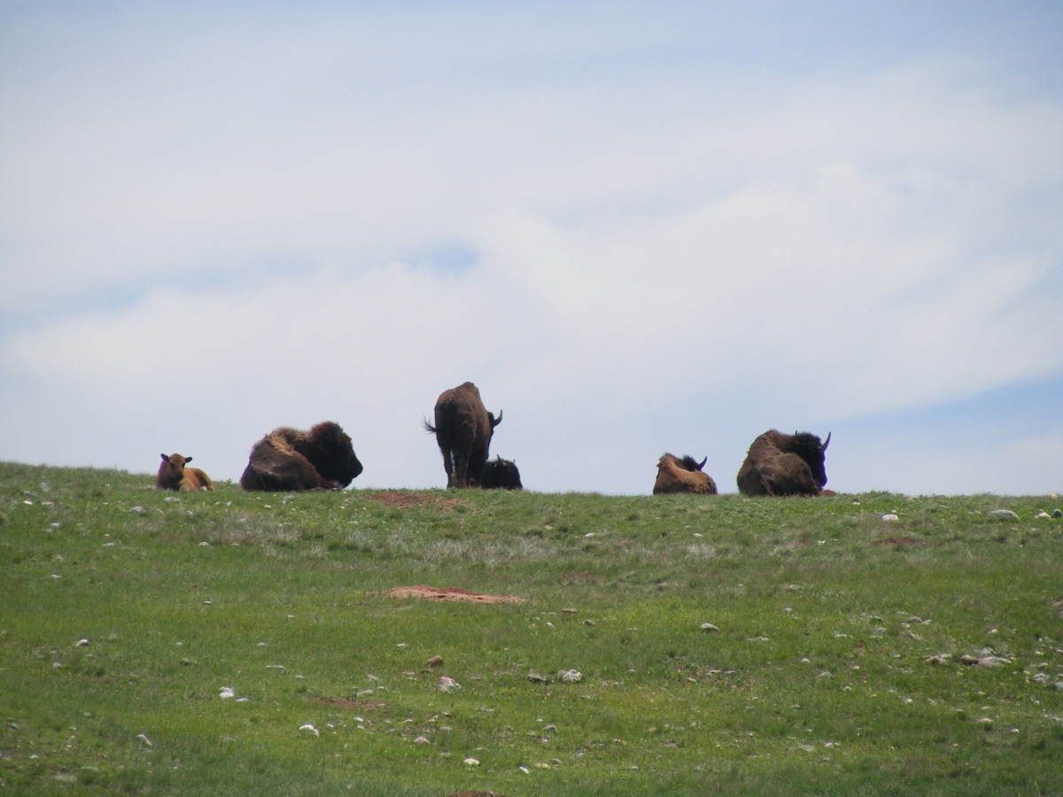
There were a couple of Bison "loners" who were
near the herd but not in their group seen in the image above.
This is my cropped camera shot of the Bison herd near the
south end of Wind Cave National Park from June 10, 2022. This part of the
herd was on the East side of US 385.
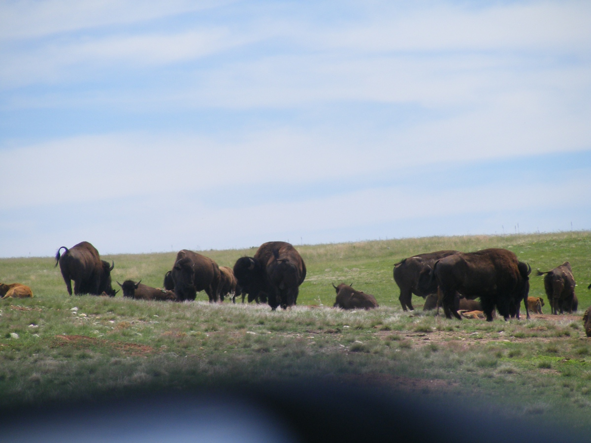
These other Bison were on the West side of US 385 on top of
a ridge. My camera was set with 10X zoom lens at full magnification.
I took this photo of more Bison on the East side of US 385.
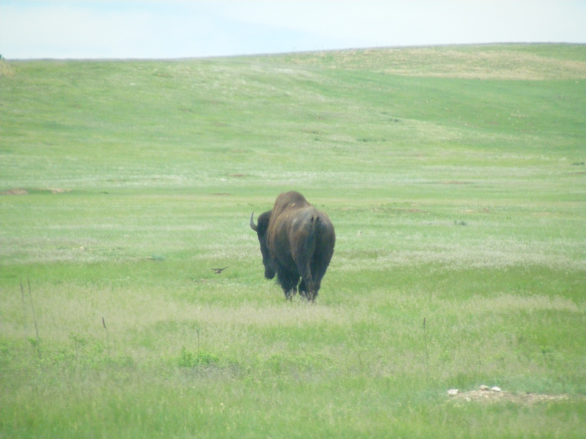
This solitary bull was slowly crossing US 385 from East to
West and began a slow walk up toward the top of the ridge.
| SOUTH FROM CUSTER, SD - PAGE 49 | RETURN TO WESTERN TOUR INDEX PAGE |