May / June 2022 Vacation Day 2 · · PAGE 2.
May 24, 2022: When we left the motel this morning, I drove from Moss Point to a Wal-Mart in nearby Pascagoula, Mississippi to top-off the fuel tank with 7.496 gallons of fuel priced at $3.939 per gallon for a total of $29.53 for about half a tank of gas.
I am continuing with my computer re-creation of the route we used during our big western tour vacation. Day 2 takes
us west from Moss Point, MS parallel to US 90 along the Mississippi Gulf Coast via I-10 until we
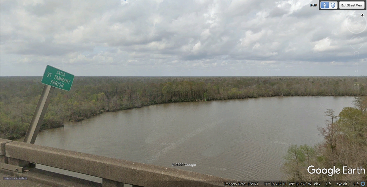
reach the state line to Louisiana. I-10 crosses the Pearl River seen here
where the next county is Saint Tammany Parish. Of course, the sign is in
the middle of this bridge as so many other state lines we have seen in our
previous trip to the northeastern USA.
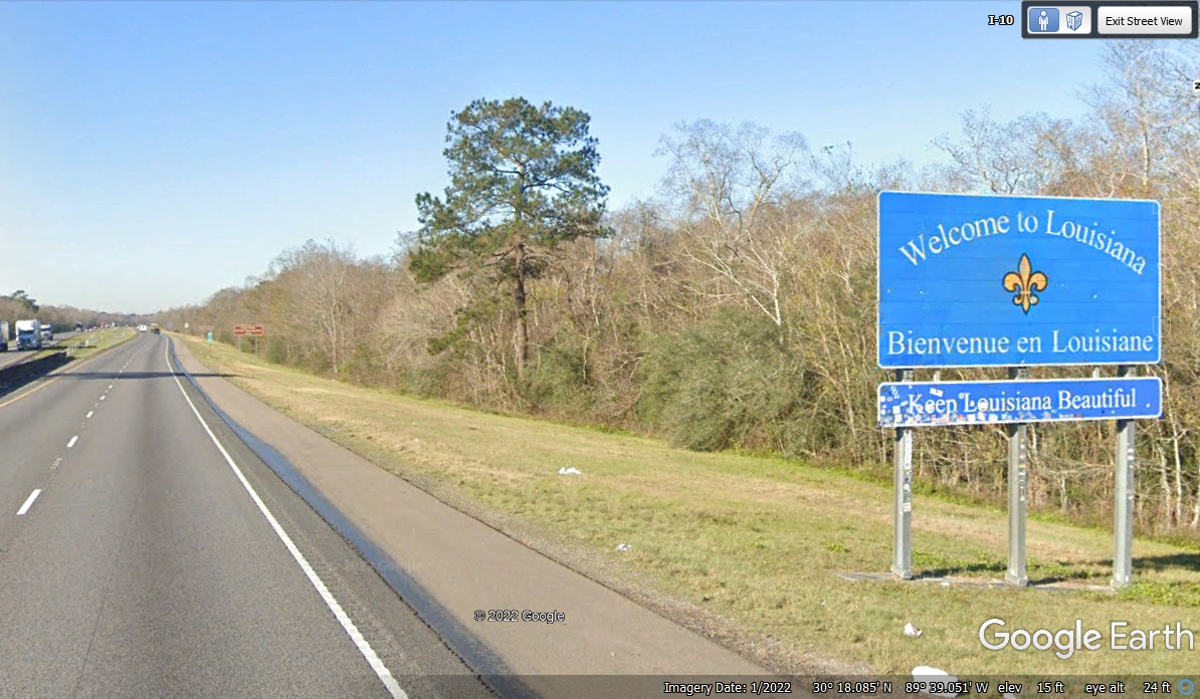
Not far from the west end of the I-10 bridge across the Pearl River is the
official "Welcome to Louisiana" sign. The irony of this photo is
the "Keep Louisiana Beautiful" sign is in need of replacement.
That part of the sign itself is not beautiful.
The junction of Interstate 12 going west is at the south end of Interstate 59,
about 75 miles from the motel where we stayed near Moss Point, MS and about 6 miles inside
Louisiana. I-59 comes down from the Chattanooga area following the route of US 11
through Georgia, Alabama and Mississippi. We continue on I-12 west since it is the bypass
north of New Orleans until we turn north on Interstate 55 that comes north out of the
New Orleans area on the west side of Lake Pontchartrain.
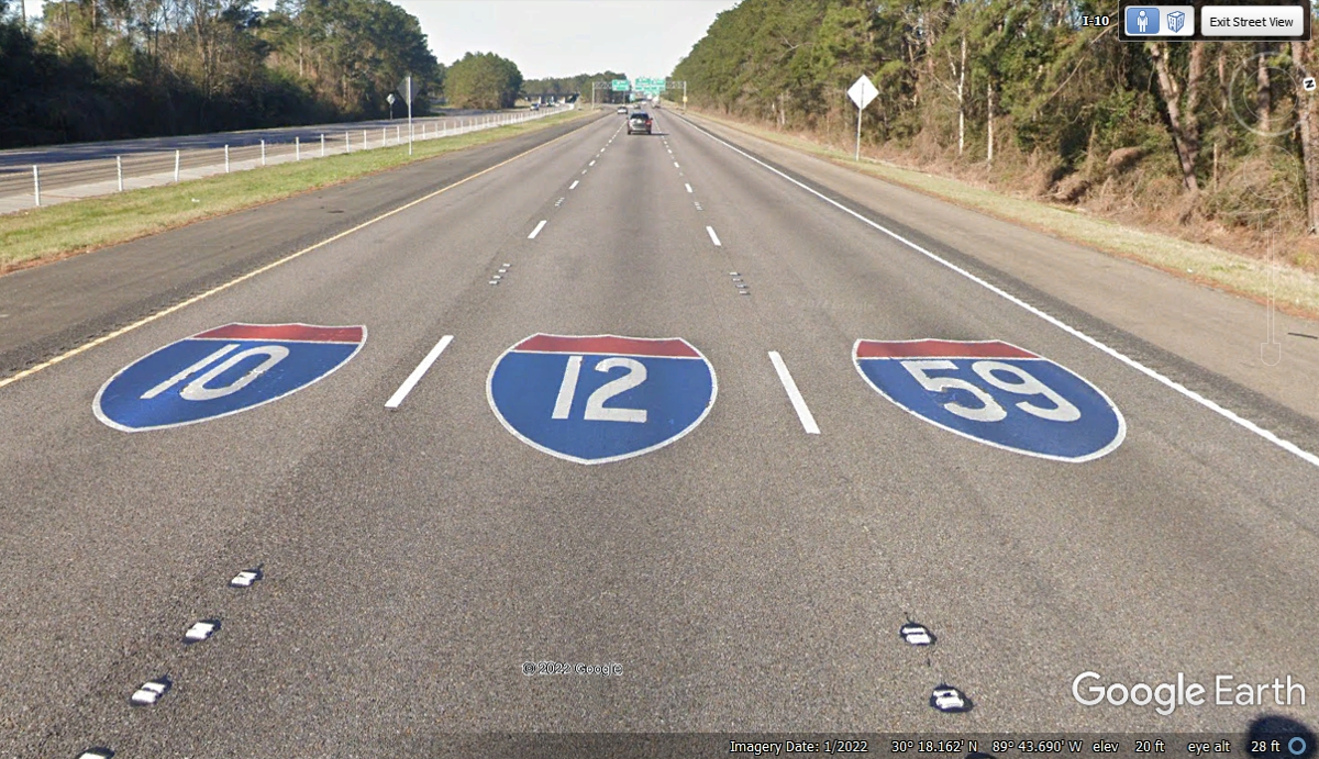
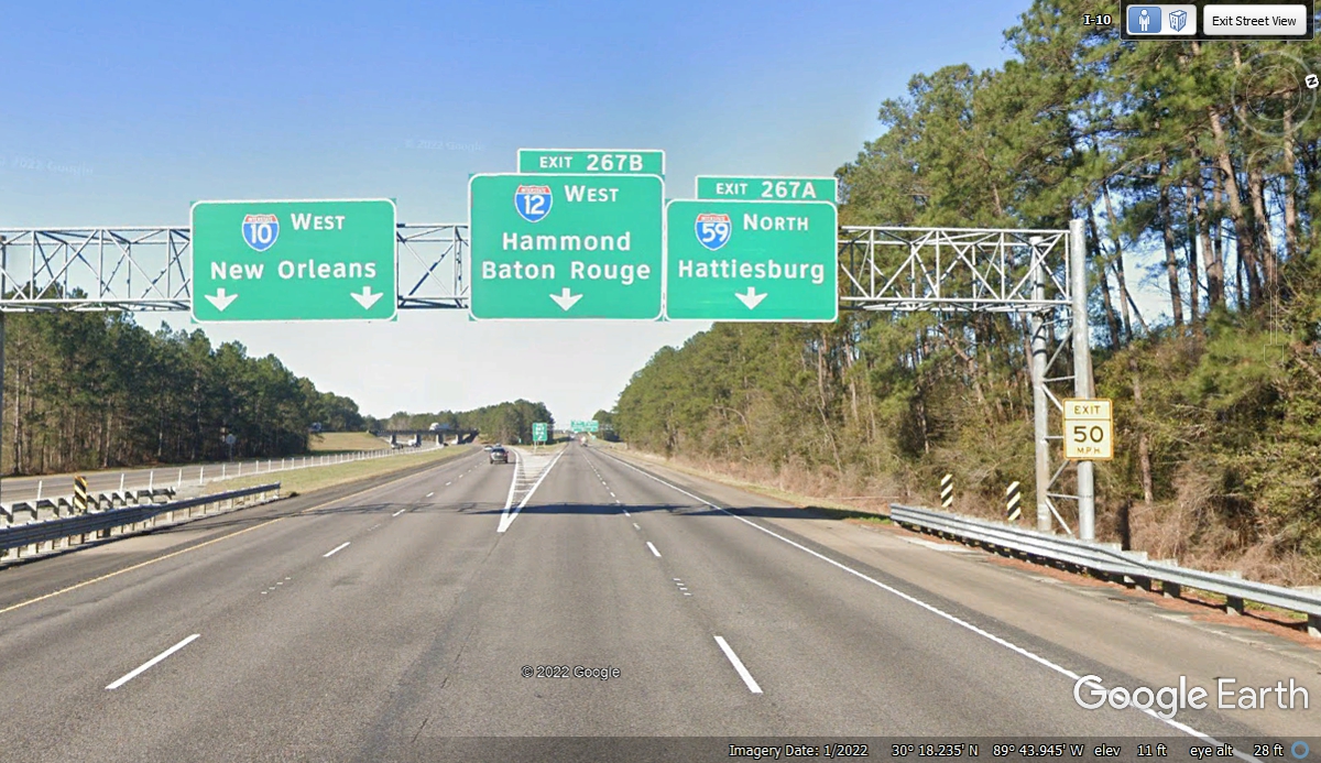
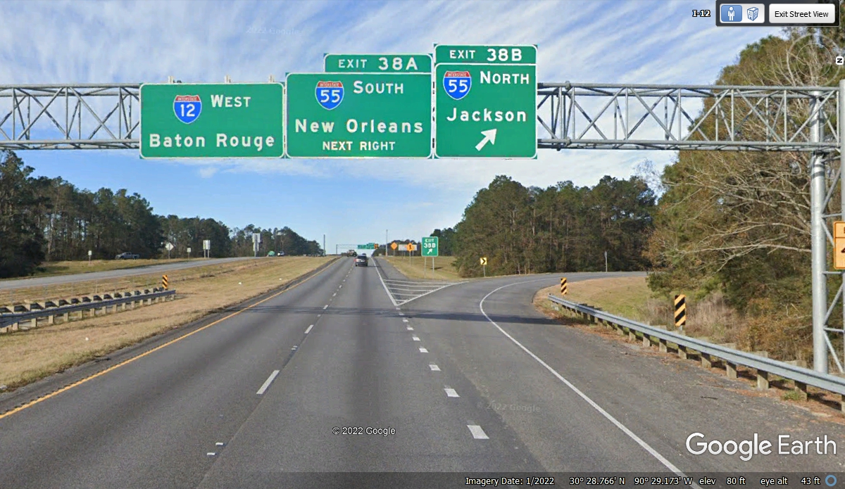
Here is the intersection of these three interstate highways.
Interstate 10 turns LEFT here going south to the city of New Orleans. I-10
then comes back toward Baton Rouge to continue WEST to California. Our
route west will use I-10 when we join that route about 105 miles west of Austin,
Texas. I will have more about that when we get there.
About half way across the length of I-12 is this junction with Interstate
55 we used to go north about 57 miles to US 98 at McComb, Mississippi.
This exit is 20 miles north of the Louisiana / Mississippi state line.
Exit 20B will put us on US 98 and back to our westerly course for our lunch stop in
Natchez, Mississippi today.

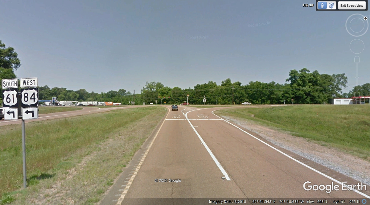
This is the one and only US 98 sign near the I--55 exit 20B as it goes west
toward the US 84 junction near Bude, Mississippi. The fuel prices on these
images are not
current during our trip. This Google Earth image below is from October
2019. The data at the bottom of these Google Earth images also includes
latitude and longitude, plus elevation information in feet relative to mean sea
level (MSL).
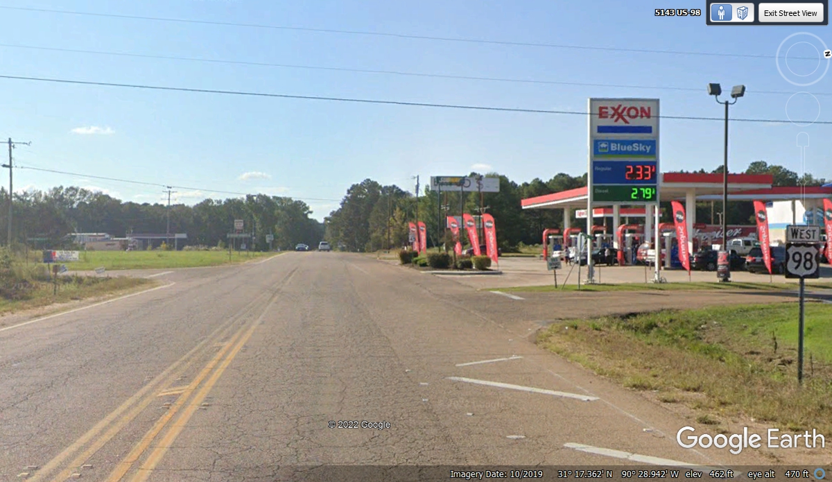
US 98 and US 84 have a junction near Bude, Mississippi. We followed
US 84 west to Natchez, MS.
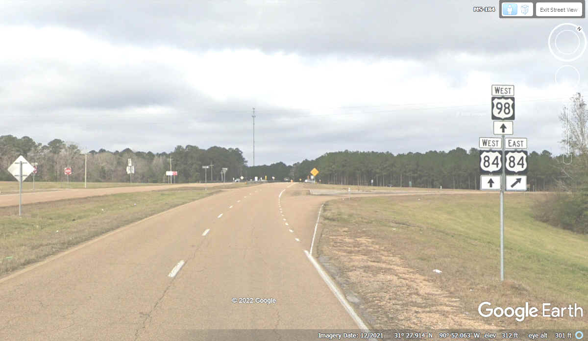
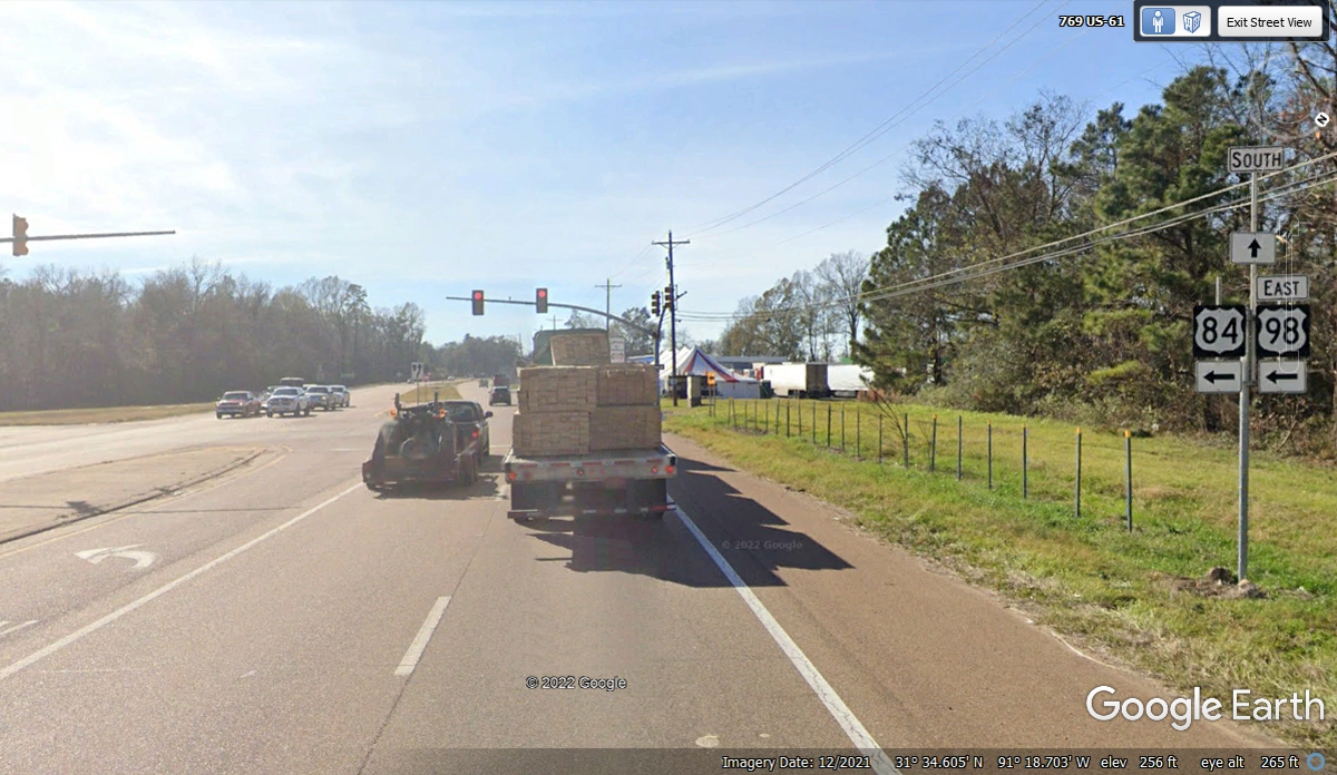
I was surprised to see US 98 turning left here to follow US 84 going west
to Natchez. My older maps showed them joining further ahead.
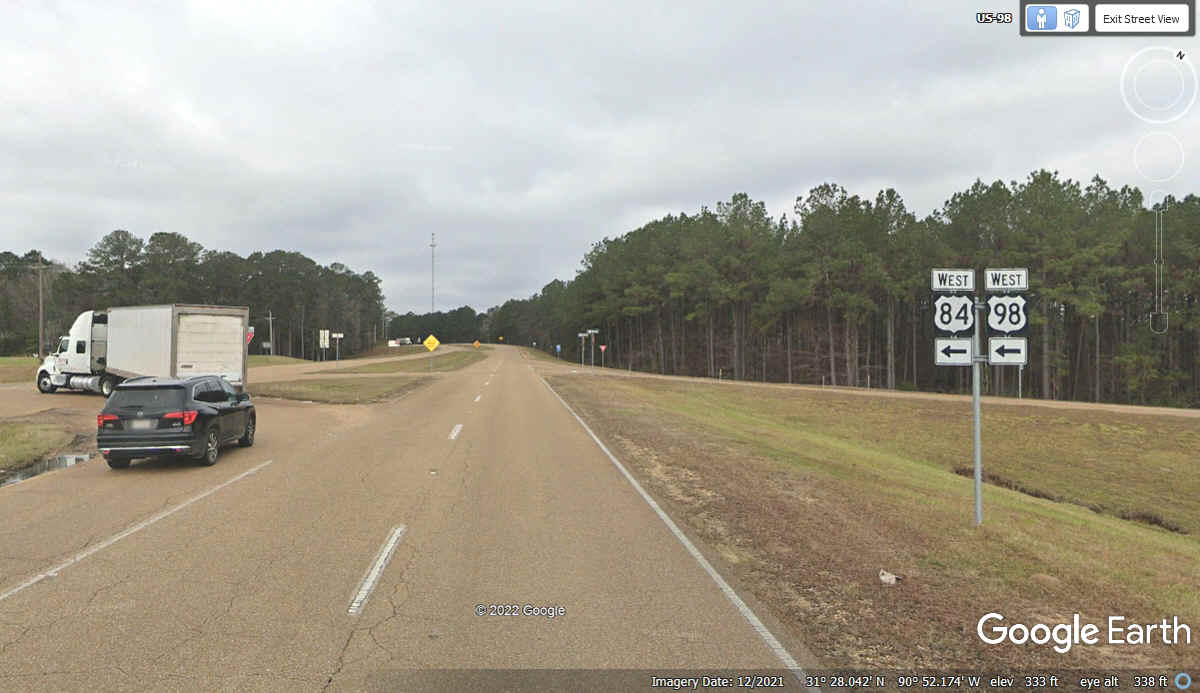
US 98 ends at this junction with US 61 where US 84 turns left on the east
side of Natchez. US 61 starts from New Orleans and goes up to the border
with Canada. US 61 is marked as the "Great River Road" for
tourists as it follows the Mississippi River, always on the East side of the
river.
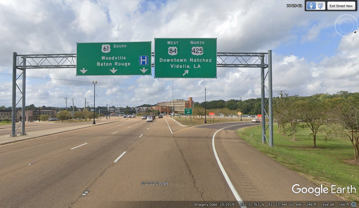
Although the US 61 sign is missing from this photo below, here is what the US 61
southbound traffic sees as they approach the intersection of US 84 and US 98
heading East from Natchez. US 98 goes all the way to the Atlantic Ocean on
the Island of Palm Beach just east of the larger city of West Palm Beach,
Florida.
US 61 follows along the Mississippi River on the east side of the river from New
Orleans north to Minnesota. This intersection is at the Eastern side of
Natchez, Mississippi.
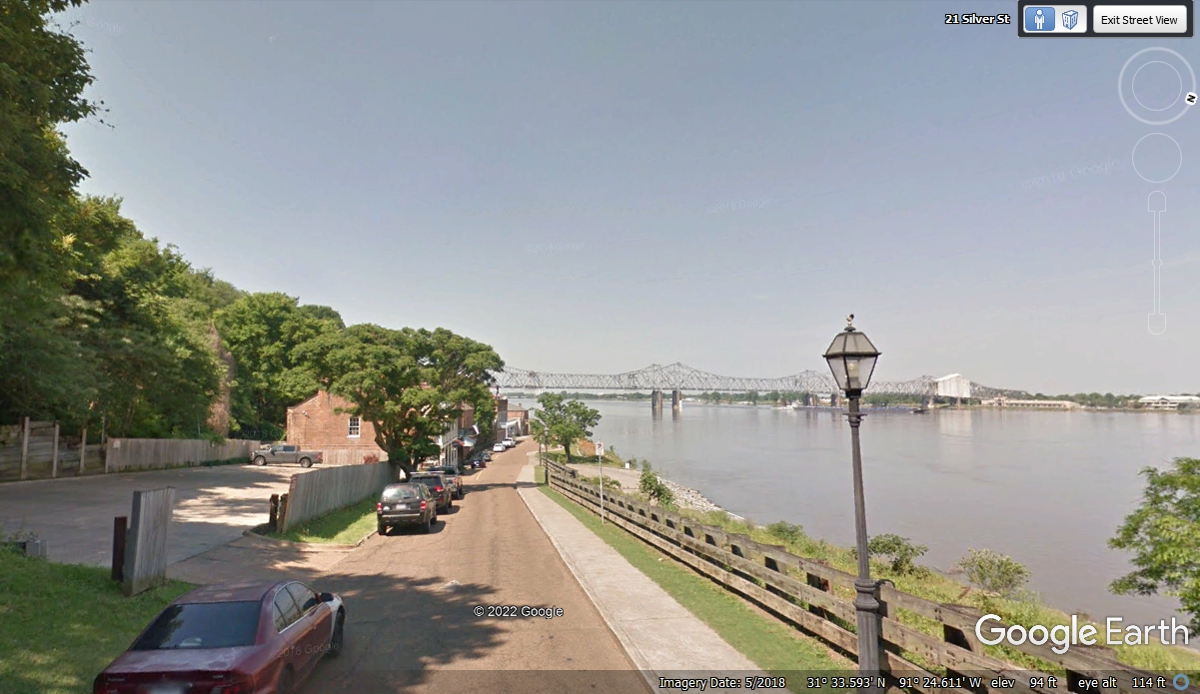
Silver Street is the road from downtown Natchez to get down to some of the
river boats that dock here.
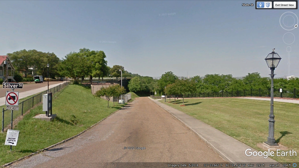
Here is the view looking down Silver Street from about half way down to the
Mississippi River.
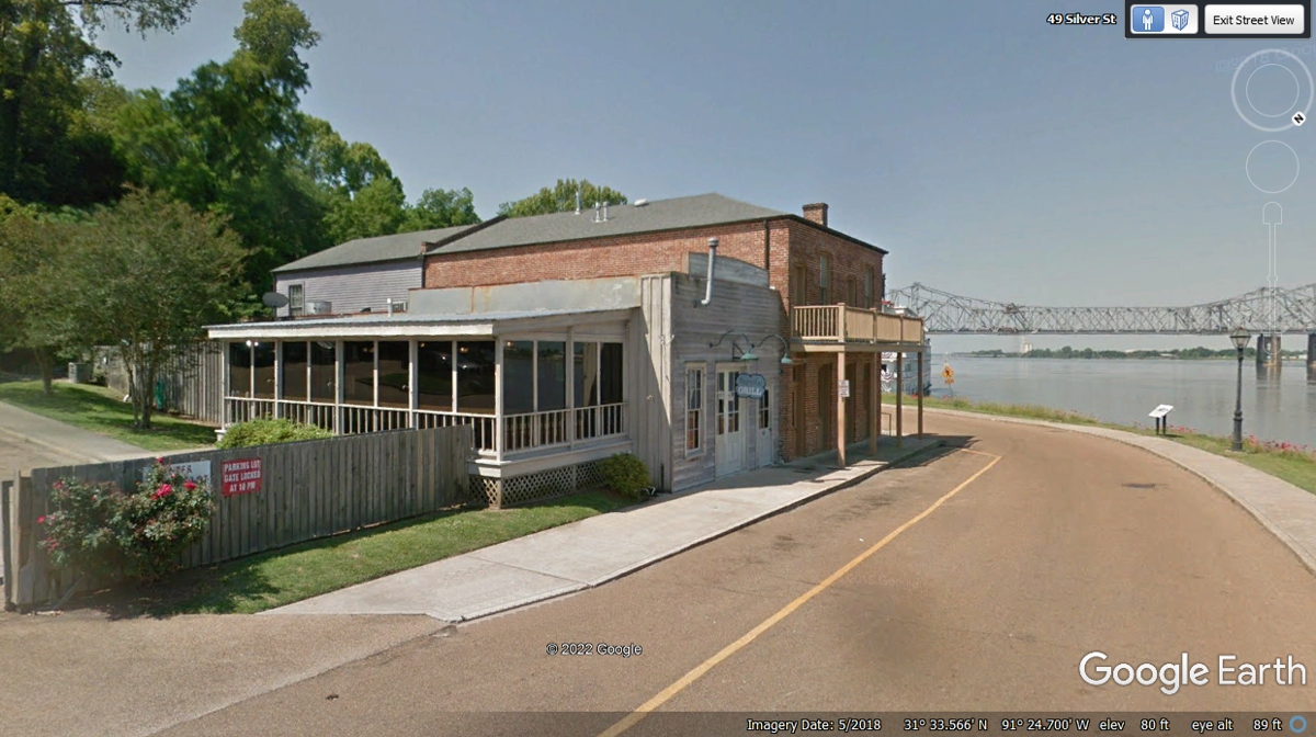
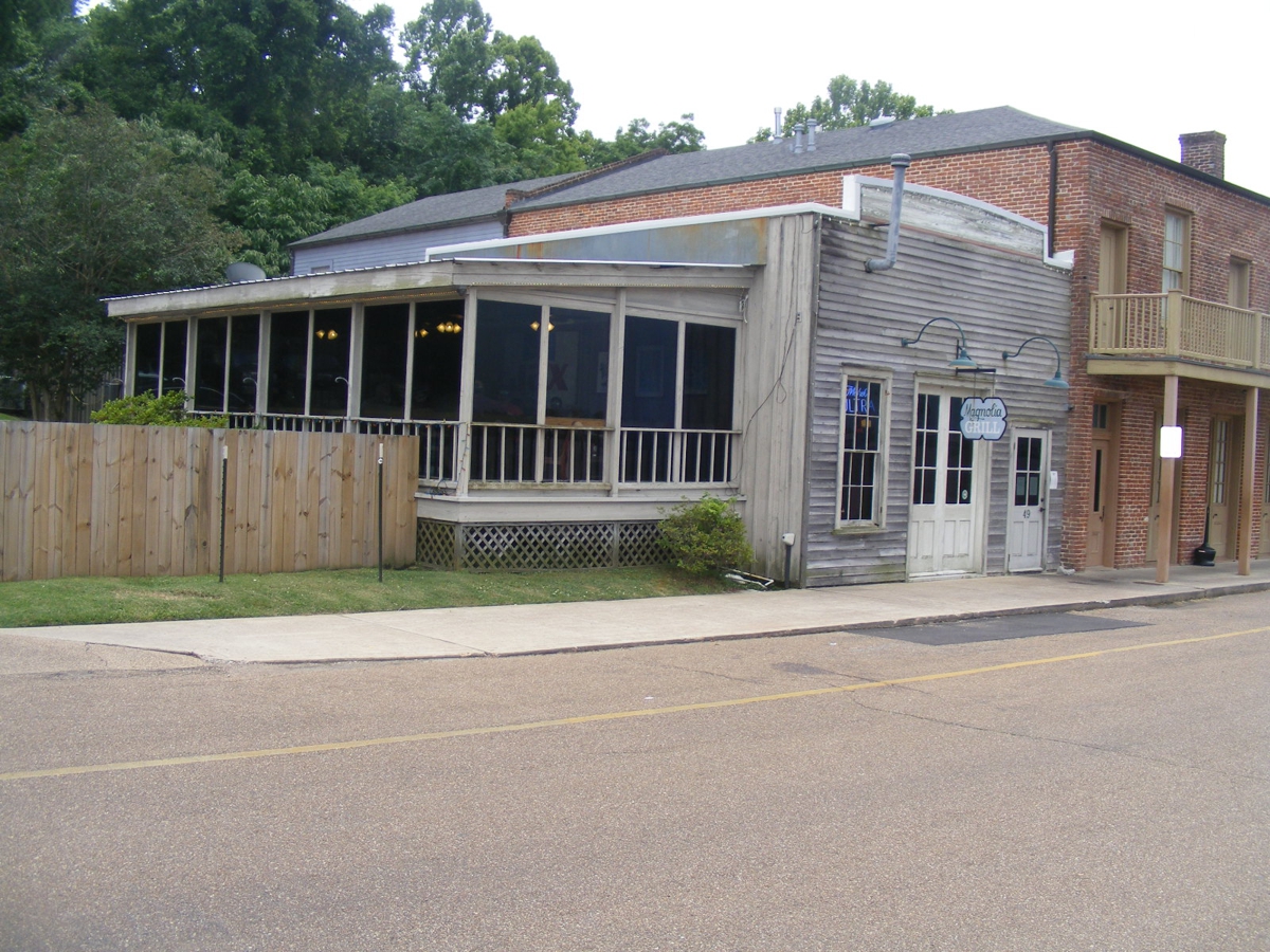
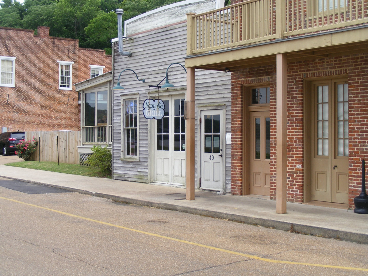
We went to the Magnolia Grill restaurant on the bluff above the
Mississippi River for lunch. They have wonderful jumbo shrimp. With
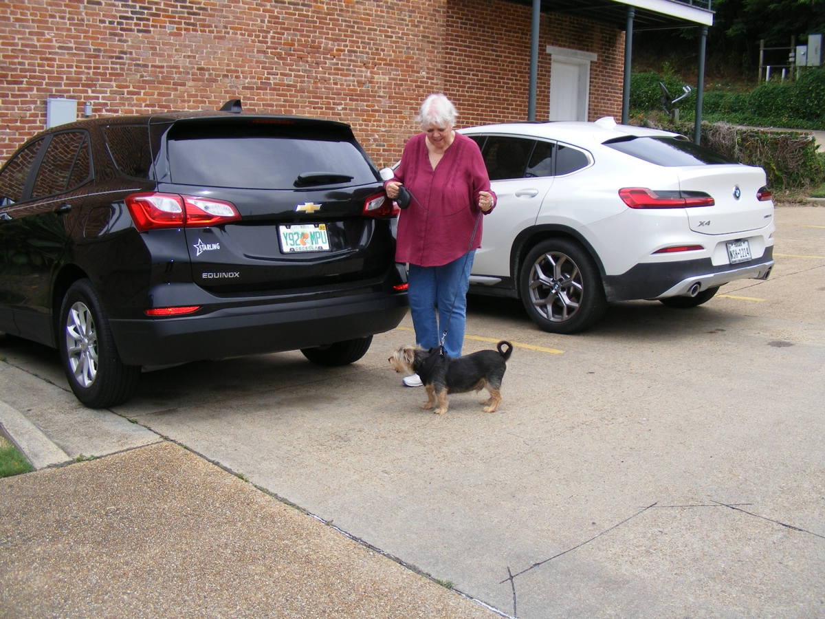
Linda's dog named "CHASE" traveling with us, he has to remain outside
of any restaurant we visit. All our meals are take-out or from the
drive-through windows on this trip. With the warmer temperatures as Spring
gives way to the coming Summer, we eat all our meals in her Chevy Equinox with
the engine idling to run the air conditioner and park in the shade when it is
available. We parked in the lot seen at the left edge of this image with
the car facing away from the sun to keep it cooler in the car. We do not
leave Chase alone in the car at any time in this trip. Every time we stop
the car, he is ready to get out to smell what is at each location and empty his
bladder.
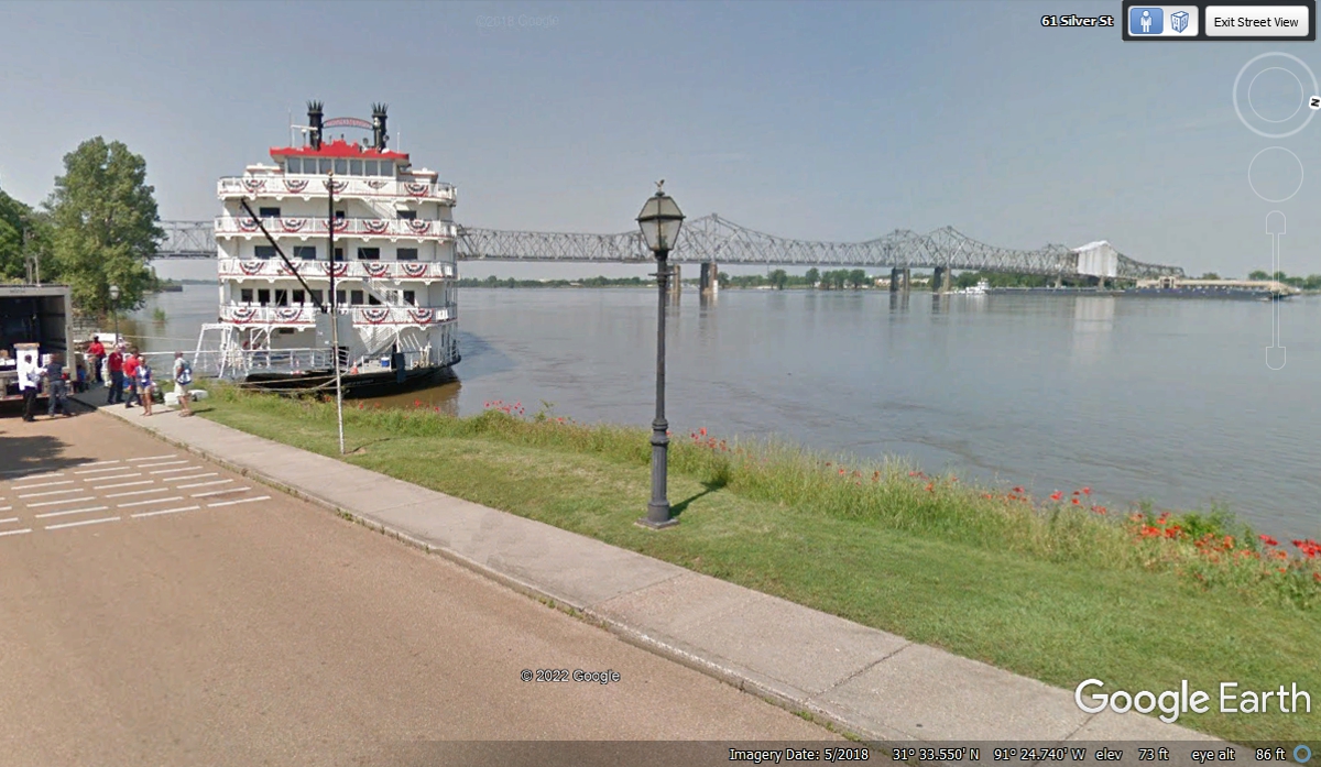
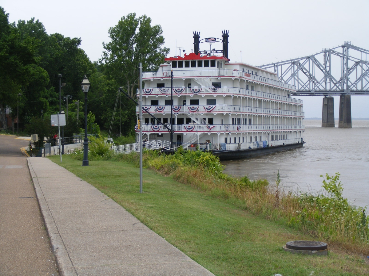
The Mississippi River has been a lifeline for the heart of our country for
hundreds of years. The river boats have evolved to what you see here in
this image from May 2018. The modern boats has a large paddle at the rear
(stern) of the boat that is now just ornamental and does not drive the
boat. Thrusters can move the boat in any direction as needed when
docking. Here is a link about modern boats and how
they are propelled.
https://usarivercruises.com/blog/the-truth-about-paddlewheels/
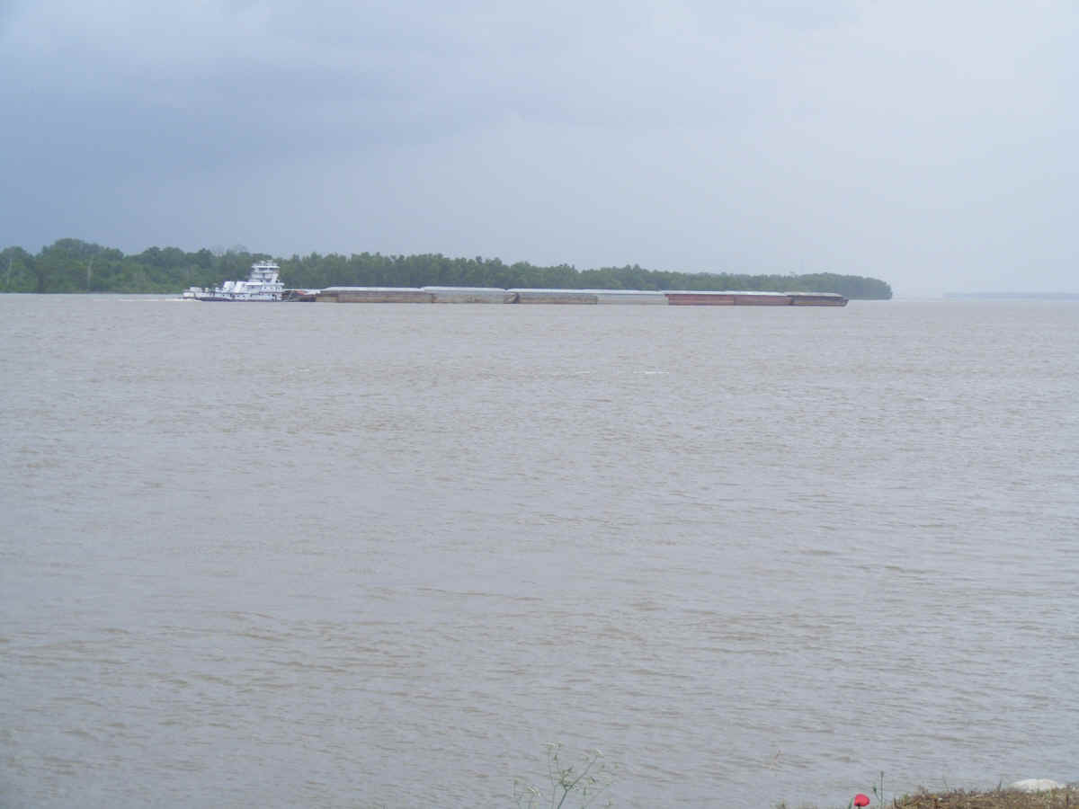
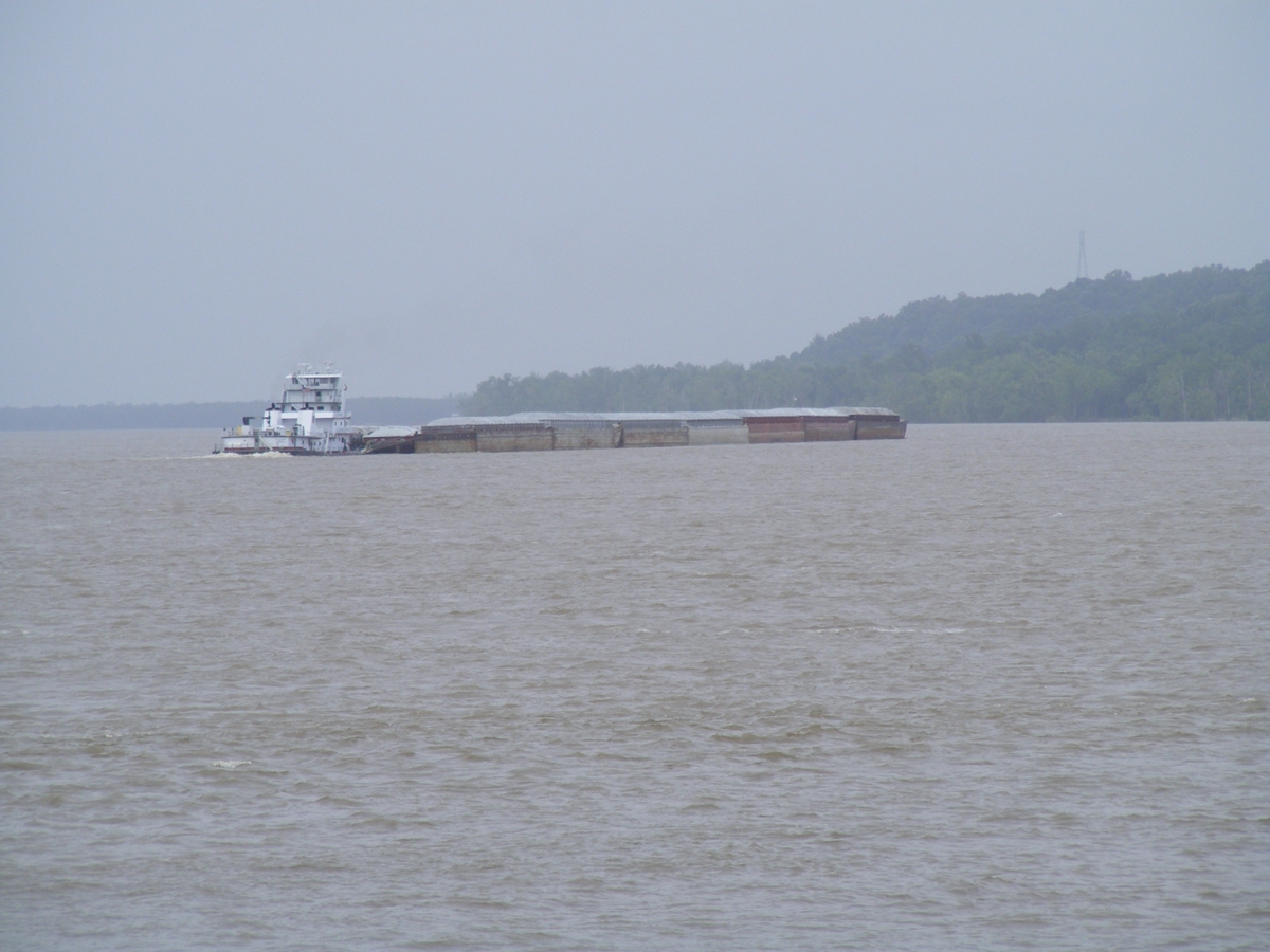
Linda discovered the memory chip in her digital camera was FULL. I
took a few photos with my camera while we were here. The tug boats push
these large flat-bottom barges up and down river with their cargo.
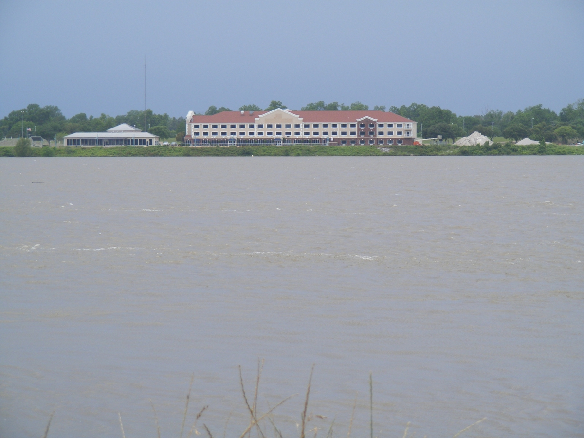
This building on the west bank of the river in Vidalia, Louisiana is the
Clarion Suites hotel.
This image captured Linda and her Dog Chase across Silver Street from the
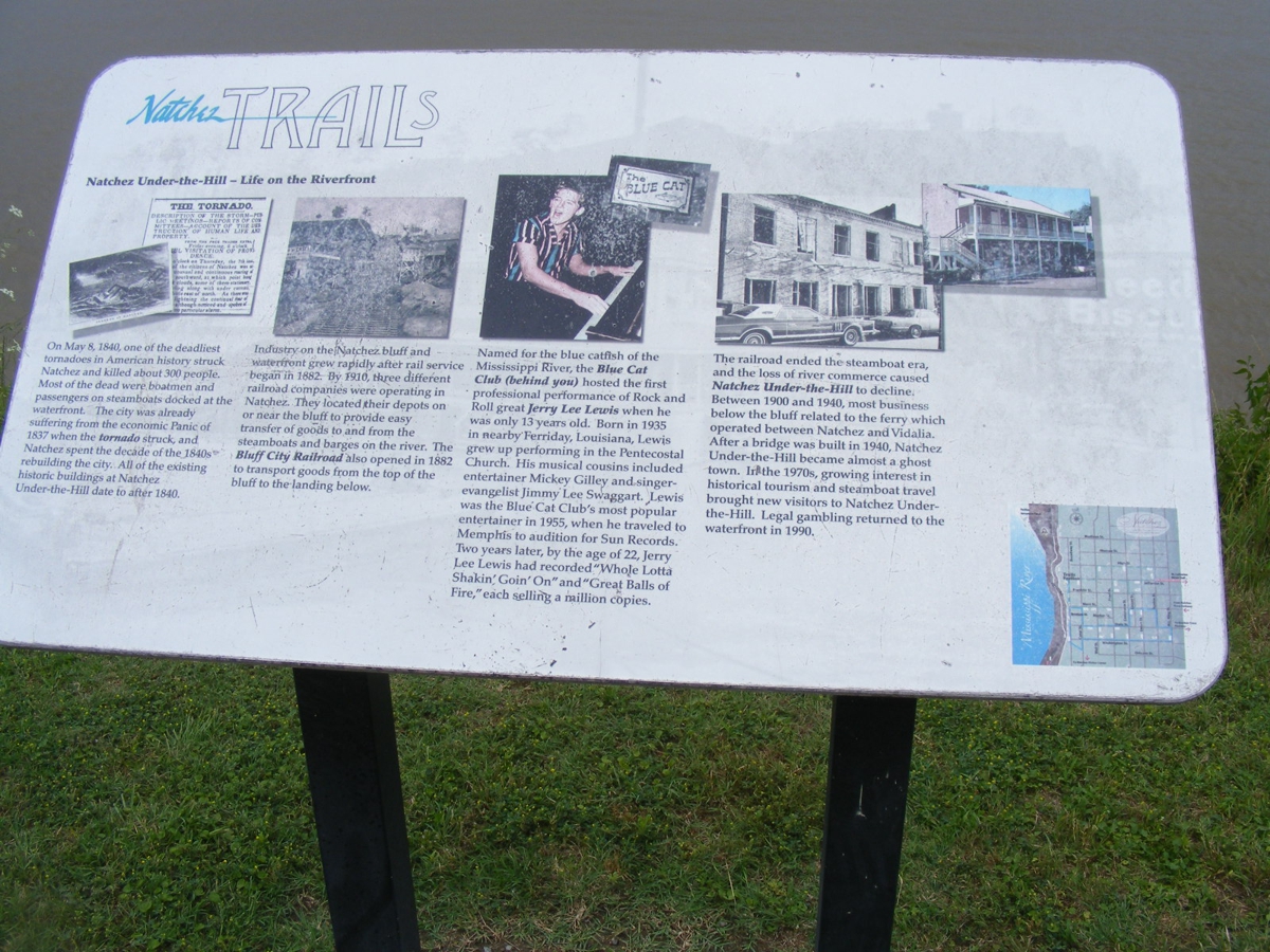
gray building of the Magnolia Grill in Natchez. There is a commemorative
plaque by the sidewalk down the street beyond Linda and Chase.
The guy singing while playing the piano is Jerry Lee Lewis who became
famous during the rock and roll era of the 1950's.
Here is a full view of the Magnolia Grill restaurant in this gray building
with a screen room for extra dining space. The fence hides some of the
parking lot where we had our meal in the front seat of Linda's Chevy Equinox
SUV.
This modern flat-bottom river boat goes up and down the river near Natchez
for dinner cruising with tourists. This is my photo taken on day 2 of our
western tour from Florida to the Pacific Ocean in Oregon.
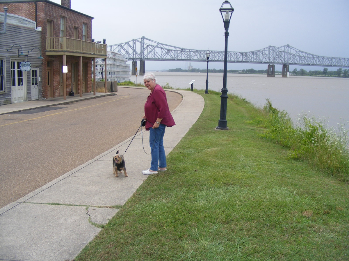
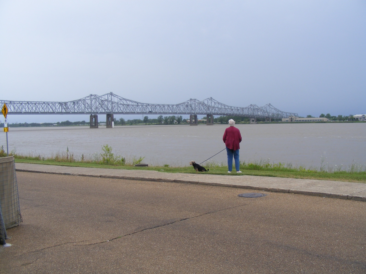
I really like this photo I snapped of Linda and her dog with the twin
Mississippi River truss bridges in the background.
Natchez is located near a bend in the river as seen here beyond the tug
boat and barges.
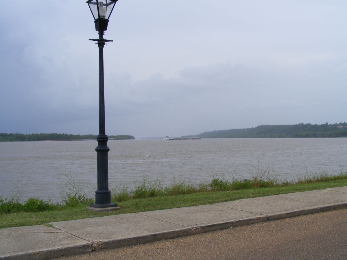
I used my telephoto lens setting to get this final image of the boat and
barges heading upstream.
1 wanted to get this image showing Linda's Black Chevy in the parking lot
adjacent to the Magnolia Grill.
We are ready to depart the restaurant before going over to Wal-Mart to get
memory chips for her camera.
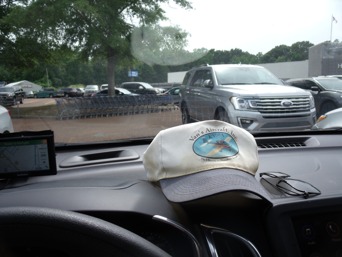
We
went back to the local Wal-Mart we passed coming into town to buy her TWO memory
chips which should last several years each. They were cheap, and that is
why I got two of them. I put one chip in her camera and it formatted the
memory chip immediately. Here is the test image I made in the car to be
sure the chip worked perfectly. My hat and sun glasses are required for
this trip as we are heading west. The polarized sun glasses cut down on
the glare from the sun.
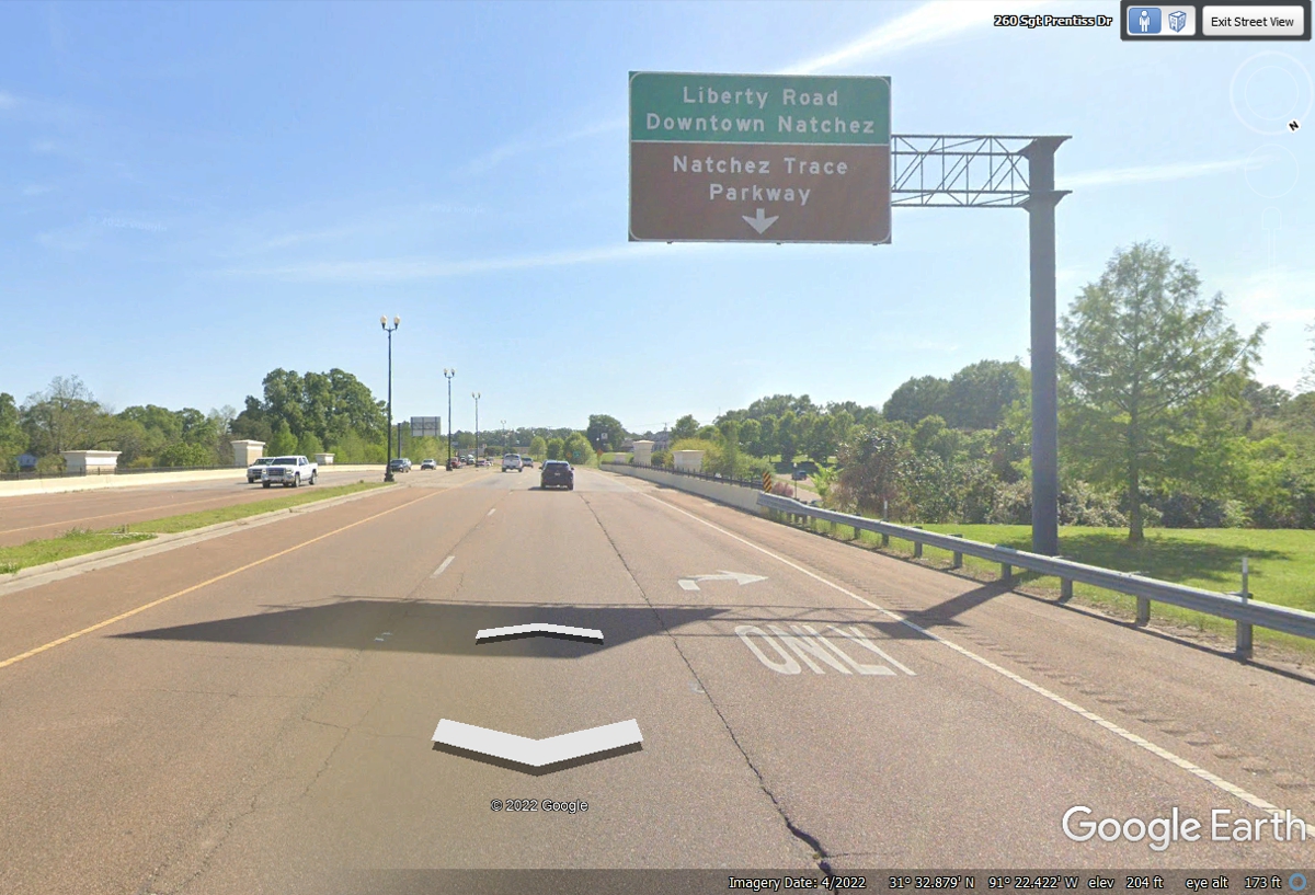
Linda snapped some photos similar to the ones
seen below from Google Earth. When we were leaving Wal-Mart, we took a
short ride north on the Natchez Trace Parkway looking for an old mansion that is
now a bed and breakfast hotel. We found the gate to the place, but it was
locked. We came back to Natchez and headed toward the bridge across the
river to Louisiana.
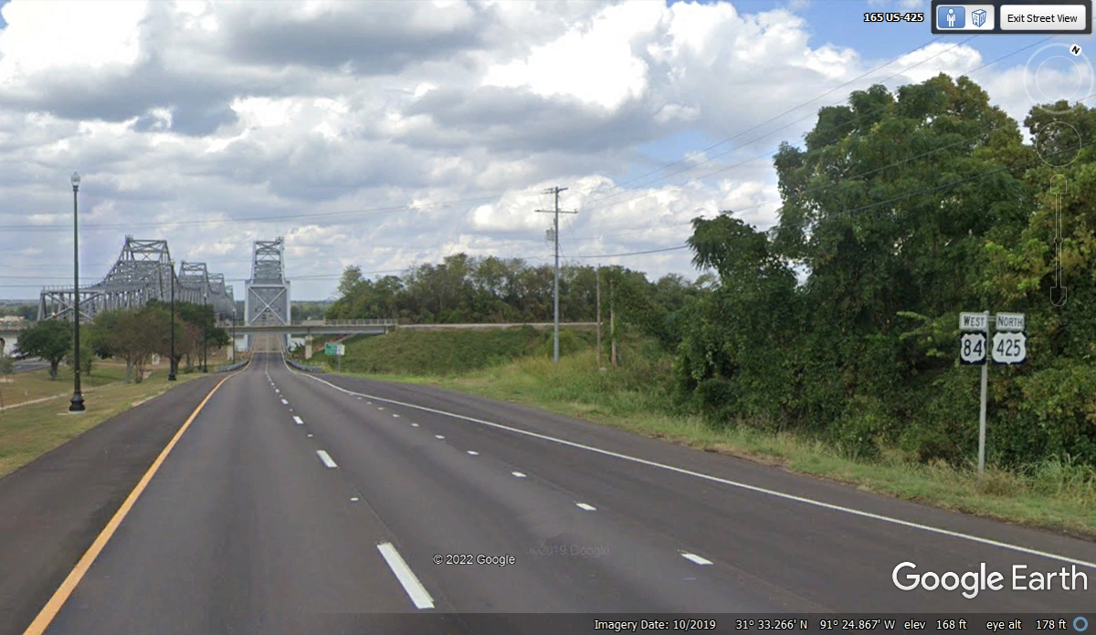
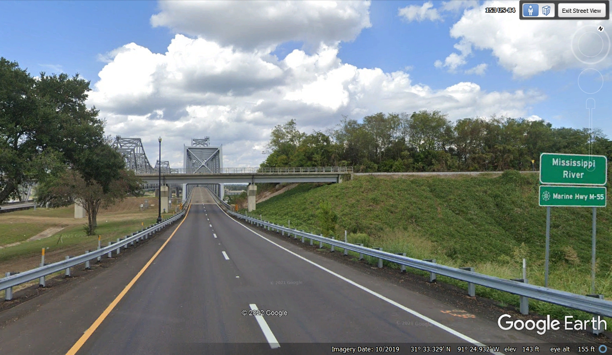
US 84 crosses the Mississippi River here at Natchez as seen in the images
above and this view from US 84 as it approaches the bridge seen in the image
below.
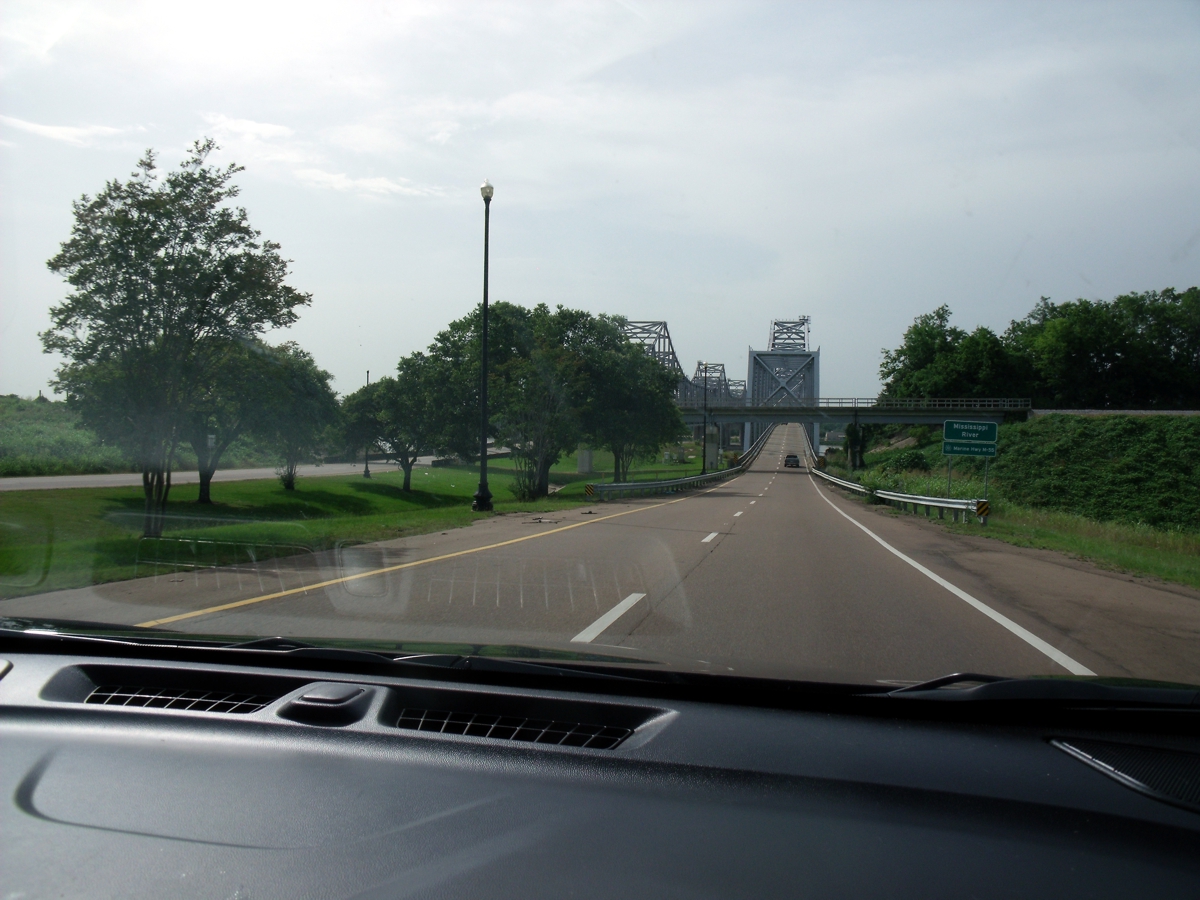
Here is Linda's photo as we approach the bridge across the Mississippi at
Natchez going west.
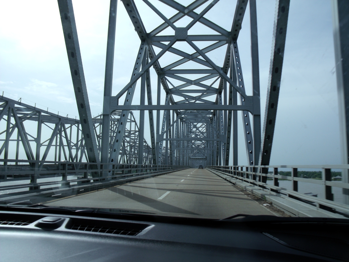
The details of the Mississippi River bridge are revealed as we get closer
to it. Since I was driving, I used these images from Google Earth.
Here is her second photo taken from inside the bridge.
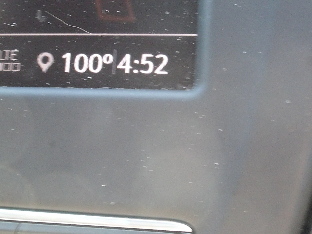
Because the outside air temperature was high, she snapped this image from
the information screen in the car. The time on the screen comes from her
cell phone since it is paired to the car. The local cell towers in each
time zone updates the clock in her cell phone as seen in this image below.
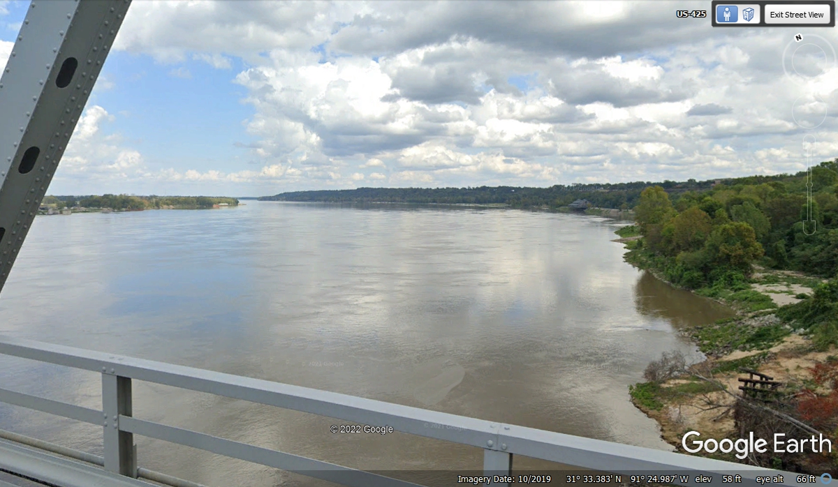
I have crossed the Mississippi River many times from Minnesota down to New
Orleans on different highways, and several times in my airplane above 10,000
feet and as low as 1000 feet above ground level. This far south on the
river, the width of it is amazing. The combined flow of water from the
Ohio River, Missouri River and more create the view seen here.
Here is a view looking back toward the bluff where the Magnolia Grill is
located. The RED LINE to the restaurant is just under half a mile in
length from this point on the bridge looking northeast. The river is
about 0.56 miles wide at the westbound bridge location.
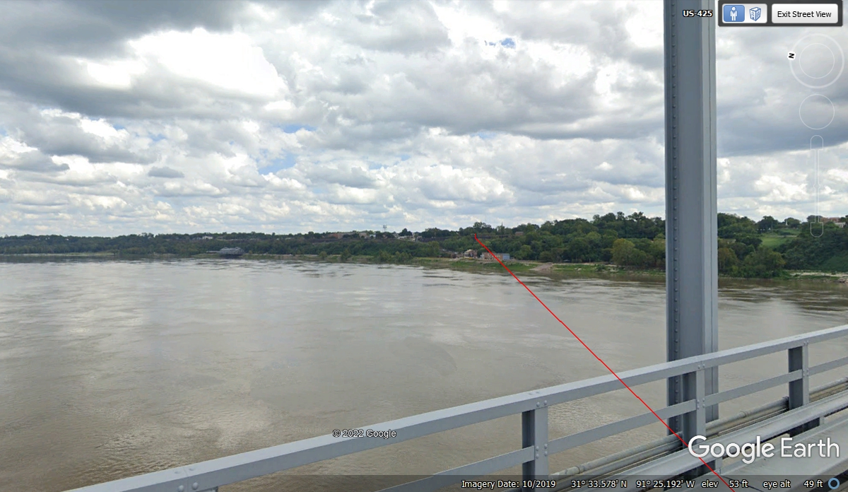
The Louisiana State Line is marked near the middle of the river bridge.

The town of Vidalia, Louisiana is at the western end of the bridge across
the Mississippi River. We are still following US 84 west until we reach
State Route 28 that will take us to Alexandria, Louisiana where we will spend the
night. Vidalia, Georgia is famous for it's sweet onions grown only in that
southeastern region of the state of Georgia.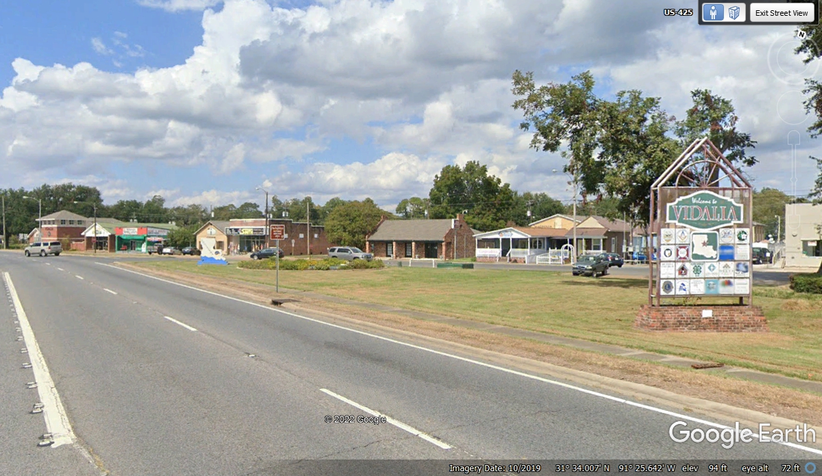
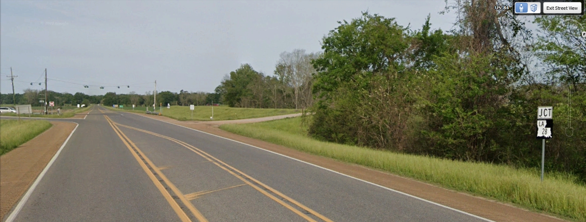
West of Vidalia and Ferriday is where US 84 meets Louisiana state
route 28 that goes southwest 40 miles to Alexandria, Louisiana. We have a motel
room reserved there for tonight.
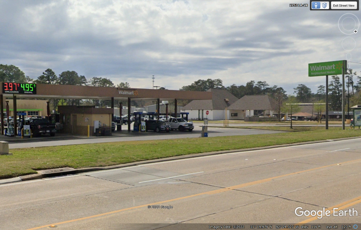
The gas from Pascagoula, Mississippi made it to this Wal-Mart neighborhood
market. I purchased 12.001 gallons of gas at $3.999 per gallon for a total
of $47.99. The fuel tank holds 14.9 gallons.
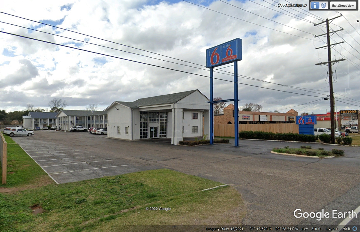
Day 2 ends at this PET FRIENDLY Motel 6 located in Alexandria,
Louisiana on a frontage road for US 71,
| ALEXANDRIA, LOUISIANA to ROUND ROCK, TEXAS - PAGE 3 | RETURN TO WESTERN TOUR INDEX PAGE |