Travel to Saint Louis · · PAGE
8.
JULY 21, 2019: This morning started at 10:15
AM Eastern Time from our motel at Manchester, Tennessee with a short ride of
just over 27 miles to the Jack Daniels facility at Lynchburg, Tennessee -
arriving at 10:57 EDT. We left Jack Daniels just before
1:30 PM Eastern time and went through Shelbyville on our way up to Murfreesboro,
Tennessee to get lunch before beginning the drive to the Saint Louis area on the
Illinois side of the river not far from the Arch across the Mississippi
River. My GPS is always displaying Eastern Time with automatic changes for
Daylight Time.
Shelbyville is famous for its Tennessee Walking Horse competitions held there. You can learn much about those majestic horses via this web site from the Tennessee Walking Horse Breeders' & Exhibitors' Association. There are videos on that site to give you the understanding of why these horses are so interesting.
Lunch at Wendy's with our usual order of salads, with chicken nuggets for
Linda and small chili for me let us finish lunch at 3:17 PM EDT. The local
traffic delayed our connection to I-24 less than half a mile from Wendy's until
3:22 PM. It felt good to get started on the long ride to Saint
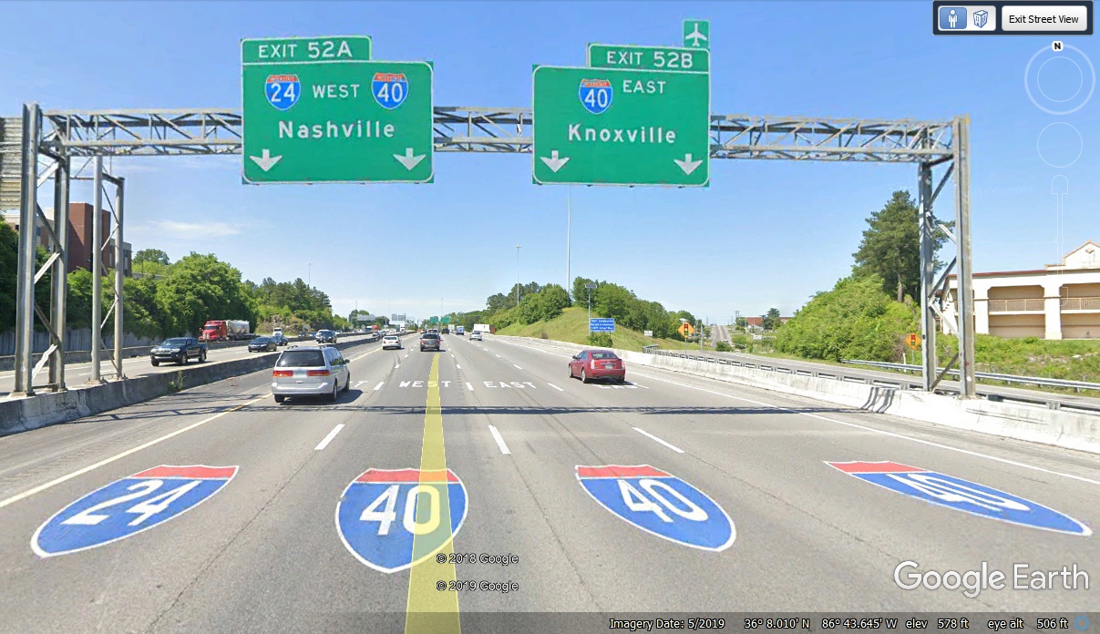
Louis. The GPS recorded the time as 3:46 PM as we connected with I-40 in
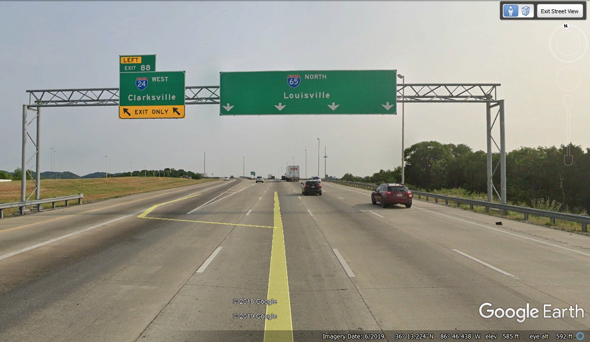
Nashville. It took about 10 minutes to get past the intersection of I-65
heading for Louisville and points north. We stayed on I-24 heading toward
Saint Louis.
The south side of Nashville has all three interstates shown as seen from
above in this image. Interstate 65 comes up from Birmingham, I-24 arrives from
Chattanooga, and I-40 comes from Knoxville.
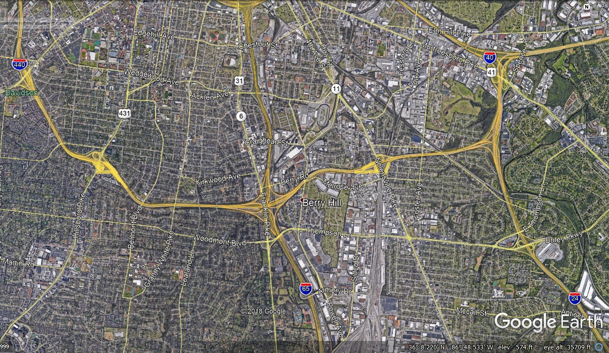
Both I-65 and I-24 get to the north side of town before they split with
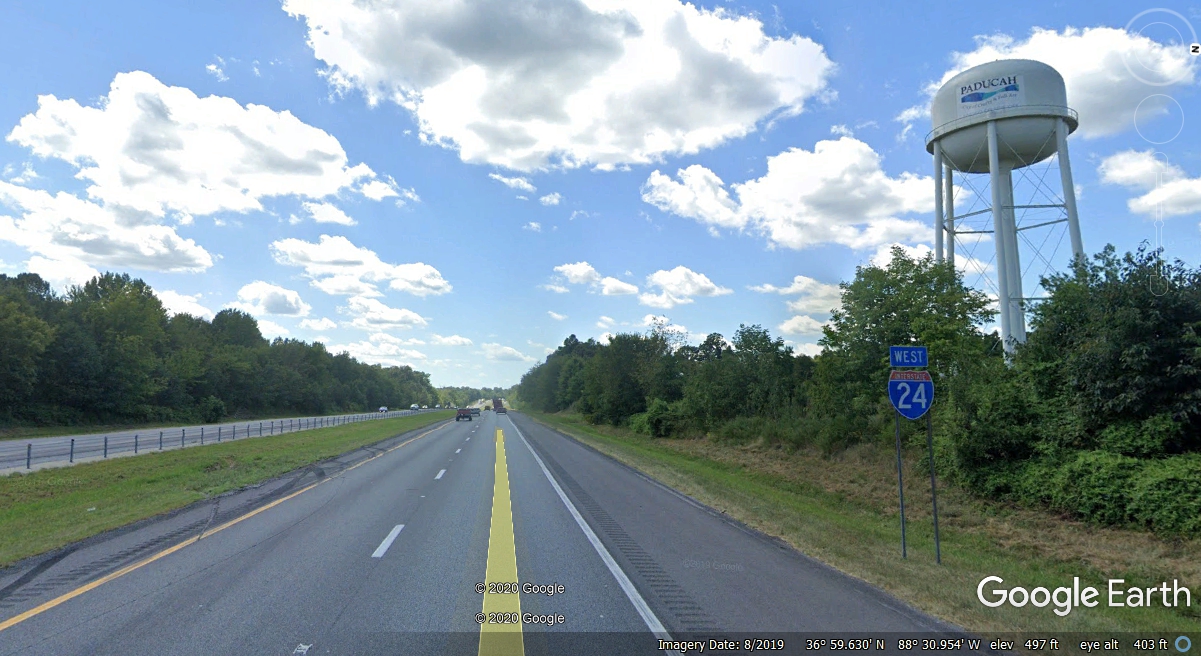
I-65 heading toward Indianapolis and I-24 going to Paducah, Kentucky and into
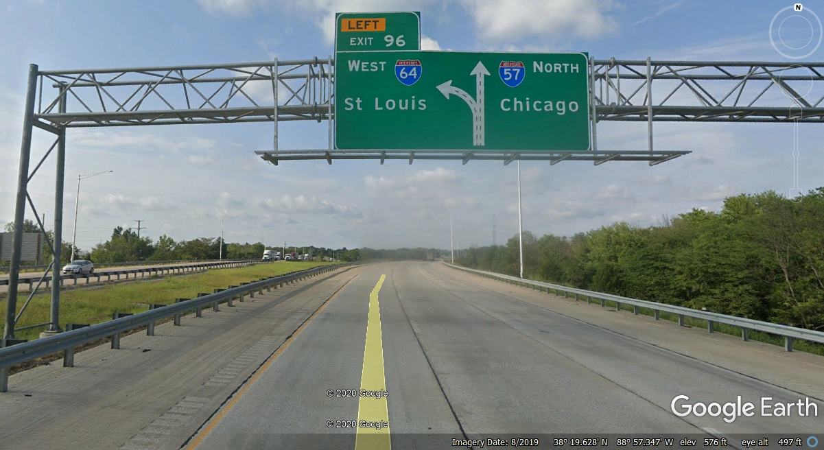
southern Illinois as a route from Chattanooga heading to Saint Louis via I-57
the I-64 all the way into Saint Louis, Missouri. Clarksville Tennessee is the
next city northwest of Nashville.
Here is the route via my old digital roadmap showing the 410 miles from
Manchester, TN over to Lynchburg, then the trip to our motel for tonight at
Cahokia, Illinois.
I had to stop when we crossed into Kentucky to change the memory card in my GPS 296. I have a second 512 MB memory card that has most of the mid-western states on it. The primary 512 MB memory card I normally use has the southeastern states up to Virginia, Pennsylvania and part of New Jersey which covers my business trips up that way.
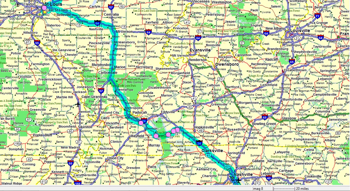
The map above shows where we got off Interstate 24 due to one-lane road
construction and a big traffic jam. I used US 68 westbound to get around
the traffic and get back to I-24 later. This was a divided highway with
local cross road intersections. We were making good time as we headed for
the "Land
Between the Lakes" along this route. It also has some areas of
older two-lane traffic as there are some areas still under construction to four
lanes.
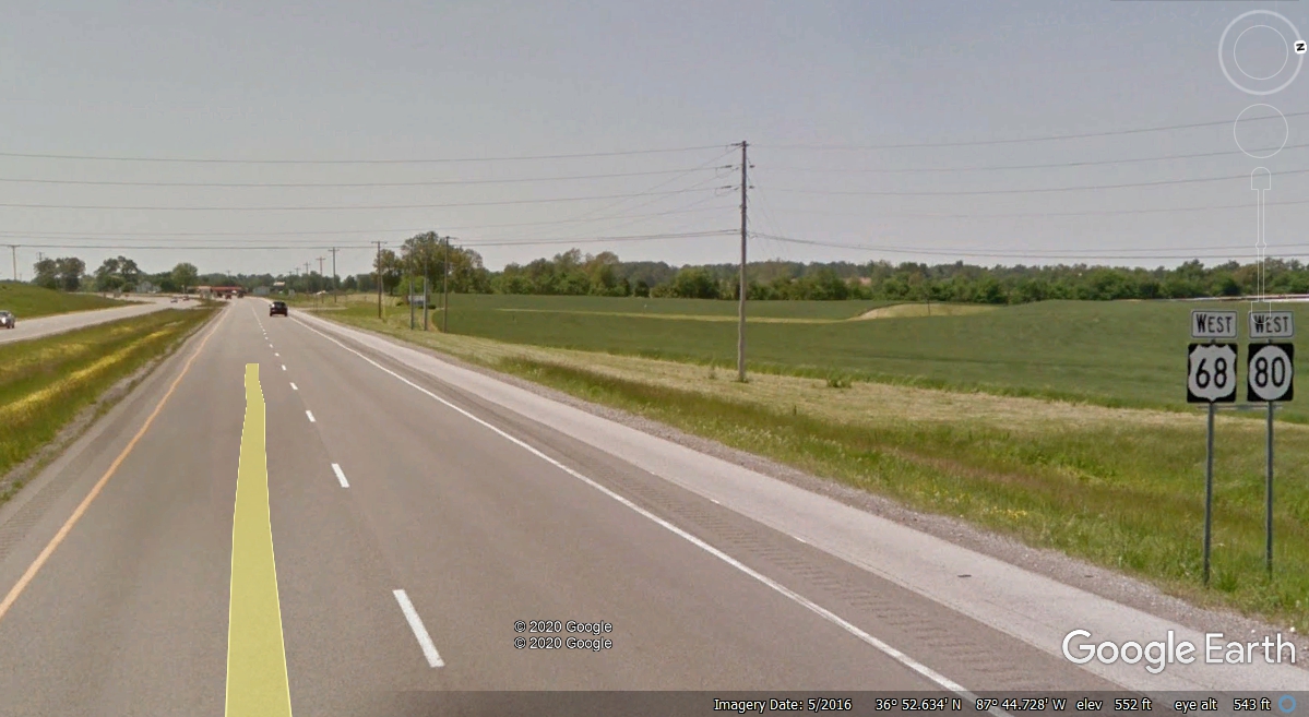
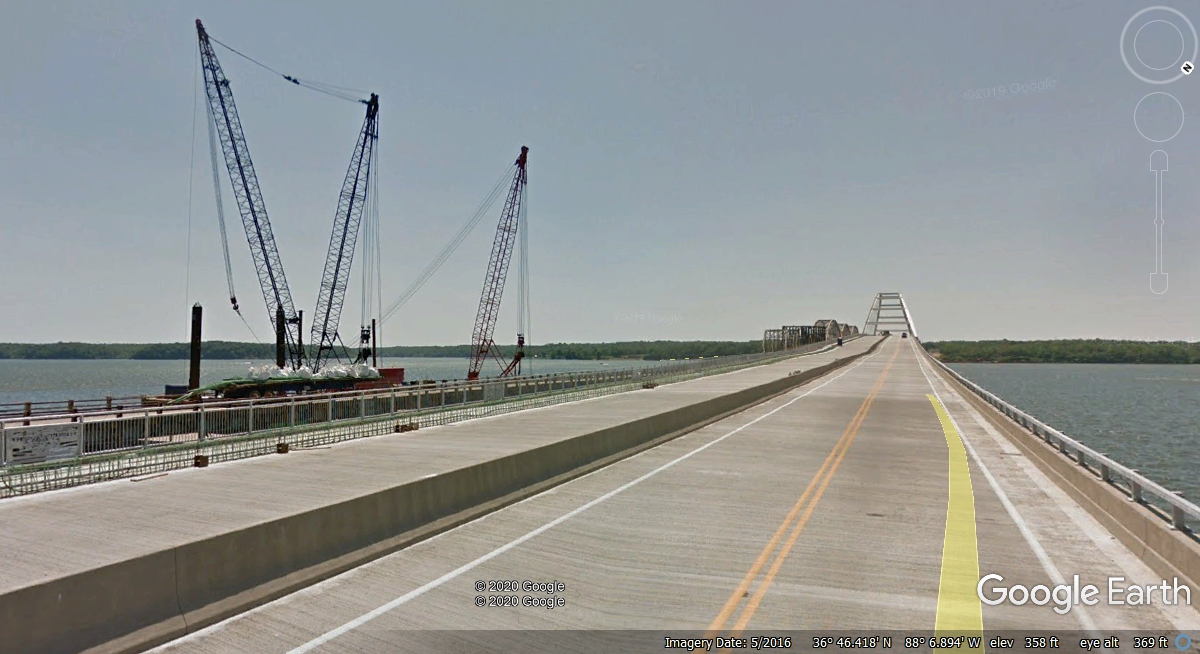
This older Google Earth image from May 2016 shows the new bridge and road
construction to cross Lake Barkley on the Cumberland River. This is the
first of the two lakes crossed by US 68 traveling west.
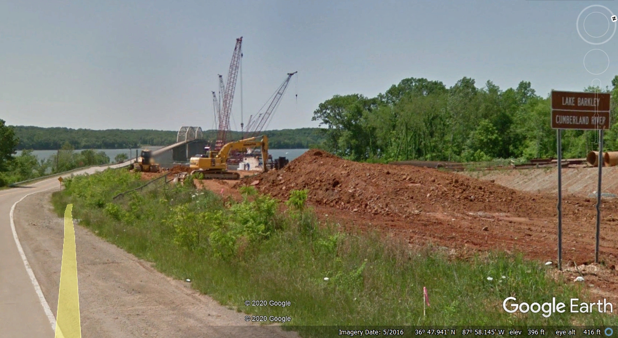
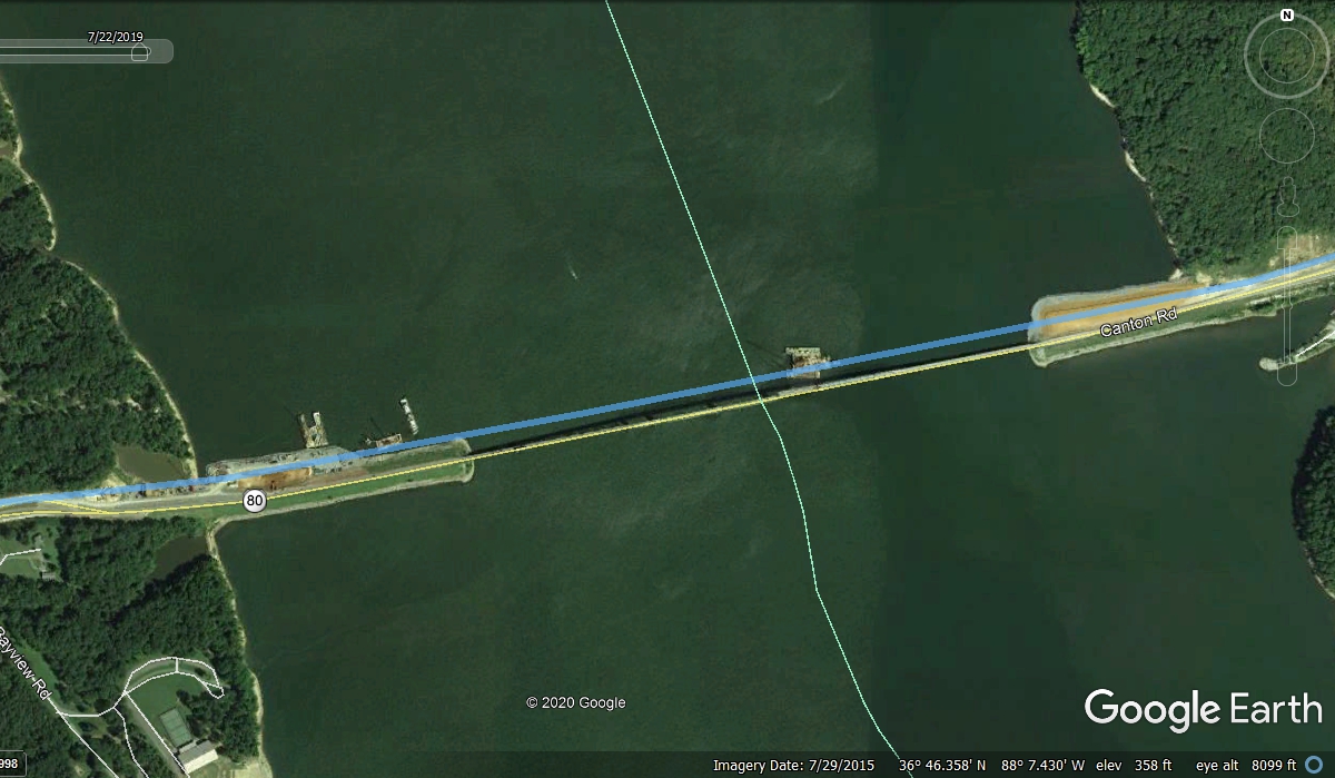
Here is my BLUE LINE GPS overlay from July 21, 2019 on a 2015 Google Earth
view of US 68 crossing Lake Barkley on the Cumberland River. The blue line
is our path using the new bridge
for crossing the lake during our trip.
This Google Earth Image also from May 2016 shows the new wider bridge
across Kentucky Lake that is part of the Tennessee River. Both of these
bridges are in western Kentucky.
Below is a 2015 Google Earth view of the bridge across Kentucky Lake on
the Tennessee River with my BLUE LINE GPS ground track from July 21, 2019 proving
the new bridge was in place when we passed by here heading for Saint Louis,
Missouri.
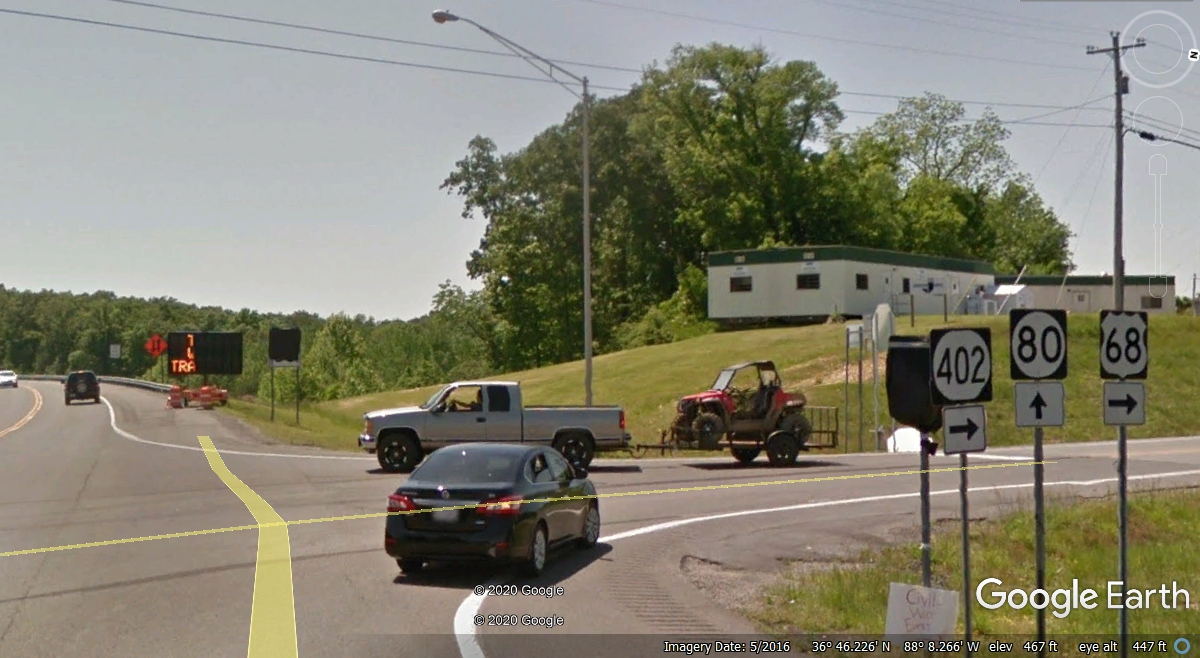
After crossing Kentucky Lake, this right turn intersection at the top of
the hill takes US 68 on a more direct course for Paducah, Kentucky on a two-lane
highway.
This kind of rarely used US Highway is usually a pleasant ride to avoid
the big trucks and potential traffic problems I saw earlier today on Interstate 24.
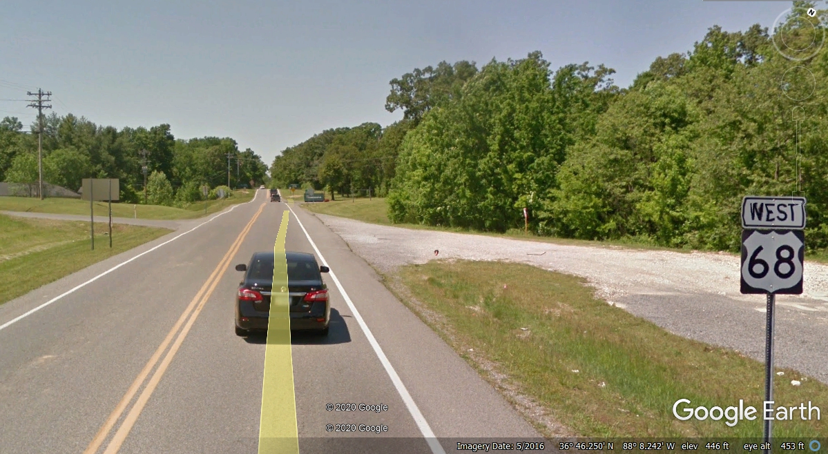
US 68 took us all the way to I-24 south of Paducah, Kentucky where our
travels will take us into Illinois. The mile marker at the on ramp
indicated we were just 16 miles from the Ohio River which is the state line
between Kentucky and Illinois.
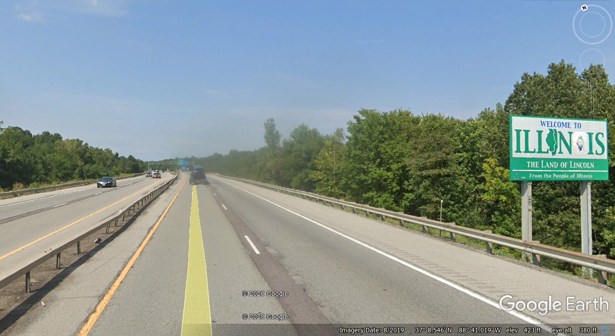
We started this day in Tennessee and now we are going across the Ohio
River near Paducah, Kentucky into Illinois. The state line is ONE MILE
ahead.
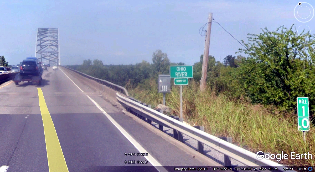
That 1.0 mile marker on the south side of the bridge points to the north
shore of the river where the official state line is located. This sign is
located about 820 feet north of the river's edge on solid ground on the
right-of-way for Interstate 24.
The first fuel stop since we left Chattanooga was here at Marion, Illinois
Exit 54 on Interstate 57. This Google Earth image below was taken about
two months before we stopped here at 7:05 PM to fill our tank before heading to
Saint Louis, Missouri tonight. The lower-priced fuel we bought at I-75 Exit 1 in Tennessee worked out very well
to get us this far.

We ran into a thunderstorm near Benton, Illinois on I-57 after our fuel
stop at Marion. We got through the heavy rain by the time we reached I-64 to make
our turn directly toward Saint Louis at 7:51 PM Eastern Time. GPS time is
the best and it tells me how well our travels are going on this trip.
It was 8:56 PM Eastern Time when we arrived at our hotel in Cahokia,
Illinois. The weather was good until we
reached the hotel. We checked into the hotel and thought about a late
dinner. The neighborhood had a few fast food places, but we decided to go
into a grocery store to get a couple of frozen TV dinners to heat up in the
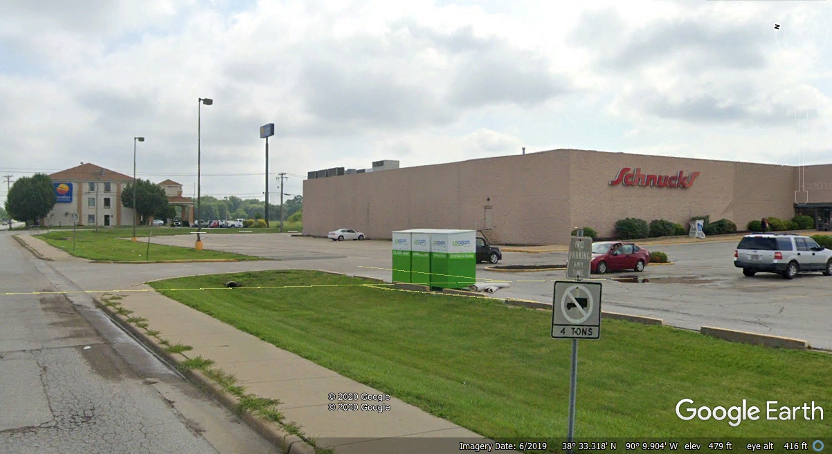
microwave in the room. This image shows the motel behind Schnucks market
where we got the TV dinners. It was very dark when we got back to the room
to have dinner.