Saturday, July 8, 2017 · · PAGE 418.
July 8, 2017: This Saturday started
with temperatures in the low-80's as I departed home and dialed up Wendell Folks
to check on his usual Saturday routine. He was making the coffee before
any of his friends had arrived for their Saturday morning B.S. session. I
have attended many of those sessions before I moved back to Florida in
2012. We talked about the upcoming eclipse of the sun where I hope to
visit him the day before the big solar / lunar event in central Tennessee.
We also talked about his trip with some of his friends going to Oshkosh in the
motor home in about two weeks. I mentioned how I had calibrated my
altimeters and pointed him to my web page where I discussed the procedure and a
link to the instructions on doing it correctly. We finished our phone call
after my arrival at the Rockledge Airport. I had sat down in the shade of
the front porch hoping Billy would arrive soon and he did as I was ending my
phone call with Wendell.
Billy and I were discussing great-circle routes last week and how the GPS 296
depicted them accurately. I showed him some examples from some courses I
have stored in my GPS 296. We went out to the hangar to move the airplane
in front of mine out of the way before I could get my RV-9A out of the hangar.
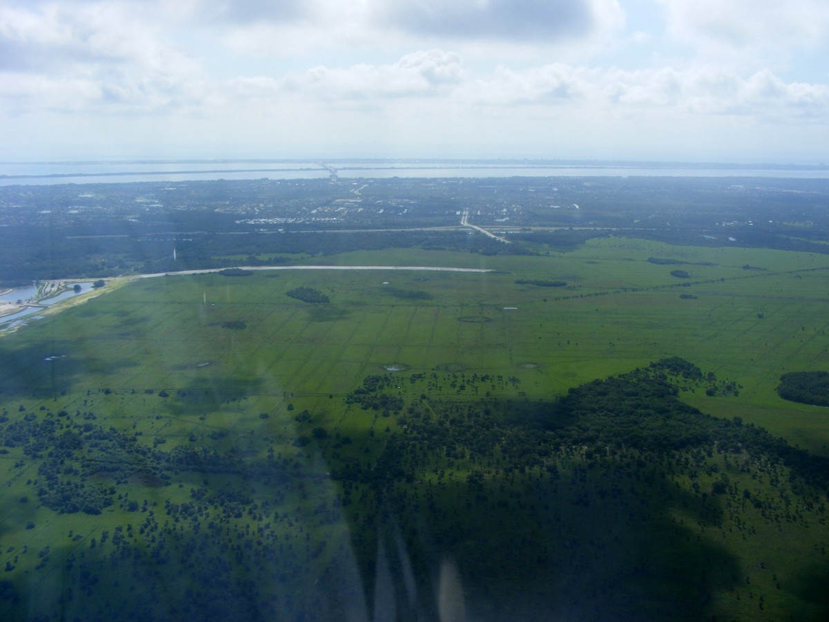
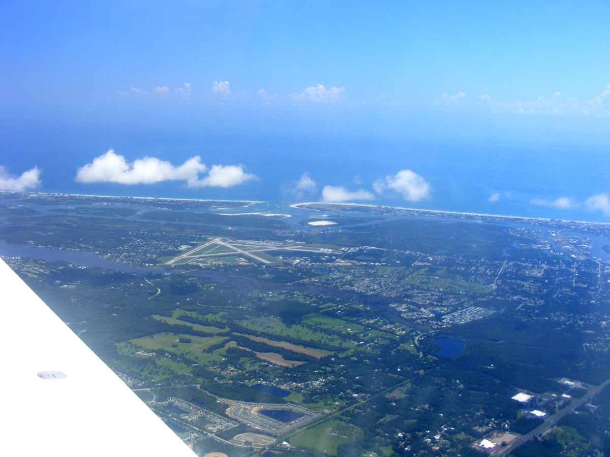
I had taken a few photos of the Melbourne area when I was finishing my
July 4th flight to and from the Sebastian Airport this past Tuesday. I
looked at the area in the photo below but did not take any photos until
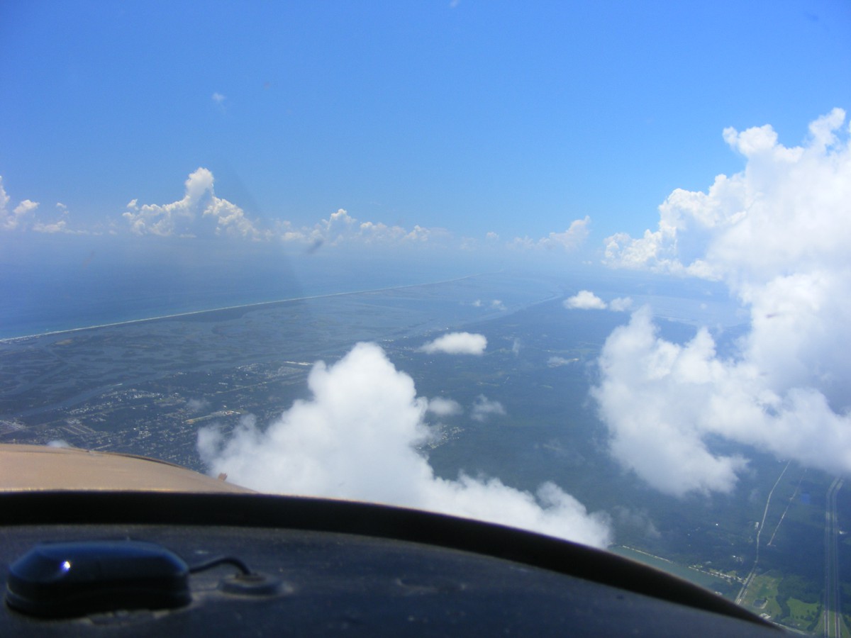
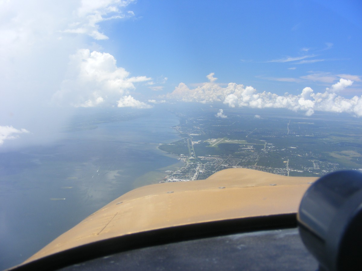
today. I flew down to the southern end of the Viera development to get a
look at the end of the Pineda Causeway on the west side of Interstate highway
95. A new road has been cleared in preparation for paving. The
intent here is obviously to connect to the Pineda Causeway when it gets extended
further west of I-95. This image is looking East toward the barrier
islands and the Atlantic Ocean at the horizon.
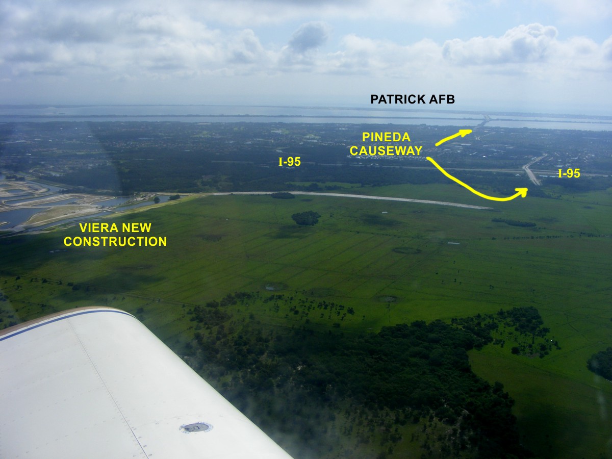
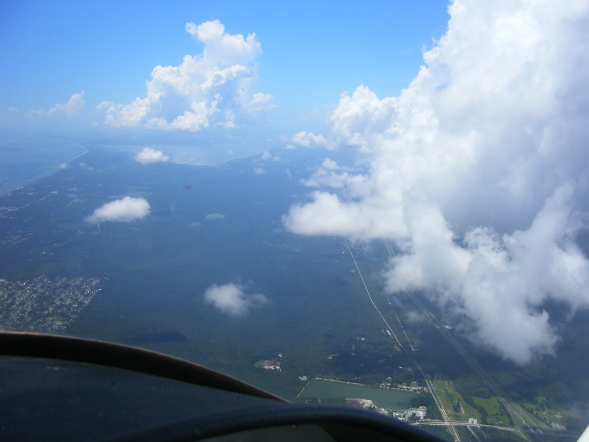
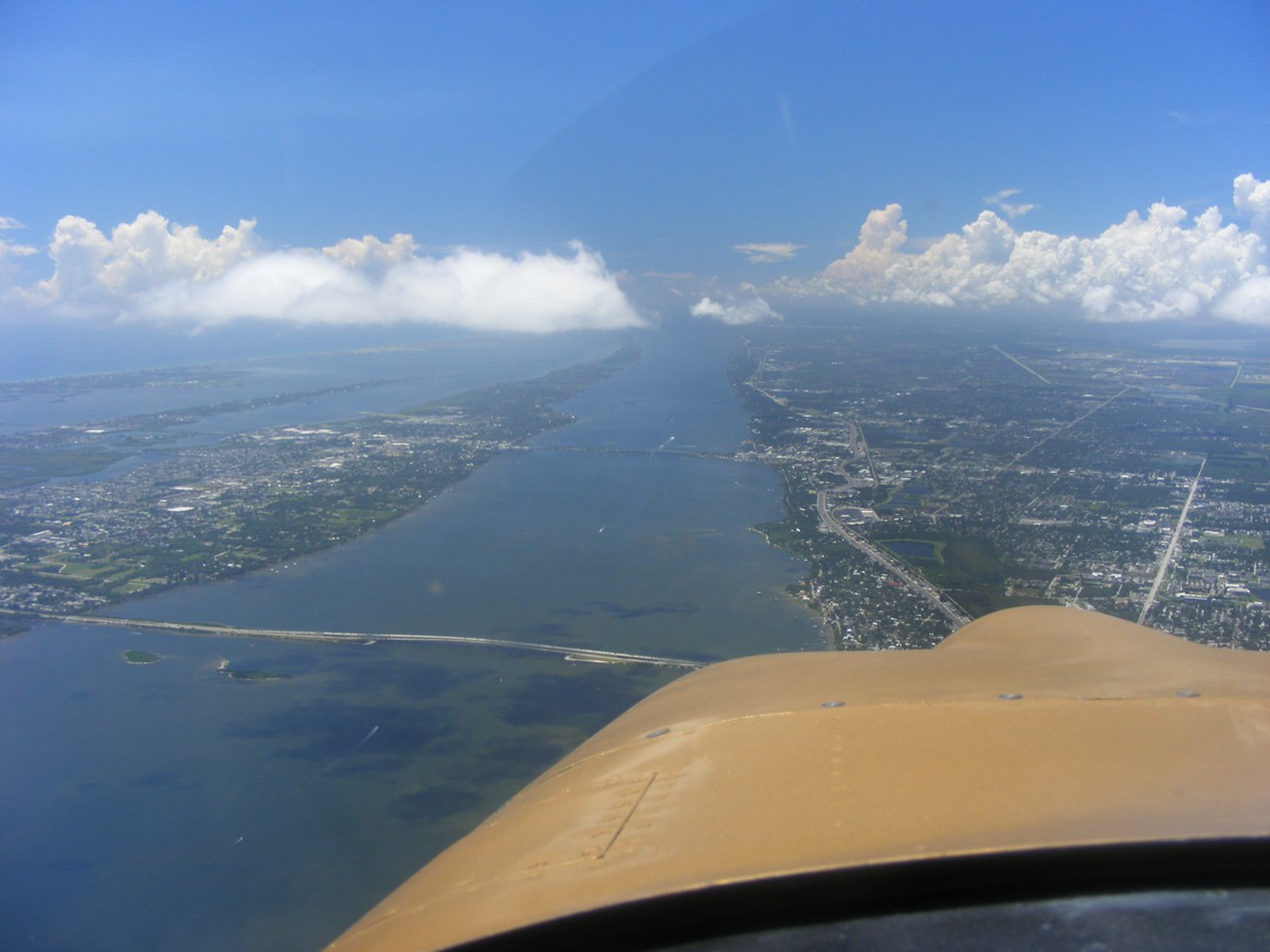
This second photo of the area was taken as I started my turn to head
north. Lake Washington was on the south side of the airplane a couple of
miles away. I did a Google search and found two online articles about
future extensions to the Pineda causeway route toward the west. Here are
the links from the 2015
article and the 2017
article about future plans.
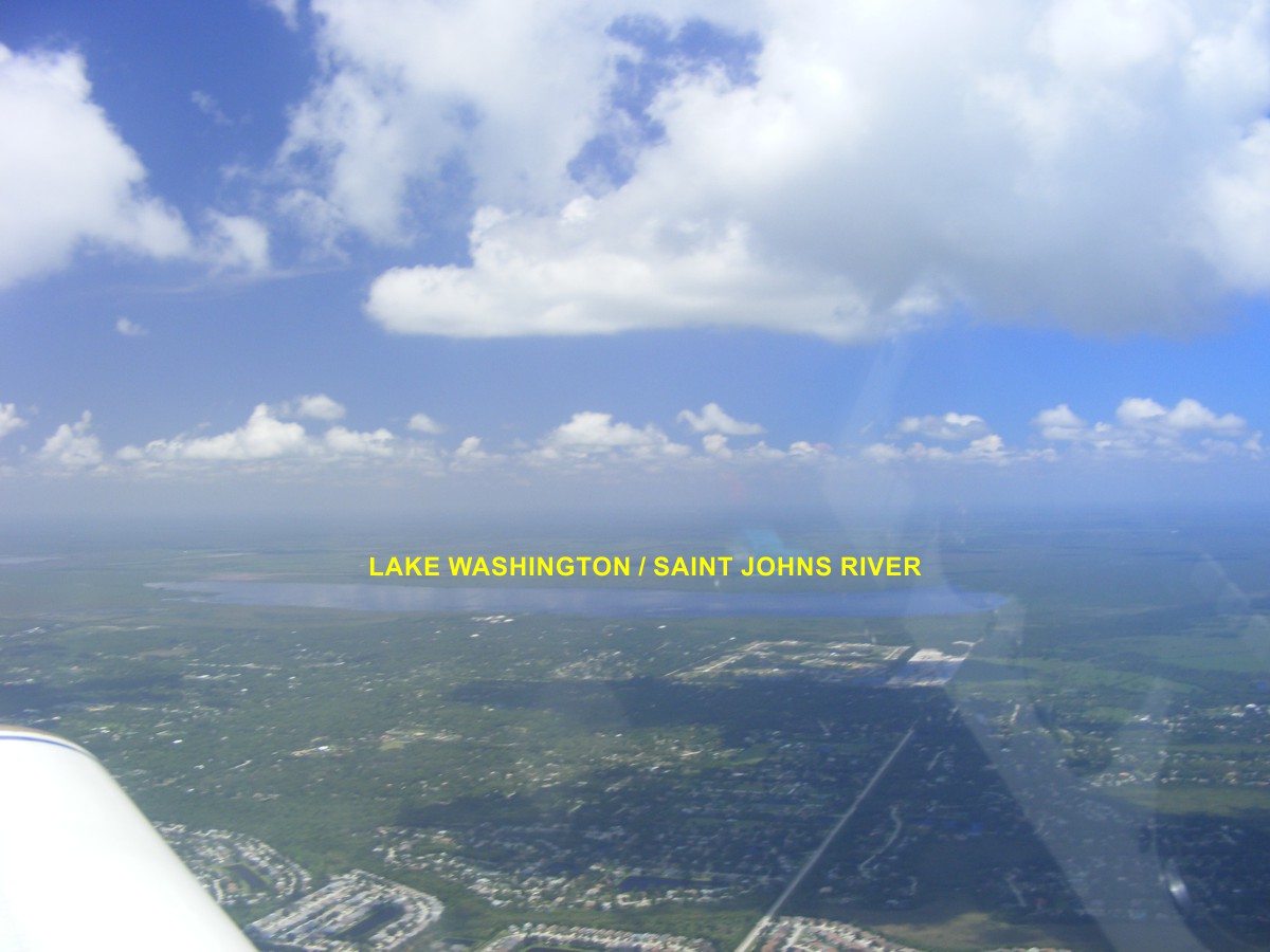
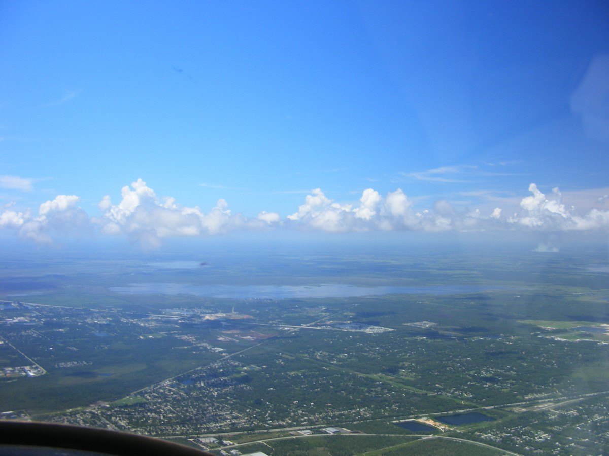
This photo from July 4th shows Lake Washington which is a mile or two
south of my position when I took the photo above.
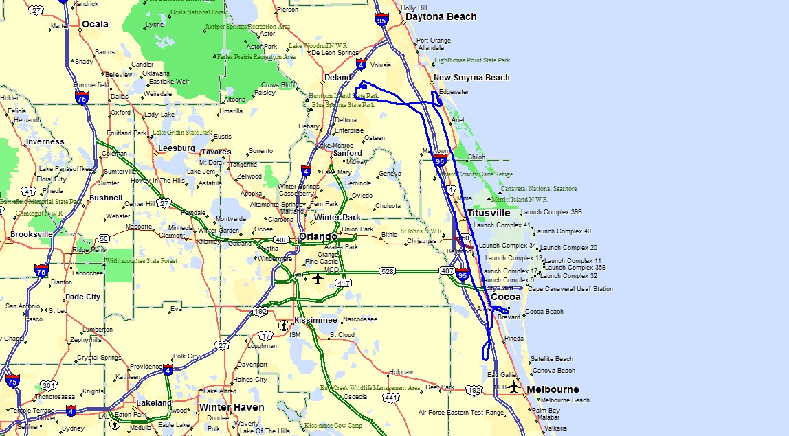
Here is the route of flight today showing my brief photo run south of
Viera toward Melbourne and west of Interstate 95. I then climbed up to
cooler air heading north not sure of where I would go as this was one of those
lazy summer days with nothing much to do but fly. I passed Arthur Dunn
Airport north of Titusville on the west side to stay clear of any potential
skydivers falling from 14,000 feet. I leveled off at 4,500 MSL to get
above the scattered clouds and dialed in the Ormond Beach VOR and headed that
way. I listened to Daytona Approach and then decided to go over to the
Deland Airport. I was descending down below the cloud layer remaining VFR
and listening to the airport common traffic advisory frequency (CTAF) since
there is no control tower at Deland. I circled down to lose enough
altitude to get under the clouds for an approach to the airport. I heard the
pilot of a parachute jump plane giving his location as southeast of the airport
at 14,000 feet. He was about to give the parachute jumpers permission to leave
the aircraft. He finished his radio transmission with "Look out
below!" I was also hearing a couple of pilots in the left-hand
pattern for runway 23 at Deland. One of the pilots was practicing
simulated engine out landings using a right-hand pattern for runway 23.
This is one of those situations where "SEE AND AVOID" really
applies. I decided I did not want to join that rat race and turned back
toward home.
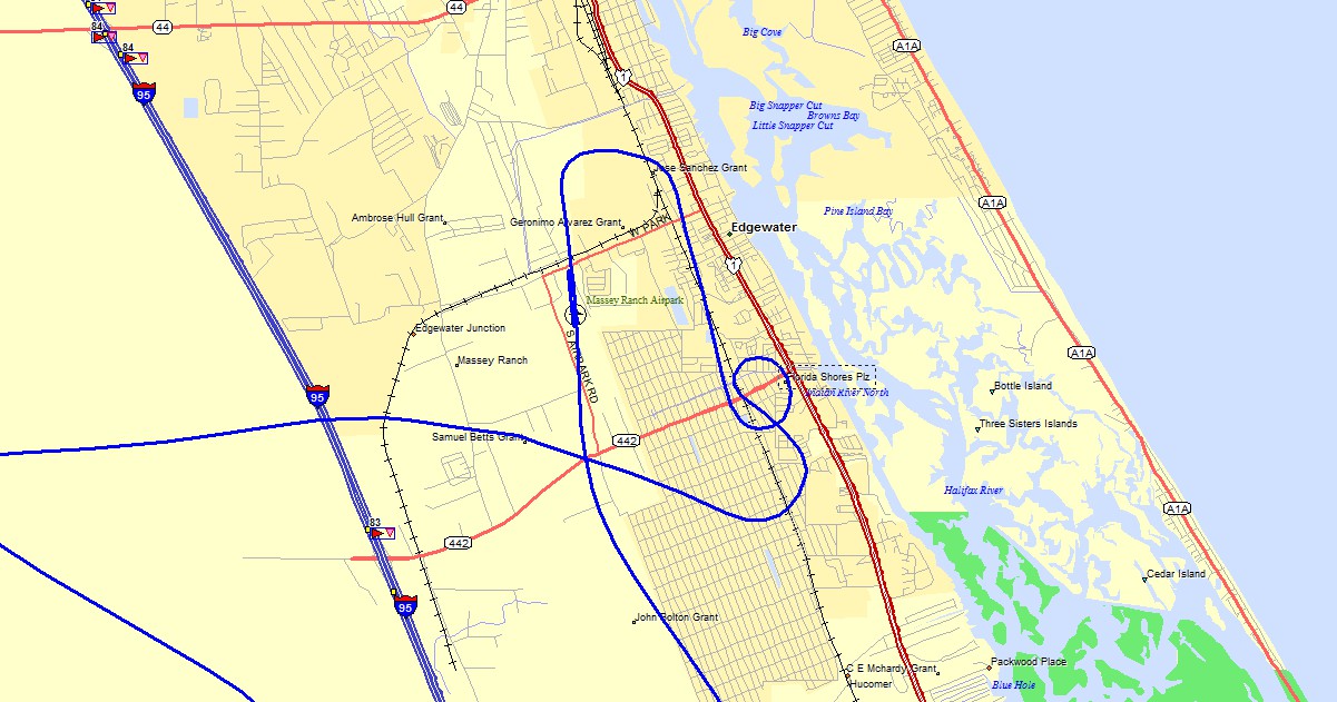
You can see above that my GPS track turned EAST and I thought about
getting in a full-stop landing at Massey before heading south. There were
two student pilots there with one of them and his instructor aboard as I
heard two different voices on the radio from the same airplane call sign.
I crossed over the field well above pattern altitude and turned out to make the
usual 45-degree entry to the pattern. When I was on course to do that
maneuver, I could see one of the students would be a conflict for me and I did a
360-degree turn before entering the pattern behind her in the downwind
leg. I greased the landing and felt good that I had given the student
waiting to takeoff my best example of how it goes when it all works out at the
end of an approach with some cross wind from the ocean. I taxied back
before the student pulled out to the runway for takeoff. I took his place
at the hold short line. The other student pilot was turning downwind as
the first student was taking off. It was during his climb out I heard the
instructor announcing they would be leaving the pattern. I watched them
climb out and start their turn away from the pattern and announced I would take
off immediately as the other student turned base leg for his next landing.
I was in the air quickly as I realized I had not retracted my flaps from my
landing. I got everything cleaned up and reduced power for the ride home
under the scattered coastal clouds we have seen in my previous pages. I
had not pushed the throttle for high speed and just thought about all the things
I see each time I fly south over the Indian River Lagoon. The railroad
bridge over the Intracoastal Waterway is always UP as there are rarely any
trains going out to the space center nowadays.
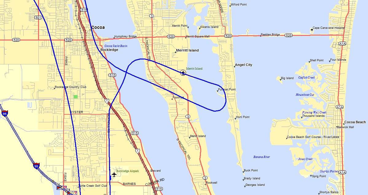
I dialed up the Merritt Island Airport CTAF on 122.975 MHz and only heard
one airplane in the pattern. I decided I would join the party. As I
was in the downwind leg I noticed another airplane holding short of runway 29
while the airplane in the pattern was ahead of me turning base leg for a
full-stop landing. I extended my downwind to the point where I saw her
make the base-leg turn and followed her to the runway with full flaps at 90
MPH. She exited the runway to the right as I came over the threshold at
the numbers for a quick touch-and-go before heading to the Rockledge
Airport. You can see my airport at the bottom of this map below and my
landing from the north on runway 18, plus my taxi route to and from the hangar.
When I got back to the hangar, the Aventura II amphibian was still at the
wash rack area. I taxied the nose of my airplane into the hangar. Van's
brags about how nose wheel RV's can turn around virtually inside the wing span
of the airplane. I use that capability as much as I can to minimize the
distance I have to push the airplane into the hangar.
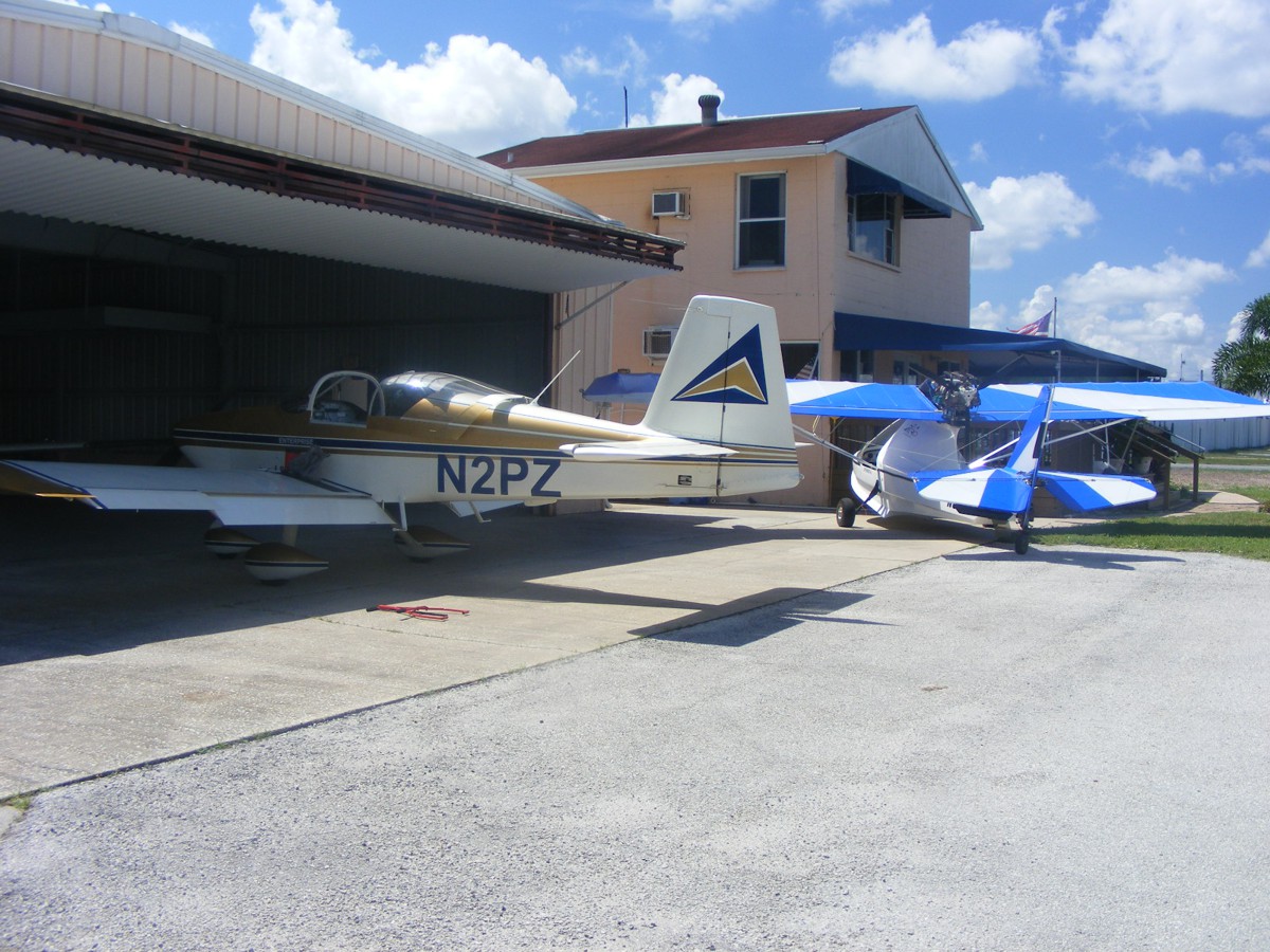
Billy had come out to see me off for this flight. He had put down blue painter's tape on the floor in front of my nose wheel and on the right side of it. He also put two more pieces of tape on the floor for the LEFT main wheel. I put the airplane back in place with the tape marks before packing up and going into the office for our usual Saturday social interaction. The Hobbs meter added 1.5 hours to indicate a total time of 492 hours since my June 9, 2005 first flight. The GPS 296 ground track mileage is over 167 miles today.
The temperature was close to 100 degrees F today as I departed the airport for lunch. The gas and groceries were part of the route home today and spending that time in the shade at the gas station and indoors at the two places where I buy groceries on Saturdays. I cannot be in the air all the time, nor would I want to be. Such is life at age 70.
Saturday, July 15, 2017 · · Fuel Run to Umatilla
July 15, 2017: Saturday again and I
have that itch to go somewhere I need to go from time to time, to get fuel to
keep my airplane in the air. You have seen the route of flight to Umatilla
enough that I do not need to post the GPS ground track anymore. I did have
some fun with flying around some clouds building up along the way. My
Departure at 10:30 AM was the usual runway 36 when the wind is mild from the
north. I went north on the Indian River to avoid the clouds above I-95 and
finally reached over 8,200 feet MSL to get between the clouds and get west of
the big ones. I dropped down to 6,500 MSL in an open area north of the
Sanford Class C airspace and clear of the Orlando Class B airspace. The
bottom of the scattered clouds was just above 3,000 MSL on the approach toward
Umatilla. I was the only aircraft in the pattern when I arrived for
fuel. By the time I got the pump started, a Piper Cub with two aboard
showed up to be second in line. The climb out was the usual route through
the gap between Orlando Class B and R-2910C gunnery range we have discussed
before. My trip toward the ocean was again dodging the clouds above 3,000
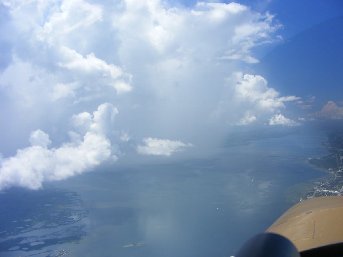
MSL above the heat. When I cleared the build-ups, the Ponce Inlet and the
New Smyrna Beach Airport made a good shot before I started turning south for home.
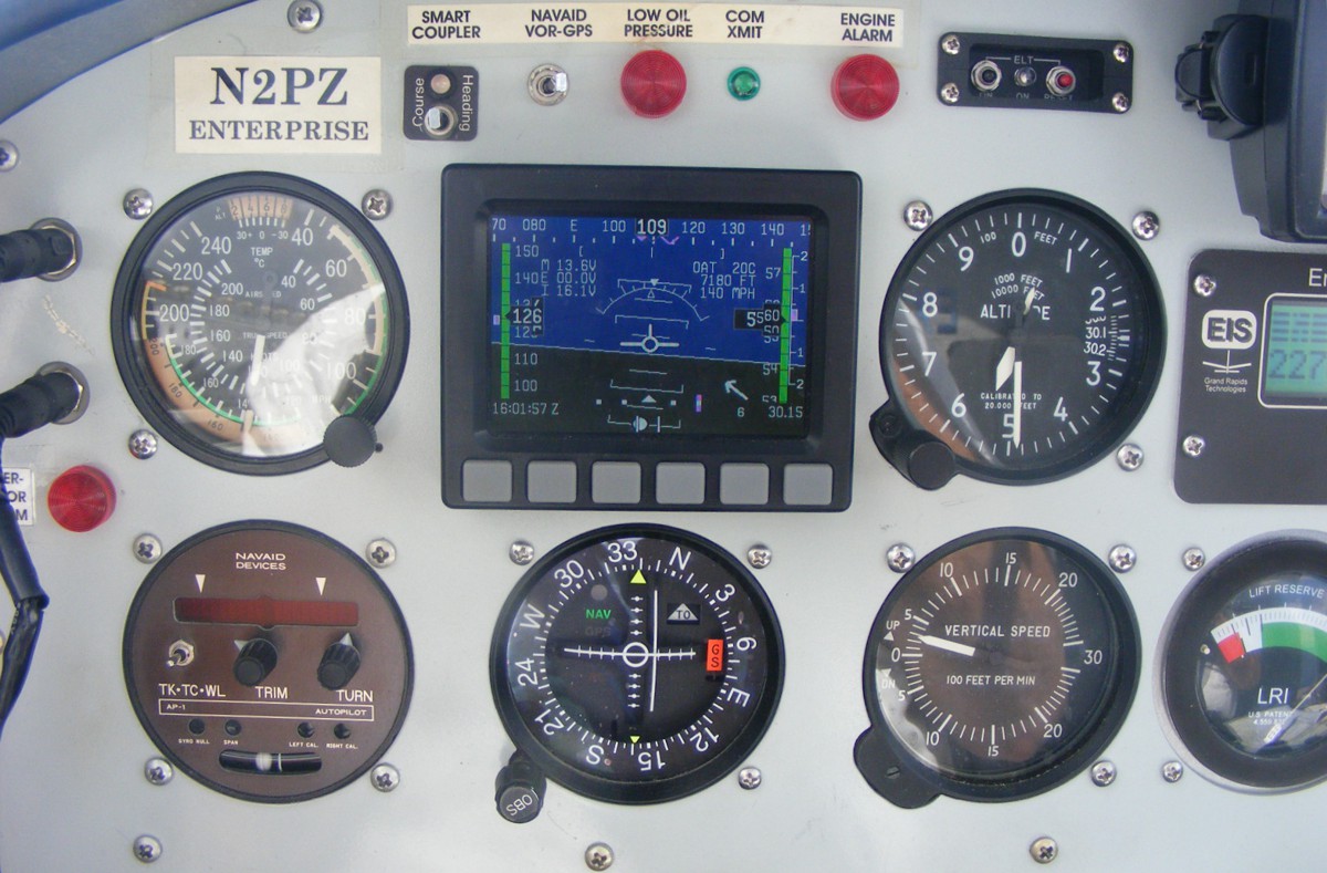
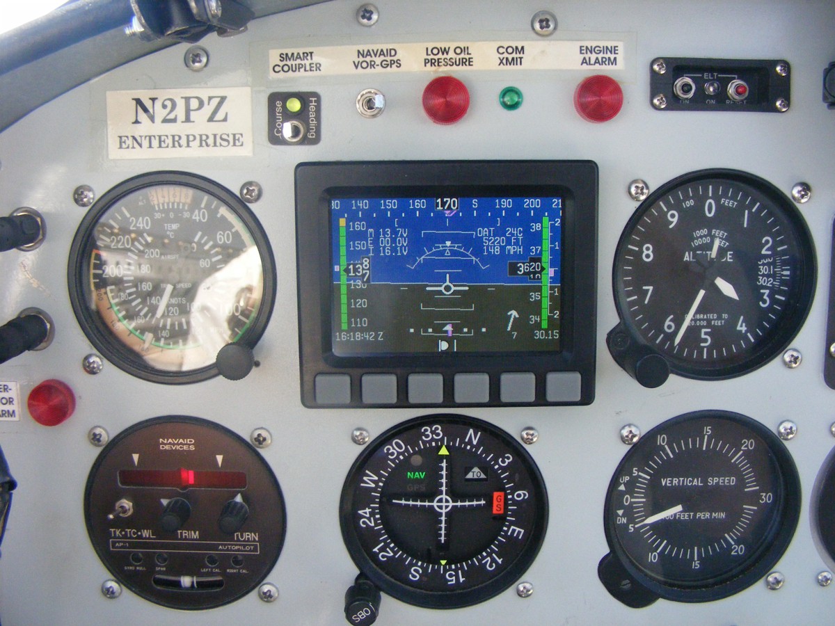
I have not taken many shots of the panel showing true air speed on the
Dynon D-10A and the gauges recently. There is a slight quartering tailwind
as I cruise at 5,500 MSL on a heading of 109 degrees. When I left
Umatilla, the Dynon got overheated and provided a gray and black screen that had
no serial data coming from my magnetometer at the back of the airplane.
When the temperature settled down behind the panel, all Dynon features
returned. The VOR receiver is monitoring OMN at the Ormond Beach airport
north of Daytona.
Here is the view looking south as I clear the front row of the clouds over
the mainland.
Less than one minute later, I can see the Indian River Lagoon and more of
the line of clouds above I-95 and US 1.
Rain showers obscured the Kennedy Space Center on Merritt Island across
the river from Titusville as I pass by heading south.
Turning my camera on course to the south, you can see the showers are no
factor in my direction of flight. You can also see the clouds west of the
river that were reaching above 8,500 MSL are now behind me. The Titusville
Executive Airport is directly ahead of my spinner from this camera angle.
The round black item in the bottom right corner of this photo is my wet compass
on top of the instrument panel.
Just two causeways between me an home base at Rockledge.
Looking west shows only a smaller scattered layer at 3,000 MSL.
Even that layer is breaking up now inland.
The Dynon and the conventional air-operated altimeter are fairly close now
with the heat behind the panel now less of an issue. I am descending for
the landing back at Rockledge with the wind at this level out of the north as a
tailwind. I will set up for an approach from the south. I have been
playing with the Navaid wing leveler in both legs of today's flight. I am
hoping it will work well for the upcoming trip to Tennessee for the total
eclipse of the sun, IF the weather is good for August 20-21, 2017.
The Hobbs meter adds 1.7 hours today for 393.7 hours total time on my airplane. The next flight I make will test my video camera on top of the instrument panel, my camcorder, and the audio recording of my intercom and radio signals before the upcoming trip to Tennessee.
The temperature was close to 100 degrees on the way home via Interstate 95.
July 29, 2017: Saturday morning and a short flight with the video camera being tested for the duration of the local flight up toward the north end of the Indian River lagoon. I turned around and came down the WEST side of Interstate 95 to stay clear of the Jump Zone over Dunn Airport on the north side of Titusville, Florida. It was a rare day when I saw three jumpers under canopy heading to the airport from the south side of the field.
My video test was normal. I do need to keep a pair of pliers in the cabin to keep the jamb nut in place on the bottom of the dash-mounted camera. I also have to set the tension on the pivot ball in the socket that allows me to turn the camera left, right, up, and down, while keeping it stable. I also have to remember to keep the sound track active or stop recording when there is not much to see outside.
I have been doing some planning for the eclipse flight on August 21, 2017. I have picked out a second potential flight area near Clemson, South Carolina if the preferred area north of Smithville, Tennessee does not have favorable weather conditions on that day.
The Hobbs meter added 0.8 hours today. I took this photo in the
hangar after the flight. The black bag contains my digital video
camcorder. Sunday night I hooked it up to my old IBM computer via Firewire
plug-in card and made sure I remembered how to download a video. As I was
getting this web page ready to publish, I found an old video I took accidentally
in Chattanooga a few years ago in flight when I was using my Fuji Fine Pix S700
snapshot camera. It has a video mode that saves the video in a WMV
format. The engine noise was not too loud as there appears to be audio
gain limiting in the camera. I may have had my finger over the built-in
microphone. I will check it out later. I have set aside an empty
formatted 2 GB memory card to use for the eclipse movie with the S700
camera. I have made a solar filter I can put on the camera during the
partial eclipse. I will remove the filter during the total eclipse, which
should not be too bright for my image sensor. This is my plan when in
flight during the eclipse. The digital video camcorder will be looking at
the ground ahead as the dark shadow of the total eclipse approaches and departs
when I reverse course. According to the data I have gathered from the NASA
eclipse page, the 2 minutes 40 seconds duration of total eclipse produced a
calculation of 1,615 MPH ground speed for the 70-mile wide shadow to cross a
spot on the eclipse path center line in central Tennessee.
| CLICK HERE for PAGE 419 | Return to MAIN MENU |