August 2017: HOT in Florida · · PAGE 419.
August 5, 2017: Another hot Saturday
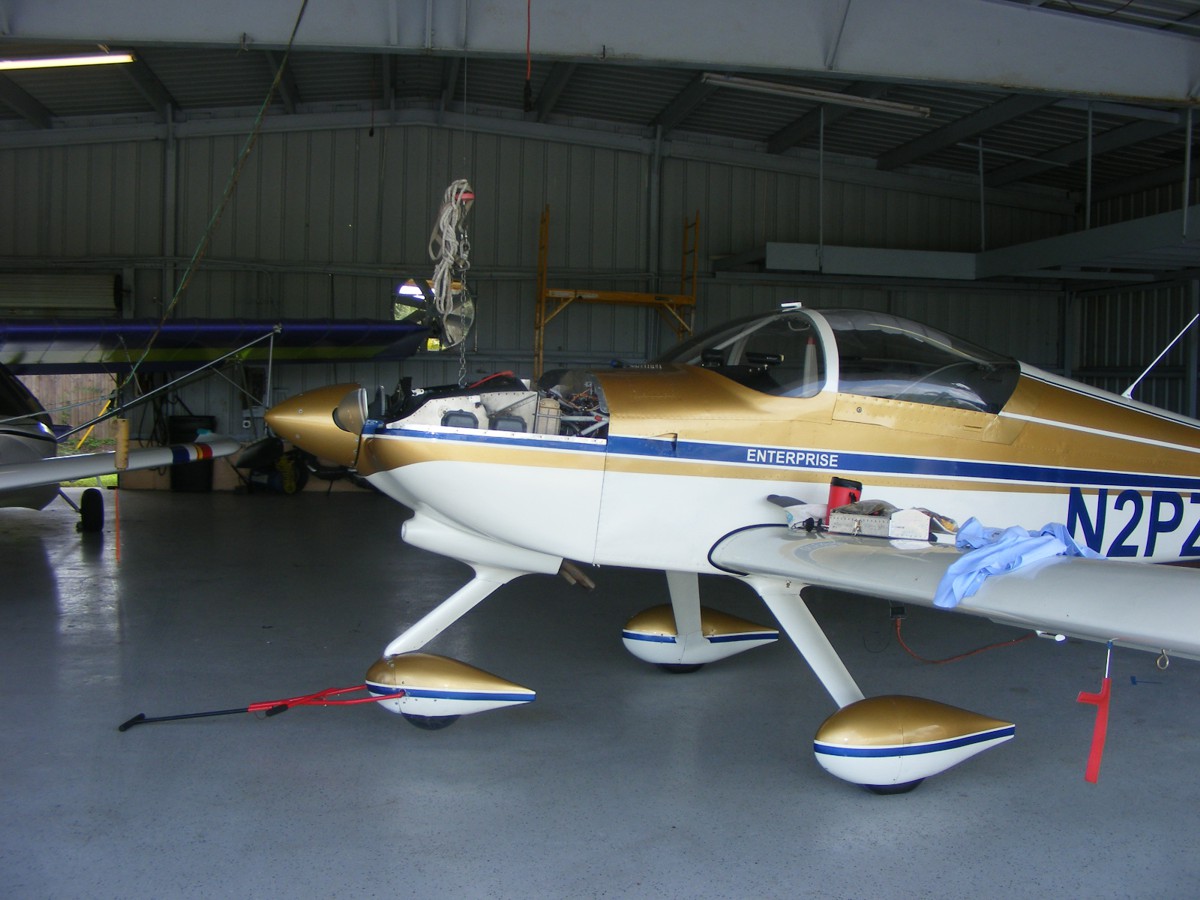
in central Florida and some maintenance on my RV-9A. I discovered the
winch in the center of the hangar here at ALAS. As you can see I pulled my
airplane underneath the hoist and Bill made sure I learned how it works and how
to put away the control cable when finished. I hooked to the lift clevis on
my engine and pushed the UP button very briefly to get the nose wheel off the
floor of the hangar.
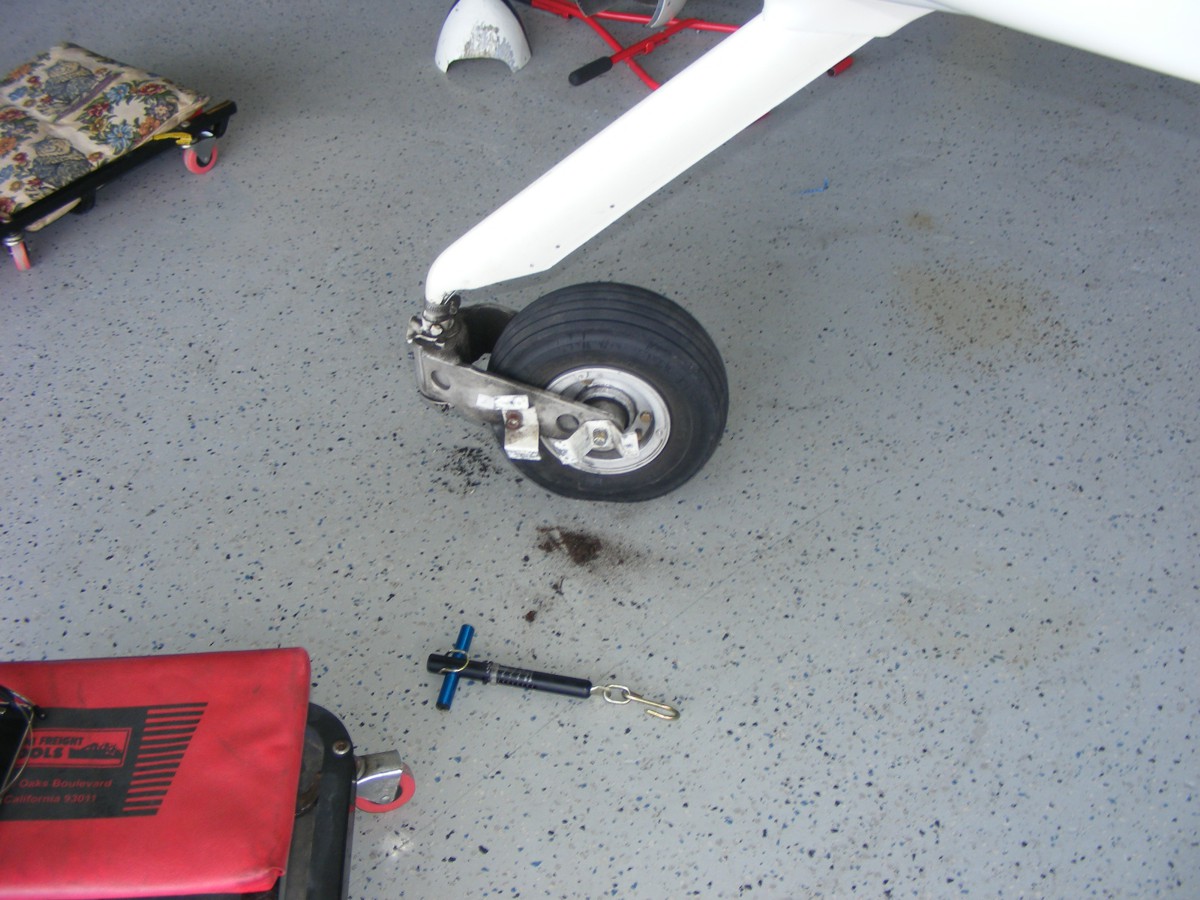
The main tool today was this fish scale I have had since I first installed
the nose wheel in my garage airplane factory. I have also used the scale when
loading baggage for a long trip. Weight and balance issues can ruin your
day in flight or even on the ground. The main purpose of today's
maintenance was to check the pressure on the two compression washers that set the amount of
force for dampening the rotation of the fork holding the nose wheel. I dug out my RV-9A
assembly manual to confirm the amount of pull in pounds for the nose wheel fork
at the axle. This photo was taken after I had completed the work and
before my lunch break. The grease fitting at the front of the fork was
filled to capacity again and after I pushed the fork back and forth with my
hands, I measured a 10-pound pulling force while the nose wheel was off the
floor. I removed the large cotter pin
that holds the large nut in place that compresses the two washers together.
I used channel lock pliers to tighten the nut in 60-degree increments of
rotation. I tested the pulling force with each rotation which allowed the
cotter pin to be reinserted near the bottom of the gear leg. The 21 pounds of desired resistance was
obtained after the third adjustment which resulted in 180 degrees rotation of
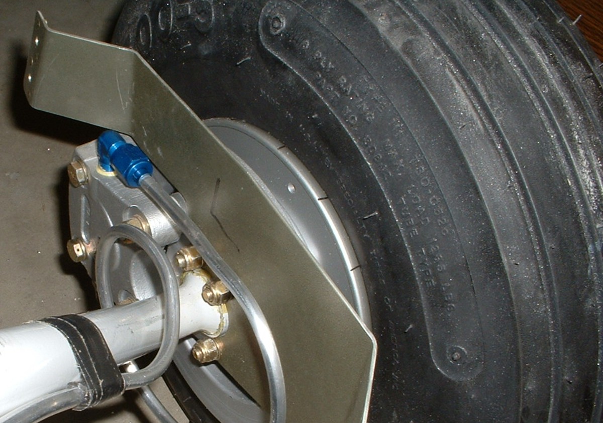
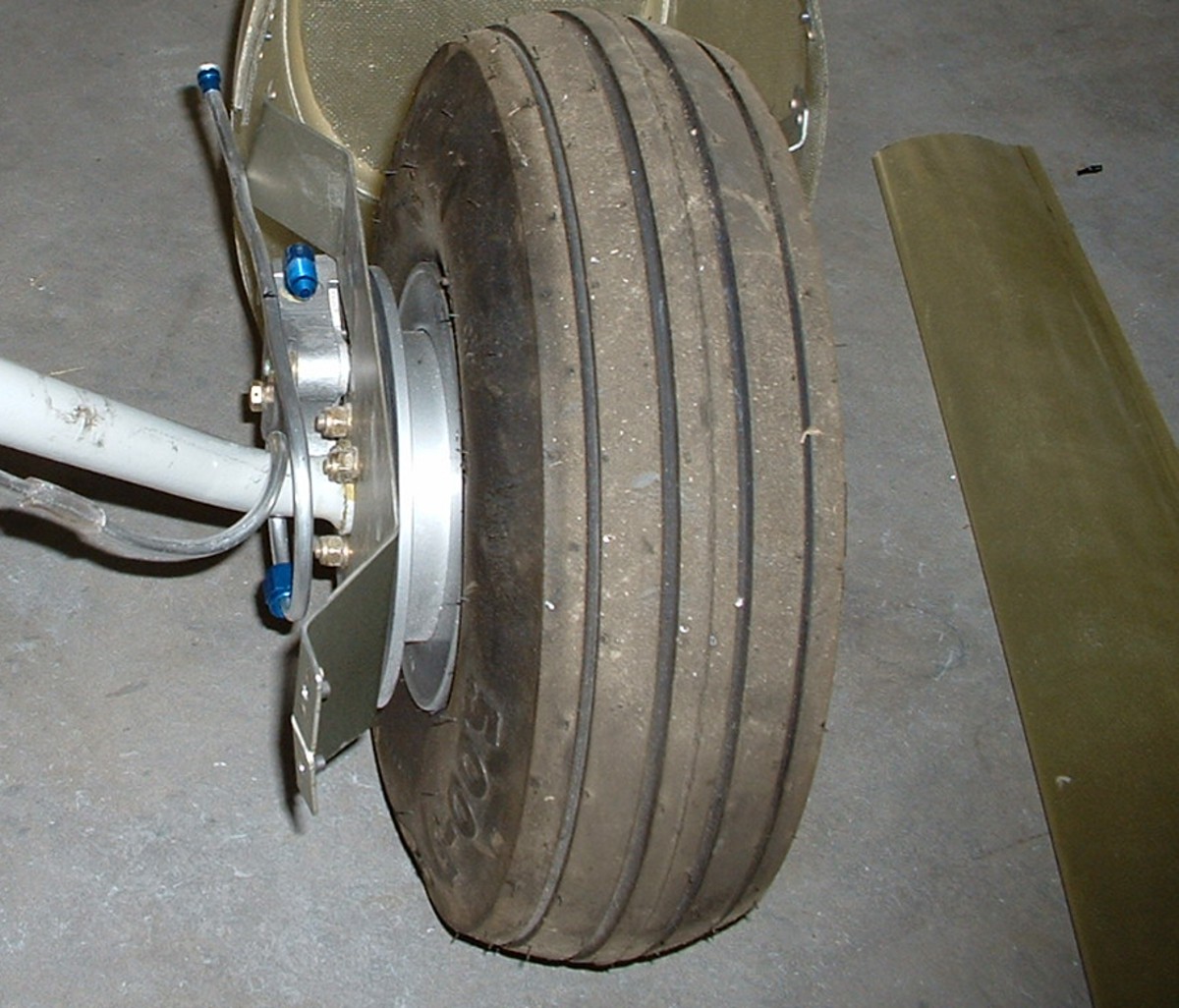
the large nut. I also removed the nose wheel from the yoke and inspected the
nose wheel bearings. They are both still clean and lubricated from the last time I had
inspected this assembly. There is a seal that keeps dust out of the
bearings.
I pushed the airplane back into its current parking place, closed the hangar doors, then went for lunch. When I returned with plenty of ice and water in the red cup, I sat down on the my creeper and took off the front ends of the main wheel fairings to check all the tire pressures.
I looked at the amount of tread left on the tires that came with the kit
from Van's Aircraft as I have been flying only from paved air strips since
October 2012 when I brought the airplane to Florida. I have had 90 takeoff
and landings since I departed the grass strip at Folks field on takeoff number
718 in my log book with my current total at 808. My first flight in N2PZ
was my takeoff number 368 as on June 9, 2005 from the Collegedale Airport in
Tennessee. I moved my airplane to Folks Field on landing number 409 after
completing phase 1 testing of the airplane. That means I have made 309
takeoffs and landings in my airplane from Folks Field and other airports before
moving the airplane to Florida. Here is what the tires looked like before
the first flights from the Collegedale Airport. This first image was taken
in the garage before moving the airplane to Collegedale.
The tread depth at new looks like more than 1/8 inch. This image
shows more dust on the tires at the Collegedale Airport in the weeks before the
inspection and first flight. The tires now have less than 1/16 inch tread
depth. I looked up the price of new tires from Van's Aircraft for all
three tires at $173.
I also added a quart of oil to the engine as a preliminary check list item before the big day of the 2017 solar Eclipse. My youngest son had his birthday this past Friday. We talked for a few minutes as he was on board a flight from Miami to Atlanta awaiting take off Friday evening. He mentioned that he has August 21 off with no expected company travels. He said he would like to see the eclipse from the right seat of my airplane. I have already altered my GPS flight plans to stop and pick him up the morning of the eclipse from McCollum Field at Kennesaw, Georgia. I have prepared GPS flight plans for Tennessee and South Carolina viewing locations in the event the weather is good in one place and not the other. I have already picked out fuel stops and looked at each airport using Google Earth. Now we start watching the 10-day weather forecasts at points along both flight paths.
The Eclipse Trip Begins in Florida
August 19, 2017: Another hot
Saturday is in store for today. I was airborne at 7:50 AM as I departed from
the Rockledge Airport heading for Folks Field near Chickamauga, Georgia. My airplane was based
there from July 2005 to October 2012. I started the trip by making a movie on my digital
camcorder using the video from the camera mounted on my instrument panel along
with the audio from my airplane intercom. The movie was just to show the area
around Rockledge during the departure. This first image from my snapshot camera
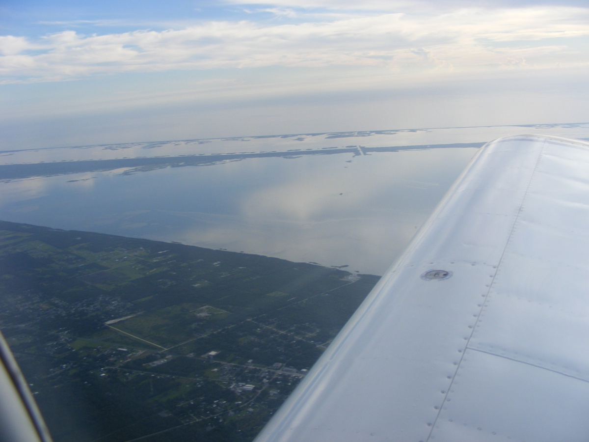
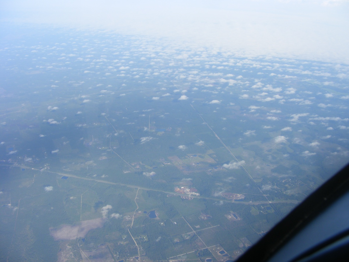
at 8:05 AM Eastern Time shows the Indian River lagoon and the Intracoastal
Waterway drawbridge on Florida Route 3 north of the Kennedy Space Center.
It is restricted airspace, hut anyone can drive on that state highway. My
current location is above Mims, Florida at US 1 and Interstate 95. I am climbing
up to 10,500 MSL for the ride up the East Coast of Florida heading for
Jacksonville, Florida and then on to the Hazlehurst Airport in southeast Georgia
for a fuel stop.
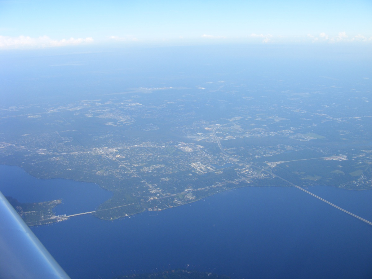
This image taken at 8:33 AM shows the Oldest City in America: Saint
Augustine, Florida with Anastasia State Park just south of the Saint Augustine
Inlet at the Atlantic Ocean.
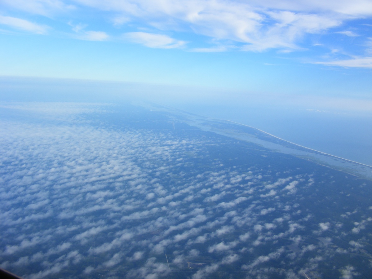
From 10,500 feet MSL at 8:48 AM and cruising at about 180 MPH ground speed
with a tail wind helping. The image below shows the Interstate 295 bridge
crossing the Saint John's River just north of
Orange Park, Florida. This view is looking west from my flight path.
There is a low-level weather front ahead as I pass by the Jacksonville Airport on
the west side and well above their Class C airspace.
The area below me is still relatively clear of clouds here in the last few
miles of north Florida. The southern tip of Georgia is hiding in the haze
nearby as I pass Callahan, Florida with US highway 1 on the other side of the airplane.
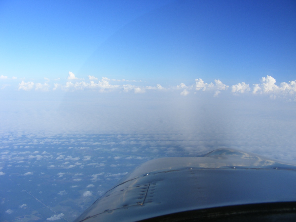
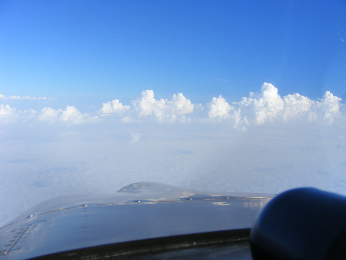
How high are those clouds ahead? I am still cruising at 10,500 feet. This photo at 9:04 AM has my
position very near JAX Center located in the small town of Hilliard, Florida on
US 1. I have my radio tuned to one of their frequencies to monitor other
air traffic nearby. A layer of clouds are down near the ground. I am
selecting a place in the line of clouds where I will not have to climb any
higher as I cross that frontal boundary.
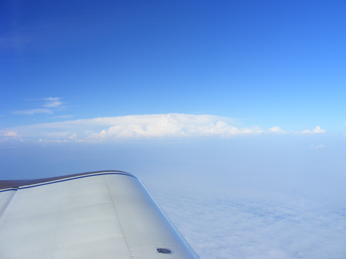
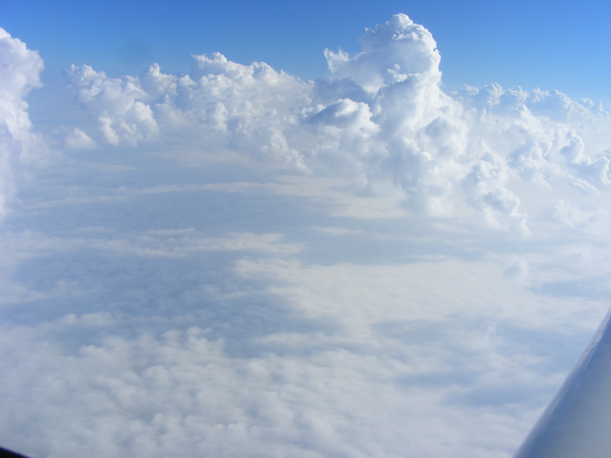
I turned my camera to the west to see what is probably a towering
thunderstorm about 100 miles away. My ground speed is around 175 MPH here.
I am starting to cross the weather front at 9:07 AM just west of Folkston, Georgia
just north of the Saint Mary's River that is the state line between Florida and
Georgia in this area.
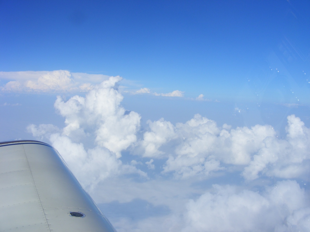
I have plenty of clearance above the line of clouds ahead.
Off to my right is an airliner descending toward Jacksonville more than 5
miles to the East and already below my altitude.
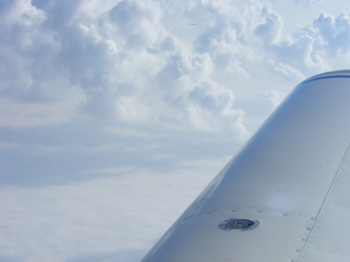
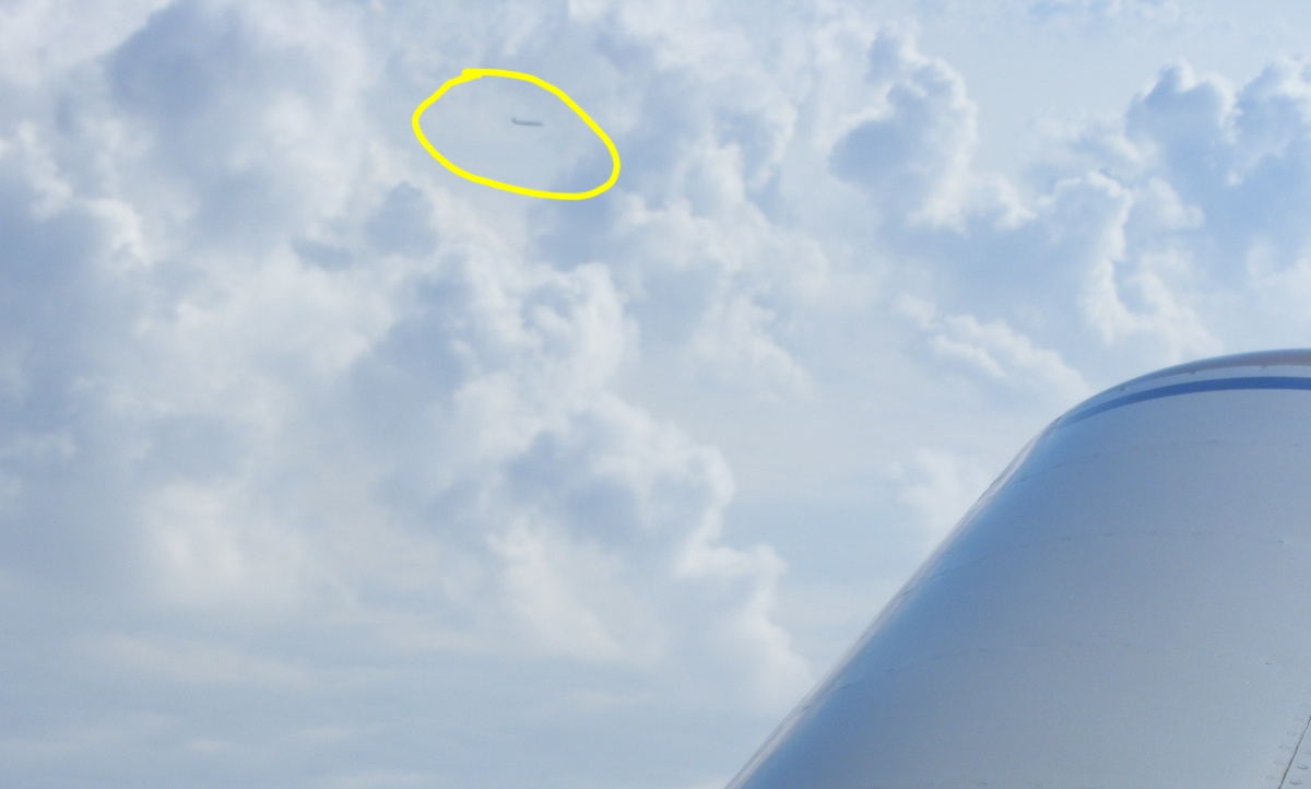
This larger view is cropped from the full-size image above just in case
you did not see the airplane.
| CLICK HERE for PAGE 420 | Return to MAIN MENU |