October 2010 · · PAGE 341.
October 19, 2010: My last visit to to the town of
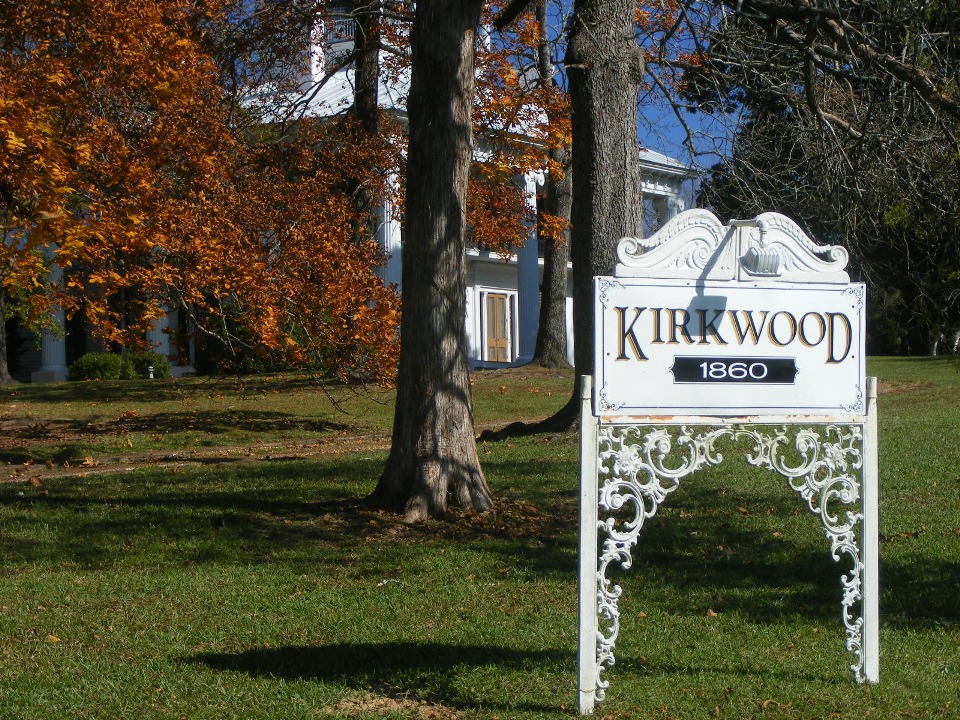
Eutaw, Alabama was eleven months before this trip, back on November 19, 2009. On
that day, I showed you this classic old mansion built in 1860.
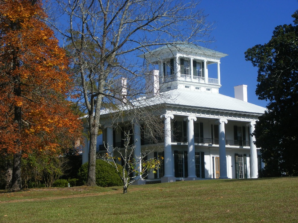
This was the key photograph from my Page 321 showing the details of the front
of the house.
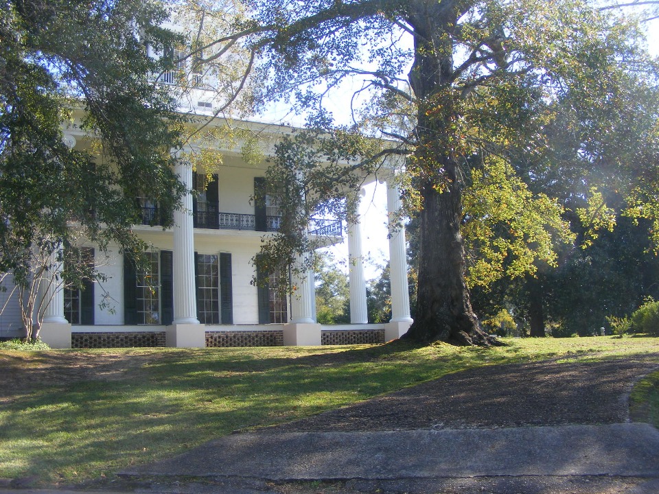
This photo showed the old drive up toward the house for arriving guests.
That was last year. On this day, October 19, 2010, the focus is the town
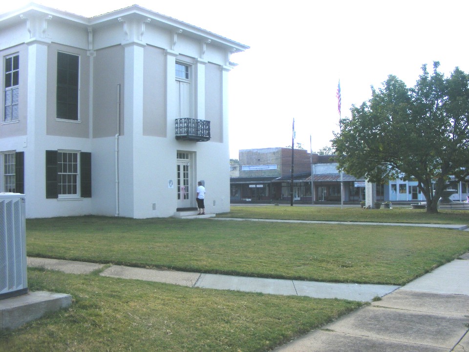
square in Eutaw, Alabama.
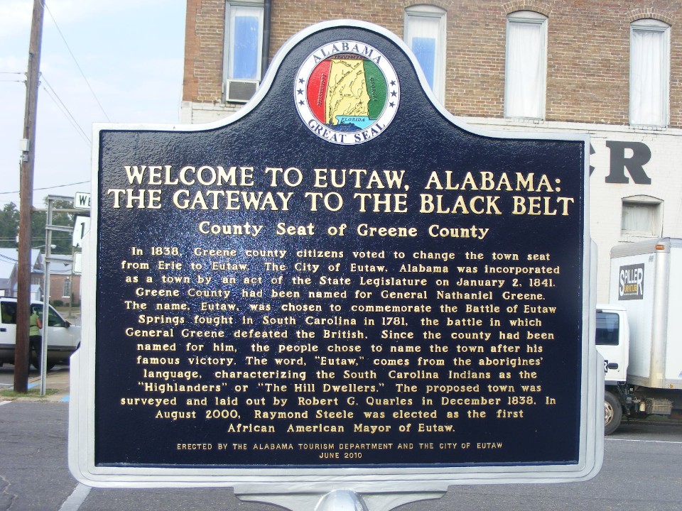
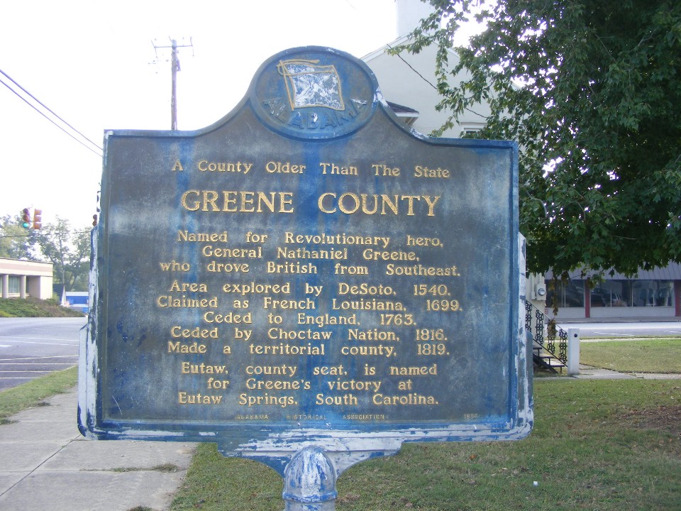
This second marker tells an interesting bit of history.
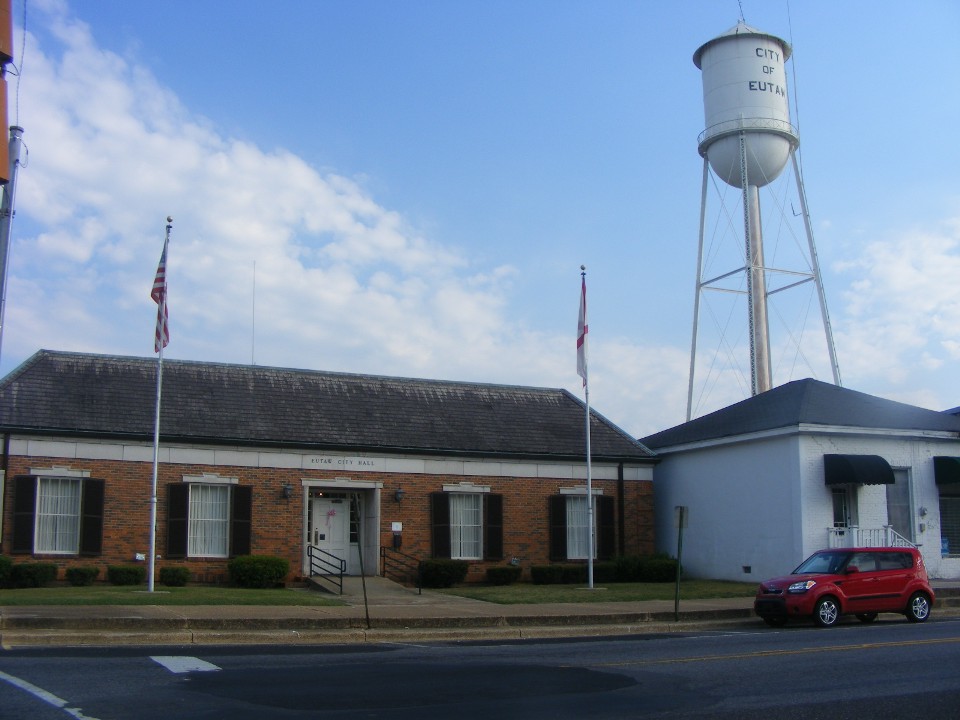
Like many small towns, the court house and city hall are here on the town
square. The little red rental car for this trip is the Kia Soul parked in front of
the Eutaw city hall building.
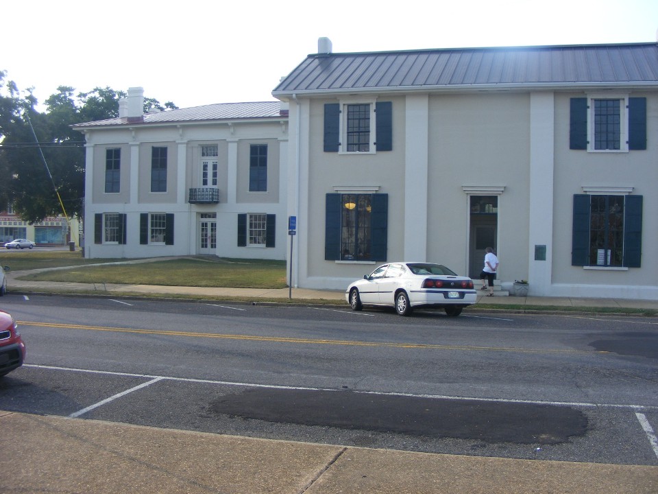
Directly across the street are some the county buildings and the old court
house. The building closest to my camera location is on the north side of the town
square.
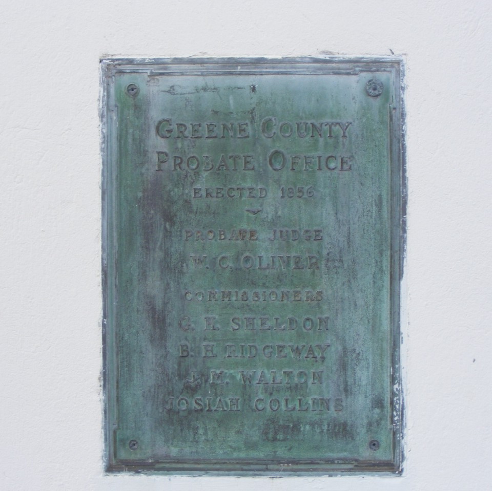
Here is the plaque on the 1856 building by the parked car. It now serves
as the Chamber of Commerce office with a museum office inside.
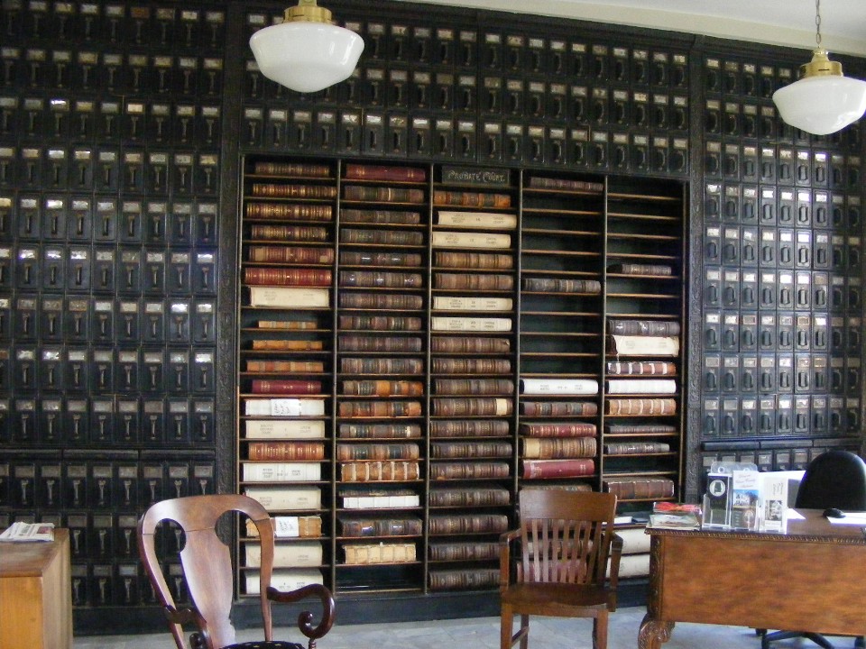
Inside that building are these old record boxes (now empty) and some original
ledgers with actual documents from the 1800's. The antique furniture was part of the
building furnishings. To the left of my camera angle is the office that is in use
today with computers and telephones of this era and a nice young lady who works with the
Chamber of Commerce.
The old court house building sits on the south side of the town square.
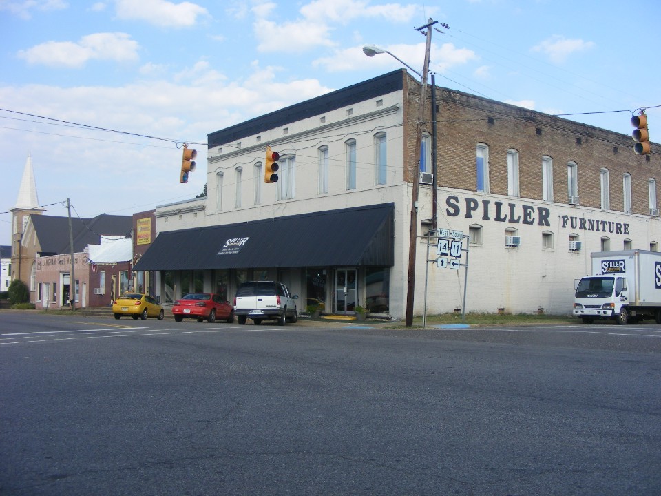
Northwest of the town square is this furniture company and a church down the
street. This is business in the small town environment. The nearest Walmart is
40 miles away.
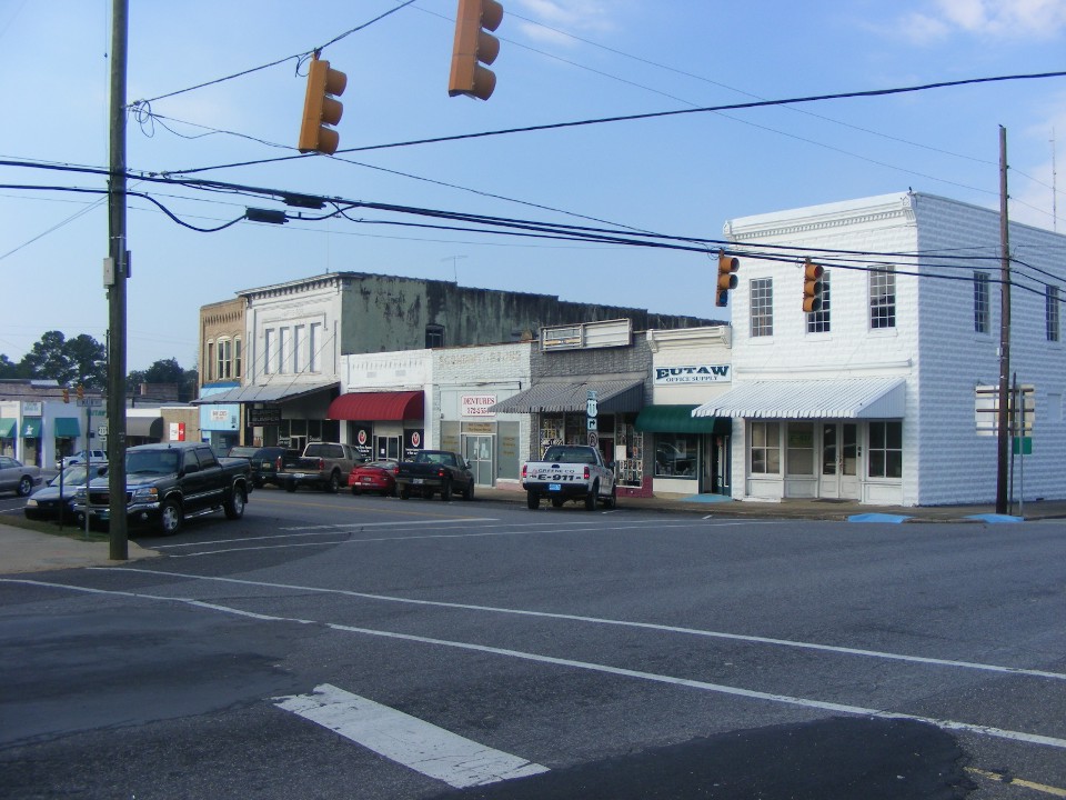
The west side of the town square like the other sides, have a number of small
businesses. This is a place similar to Mayberry, where folks like Sheriff Andy
Taylor, Opie, Aunt Bea, and Floyd the barber can still exist in this century.
The US 11 highway sign above points the way south toward New Orleans. I traveled a few more miles down that way parallel to Interstate 20 & 59 routes heading for Mississippi. I saw a number of man-made ponds with fish farms in the next ten miles. The gently rolling terrain was easily massaged with earthen levies to create those spawning grounds not far from the Tombigbee River. Lunch and a fuel stop occurred in Laurel, Mississippi south of Meridian on Interstate 59.
| CLICK HERE for PAGE 342 | Return to MAIN MENU |