
January 2009 · · PAGE 291.
January 28, 2009: What can I say about flying in January near Chattanooga, Tennessee? The weekends and the good weather have not been in phase this year. That keeps my airplane in the hangar and me on the ground. But the forecast for the weekend to come is looking good with the most sunshine forecast for Saturday, January 31. Now if only the reality will match with the forecast.
I also got a call from an RV-builder wannabe yesterday. Hopefully he will get a chance to stop by the airport and see my airplane and Wendell's RV-8 this weekend. We shall see and post photos on our usual Sunday update for February 1, 2009.
I have been remiss in posting updates again, but I do have a new addition to the OTHER RV SECTION of this web site as a result of a recent Florida trip that mixed business with pleasure. The stop to see the builder occurred on Sunday, January 11, 2009.
I had been contacted a few months ago by an RV-9A builder who lives on Merritt
Island, near Melbourne and Cocoa, Florida. I took this picture when I flew over the
area on December 30, 2005. Merritt Island is closest to the mainland in the photo
and the island tapers going south, ending in a long thin strip of land. Our builder,
Jeffrey Rosson lives on that island beyond the TWO causeway
bridges you see connecting the island to the mainland. There is another causeway and
bridge near the southern end of Merritt Island where the island gets very thin in width.
That bridge is hidden in the haze of this photo. This photo is looking south.
The barrier islands are on the far left side of this photo with the Atlantic Ocean
on the other side of them.
I have created a page for Jeffrey in the OTHER RV SECTION of the web site. Use this LINK to go to his page.
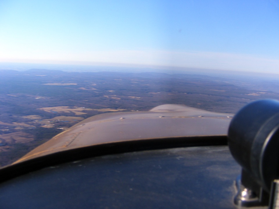
January 31, 2009: This
was a good Saturday to go flying! The weather was clear, the winds were a bit
unusual, but manageable. This is the view about 30 miles from the McMinnville,
Tennessee airport (KRNC). I am over the Cumberland Mountain Plateau at about 4,500
feet MSL and it is bumpy, but the headwinds are virtually zero. The temperature
outside is in the high-40's or low 50's and just a bit of haze in this area. I did
see a fire off to the right of my flight path, and the associated smoke being blown off by
the winds above 5,000 feet MSL.
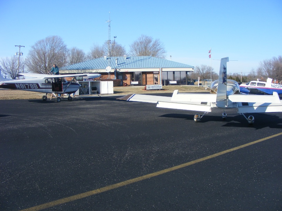
With 100-low lead AVGAS priced at $2.65 per gallon, the Warren County Airport
at McMinnville is a popular destination for general aviation pilots on a beautiful day
like today! This is the airport where we refueled when Monte and Darlene were up
from Florida for a long weekend "mini-vacation" back on November 16th.
When Wendell and I flew in today, we were the only ones pulled up to the fuel pump.
By the time we paid the bills, a Mooney came in and Wendell moved his plane out of the
way. This older Cessna 172 on the left pulled in and I was moving my airplane out of
the way and getting ready for engine start. If you look closely at the far left edge
of this photo, you will see the shadow of a wing tip from another Cessna waiting behind
the one at the pumps. The Mooney is scheduled to be next after the older 172.
The fuel service here is provided by the FBO, no self-service.
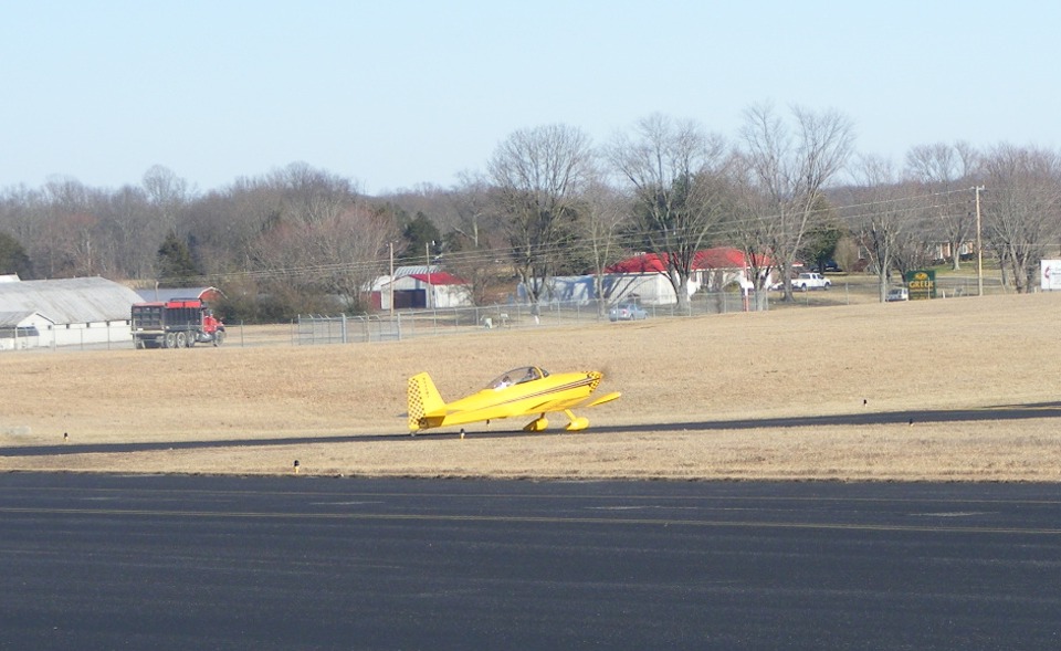
I was talking with the two guys from the older Cessna. They had flown up
from Moontown Airport (3M5) near Huntsville. I asked if they knew my friend David
Edgemon and they told me he had taken off just ahead of them but had no idea where he
went. Wendell got away first and I did not worry about trying to keep up with him
since he has more power and less drag. I took this shot while standing in my seat as
Wendell completed his engine runup and another plane was in the pattern on approach to
runway 23. I took off just a few minutes later and climbed to 5,500 MSL to catch a
22 MPH tail wind for the trip home.
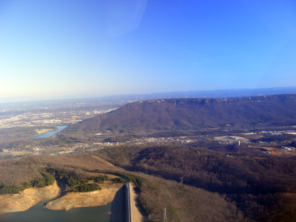
This photo is showing the TVA "battery" only about half full at
Raccoon Mountain reservoir below my airplane. Lookout Mountain is directly ahead of
my route of flight as I ducked under the outer ring of the Chattanooga Class C airspace.
That is the Tennessee River at the foot of the mountain as it winds past Moccasin
Bend. At this low altitude, the tail wind advantage is gone.
This next shot gives a better view of downtown Chattanooga, its bridges, and
the complete peninsula of Moccasin Bend formed by the path of the Tennessee River at this
point. Take not of the high water mark of the reservoir below the airplane.
TVA will pump water up from the river to fill the reservoir at night when there is a lower
demand for electricity. During times of peak electricity demand, the water is
allowed to escape through turbines to recover that energy.

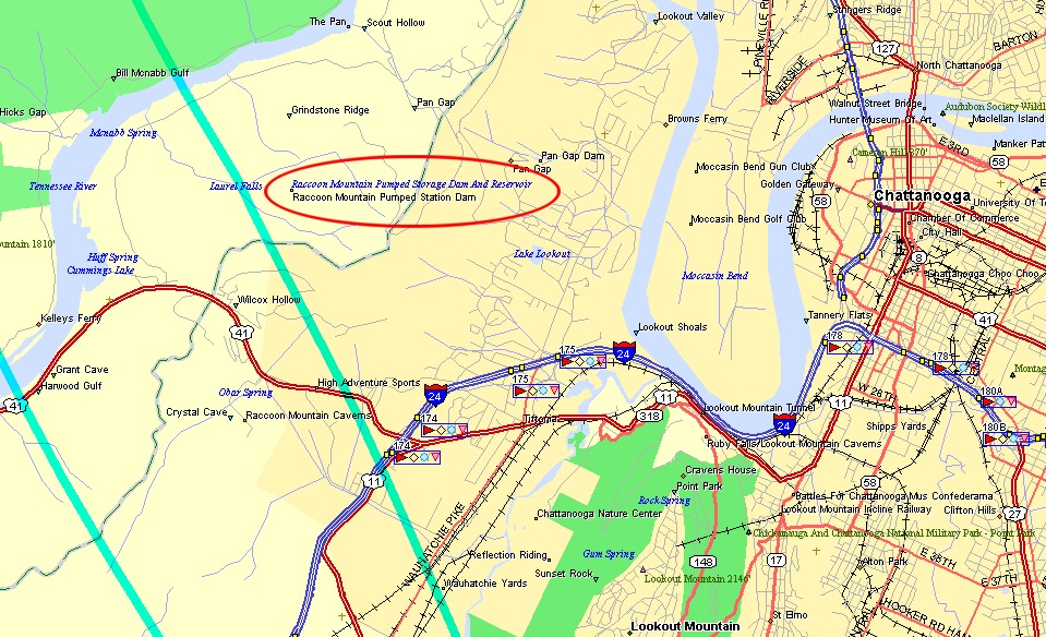
Here is a map view of this area with my green highlighted GPS ground tracks
overlaid to indicate camera position.
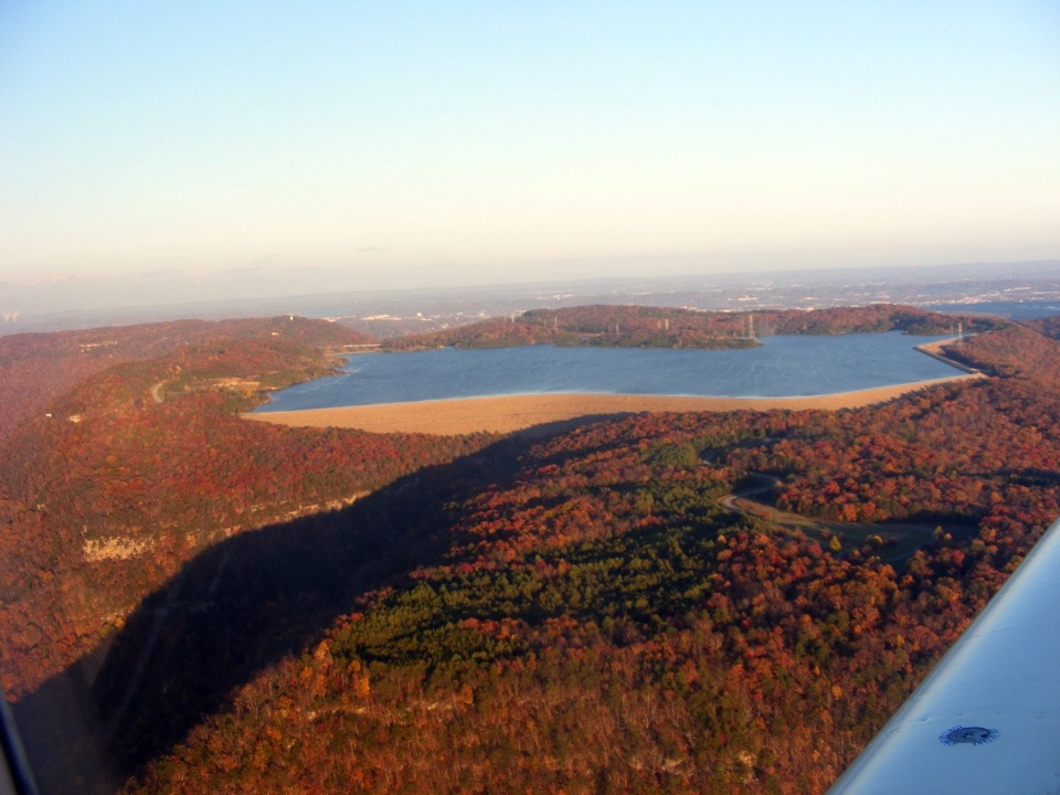
Here is how the Raccoon Mountain Reservoir looks when it is full. This
photo was taken November 16th, 2008.
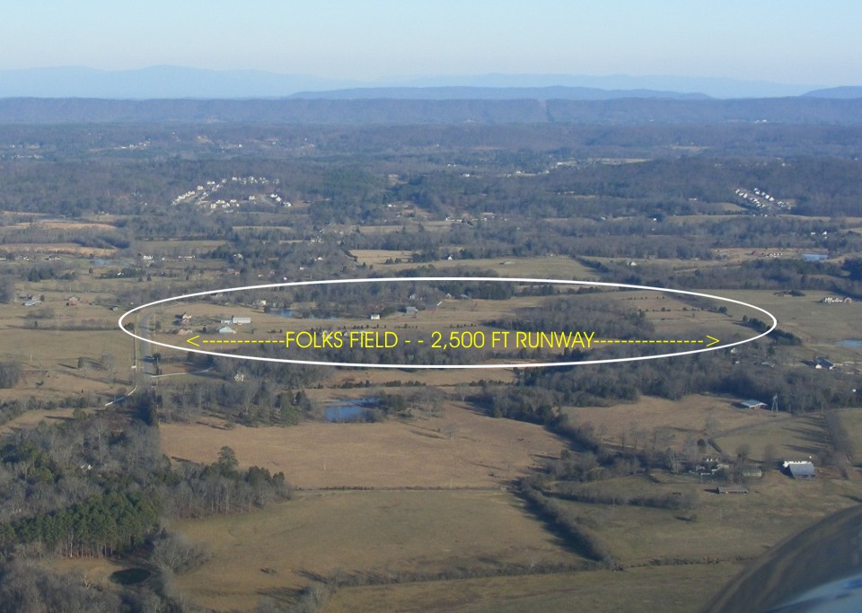
After I crossed Lookout Mountain, it did not take long to reach Folks Field
about 10 miles south of the Chattanooga Airport. This view is looking toward the
East with the runway on a heading of 10 and 190 degrees magnetic. I am about to
enter a LEFT DOWNWIND pattern for runway 1. Can you see the YELLOW RV-8 parked in
front of the hangar? The runway is just above the yellow letters and the typed
arrows below. The little yellow blob in front of the white hangar is Wendell's RV-8.
Look about 1/2 way along the "arrow" on the left side of the words Folks
Field.
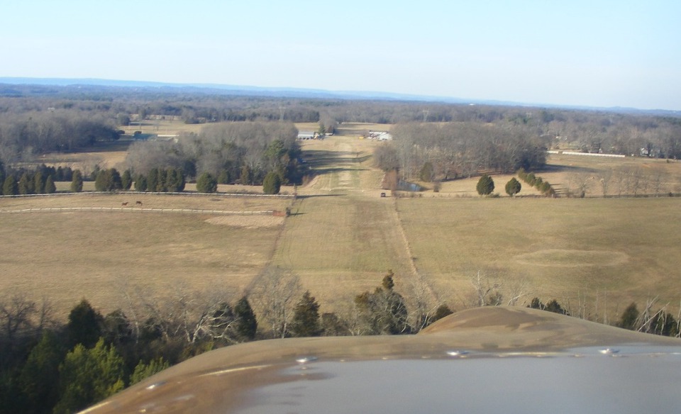
Here is the view looking NORTH on final approach to runway ONE at Folks Field
at about 75 MPH. There is 2,500 feet of runway ahead from the location where you see
the black car parked along the right side of the runway. There are two white
five-gallon paint cans marking the runway threshold just beyond the car. It doesn't
look like nearly half a mile of runway ahead from this approach angle. If you look
closely, you can see Wendell's YELLOW RV-8 and my Pearl White Cadillac on the right side
of the runway near the north end of the field.
At the end of the day, the Hobbs meter now has another 1.1 hours added to it for a total of 270.6 hours on November TWO Papa Zulu.
| CLICK HERE for PAGE 292 | Return to MAIN MENU. |