October 2008 - Flying the Tri-State Area · · PAGE 274.
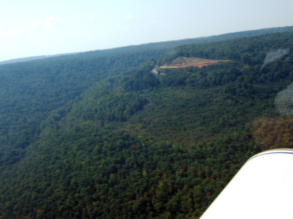
October 5, 2008: Marty continued to
take photos as we departed the Tennessee River near the point where the Tennessee,
Alabama, and Georgia state lines all come together. We both commented on the lush
green forests that are common in this part of the southeastern USA.
We headed a bit SE near the north end of Sand Mountain in Dade County, Georgia.
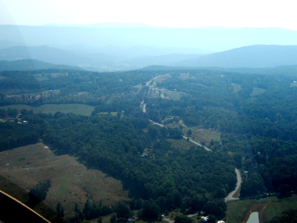
My maternal grand parents raised my mother and her two older sisters in this area.
Since we were so close, I thought I would fly over to see what new changes have
occurred recently. The valley beyond this mountain plateau has US 11 and Interstate
59 running SW toward Gadsden and Birmingham, Alabama.
Marty kept snapping photos as I started my bank turn to approach the old home
place. I cannot accept the idea so many folks have built homes up on this part of
the mountain. My childhood memories are from the 1950-1960 era. A lot can
change in 48 years.
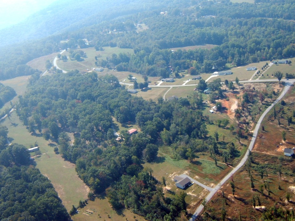
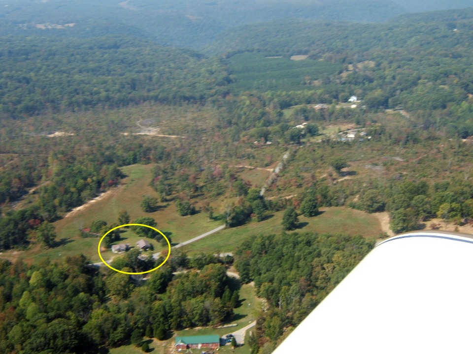
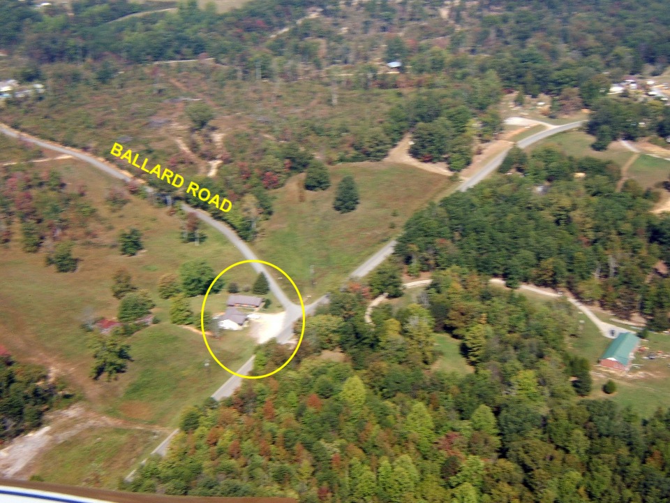
The old place finally comes in to view as I fly above the sloping bluff on the
East side of Sand Mountain. This view shows the flat-top of this mountain plateau
that runs for well over 100 miles toward Birmingham.
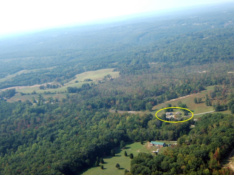
We approached from the direction at the top right edge of the photo. The
Tennessee River is just a few miles up that way.
I really need to drive up here in my car soon to see the changes up close.
The two buildings in the circle are on the old home property. The larger
building closer to the route of flight is the "new" country store built in the
late 1950's. That is why there is a large driveway/parking area in front of the
buildings. The other building near the top of the circle was the first building with
a large room that was the store on the north side of the structure. The residence
occupied the south side and back of the old building. My grandparents started
selling gasoline from Standard Oil of Kentucky back in 1947, the year I was born. In
those days, most auto fuel contained lead and was available in Regular (93 octane) and
Ethyl (100 octane). The only unleaded fuel of that era was from Amoco - that
"white gas" with no color added. Of course, the earliest prices for
gasoline were 26.9 cents for regular and 31.9 cents for premium 100 octane. My, how
things have changed in 48 years.
It was time to say goodbye to childhood memories and get on with today's
flight. We retraced our route a few miles NW and back to the Tennessee River near
the TAG border point (Tennessee-Alabama-Georgia).
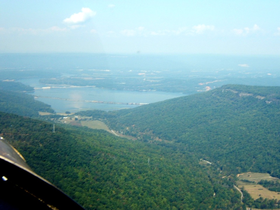
That is the Tennessee River where it turns south near South Pittsburg, TN.
And yes, the local high school team is the "Pirates" in case it matters.
I get the idea it is not in honor of the Pittsburgh Pirates from Pennsylvania, but
may refer to river pirates from the 19th century. But then again, northern tourists
stopped by southern deputy sheriffs in the 1950's may have a different definition of
"pirate" due to personal experience. The area is still a speed trap for
those folks on the highways. I love flying at 140-160 MPH with no worries about
cops.
| CLICK HERE for PAGE 275 | Return to MAIN MENU. |