October 2008 - Flying Near Chattanooga · · PAGE 271.
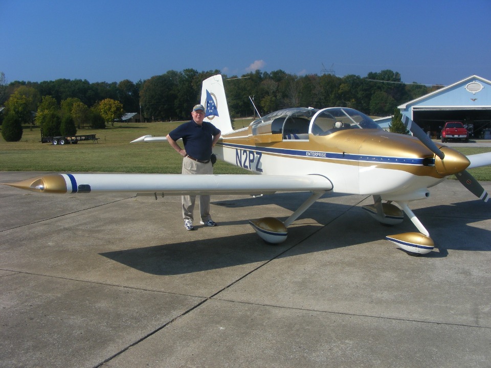
October 5, 2008: Before departing Folks
Field, I made sure to take this "class photo" of Marty on the ramp at Folks
Field. After departure, we headed northwest around the Chattanooga Class C airspace.
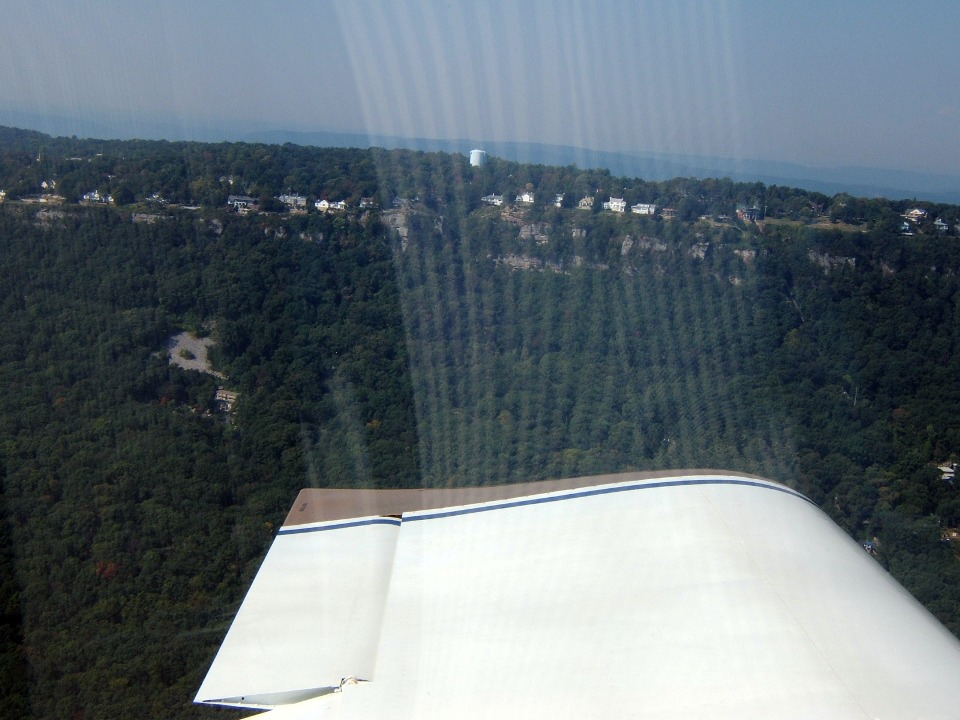
I banked left to show Marty the "corn maze" on the valley floor below and
East of the Rock City tourist attraction atop Lookout Mountain. We also got a good
look at the Incline Railway that runs two cable cars up and down the side of Lookout
Mountain.
As I said before, Sunday was great for flying! Here is the view of the
city as we head up the Chattanooga Valley near Lookout Mountain. Interstate Highway
24 is hugging the Tennessee River at the left side of the photo, then turns East across
the city.
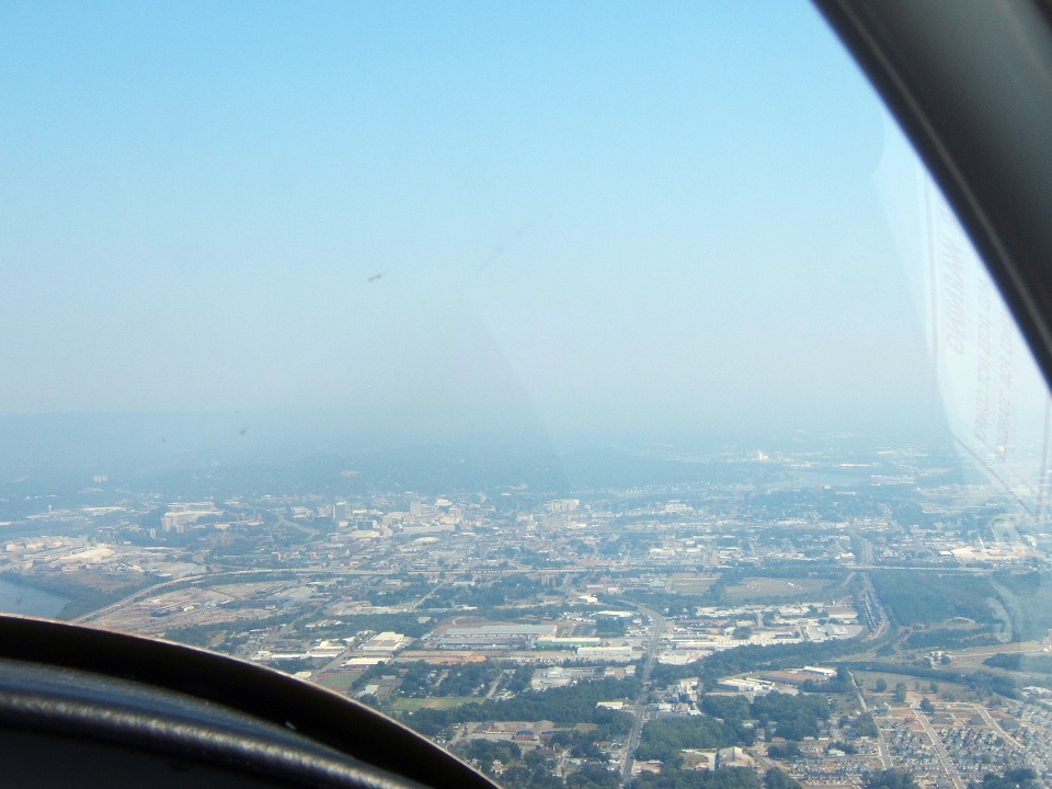
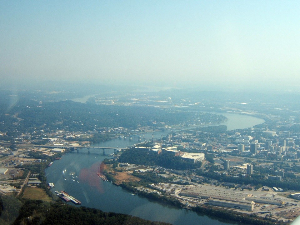
As we get closer to the city, an old industrial district adjacent to the
Tennessee River shows signs of re-development.
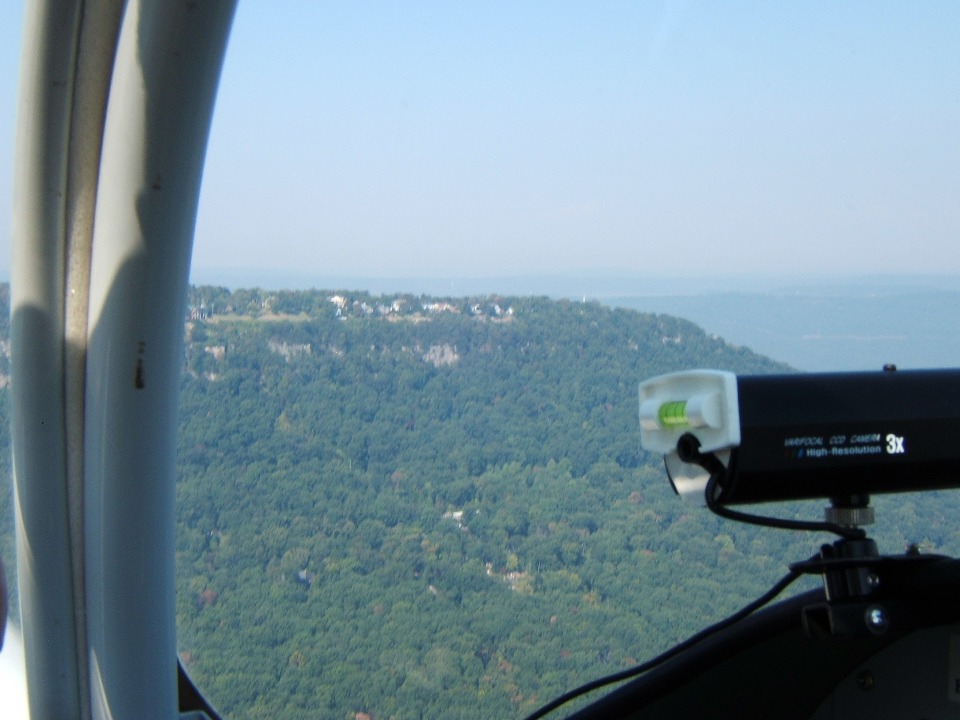
Marty took this picture as we were flying north about 1 mile off the "East
Brow" of Lookout Mountain. It shows Point Park, a US National Park at the
northern end of Lookout Mountain. This site was a confederate artillery battery to
control river traffic during the Civil War.
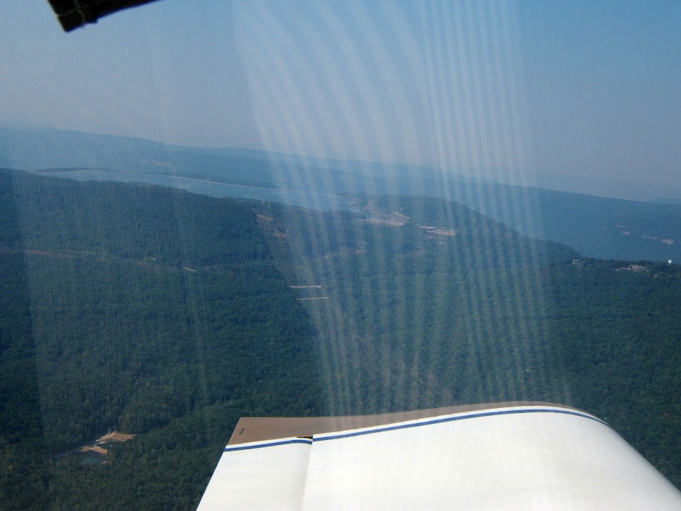
That stripe pattern is the reflection of my shirt from the inside of the
canopy. His digital snapshot camera is similar to my old one with a retractable
telephoto lens. It cannot use an external polarizing filter to minimize these types
of reflections. I verified the distance of my flight path from the town of Lookout
Mountain using a GPS ground track overlaid on a digital street map. You may notice
my flaps are still partially extended, an oversight on my part from our takeoff, but it
worked in our favor here to provide stable slow flight while we were "flight
seeing" the local area.
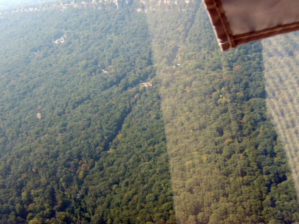
The view out my side behind the wing reveals the gap in the trees that is the Incline Railway. Cable cars have been going up
and down the mountain side since the year 1895, for 113 years as I write this.
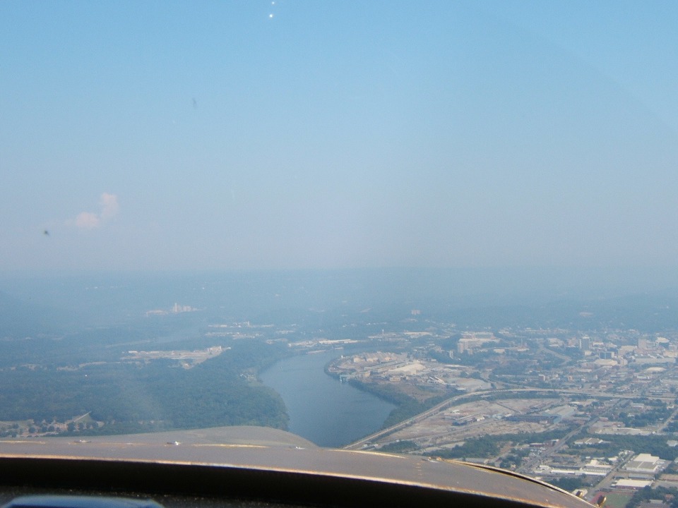
Downtown Chattanooga was on the other side of the airplane as I began following
the Tennessee River near Moccasin Bend. The bend in the river got its name because
of its shape as seen from Point Park at the north end of Lookout Mountain. By the
way, Moccasin Bend is directly under the airplane, out of sight from the camera. The
RED mixture knob is reflected from the inside of the canopy. The view is looking
upstream on the Tennessee River. The Chattanooga Airport is out there in the haze
about EIGHT miles away. We remained outside their Class C airspace at all times and
monitored their frequency as we flew this part of the route.
Here is another interesting fact about the Chattanooga area: Raccoon
Mountain and its TVA water reservoir.
Marty got the first photo of this special place used by TVA to store
"energy" by pumping water from river up to this mountain top during off-peak
power usage times. Then letting the water come back through a power generation
station during peak demand hours.
| CLICK HERE for PAGE 272 | Return to MAIN MENU. |