October 2008 - Flying the Tennessee River "Grand Canyon" · · PAGE 272.
October 5, 2008: We turned away from
Chattanooga and crossed the mountain ridge at "Skillet Gap" just across the
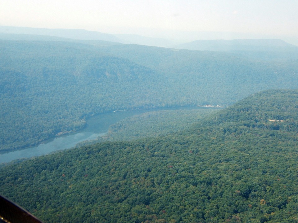
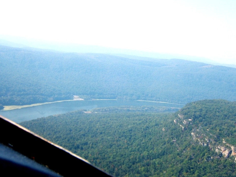
river behind us from the Moccasin Bend area. Marty took this photo on the right side
of the airplane showing the river on its first turn downstream from the city.
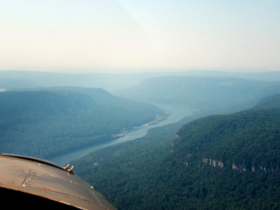
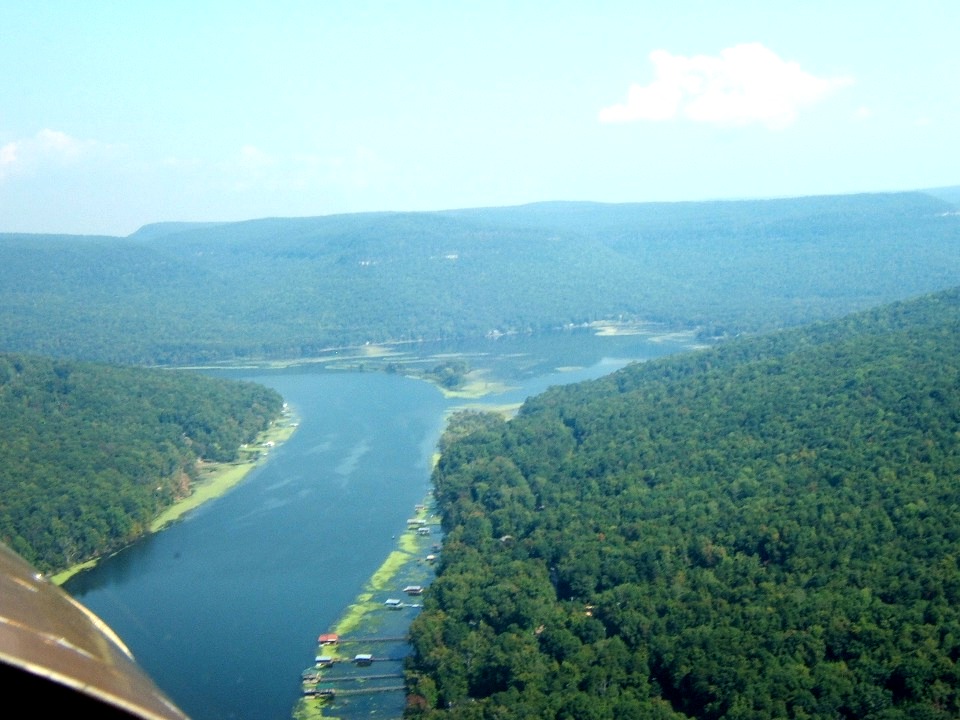
Marty also took this photo a few seconds later as I completed the turn over the
river and followed it on a SW heading. The exposed granite face close to the
airplane is called "Pot Point" with the Prentiss Cooper State Forest and
Wildlife Refuge extending to the west from this area. The Raccoon Mountain Reservoir
is again coming into view at the left edge of the photo as we continue downstream on the
Tennessee River.
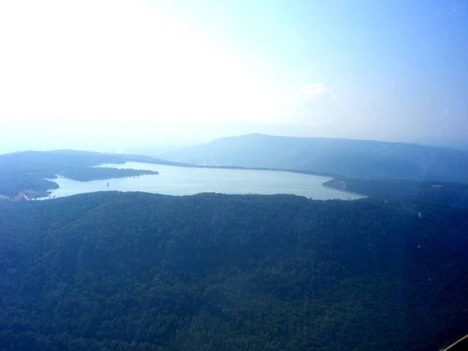
I took this photo from about a mile away while flying southwest over the
Tennessee River. This was about the time I noticed my flaps were down a few degrees
and pulled them up into cruise flight position .
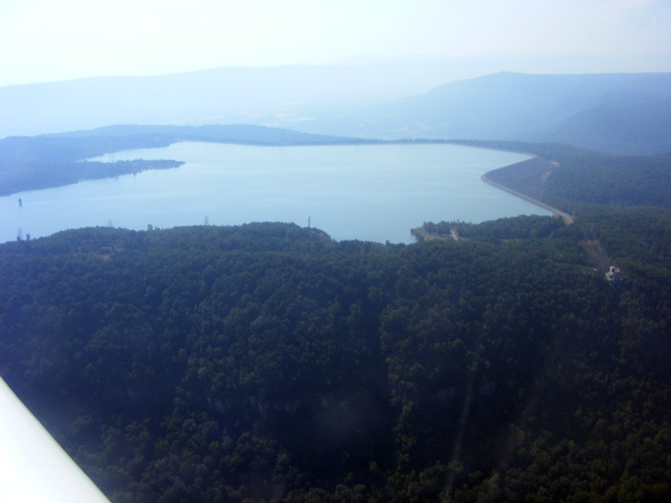
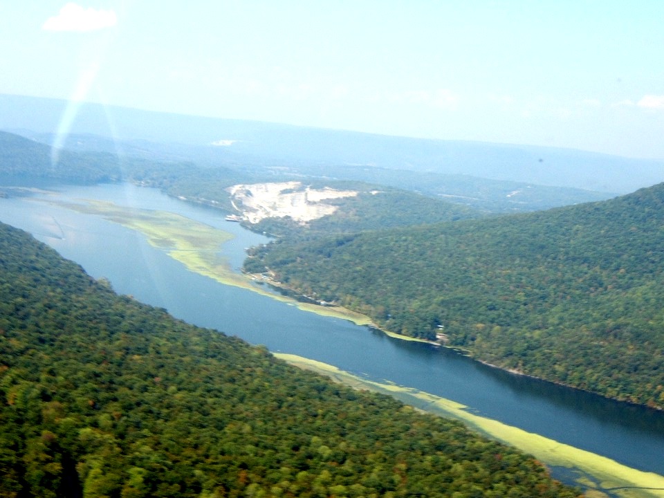
The next shot is about half a mile out and shows the reservoir dam near the
right side of the photo. That is Grindstone Ridge on this side of the reservoir from
my location. There is an access road to this facility from US 41 west of Interstate
24 past the Tiftonia area.
Marty got this shot just past the Raccoon Mountain Reservoir as we passed Hicks
Mountain seen on the right side of this photo. At this point on the river, it
changes course toward the west briefly as US 41, 64, & 72 joins up on the south shore
to follow the river. The gap in the trees beyond the sandy shores hides the highway
from direct view except for one location.
As we rounded the bend in the river, I descended down to the level of the
mountain ridge tops. The amount of haze in this photo attests to the lower altitude
as Marty pointed his camera down to Mullins Cove Road on the north side of the river.
The road is hidden most of the way under the canopy cover of the forest. This
is very near the location of the old Kelleys Ferry site.
Around the next bend in the river, we were flying north when Mullins Cove came
into view. Marty took this photo. This is also a great part of the river where
fishermen catch large mouth bass. Mullins Cove Road continues to be mostly hidden by
the forest.
We flew around the next bend in the river seen in the photo above. The
highway that is US routes 41, 64, and 72 was about half way up the mountain on the left
side of the airplane. The forest there is thick enough that I never knew until today
how high I was driving my car above the river. The highway is just barely visible in
the lower left corner of the photo below. The rock quarry on the right side is
located in an area called Bennett Lake. They were cutting large blocks of granite
from the quarry and putting them onto river barges for transport.
| CLICK HERE for PAGE 273 | Return to MAIN MENU. |