Florida Day Trip on May 12, 2007 · · PAGE 238.
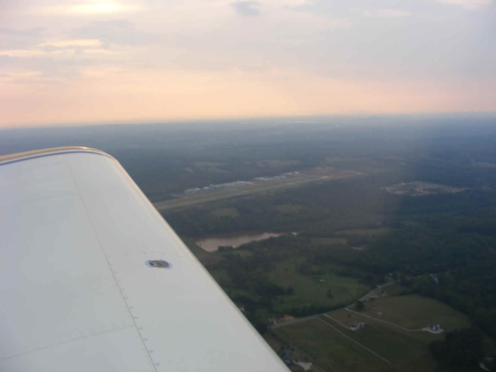
May 12, 2007: The GPS and autopilot had a hiccup during the descent toward Alma. The data stream was interrupted and the green LED went out. That is usually followed by a roll command to the wing mounted servo. I quickly switched the control to the off position and continued the descent around the scattered clouds between our location and the airport.
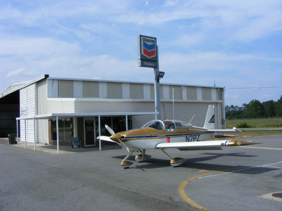
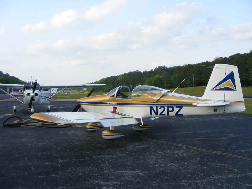
A Beech V-35 Bonanza was on the ramp getting fuel when we arrived. This was the first time I have parked on the side of the pumps toward the FBO office at Alma. The pilot came over to ask about my airplane before he departed. He was telling me that a number of RV's were flying and more being built at his aviation community near the Georgia coast a few miles away to the East. He asked about the paint scheme and I pulled out my wallet to show him a photo of my Comanche model airplane to explain how I had adapted that color scheme to the RV-9A air frame.
The RED CUP makes yet another appearance. At least this time I remembered
to take it off the wing when I got into my seat for the departure. The light wind
from the south has blown my rudder up against the stop. We departed Alma at 4 PM
heading north.
Before we began the descent from 12, 500 MSL towards Alma, I had noticed some
clouds building to the north along our intended route. I would get a good look at
these clouds up close after passing Dublin, Georgia on the way home. The straight
GPS ground track on the right is from the morning southbound flight. All those other
tracks you see near Macon, Milledgeville, Forsyth, and Thomaston were a futile attempt to
find a path through a nasty weather front with lots of heavy rain. Atlanta center
and approach were really busy working all the airliners and a number of general aviation
flights all trying to get around that mess. I could hear pilots heading as far east
as Greenwood and Columbia, South Carolina to get around the storms. That front that
I had flown under early in the day had produced dramatic results in the afternoon.
The other route was to the west into Alabama.
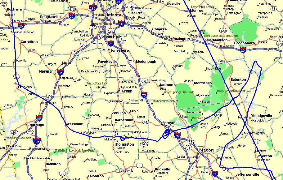
From the vantage point between Jeffersonville and Macon, the view to the East looked
better. After heading that way, it became clear there was not an easy path home
going that way. The Atlanta controllers were talking about LaGrange being the better
alternative. By the time I got back to the Forsyth area, I had made a decision to
land and wait for the rain to "let up a bit" as we say down south. The
controller suggested vectors to Macon to make a descent. I could see the interstate
highway below me and indicated I would spiral down near Forsyth to about 1000 feet AGL to
fly under the lowest cloud layers that were producing light rain in nearby areas.
The visibility in those rain showers was easily more than three miles for VFR
flight. I pulled the carburetor heat on as I began my spiral course downward.
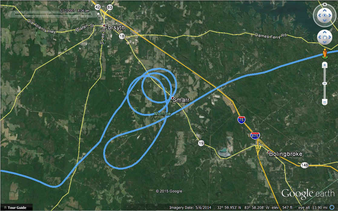
MAY 28, 2015 UPDATE: The GPS TOUR flight for this
day trip to Florida lets you see the descent as I spiraled down to get under the weather.
All I saw during the descent was CLOUDS all around me where I was circling down in
clear air. The clouds were moving northeast with the weather system. You can
see that movement as the circles are not directly above each other. The GPS track
for that descent is seen in the map above just below Forsyth, Georgia. If you look
at Google Earth as I did to make this screen capture, you can drag this part of the map
toward the upper right and you can line up the three circles. I set them in the
center of my screen to show how much the air was moving While flying this part
of my mission that day, you can see the altitude readout changing with each 360-degree
turn. Since Google Earth cannot re-create the weather from that day, you will have
to use your imagination. The entry into these spirals was from the northeast with
the exit to the south then to the west. This location is northwest of Macon,
Georgia.
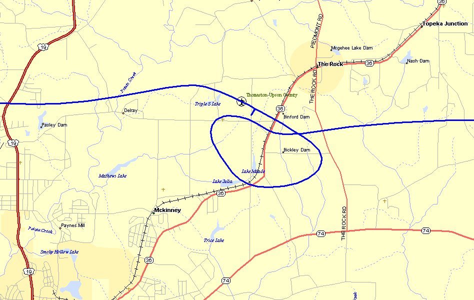
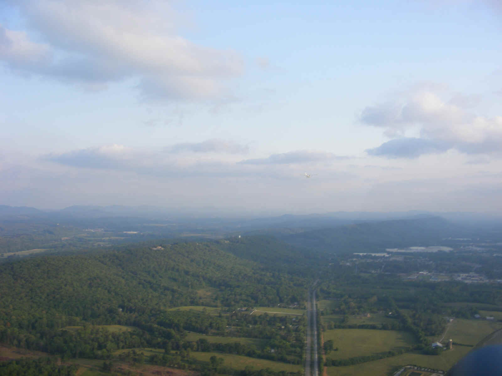
The Atlanta approach controller suggested Butler Airport (6A1) with a heading
of 220 degrees from my location. He and I both agreed that my visual observations
would better serve me now that I was down low and could see what was happening better than
his radar could provide. I started for Butler then noticed the weather looked better
in the direction of Thomaston, Georgia. The controller gave me a phone number to
call when I got on the ground. The GPS pointed the way to the airport and the rain
was very light as we headed that way. I flew over the field at pattern altitude and
announced my landing for "runway 30 or whatever, it's a runway." A thin,
low cloud blocked my view of the runway as I turned base leg. The view was clear
when I turned for final approach.
We pulled up to the ramp in front of the FBO with four rocking chairs on the front porch. Two guys came out to meet us and directed us toward a tie-down spot just in front of the building at the edge of the ramp. When I got out of the airplane, one asked me if I was Captain Kirk since he saw the name "ENTERPRISE" on the side of the airplane. We landed just before the airport was scheduled to close at 6 PM. The phone rang in the FBO and one of the guys went back inside to answer it. He came outside with an umbrella as we were getting my airplane secured. The phone call was from the Atlanta approach controller to verify we had landed safely.
One of the guys, Pete Pettis, has an RV-6A. Needless to say, we had some good discussions during the 45 minutes we waited for the weather to improve. We discussed the differences between his fixed-pitch prop vs. my constant-speed propeller, fuel burn rates, cruising speed, etc. I won on fuel economy of course! He also thought I was going to stall on landing since I was going slower than he does with his RV-6A. I explained the difference in the Roncz airfoil wing and his aerobatic wing. I sketched out the wing profile and indicated the differences from his wing cross-section. When we went outside later, I pointed out the difference in our flaps and how they are attached to the wing on the RV-9A becoming "Fowler Flaps" that extend aft to increase the effective wing chord. I also reminded him that he has a 23-foot wing span, while the RV-9A has a span of 28 feet. The RV-6 has a wing area of 110 square feet, while the RV-9A has 124 square feet of wing area. The differences allow the RV-9A to land a good 10 MPH slower than the RV-6A. At this point I told him about my transition training with Mike Seager in the Van's RV-6A demonstrator airplane.
During this short visit, I kept checking the weather radar online. I called Wendell at 6:15 PM to get the weather report at home and told him where we had landed to wait for the weather to improve. Finally, all the red and yellow rain storms turned to green and lighter green radar returns. At this point I went out on the ramp to take a look toward the west since that is the way we would have to fly around the Atlanta class-B air space. The ridge four miles west of the airport was visible, so we were back in the air in light rain in short order. When I cranked the engine, the rain on the windshield was blown up and dripped down inside the canopy. A little higher idle blew it past the opening. I can see that I need to put some rubber weather stripping on the canopy frame to prevent that problem in the future. Since the runway was 6,300 feet long, I took off from the mid-field intersection to find better weather.
Looking at the GPS ground track above, you can see how we headed west looking for brighter areas with less rain to fly through. We were able to maintain VFR at 1000 feet AGL and could have flown higher. The GPS 296 obstacle database did its job alerting us to one tall broadcast tower off to the left of our flight path. There were some heavier rain showers near Interstate 85 as we passed that area. We had about a five-mile gap between two of the showers. The one on our right had cloud-to-ground lightning associated with it. We flew a little closer to the other heavy rain shower. At this point, I was telling Terry about my early flight training days in Florida and some of the rain showers I dodged in those days.
The sun finally started to break through the clouds to the west as we turned on
a direct course for home. That is the West Georgia Regional Airport near Carrollton,
Georgia in this photo taken at 7:27 PM. A few more light rain showers were off to
the east of our flight path as we put Atlanta's class-B airspace behind us. We flew
directly over downtown Rome, Georgia at 2,500 MSL. I pointed out the Rome VOR off
our right wing on a hilltop southeast of the city, then the Richard B. Russell airport
later, northeast of the city.
I made a high-speed pass down the runway to announce our arrival to Wendell and we were on the ramp in front of the hangar at 8:05 PM. I told my passenger about the comment made by the flight examiner who gave me my private pilot check ride in 1993: "Now you have a license to learn." Today was the day I learned more about the "system" and how the controllers assist you when weather becomes an issue. It is all about flying safely and knowing when to be on the ground, not in the air.
Oh, I almost forgot to mention the light rain at 150 MPH washed the airplane. It removed a few "love bugs" I smashed on the wings during my lunch stop at Fort Pierce, Florida.
Terry and I left Wendell's air field and went through the Chickamauga Battlefield National Park on the way to where I would drop him off to visit his son and his family this week. I gave him a little bit of Civil War history as we passed the old field cannon and the various monuments to the army units from both sides that fought here in the war. We stopped at Long John Silver's for some food after exiting the park area. Monte called to check on us when we were having dinner. I gave him the short version of the day's events and promised to get these web pages updated to give a better account. It has taken me a good SIX HOURS to get the GPS ground track maps made, upload the photos from my digital camera, and do all the necessary editing to this web site. Next weekend, we get to do this again when I take Terry back to Florida. As I publish this on May 13th, the 10-day forecast for next Sunday in Florida looks better than Saturday, May 19th. We shall see...
May 16, 2007: I was
checking on the cost of AVGAS at Collegedale after I realized I needed more fuel for my
upcoming return trip to Florida. Trying to get around the Atlanta weather last
Saturday, plus flying home "down low" burned more fuel than I expected.
The solution was to fly over to Collegedale as soon as I got to Wendell's field before we
began our usual evening session of working on his RV-8 project. Wendell brought his
Cessna 182 along to put some fuel in as well. The price today for local pilots with
fuel accounts was $3.62 per gallon of 100 low-lead. The normal price for transient
pilots is ten cents more per gallon.
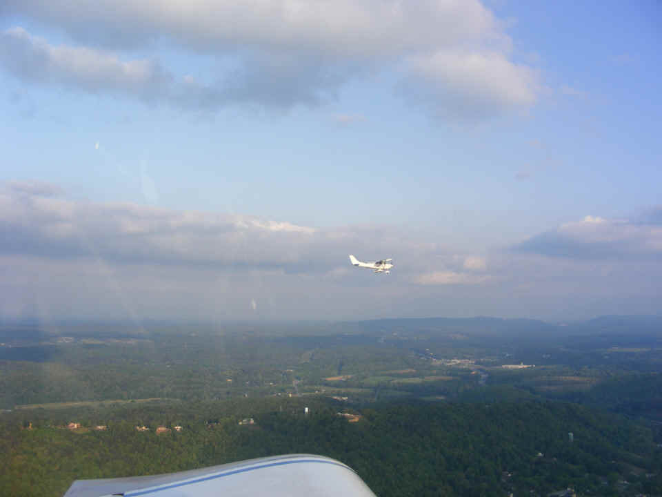
On the way back to Folks Field, I told Wendell I would try out the new camera
and had him take off first. I took this photo after I got my airplane up to altitude
and trimmed for level flight.
I took this photo about 1 minute later. It shows the ridge line just east
of the town of Ringgold, Georgia. The state highway and CSX railroad are clearly
visible in the valley below as they head south to Ringgold.
I pulled closer to Wendell and took this picture as we were crossing Ringgold.
Interstate 75 is visible beyond the ridge below. The shadow of his wing on
the side of the Cessna fuselage indicates the sun is getting low in the west. We
wanted to hurry home before sunset to work on his RV-8.
May 19, 2007: I came over to Wendell's place today to inspect my airplane, pack it and get it ready for tomorrow's flight to Florida and back. I took off the upper cowl and checked on things inside and also used the fluting pliers on one part of the strap that secures the cowl to the firewall. After I helped Wendell fit his cowl smoothly to the fuselage, I realized that my cowl attachments needed a bit of tweaking.
| CLICK HERE for PAGE 239 | Return to MAIN MENU. |