Spring 2007 · · PAGE 236.
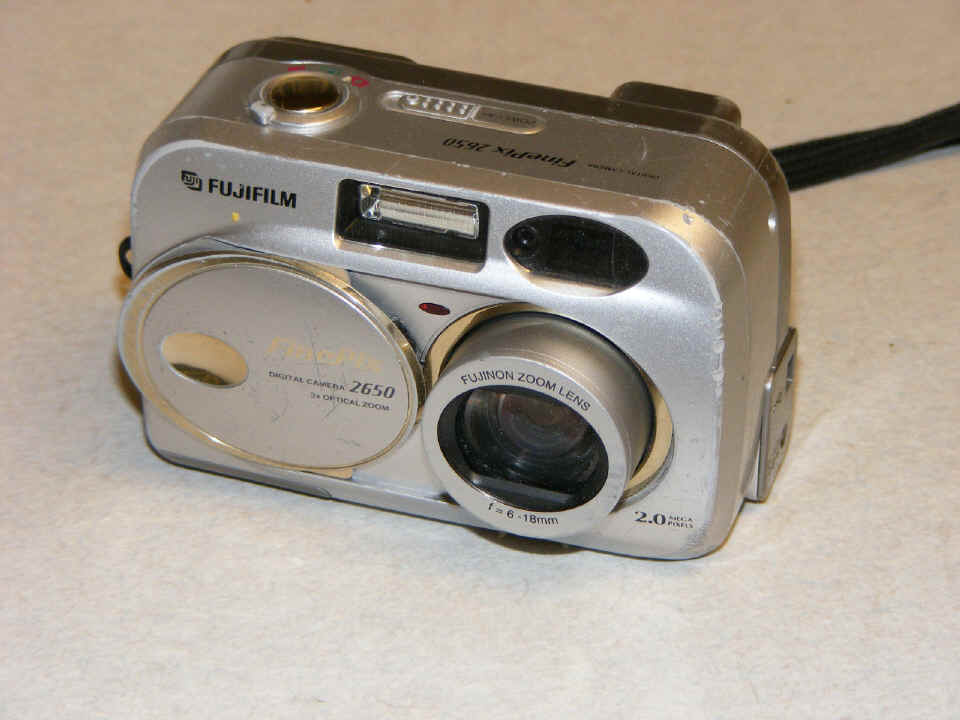
April 29, 2007: The old Fuji digital camera
is officially retired after the beating it has taken since I got it in November 2002.
It has served me well in publishing this web site, but it finally has problems that
are not easily fixed by restoring a loose connection, etc. The old 2650 could take
2-megapixel photos, while the new Fuji S700 takes up to 7.1-meg shots. I took this
one using 2-meg settings and reduced it from 1600x1200 to 960x720 for the usual display
size on this web site.
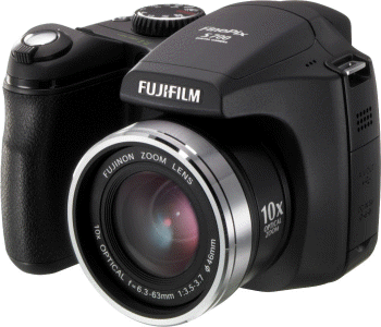
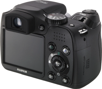
Here are the web advertising photos of my new camera that took the photo above and all that you will see going forward on this web site. The new feature for me on this model is the ability of the camera to use 46mm filters in front of the zoom lens. The big advantage will be the removal of reflected glare seen on the inside of the windshield and canopy in some of my cross country photos.
 |
 |
I also worked with Wendell on Saturday afternoon to add cooling baffle fabric to his RV-8. To see those photos from the new camera, CLICK HERE for his latest page.
May 5, 2007: It was another Saturday afternoon session with Wendell. I also took some time to cover part of the hinge openings on the elevators of my RV-9A. Some RV-9 owners talk about the "whistle" that comes from the -9 is caused by the oversized openings for attaching the elevators to the horizontal stabilizer. I have put some clear UHMW tape across the gaps to see if that is true. I will know the next time I fly Enterprise.
I got a call from Florida regarding my day trip mission scheduled for next weekend. It looks like the flight will end at Fort Pierce at the Tiki Restaurant located on the field.
Florida Day Trip on May 12, 2007
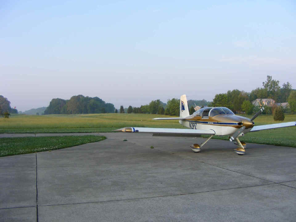
May 12, 2007: The trip to Florida today
looked good according to the weather forecasts. I took this shot at 7:19 in the
morning on the ramp at Folks Field before my actual departure time around 7:30 AM.
By the end of the day, five flight segments would cover 1,390 miles. The GPS flight
plan is for 600 miles each way. Read further to learn where those extra miles took
me on this day! May 28, 2015 UPDATE: The GPS log
files for the FIVE flight segments are now posted on the Google
Earth Tour MENU page. Read this page and the following TWO pages to know what
you can see in the Google Earth tour for this day's travel, May 12, 2007. You will
get a chance to see what it can be like to land from the SOUTH end of the runway at Folks
Field near Chickamauga, Georgia. That landing is at the end of log file 05.
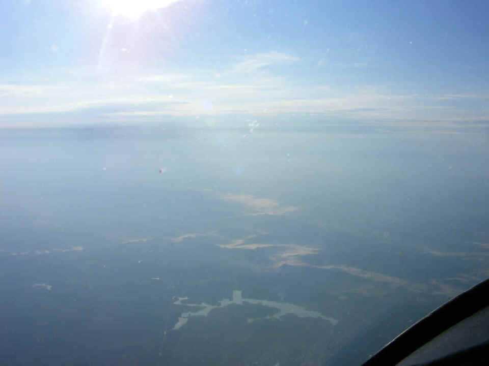
The ride across north Georgia in the morning sun (8:04 AM) reveals the mists
rising from the terrain north of Jasper, Georgia. The clouds on the horizon hint of
things to come later in the day. And of course, there is a bug strike on the
windshield. The polarizing filter on the digital camera is helping to reduce the
reflections off the inside of the windshield.
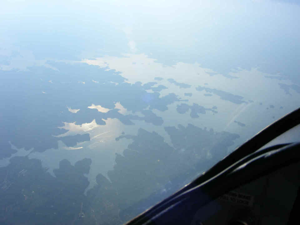
Here is Lake Lanier near Cumming, Georgia at 8:09 AM. I was cruising at
9,500 feet MSL.
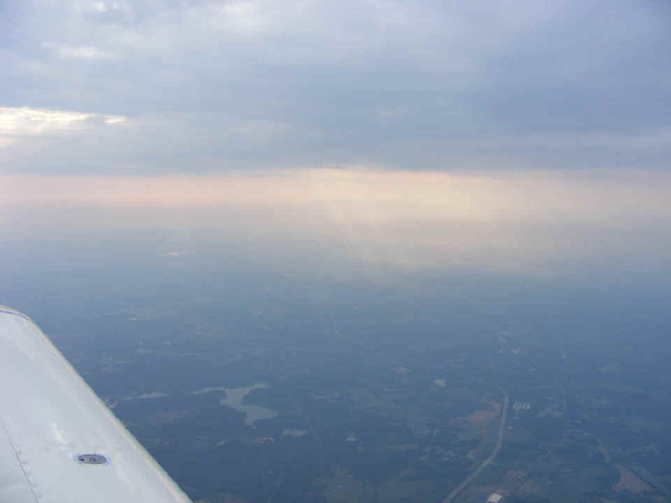
I took this photo at 8:18 AM after passing WOMAC intersection northeast of the
Atlanta class B airspace. Gwinnett County airport (KLZU) was on the other side of
the airplane, but this line of clouds had my interest. I had to descend to 7, 500
feet MSL to remain in VFR conditions as I changed my heading for my next waypoint, the
Dublin, Georgia airport.
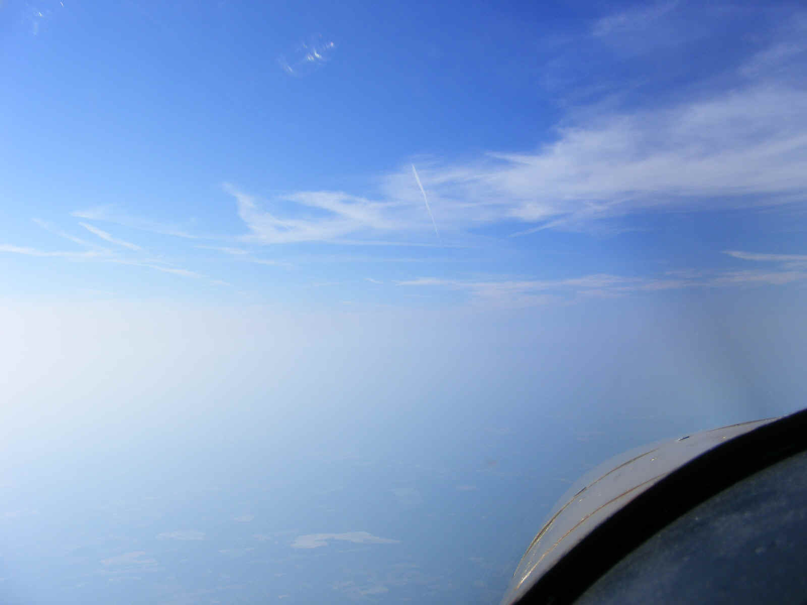
I took this photo looking toward the south after passing Dublin and calling JAX
center for flight following advisories. Things were looking good for a great flight
to Florida today. But all that was about to start changing, no matter what the
weather forecast said.
Here is a map of my GPS ground track south of Dublin, Georgia. That
straight line track on the left is my southbound flight path. I had no sooner been
handed off to Valdosta approach from JAX center, when the Valdosta controller said I could
check the weather at Homerville where I intended to land for the lowest AVGAS fuel price
in Georgia. The smoke from the big forest fire in Ware County, Georgia was blowing
across that area and reduced the ceiling to 100 feet AGL. I diverted to Alma,
Georgia (KAMG) which was visible from my position north of Douglas, Georgia. The
fuel price was only seven cents per gallon higher, but I had hoped to land at a new
airport (for me) to add to my flight options.
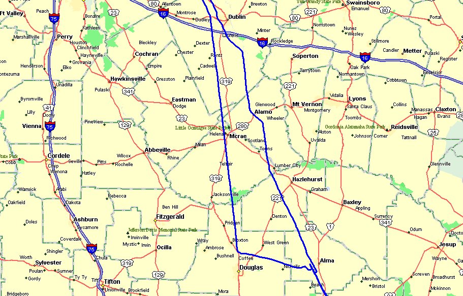
The GPS ground track on the right in the map above shows my north bound departure from Alma and the turns I made to remain VFR as we climbed into cooler air above the scattered and building cumulus clouds later that afternoon. The northbound departure from Alma was around 4 PM. We will discuss that part of the trip later.
| CLICK HERE for PAGE 237 | Return to MAIN MENU. |