June 2022 Vacation Day 14, Oregon
Attractions · · PAGE 35.
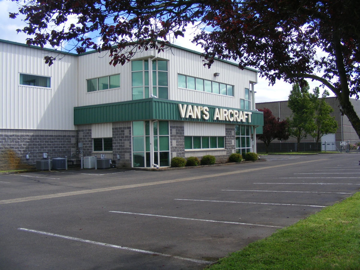
June 5, 2022: We started this day with a
short ride south to Van's Aircraft at the Aurora Airport near Interstate
5. This being Sunday, they were closed of course. This is the
company that built the airplane kit that became my RV-9A with Van's serial
number 90622 and registered with the FAA as N2PZ, November 2 Papa Zulu. You can learn
all about how it was built via the home page of this web site: http://www.n2prise.org
and also www.n2prise.com. The serial
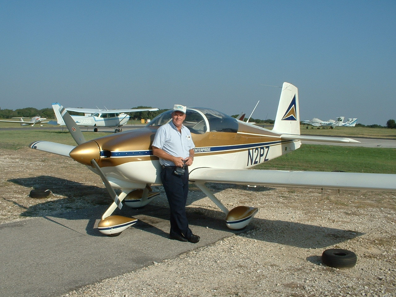
number from Van's is based on the order number of the tail kit as that is how
everyone starts building their airplanes. When it was time for my first
flight of my airplane, I sent information about the date of that flight to Van's
and they posted it as RV-9A number 155 to take flight. That low number
was an indicator about how fast I worked on the airplane to complete it.
As I create this web page on August 1, 2022, there are 1,173 RV-9 and RV-9A
models completed and flown.
The image below is from the home page of MY web site with a resolution
of 1200 by 900 pixels. It was taken on the ramp at the Georgetown, Texas
airport on Labor Day, September 5, 2005.
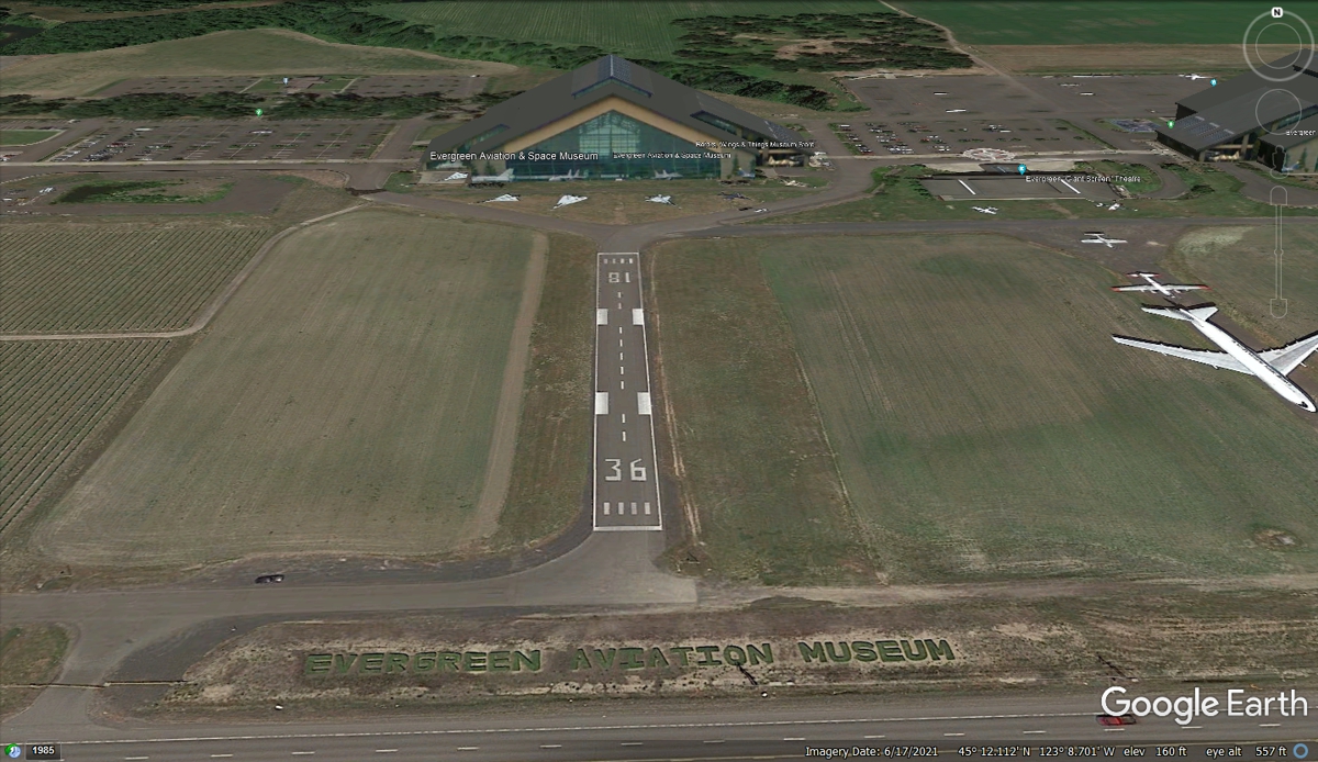
The next stop for today is to see the Hughes H-1 known to the public as
the Spruce Goose. The trip over to the Evergreen Air and Space museum was
on some country roads and a couple of state highways only 26.3 miles from Van's
Aircraft. There is much to see here which could take more than one day on
the ground up close with some famous military and cargo airplanes.
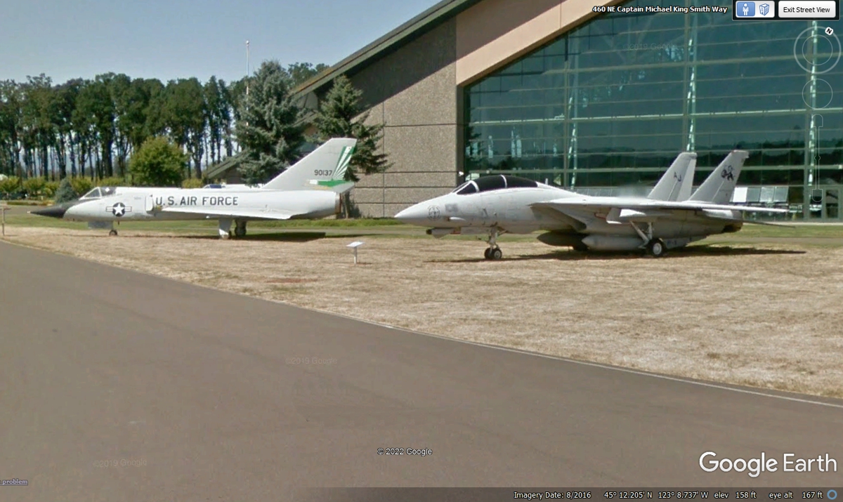
The front yard of the aviation museum has an F-106 interceptor and a US
Navy F-14 Tomcat like the ones seen in the movie "TOP GUN".
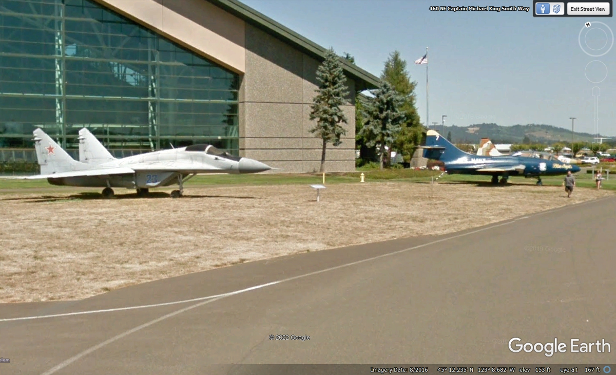
This RUSSIAN MIG-29 is still in service with some countries with ties to
the Russians. The Blue Angels jet is from the Korean War era of the
1950's.
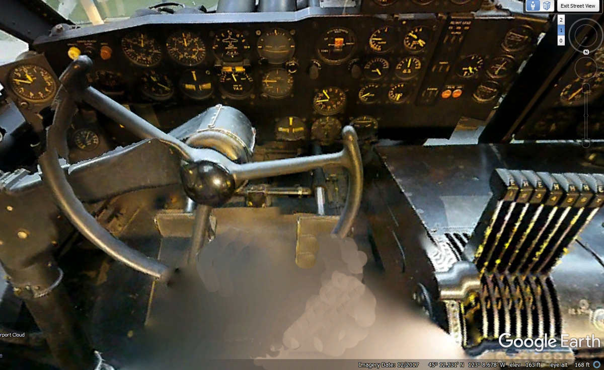
Here is where Howard Hughes sat to fly this huge airplane in 1947 during
it's one-mile flight. I was able to "get inside the building"
and use the arrows of Google Earth to move around inside.
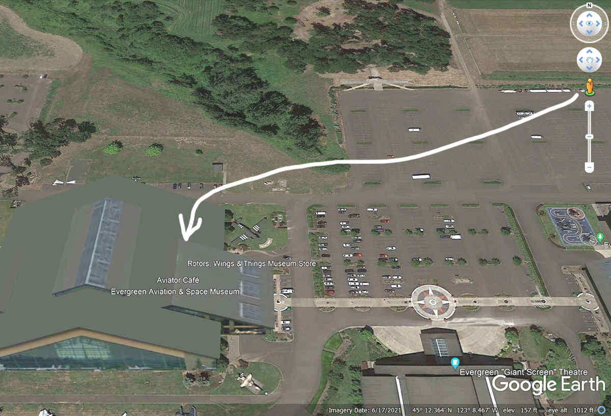
Here is how to navigate inside a building. I have put this arrow on
the full screen image of where you need to drag the little Google Earth man to
see what is inside the building. When you drag the little orange man to
the spot indicated by the arrow and LET GO of the mouse button, Google Earth
takes you inside if there are BLUE DOTS visible on the image. Once your
viewing the inside, Click on the white arrows to move around to see those indoor
images.
This retired Boeing 747 air freighter now serves as a dual water slide on
the west side of the main building of the museum.

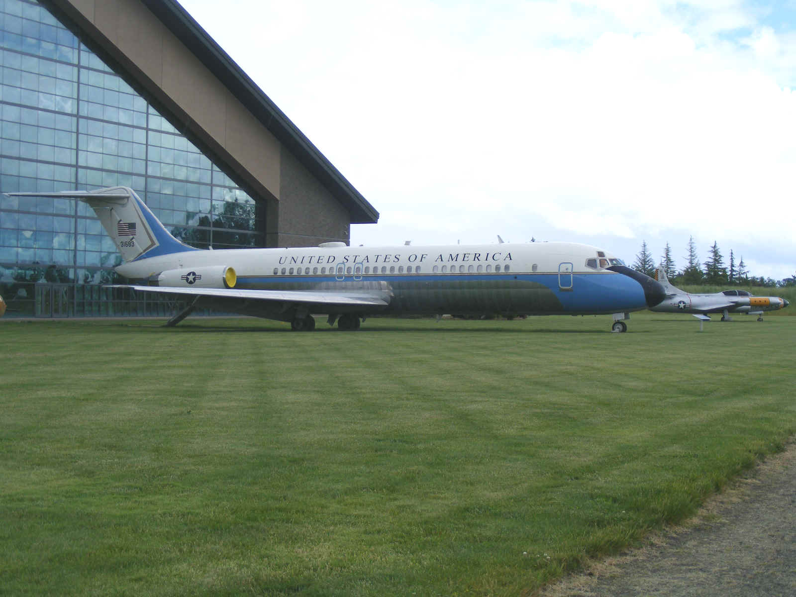
This retired US Government executive aircraft has been used for VIP
travels. It is a McDonnell Douglas VC-9C known in the commercial airlines
as a DC 9-32. It now sits on the field at the Evergreen Aviation Museum.
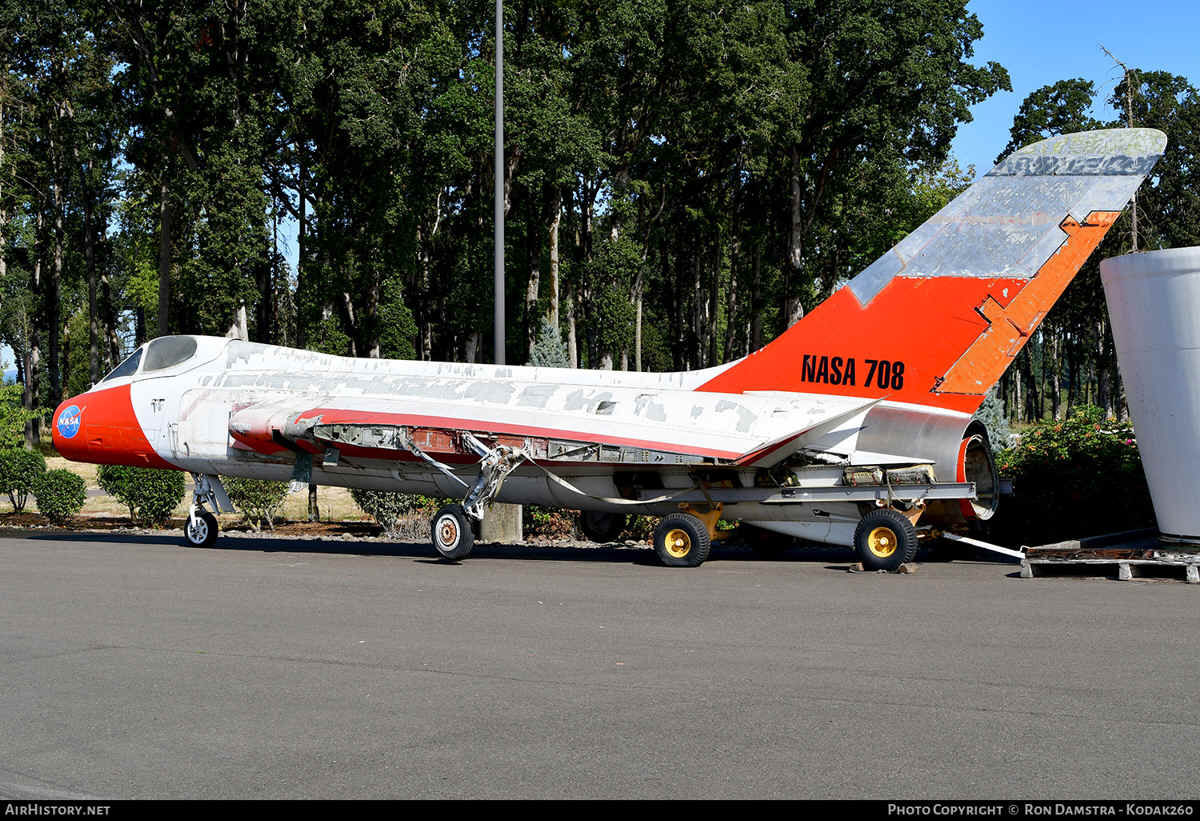
This is one of Four F5D Skylancer test aircraft build by Douglas Aircraft
for the US Navy. When I was walking around the main museum building, I met
a young man and his father who are regular visitors to the Evergreen Aviation
Museum. He pointed to this airplane when we were standing near the back
door of the museum building looking at the wings for this airplane. Watch
for this one to go on display in the next year or two when it is properly
restored. More details are on this NASA web page: https://www.nasa.gov/centers/armstrong/history/where_are_they_now/F5D_708.html
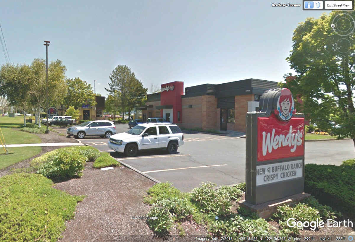
This fuel stop was after our visit to Evergreen Aviation Museum in the
town of Newberg, Oregon. The lady pumping gas let us know there is a
Wendy's very close by as it is time for lunch before we start making our way to
the Oregon Pacific coast at the town of Seaside, Oregon.
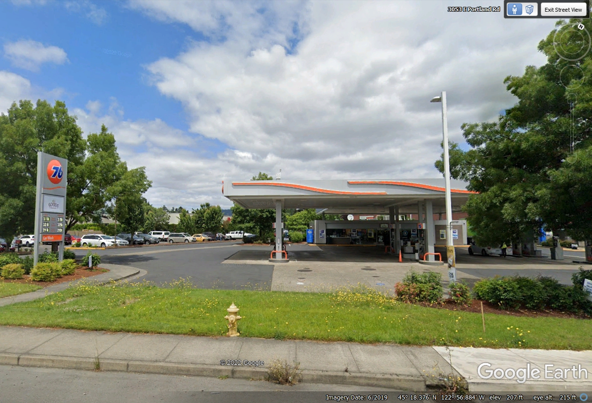
This Wendy's location was just two blocks north of the Union 76 fuel stop
at 3400 Portland Road. We parked adjacent to this sign in this image. Chase was very
happy with all the green grass.
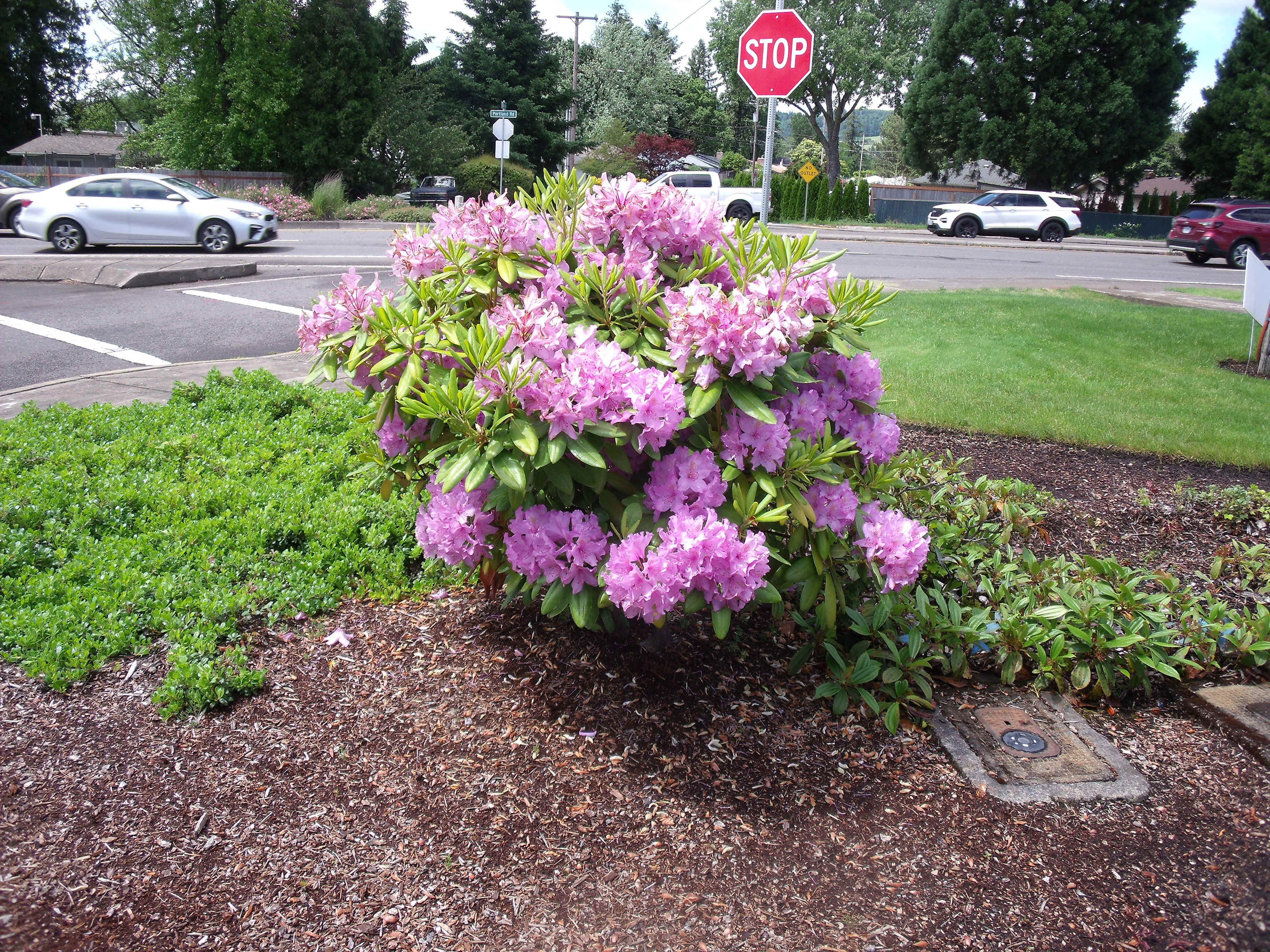
Linda took this photo of an azalea bush when we were at Wendy's for
lunch. It was directly in front of where her Chevy Equinox was parked.
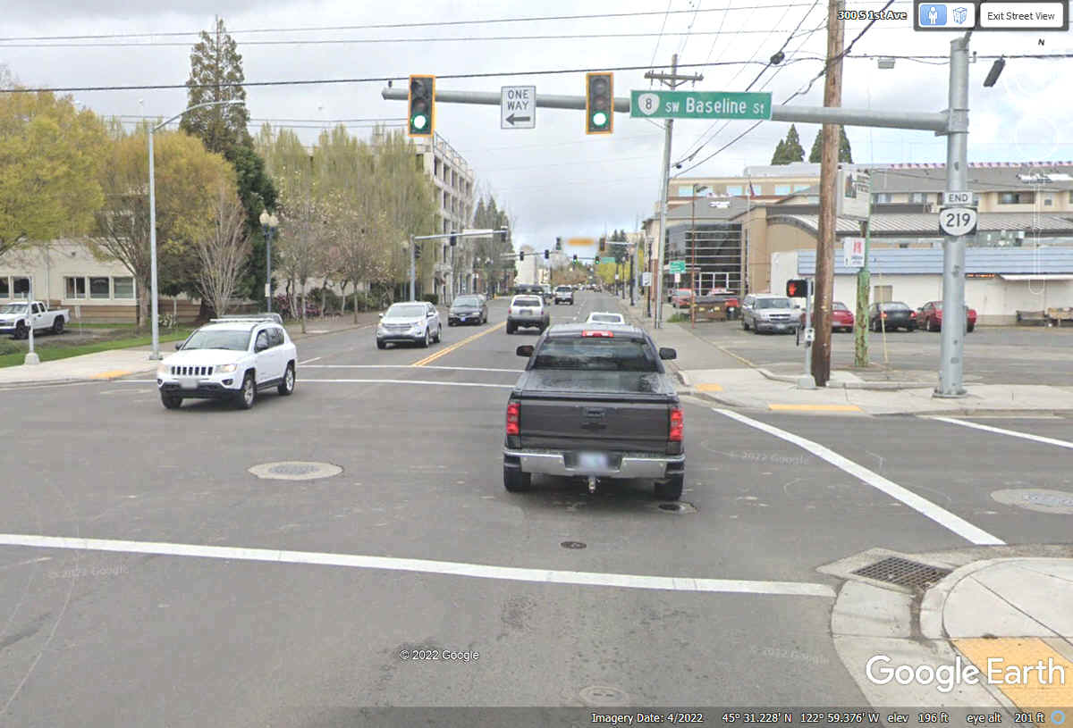
This intersection is where Oregon state route 219 ends. The GPS took
us north on local roads to connect with US 26 near North Plains, Oregon.
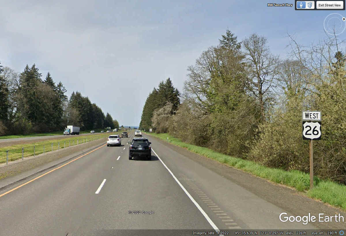
US 26 will take us to the town of Seaside, Oregon where we can get to the
shore of the Pacific Ocean.
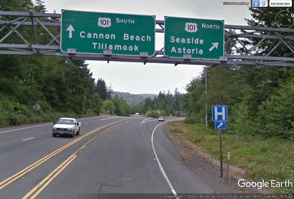
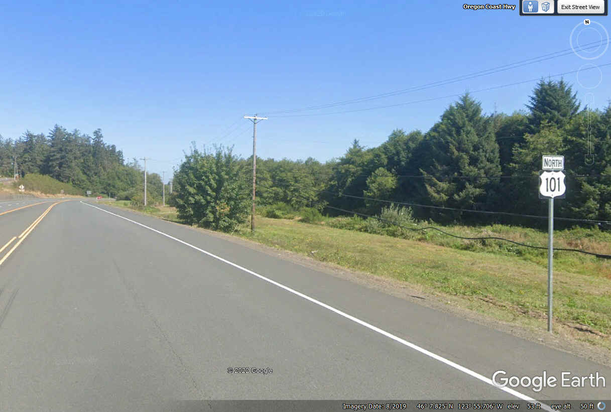
US 26 merges with US 101 to go north to the town of Seaside for our route
from here.
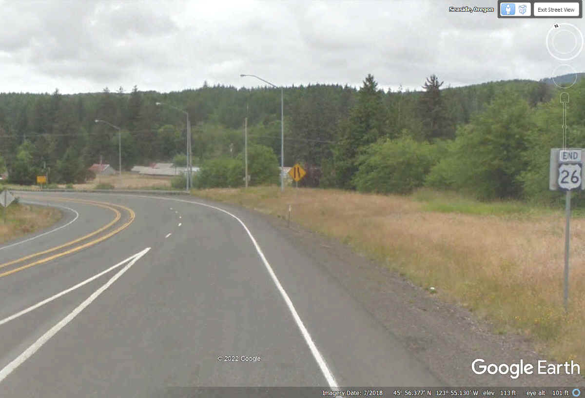
According to Google Earth, the end of US 26 is here and we are now in
Seaside, Oregon heading north to see the Pacific Ocean at the nearest beach.
The Oregon DOT agrees and put the END sign above the US 26 sign.
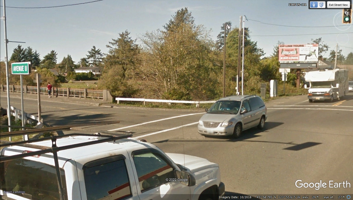
Avenue U has the southernmost beach access in the town of Seaside,
Oregon. We turn left here to go to the beach.
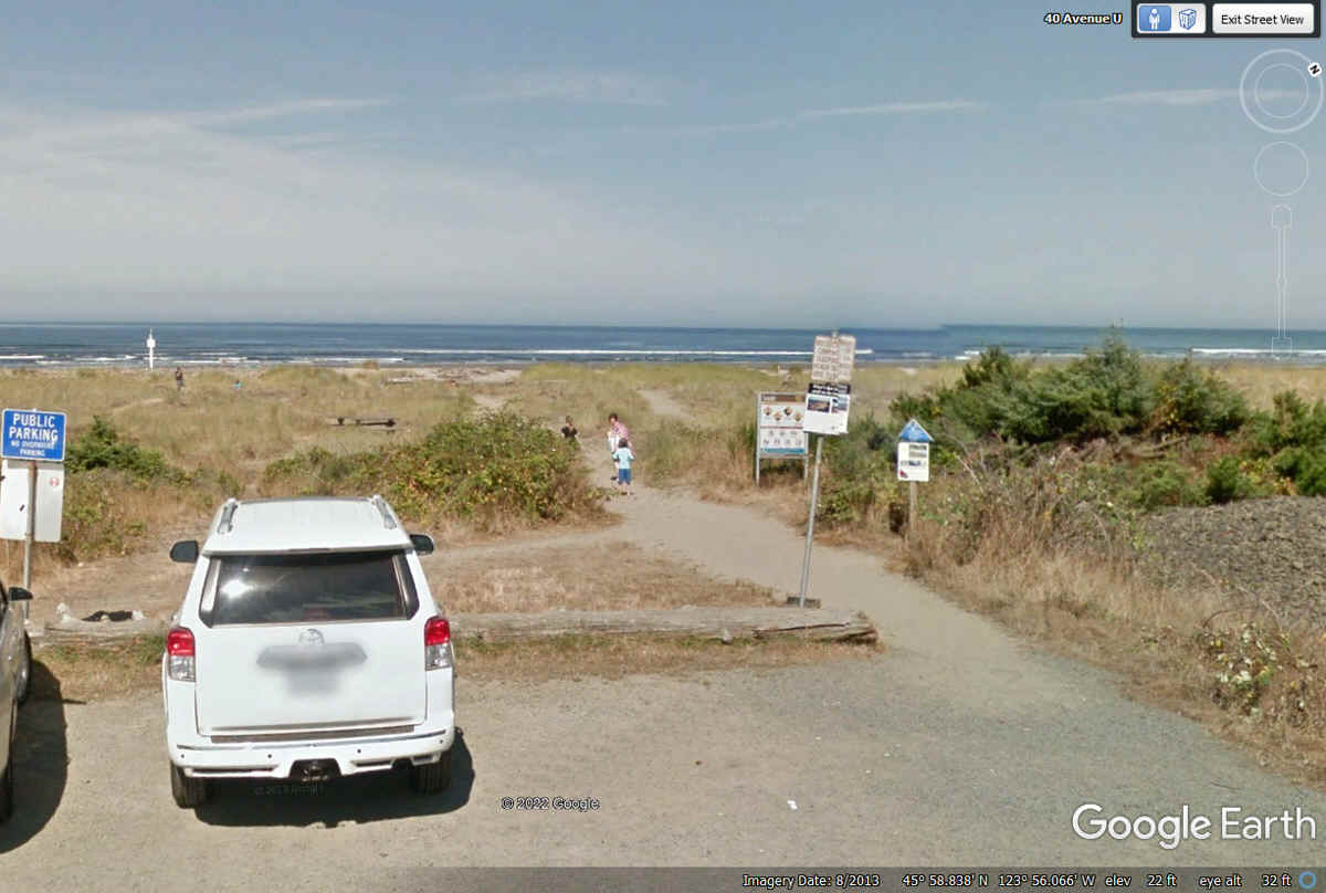
This the last image captured by Google Earth at the end of Avenue U.
The shore line here is north/south.
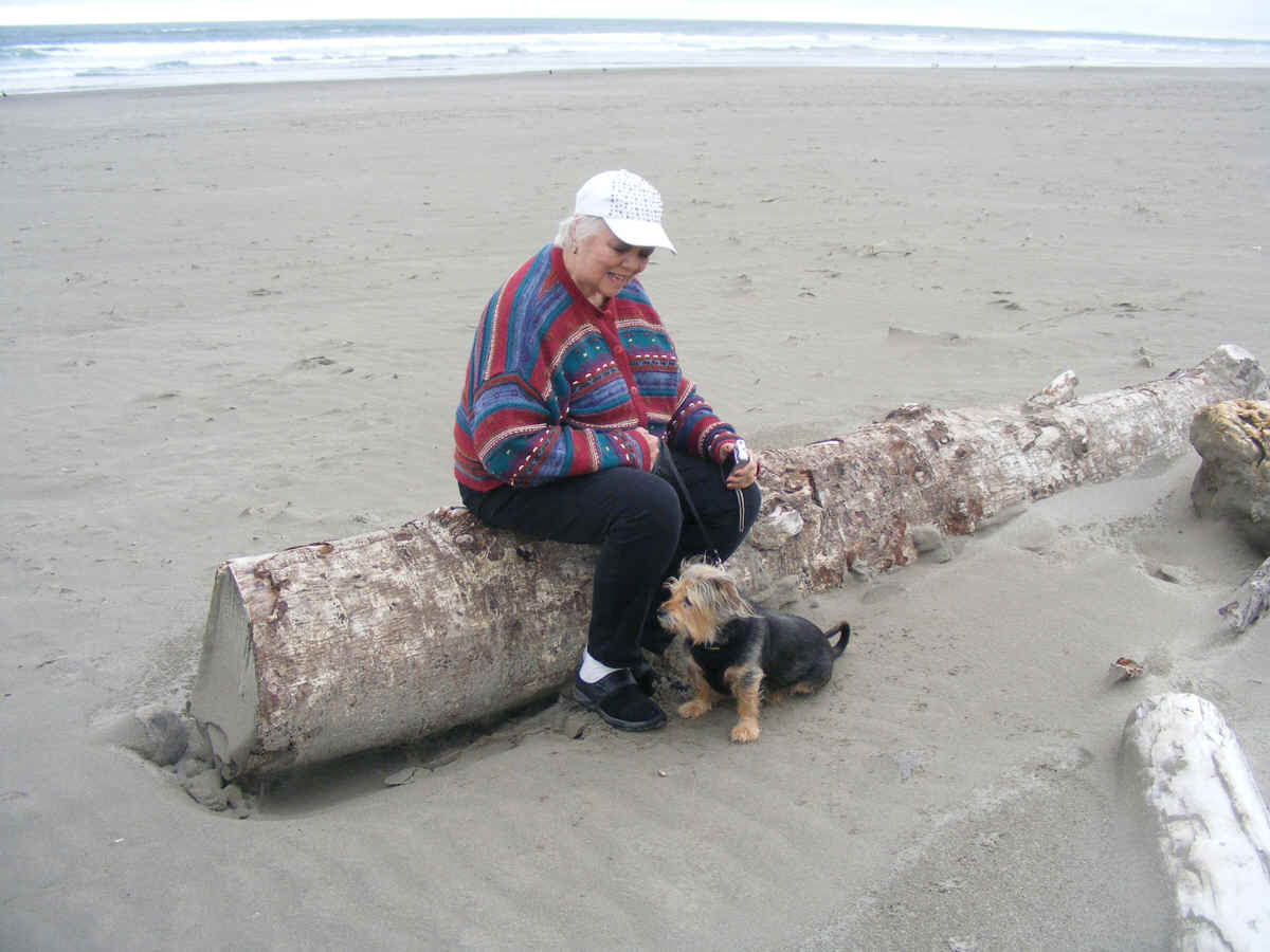
I took this photo with my camera when Linda sat down on the log to get her
camera ready to take some photos. Chase was watching the waves and noise
that came with them to the shore.
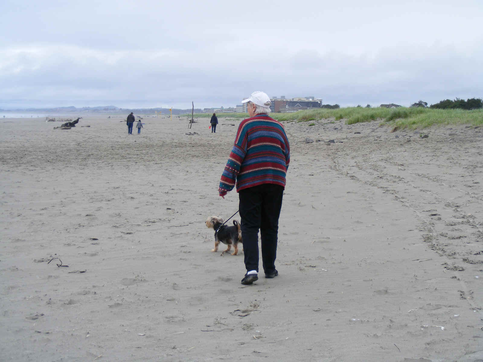
Since her dog Chase will not pose for the camera, I had to move to my left
to get this better image. Chase is still looking at the ocean. There
is a cool sea breeze today, June 5, 2022.
One more move to the left and I get Chase looking this way.

This beach is relatively flat putting the waves out there at low tide.
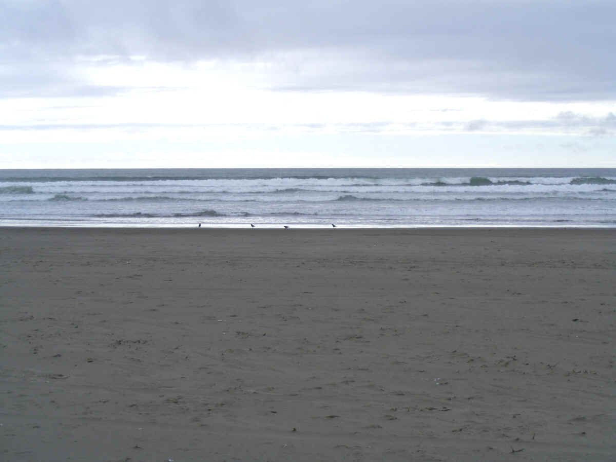
I had promised Linda she would get to see the Pacific Ocean and here it is
as my camera is looking north. Those mountains are in the state of
Washington.
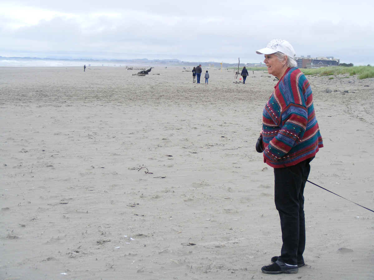
Linda takes a walk north a bit on the beach on the way back to her Chevy
Equinox.
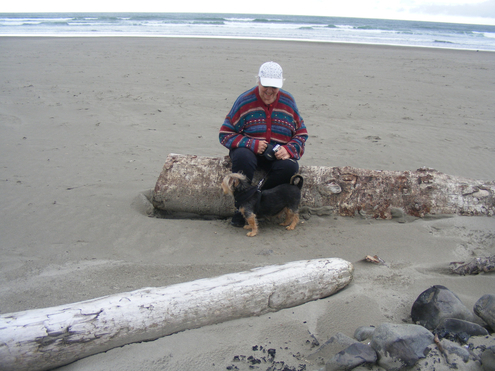
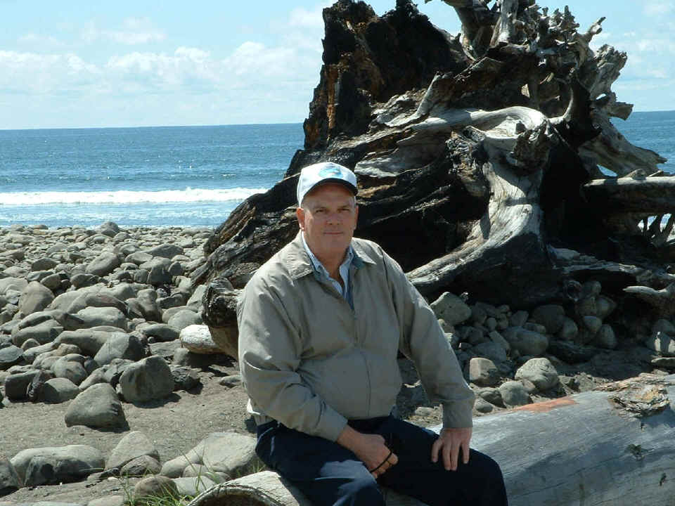
This image was taken of me on this same beach is from May 16, 2004 here
with my wife Carol (now deceased, December 10, 2018). This was 7 years
before I had my heart problem in June 2011. I can see how I was
heavier in those days. I weighed 238 pounds when I had the M.I. and a
quadruple bypass that week My weight as I write this page in 2022 is just
under 198 pounds.
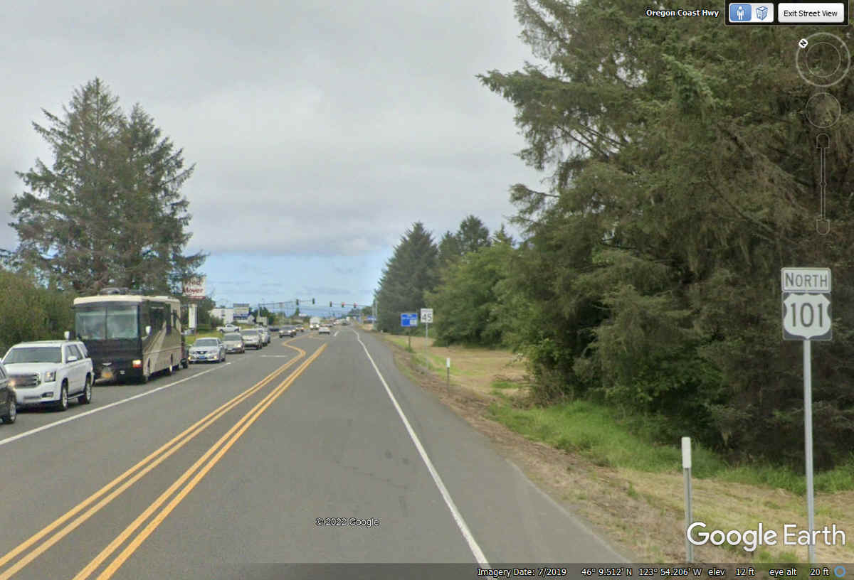
US 101 is the main road through the town of Seaside, Oregon
as we leave some of the commercial
district behind.
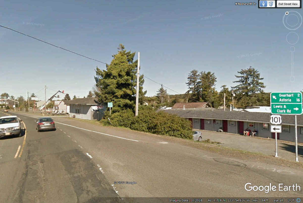
We keep going on US 101 heading for Astoria, Oregon.
There are a pair of bridges ahead to get to Astoria.