The Golf Course Housing Development · · PAGE 26.
February 11, 2016: The cleanup of the arsenic
contaminated soil from the abandoned golf course behind the house has begun. The
short street where our driveway is connected is the old golf course access road. It
was supposed to be closed to the construction traffic, meaning dump trucks and other heavy
equipment. A low-boy tractor trailer rig brought in a big scoop shovel on tracks to
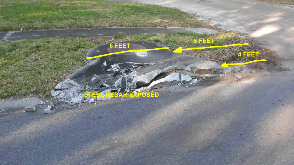
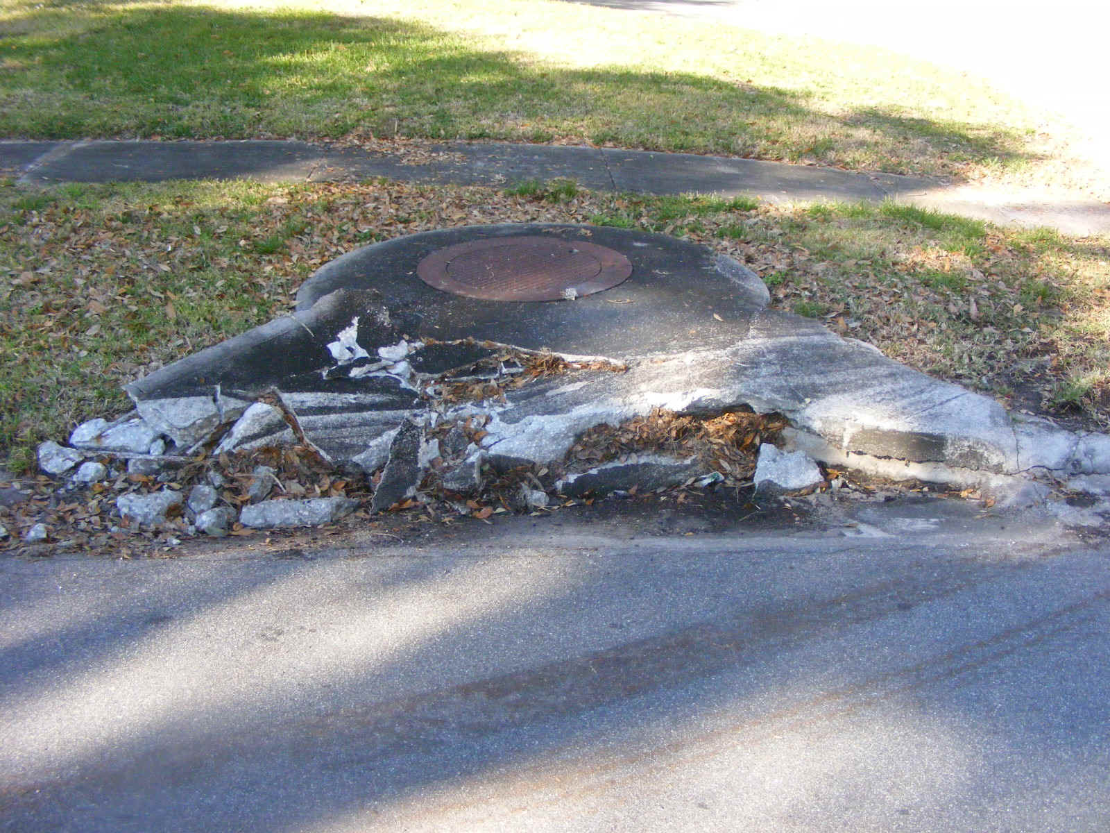
do the soil excavation on Monday, February 8, 2016. Damage to storm drain in our
yard from dump trucks making tight turn to leave the access road while entering
Meadowbrook Road. I am standing on the center line of the street. The drain
opening has been shattered by a dump truck leaving with a full load of contaminated soil.
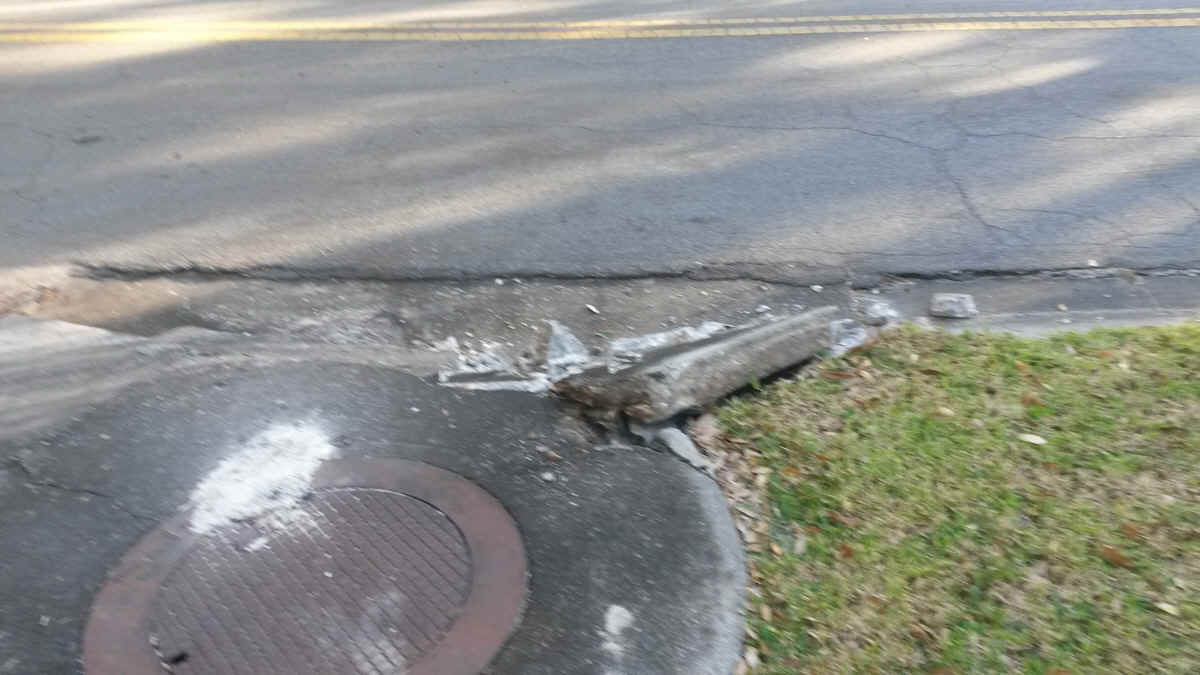
Here is the view of the damaged drain as seen from the sidewalk.
The path of destruction was EIGHT feet from where the truck should have entered
the street.
The drain across the street shows how our side looked before the damage seen
above.
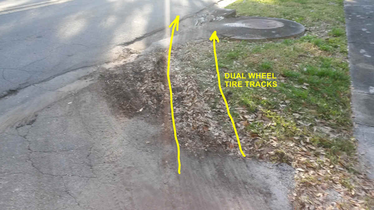
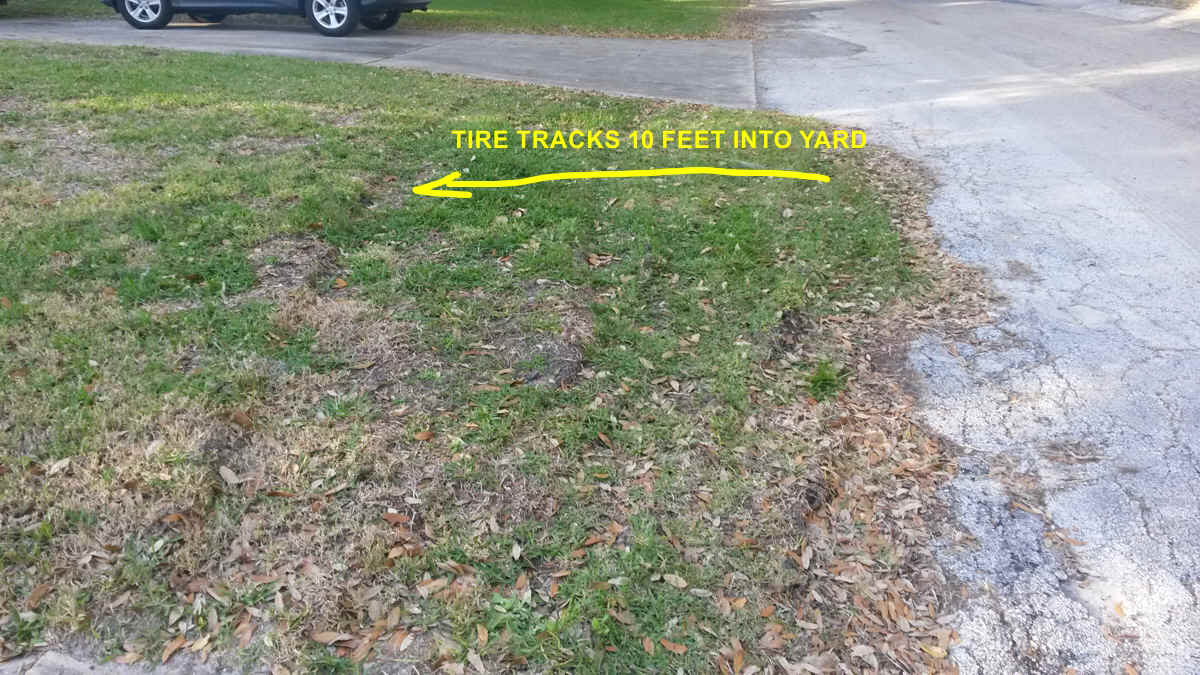
The track across our driveway and and grass ten feet from the access road
appears to be a pickup truck or other lighter vehicle that was parked in the yard. I
was not at home when all this happened.
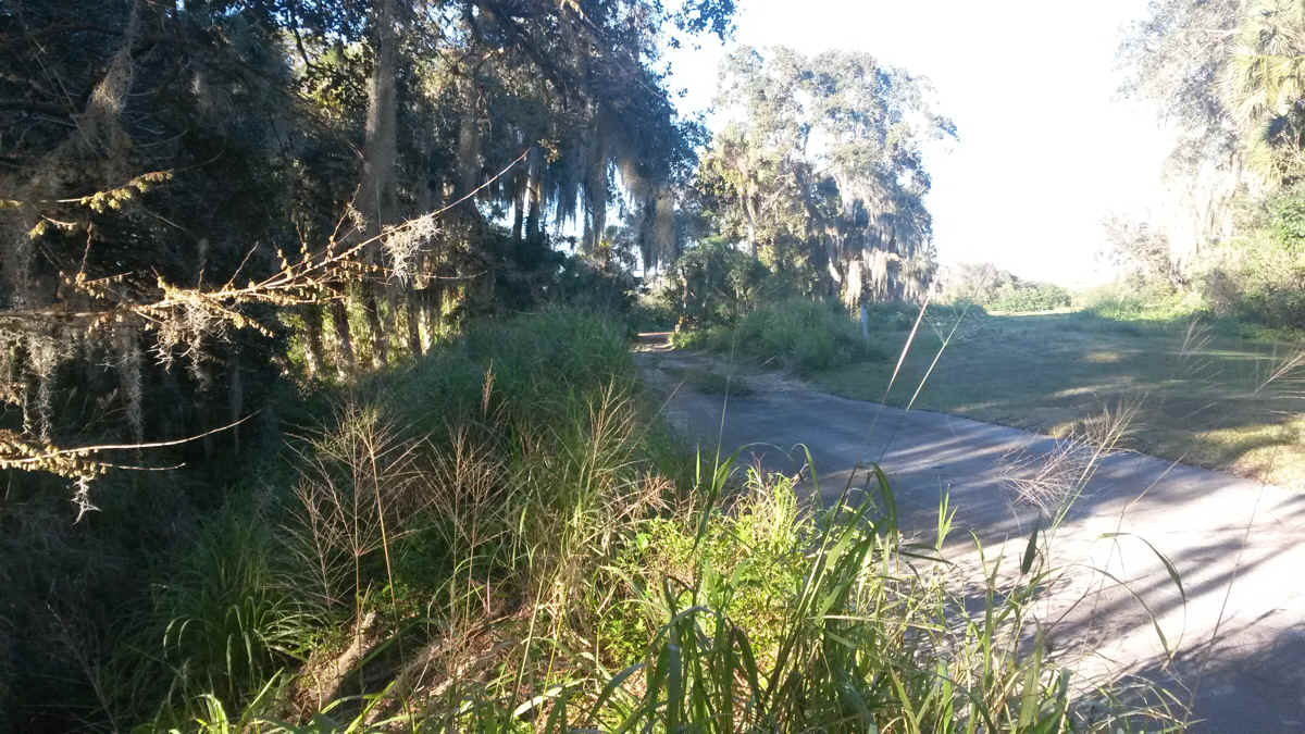
The access road steel cable was removed and the narrow path has been beaten
down by the dump trucks going in and out from the end of the paved access road. The
large drainage ditch leading from the golf course to the Tillman Canal is at the left side
of this photo. A large concrete culvert is under my feet with grass and soil across
it where I am standing to take this photo.
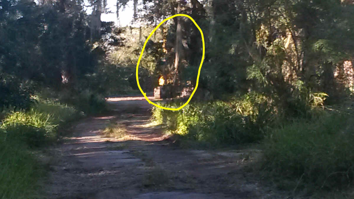
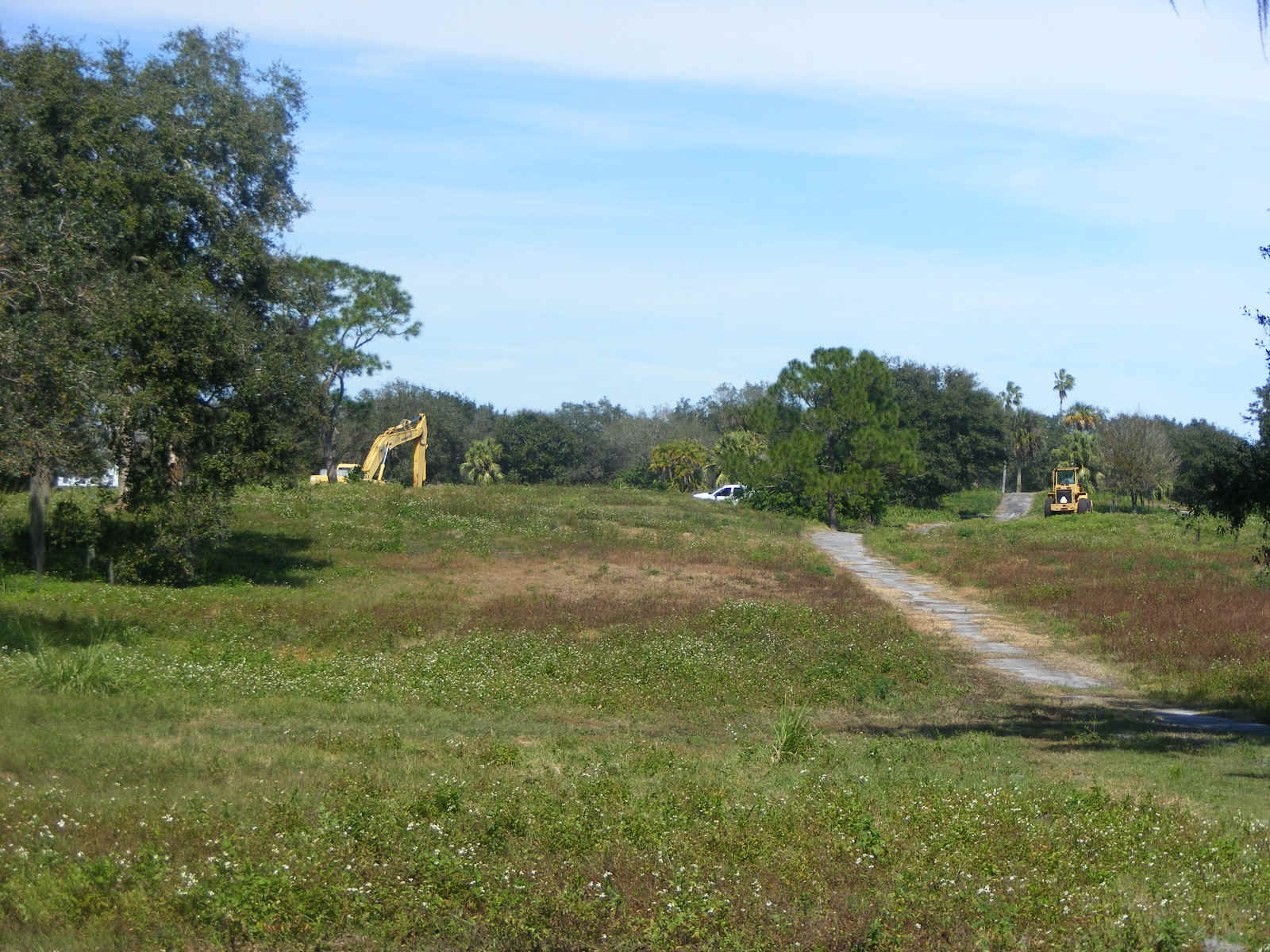
The excavator is parked just up the dirt road as seen in this telephoto picture
taken from the same spot as the photo above.
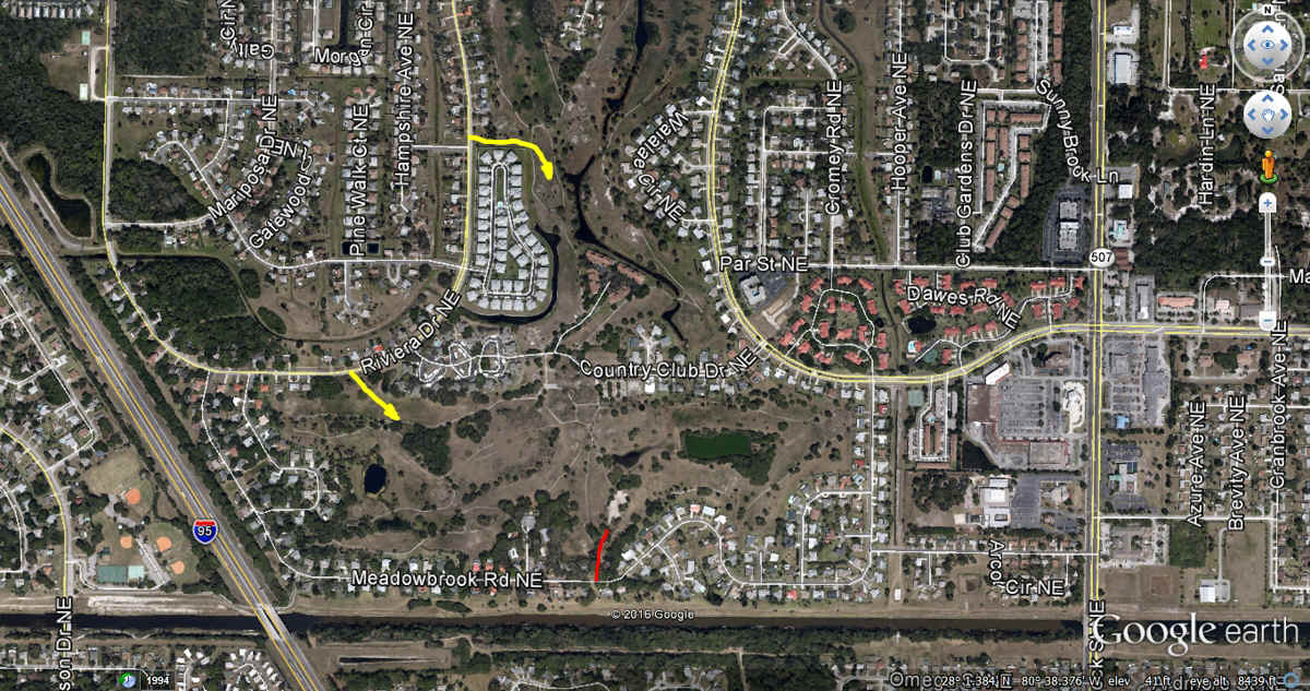
Here is a Google Earth view of the old golf course and the authorized access
areas from Riviera Drive shown in yellow with our access road from Meadowbrook Road marked
in RED.
February 17, 2016: The work continues on the
golf course north of the house. I had seen the motorized shovel working with a dump
truck and another vehicle out back seen in the telephoto image below after lunch toward
the center of the golf course. The photo was taken looking from the abandoned
putting green behind our home.
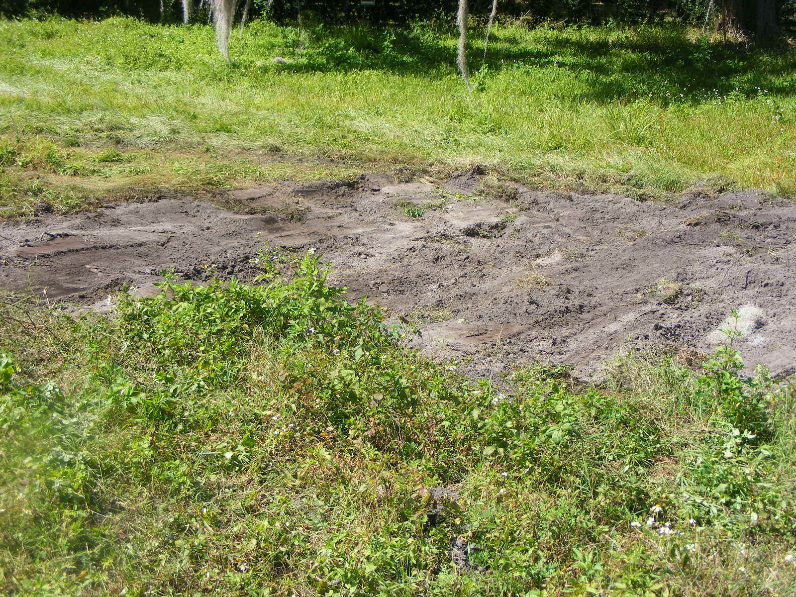
They were gathering topsoil samples from two areas near the edge of the golf
course property adjacent to the putting green. This photo shows a flat area behind
the house next door on our west side. I am standing at the west edge of the elevated
putting green looking down at the sample area.
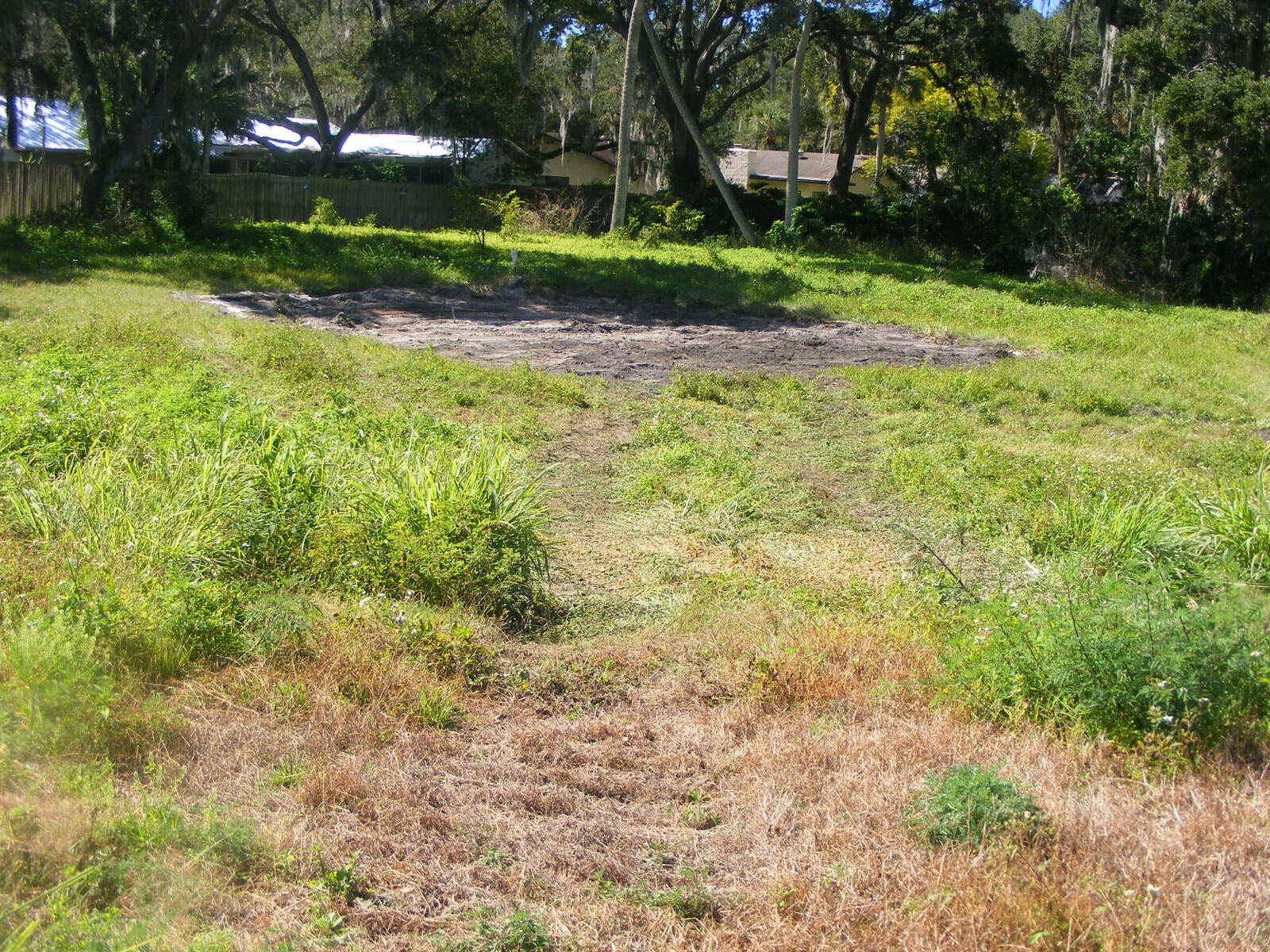
The second smaller area was scraped just north of the photo above and still on
the west side of the putting green.
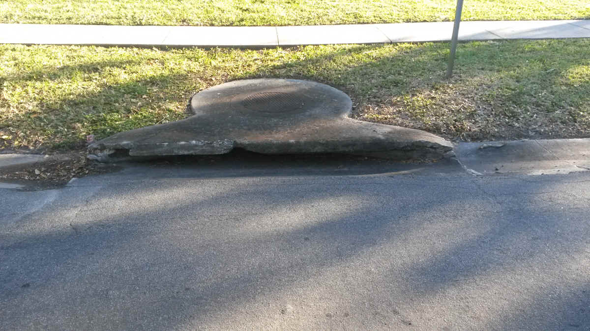
The last photo of the day shows the destroyed storm sewer location by the
access road at 1351 Meadowbrook Road NE. The rain storm last light washed a large
number of leaves down the street to this point, plugging the normal storm sewer opening.
It was crushed by a dump truck on February 11 as seen at the top of this web page. I
told some city workers I met over on Riviera Drive the other day about this damage.
| GO TO PAGE 27 | BACK TO HOME MENU |