OSHKOSH 2010 -- Wednesday, Homeward Bound · · PAGE 28.
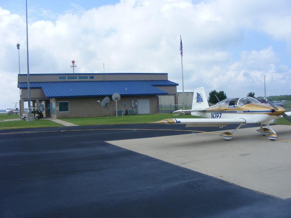
July 28, 2010: Edward dropped me off at the
Georgetown Airport before he headed off to work at his office. The low-hanging
clouds of a broken and scattered layer presented me with a first in my years of flying.
I have never needed a Special VFR clearance since my flights usually begin and end
at non-towered airports. The dew point was not so bad this morning and I did not
have to do much wiping of the canopy and windshield before starting the engine. I
got the GPS programmed, listened to ATIS, then called on ground frequency for a VFR
departure. The controller gave me a clearance to taxi to runway 18 for
takeoff. About one minute later as I was moving up the taxiway, he advised me the
ceiling dropped below VFR minimums, telling me the airport is now IFR. What are my
intentions? I gave him the usual reply, daylight above and he understood I wanted an
SVFR departure to get me into the clear weather on my intended course. Clearance was
given and I stayed clear of clouds and climbed through the gaps to get into the clear area
above. I advised him as I departed the Class D air space and turned on course for
KRFI, Rusk County Airport.
As I climbed to a comfortable cruising altitude, the ground below was visible through broken and scattered layers and I continued on. I looked north to see better conditions, but I was still able to conduct VFR flight on my desired course. I was also starting to think about diverting to an alternate airport. I had burned less than 12 gallons on the way down from Sherman to Georgetown yesterday, so I was not concerned yet since the tanks hold 36 gallons.
Conditions were VFR on the ground when I passed over the airport at Palestine,
Texas. (The locals call it "palace-steen.") Conditions were not VFR
as I closed in on my destination at Henderson, Texas. I went looking for a broken
spot in the clouds along the approach to runway 35. When I found one, it was too
small and the clear air underneath did not allow for minimum ground clearance. The
AWOS confirmed my visual observations. When I passed over the field, it was buried
under the clouds.
I flew past KRFI and over to the airport at Carthage, Texas finding the same
results. Looking to the east toward Shreveport, it looked even worse. I
started dialing up AWOS frequencies on the radio for various airports to the north and
west where I had seen better weather when I flew over Palestine earlier. When I
listened to the automated weather for Mount Pleasant, Texas (KOSA), I knew things would be
"pleasant" when I got there for a VFR approach. The AVGAS price was under
$4.00 and the sky was beautiful. I arrived with a full hour of reserve fuel.
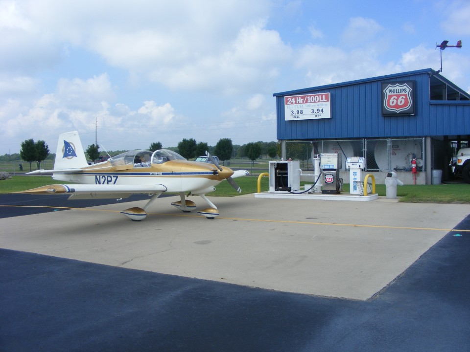
The FBO is new and nice, but I did not know how new until I published this
page. This is Mount Pleasant Regional Airport, the only one in my GPS Jeppesen data
base (as it should be). There was an older airport called Mount Pleasant Municipal
closer to the town and it has been closed. My GPS ground track shows the location of
the new airport on my older digital map program.
The lineman greeted me and pumped the gas for me from the self-service pump at
no extra charge. The guys in the office were quite friendly and wanted to know about
my airplane. I gave them one of my web site cards and let them know about the
content of my web site, including videos from Oshkosh 2006. I checked the weather
and found I would be in good conditions all the way home. The departure would take
me over Texarkana, south of Memphis dodging the Class B air space, and the Columbus MOA in
northern Mississippi. One take off and one landing would get me home, non-stop.
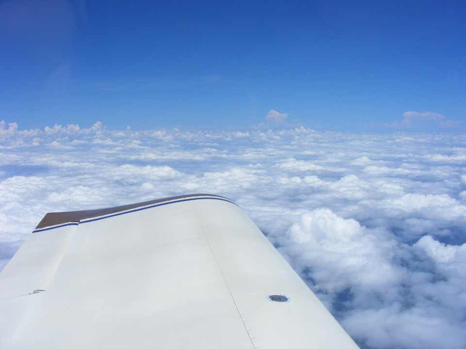
The only turns after leaving the pattern were going up through the scattered
cloud layer to get in the clear on top.
I was about 10 miles east of Texarkana when I took this photo and then opened
up my lunch. The weather ahead was excellent for a long VFR cross-country flight.
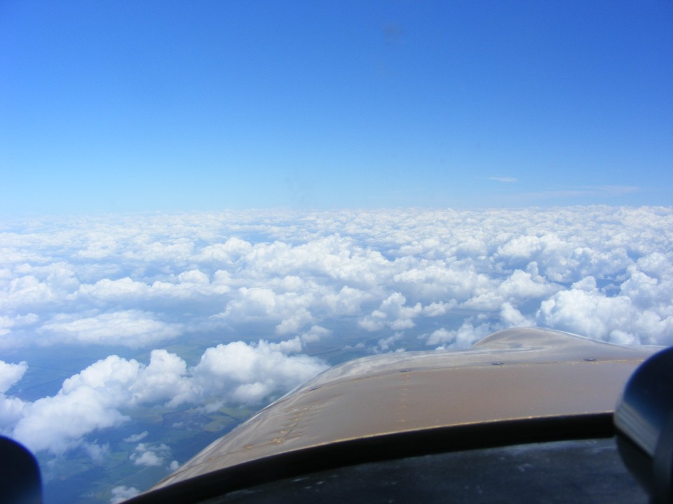
That is the weather down south of me along the Interstate 20 highway route
where I had hoped to get fuel earlier. I heard pilots and controllers talking about
the weather conditions down that way. I was very happy to be up here in the clear
air with good weather along my route.
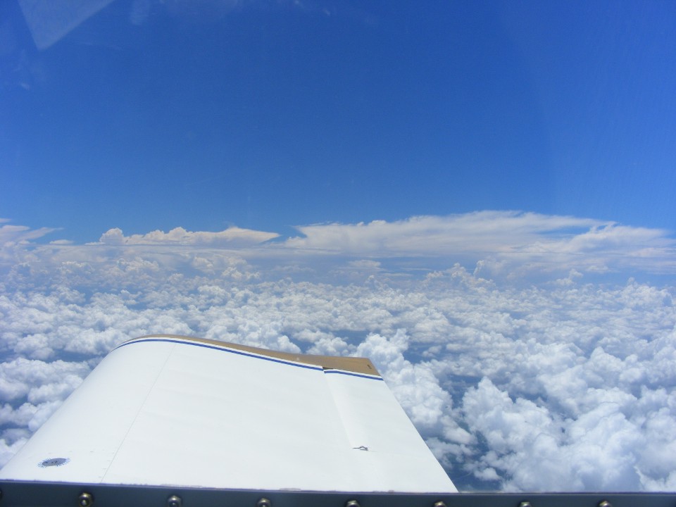
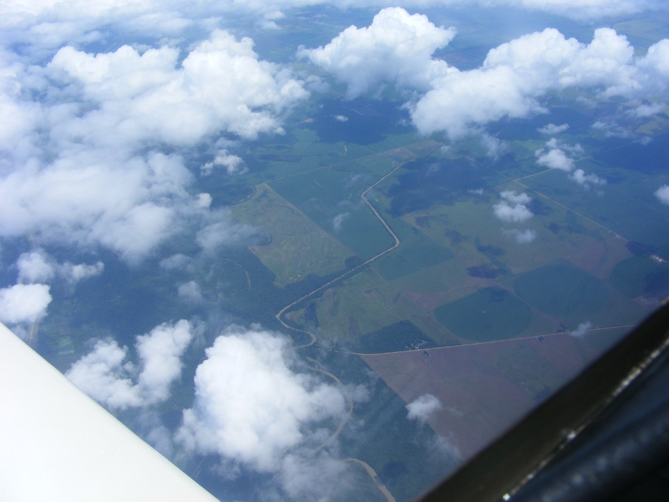
The weather to the north was the same as it was ahead of me, broken and
scattered, with nothing building up in the flight levels as there was back to the south.
Here is the view looking down at Arkansas farm lands.
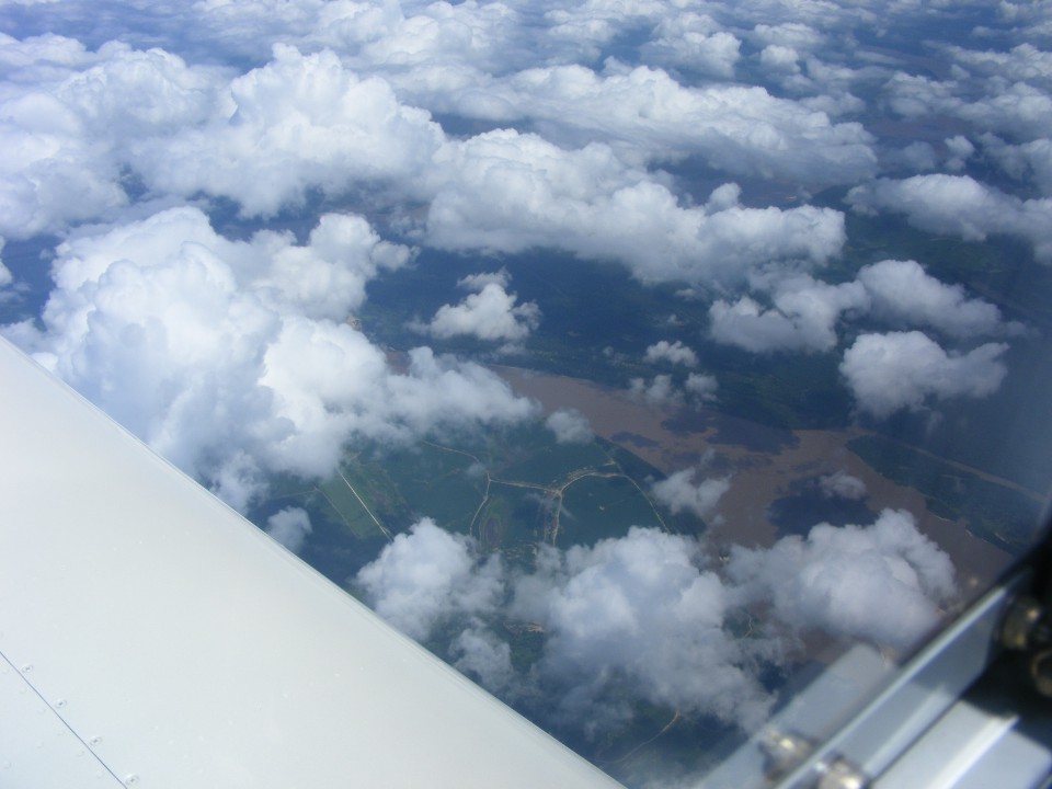
Six minutes later, I crossed the Red River about 18 miles east of Texarkana.
With that muddy color, there is no doubt why it has that name. I grew up in
the red clay territory of North Georgia. This makes me feel more at home, even up
here at 11,500 feet MSL.
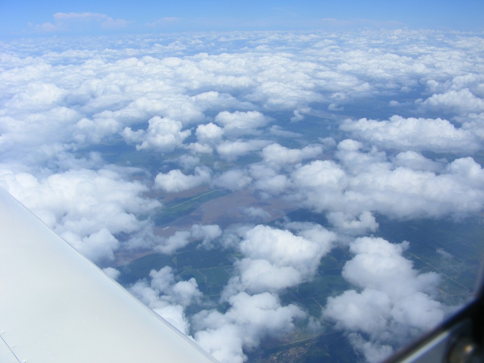
Here is the last time I will see the Mississippi River on this trip. This
crossing is about 71 miles southwest of the Memphis Airport. The nearby towns are
DeWitt, Arkansas about 29 miles west of here, and Clarksdale, Mississippi about 15 miles
east. The total number of crossings of the big river is 12 times in 30.3 hours of
flying for the entire trip. I could still hear pilots and controllers talking about
the weather down toward Jackson, Mississippi along the I-20 corridor. And for what
it is worth, I crossed the Missouri River twice, the first time near its end at the
Mississippi River. The second crossing was near the middle of Missouri, about 9
miles southwest of Columbia, Missouri. Those are the two longest rivers in the USA.
| OSH 10 - PAGE 29 | OSHKOSH 2010 MENU | MAIN MENU |