Cairo, Egypt to Dhahran, Saudi Arabia with Jerrie Mock in 1964 · · PAGE 7.
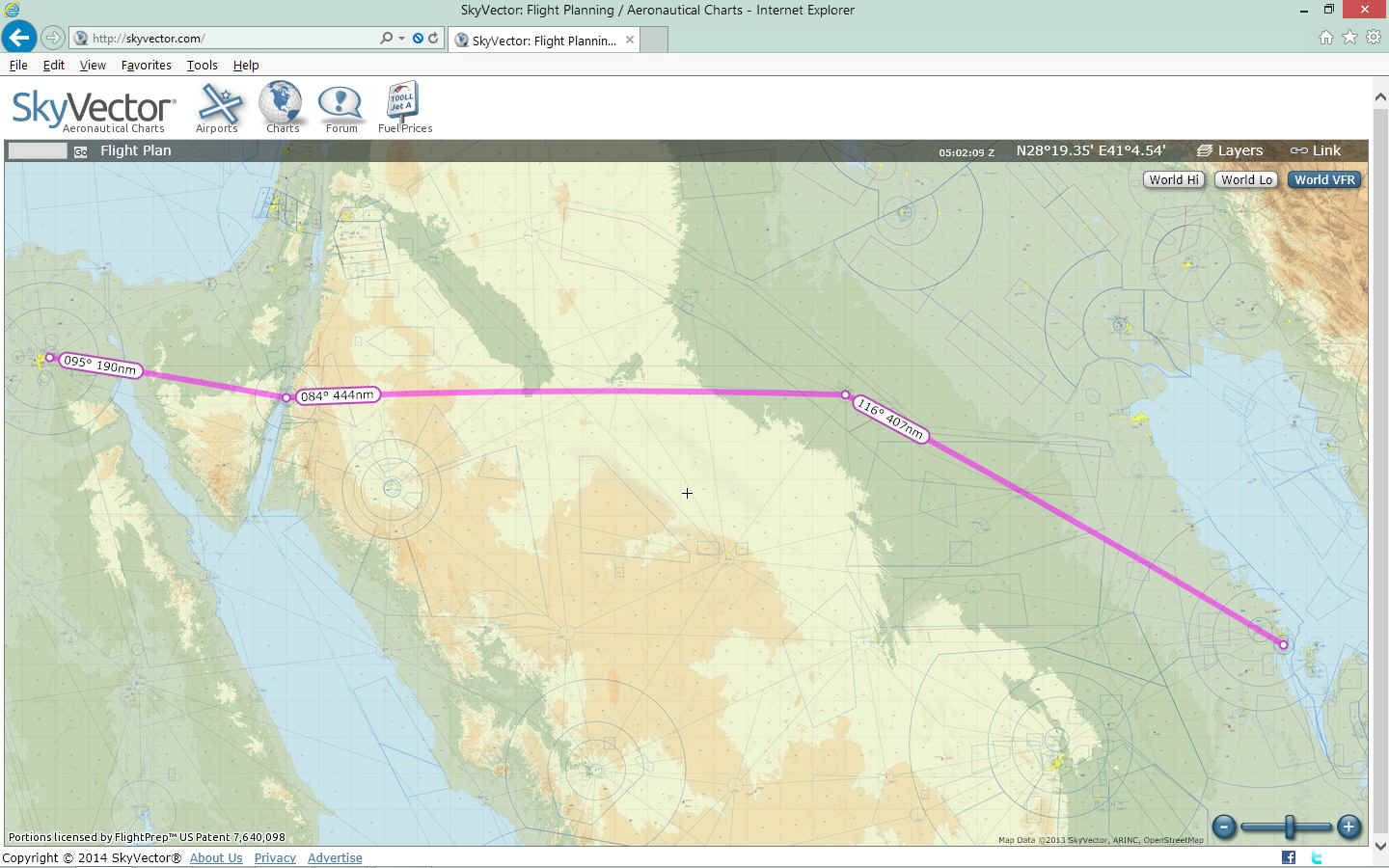
April 3, 1964: The flight from Cairo, Egypt to Dhahran, Saudi Arabia took her across the Sinai Peninsula of Egypt to the north end of the Gulf of Aqaba, across southern Jordan and into the Arabian desert where she encountered a sand storm. She flew west until she reached an airway that followed the Trans Arabian Pipeline southeast toward her destination. UPDATE: June 28, 2015: I am updating these pages to give references to the new Google Earth tour flights I have been creating for Jerrie Mock's flight segments around the world. Today I discovered some clues in her book I had missed when I first created this page. The screen capture below is what I thought her route was between Cairo, Egypt and Dhahran, Saudi Arabia. The image below this one shows the actual path for this day of her journey.
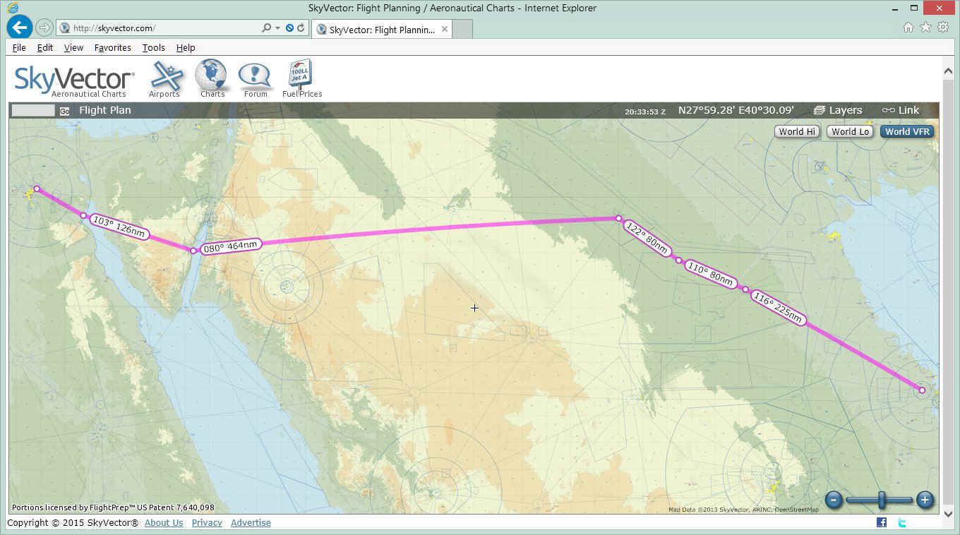
UPDATE JUNE 28, 2015: The first clue from
page 120 of her book after her departure from Cairo was her heading of 117 degrees
magnetic which takes her further south of the Suez Canal. The second clue was also
on that page where she described her route across the Sinai Peninsula. This new map
shows the correct route. Jerrie made a point of avoiding Israeli air space by using
a navigation beacon about 30 miles south of Eilat, Egypt at the north end of the Gulf of
Aqaba. My previous map above showed the more direct route directly over Eilat and
the town of Aqaba, Israel just across the border.
Here is the Google Earth image of the South Sinai Peninsula.
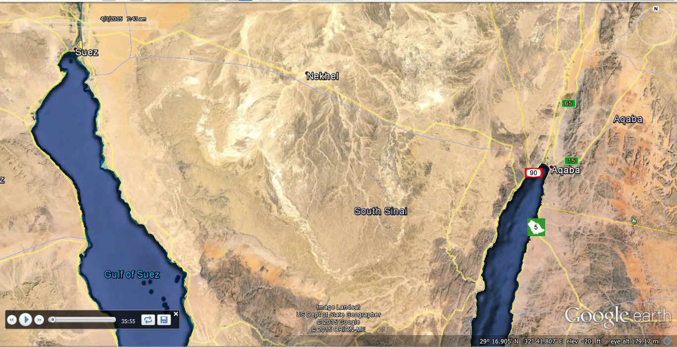
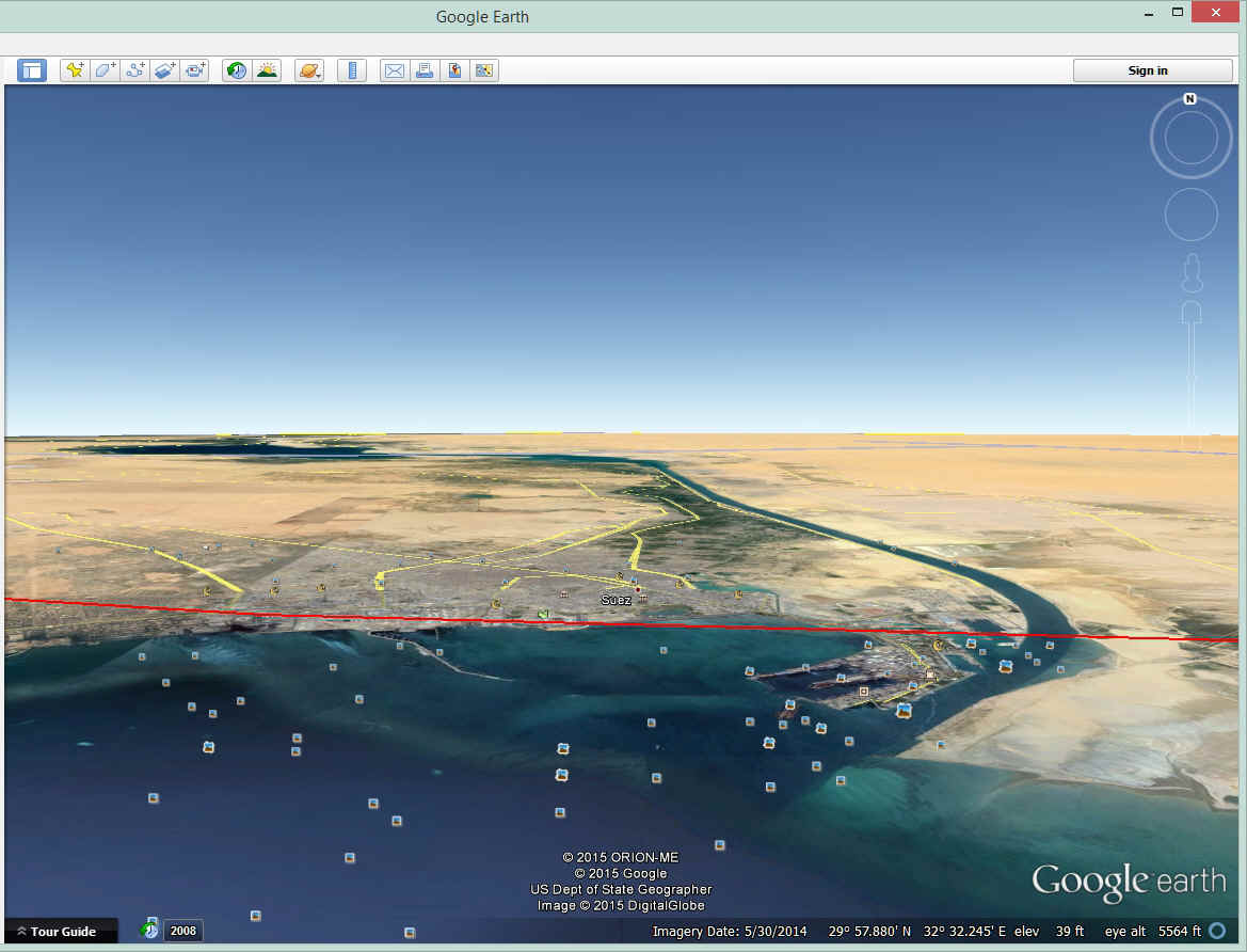
UPDATE JUNE 28, 2015: The first point of
interest after departing Cairo is the Suez Canal. There are some low mountains up to
2,800 feet high between Cairo and the town of Suez at the north end of the Gulf of Suez.
The Suez Canal heads north from the city to the Mediterranean Sea. Jerrie's actual
flight path crossed the Gulf of Suez about 23 miles south of the city.
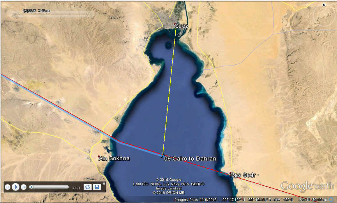
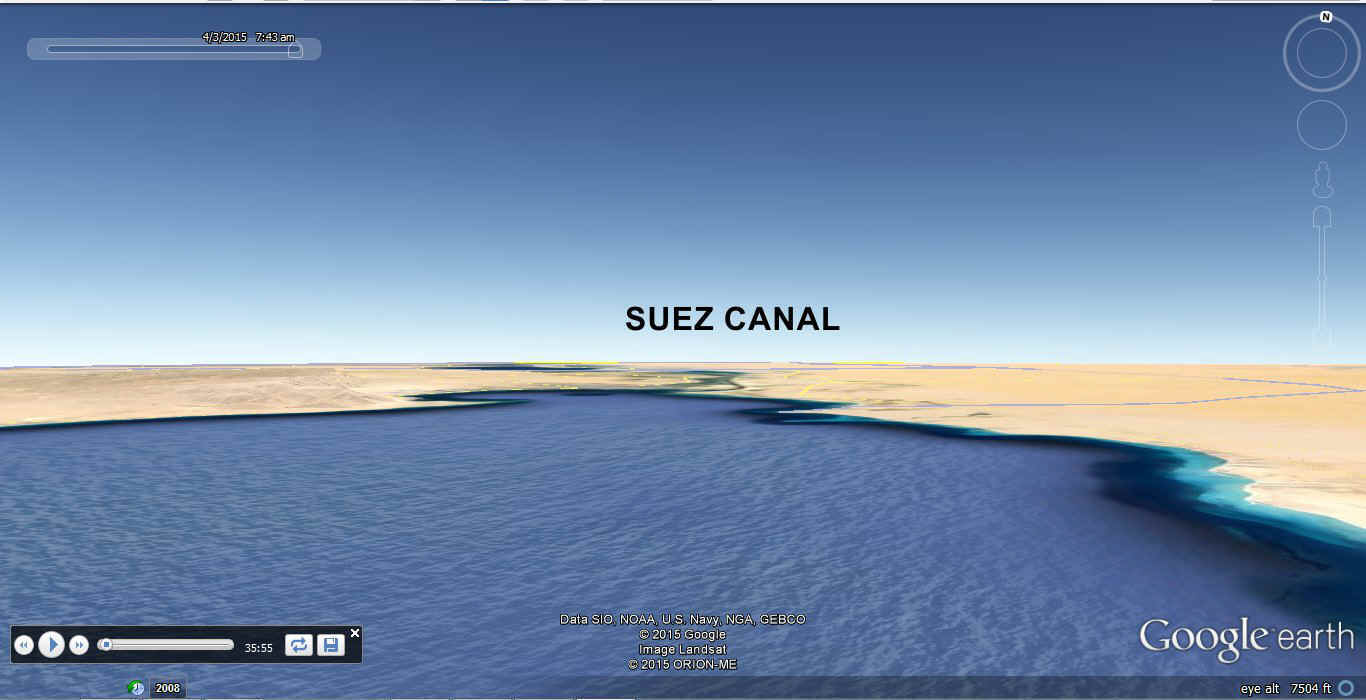
Here is the view Jerrie saw looking north as she crossed the Gulf of Suez.
This is looking north from her actual path from Cairo about 36 minutes after
starting her journey for this day across the desert and the southern Sinai Peninsula.
UPDATE JUNE 28, 2015: This view looking
north gives another perspective of the Suez Canal area at its south end. When you
look at Google Earth, there are plenty of photos of this area for viewing when you have
the program open. June 28, 2015: The image below
is the original screen capture from Google Earth showing the first route I thought was her
path toward Saudi Arabia.
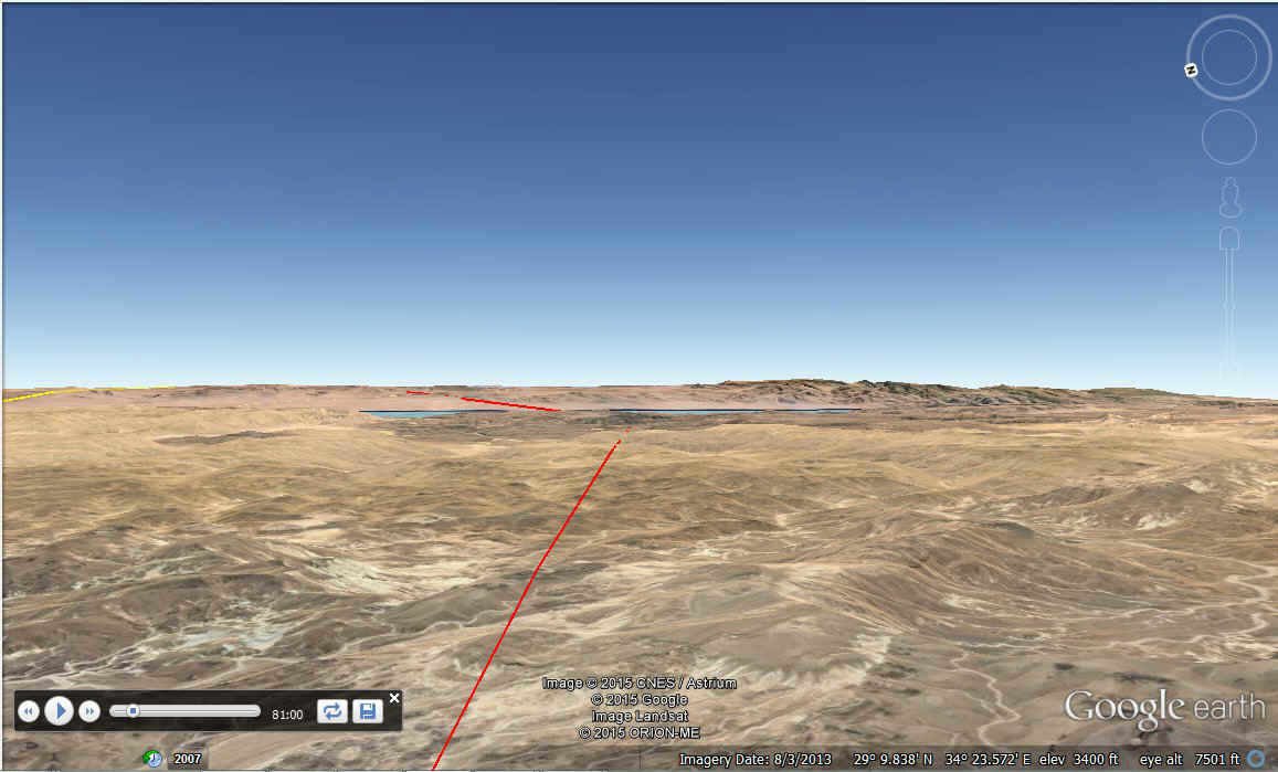
UPDATE JUNE 28, 2015: The Sinai Desert is
just that, mostly empty desert. The ground elevation across this area varies from
2,000 feet up to 4,700 feet above sea level. That blue water ahead is the Gulf of
Aqaba.
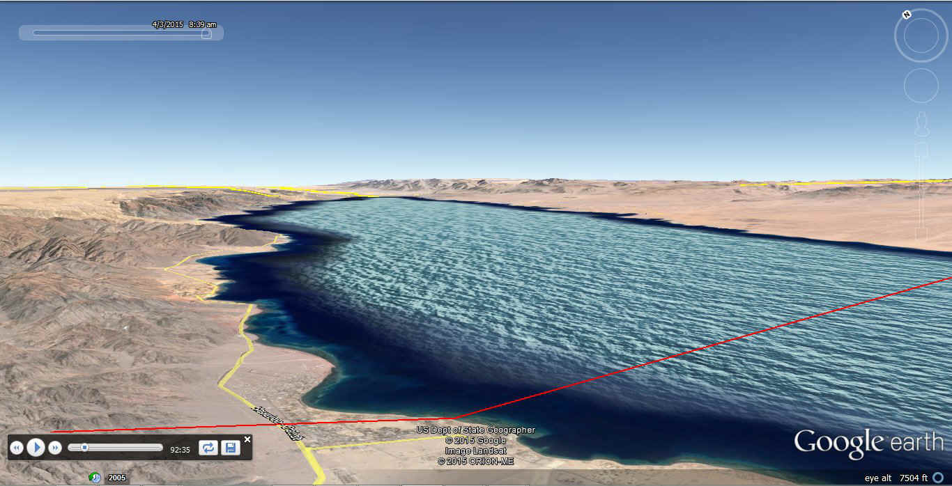
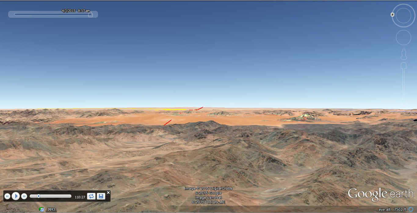
UPDATE JUNE 28, 2015: This view from an
altitude of 7,500 feet MSL shows the north end of the Gulf of Aqaba from the Egyptian side
of the gulf. The red line is the route flown by Jerrie Mock where she changed course
when passing a low-frequency radio beacon (NDB). The mountains northeast of the gulf
rise to about 5,000 feet on the higher peaks. Crossing the towns at the north end of
the gulf is likely to attract both Israeli and Egyptian jet fighters as that is a
sensitive area. Where Jerrie crossed from this vantage point has Saudi air space
across the Gulf of Aqaba.
UPDATE JUNE 28, 2015: The Saudi Arabian
mountains East of the Gulf of Aqaba rise to 5,000 feet or more as seen here.
Absolute desolation is defined here. This course is closer to civilization and oil
pipeline routes across the desert. US Air Force pilots familiar with this area
warned her against taking a more direct route south of here as this path beyond the
mountains was safer in case of a forced landing. The sand blown into these mountains
is over 4,000 feet above sea level.
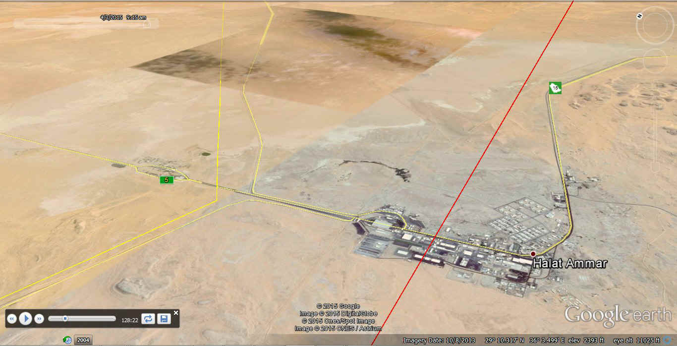
UPDATE JUNE 28, 2015: This is the southern
tip of Jordan where a Saudi town is nearby. Customs check points are on both sides
as you can see. The RED LINE is my estimate of her course line as she continues to
the East where she will follow the Trans-Arabian Pipeline route down to her destination.
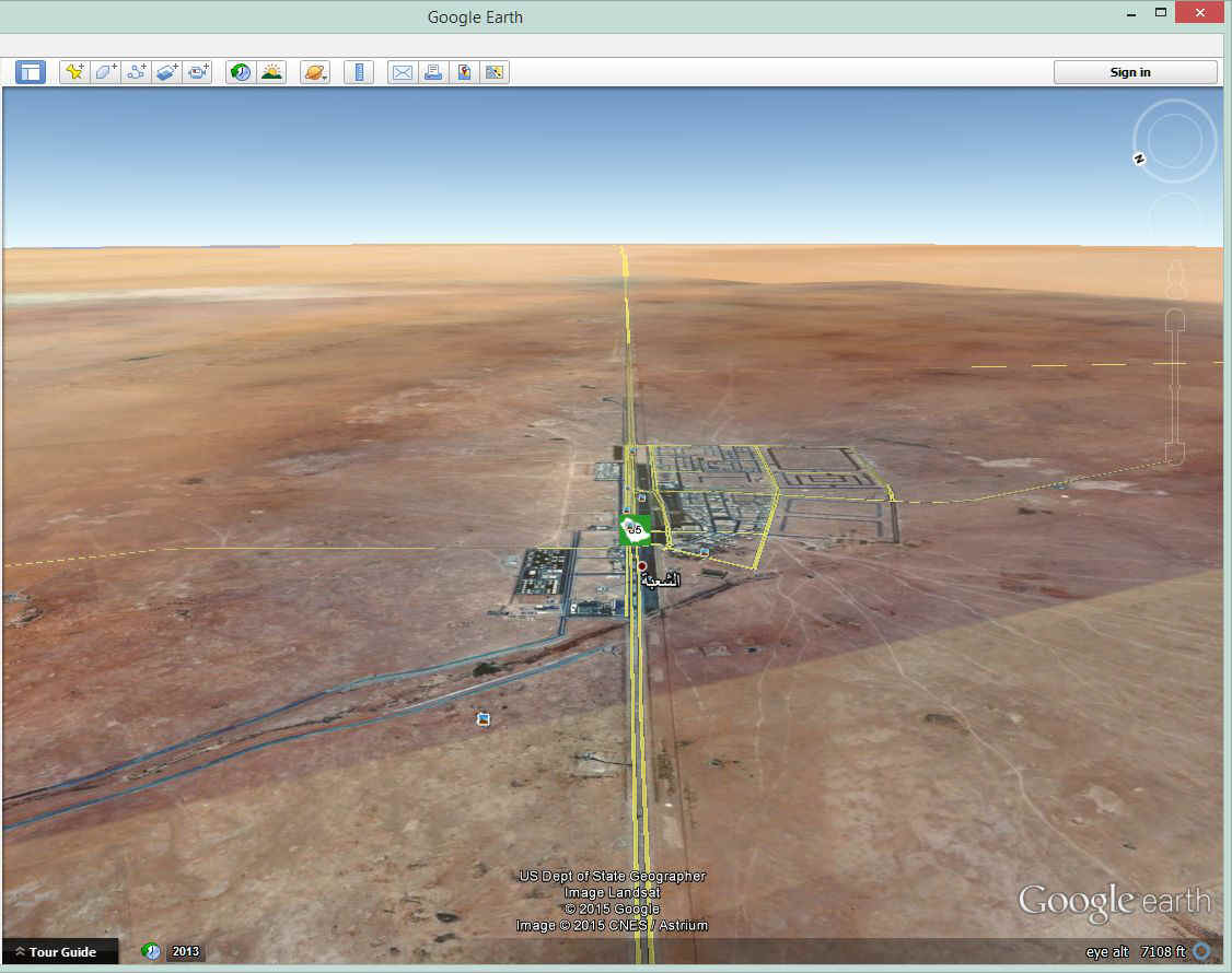
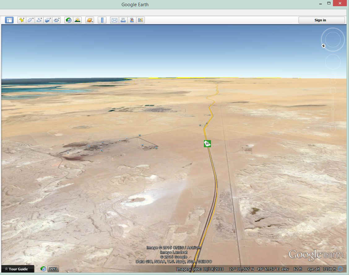
Here is Rafha where she began following the pipeline southeast toward Dhahran.
The road and pipeline run together for hundreds of miles. Many of the
airports out here belong to the pipeline company to support their maintenance facilities.
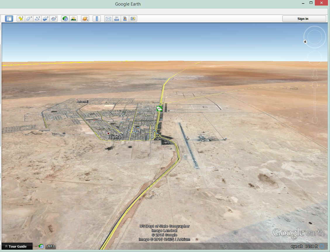
The road and pipeline connect all the main locations on the pipeline.
This is an image of Shu' bat Nisab, Saudi Arabia. She encountered a sand storm
during this part of trip.
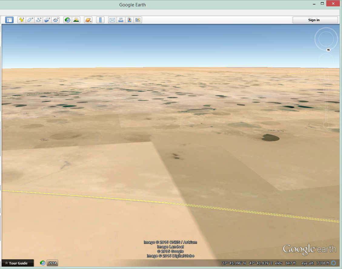
Further along is an unexpected site where an underground river flows toward the
Persian Gulf. Irrigation wells bring water to the surface instead of oil. The
yellow lines here mark the location of the highway adjacent to the pipeline. This
view is from above 7,000 feet MSL and is similar to what Jerrie saw in 1964.
This view ahead shows the Persian Gulf, the highway and pipeline heading
directly for Dhahran.
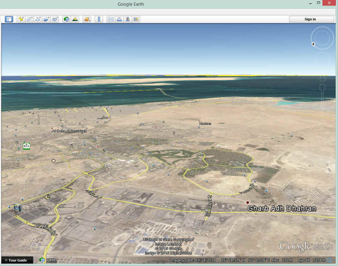
Finally, Dhahran comes into view with the airport on the south side of the
city. I have no idea if that golf course was here in 1964. This aerial photo
was taken in 2010 for use on Google Earth.
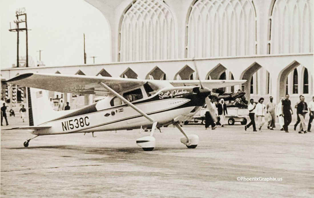
She became the first woman to land an airplane in Saudi Arabia with permission
granted by the king himself. She was now on the shores of the Persian Gulf.
One of the local Saudi air force men who met her plane went out to check the
airplane after she got out on the ramp. He looked inside and determined she was
really alone. He turned to the crowd of men and women and yelled "There is no
man!" and they all cheered. This is a country where women cannot drive cars,
even today, let alone in 1964 when Jerrie came here. She was a modern American
woman who is flying an airplane around the world! They loved it!
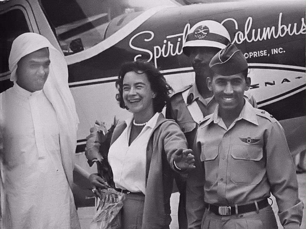
The picture below was taken by Aramco chief photographer Burnett H. Moody when
Geraldine L. "Jerrie" Mock landed her "Spirit of Columbus" in Dhahran,
Saudi Arabia in 1964. Look at this web page for more details of her stop at Dhahran:
http://www.aramcoexpats.com/articles/2005/10/smithsonian-uses-historic-aramco-photo/
Do you see that the "wind sock" for the long-wire antenna under the rear of the
airplane is now missing? The metal tube for the wire is there below the number
"8", but not the wind sock that keeps the wire extended properly. She did
not mention this in chapter 13 about her one night in Dhahran. Could this be caused
by her flight through the top of the sand storm?
You will also enjoy this web page from the Smithsonian National Air and Space Museum web site about Jerrie Mock.
UPDATE July 1, 2015: The Google Earth Tour files now show this leg of the flight around the world. You will find the airport has elevation errors in key areas in the Google Earth model. I have modified my "GPS file" to avoid elevation conflicts in the display of ground operations here. You will notice the "ups and downs" of the terrain here at Dhahran Airport as you fly the tour.
| CLICK HERE for PAGE 8 | CLICK for Jerrie Mock MENU | Return to N2PRISE MAIN MENU |