June 2022 Vacation Day 15, Oregon
Attractions and Points East · · PAGE 38.
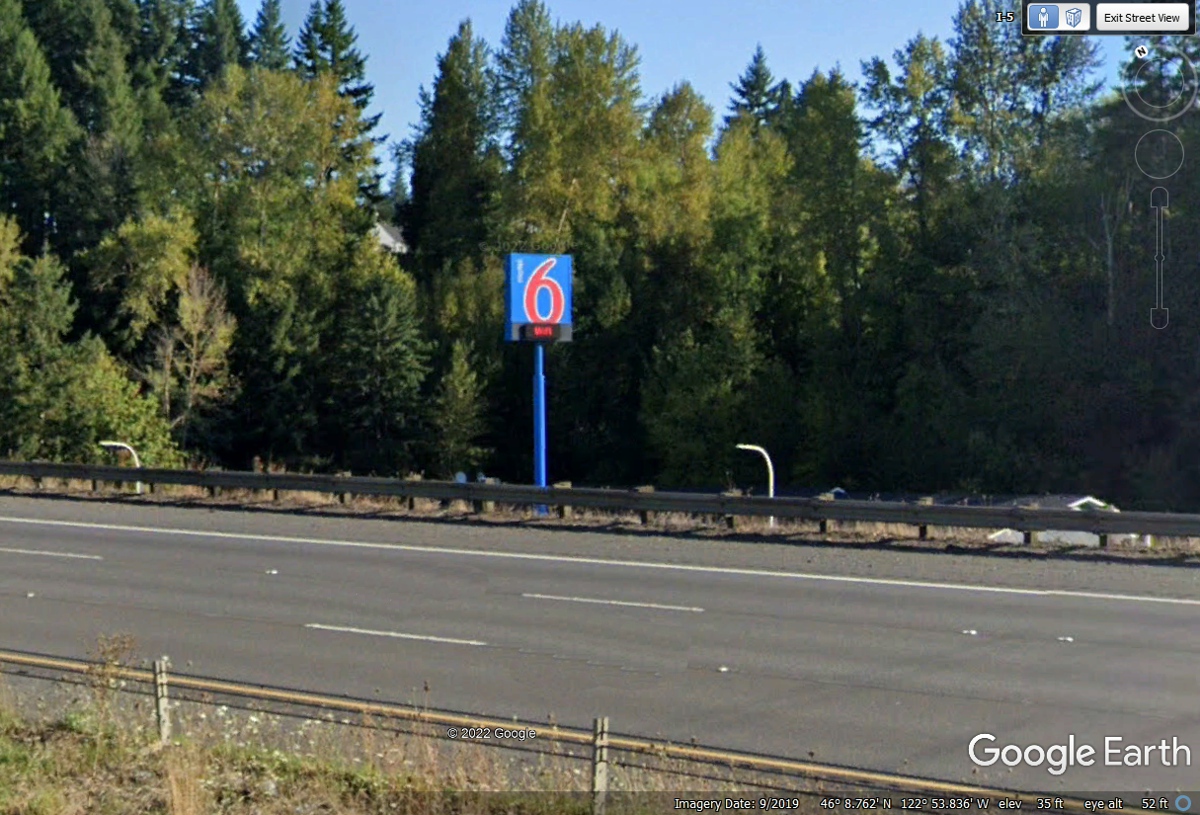
June 6, 2022: We get on I-5 and resumed
our cruising speed down toward Portland, Oregon. I noticed the Motel 6 sign
where we spent the night of June 5 in Kelso, Washington. We spent the morning
today going over to Mount Saint Helens to see the 1980 volcanic eruption debris
and related sights along the way.
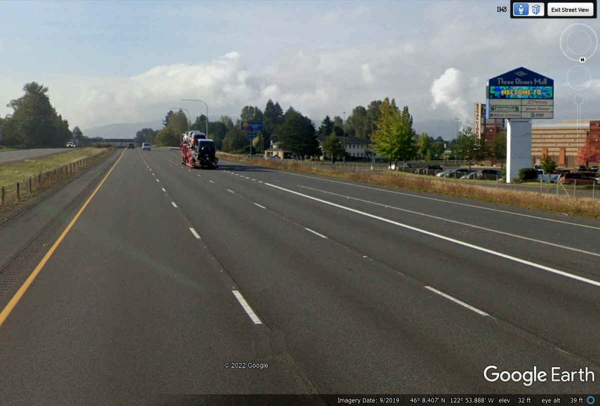
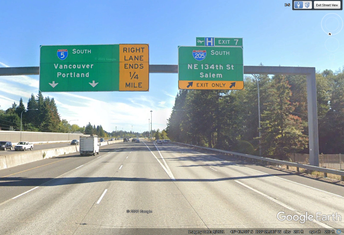
Here is our first view heading south of Kelso on Interstate 5. Our
next target is 32 miles south from this location where I-205 splits from I-5 and
we will begin our trek east.
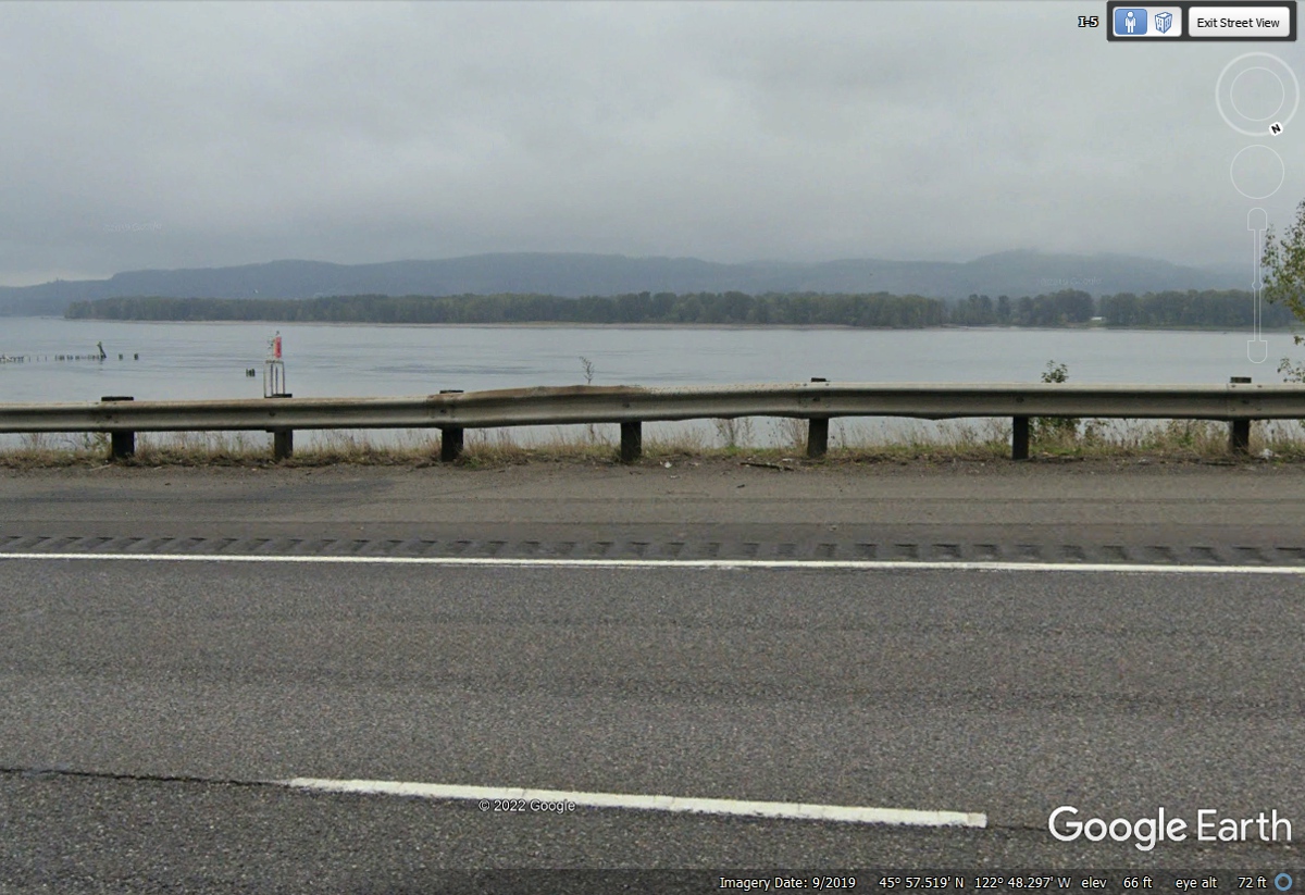
This close encounter of I-5 with the Columbia River is less that 4 miles
south of Kalama, Washington. Oregon is on the other (WEST) side of the
river seen in the image below.
Interstate 205 splits from I-5 north of Portland on the Washington side of
the Columbia River. This interstate 205 passes to the EAST side of
Portland, Oregon and connects to I-5 south of the big city. I just
realized there is an Interstate 205 down near Tracy, California.
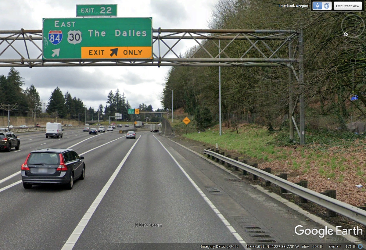
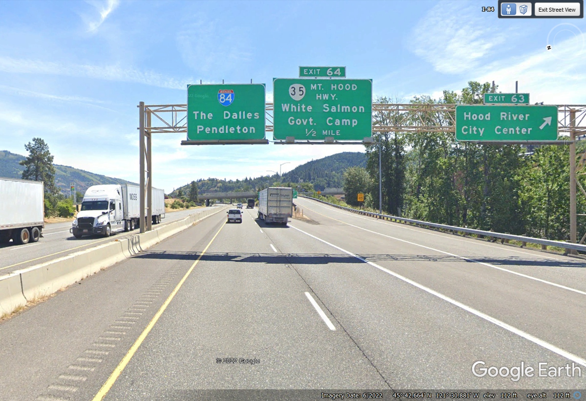
Now we see that I-205 route number here in the Portland, Oregon area with
a Junction to I-84 and US 30 going East following the Columbia River. That
is our route for this afternoon.
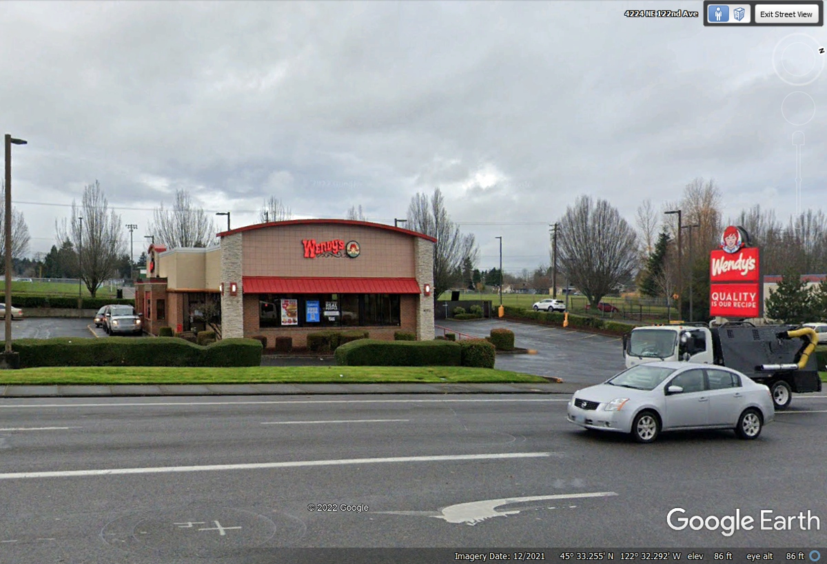
I used my GPS database to find a Wendy's location when we reached
Portland, Oregon on I-84. We got into the drive thru land and discovered
they did not have the usual items we order. We departed here to search for
another Wendy's and came up empty.
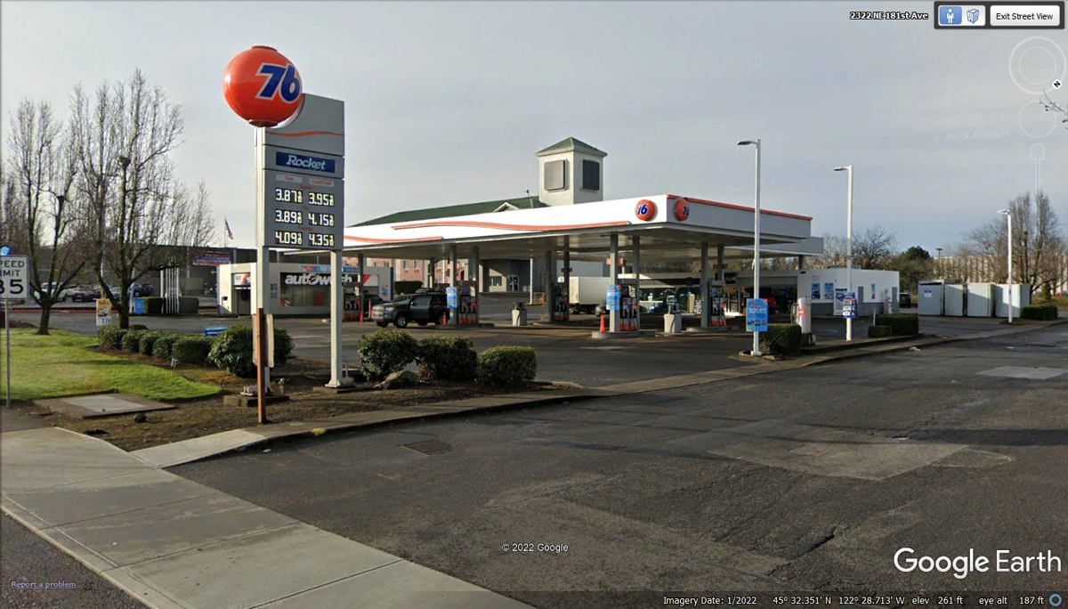
While we were looking for another Wendy's, I noticed we needed to get fuel
after our trip to Mount Saint Helens earlier today.
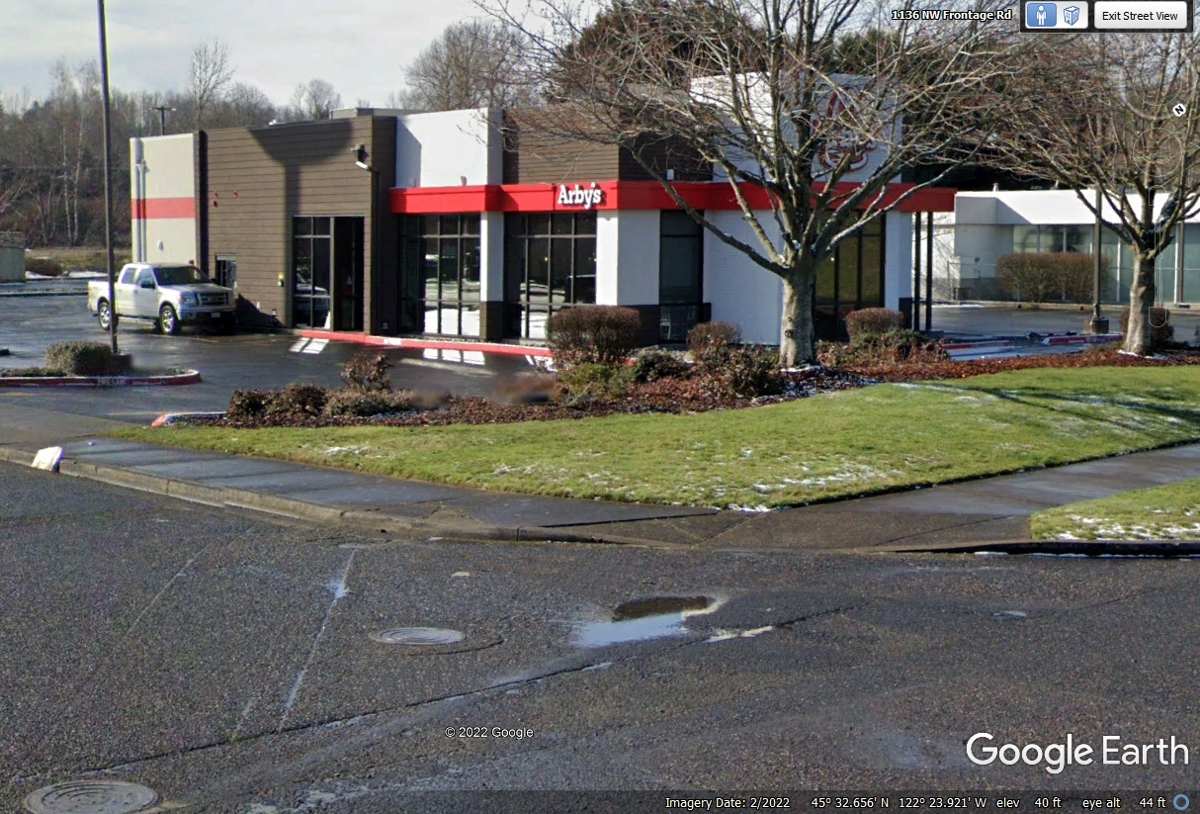
We discovered this Arby's on a frontage road to I-84 near the Portland
Troutdale Airport. We had our usual Arby's order with milk shakes. I
watched some helicopters flying in the pattern of the airport and a few fixed
wing Cessna trainers also.
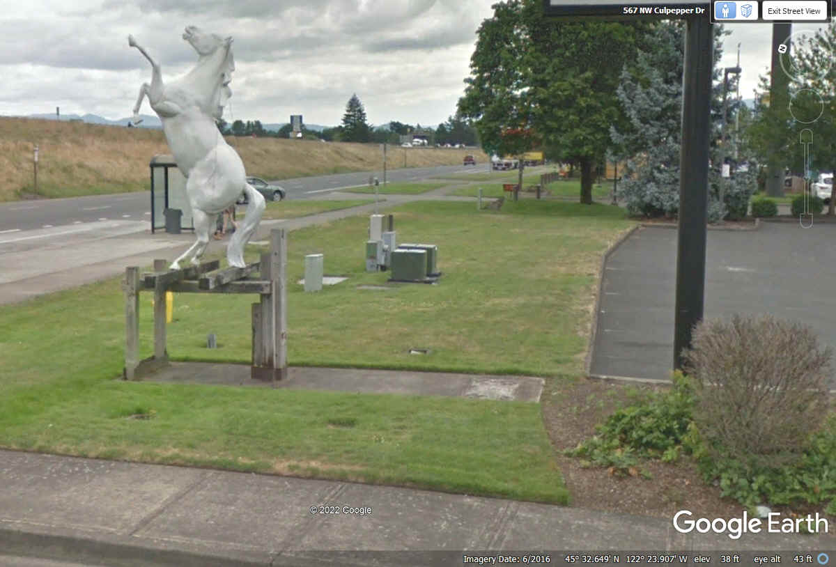
This stallion statue was across the side street from Arby's. We
parked our car here to enjoy our meals. We noticed all kinds of traffic
was using this frontage road since the eastbound entrance ramp for I-84 is just
beyond those trees near the center of this Google Earth image below.
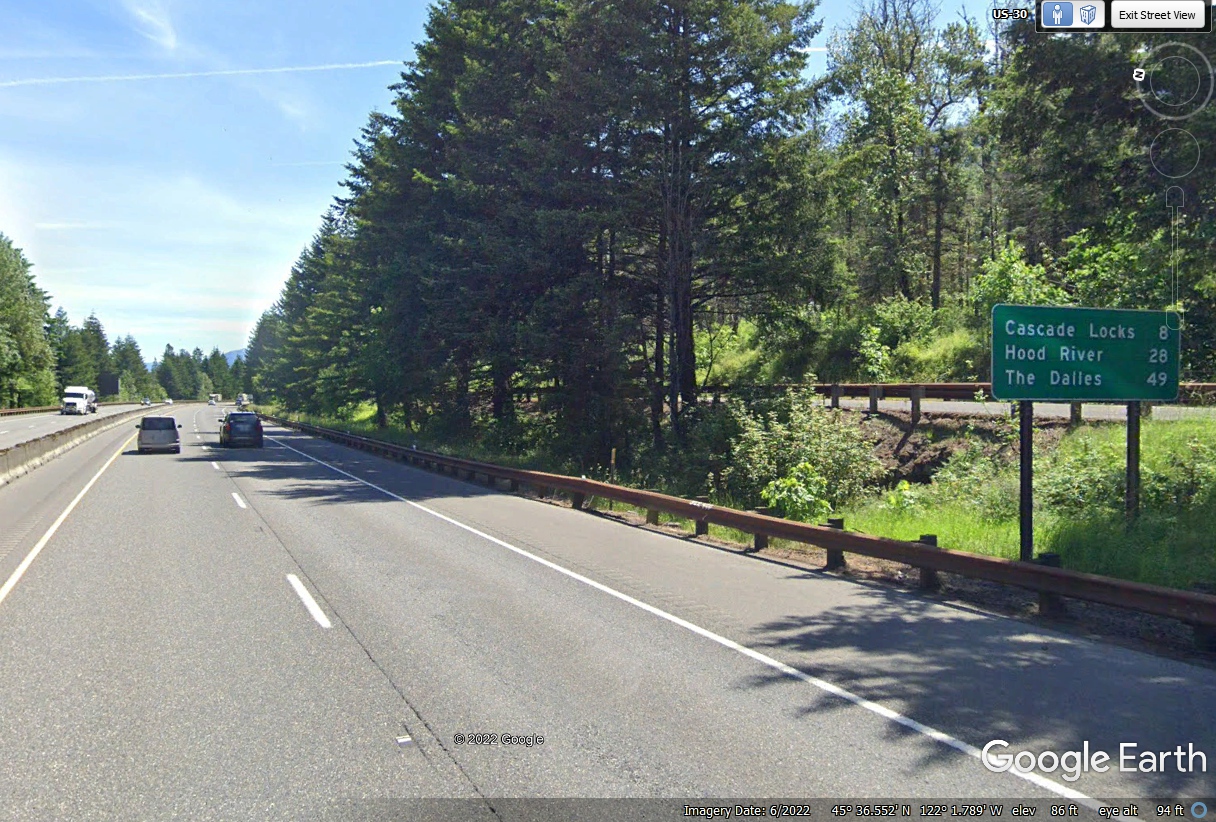
There is much to see ahead along the route of the Columbia River.
This sign marks the end of Portland and the beginning of this National Scenic
Area.
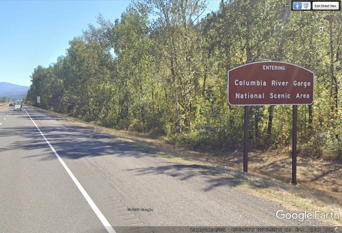
The sign in the image above promises scenic views. Up to this point
on the highway, there were trees blocking the view of the river.
The land adjacent to the river has been re-shaped to allow tourists to
park their cars between the East and West travel lanes and catch a shuttle bus
up to the top of Multnoma Falls seen in this image to the right side of the
highway up high on the bluff. This view is looking East. There is
plenty to discover about this double cascade of water falls using a Google
search.
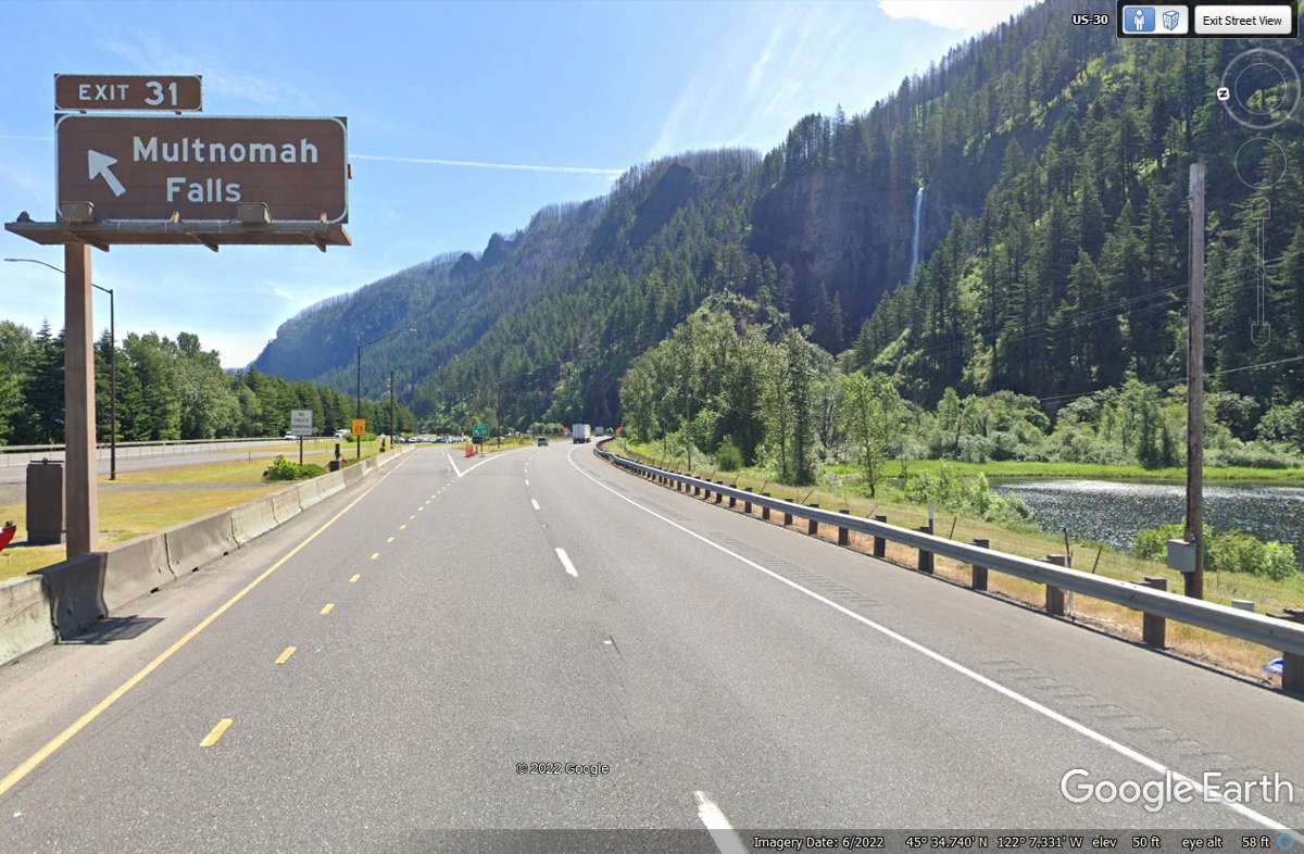
When I looked at the parking areas for the Multnomah falls area, I
recognized a ground level view would not be complete.
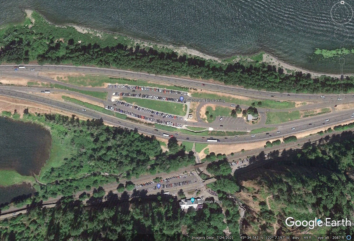
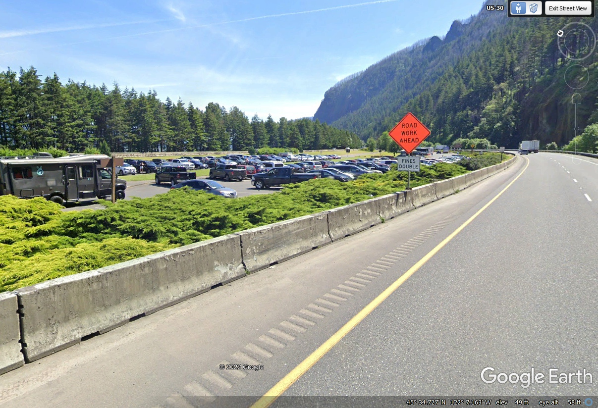
Here is the ground level parking area and shuttle bus for Multnomah Falls
as seen by Eastbound traffic on I-84.
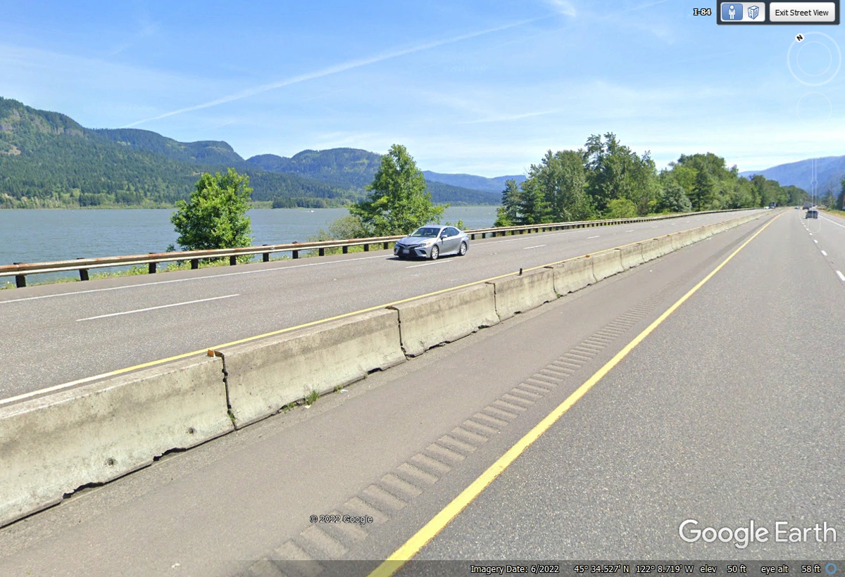
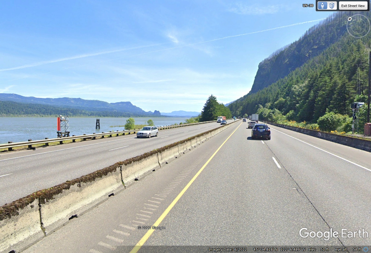
The bright orange channel marker reminds us the Columbia River is the
largest navigable river in the Pacific Northwestern United States. A lot
of barge traffic carries freight on this river along with River Boat pleasure
cruises. This image confirms how much the river has created this gorge
over the millennia. The speed limit for the highway is 65 to 70 MPH.
The passenger jet contrail shows the fastest transportation flying over this
rugged landscape.
I have been capturing these mileage signs all through this trip that
started in Florida back on May 23, 2022. Here is another one next to the
Columbia River in Oregon.
The Bonneville Dam opened in 1938. https://en.wikipedia.org/wiki/Bonneville_Dam
That Wikipedia article can provide more details.
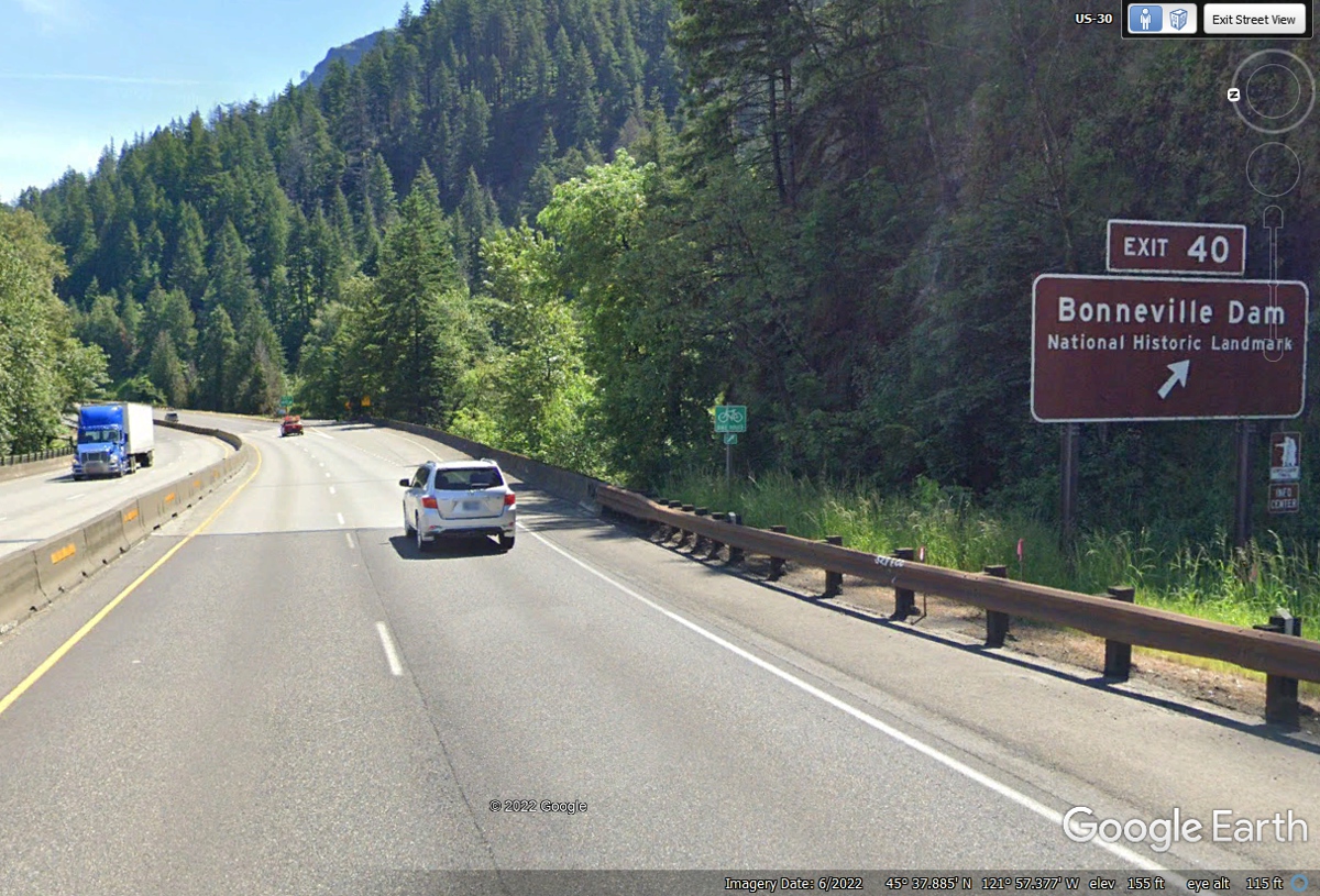
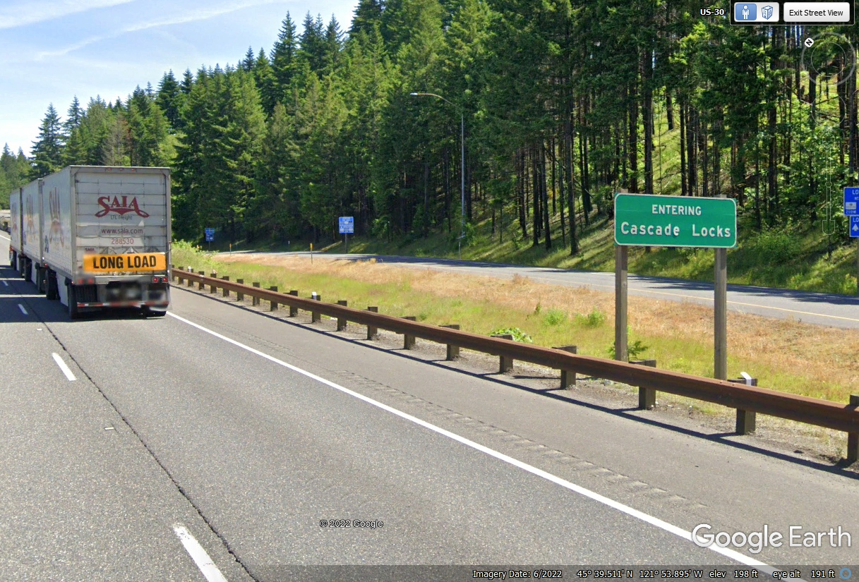
Cascade Locks is a small town on the south shore of the Columbia River
near a couple of dams on that river.
This
is the second time I have been
on this route. The last time was May
18, 2004. This
is along Interstate 84 about four miles west of Hood River, Oregon. This
part of the interstate highway system replaced a classic portion of US 30.
Oregon - May 18, 2004 going upstream
on the Columbia River.
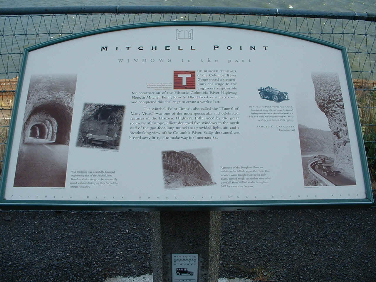
The Mitchell Point overlook in Oregon was CLOSED today, June 6,
2022 as Linda and I are retracing this route to show her the scenery along the
Columbia River.
This
2004 picture below is large enough to show all the details of the information
sign about this location alongside the river, highway, and railroad.
Looking
past the sign, this is what I saw. That is another railroad on the
opposite side of the river.
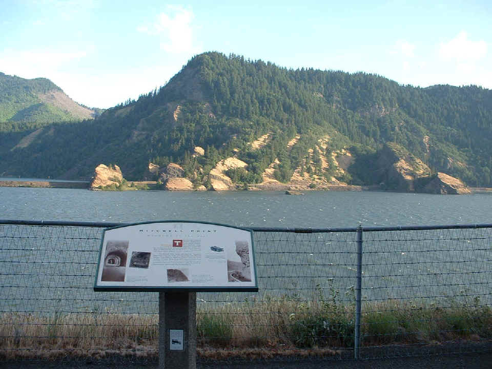
Now
you know why I said "another railroad" since there is one on this side
of the river and the interstate highway as well. This view is looking west
toward the Portland area (way down stream).
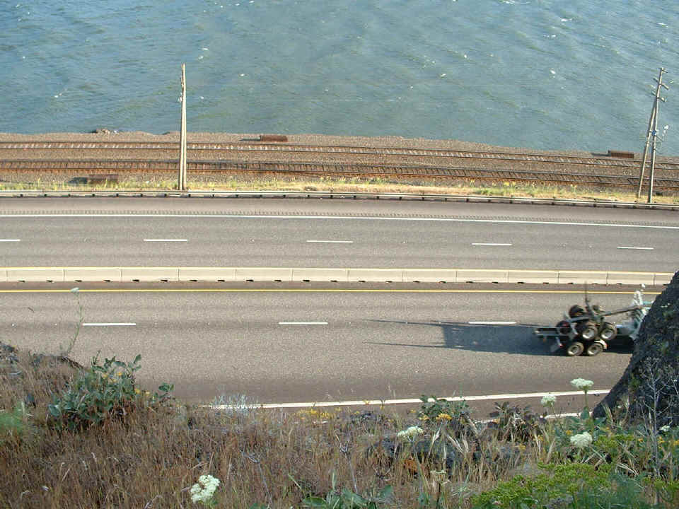
I
tried to catch this logging truck in the picture, but alas, digital cameras have
a bit of delay from the time you press the button before they actually take a
picture. It sure gives you the idea of just how close the railroad and
highway are to the hillside of Mitchell Point where I am standing.
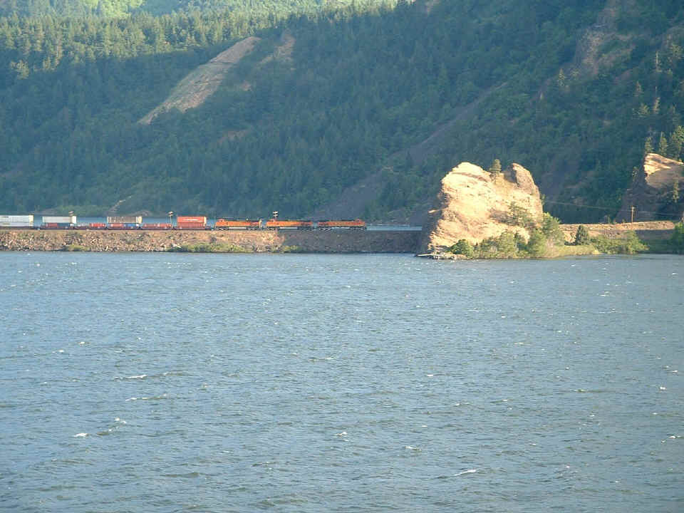
I
zoomed my camera lens to maximum and got this picture of a train going East
along the other side of the river. Although I was on a business trip, I
tried to enjoy the ride along the way to my technical seminar in Moses Lake,
Washington.
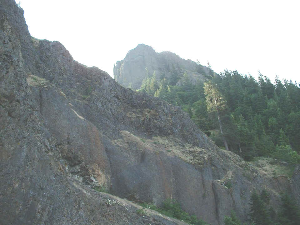
 This
image is looking
over my shoulder from the tourist sign. It is the craggy peak that is
Mitchell Point.
This
image is looking
over my shoulder from the tourist sign. It is the craggy peak that is
Mitchell Point.
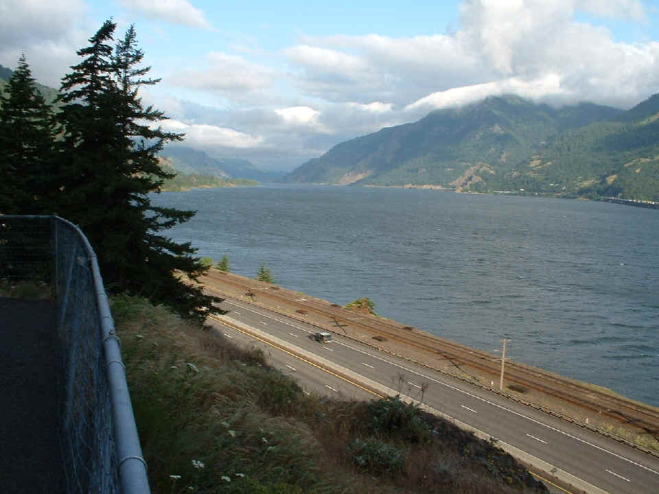
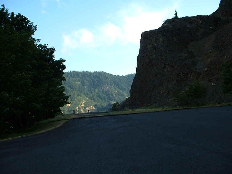
I
took this picture as I was leaving the parking area at Mitchell Point.
It puts things in perspective for the viewpoint of all the pictures above this
one on this page. Look near the center of the fence at the far side of the
parking lot and you will see the information sign shown in the first picture at
the top of this page.
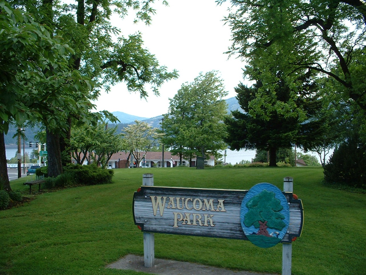
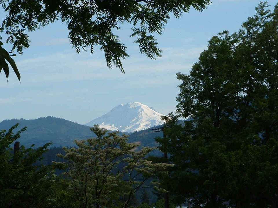
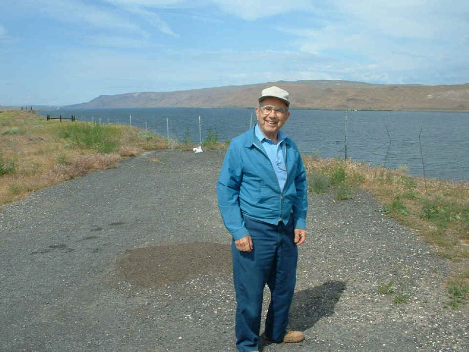
Mitchell
Point is a good place to get out and stretch after a 1-hour ride from Portland,
just because of the view of a dormant volcano that eluded me a few days ago.
No, it was not Mount St. Helens, but Mount Adams on the Washington side of the
Columbia River. And a good place to get that picture was from this
city park. The camera set the exposure for the foreground and the greenery
of the park. This exposure setting completely washed out the details of
the volcanic peak which is in this picture, but only shows up in the picture
below this one.
This
photo is taken from the same spot as the one above, but the difference is that I
pushed the zoom lens to maximum and got this picture of Mount Adams across the
river in Washington. At this point along the Columbia River, things are
very lush and green from the Pacific moisture and the prevailing winds.
Wind surfing and sail boating on the river here is a great pastime.
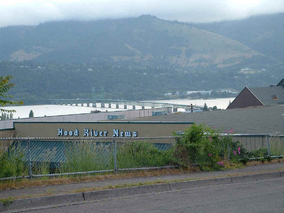
The
Hood River Bridge to the Washington side of the river is clearly visible from
much of the town. This viewpoint is overlooking the local newspaper
office. The town is named for the Hood River coming from the south, which
empties into the Columbia River at this location.
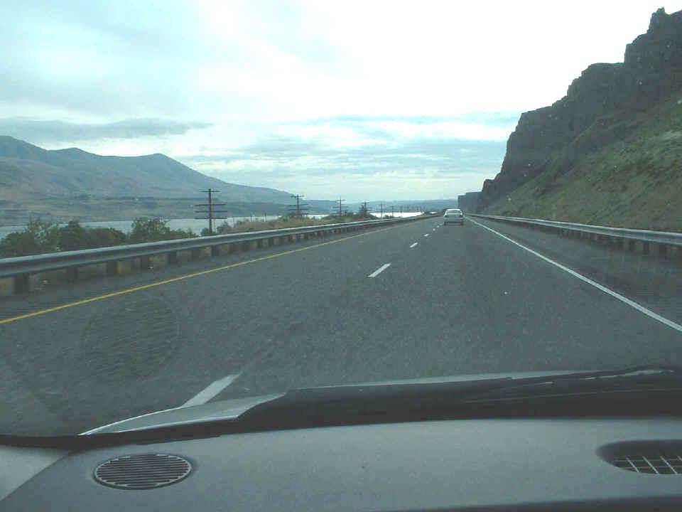
It
doesn't take very long until the land starts to become more of a desert domain
as seen in this photo taken on I-84 further East along the river.
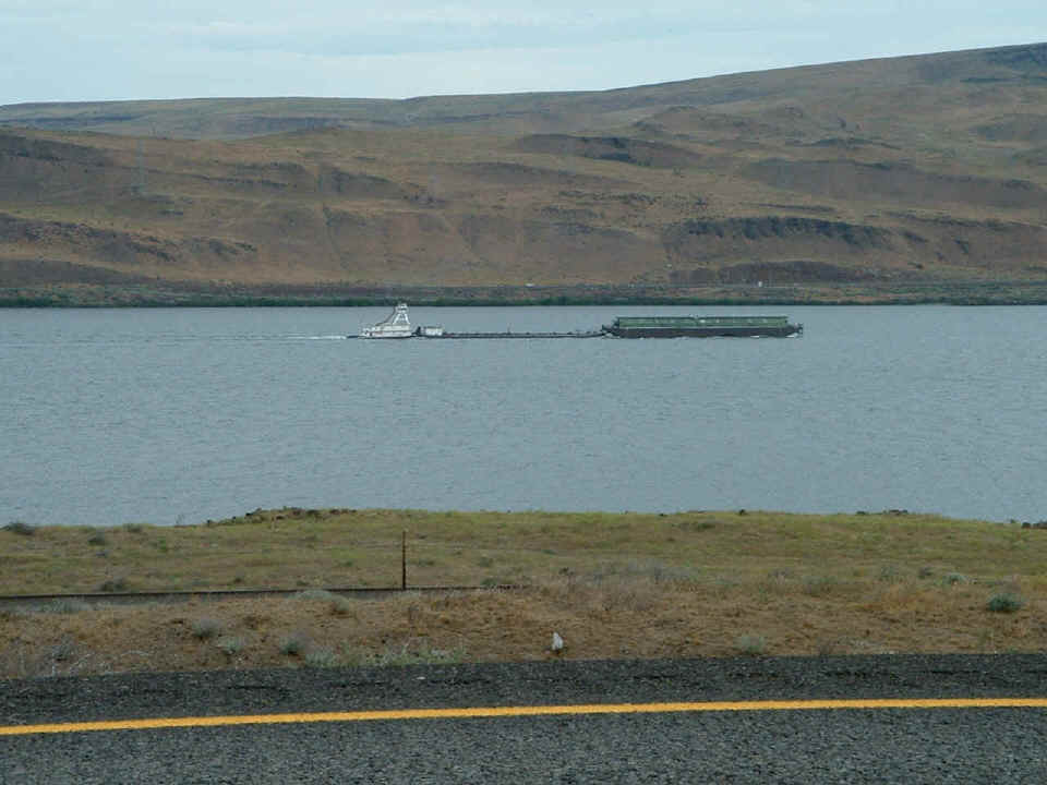
I
came upon this river tug boat pushing some barges upstream on the river and had
to stop the car long enough to take this picture. It also shows the
desert-like conditions that are becoming more a part of the landscape.
I stopped about a mile further up the road and found a good vantage point near
the intersection of Oregon state route 74 and Interstate 84 to take the
following pictures. From this vantage point, I am standing beside a
frontage road that is between the railroad and the interstate highway
right-of-way about 17 miles west of Boardman, Oregon.
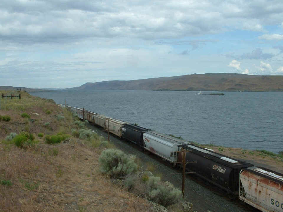
I was not the only one to stop at this location to check out the sights.
This is Wayne Swartzendruber of Hesston, Kansas. He had been spending a
few days in the Portland area visiting some relatives and had just started
driving back to Kansas today. He had recently broken his 35mm film camera
and was interested in my digital camera and where I got it, etc. This
is the last image from May 18, 2004.
June 6, 2022: Back to newer Google Earth images as we are going
East on Interstate 84.
This
point along route I-84 the road is going south next to the Columbia River 80
miles East of the beginning of I-84 in Portland, Oregon where it leaves
Interstate 5.
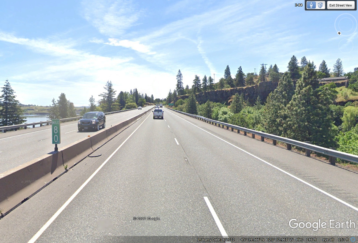
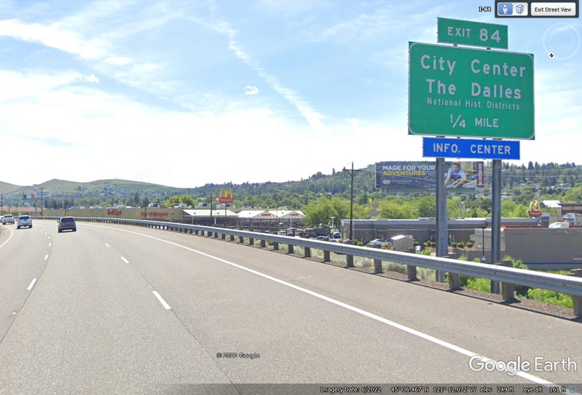
The
town of The Dalles has its city center 84 miles from Portland, Oregon on
Interstate 84.
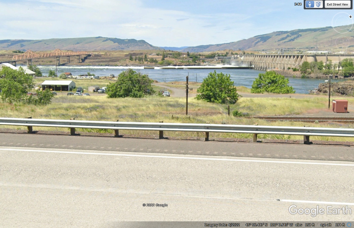
Just
East of The Dalles is this truss bridge that goes over into Washington State,
and The Dalles Hydro-electric dam across the Columbia River. As you can
see from this Google Earth image, both of these structures are visible from
Interstate 84.
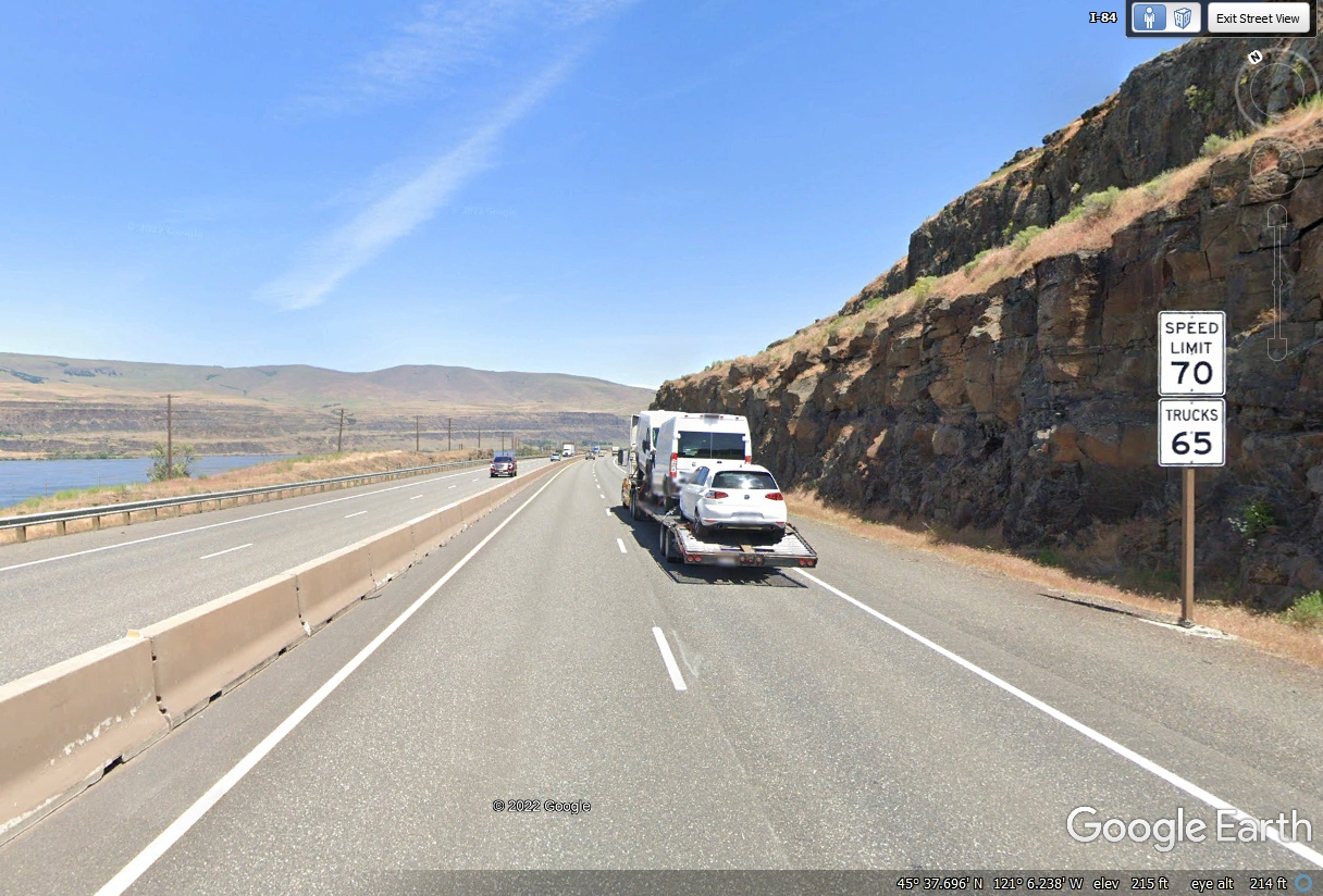
With
The Dalles behind us, the speed limit is now 70 MPH as we head for our hotel for
this evening.
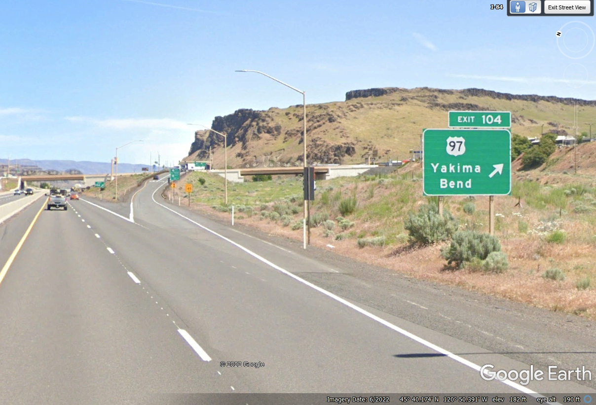
We
are now 104 miles from the beginning of I-84 back in Portland, Oregon. US
97 was our route through northern California, Klamath Falls and Bend Oregon from
a few days ago.