Golf Course Preparations Begin · · PAGE 49.
December 12, 2017: The surveyors have
started laying out the property lines of all the existing homes adjacent to
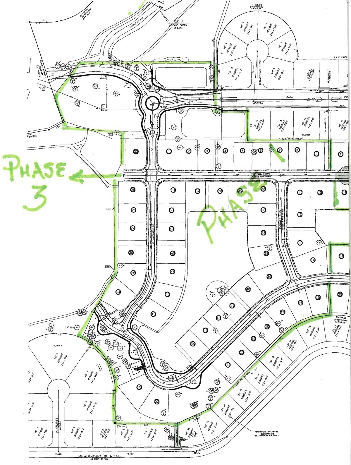
Phase 1 of the development. There will be 50 lots on the golf course in
this first phase. When the stakes with the white flags appeared, I started
taking these photos to verify the measurements with the information I downloaded
from the online county map sources showing this property.
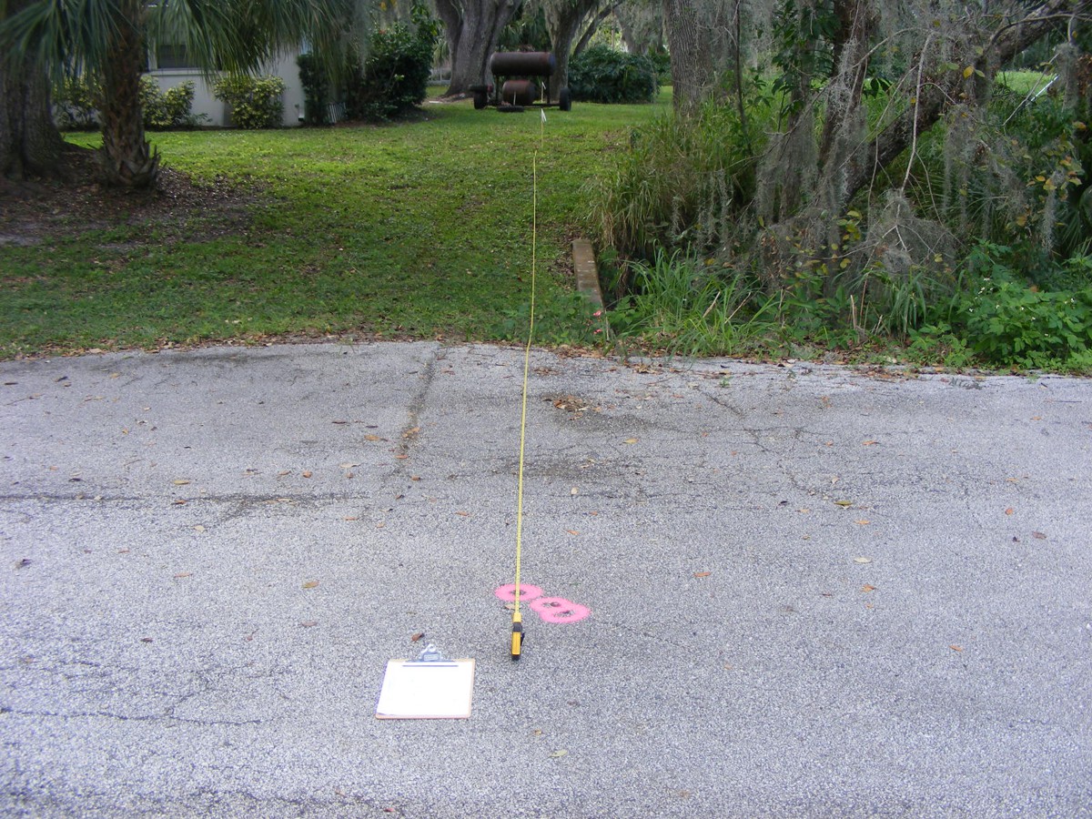
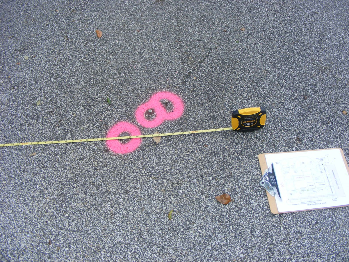
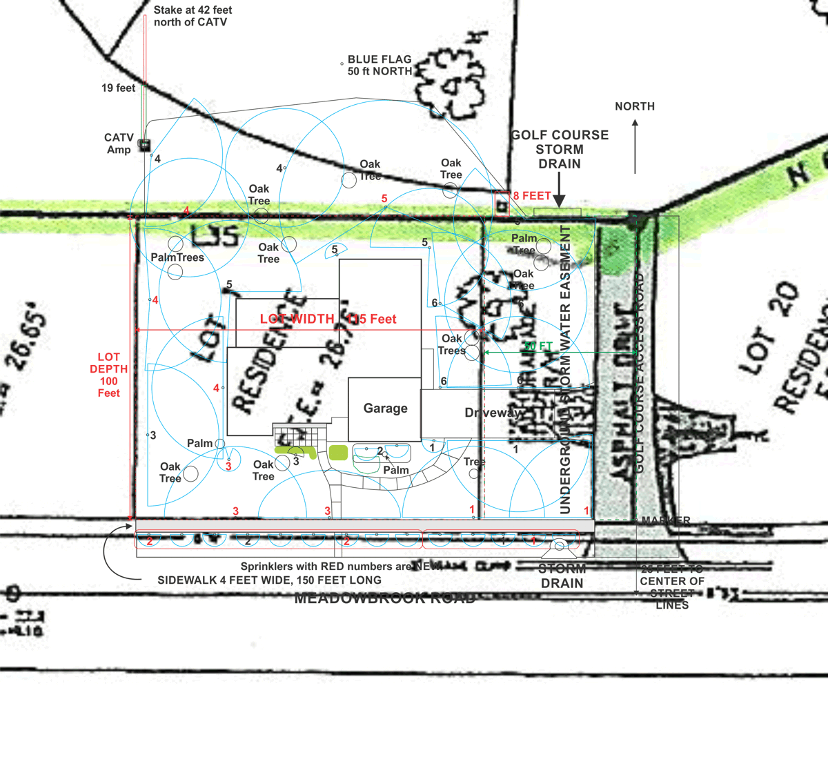
This marker in the street on the east side of the house is 100 feet north
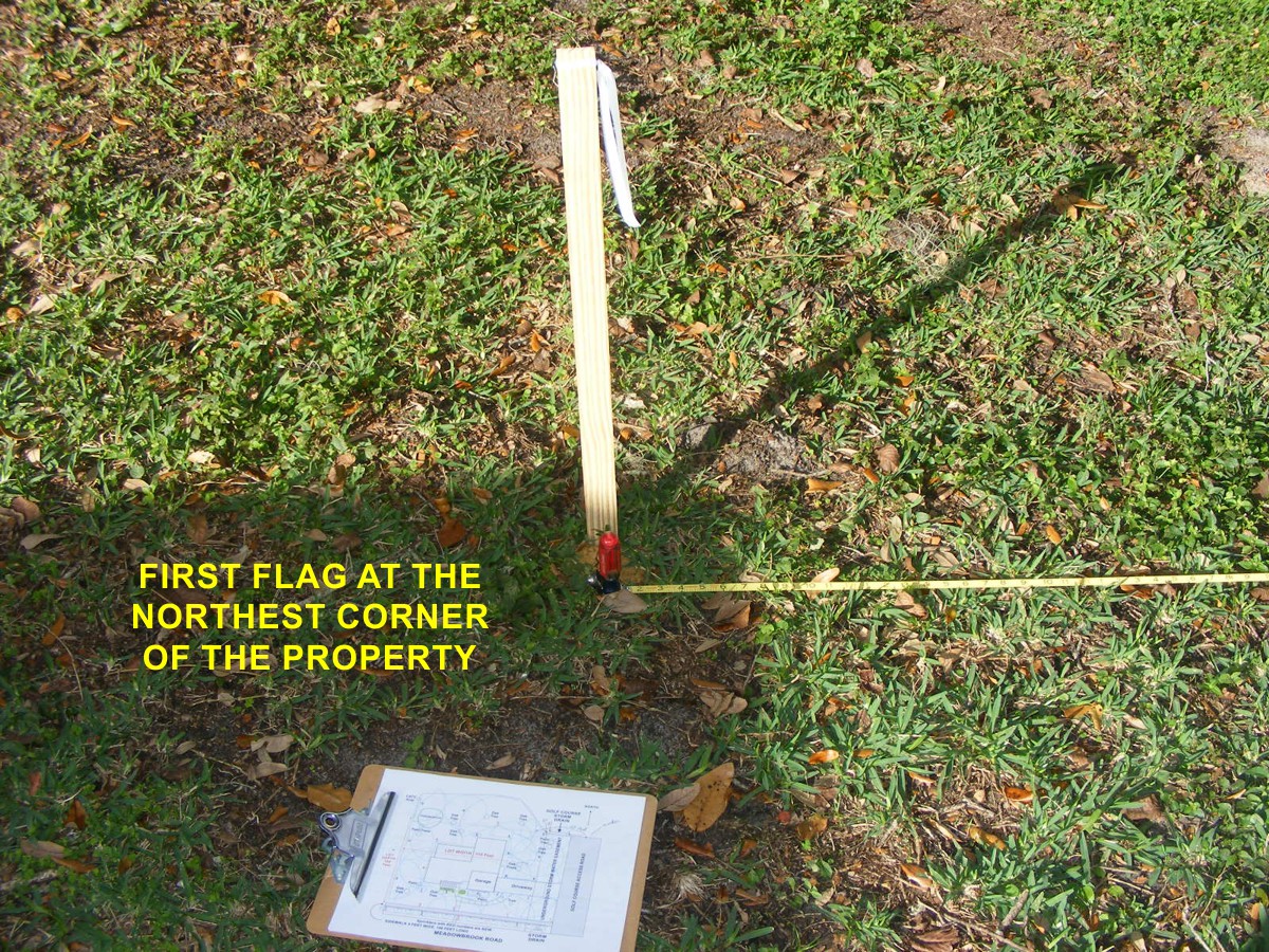
of the sidewalk for Meadowbrook Road. From here to the first stake with
the white flag is 50 feet that marks the northeast corner of the lot where it
begins adjacent to the water easement for the Saint John's River water management
storm drain from the golf course. The culvert under the east side of the
property connects to the Melbourne Tillman Canal that is
just behind the houses on the south side of Meadowbrook Road.
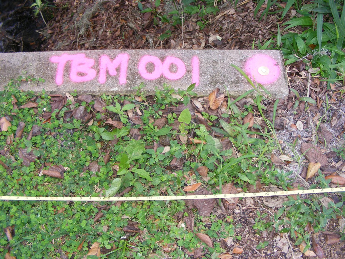
As the surveyors passed the actual culvert that drains the golf course,
they put their permanent marker on it that was not there before.
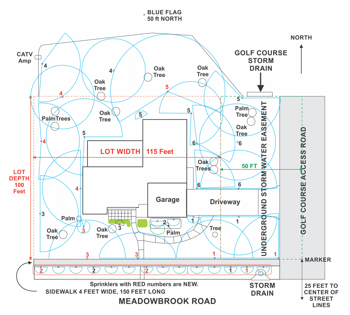
This is part of the base map from the county that I used to produce my map of the
sprinkler system and the house on the property that measures 100 feet deep and
115 feet wide.
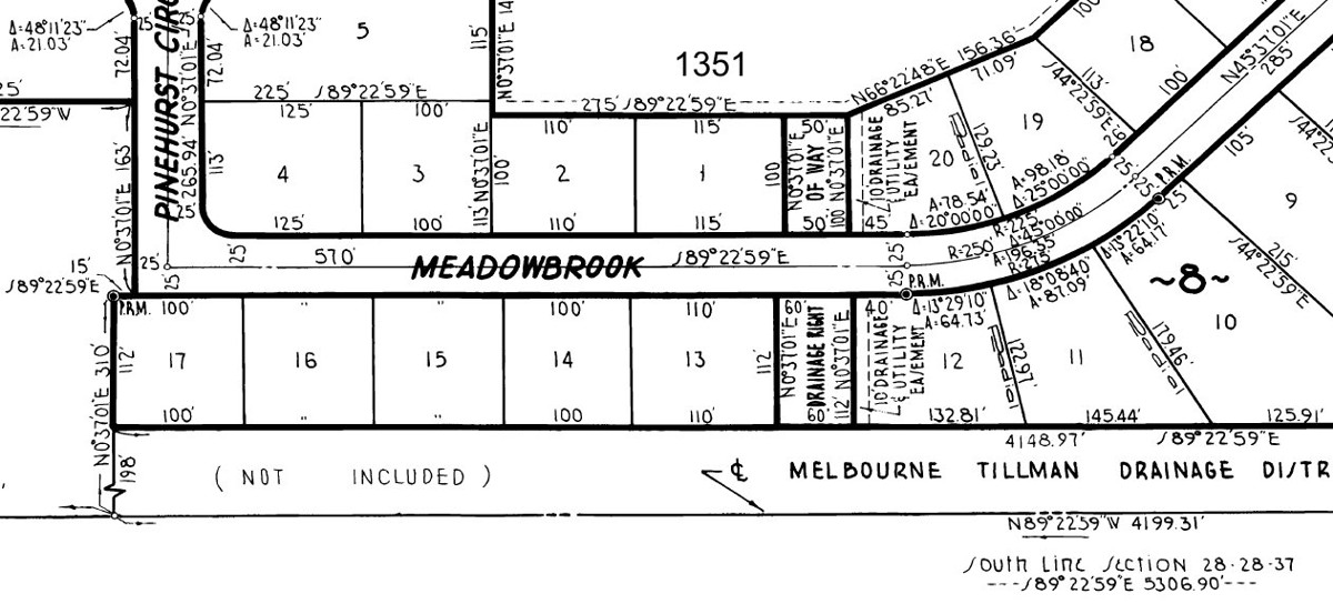
The RED DOTTED LINE marks the property with the house on
it. The area north of the red property line has utility easements on it
for power, cable TV, and telephone lines. Photos showing the routes of the
cables will be shown further down this page.
I received a map of the project at a recent meeting of the home owners
association. I have matched the size of that map to the map I created
above. Lot 22 of Phase 1 is seen here just eight feet from the property
line for 1351. That EIGHT feet has a utility easement for the cable TV,
phone, and electric service. My measurements for the location of the CATV
amplifier matches the map from the developer from heavy black lines. January
7, 2018: I found a new marker stake in the ground 42 feet north of
the CATV amplifier location could be on the property line between lots .
Based on the overlay map below, The CATV amplifier is 19 feet from the property
line for lot 22 and 42 feet from the line between 22 & 23.
Here is a bigger view of Phase 1 map.
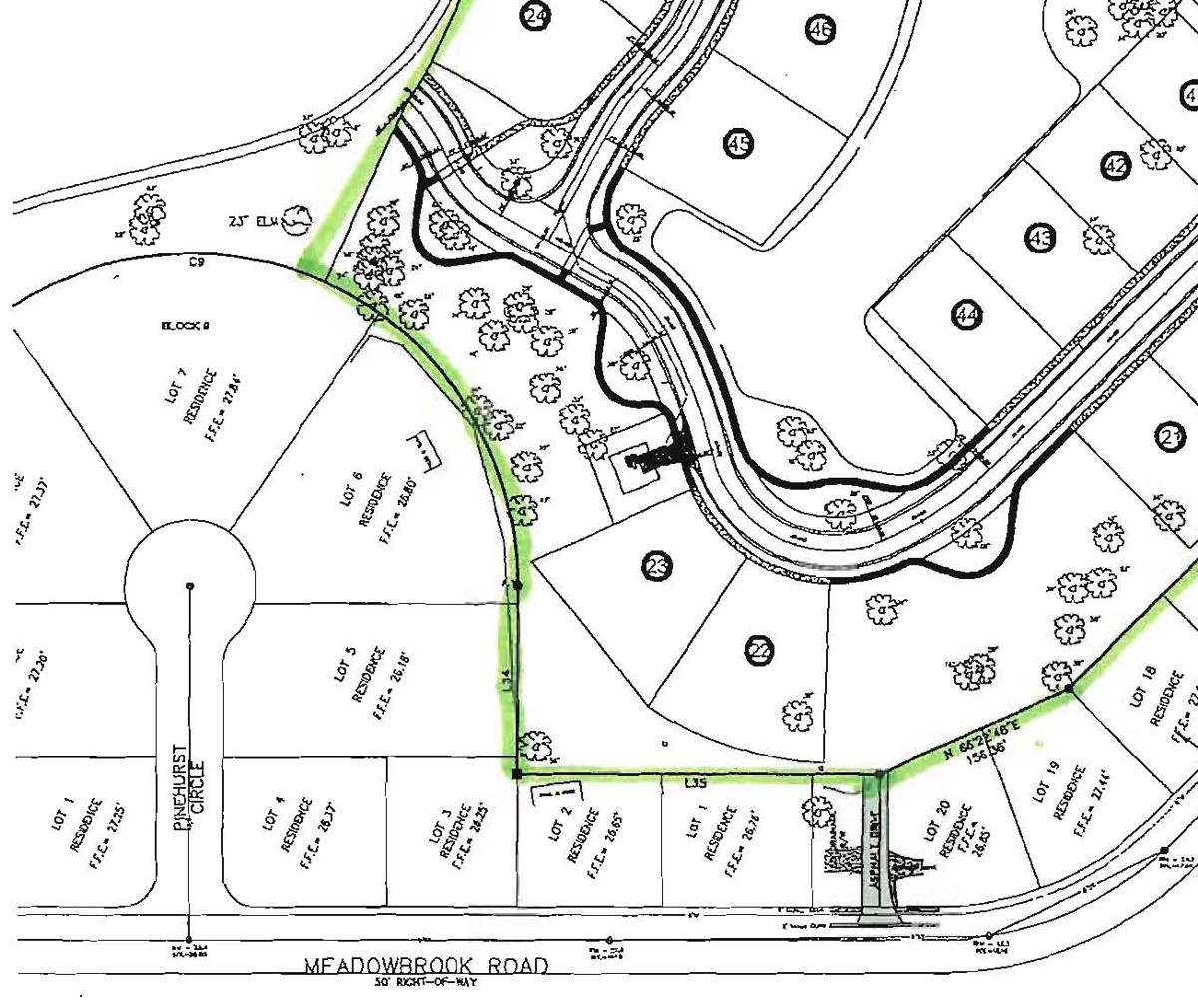
This is the bottom of the map above for better viewing in our area.
Lot 22 has the southeast corner of that lot just EIGHT feet from the northeast
corner of 1351 Meadowbrook.
One of the key things I have been doing is checking the placement of the
sprinkler heads near the north property line and where the temporary
construction fence will be installed. My measuring tape follows the line
of the easement and we have one sprinkler right on that path. When the
underground utilities were being located, I realized how close the sprinkler
heads and pipes are intermingling.
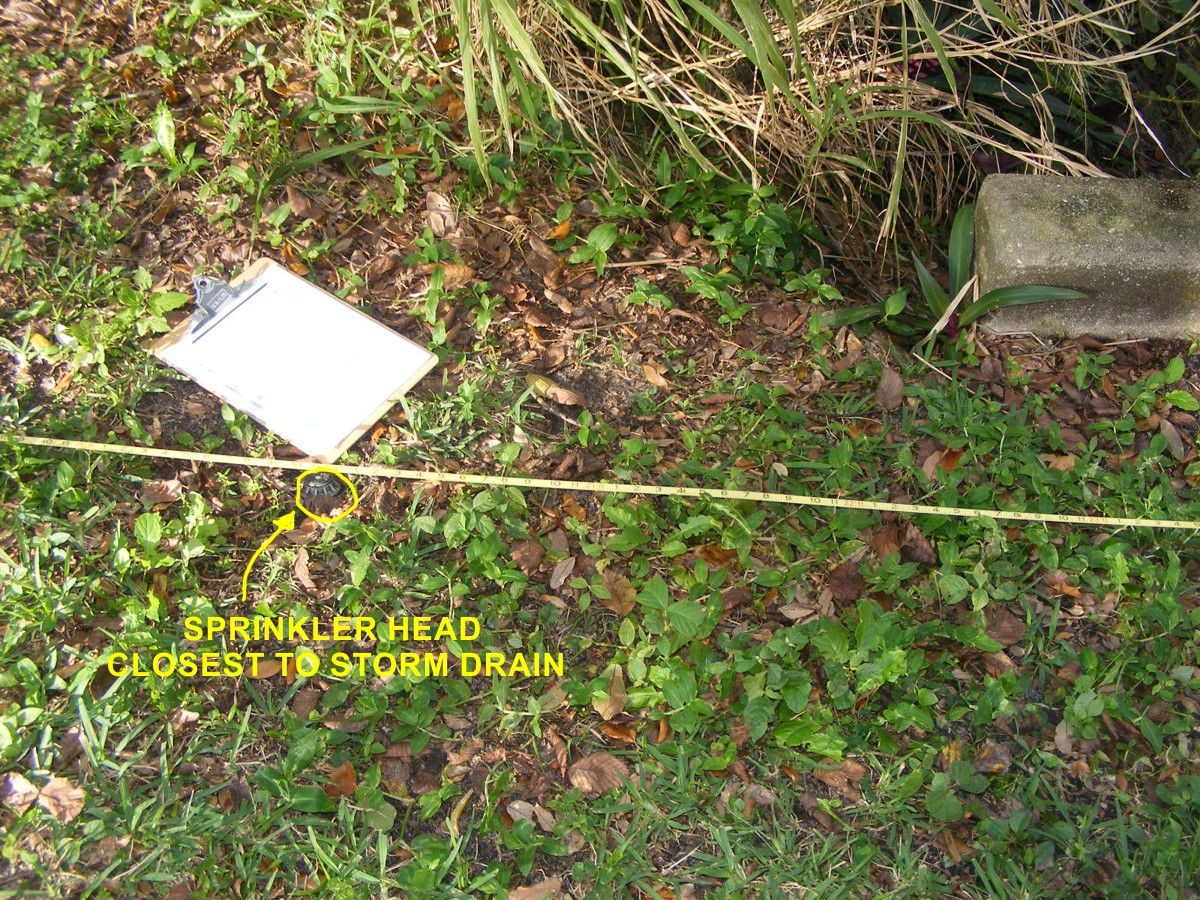
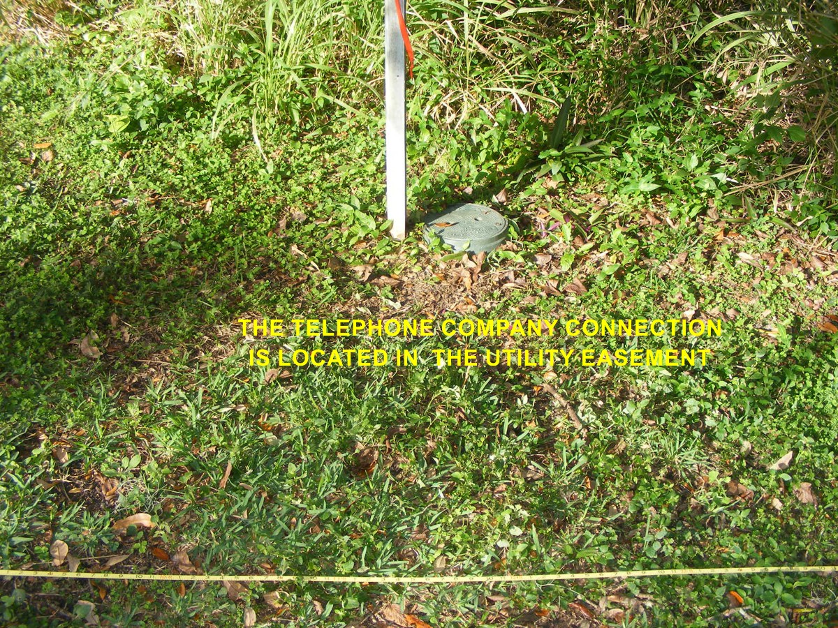
The telephone company access point is near the sprinkler head seen above
and a few feet from where our lot begins.
This marker flag is where the northeast corner of the lot meets the Saint
Johns River easement that drains the golf course area.
| GO TO PAGE 50 | BACK TO HOME MENU |