2020 Annual Inspection Begins · · PAGE 457.
September 26, 2020: I went up to the
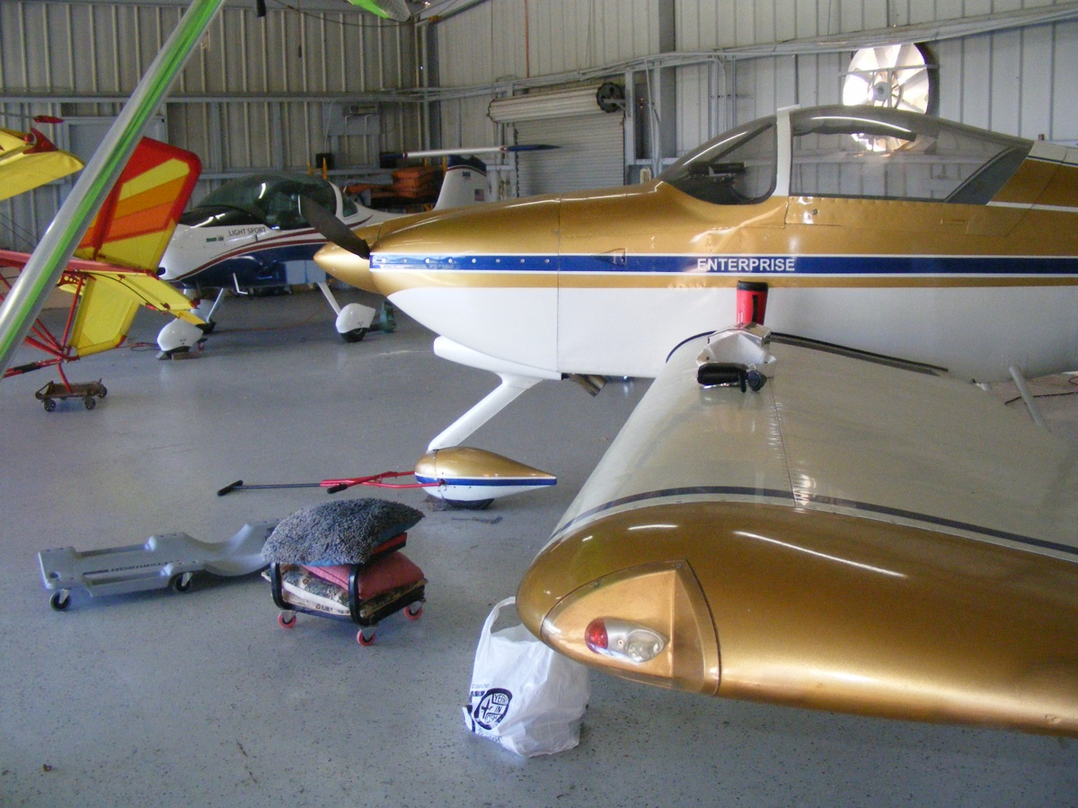
Rockledge Airport to start my annual inspection of N2PZ. I met Billy as he
was preparing to go up to North Carolina for a few days. We moved one of
the other airplanes in the hangar forward so I could swing my prop for the
cylinder compression tests. I do not intend to fly today, just work
on the airplane and do some cleaning. I brought in my backboard creeper to
get under the airplane, and my stool with wheels on it when I need to sit down
during today's work.
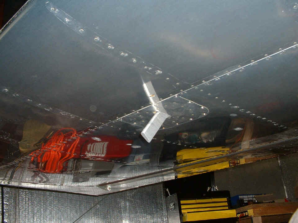
Here is the airplane ready for the cylinder compression tests. The
results were the same again this year with 80 PSI test pressure and all
cylinders reading about 78 PSI at top dead center of the compression
stroke. I appreciate the advantage of having cylinders that have
nickel-carbide coating after 15 years of service. I did not realize this
image was not correctly focused until I created this web page after processing
the images to the correct size.
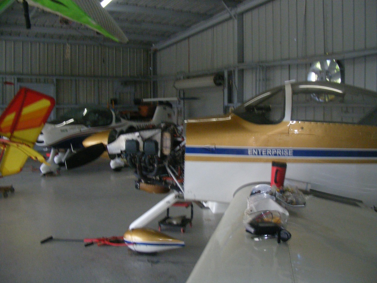
Here is the same image with some additional image processing to
"sharpen" the view. I can see I need to use the zoom feature
when I look at each image on the camera display screen as soon as I take it.

Summer is the "wet season" for Florida and rarely does the good flying weather synchronize with the weekends. I was talking with my old friend Marty Mason the other day. He asked me why I had not been flying since June. Now you know why. The annual inspection will not be complete until I can make a test flight and fill in the aircraft log book accordingly.
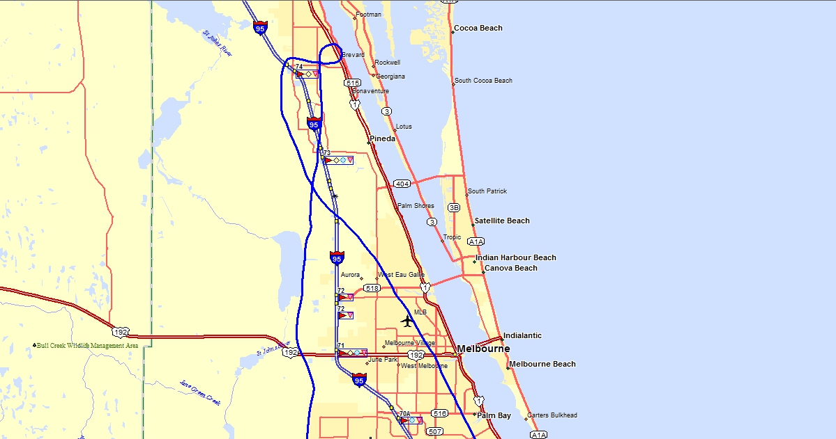
October 17, 2020: Good flying weather "Maybe" for today. It looked good from weather radar and driving to the airport today. The wind was out of the north and a cool front was coming into the area from the north. I was airborne at 11:13 AM according to my GPS data. I climbed up west of the airport to get a good look at the weather for my decision on which way to go. I started off going south over I-95 while climbing to stay clear of the Class D airports in this area of Brevard County, Florida. I was up at 5,000 MSL down near the Melbourne Airport (KMLB) before I turned toward the north. It was a partly cloudy day and I was going up on top of the clouds to see how clear it is up north.
Massey Ranch (X50) airport
near New Smyrna Beach, Florida was where I would make a full stop landing then
back taxi on runway 36 to head back home. I was up near 7,000 feet MSL
over the Indian River Lagoon when I decided I could get over near the beach to
get down low for the approach to Massey in VFR conditions. This was a day
with broken cloud layers and more. I flew over the highest cloud bank at
around 8,000 feet when I was near the Kennedy Space Center. I noticed some
turbulence when I was on final to runway 36, but I have been flying near trees
at several airports and know what to expect to maintain a safe approach to the
runway.
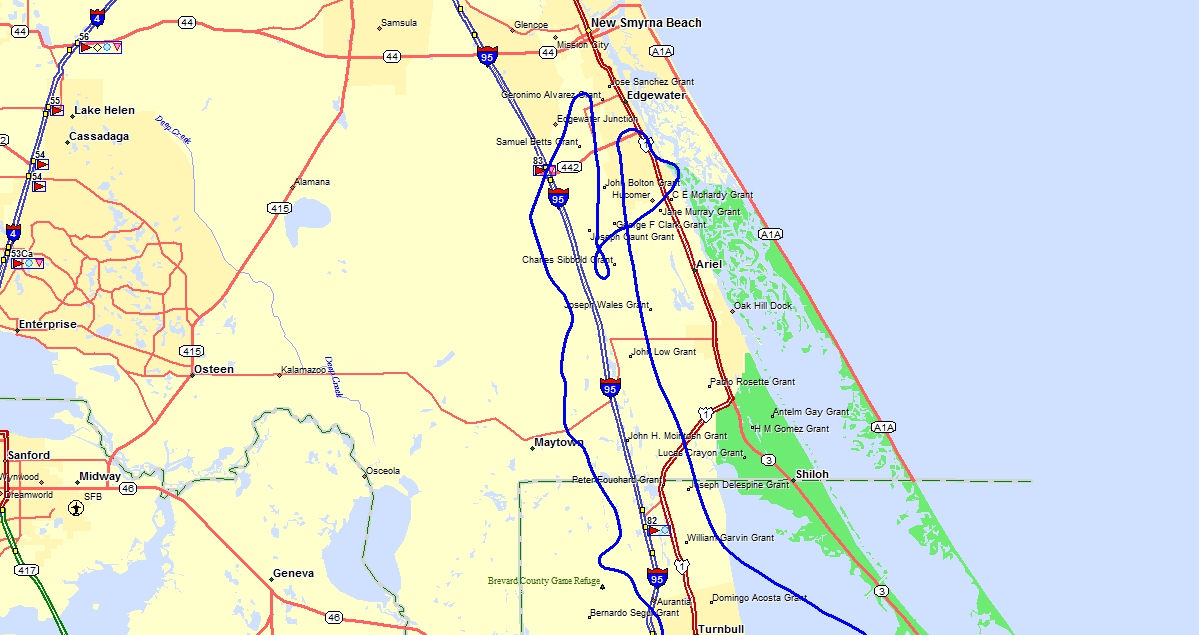
When I departed Massey and headed south, the base of the broken cloud layer was about 2,000 feet MSL. I had to do a zigzag flight path to get around and above the clouds up north of Titusville. I climbed up to over 6,000 feet MSL to get to an area where I could descend clear of clouds in VFR conditions over I-95 west of the Rockledge Airport. The GPS reported my touchdown at the airport at 12:30:30 PM.
The Hobbs meter adds 1.4 hours today for a total time since new of 441.8 hours.
December 28, 2020: Monday looked like a good day to go flying here in Central Florida. The company is closed for the remainder of the holidays and I have more days off duty this week. I got a late start for the airport and had my lunch before going to the airport. I started by cleaning my airplane of the dust and crud that accumulated in the hangar. Bill had some things to do today and it worked out not so good as the weather started moving into the area.
For those of you wondering why I have not been flying lately, I took some vacation days in November so Linda and I could go up to Georgia to introduce Linda to my sister on the second day of the trip. We then spent the weekend at her daughter's home in Decatur, Georgia. Monday came and we headed up to the mountains in Georgia, North Carolina, and Tennessee. All the details, photos, and Google Earth images are found on this part of my web site.
There are 21 web pages and 435 images in those pages to tell the story of our nine-day vacation trip for Linda, myself, and her dog "Chase." His name is appropriate if he gets out of the house without a leash.
I will publish the details here when I make my NEXT flight.
2021 Has Arrived with Good Flying in Central Florida
January 16, 2021:
A day to go flying. The winds are brisk on the ground, and blowing from
the West at 30 MPH up at 3,000 AGL. Today's flight was down to Valkaria to
do a couple of touch and go landings on runway 10 with the wind down the runway.
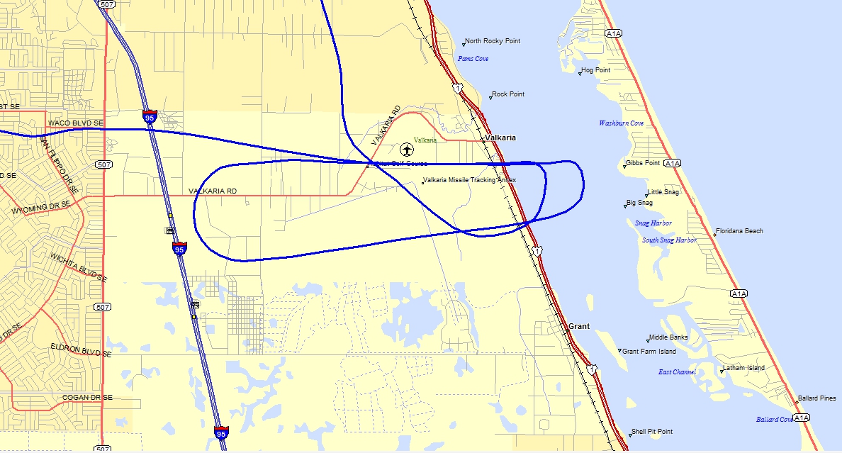
The usual take off from Rockledge was using runway 36. The wind was
from the NW and tested my stick & rudder skills when I cleared the tops of
the trees. I turned west and climbed up over I-95 to remain clear of
Patrick AFB class D. I climbed up to 3,000 AGL and hit a
"one-shot" turbulence as I approached KMLB over the top. That
brief turbulence rolled me about 60 degrees to the right followed by my quick
return to wings level as I continued toward Valkaria Airport. Only one
other airplane was in the pattern down there. The wind speed on approach
was about 15 MPH for runway 10. My return to Rockledge was down low out
near the Saint Johns river clear of Melbourne class D air space.
Back at Rockledge, the wind was still from the northwest when I made my
crosswind approach to runway 36. You can see where the wind started
pushing me to the right as my wheels left the runway on departure. My
landing upon returning was textbook crosswind and I stayed very close to the
centerline.
The flight time today was only 0.8 hours as it was bumpy and tested my basic skills.
January 20, 2021: The day we get a REAL PRESIDENT this time where the VOTERS CHOICE is put into action and the last FOUR YEARS end the way we ALL wanted. This day was also when I had a flare up of kidney infection and ended the day in the hospital. I got out on January 26 and went home with four days of home nurse I/V antibiotic treatment ending on January 31. The dishwasher was replaced by me at the end of February. The side mounting brackets were not delivered until March 1. Those brackets connect to the wooden cabinets on both sides of the appliance and were installed March 6. March 29 was the scheduled appointment with my urologist as a follow up to the January hospital stay. I had some new x-rays taken for that day's discussion. I also scheduled my appointments on a 6-month cycle to help prevent any future kidney infections.
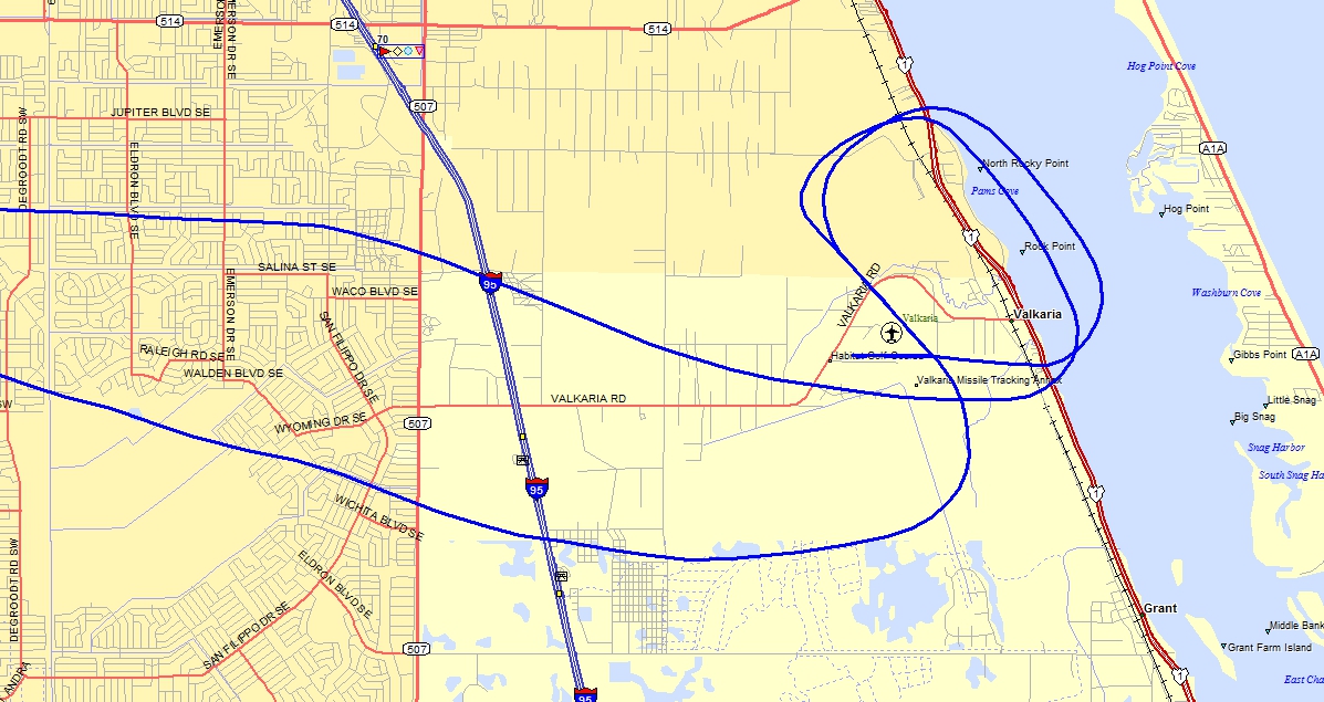
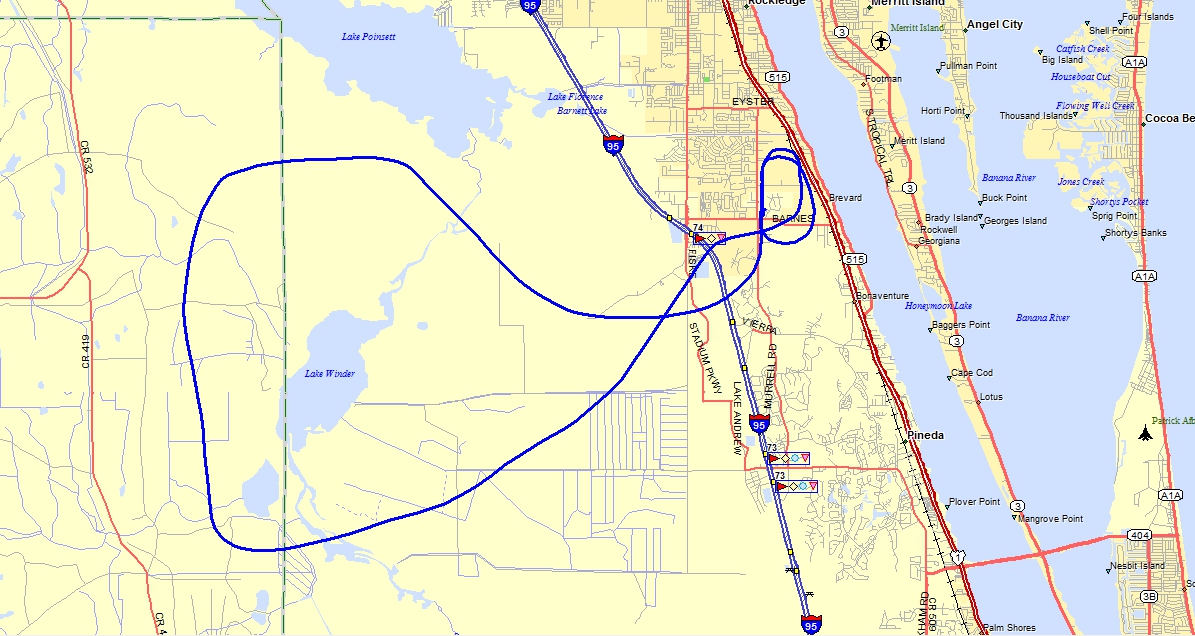
April 10, 2021: I needed to fly again
before my BFR check ride coming up next week. My ride down to Valkaria
today was better than the last time. Runway 14 was in use today due to the
prevailing winds from the southeast. The upper trace in the image below is my inbound
track to get behind a Cessna in the pattern. I followed the Cessna to the
end of the runway after landing then turned on to runway 28/10 and taxied down to the west end
for a take off on 10. The taxiways in the center of the field were being
repaved. I decided to take off from runway 10 as the trees on the south
side of 10 were blocking much of the cross wind. I flew out over the
Indian River again and turned back to get a touch and go on 14 before heading
back to Rockledge via the bottom ground track seen below. The approach and
landing back at Rockledge was from the north with no problems.
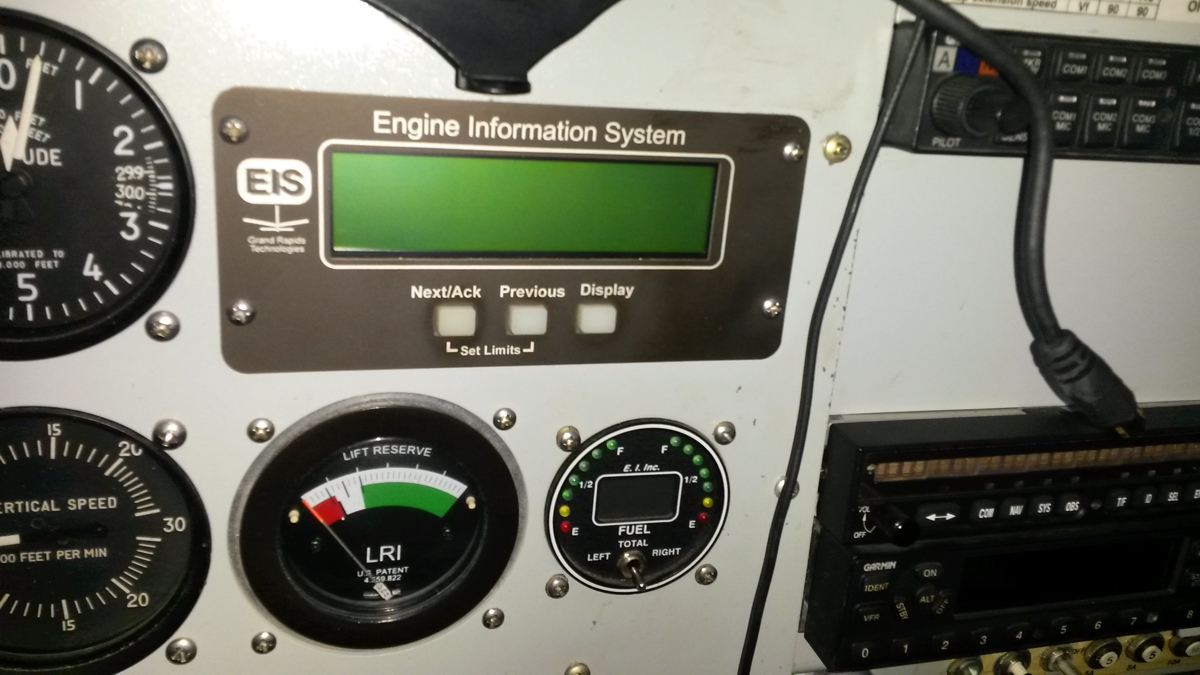
April 15, 2021: Was the day I wanted to get
my BFR test done. I noticed right after takeoff my engine monitor was not
working correctly. The EGT values were way above normal around 1,700
degrees F. I thought about how much fuel it would take in the exhaust
header to do that. The question was whether the carburetor was running
that rich or the engine monitor had problems. The choice to return to the
field was made as I did not want to run out of gas if it was flowing that freely
with a very RICH fuel setting. I made a go-around before my landing back
at Rockledge.
April 17, 2021: I went back to
Rockledge on Saturday to work on the electrical connection to the engine monitor. I
opened up the main instrument panel and found one of the DBM-25 connectors was
loose on one end of the connector. I went to Lowe's to get some longer
4-40 machine screws and secured the DBM-25 connector properly. I started
the engine on the ramp in front of the hangar and the engine monitor values were
back to normal. I departed for a trip over to Umatilla airport for fuel.
Here is the usual flight path over there and back. It felt good to
get the airplane up to speed at 4,500 feet.
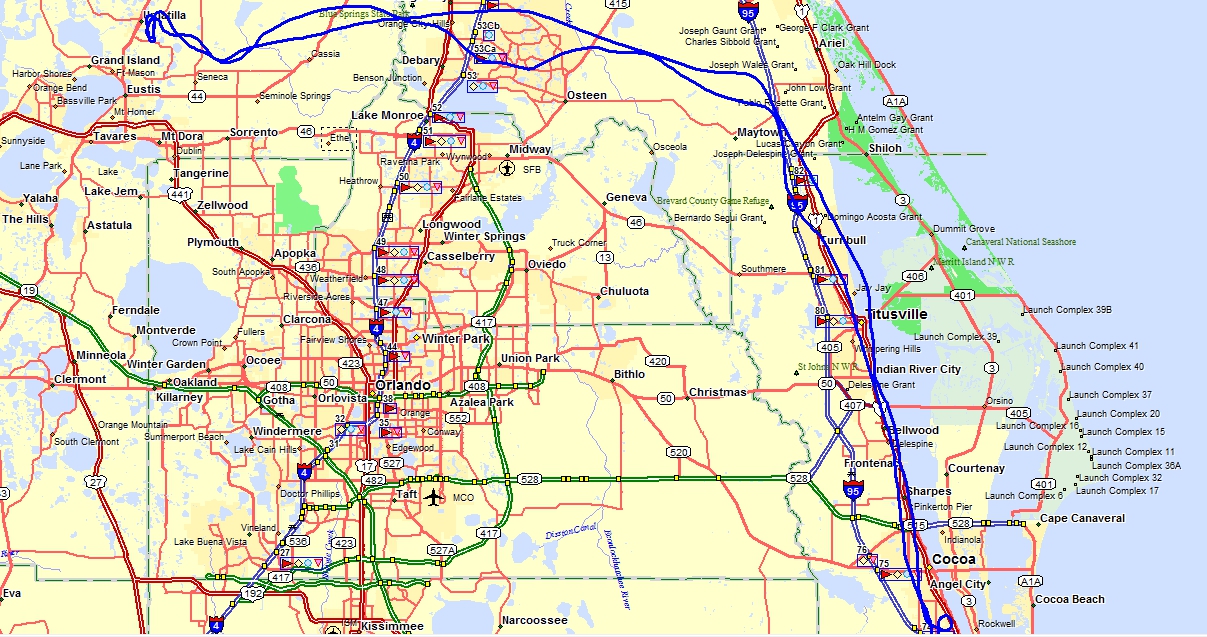
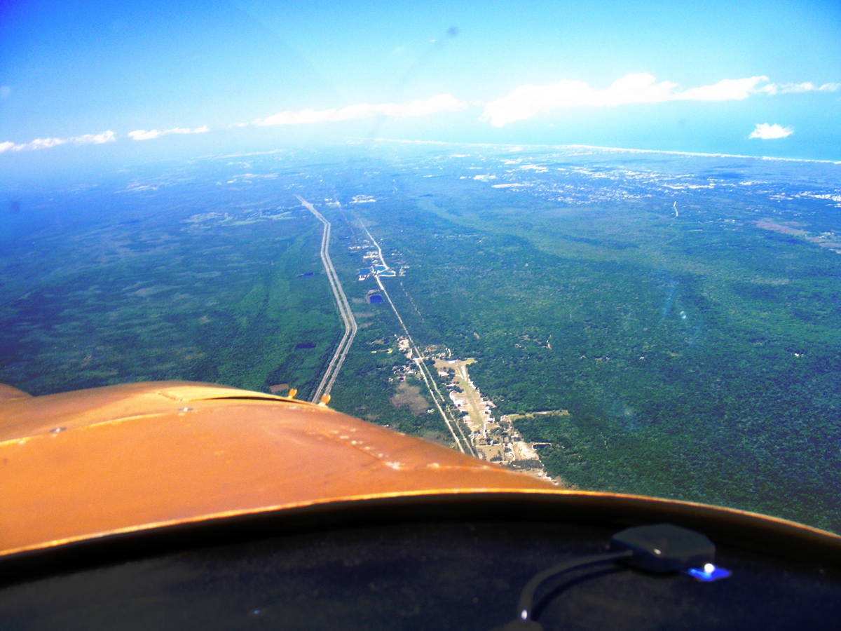
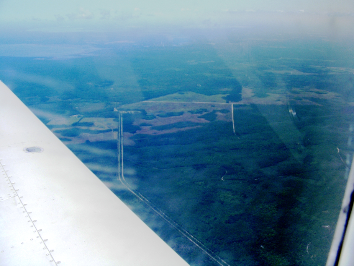
Looking north over I-95 with the Atlantic Ocean and beaches at the far
right of this photo. I used the "auto adjust" feature of my
image processing program to add contrast to the ground. The winds were
blowing at 25 MPH when I turned west on the north side of Orlando Class B
airspace. Blue Ridge Flightpark Airport is about to pass under the
cowl. The grass runway is 2,500 feet in length. This airport is 16.7
miles north of Arthur Dunn Airpark located on the north side of
Titusville. The next area to the north is named Creighton.
This image looking west in front of the left wing was also processed for
ground contrast. I used Google Earth to compare to the image below and
discovered a little place called Maytown. The closest town is Oak Hill on
US 1 just under 10 miles from hear via named country roads without county road
numbers.
Umatilla airport has a new fuel pump with a hose that can be retracted by
electric motor. The pay station is also new and took me a couple of times
to see how the alpha letters worked with a separate keypad for numbers.
The large size display is a winner! The price of AVGAS today was $3.97 per
gallon. The ground wire to the aircraft is still hand-cranked to roll it
up after use since it is a small cable.
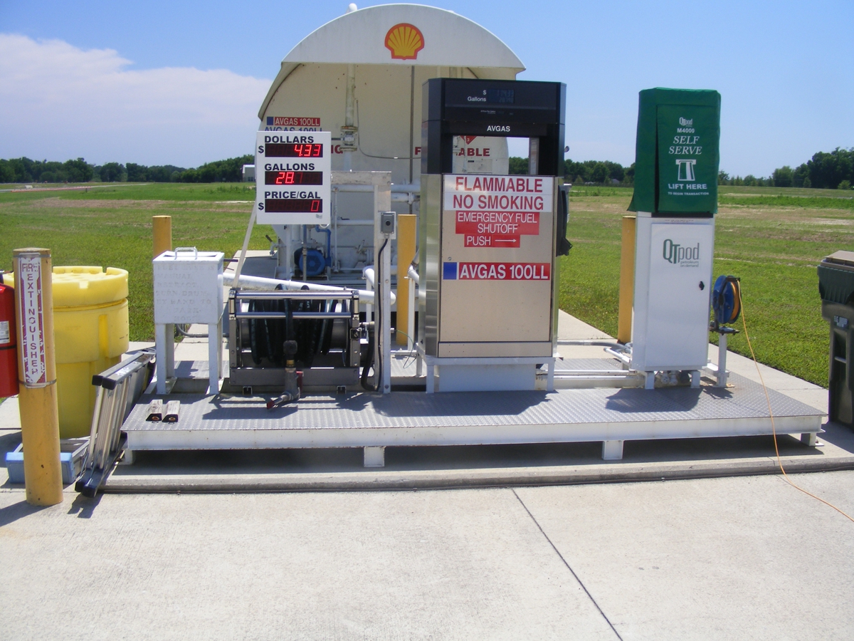
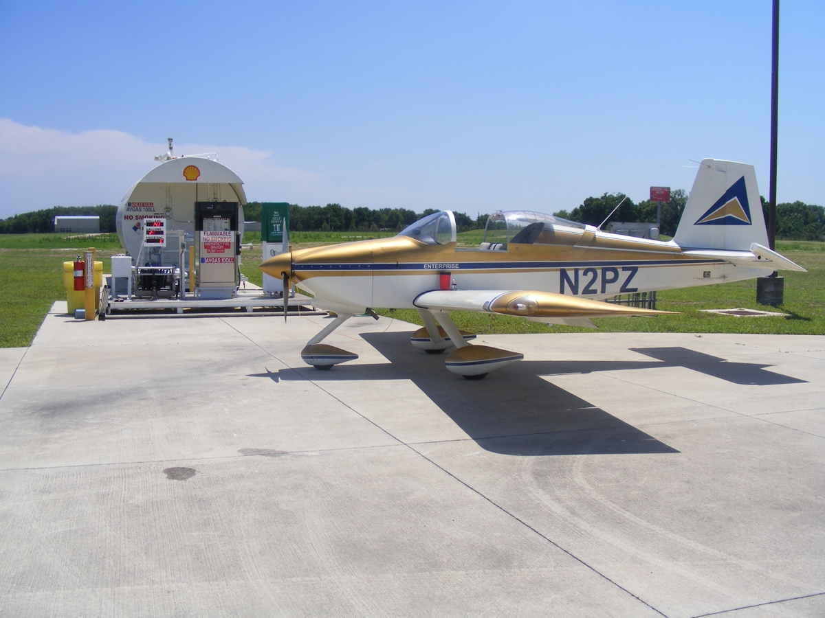
Here is the traditional photo I take when I buy fuel at any airport.
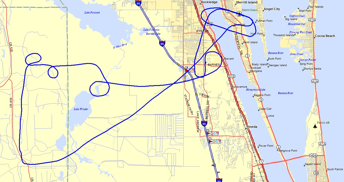
April 22, 2021: After waiting for good
weather again, the BFR was completed as seen in the ground track image
below. The 45-degree bank angle turns were over farm land to the west of
populated areas. The straight course heading south was for doing power-off
and power-on stalls. My passive, air-operated lift reserve indicator stall
warning device was very active during the stall maneuvers. Next were some
cross wind landings at the Merritt Island Airport (KCOI).
There were two other aircraft in the pattern when we arrived at pattern
altitude. We made one Touch & Go on runway 29, followed by a full-stop
landing on runway 29, and taxi back to the end of the runway at the edge of the
Indian River for takeoff. It is a short flight back to Rockledge where we
landed to the north on runway 36.
After I got the airplane shut down on the ramp, I showed the flight
instructor the little wing device with two holes in it to drive the needle on
the lift reserve indicator. The image from above is repeated here to show
the LIFT RESERVE INDICATOR below the Engine Information System unit. The
right edge of the red marker is the stall speed with FULL FLAPS extended.
The white-to-green point is the stall speed with FLAPS UP (retracted).
The probe for the lift reserve indicator is mounted on the right wing bell
crank access plate. This photo is from page 130 of this web site from the
day it was installed, May 25, 2005.
The Hobbs meter reads 446.9 hours after all the flights described on this page above beginning on April 10, 2021 up to April 22, 2021.
| CLICK HERE for PAGE 458 | Return to MAIN MENU |