A Good Day to Fly and Take Some Photos · · PAGE 439.
June 17, 2018: Sunday! The
weather is better than yesterday and I did not have any computer issues as I did
yesterday morning (Saturday). A recent Windows Update changed some details
of Internet Explorer 11 that altered the display of Facebook postings. I
found the solution online and was happy to see the browser working as it should
again. By the time I got that fixed on Saturday, it was lunch time and the
temperature outside was HOT! I checked the weather online and the local
weatherman in Orlando last night about the weather for today (Sunday). He
had a graphic on screen showing the chances of RAIN for the week ahead and made
the statement "This is the way it will be for the next FIVE
MONTHS". The rain chances were from 30% to 90% from day-to-day on his
graphic. If you don't like the WEATHER in Florida, just wait a minute, it
will change.
I was out of bed just after 7 AM today with no alarm clock needed. I went
into my office and checked the current weather online. The computer was
working very well today. I had my usual light breakfast and prepared for
the trip to the Rockledge Airport. The first GPS data point in the
airplane was stamped 11:05:56 AM when the Hobbs meter also started while parked
in front of the hangar. By the time I began the takeoff roll on runway 36,
the GPS time stamp was 11:11:29 AM. The last GPS data point was just
inside the hangar door at 12:09:26 PM. Here is what I did in that one-hour
flight.
The takeoff was from runway 36 into the light wind with my usual right
turn to the south over the Indian River, then climbing and heading west across
Interstate 95. I reached 2,500 feet then turned south to pass above the
Melbourne Airport as a Delta Airlines flight took off to the east on the shorter
runway NINE LEFT (9L). Nine right (9R) is the longest runway and is still
being re-paved.
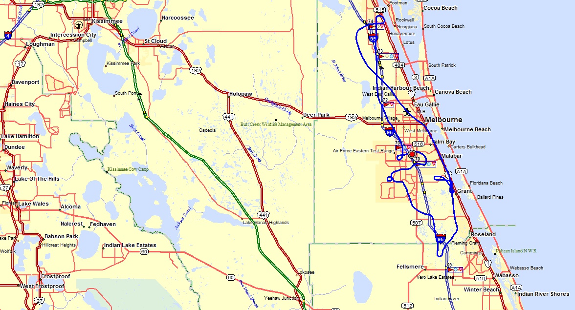
The GPS ground track map shows the south end of Brevard County and the
Sebastian area where I had thought about doing a touch-and-go landing. The
radio call from a parachute JUMP PLANE high above the airport and one other
airplane in the pattern for runway 5 was a good reason to avoid the
airport. I did see what appeared to be a light-sport airplane flying very
low over some wooded areas south of the Sebastian Airport.
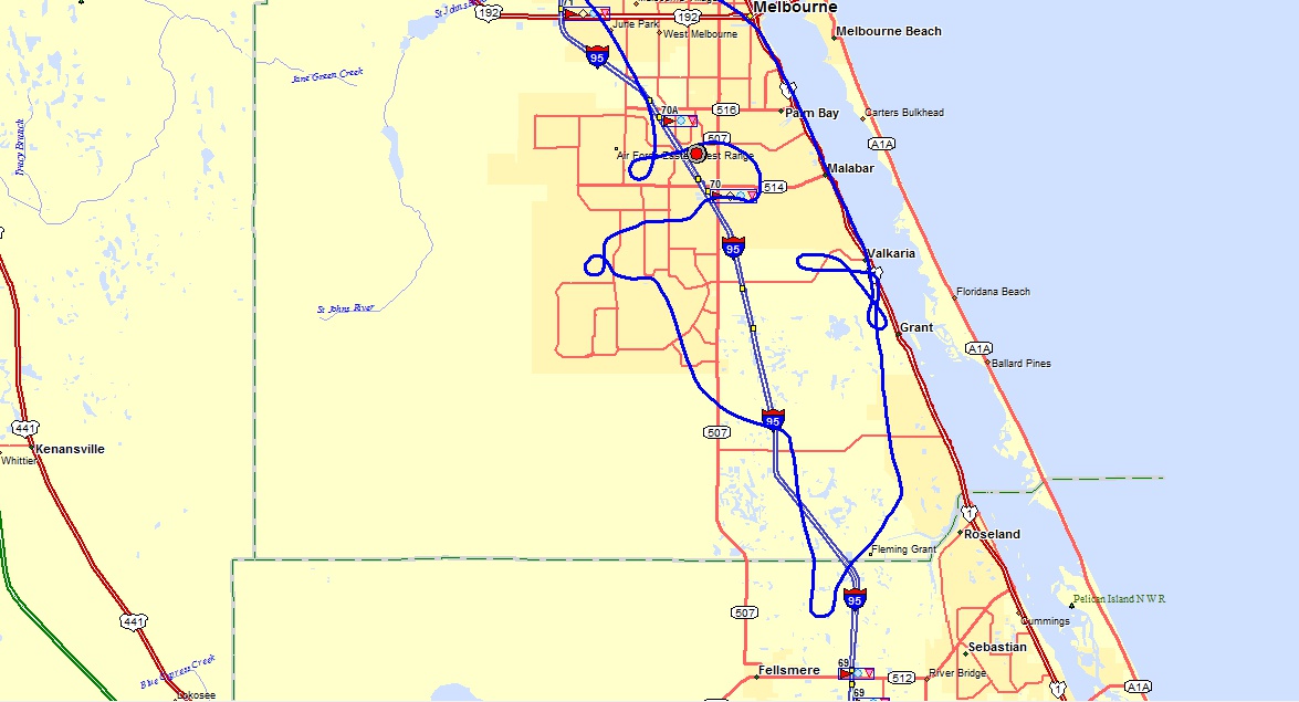
This next GPS ground track map shows where I did a touch-and-go on runway
10 at the Valkaria Airport. I noticed they only had ONE of their TWO
runways open. The northbound part of the flight is mostly west of I-95
before I made a photo pass on the golf course housing project just north of the
RED dot that marks the location of my home. All those other turns on the
north bound part of the flight gave me a different look at streets I drive on
from time to time.
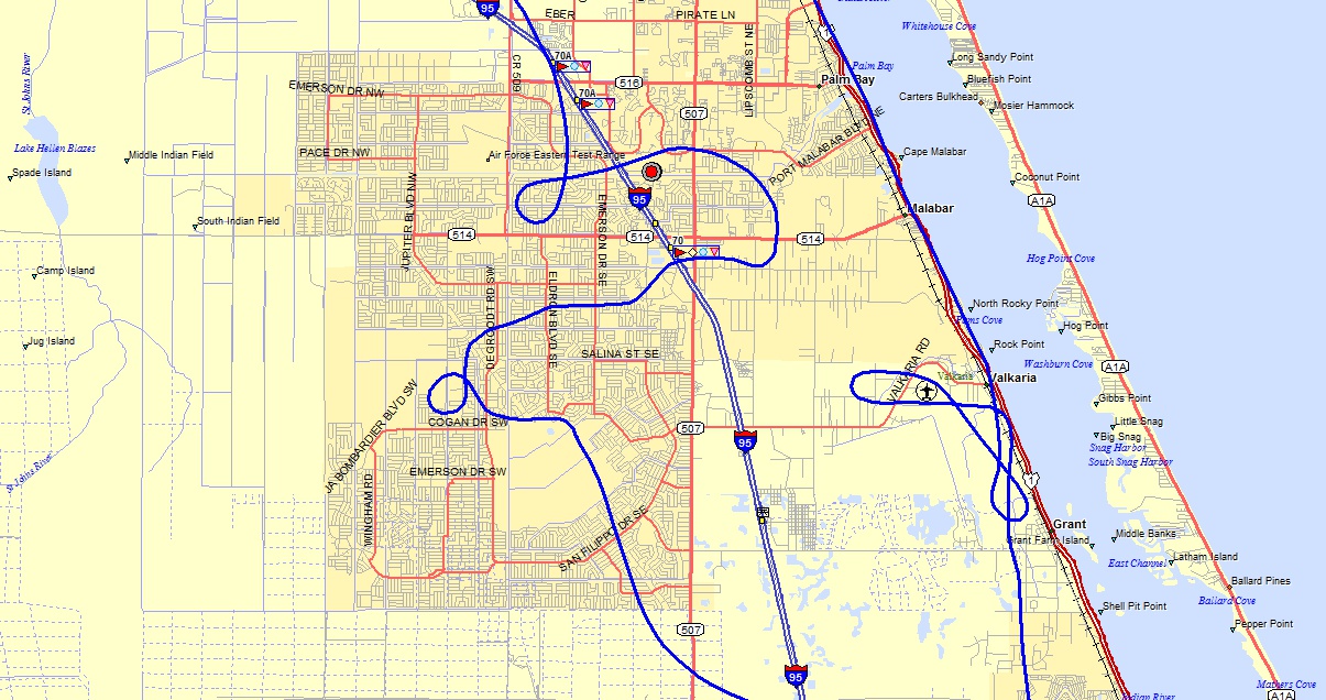
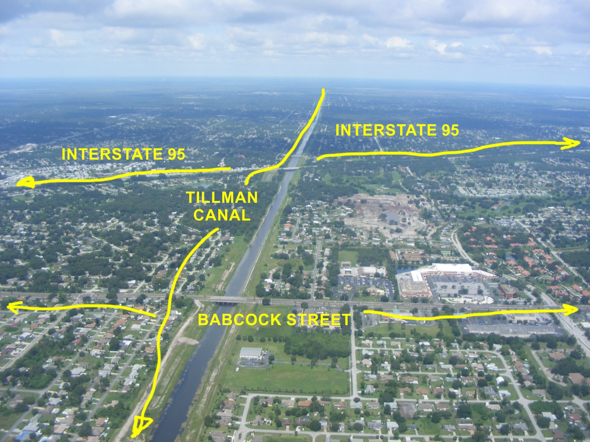
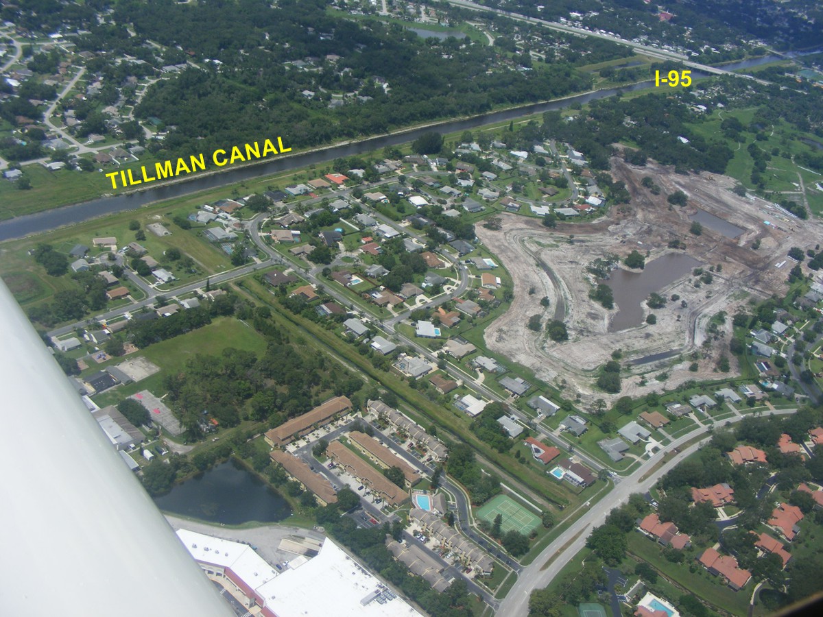
Babcock Street highlighted below is state route 507 seen in the map above
crossing I-95 on the way north to downtown Melbourne. The Melbourne
Tillman Canal drains a lot of farmland out west of here and is part of the Saint
Johns River water management district flood control infrastructure.
I have lined up for a photo pass along the NORTH side of the old golf
course construction area on today's flight.
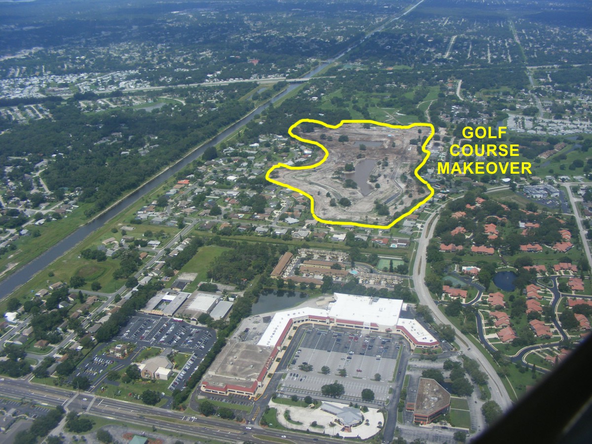
This photo was about as close as I could get over the site and not leave
anything out. These are "point and shoot" photos and hope you
get it right!
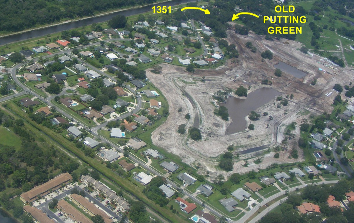
Here is a cropped section from the photo above with a little more
information. The house where I live is hidden by big OAK TREES. The old
putting green directly behind the house is becoming two building lots for new
homes. The GPS guided bull dozer lays out the roads. The surveyors
add the precise locations of the sanitary sewer system components. The storm
drains will empty into the Tillman Canal.
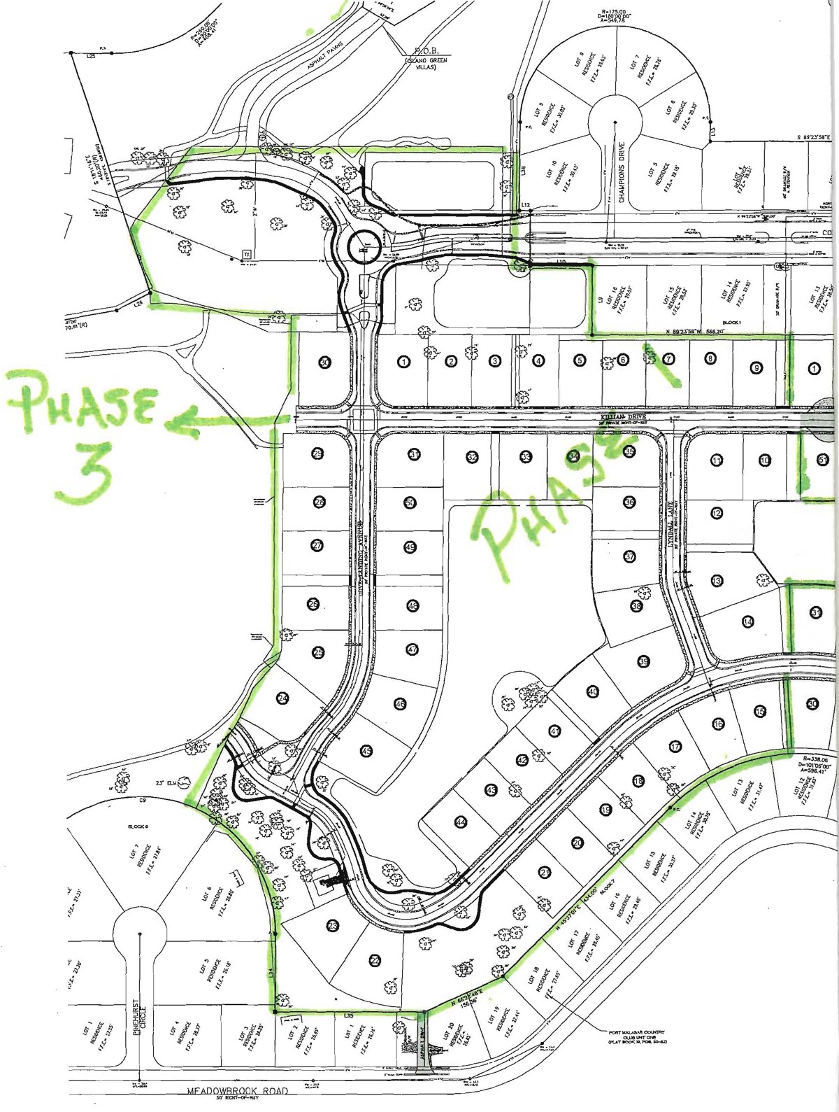
This map below is the site plan for part of the construction area seen in
the photo above. The original retention ponds from the old golf course
have been re-shaped to allow for home site lots.
After the photo shoot of the old golf course, it was time to head back to
the Rockledge Airport. I climbed up higher than the Melbourne Airport
Class D airspace and stayed west of I-95 until I was past the Patrick Air Force
Base Class D and lining up for my approach to Rockledge.
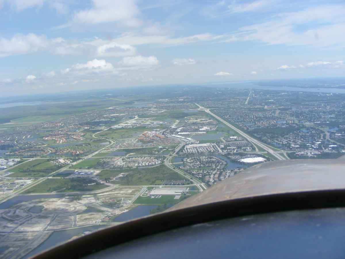
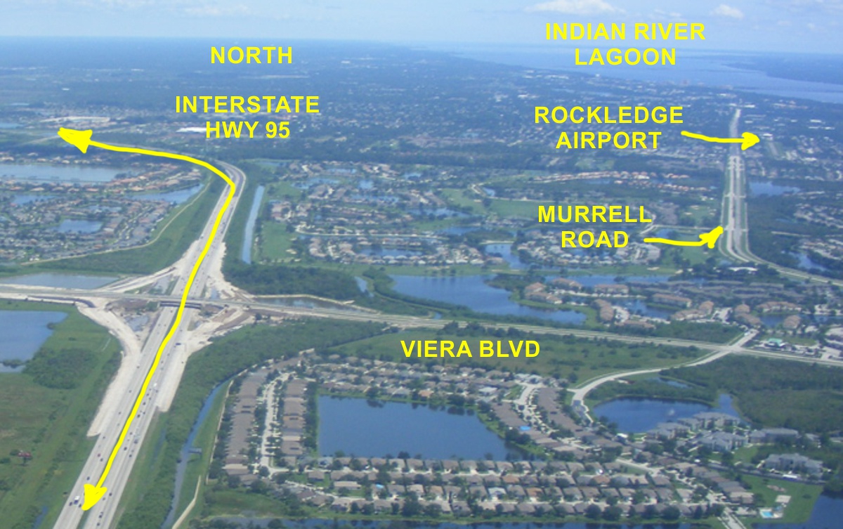
The area below is known as Viera and is south of Rockledge
This is a photo segment cropped from the wide-angle photo above.
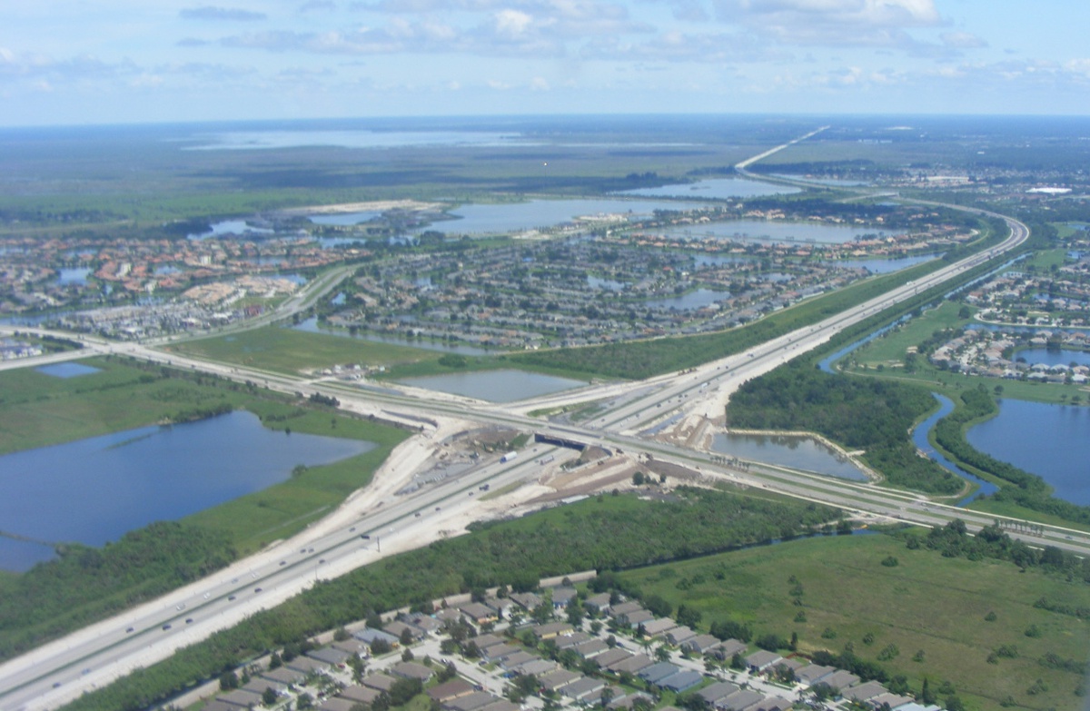
Another new interchange is being built in this end of Brevard County.
Murrell Road runs parallel to the Rockledge Airport runway. Billy told me about
using the southbound lanes for an engine-out forced landing. Viera
Boulevard is the main East/West road in the middle of Viera connecting US 1 to
the major North/South streets all the way to the western edge of the developed
area and the natural land to the west.
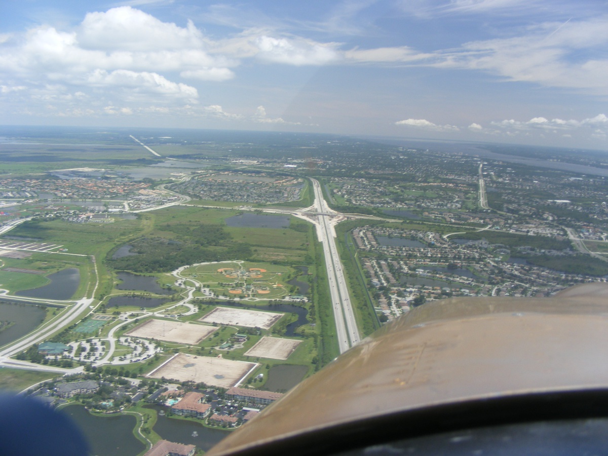
The overpass for Viera Boulevard has been here for a number of
years. This year an interchange is added to the interstate highway with
the new "on ramps" and "off ramps". This will relieve
the traffic congestion of the exits on the north side and south side of
Viera. This photo is taken from about 500 feet above ground while on my
approach to the Rockledge Airport.
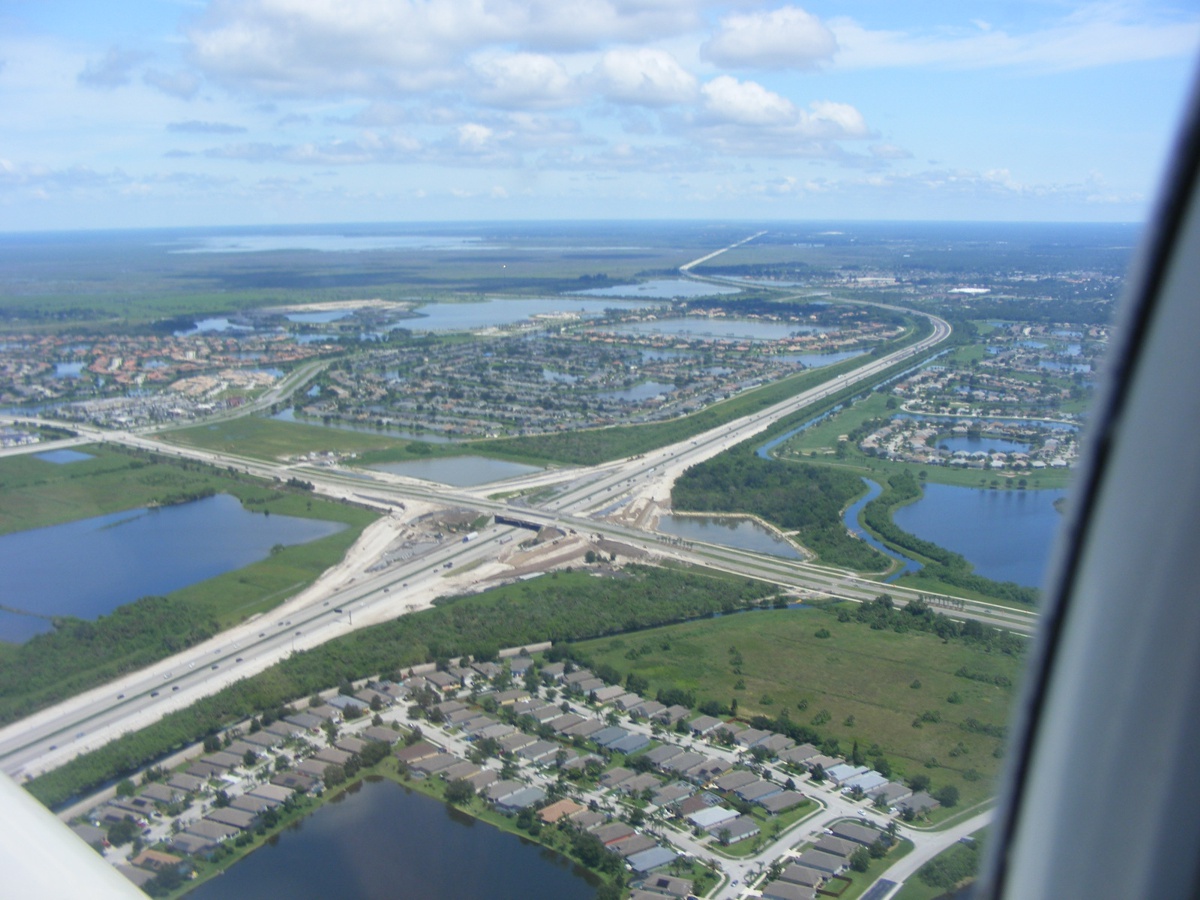
The photo above shows how all the neighborhoods have water retention ponds
for flood control when it rains very hard. Just a little bit of cropping
of the image above gives a different "feel" to the housing area at the
bottom of the photo below.
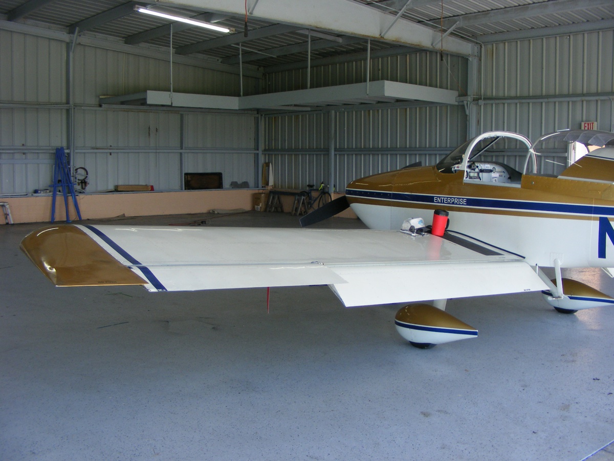
The nice part of having only three airplanes and an auto-gyro in the
hangar allows me to taxi into the hangar door onto the FLAT floor. My
airplane can then be turned virtually in the space of it's wing span.
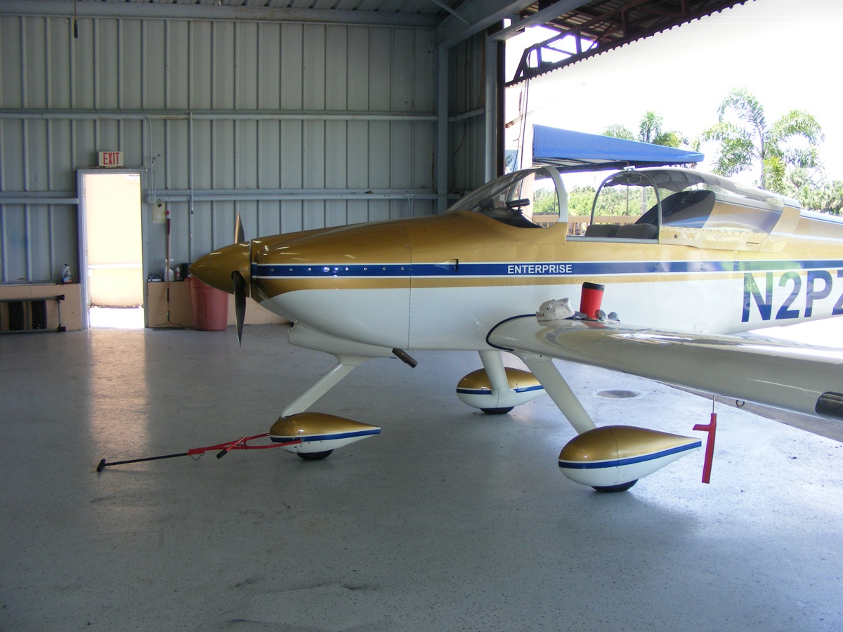
The "turn around" and a push with the tow bar will put the tail
of my airplane in that corner.
One hour gets added to the Hobbs meter today before I head over to Wendy's for lunch.
| CLICK HERE for PAGE 440 | Return to MAIN MENU |