December 28, 2014 / Umatilla and Morning FOG in Florida · · PAGE 385.
December 28, 2014: The flight today was over to Umatilla (X23) where I went for lunch with another pilot and reader of this web site. Kevin Torman sent his first email on December 23rd to introduce himself as a long-time follower of this web site. It was a good FIRST message from someone who is nearby. I sent my reply late that night and got a reply from Kevin on December 25. I was watching the weather and replied to him December 27 to let him know I could fly to Umatilla on Sunday, December 28th. The weather forecast for ground FOG on Sunday took a bit longer that I expected to clear the airport. Most of this posting is about getting there, but there is a surprise at the end of the two flights for today.
Before we jump into the details, I want to thank Bill Blackwood who lives here in Melbourne, Florida. He has read most of the airplane web pages and is a tech guy with similar past experiences with satellite antennas. He retired from Harris Corporation about four years ago and has learned to fly since then. He is working on his IFR ticket. I need to meet him and see how serious he is about the new RV-14 from Van's Aircraft. We exchanged emails on December 14 and another on December 29 while I am preparing this web page. Bill is in Virginia for holidays and we should be meeting some time next week.
I have learned more about using the Garmin program MapSource with the GPS
ground track from my 296. I can examine each GPS data point in the flight without
exporting the data to a spread sheet. The flight today was via a low-altitude path
under the Orlando Class B airspace between Orlando Executive (KORL) and the Sanford
Airport (KSFB) Class C airspace to the north. I cruised through there at 1,800 feet
MSL. I flew out the west side of the "tunnel" and found the fog on the
ground just west of Apopka, a northwestern suburb of Orlando. The Apopka airport
(X04) was completely hidden in fog. I was at 2,000 MSL cruising north to Umatilla
with GROUND FOG all the way. Here is the flight path across the Orlando area then up
to Umatilla.
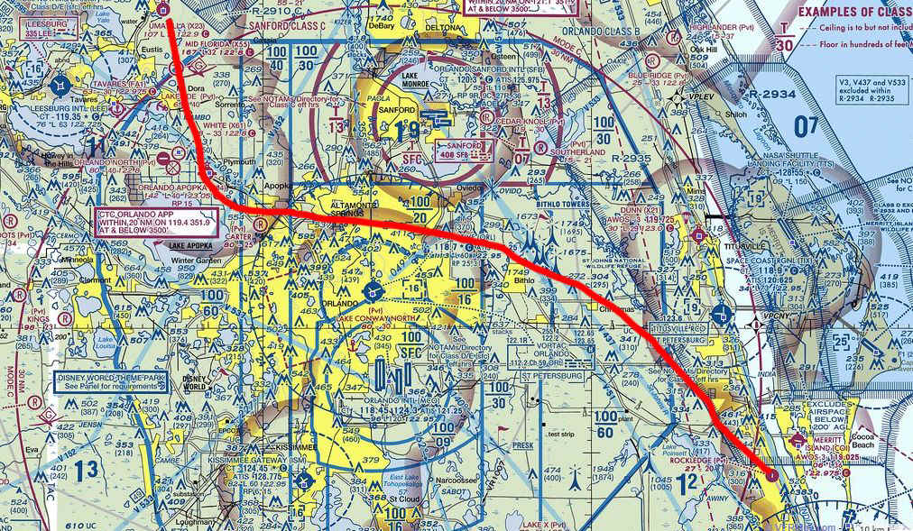
I imported part of the Jacksonville Sectional Chart and put a free hand line on
it representing my course seen above from an actual GPS ground track. There was
plenty to see along the way. This was the first time I tried this route in the
RV-9A. I found that the way points I selected through the "tunnel" worked
well with my autopilot to keep me clear of controlled airspace. I will take some
outside photos on the next trip using this route. The route was 21FA, SPINR, IPNEC,
X04, and X23 for the destination. Those two intersections are the GPS data base and
appear on the Terminal Control Area chart for Orlando Class B Airspace.
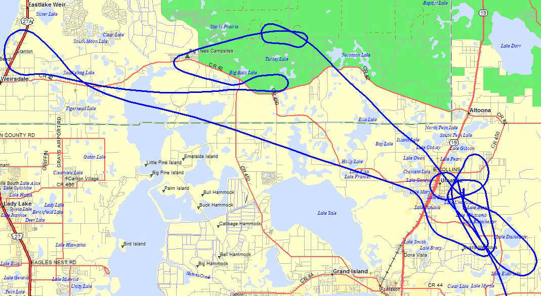
I arrived at Umatilla with plenty of ground fog. I made a few passes over
the airport with the GPS guiding me at an altitude of 2,000 feet MSL. I looked to the
northwest and saw the end of the fog and headed that way in case I needed to land.
Here is the path I took out and back to Umatilla. I listened to the ATIS
weather at Ocala to learn they had clear VFR conditions. By the time I got to
Weirsdale, the clouds were minimal. I turned back on course for Umatilla. This
time I found the low clouds were breaking up and I found a spot to make my descent for a
landing.
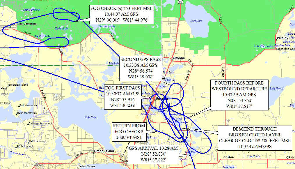
This map with notes will give you a better idea of my first and second arrival
at Umatilla. That "FOG CHECK" maneuver showed me the clouds went down to
ground level to create the fog over Umatilla. I had to get down below the western
cloud deck to see where the clouds went all the way down to the ground. When I
returned to the airport at 11:07 AM, the clouds were breaking up and I could see the
runway for a normal landing.
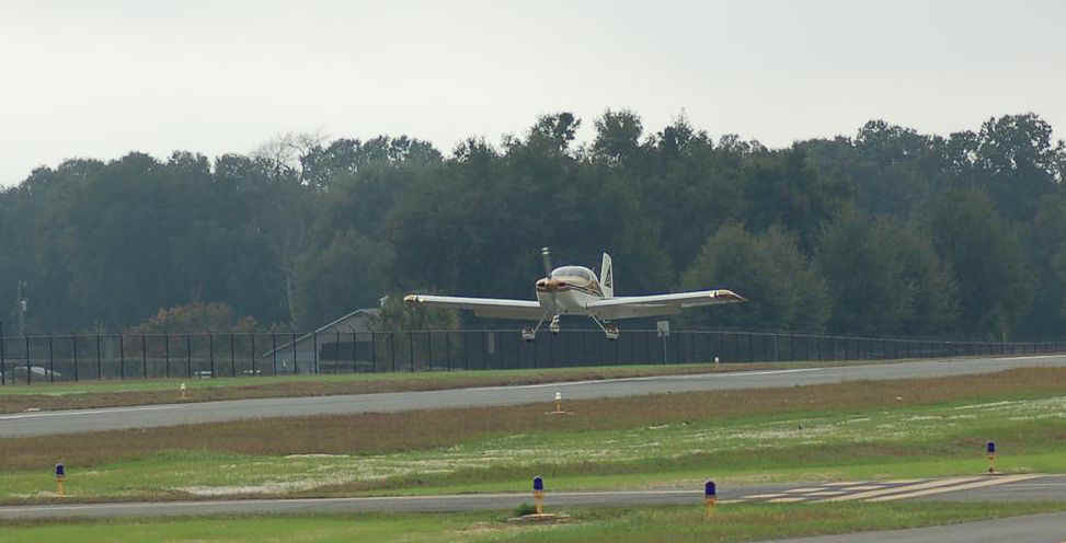
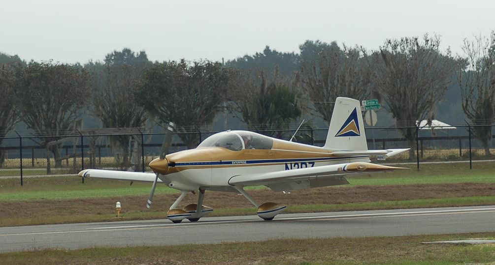
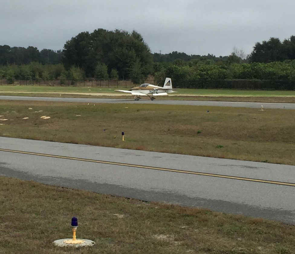
Kevin took this photo as I was on final approach at 11:08 AM, about 40 minutes
after my FIRST arrival above the airport covered with ground fog.
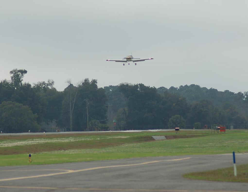
The very fast shutter speed of his camera "stops" the propeller in
these landing photos since the RPM is reduced on approach.

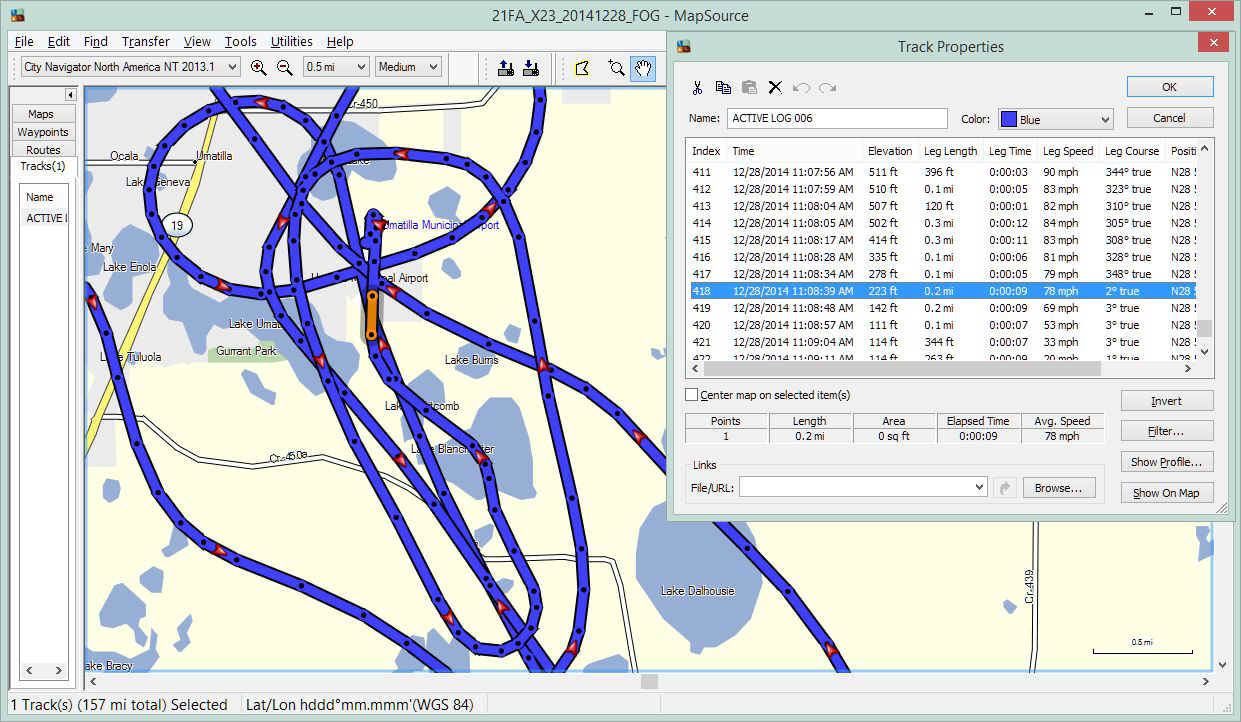
The screen capture below shows how I was able to get precise times for the maps and photos above. The field elevation for the airport is 110 feet above mean sea level. Look at the lines of data in the "Track Properties" window below. Look at the line that shows my speed at 53 MPH when I am firmly on the runway. The ORANGE line segment on the map corresponds to the line of data highlighted with BLUE in the Track Properties table.
The total ground track for my flight today was 157 miles when I had to fly west
to check the fog bank and where I could land if Umatilla did not clear up. I soon
found that several friends here were awaiting my arrival.
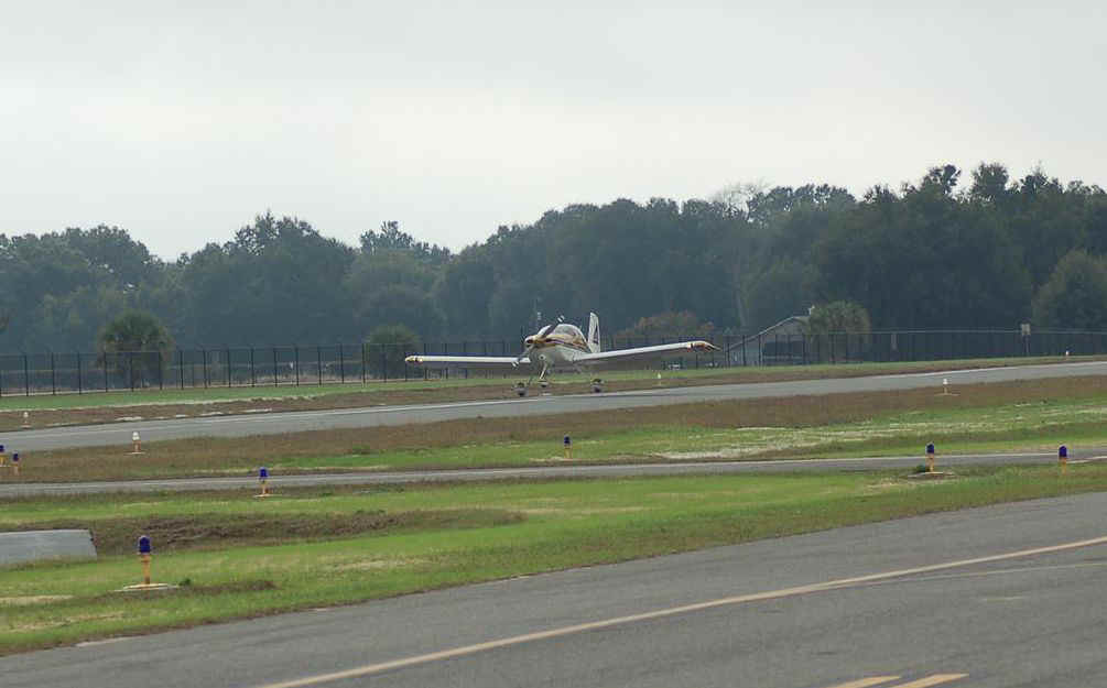
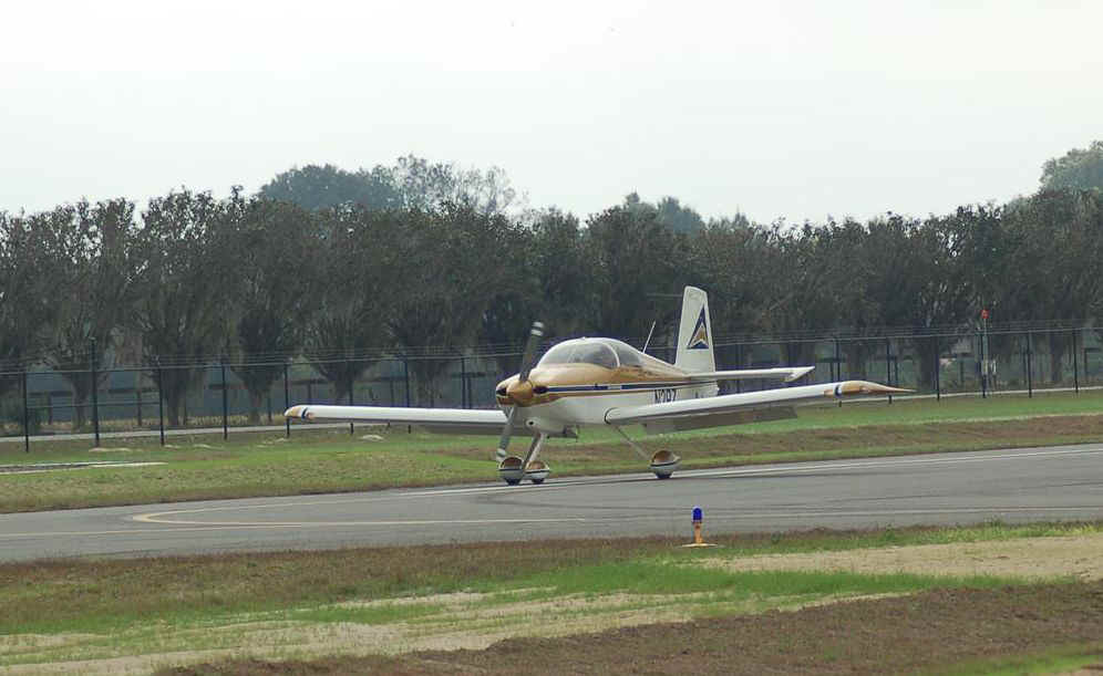
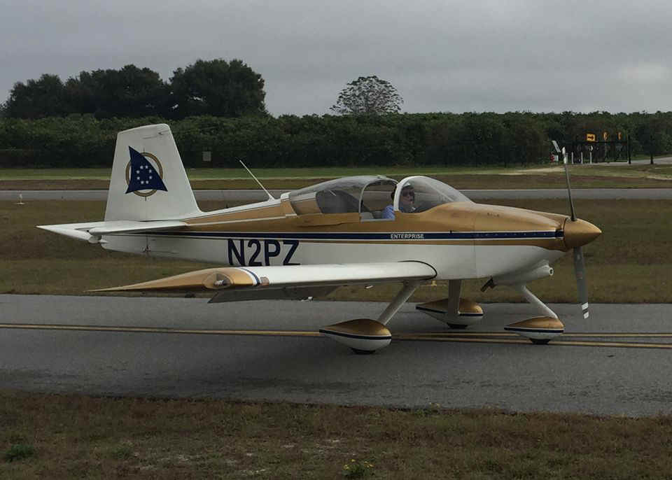
The propeller is still turning at low RPM and appears to be stopped by the fast
shutter speed of the camera.
I did not have a chance to get out before the first photo was taken for this
excited youngster.

I made sure he watched the ailerons and elevator as he moved the control stick.
His feet could not reach the rudder pedals, so I moved them as he was looking at
the tail of the airplane.

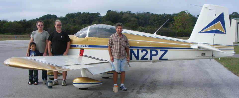
Here is the Umatilla Welcome Committee from left to right: Hunter Siblag
(age 8), Allen Moon, Steve Austin, and behind the wing is Kevin Torman, my host for the
day and email writer who prompted me to take the flight on this day.
| CLICK HERE for PAGE 386 | Return to MAIN MENU |