Summer Flying in Florida · · PAGE 378.
June 28, 2014: Today was my first Saturday flight after the official beginning of summer. This was a short flight down to the Valkaria Airport for a landing on runway 14 and a departure on runway 28 which was recently repaved and is now back in service. I did not take any photos from the air as the pattern had a couple of airplanes coming and going while I was there.
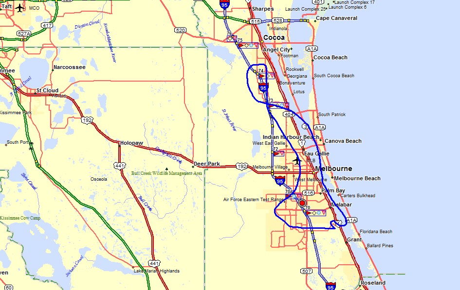
Here is the flight path today showing how I landed at Valkaria on runway 14 and
departed on runway 28 at the south end of the GPS ground track. (The maps were
posted on July 6, 2014.)
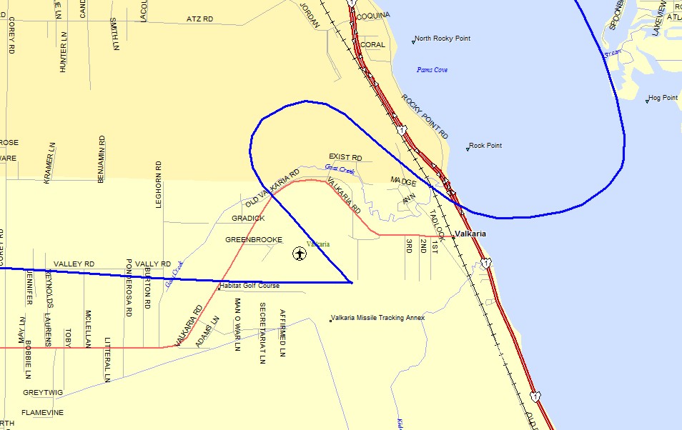
Here is the close view of the airport where I changed to runway 28 after the
landing on runway 14.
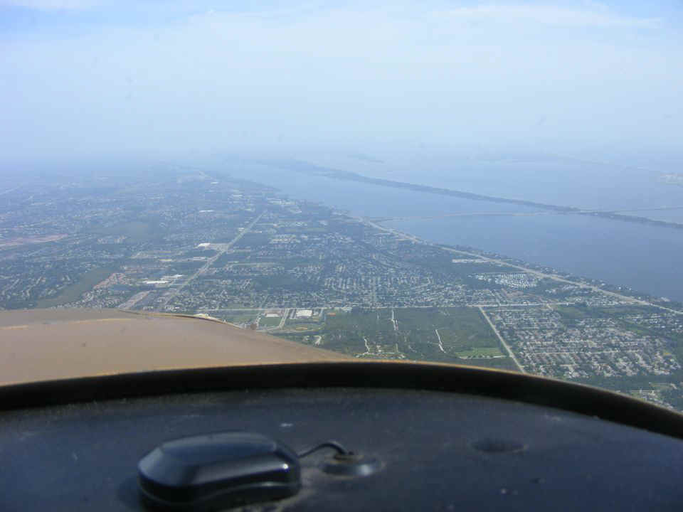
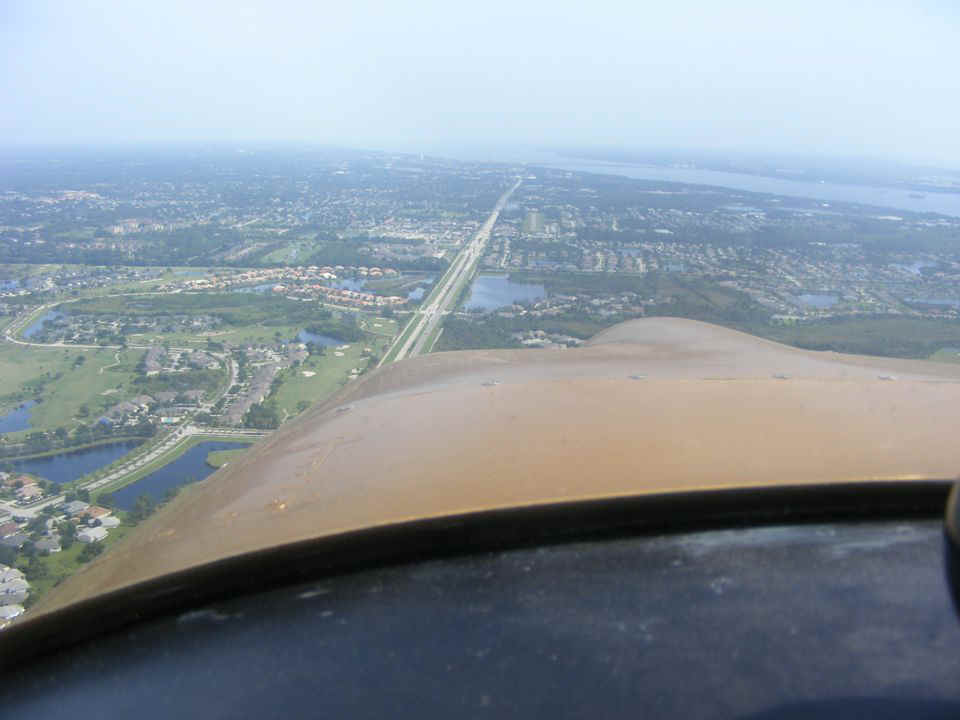
The photo below was taken during my return to the Rockledge Airport after I
passed over the Melbourne Class D airspace. The haze today reduced visibility.
This view is looking north at the Indian River and shows the long thin southern portion of
Merritt Island with the Banana River on the east side of the island. The Pineda
Causeway is barely visible heading east toward Patrick AFB.
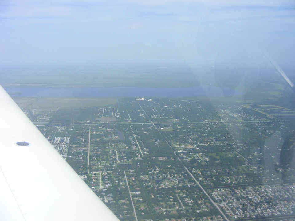
I turned my camera inland looking west to show the haze in that direction.
Lake Washington is visible beyond Interstate 95 running left to right across the
photo just beyond the fuel filler cap on the wing.
I took this photo when I lined up with runway 36 at Rockledge from about 3
miles south of the airport. The long 4-lane road is Murrell Road. Look beyond
the pond ahead to see the 2000-foot runway about half a mile north, just to the right and
parallel to Murrell Road.
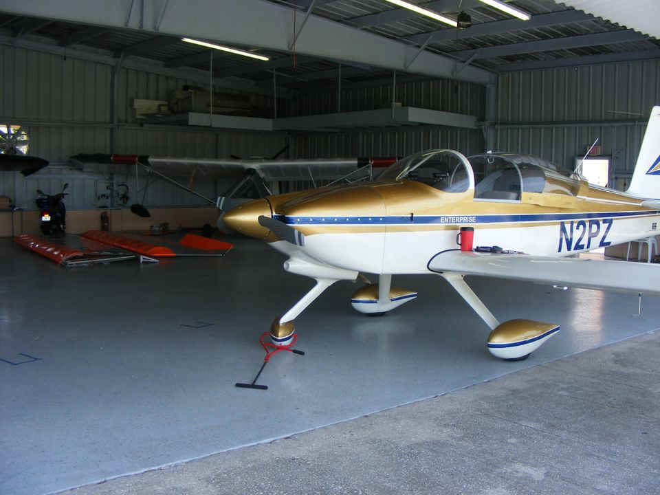
I taxied the airplane inside the hangar on the flat floor before turning it
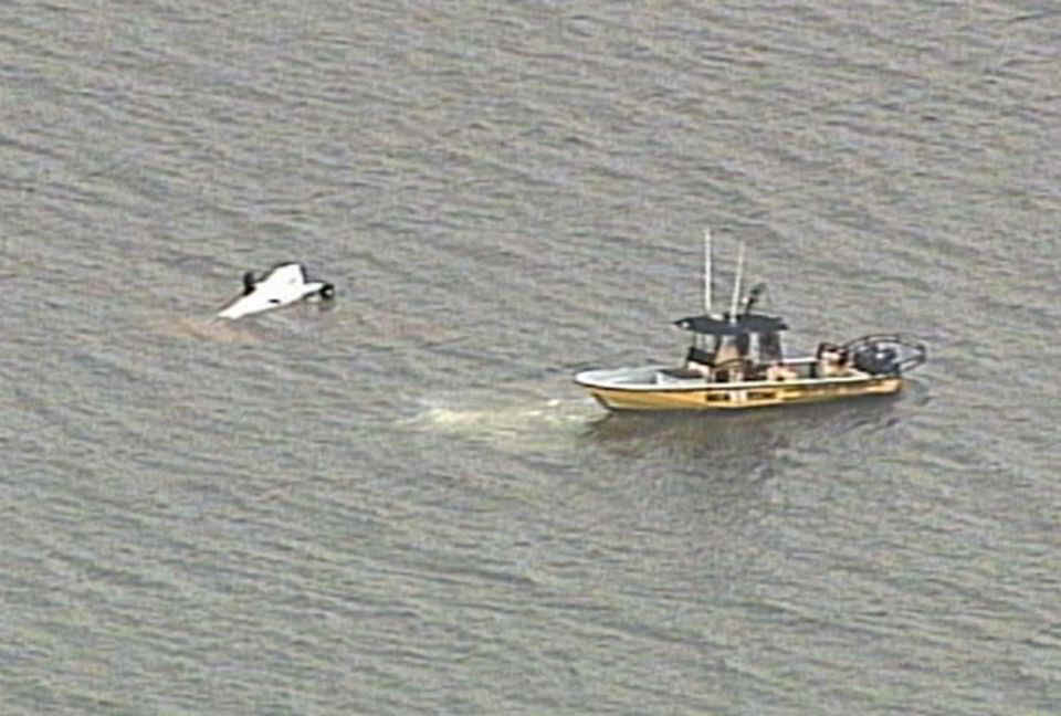
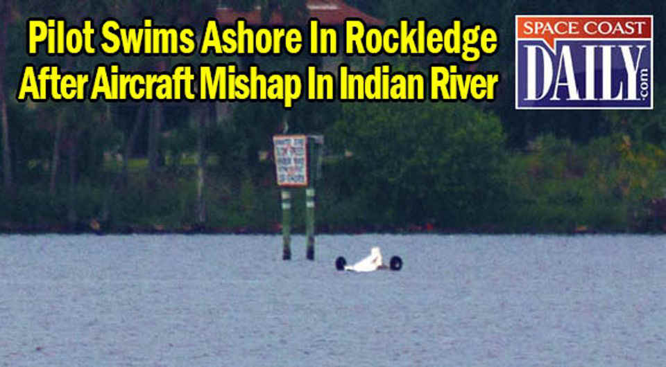
around with my tow bar to its usual parking place. That pair of wings on the floor
at the back of the hangar are from Bill's AV-II amphibian that was destroyed in a forced
landing earlier this week. He was out practicing water landings with another pilot
when the engine quit. He had a good landing on the Indian River all setup except for
the wake from a passing boat that could not be avoided as he stretched the glide as far as
he could. The airplane topped the wake and "bounced" back into the air
below stall speed and nosed into the water on the way back down and flipped over.
Bill and his passenger got out alright. The hull was cracked and folded
longitudinally. The airplane was headed for a sand bar in shallow water making the
swim to a safe spot fairly easy.
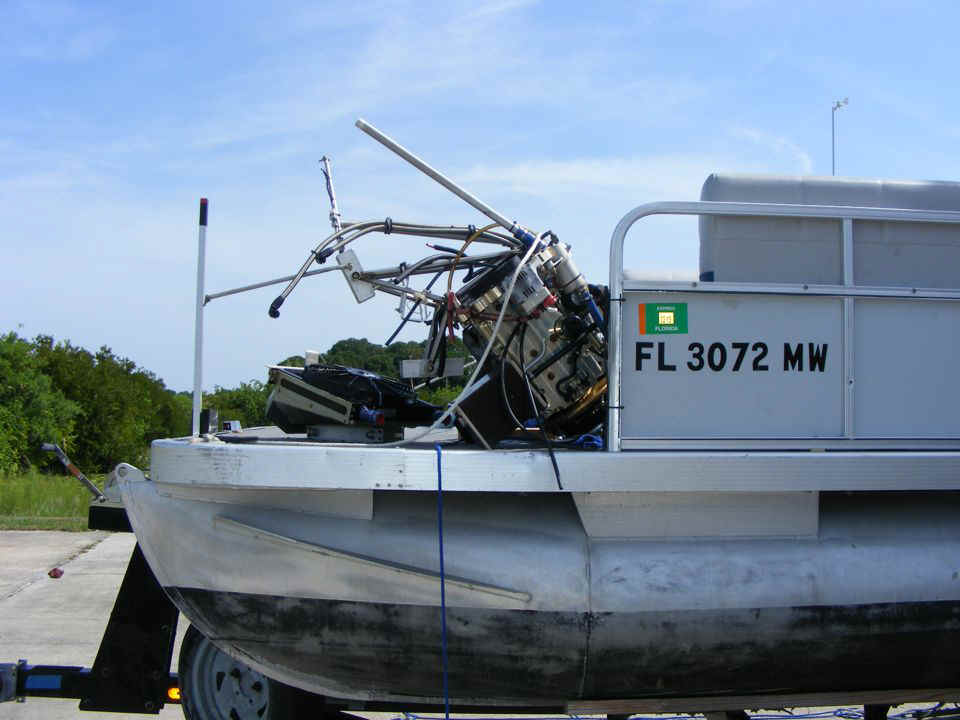
Here is a photo of the Rotax engine still on the deck of Bill's pontoon boat
after the salvage from the Indian River. The propeller was undamaged and was one of
the first things removed from the airplane when they got it turned upright, extended the
landing gear, then pulled the wreck up on the sand bar in the river. The only oil
that leaked was when the oil cooler was disconnected from the engine. That little
bit of oil dripped inside the aft fuselage area, not on the sand bar. Since this
incident happened on the water, the US Coast Guard has jusrisdiction for the event, not
the FAA.
Below is a photo from my previous web page showing what the airplane looked
like before the incident on the water. The bright orange and white color of the
wings made it clearly visible in the air or on the water.
Here are a couple of web site photos taken by local news outlets on the day of
the incident.
My total flight time today for the short trip down to Valkaria and back was only 0.7 hours added to the Hobbs meter. It was a good Saturday to go flying again with no troubles and a greased landing at both places today.
| CLICK HERE for PAGE 379 | Return to MAIN MENU |