April 2014 - Planes of Fame Air Museum · · PAGE 376.
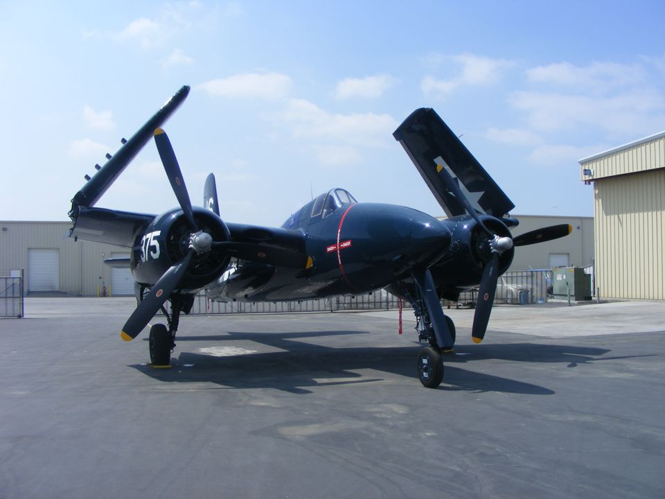
April 12, 2014: This is one of the few surviving
Grumman F7F Tigercats. It is a rare twin-engine piston fighter that never saw much
service from an aircraft carrier. Wikipedia has plenty of information about the
history of this design. Jet fighters replaced it in the 1950's.
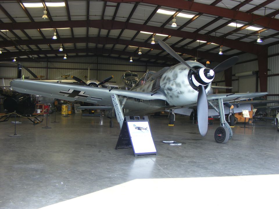
This German Focke-Wulf FW 190 survived from World War II in Europe.
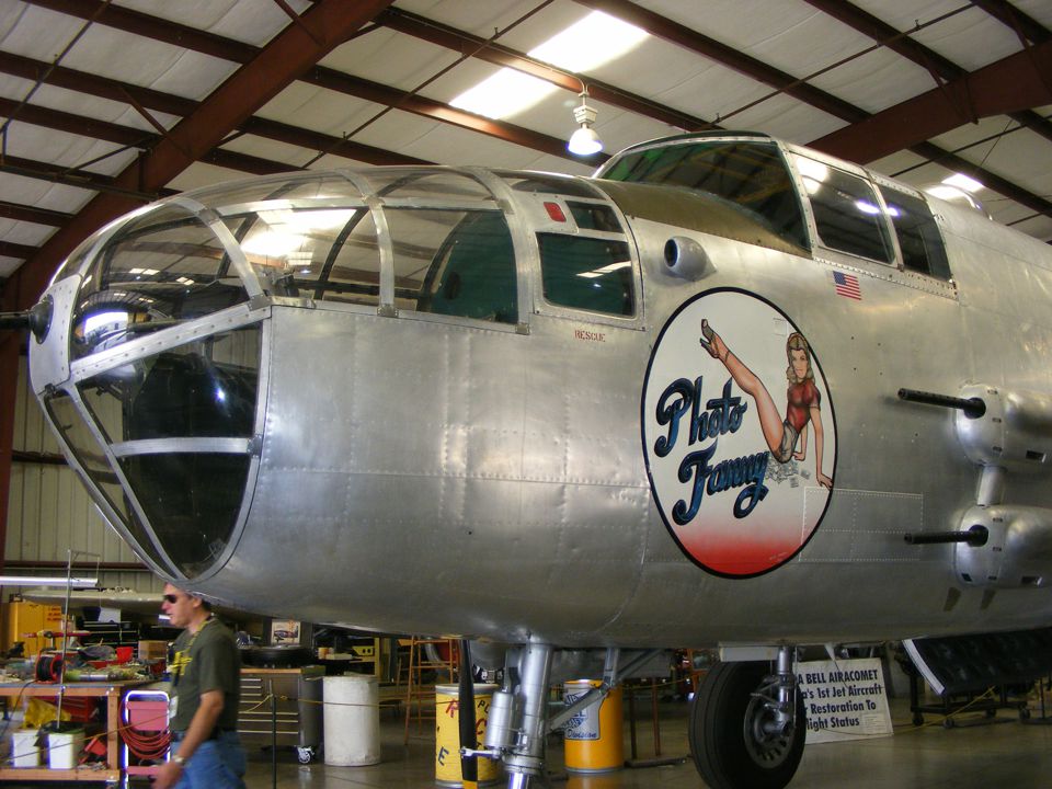
This B-25 is also flyable. Take a look at the sign below the B-25 in the
background. I walked around the nose and noticed the pieces of the first American
Jet aircraft, the Bell Airacomet P-59 that will be restored.
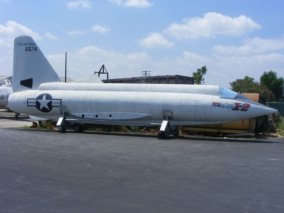
From the X-plane series is this Bell X-2, which is one of only two built.
The other one was destroyed in 1953.
Compared to these airplanes, my RV-9A is good for tooling around and
sight-seeing at 140-160 MPH. I had a one-hour flight on Saturday,
April 26 that took me over Brevard County and over near Kenansville, in Osceola,
county to the west. I flew across Palm Bay and near the Valkaria Airport before
climbing up to 4,500 MSL to clear the Class D air space of Melbourne and Patrick Air Force
Base before returning to Rockledge Airport.
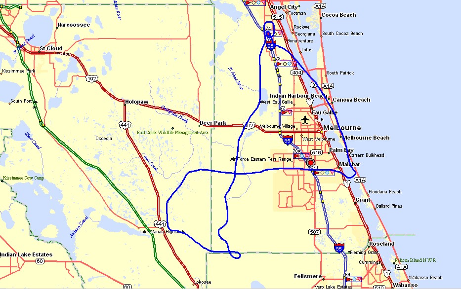
The Hobbs meter added 1.0 hours to a new total of 354.2 hours total time.
May 24, 2014 - Nearby Flying in Florida
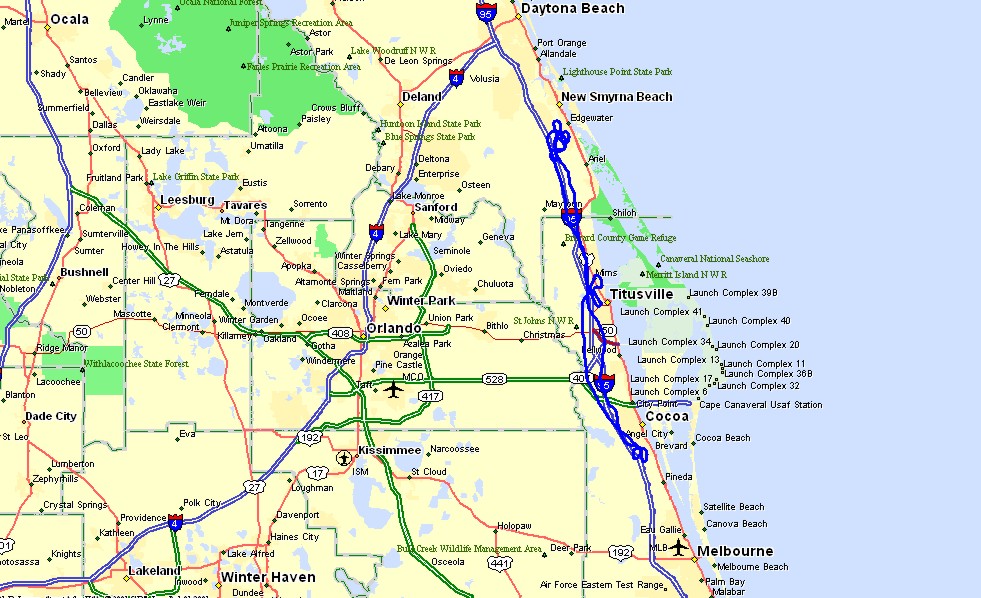
May 24, 2014: The flight this Saturday was north
of the home field to get some landing practice at two other airports. Massey Ranch
(X50) near New Smyrna Beach was my first landing for a full stop and back taxi on runway
36. There was only one other airplane on the ground doing an engine runup test when
I arrived. As I was departing the pattern, a Cessna entered the pattern to land
behind the departure of the other plane I had seen on the ground. This was my first
landing at Massey Ranch.
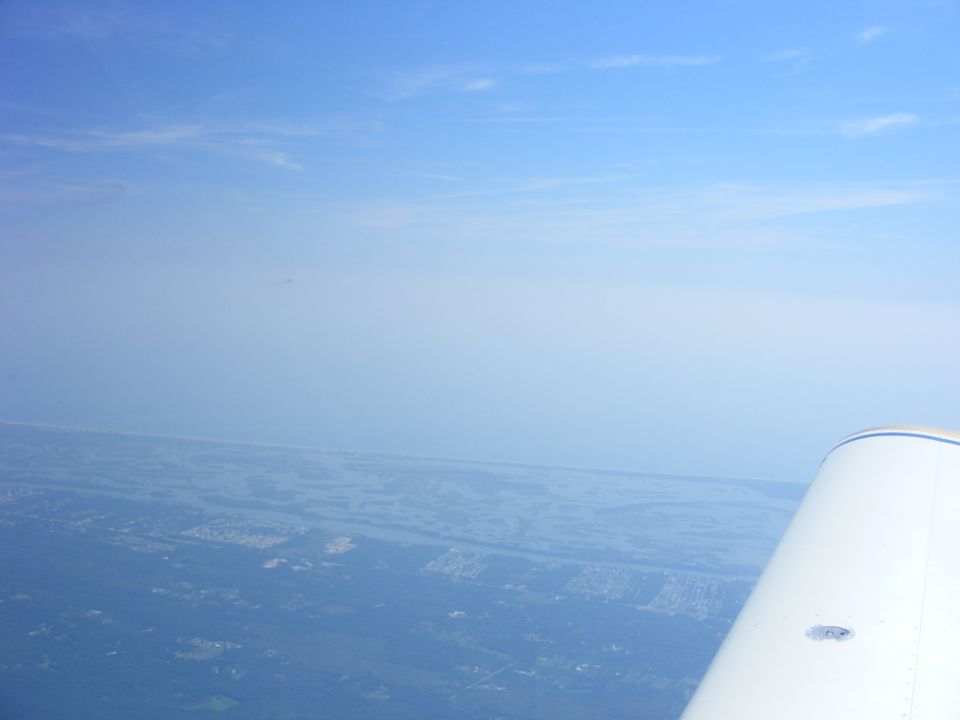
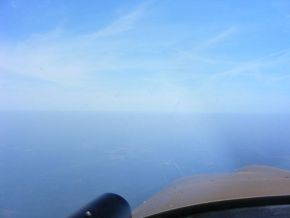
I noticed the haze in the air when I left Rockledge Airport. I decided to
climb up to find the top of the haze level. It topped out at about 6,000 feet MSL as
seen from this photo looking out over the Atlantic Ocean to the East.
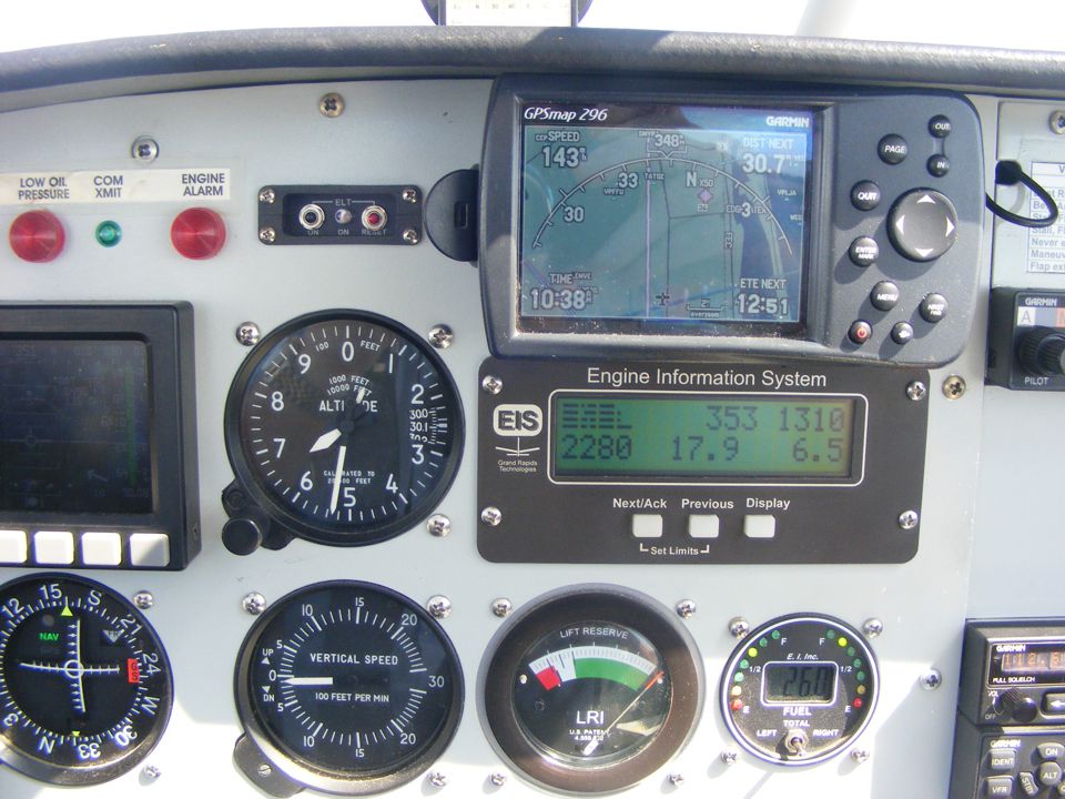
The altimeter is showing 6,500 feet MSL for a VFR cruising altitude with the
autopilot on course for the VOR located at Ormond Beach Airport. My old analog
NAVAID wing leveler always tracks about half a mile to the right of the GPS course line.
The morning sun coming in from the right side of the airplane adds to the glare on
the GPS screen.
The view looking ahead to the north shows Interstate highway 95 through the
haze below the nose of the airplane. You can see how clear it is above my altitude.
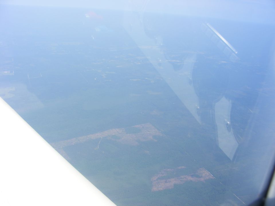
The view looking down 6,500 feet below shows how hazy it really is and how good
it is to be on top in clear air.
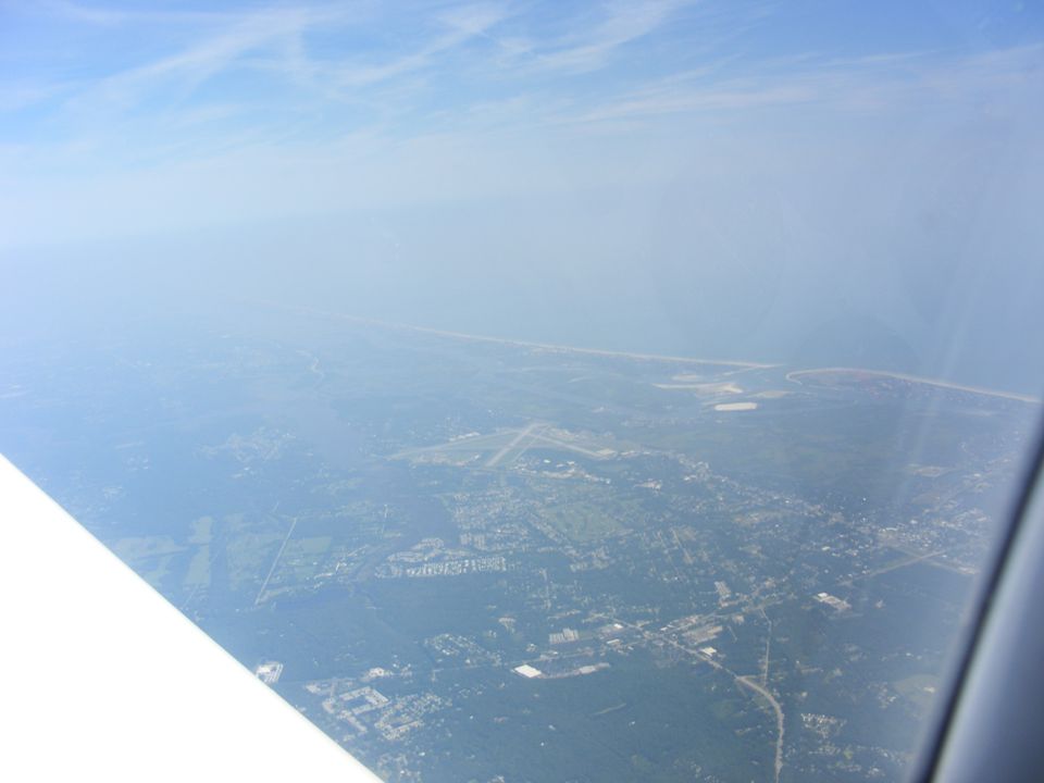
The airport for New Smyrna Beach, Florida (EVB) is just north of Massey Ranch
as seen from this vantage point at 6,500 MSL just before I start my descent to the airport
directly below my current location.
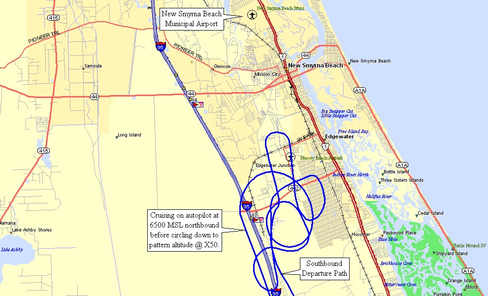
Here is a GPS ground track that shows my descent from 6,500 MSL to the Massey
Ranch airport and my departure southbound.
| CLICK HERE for PAGE 377 | Return to MAIN MENU |