Florida Local Flights · · PAGE 360.
October 21, 2012: This Sunday is the first
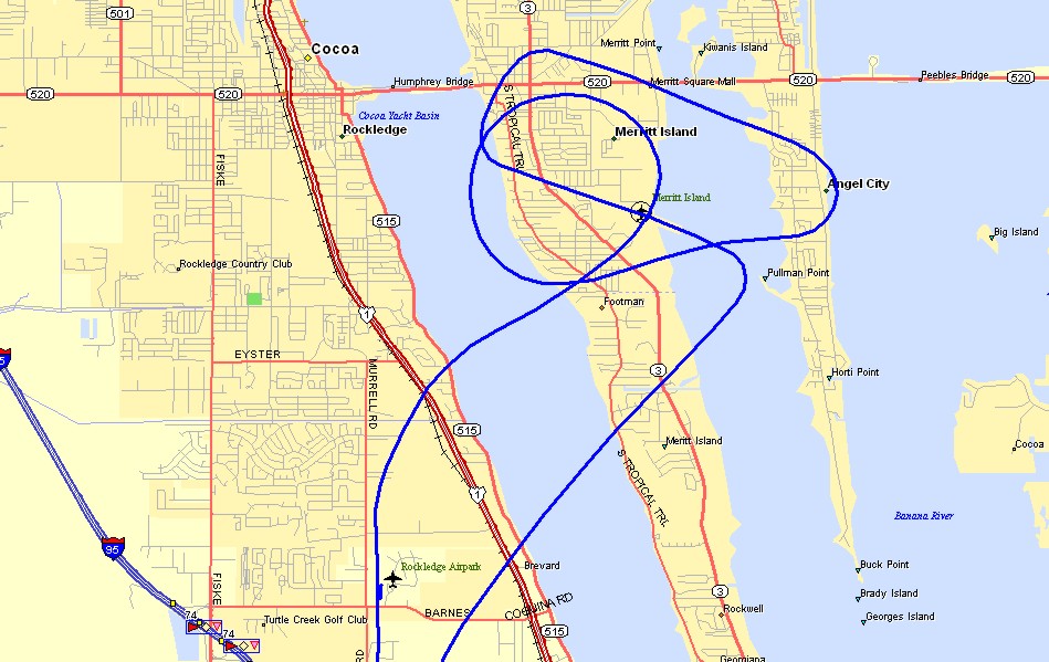
time I take a local flight in Brevard County in my airplane. The flight begins at
Rockledge Airport with a takeoff from runway 36 and a short flight of about five miles
over to Merritt Island Airport (KCOI). I circled one time over the field well above
the pattern altitude to get a look at the number of planes and helicopters that are active
here today. I could see the few airplanes working in the pattern and the one that
departed. I fell in behind the last guy in the pattern flying in a Piper Arrow and
flew the left downwind leg and turned base as he passed off my left wing on final
approach. When I turned final, the wind became an issue and I added more power to
get to the threshold. There was a flight of two Robinson helicopters lifting up on
the ramp just south of runway 11 just over half way down the runway. They crossed
the runway as I touched down on the numbers for a touch and go. I stayed on the
runway until they passed over to the north. I added power and took off over the
river and turned out of the pattern to the southwest to get out west of I-95 just south of
the Rockledge Airport.
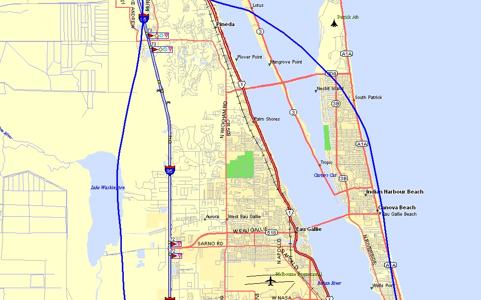
Flying down the west side of I-95 keeps me clear of the Class D airspace for
Patrick Air Force Base and the Melbourne Airport (MLB). I listened to the Melbourne
control tower as she worked a number of airplanes on this severe clear day. My
return to Rockledge was via the shoreline up to the air base where I flew over their class
D airspace above 4,000 feet MSL as I turned away from the ocean.
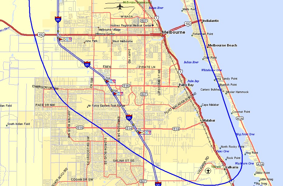
At the south end of my local route, I flew over an abandoned air field listed
on the map as Air Force Eastern Test Range. I descended over the Valkaria Airport to
see no activity there. Before heading north along the beach. I called the
tower at Patrick AFB since I was hearing him working an airplane flying in his traffic
pattern.
The landing back at Rockledge was on runway 36 into the wind. The sock
was straight down the runway there when I touched down. I had the camera in the
airplane, but did not take any photos from the air as I was too busy at Merritt Island
Airport and just getting a good look at the area when I was flying down past Melbourne and
back up the beach. The Hobbs meter added 0.9 hours today and 2 landings went in my
log book.
The Enterprise now has 338.7 total hours on the Hobbs meter. My total flight time is now 530.8 hours with 722 landings in my pilot log book.
November 10, 2012: I
really went somewhere in Florida today, not just "around the block" as I did
above. There was a fly-in for lunch today at the Winter Haven, Florida
airport. I headed over that way from Rockledge Airport at 10 AM. I had a 20
MPH tailwind in the first leg of the flight heading southwest from Rockledge Airport.
The GPS ground speed varied between 130 to 150 MPH during the trip to Bartow.
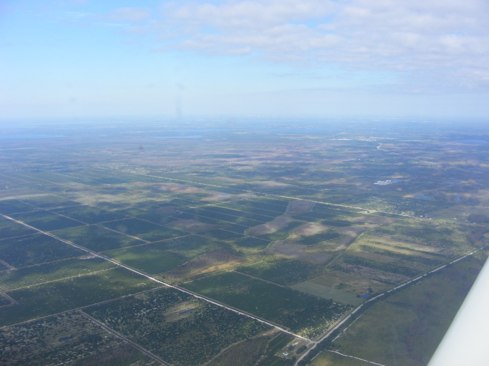
I took this photo of farmland off the beaten path down south of the Orlando Class B
airspace. The city of Orlando is hiding in the haze about 30 miles north of this
location. The water management canals like the one just ahead of the wing in this photo
are part of the flat lands of Florida.
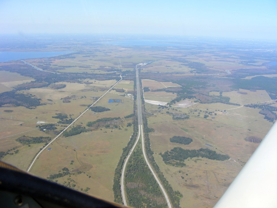
This photo is looking northwest of my position over the Florida Turnpike in
Osceola County south of the town of Saint Cloud. The Canoe Creek service plaza is at
the turn in the highway just north of that canal running across this photo. The
two-lane highway in the photo is county road 523. Cypress Lake is on the left side
of the photo. Lake Tohopekaliga or "Big Lake Toho" as it is referred to by
the locals from Kissimmee, Florida. Kissimmee is located at the northwest corner of
the lake in the haze beyond the curve in the turnpike. The land below is grazing
land for cattle and there are some chicken houses down there that are visible when driving
in this area. You can also see an occasional BALD EAGLE down there near one of the
lakes.
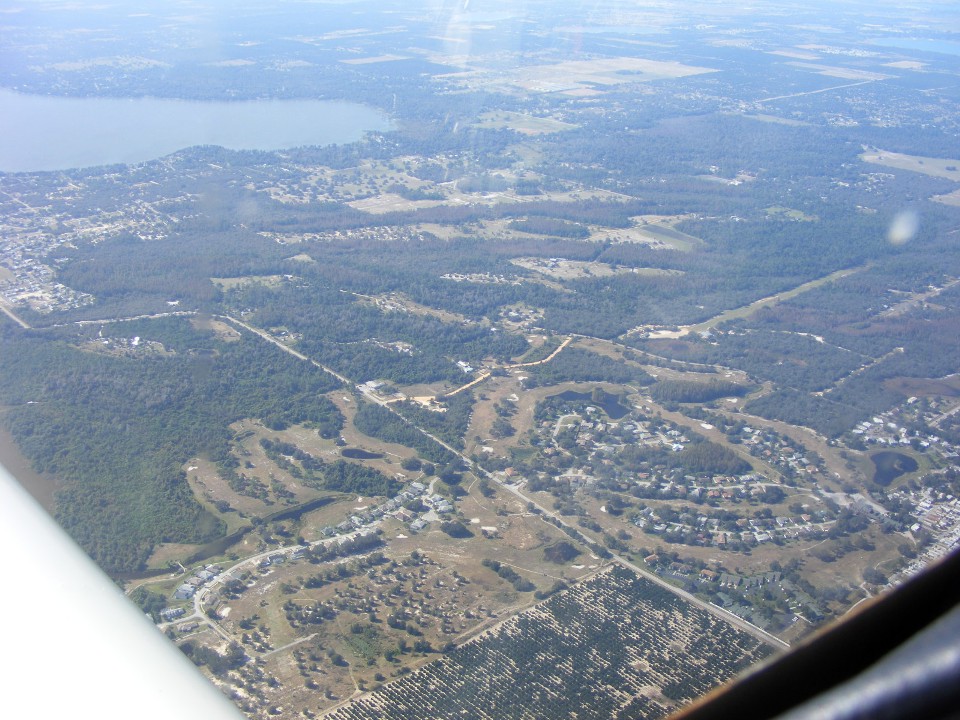
This short trip today was flown using the Orlando Terminal Area Chart and my
GPS of course. That is Lake Pierce below and the private grass air strip known as
Southerly Airport (58FD) a few miles east
of Dundee, Florida. My GPS and autopilot were keeping me on course as I flew in the
uncontrolled airspace between the Avon Park Bombing and Gunnery Range south of my route
and the Orlando Class B Airspace to the north. I was using the Orlando chart to
answer the question of where could I land if I had a problem. I noticed the private
airport ahead on the chart and made this photo as I passed near it. The green runway
is beyond the golf course and ends near the bug smeared on the windshield at the right
side of this photo. I have since added the private airport to my GPS waypoint
database.
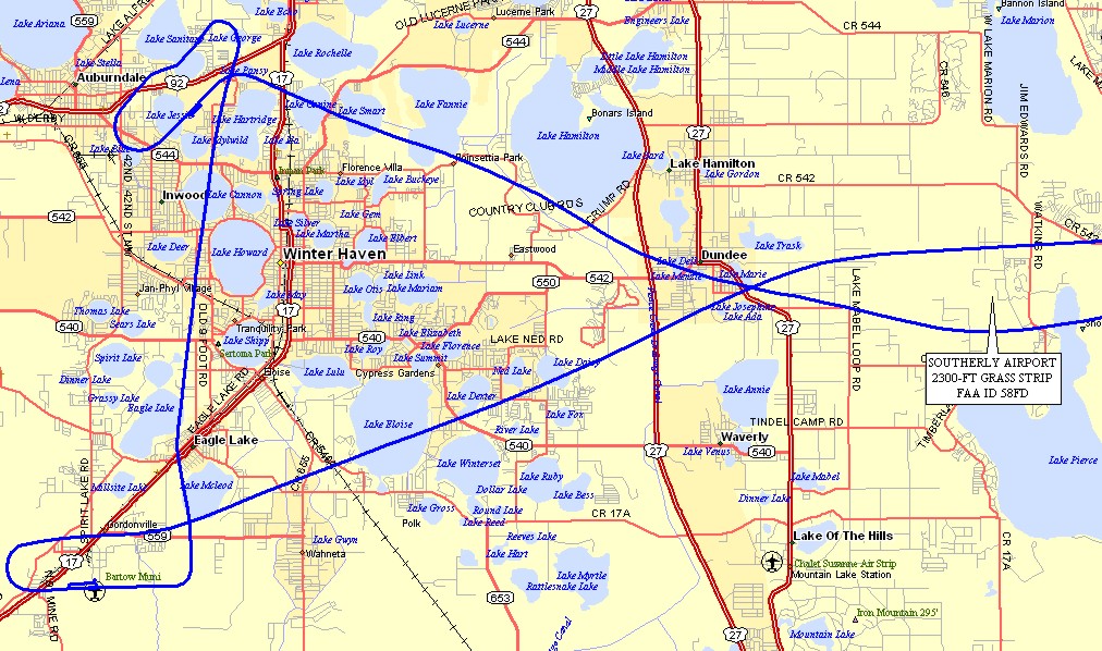
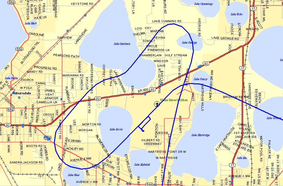
Here is a streetmap showing the Southerly Airport 2,300-foot grass landing
strip, the fuel stop at the Bartow Airport (KBOW), the Winter Haven Airport (KGIF, Gilbert
Field) where the fly-in luncheon was held. The distance from the Bartow Airport to
Gilbert Field is about eight miles. This map shows part of Lake Pierce near
Southerly Airport.
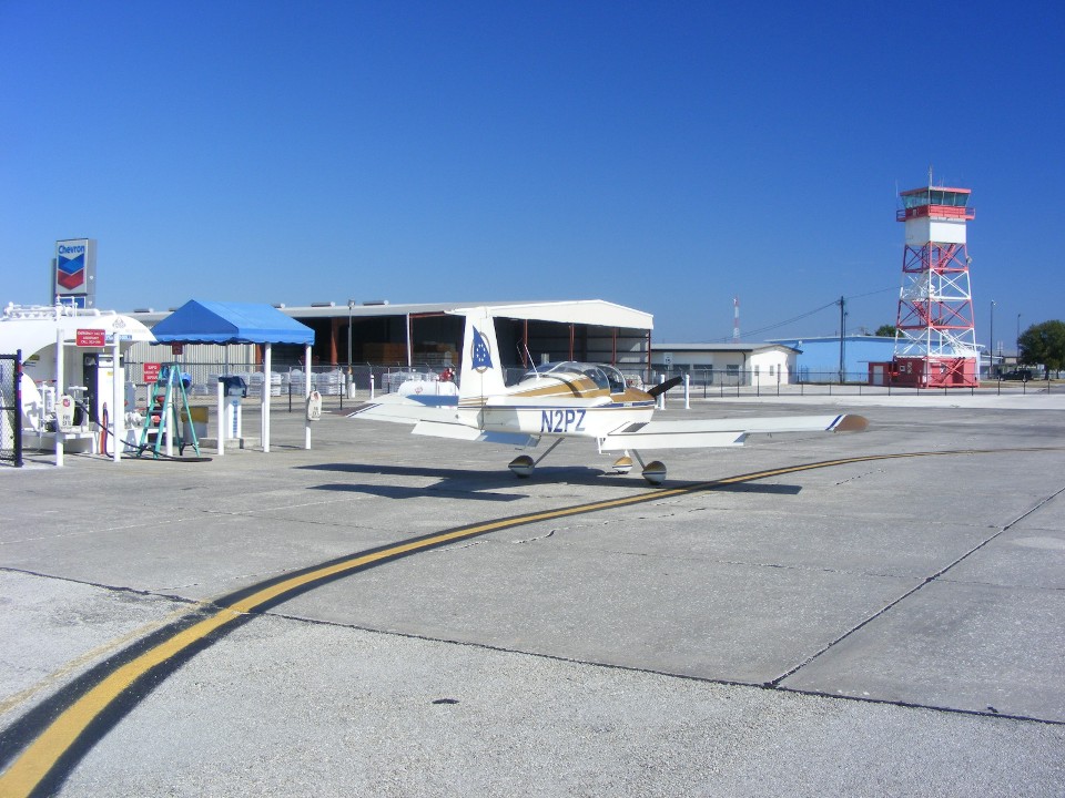
My stop at the Bartow, Florida airport was to get fuel. I filled the
tanks with a purchase of just under 22 gallons of 100 low-lead AVGAS. I last bought
fuel at the Hazlehurst, Georgia airport (KAZE) during the flight to Florida October 7,
2012. This fuel stop was from 10:40 AM to 11:00AM.
My GPS ground track shows the modified pattern I flew for runway 5 at Winter
Haven. I needed to see a plane below me I heard on the radio as I was flying the
downwind leg, then extended my downwind to let him land ahead of me. The ground
track comes from Bartow at the bottom center of the map and indicates the taxiway and my
parking location on the field near the end of runway 5 at 11:16 AM when I turned off the
GPS. Some of that 16 minutes was on the ground at Bartow before takeoff and of
course the time to get in the pattern, land, then taxi to my parking spot. My
departure after lunch at 1:22 PM is turning East at the right side of the map.
| CLICK HERE for PAGE 361 | Return to MAIN MENU |