Flying North of Atlanta · · PAGE 263.
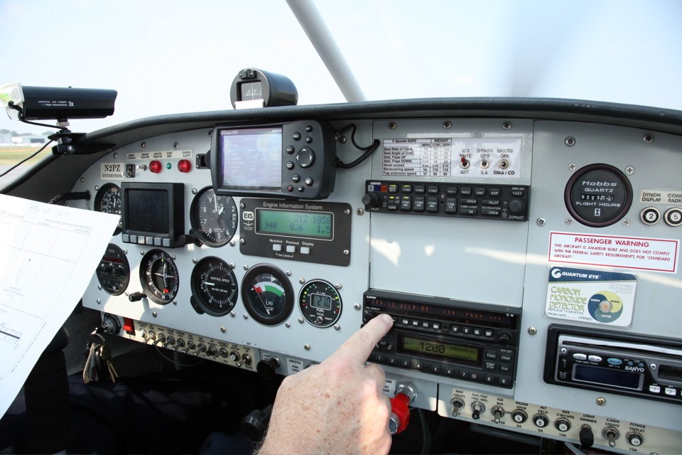
August 17, 2008: I was giving an explanation
of my actions to Dale as each preflight and engine startup step is accomplished. At
this point, the engine is running at 940 RPM with the blurred prop visible out front.
I am reading from the airport diagram I downloaded from AIRNAV.COM for McCollum
field and tuning in the ATIS for the airport before I contact ground control to request
permission to leave the ramp for the runway.
The fuel gauge shows 21 gallons total fuel on board. The COM radio
numbers are not legible due to the shutter speed vs. pulsed refresh rate of the display
characters on the Garmin SL-30 radio. The LCD display on the radar transponder and
the fuel gauge are readable since liquid crystal displays use very little current for the
display. The LCD symbols are turned on all the time. The mixture is not full rich to
avoid fouling the spark plugs while taxiing on the ramp and taxiway Alpha.
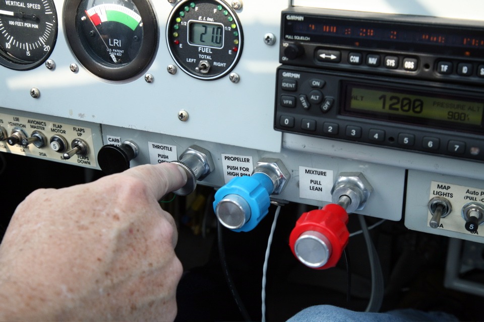
This photo was taken as the airplane is rolling on the runway with the nose
gear off the ground and we are just becoming airborne. Check the needle low in the
green zone on the LIFT RESERVE INDICATOR. The RPM is at 2640 and the fuel flow rate
shows 12.6 gallons per hour with the boost pump switch in the ON position near the RED
master switch. Dale is using a zoom lens on his camera and it is currently in the
wide-angle mode. With the nose up, the fuel gauge shows 23 gallons. I
originally calibrated the electronic fuel gauge with the airplane absolutely level by
putting in fuel in three-gallon increments.
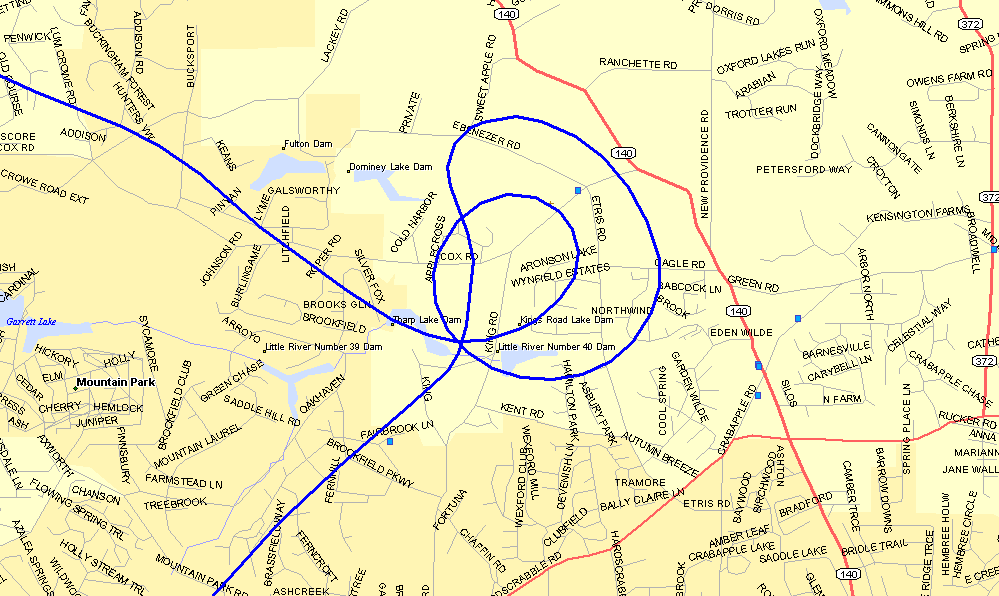
This is the first photo taken looking West as we make the first turn around his
house near Roswell, Georgia. His house is in the trees on this side of the fish
pond. You can see a 200-foot tall tower coming up out of the trees near Dale's
house.
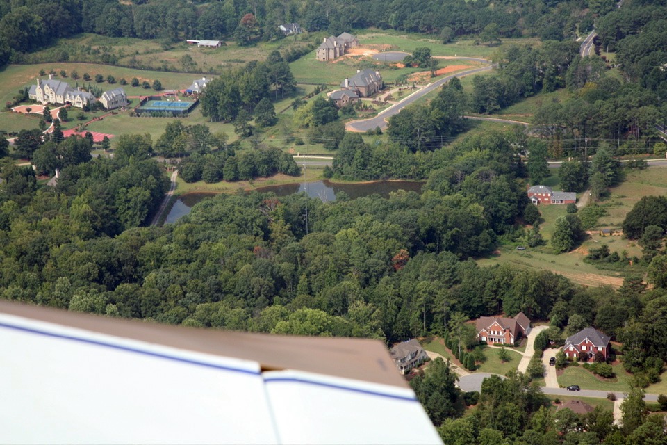
His little man-made pond is not on my digital map, but you can see where we
came in from the southwest and made two turns around the house. The first one was a
shallow 30-degree bank and you can see from the photo above it was too far away to see
down in the trees. My next pass was made using a 60-degree bank angle, just like all
pilots have to demonstrate in their initial check ride and each biennial flight review.
I explained this to Dale to assure him it is a standard maneuver. When we
rolled out after the second pass, he commented about feeling the G-forces. I really
did not notice the 2G's that come with the 60-degree banked turn. I was too busy
executing my "turn around a point" maneuver while he snapped the following
photos below.
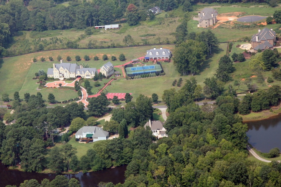
The neighbor across the road has quite an estate as you can see in this photo.
Or is this a tennis club with parking near the street?
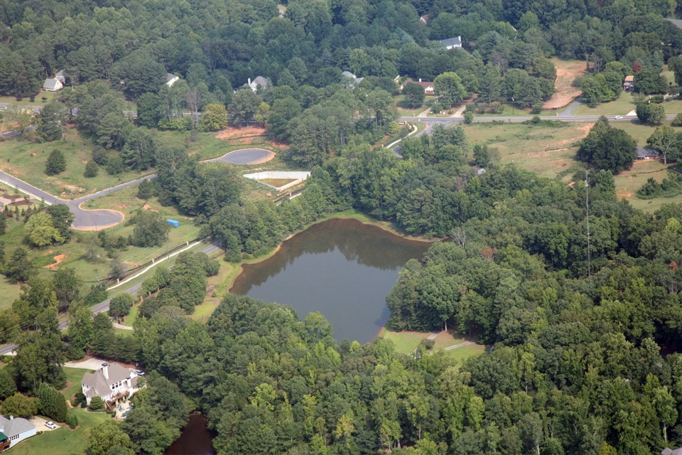
Here is a shot with the fish pond coming into view in front of the right wing.
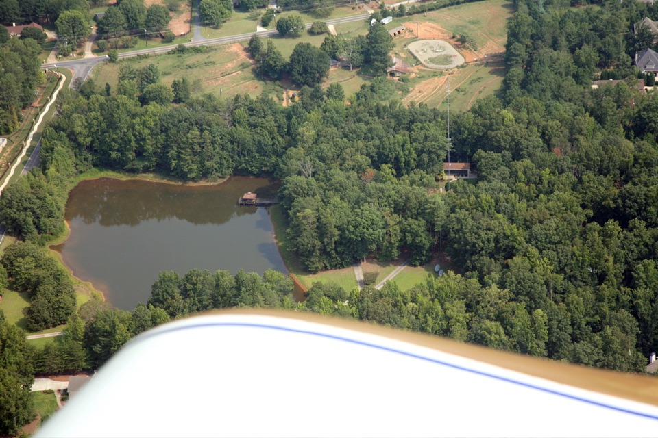
This view looking north reveals two satellite dishes near Dale's driveway, and
the workshop out behind the main house. The 200-foot tower is visible in front of
the workshop. You also get a good view of the pond west of the house. The zoom
lens on his camera is doing a good job here.
| CLICK HERE for PAGE 264 | Return to MAIN MENU. |