Oshkosh AirVenture 2006 · · PAGE 221.
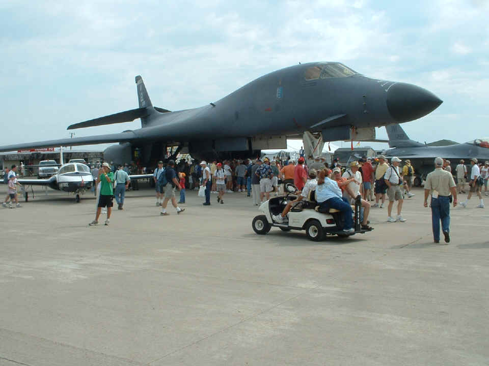
July 25, 2006: Look at this! The U.S.
Air Force flew in a B1-B supersonic bomber from Ellsworth Air Force Base, South Dakota for
display in AeroShell Square. You can see that Wendell is going over to get a closer
look at this BIG sleek airplane. We had a chance to talk with one of the crew from
this airplane and learned quite a lot about the B1-B bomber. That paper work in
Wendell's hip pocket consists of data sheets about various products and a quote for a
Dynon D10-A and accessories. He got a show special on the Dynon unit, and on a kit
to convert one of his Dave Clark headphones into a unit with automatic noise reduction
circuitry. Guess who gets to do the electrical work on that project (ME). I
was considering getting one of those ANR kits for my old Peltor headphones. Now I
get a chance to try out the kit in Wendell's headphones.
With all the photos that are on pages with the date of July 25th, you can tell
that I left my camera behind at my tent on Monday, July 24th. After lunch we went
back to the vendors booths to verify that Wendell's old Dave Clark head set would accept
the ANR upgrade. Then it was off to see the sales manager at Pacific Coast Avionics
to get the deal on the Dynon D10-A. He had to pay by check to get the deal, but
Wendell had come with a blank check in his wallet just for such an opportunity. The
guy offered to give us the unit right there, but we declined since the airplane was so
fully packed. UPS shipping was included with any orders placed at the show, so we
took the offer of free shipping.
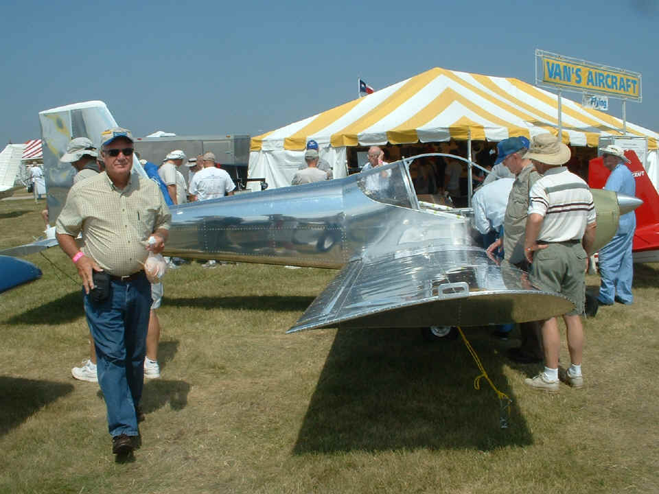
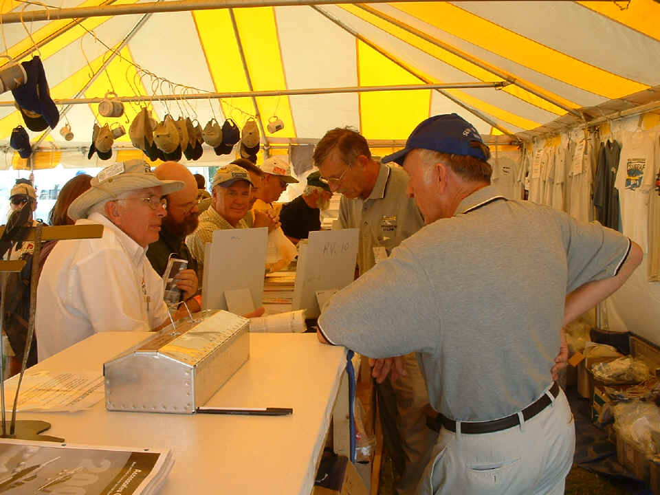
We stopped by the Van's Aircraft booth to find the prototype of the RV-12, a
light-sport aircraft that can have the wings removed for trailering to and from the
airport as needed. Wendell just happened to step into my photo as I was taking this
photo. He had been looking at a customer-owned RV-10 with air conditioning installed
in it. That is the RV-10 wing tip at the left edge of the photo.
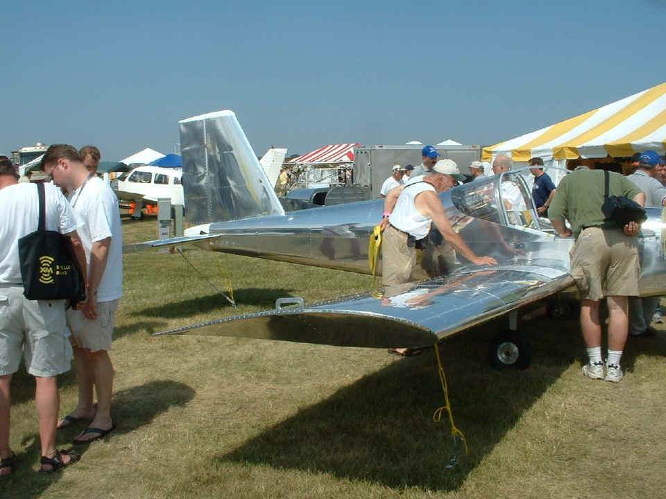
From this camera angle, you can see the RV-12 tail cone is made of fiberglass.
It is a first for Van's airplanes. The airplane is assembled with pop-rivets
only, with no solid rivets in this thing.
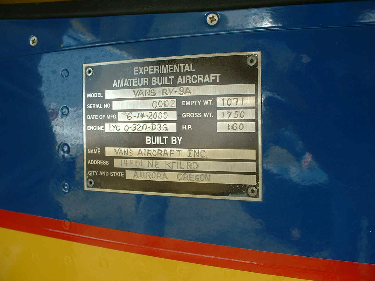
The original blue and yellow RV-9A was also on display. This is the first
one built from a true RV-9A kit. The first one was built as an RV-9 tail dragger
with an 0-290 engine installed in it and was later converted to a nose-wheel model and the
engine was upgraded to an O-320. This one was built originally as a nose-wheel
airplane with an O-320 160 HP engine.
Wendell has already had his photo taken talking to Van with his camera. I
came to the "side door" of the tent later to snap this photo.
When the day was over, Wendell had placed his order for the Dynon D10-A, and we
sat through a video lesson on the Garmin GPS 396 to pick up some additional hints on
things we had not yet discovered. After that class was over, we headed off to join
the folks from home for a steak dinner in Appleton, away from the Oshkosh crowds.
Later that evening, it rained again when I was just getting settled on my air mattress in
my tent. That was when I thought of the phrase "rain drop rhapsody" and
wanted to share it with you in these pages.
Shortly after I took the photos above, I was walking across the road into the
home-built parking and camping areas when David Edgemon was heading toward the area we had
just vacated. He had arrived today from the Moontown airport near Huntsville,
Alabama. When I went to his airplane later in the evening, I discovered he was not
camping out that night, but had found some space in a friend's motor home for Tuesday
night.
July 26, 2006: Wednesday presented another
overcast sky early in the morning. Some breaks in the low-hanging clouds occurred
and the departures began. We stopped by the flight service office after breakfast
and got the bad news on the weather. Our short route north would not be duplicated
on the way home. By the time we were packed and ready to go, the low clouds had
cleared considerably to a scattered coverage. There was a large area of storms
between Saint Louis to Chicago and across lower Lake Michigan moving in an ENE direction.
The others heading in my direction wanted to tag along when they discovered Wendell
had a Garmin 396 aboard the "Enterprise" for the trip home. The 396
provides near real-time weather radar and other information appropriate to flying in or
near bad weather. The first to join up was Jim Harchanko with his RV-7A, followed
quickly by Bob Butler and his RV-6A. Both are members of TVRVBG in the Huntsville, Alabama area.
Another TVRVBG member, Ed Siegler, had also been considering joining up with us,
but changed his mind after getting a weather briefing at the flight service office.
He decided to stay until Thursday, July 27th for his flight home. The last one to
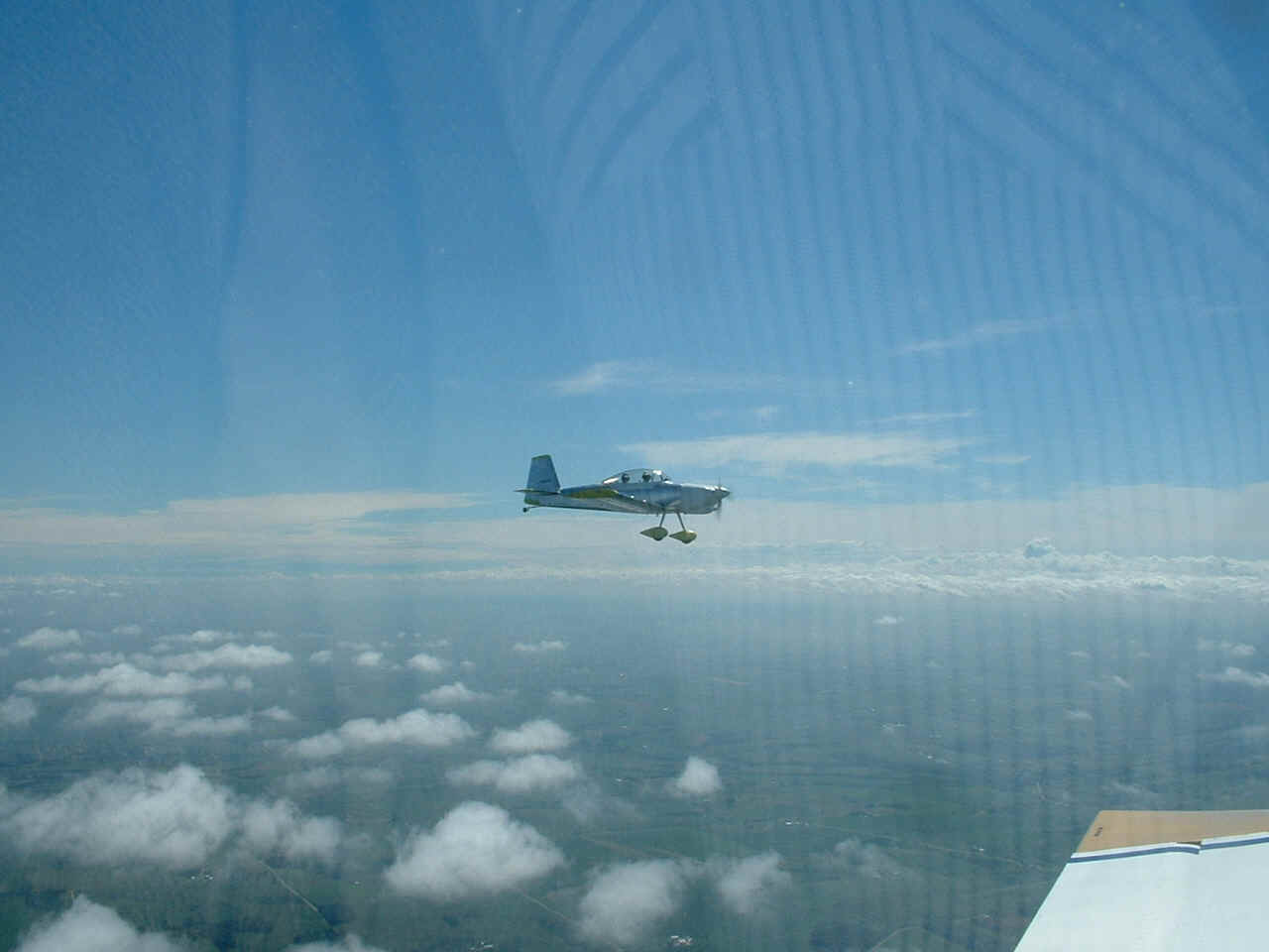
join our flight was Marshall "Jake" Jacobson with his RV-8 heading for Athens,
Georgia. Here is a photo of his RV-8 flying off my left wing. I had the video
camera running, but I also wanted to get this digital camera snapshot for higher
resolution than video snapshots provide.
When we began this flight, we were looking at the Chicago area weather hoping
to see a break in the rain showers and thunder storms to save us many miles of flying
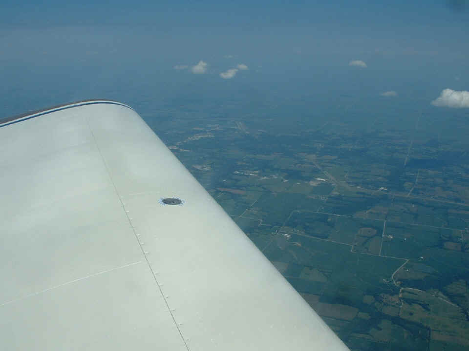
around the west end of the weather. This photo was taken as we were flying across
northern Illinois parallel to the towering weather and clouds you can see off in the
distance. Oddly enough, the winds here did not affect us too much, if at all.
The true airspeed matched the GPS ground speed for most of this flight from KOSH to MO8 near Brookfield, Missouri. The
price of gas there was very good at $3.24 per gallon for 100 low-lead self-service.
The airport was unattended as I had expected. There is only a porta-potty by the
fuel pumps. Access to the office and the soda machines inside was easy by entering a
four-digit code in the door lock. There were some FREE snacks on top of the drink
machines. It was very hot here in the middle of the country when we stopped for
fuel. And would you believe I did not take a single snapshot on the ramp!
Back in the air again heading across Missouri toward Kentucky and Tennessee,
everyone moved at their own pace. We all stayed on 122.75 MHz and I heard the RV-8
drop into Cape Girardeau, Missouri to add additional grease to his constant speed
propeller. Marshall had mentioned that could happen, and it did. Since I
was the heavy guy with the lowest power, Bob and Jim pulled away at their normal cruising
speeds to get home to Alabama as quickly as they could. There were a number of
storms passing their home area, and it turned out that I was talking with them later in
the flight providing Nexrad radar information from the GPS 396.
As Bob and Jim pulled farther out in front, I climbed higher to take advantage
of any tail winds available up high. For a while, I picked up 30 MPH, then 20, then
10. I was able to continue providing them storm cell advisories as they neared their
respective airports at Decatur and Moontown in northern Alabama. You can see the
stationary front far off in the distance over southern Tennessee from my high vantage
point over Missouri.
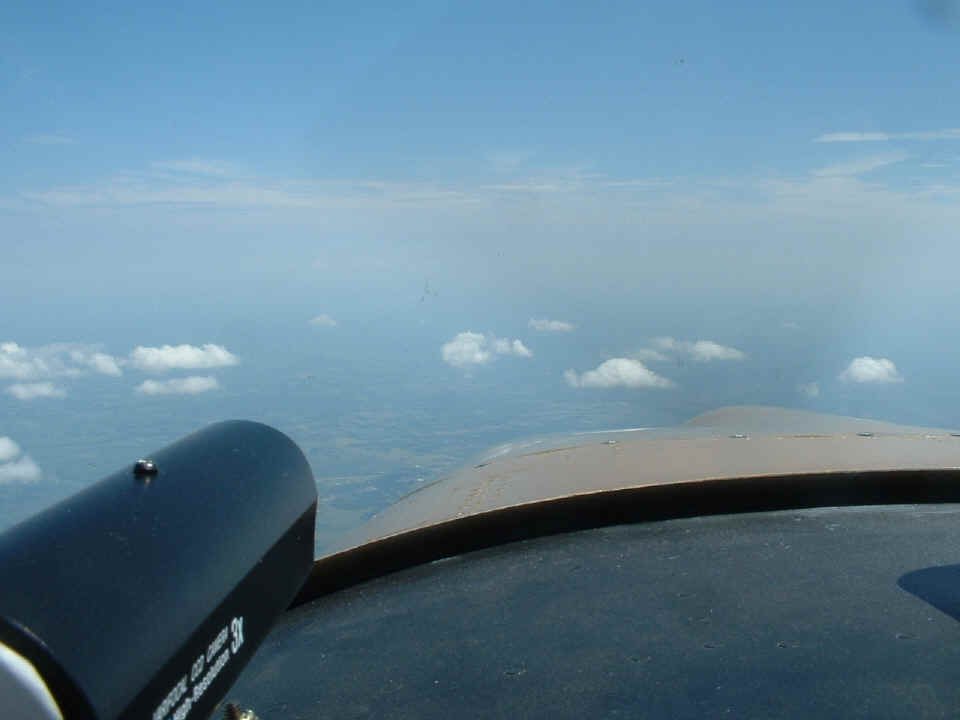
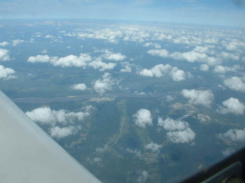
Here is my last photo looking EAST at the Mississippi River with a river tug
pushing barges downstream. That is southern Illinois across the river. We
passed by Saint Louis on the west side and found nothing of the earlier bad weather and
sigmets for hazardous weather. I had considered going down the western portion of
Illinois on the EAST side of Saint Louis when we passed north of Peoria, Illinois.
The fuel stop on that route would have been at the airport serving Litchfield, Illinois (3LF). The GPS 396
depicted some storm cells along that route that were moving away from Peoria and
Litchfield, but the group chose to continue to MO8 for the better weather there and the
guaranteed lower fuel prices.
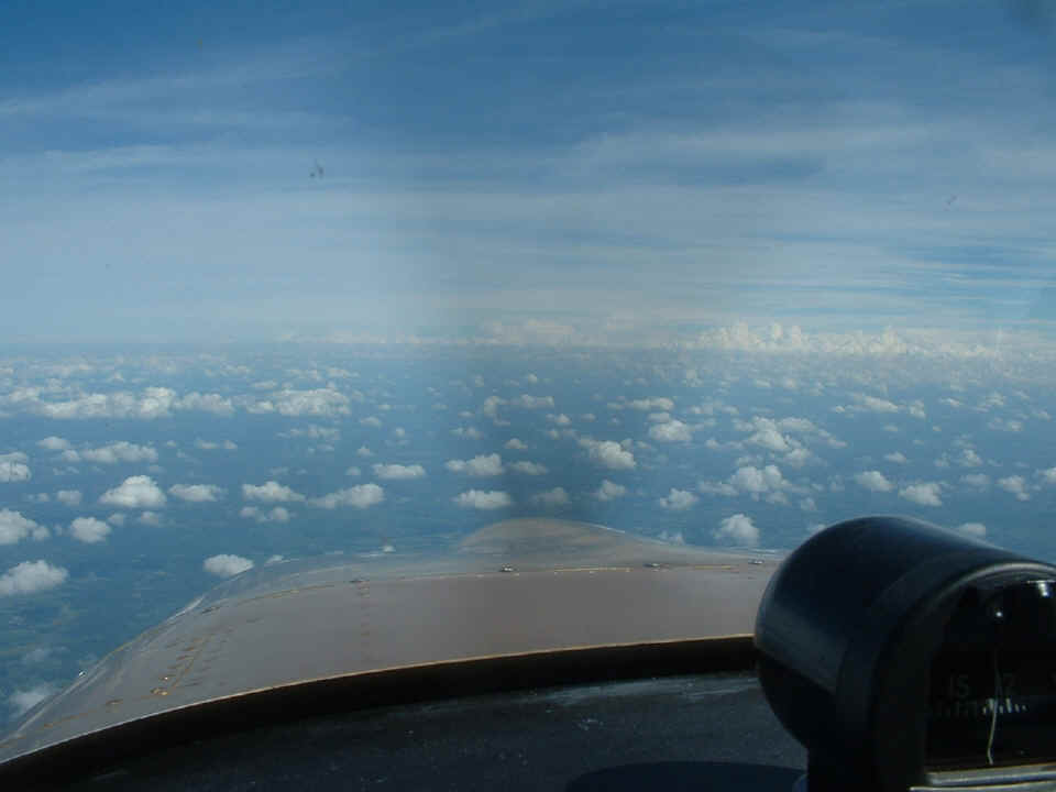
Here is my last photo of the day taken from the Murray, Kentucky area looking
ahead along our direct course for home. We stayed at 13,500 MSL for as long as
possible. We started down when we got to those big clouds near Nashville and
Murfreesboro, Tennessee. We turned a bit in the Nashville area to avoid some
towering cumulus clouds that were in the 16,000-foot range. When I saw a layer that
was around 12,000 feet, I realized it was time to begin our descent for Chattanooga under
the cloud decks.
When we got under the lowest cloud layer, we could see the storms we had been
spotting on the Garmin GPS 396 XM weather radar for Jim and Bob as they headed into
northern Alabama. Those rain showers had moved closer to our route of flight.
As I approached Lookout Mountain from the northwest, some of the rain showers were off to
our right side no more than three to five miles. I did see a few rain drops hit the
windshield, but only a few. We passed over the mountain and remained outside the
Chattanooga class-C 10-mile ring. The wind was reported at 270 degrees from
Chattanooga ATIS. We decided to make the approach to Folks Field from the south
since we would not have to cross the wires at the north end of the field. Remember
my long takeoff roll when we left home last Sunday? It was back in the landing roll
since the airplane still had a heavy load. We did get home with less fuel than we
had at the first takeoff, but I could not tell if that made any difference in the ground
roll to a stop. I normally land solo with my stop easily made at or before reaching
the hangar from the southern approach. This time, we rolled to a stop by the
house. Wendell seemed to think we had a bit of a tail wind instead of 90-degree
crosswind during the landing. The time was 6:20 PM Eastern time when I turned off
the engine on the ramp. The total Hobb's meter time for today was 6.3 hours from
engine start at the campground, taxi to runway 18R at KOSH, and the two flights to make it
home. The total Hobbs time for the week is 11.3 hours, which brings the time on the
airplane to 200.9 hours.
As for the remote video camera, it kept getting unplugged in the temporary
tangle of wires below Wendell's legs. That tells me it is time to consider a more
permanent wiring situation in the near future. The video tests and my first real
video are history. It is time to finish the installation of the video system to a
more permanent condition.