OSHKOSH 2010 -- Wednesday, Homeward Bound · · PAGE 29.
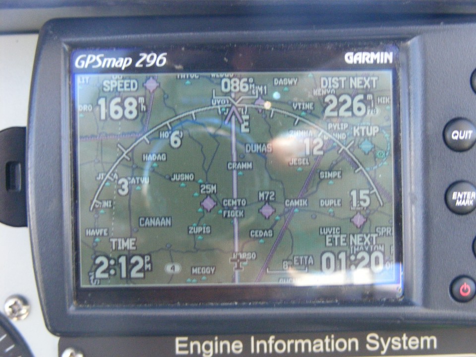
July 28, 2010: I crossed into Mississippi
about 73 miles southwest of the Memphis Airport. The autopilot was flying me past
two waypoints that kept me out of the Memphis Class B airspace. This photo shows me
east of the Memphis Class B, with the Columbus 3 MOA shown as the straight line to the
right of my little airplane on the GPS screen. At this point it is 226 miles to home
and that should take about 1 hour 20 minutes at this cruising speed of 168 MPH over the
ground. Columbus 4 MOA is on screen in the upper left corner near Corinth,
Mississippi ot the right of the word SPEED.
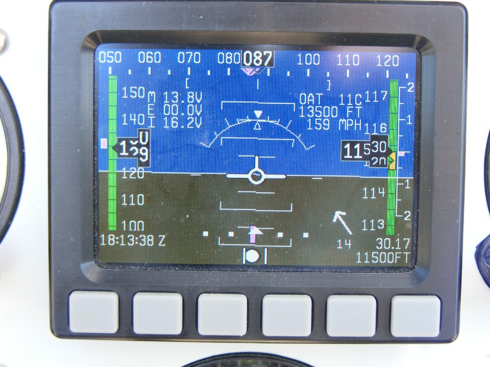
The Dynon D-10A is reporting a true airspeed of 159 MPH and a tail wind of 14
MPH, not quite exactly on my tail. The altitude bug is set for 11, 500 feet MSL.
I don't have an altitude hold servo, just roll control to keep me on course.
I did talk to the guys at Dynon about getting their servos to upgrade the airplane
autopilot systems. The new software for the D-10A can manage both servos and stay on
course with the information it gets from the GPS as seen at the top and bottom of the
screen in purple. My old NavAid autopilot flies about half a mile to the right of
the GPS course. But what can you expect from analog DC voltage comparison and a real
gyroscope inside the NavAid control head. A Smart Coupler inside the NavAid control
head reads the GPS data stream and produces a +/- 0.5 volts DC offset voltage to send to
the analog voltage comparator in the main circuits of the control head.
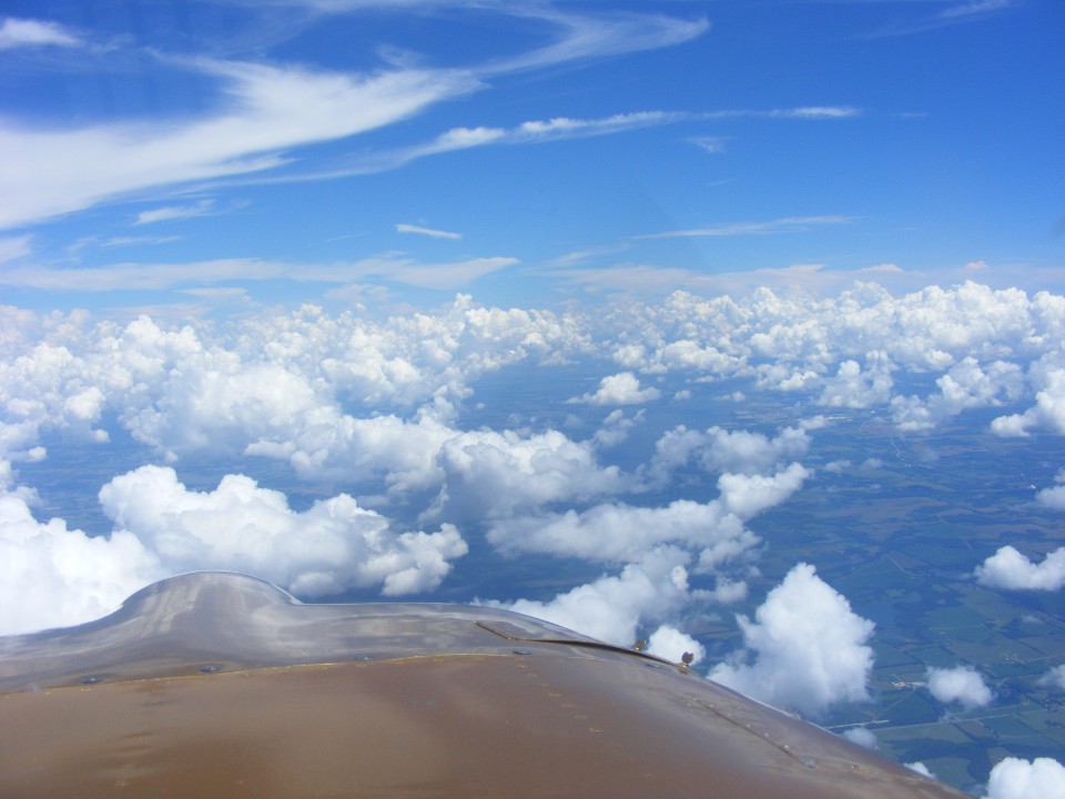
It doesn't look like Northern Alabama, but it is. Just in case you missed
it, Columbus 4 MOA covering extreme northeast Mississippi, the northwestern tip of
Alabama, and an area of Southern Tennessee. Airports below the MOA include Selmer,
Savannah, and Clifton, Tennessee, plus Corinth, Mississippi. I saw two military jets
heading for that MOA when I was passing near Florence, Alabama. They were playing
down low dodging the clouds as the wing man was chasing the leader They must have
been down around 5,000 feet MSL.
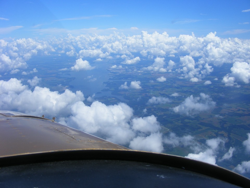
Believe it or not, that bit of water down there is the Tennessee River bend
about 6.5 miles west of Florence, Alabama. From there the river turns northwest
until it reaches the northeast corner of Mississippi. Not many folks have looked at
a map enough to see that is the only portion of the state line between Mississippi and
Alabama that is defined by a river, the Tennessee River. From there, the river winds
its way north to western Kentucky and to the Ohio River at Paducah, Kentucky.
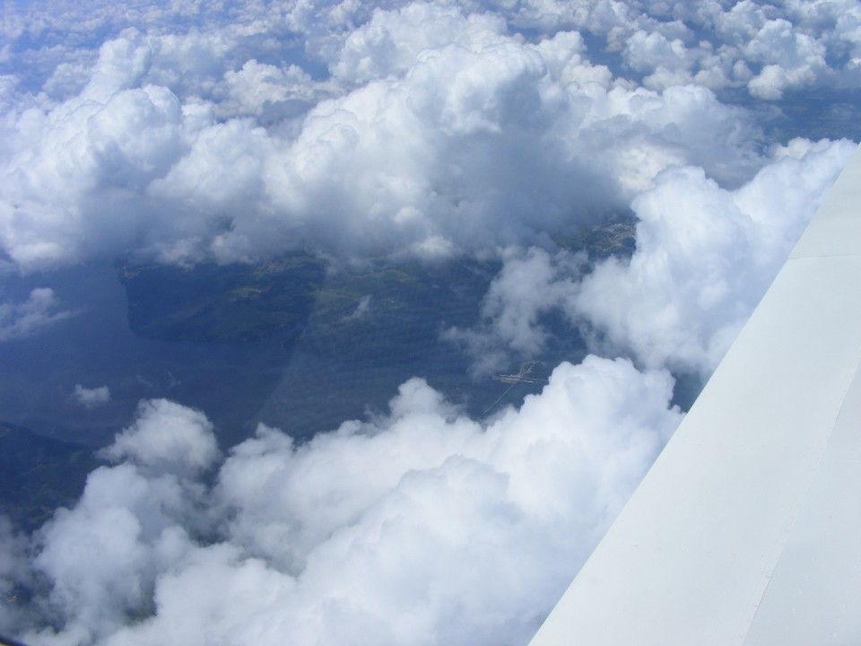
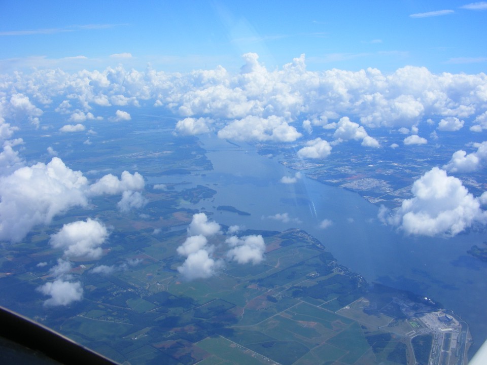
Approaching Huntsville from the west, the lake on this part of the Tennessee
River is a big one. There is that lake effect of keeping the clouds thinner above
bodies of water. If you are curious about the dams and lakes on the Tennessee River use
this link for the complete list.
These clouds are moving from south to north as seen in my winds aloft display
on the Dynon near the top of this page. That is why they are dissipating slightly as
they pass over the river, then reforming as they get on the north side of the river.
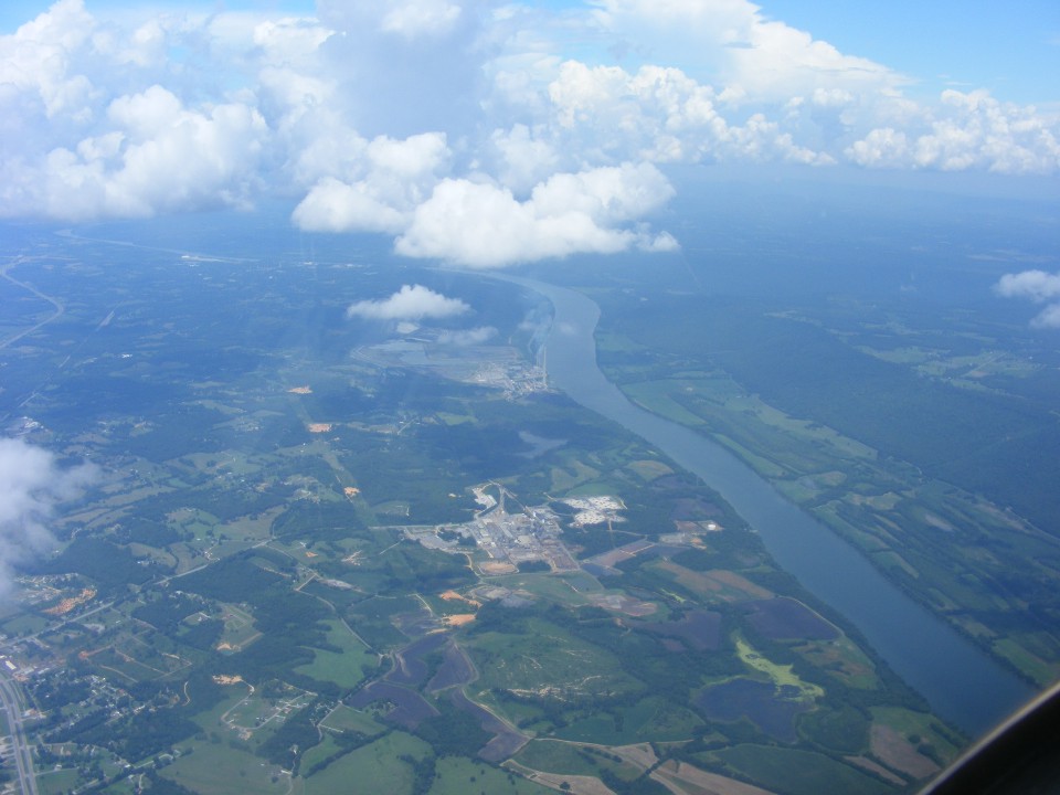
The Brown's Ferry nuclear power plant is at the bottom right corner of the photo
below.
This is the last time I will see the Tennessee River today, in northeast
Alabama. That four-lane highway at the very bottom left corner of the photo is US 72
near Stevenson, Alabama. I started a video recording after passing the next
mountain, which is Sand Mountain, where my mother and her sisters grew up in Dade County,
Georgia. I flew directly over Trenton, Georgia on my way to Chickamauga
International Airport (aka Folks Field).
And finally, I can read the time stamp on the photo and not have to change it
to Central Time. I have been on the ground for a few minutes and it feels good to be
back at home. The last GPS data point was recorded at 3:35 PM Eastern Time.
This photo was taken at 3:48 PM. My car battery was very low when I tried to crank
it up to move it out of the hangar.
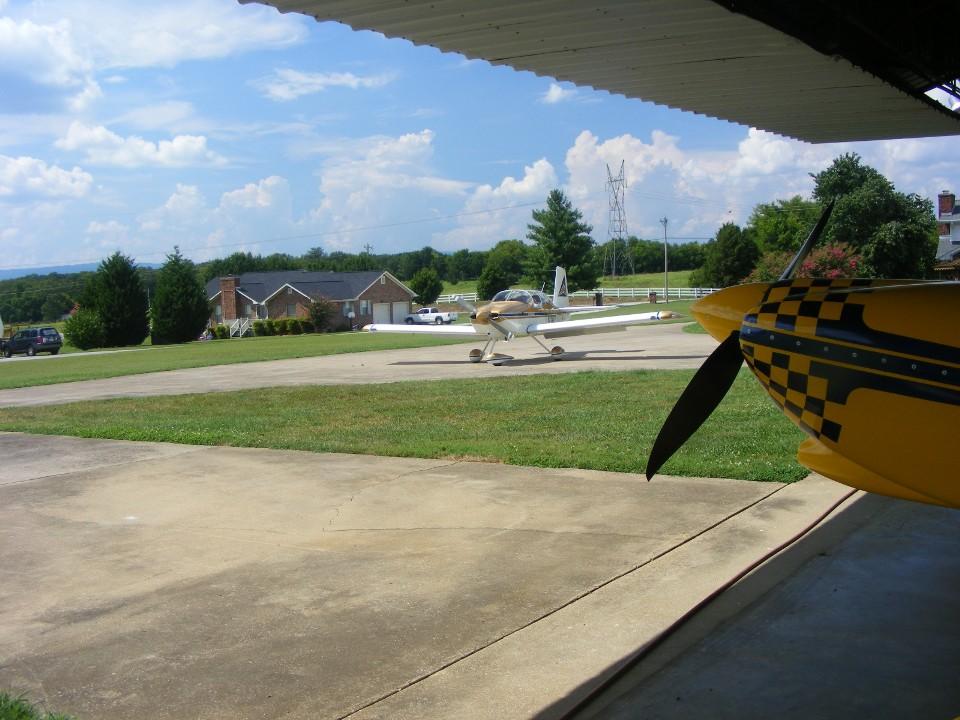
Fortunately, a young man stopped by to see if Wendell was here since I had pulled out Wendell's RV-8. I asked him to pull his car up close to mine to jump start it. I moved the old Caddy out and brought my airplane up to the front of the hangar and shut the engine down without stirring up the grass and dust into the hangar. I left the car running out on the ramp to put a charge on the battery as I was putting away the airplanes. I also spotted a leak in the car radiator. I could see a repair bill coming which could not be avoided. All that stuff was taken care of on Friday.
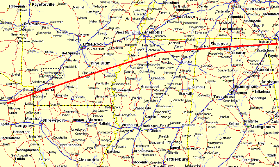
Here is the GPS ground track for the final flight from Mount Pleasant, Texas to
Folks Field. Hobbs time for the trip was 3.6 hours, non-stop.
So, what's left to do on the Oshkosh 2010 trip? I have to process my videos and select some video frames for snap shots to be added to this story. Let's face it, I was really busy when I was flying the approach to land on runway 36 LEFT at Oshkosh. I did take time to set the direction of the video camera for the approach and landing on Sunday. The video looks good and tells a story that snap shot photos cannot. Stay tuned, there is more to come, soon...
| OSH 10 - PAGE 30 (soon) | OSHKOSH 2010 MENU | MAIN MENU |