
OSHKOSH 2010 -- Saint Louis Departure Northbound · · PAGE 6
July 24, 2010: The East Saint Louis Airport
controller was very helpful in our photo and movie passes by the Arch and the waterfront
along the Mississippi River. We thought we were getting all the radio transmissions
and our intercom conversations on the recording, but it was later discovered the audio
cable had been disconnected. I went over the tape later that evening at the hotel in
Galesburg and discovered the silence.
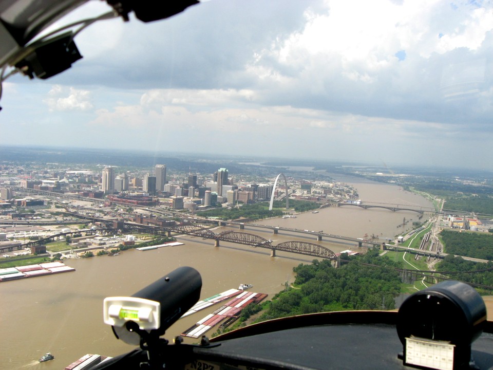
Eddie took this last photo of the Arch and the video camera as we made the last
pass northbound to leave Saint Louis behind. To see the video of the arch flyby with
my later narration, RIGHT CLICK HERE and download the
76.6 megabyte MPEG video to your hard drive, then play it from your hard drive.
The Missouri River joins the Mississippi just north of Saint Louis. It is
the reason the city was built here. The Missouri River was part of the Gateway to
the West and Saint Louis was the jumping off location for settlers heading west.
Many would ride on river boats to Saint Joseph, Missouri before joining a wagon train
heading west across the plains.
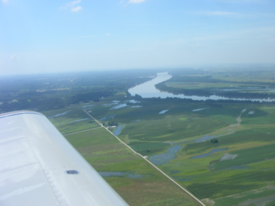
Here is the point of confluence of these two mighty rivers. From this
viewing angle, the Missouri River appears to have a smaller width than it actually has
since it is partially blocked from view by the trees.
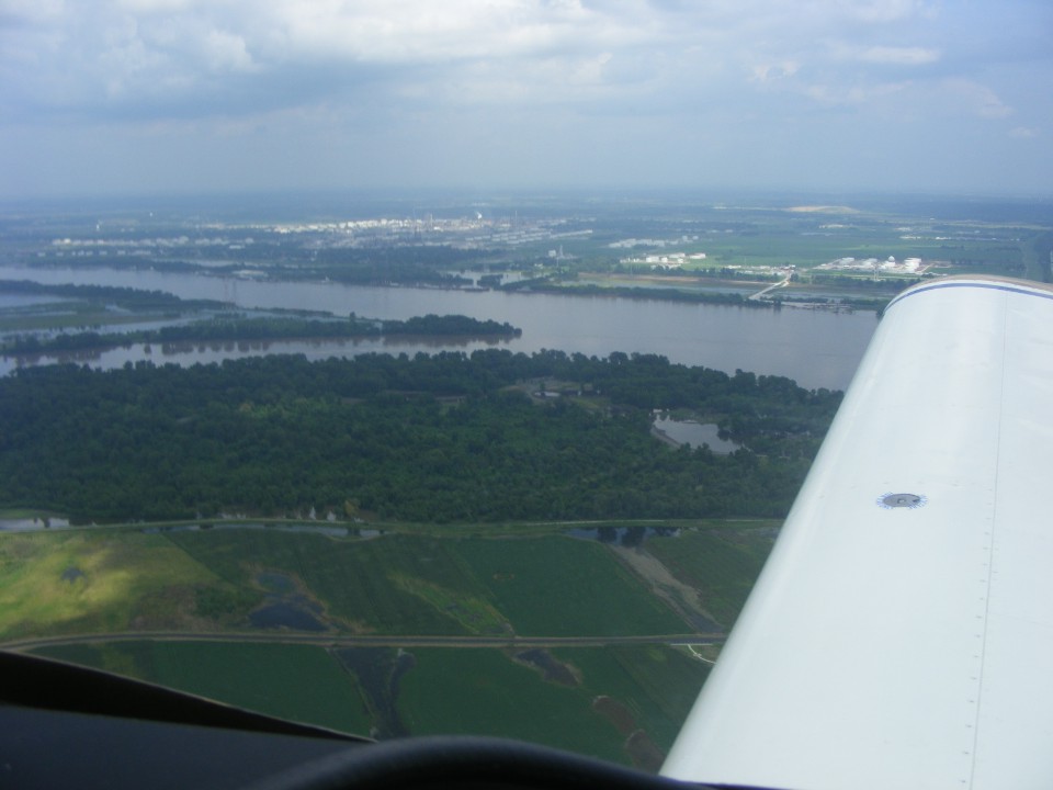
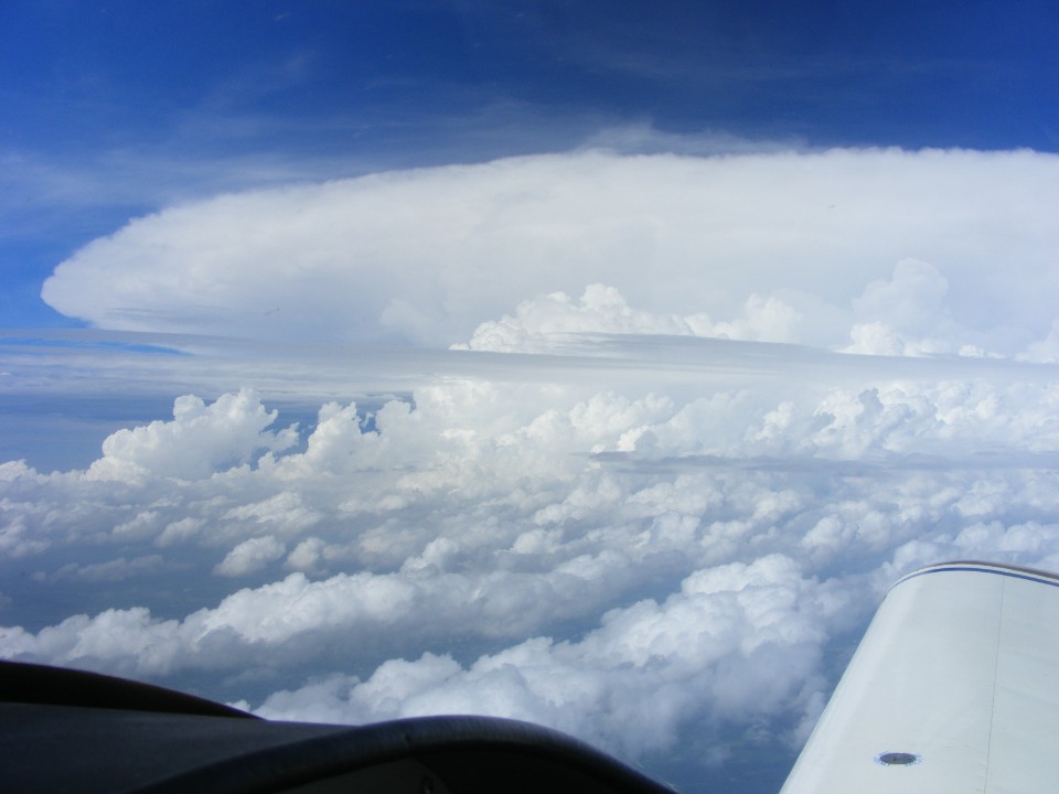
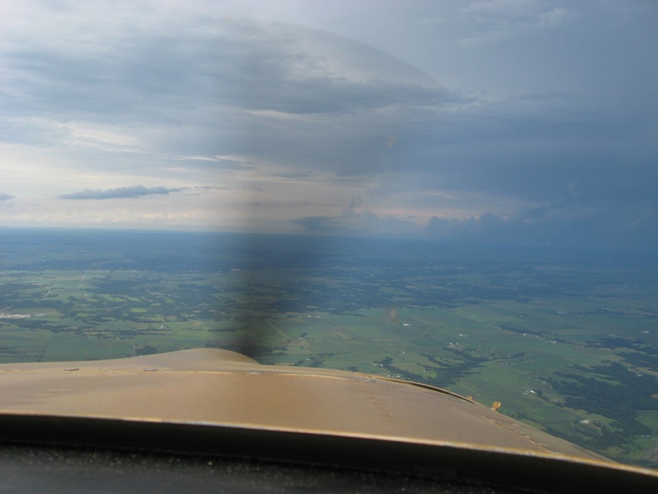
When we began our departure from Saint Louis, the intent was for a direct route
north to Galesburg, Illinois. As we cleared the heavy air and haze of the city, a
large developing thunder storm ahead convinced me it was time to head west around the back
side of the storm. Edward took this photo as we were also avoiding an MOA in western
Illinois. We turned the corner of the MOA as we reached the Mississippi and climbed
up into cooler air as we cleared the northern boundary of the Saint Louis Class B air
space. This photo was taken at 4:06 PM Eastern Time.
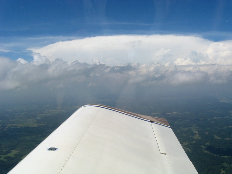
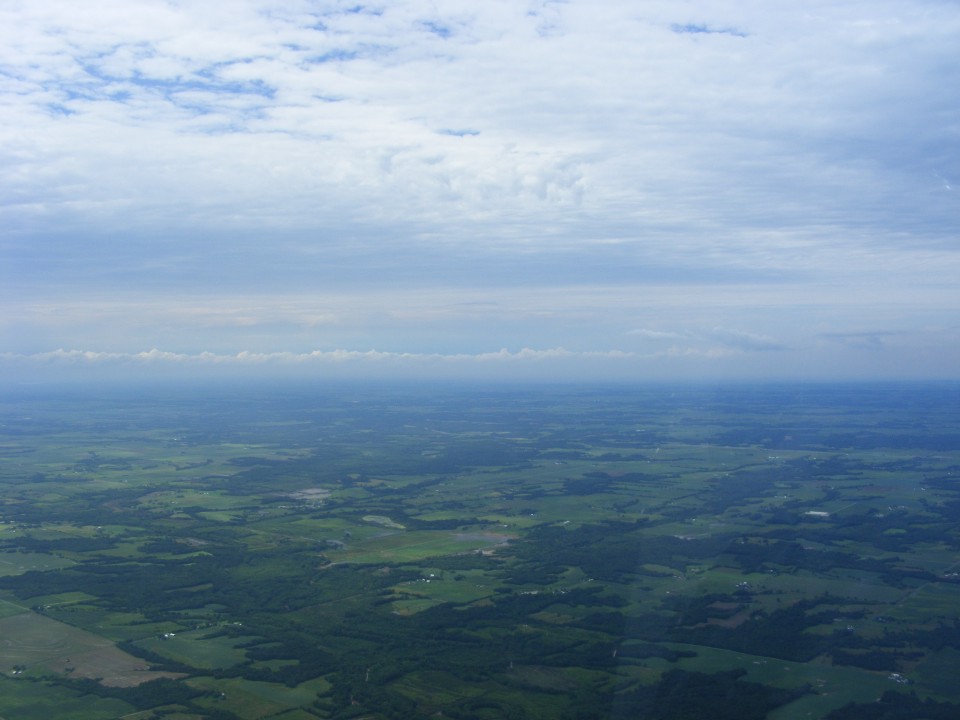
I took this photo at 4:19 PM as we climbed higher and we had a better vantage
point due west of the storm. The winds aloft were 30 MPH from the west. The
crab angle was very noticeable even considering our forward speed of 160 MPH.
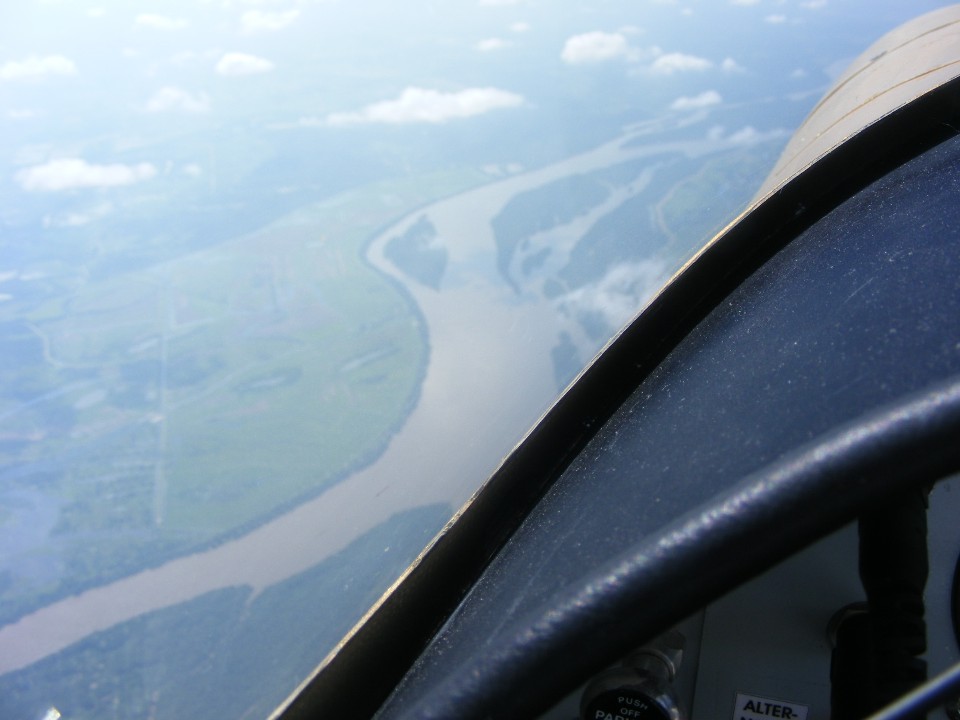
Here is the view of the Mississippi River on the left side of the airplane
somewhere south of Hannibal, Missouri. As you can see, my camera focused on the
inside of the airplane, not on the river below. I must be more careful where the
center of the frame is placed on these shots.
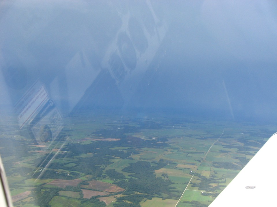
You can see the rain is just a few miles off the right wing and sunlight is in
the areas closer to our flight path here in Illinois just east of the Mississippi River
banks. The instrument panel is reflected from the inside the canopy since Edward has
no polarizing filter on his camera.
The course ahead toward Galesburg is behind the cold front and the air is
clearing as we turn on to the GPS direct route to KGBG Airport.
At this time the winds are now a tailwind and the GPS ground speed is up to 219
MPH.
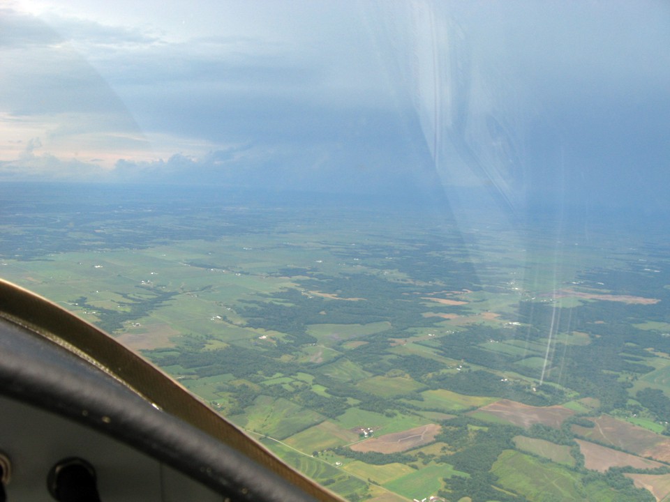
The view looking west shows some clear skies but the possibility for more light
rain. We will reach Galesburg and be tied down well before the weather from the west
will be there. Those high-level clouds are shading the land in this area. The
outside air temperature is 20 degrees cooler than what is was in Saint Louis and points
south of there.
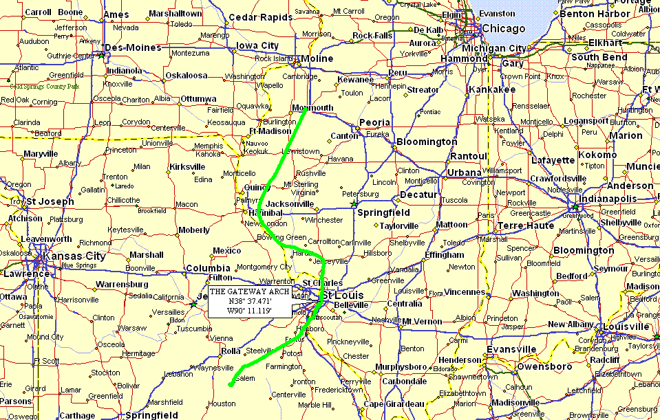
Here is the GPS ground track from Salem, Missouri to Galesburg, Illinois.
The deviation toward Hannibal, Missouri got us past the towering thunder storm
across our intended route of flight from Saint Louis to Galesburg.
| OSH 10 - PAGE 7 | OSHKOSH 2010 MENU | MAIN MENU |