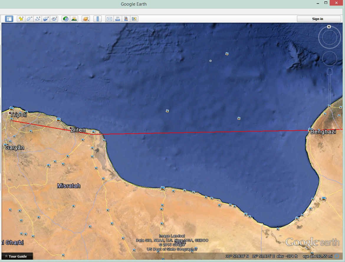
Tripoli, Libya to Cairo, Egypt with Jerrie Mock in 1964 · · PAGE 6.
April 1, 1964: The second blue flight path
on the right side of this map is from Tripoli to Cairo.
It was a routine flight with some of it over the sea not too long after
departing Tripoli. The flight across the Gulf Of Sidra (Sirte) began near the town
of Misrata and ended when Jerrie flew over Benghazi, Libya. The direct flight over
the water saves about 30 minutes of flying time if the coastal route over land is
followed.
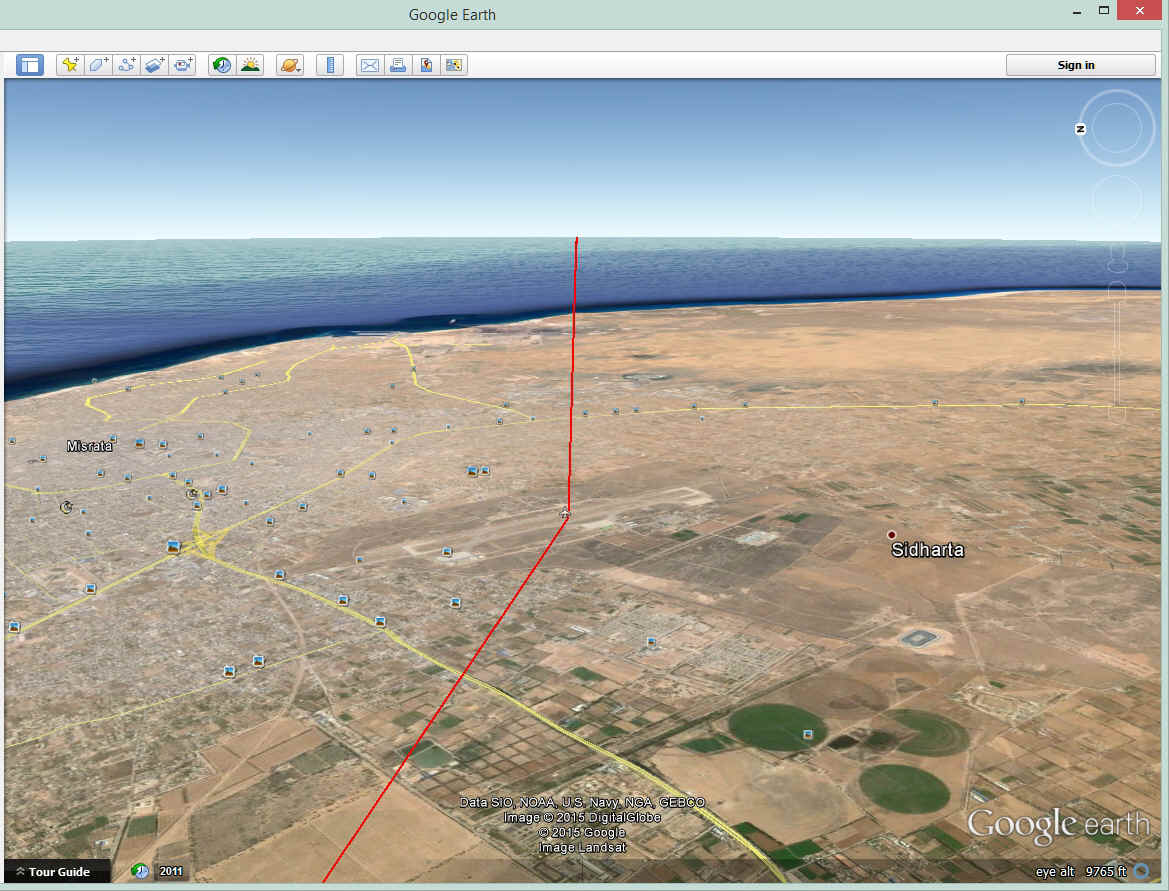
This is a view of the Gulf as seen from about 9,000 feet flying over the
airport near Misrata. At this point, everything north of her course line is
considered the Mediterranean Sea. The Gulf of Sidra is the water to the right
(south) of this course line. She is flying EAST and that is good!
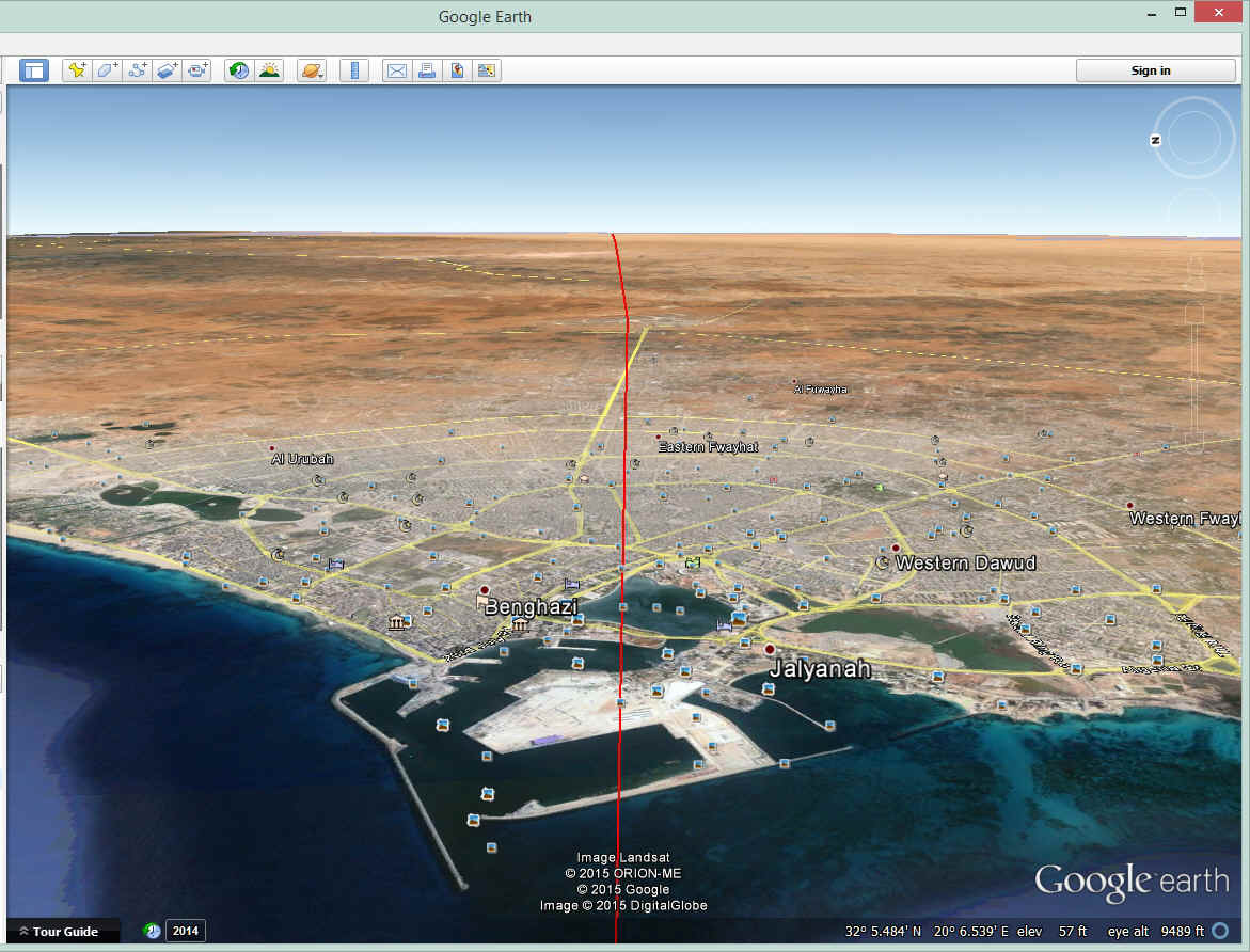
At the other end of the route across the Gulf of Sidra is Benghazi seen here
from about 9,500 feet MSL.
This old air base is the airport serving Tobruk, Egypt just under 230 miles
East of Benghazi. There is mostly desert sand along that route.
I draw these RED course lines on Google Earth maps to follow the route Jerrie
describes in each chapter of her book. When I got to the Mediterranean shore in
Egypt, these rugged cliffs caught my eye and I "flew" down low to get a closer
look. The tops of these cliffs are about 380 feet above the water.
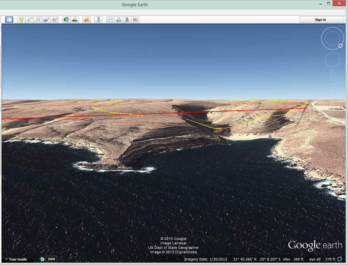
This is the view Jerrie saw as she flew past this location. From this
view point from 9,500 feet above, it becomes apparent the erosion at the cliffs is from
rain water, not from the tides on the shore. When it rains in a desert, there is
nothing to stop the surface water from running wild. This is the kind of thing that
happens in Las Vegas, Nevada when it rains there.

After a short hop across water, there is more desert to cross to reach the
airport at Mersa Matruh, Egypt on a charted airway Jerrie was following heading for Cairo.
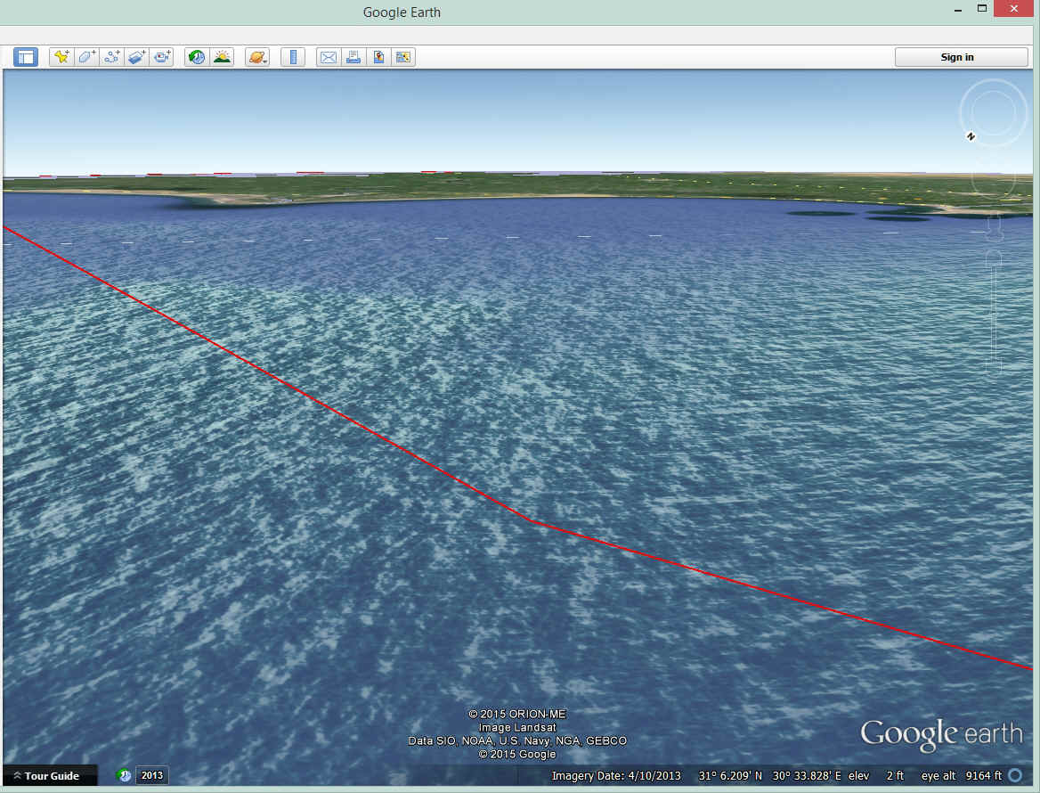
She had to avoid some restricted airspace near Alexandria by flying to a point
about 29 miles north of the city out over the Mediterranean Sea.

This is the view from that waypoint 29 miles north of Alexandria, Egypt as seen
from 9,500 feet MSL. This is part of the detour north of Alexandria over the Mediterranean
Sea to avoid some restricted airspace. The city of Alexandria is near the sandy
shore at the right edge of the image.
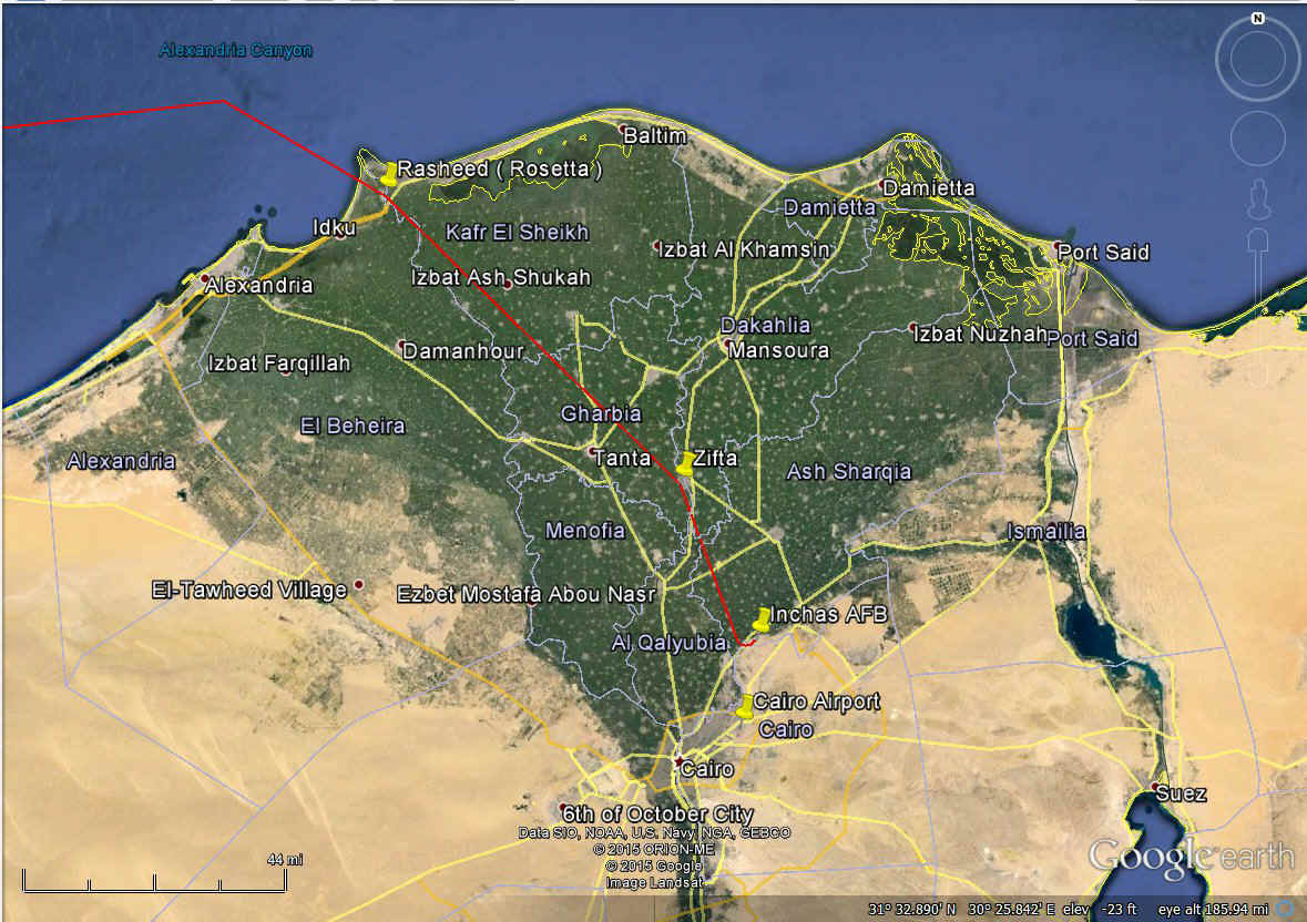
Jerrie described this approach to Cairo by airplane based on what was on her
charts of the Nile Delta. The end of the red line is at Inchas air base. OOPS!
I had a similar image here when I first created this page. I have been
working on the Google Earth flight tour project and today I reached Cairo. I was
reading page 94 that described her arrival path to Cairo. She referred to the
EASTERN edge of the Nile delta and that was the previous image that was below this
paragraph. The previous RED line went over to Port Said and I wondered why. I
read her arrival description about flying over the town of Rosetta, now called
Rasheed. (This was where they found the "Rosetta Stone" that was the key
to deciphering ancient Egyptian hieroglyphics.) She came in from the Mediterranean
Sea where Rasheed is 8 miles from the sea on the western branch of the Nile River.
With her approach via a beacon at Zifta, she saw an airport with runway 5 on it and landed
there instead of the Cairo International Airport which also has a runway 5.
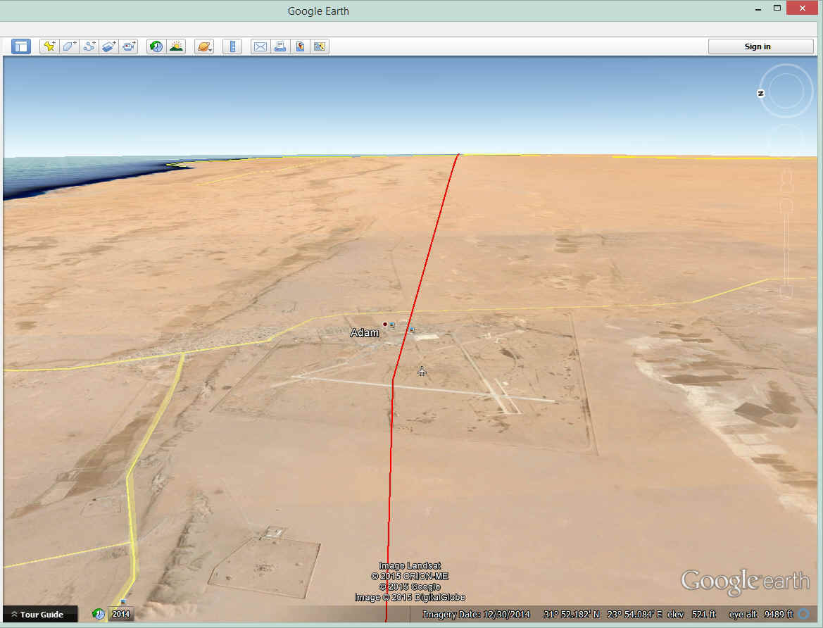
The landing in Cairo would be in the afternoon, but there was a surprise when
she mistakenly landed at a "secret" military airport (Inchas, chapter 11)
that was NOT on the aeronautical chart. I will leave that story for you to read
about in the book. The newspaper clipping seen in the book gives the military
airport information wrong on purpose to protect its secrecy. Here is how the
"secret" air base appeared in 2014.
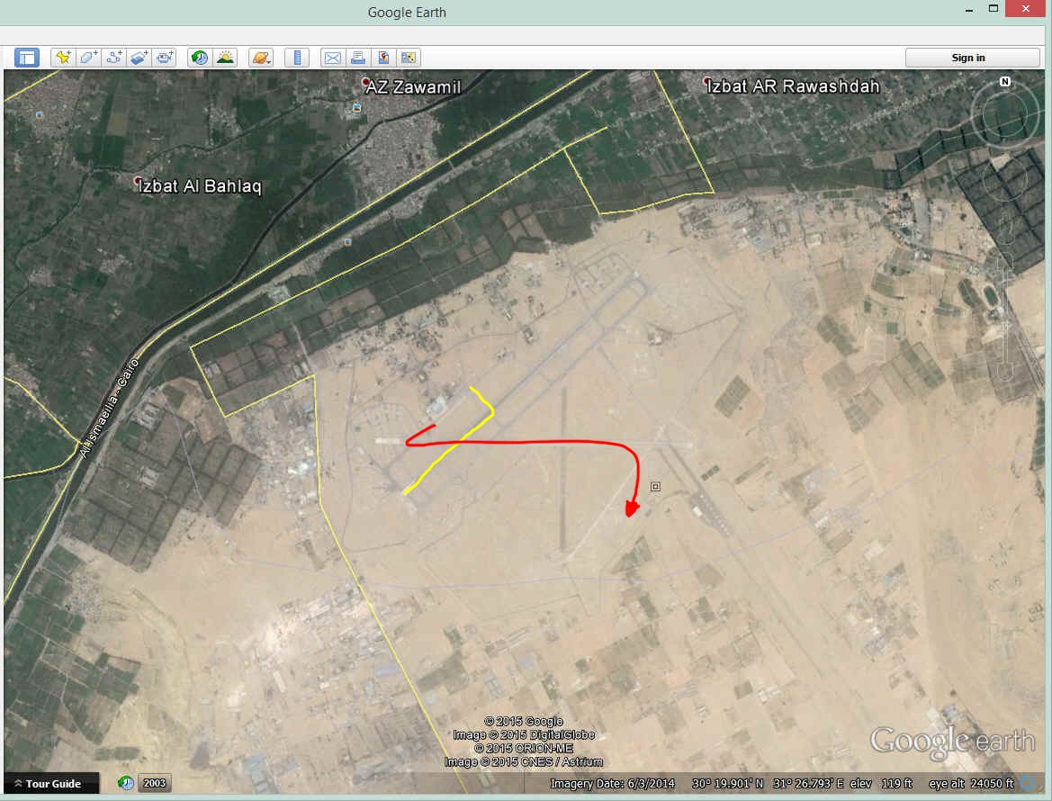
This is the runway where she landed at the Air Force Base in 1964. It is
depicted above by the yellow line as she described her landing. The RED line above
was apparently the runway and departure turn to the right to get her going toward Cairo
International Airport after it got dark.
The air base was only 14 miles from the Cairo International Airport not 200
miles. They would not let her takeoff from that air base until after dark so she
could not see anything but the lights of the city as she departed. At 1000 feet up
she could see the Cairo airport and confirmed it was the right place by using her VOR
receiver on the frequency of 112.5 MHz. I wonder why she did not think of that
earlier instead of landing at Inchas, and held as a guest in a palace. Read all
about it in the book.
The image below shows the Cairo International Airport as it appears in
2014. There are THREE parallel runways here today and one cross wind runway. I
would bet the two runways at the south side of the field were not there in 1964. I
found an older Google Earth photo dated 1972 when the first parallel runway was under
construction. It shows up in year 2000 as a well-used runway. In 2009, all
three runways are completed.

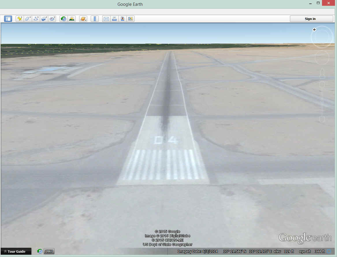
Compare this runway approach with the one at the Inchas Air Force Base seen
above. She had a night landing at Cairo and could only see the runway lights and the
terminal buildings up ahead on the right. Google Earth does not put in the runway
lights (sorry).
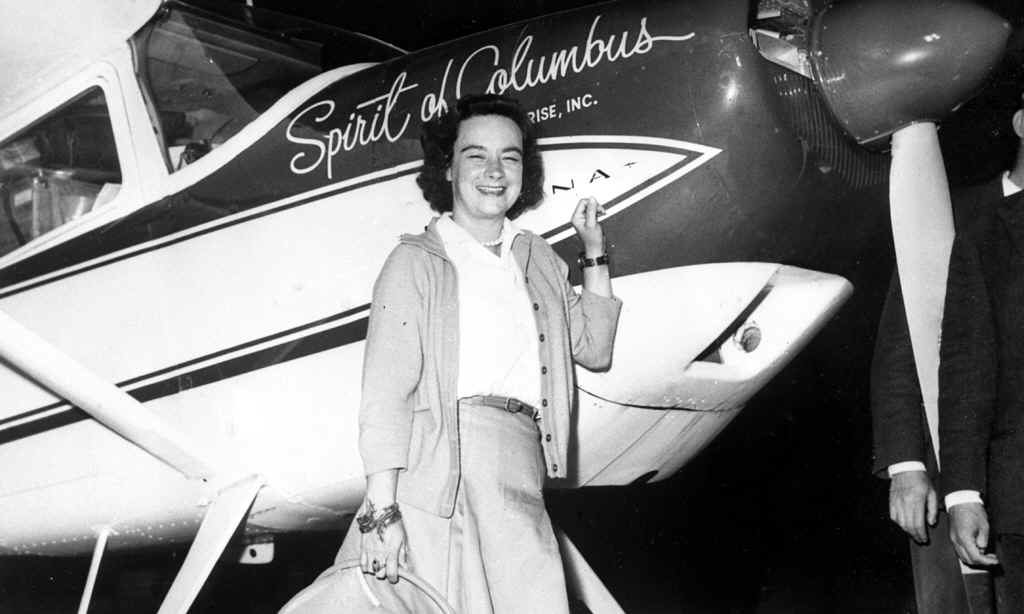
Of course the story had a happy ending as she continued the flight into the
history books. Here is her arrival at Cairo after the short flight from the military
airport which was about 14 miles away. This is the pandemonium when she landed at
night at the Cairo International Airport.
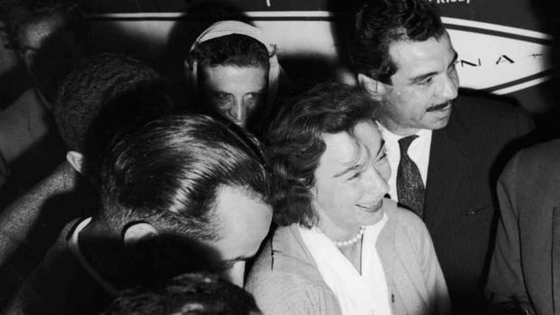
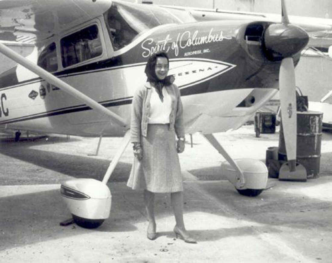
After the crowd at Cairo was moved away, this solo photo is the real pose with
her hair combed for the newspapers.
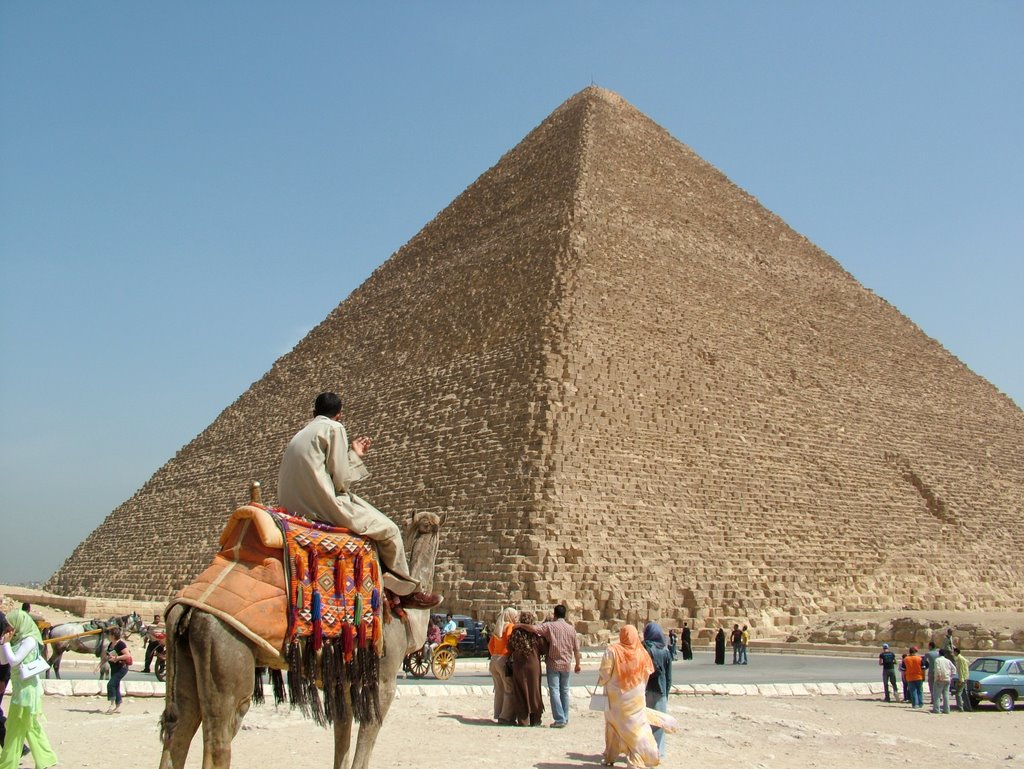
April 2, 1964: She had one day in Cairo for
some souvenir shopping and to be a tourist for a few hours after getting her paperwork in
order. Her first stop was to see the Sphinx and the Pyramids. She actually
went out of town and rode a camel at the site of the Sphinx, and the Pyramids. The
Aero Club had a reception in her honor on the evening of April 2, 1964. Cairo was
the first place where she arrived to a crowd of people to greet her. She was in the
newspapers for the world to follow her progress around the planet.
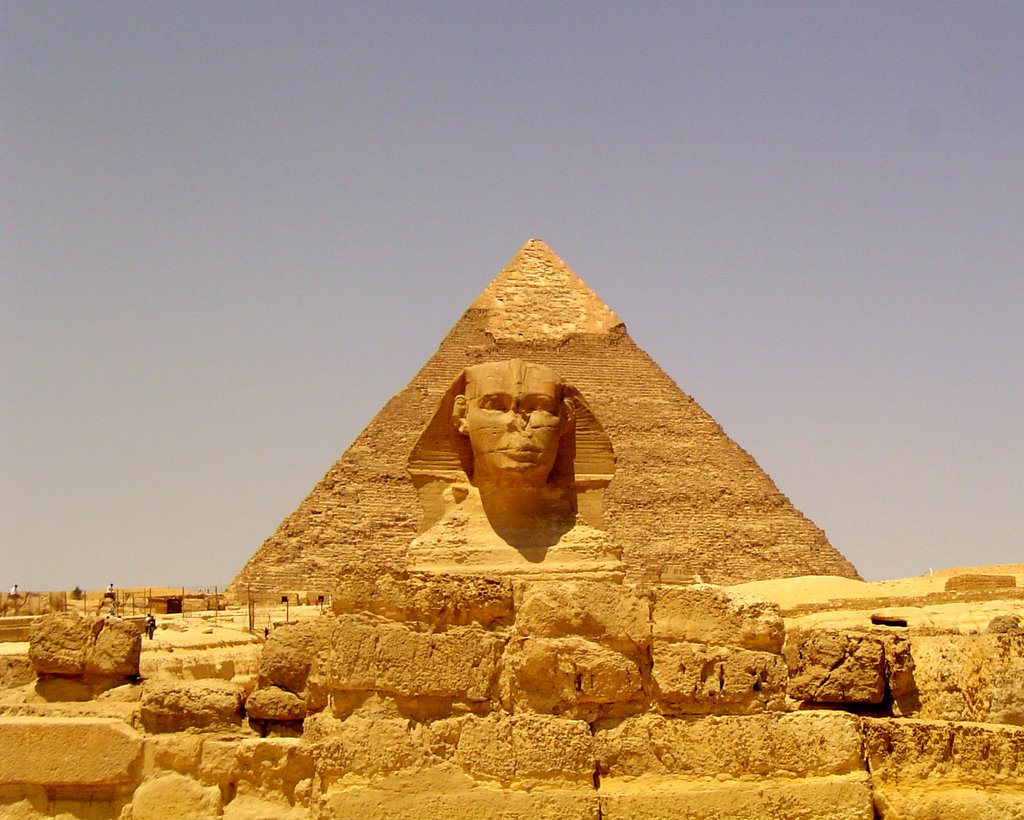
She had a chance to ride a camel and be that tourist.
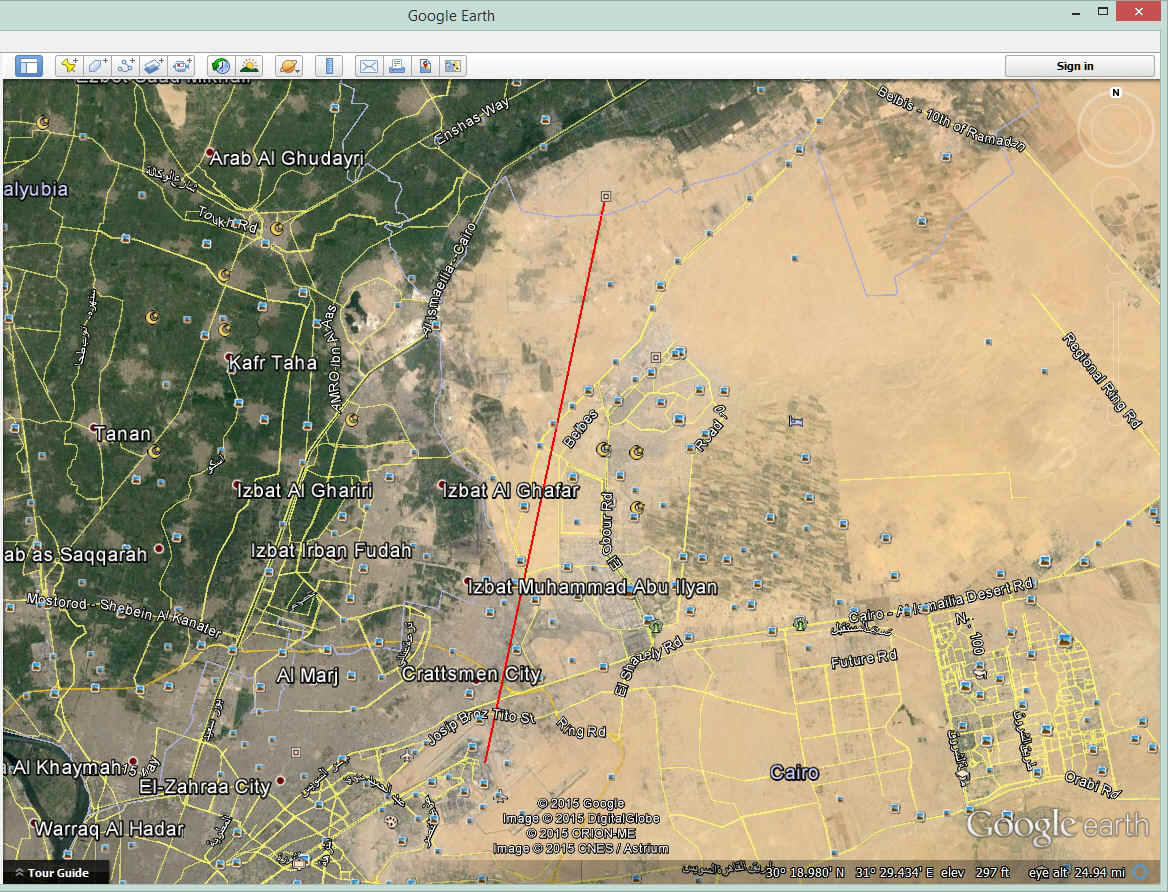
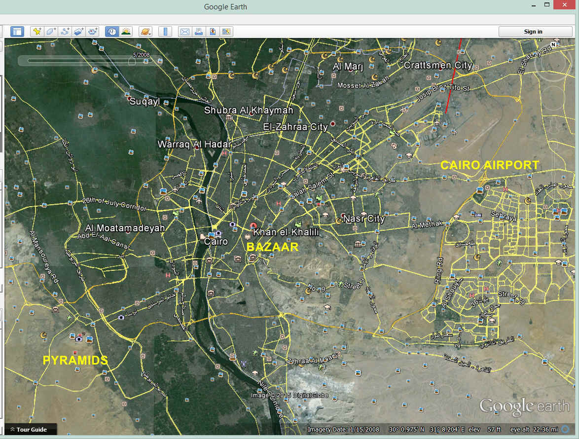
The other thing she wanted to do was go shopping. Her host took her to
Khan el-Khalili bazaar that was established in the year 1382. Look up the bazaar and
you will find plenty of photos of the place online. This Google Earth image below
puts things in perspective. The pyramids are about 10 miles from the shopping
bazaar. The airport is just another 10 miles from the bazaar.
April 3, 1964: She could not get fuel on
April 2 and had to also get her passport stamped before departure. The fuel truck
did not come to the airplane. She had to taxi the airplane two miles across the
airport to a place near one of the passenger gates. The fuel was in drums and was
pumped by hand cranking. The way she described the whole incident sounded like
something from a movie comedy, but it was real. You need to read the book to get all
the details as there are too many to list here. The long wire H.F. radio antenna
"wind sock" is visible hanging down under the airplane. The electric motor
to let it out and reel it back into the airplane was burned out between Bone and Tripoli.
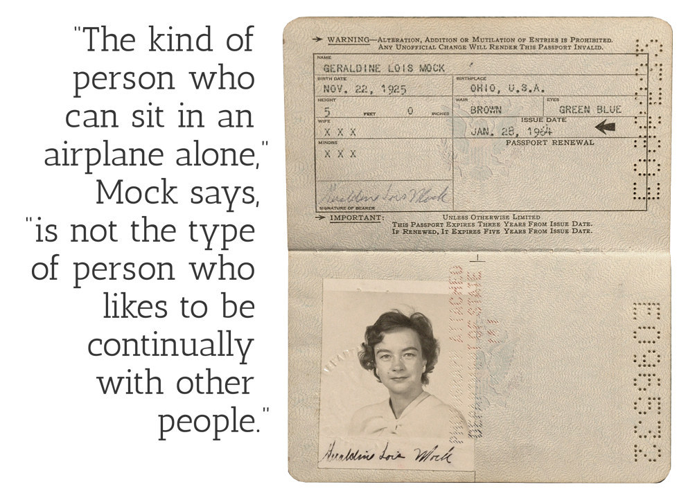
Here is her passport used for the trip around the world. When she was
asked why she never became as famous as Amelia Earhart, she made the comment seen in the
image below.
| CLICK HERE for PAGE 7 | CLICK for Jerrie Mock MENU | Return to N2PRISE MAIN MENU |