June 2022 Vacation Day 21, Departing Texas, Entering Oklahoma · · PAGE 53.
June 12, 2022: Sunday and we
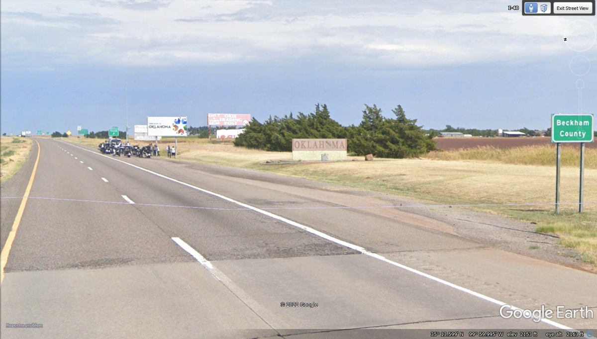
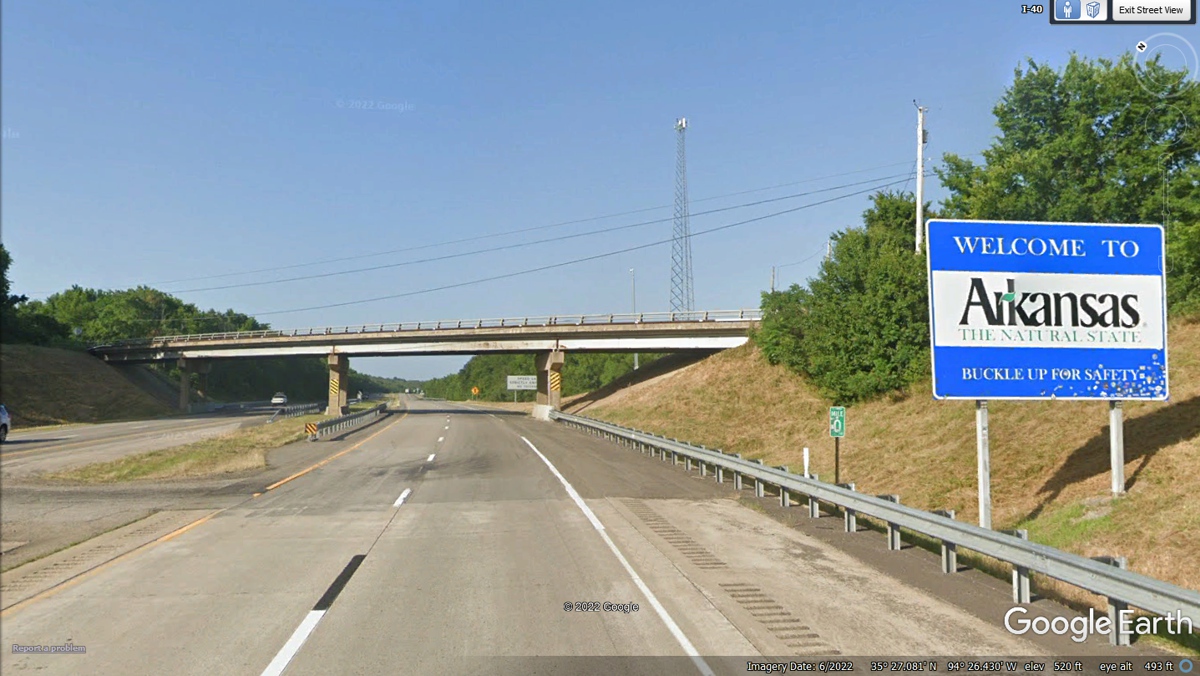
leave Texas behind us on I-40 crossing into Oklahoma. This state line is
marked at two locations for Tourists and the actual state line. The
distance from our motel this morning to the actual state line is about 13.5
miles. We have crossed plenty of state lines in this big western
tour. The change of pavement from the Department of Transportation is a
good marker. That faint white line crossing the road is put there by the
Google Earth program.
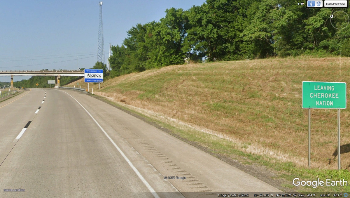
The big stone marker and billboard are usually put there by
the State tourism group. On the day the Google Earth Vehicle crossed the
state line, a group of motorcycle riders were forming up to head East.
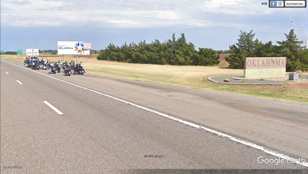
This exit from I-40 going East connects to a segment of the
old US 66 route.
After some easy slower riding on the concrete road that was
US 66 for many years, the DOT wants to remind us the road will divide up ahead.
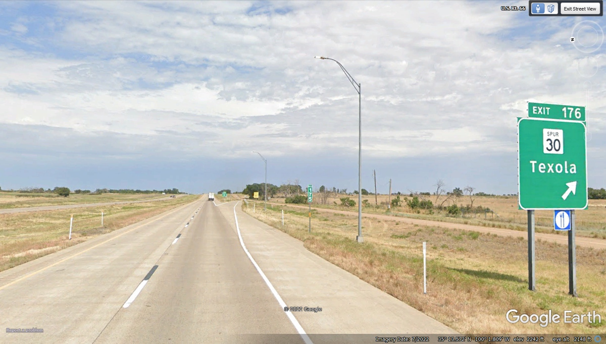
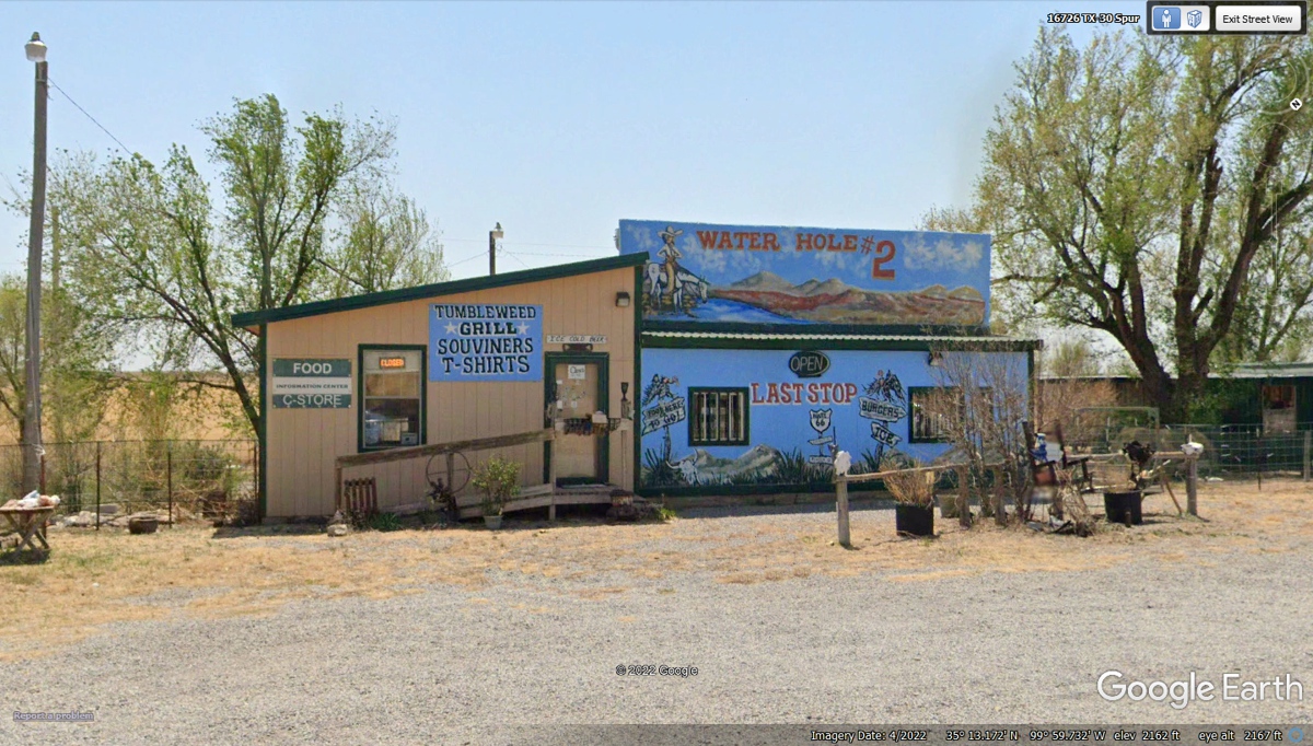
The Tumble Weed Grill is a classic Mom & Pop restaurant
on the roadside of US 66 from the glory days before the interstate
highways. The Tumbleweed Grill has been remodeled and it is still in
business with good food. They have a Facebook page to give you a peak
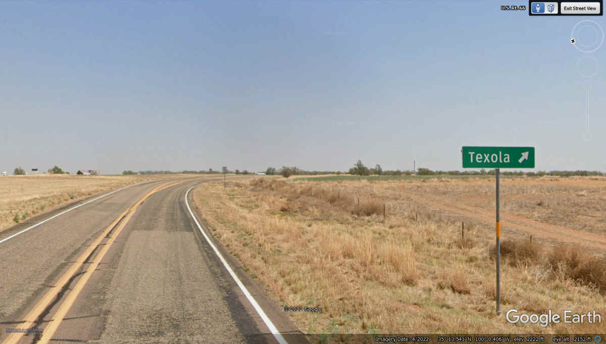
inside. It is located on the west side of Texola, Oklahoma. Some
folks stop here when they are on a trip west on US 66. Most of the town is
a ghost town today with only a few residents.
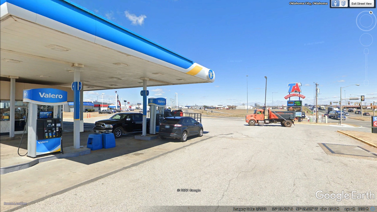
This is our next fuel stop on the south side of Oklahoma
City after a lot of flat country since the state line from Texas.
The fuel purchased here was 12.236 gallons from the last
fuel stop at Loves Truck stop in Clayton, NM seen on Page 52.
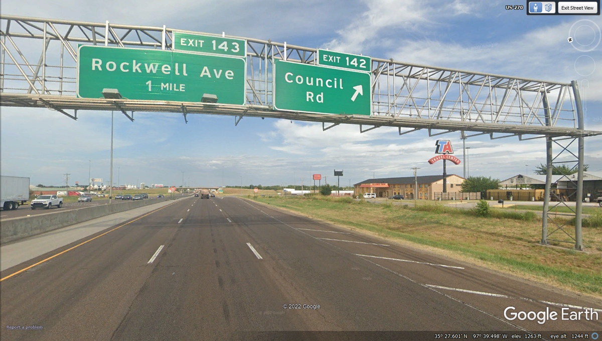
Getting back on I-40 Eastbound from our fuel stop shows it
crossing I-44 after 3.4 miles as I-44 came from the south and continued north by
itself. The two interstate routes did not run concurrent.
This is the interstate junction to get from I-40 to Interstate 44 going East or West. We are going straight through on I-40 East.
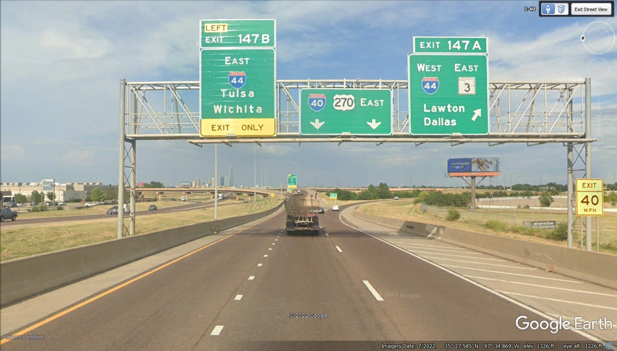
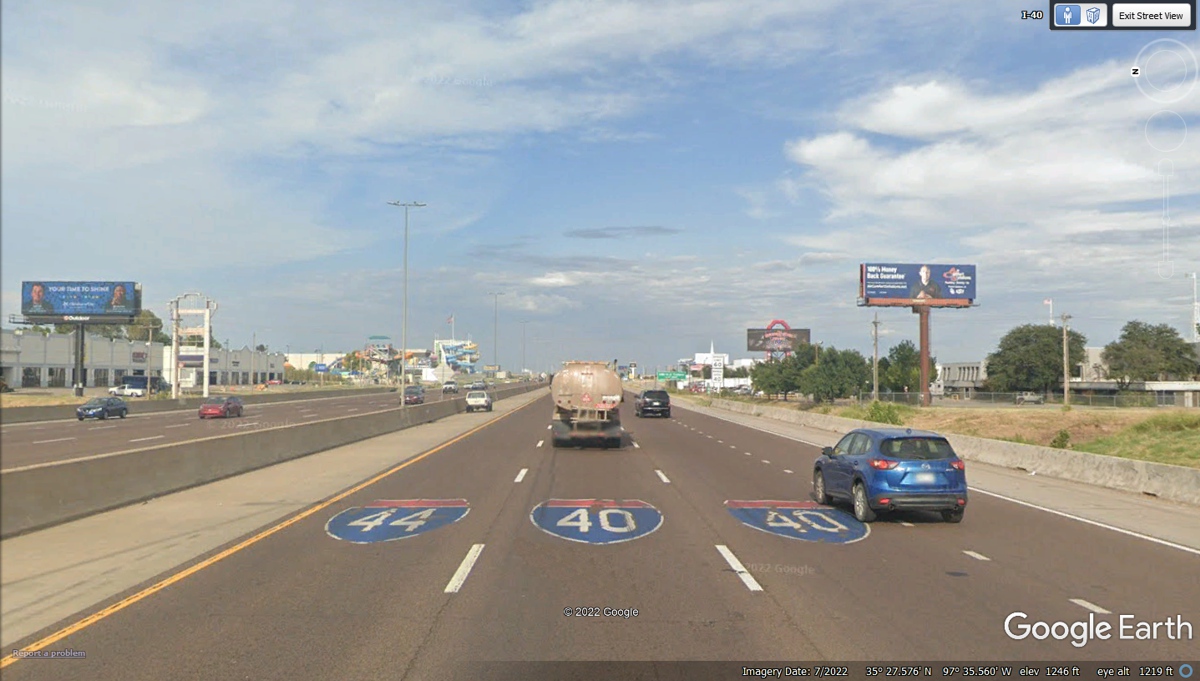
The other big interstate highway crossing I-40 in Oklahoma
City is I-35 going north and south, along with US 62 and US 77. We
continue EAST toward Arkansas.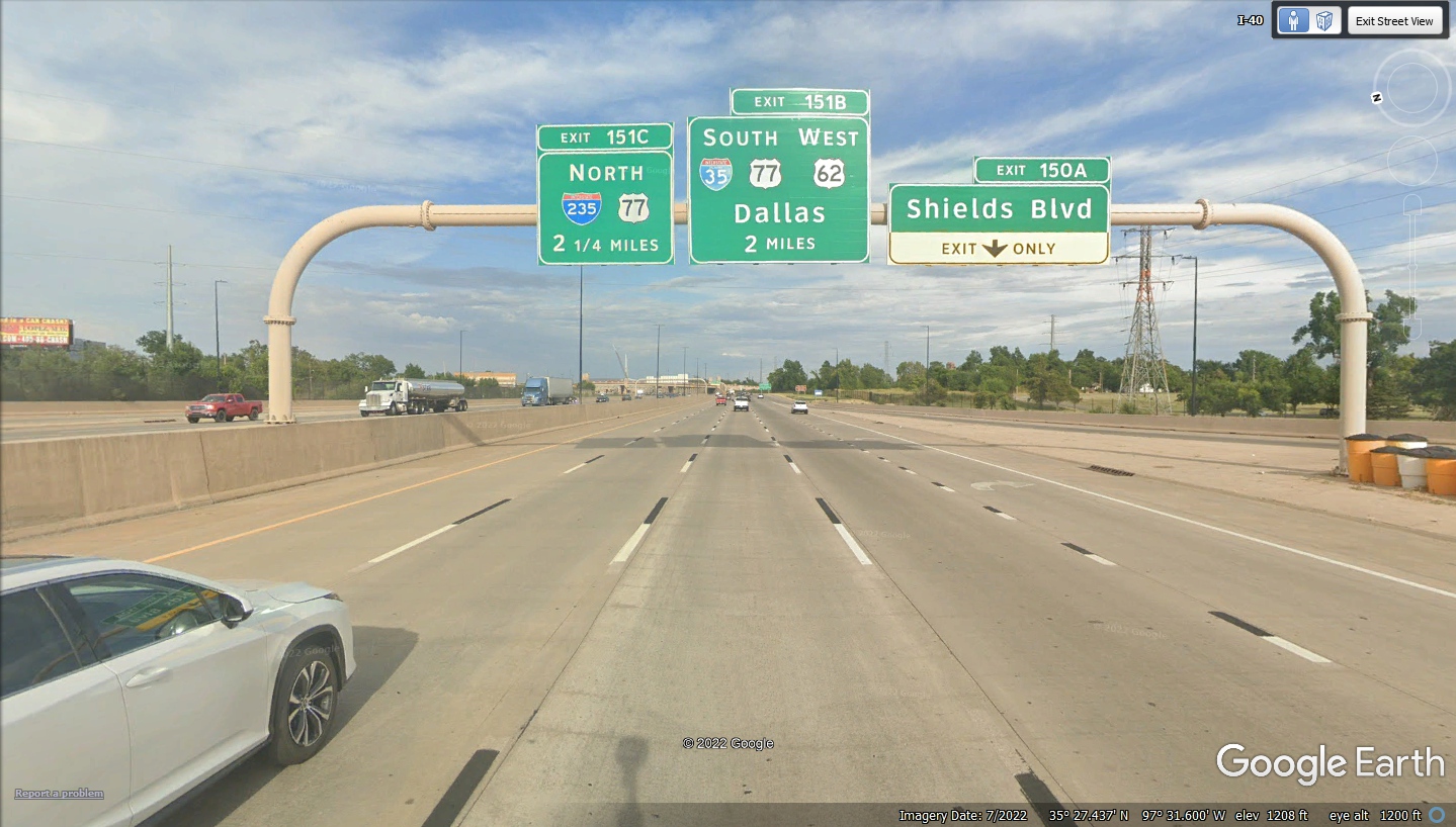
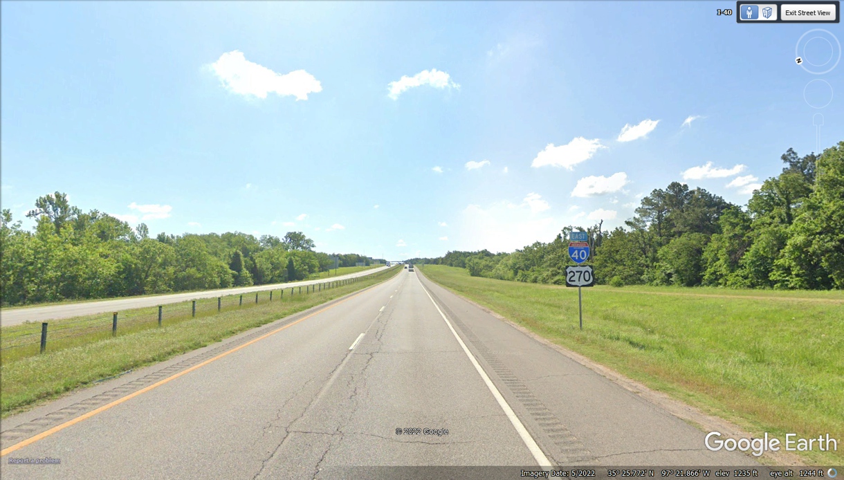
After passing Tinker AFB, the road soon gives way to open
country with trees on both sides of the freeway as US 270 runs concurrent with
I-40.
We have seen US 64 at its western end near the four-corners
monument in northeastern Arizona, and used it from Raton, NM to Clayton, NM when
we started our turn Eastward from Interstate 25 in northern New Mexico.
This exit and two more crossings with US 64 are in our path on I-40 before we
leave the state of Oklahoma.
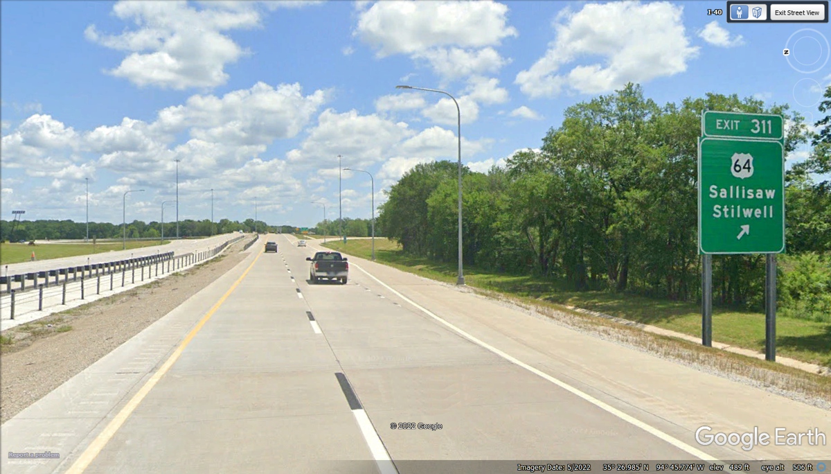
Here comes that final US 64 intersection with I-40 in
Oklahoma.
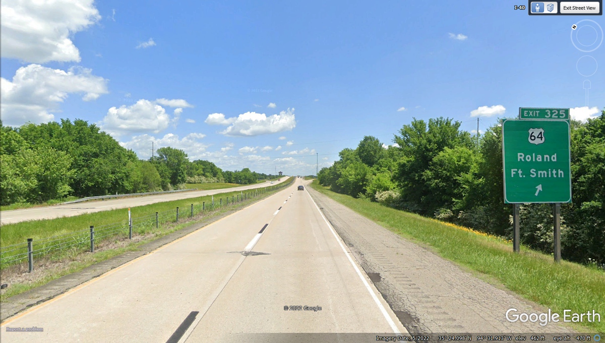
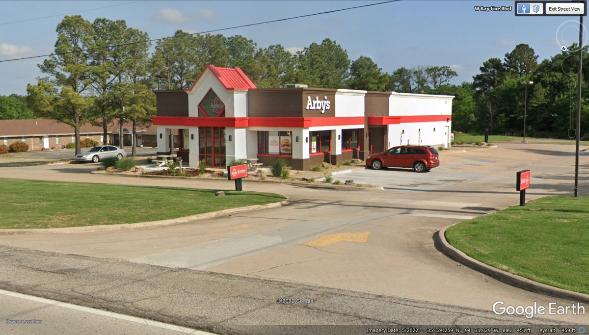
LUNCH is at Arby's today for their Market Fresh Sandwich
menu and chocolate milk shakes!
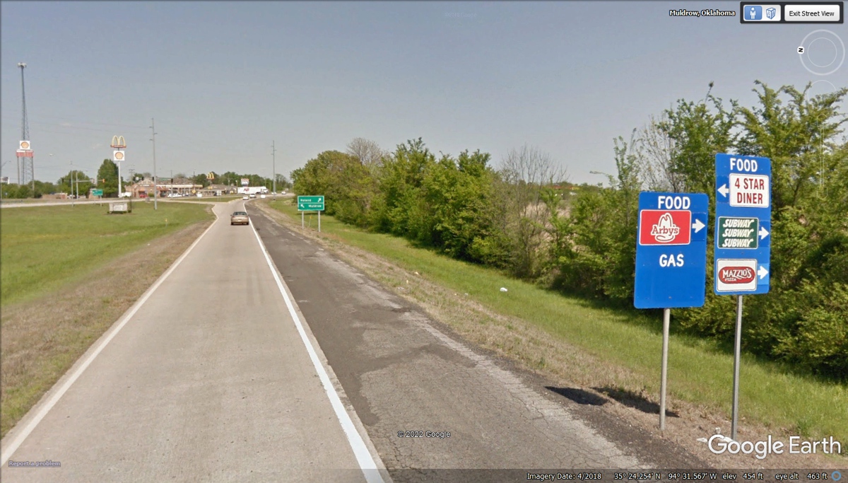
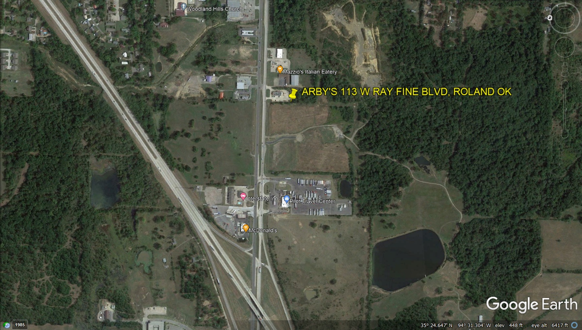
The Pilot Travel Center with their Wendy's restaurant was
the first place to stop after leaving the exit ramp 325. We drove to the
Arby's location about 3 tenths of a mile from the exit ramp.
After our stop at Arby's in Chadron, Nebraska, we were
ready for another visit and lunch from Arby's. The receipt here was
stamped at 3:33 PM.
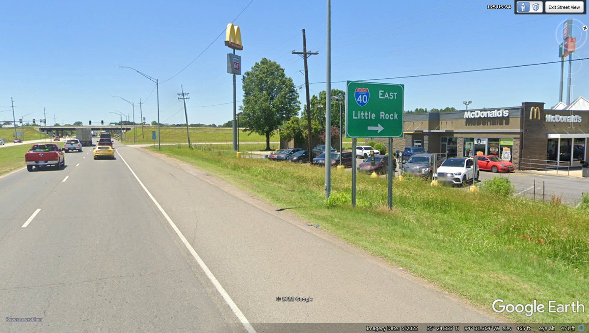
We drove up the hill to the entry ramp to I-40 East heading
for Little Rock, Arkansas. (they pronounce it R-can-saw)
I was born in 1947 and raised in North Georgia about 20
miles from Echota, the capital of the civilized Cherokee Indian Tribe.
Look up "Trail of Tears" which is the event of the forced removal of
Native Indians from the southeastern United States from 1830 to 1850 to provide
lands for "white settlers". The Indians were resettled in
Oklahoma. When native American tribes established gambling on their
reservations, many of them lived better from the income from those casinos.
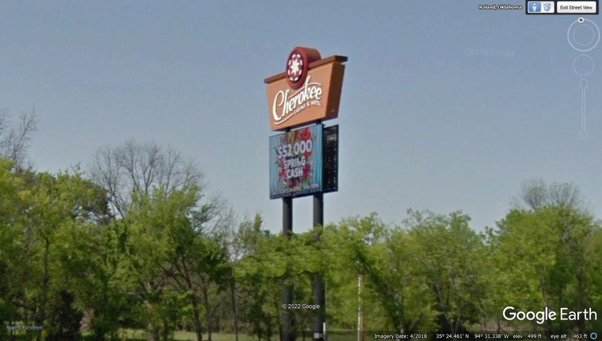
Here is a reminder that Native American Tribes have their
own government within the territory of the United States of America. This
sign is in the state of Oklahoma.
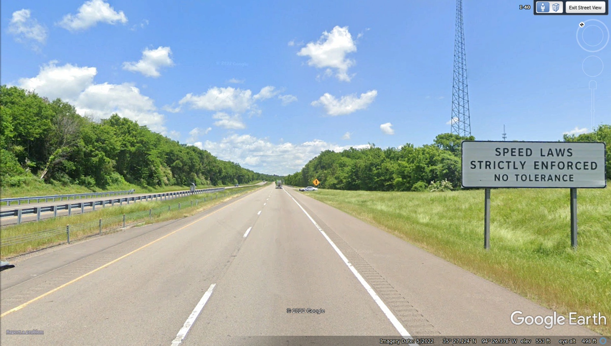
Crossing the state line into Arkansas resets the mile
markers to zero going East.
The first sign after the state line is the speed laws
strictly enforced with a state trooper at the next on-ramp with his radar
looking in this direction.
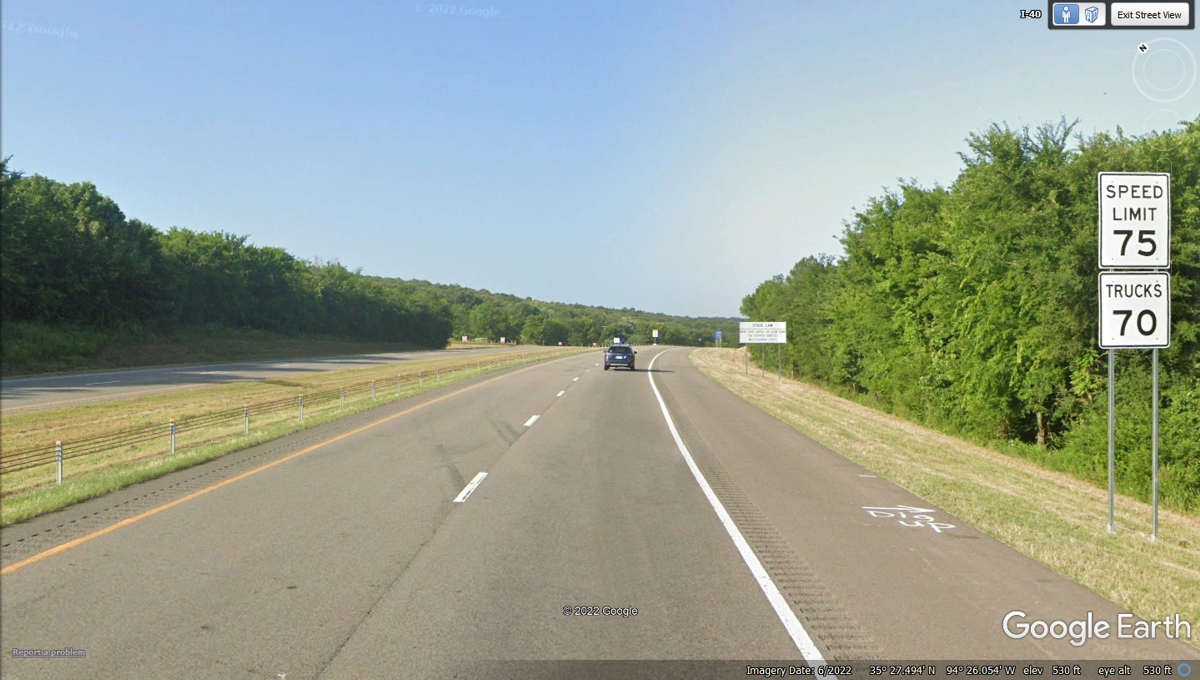
Now we know the state speed limit on the Interstate
highways is 75 MPH.
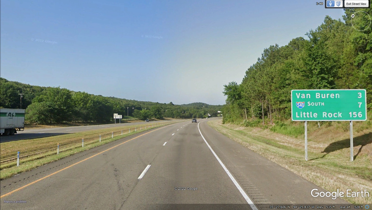
Little Rock is the capitol city of Arkansas and the
location of our motel for this evening. Interstate 540 is a bypass around
a number of cities in northwest Arkansas.
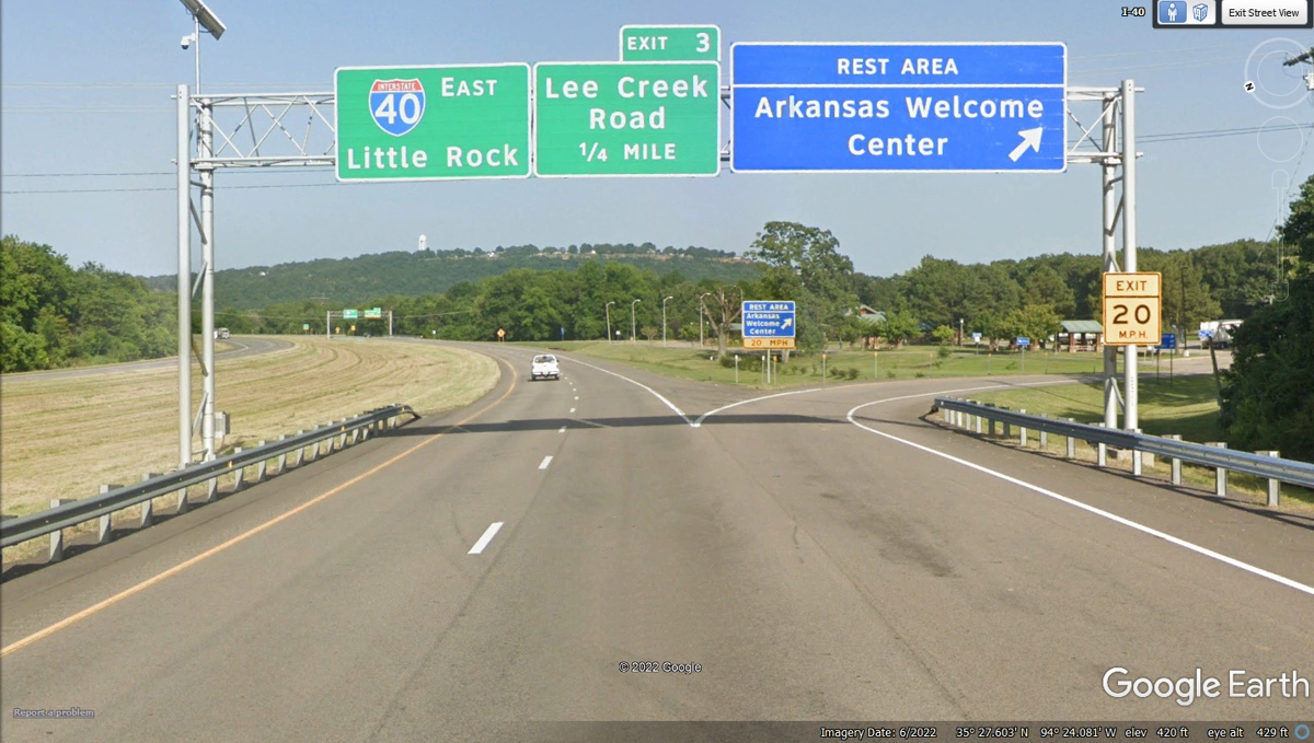
We will go all the way across Arkansas following I-40 until
we reach Memphis, Tennessee after we get on the road tomorrow morning.
Interstate 540 connects the cities in northwest Arkansas
running parallel with US 71. We used I-49 in Louisiana during the first
part of this trip out west. This segment of I-49 is yet to be connected
all the way down toward New Orleans.
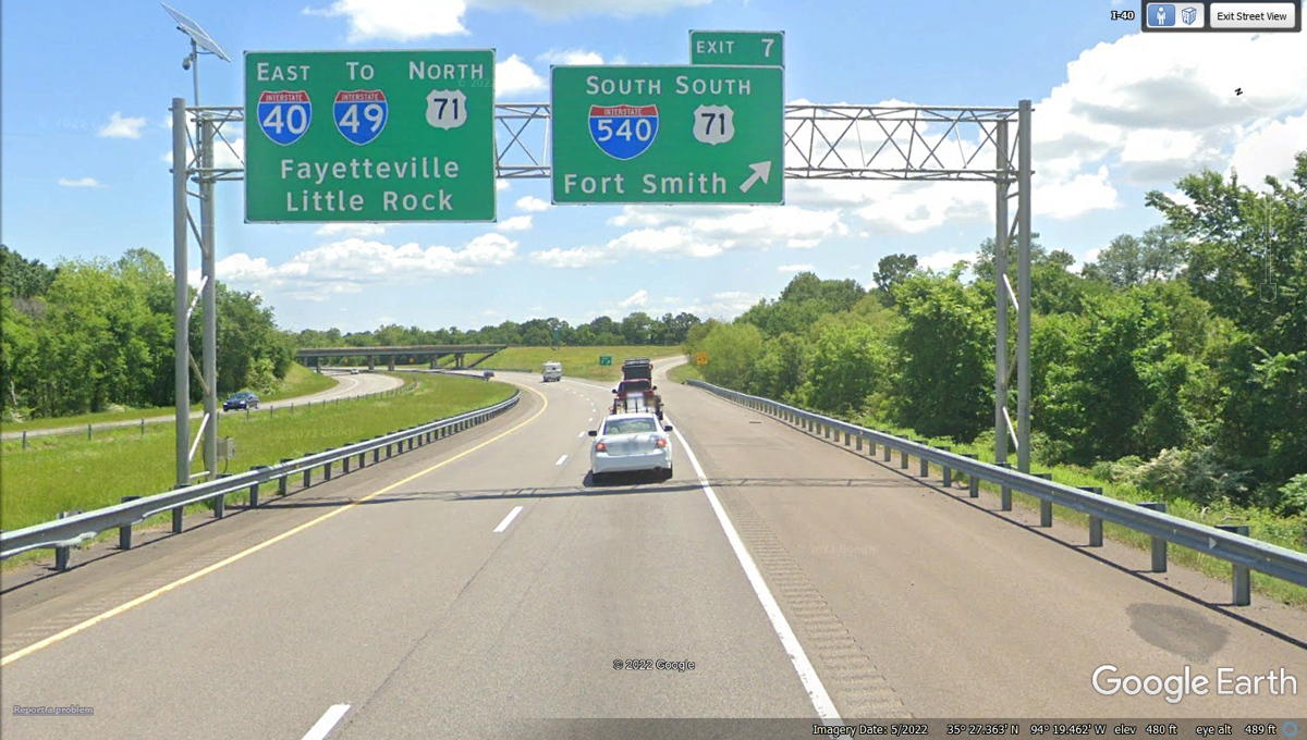
The segment of Interstate 49 that begins here will
eventually reach Kansas City to connect to I-29 all the way to Canada. We
stay on I-40 going East.
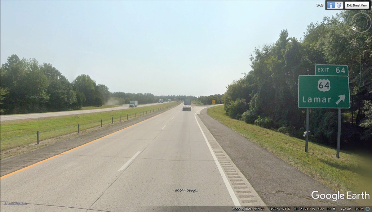
US 64 has been running near I-40 from Eastern Oklahoma and
here in Arkansas. The fact that US 64 connects to this section of I-40 at
Exit 64 got my attention as I was scanning the path of I-40 on the way to Little
Rock, Arkansas.
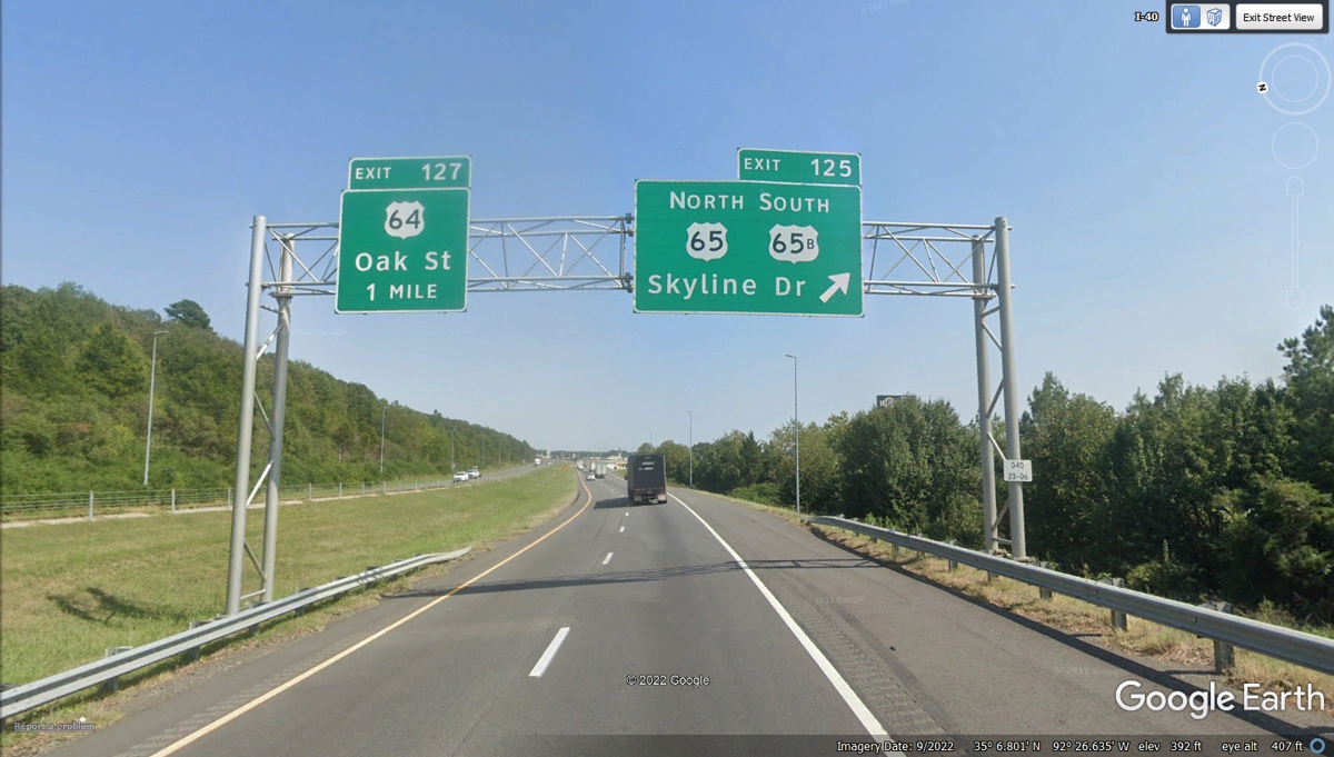
US 64 (East & West) and US 65 (North & South) cross
paths here in Conway, Arkansas. I stopped for fuel in Conway, Arkansas in
December 1966 on my FIRST cross country trip from Dalton, Georgia to Victorville, California to see
the family of my first wife and mother to my two oldest sons.
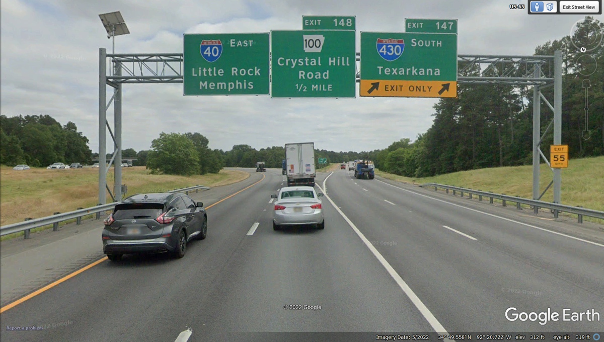
Another 20 miles south on I-40 brings us to the junction to
I-430 going south, while we stay on I-40 going East.
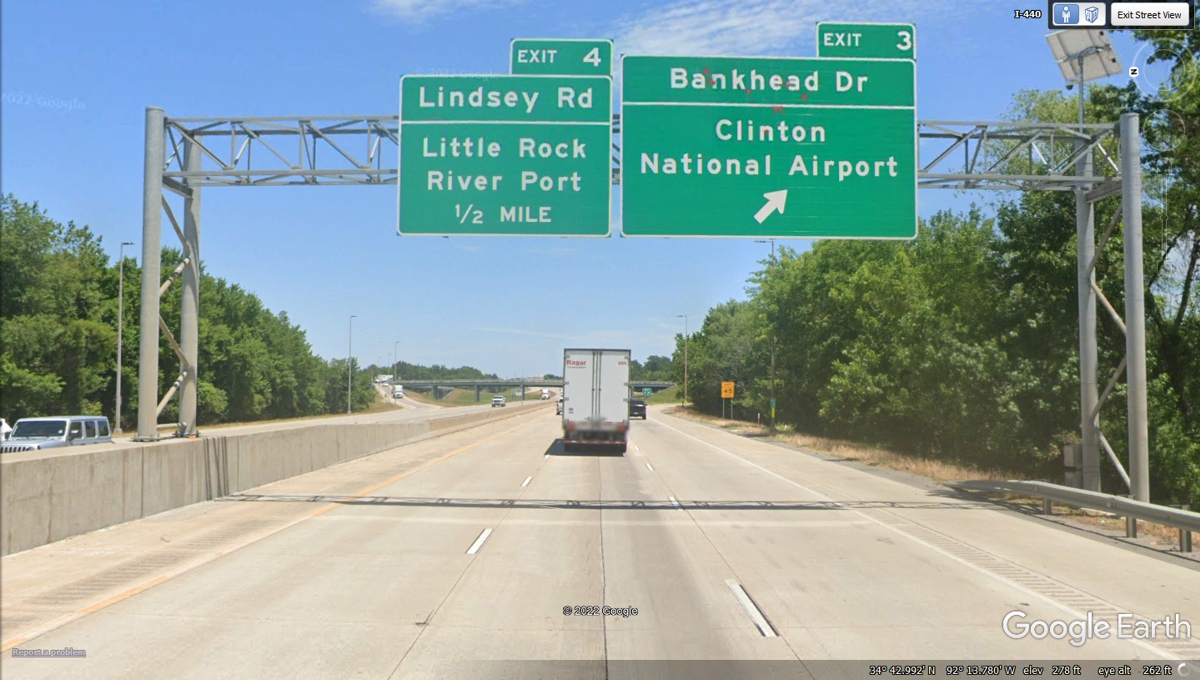
The route for this evening is via Exit 153B, I-30 south across the Arkansas
River to follow I-440 East to Exit 3 and our Motel 6 near the airport.
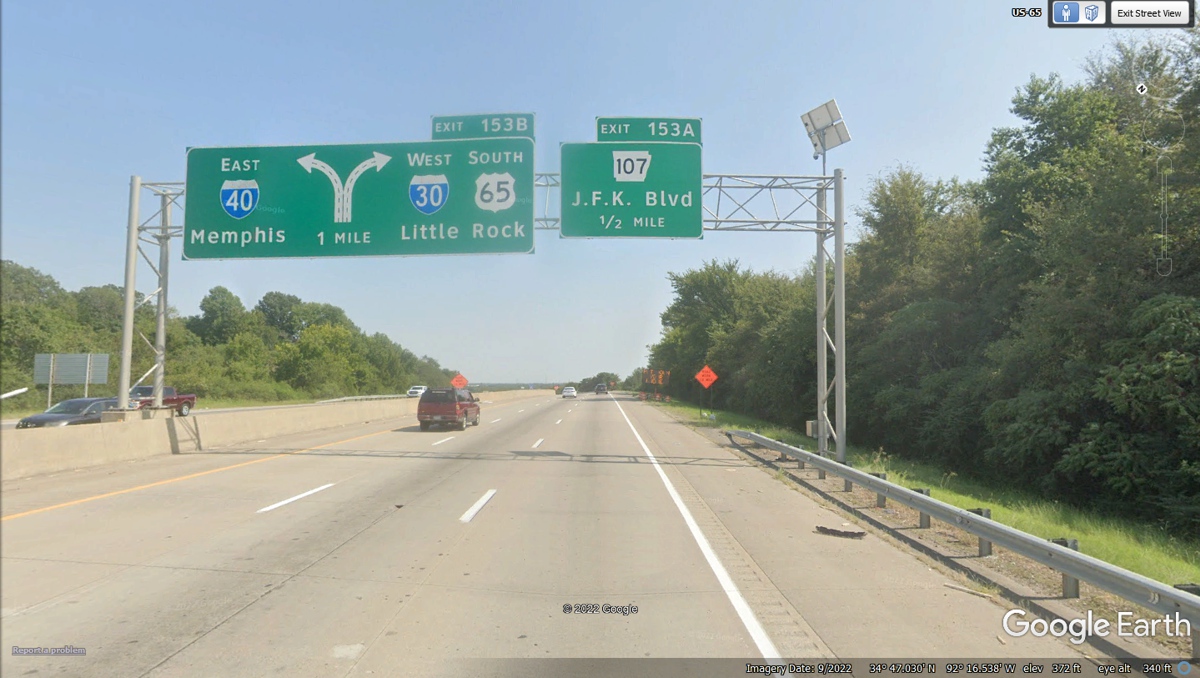
Our next turn to I-440 and the Little Rock Airport is the
next left exit 1.25 miles ahead.
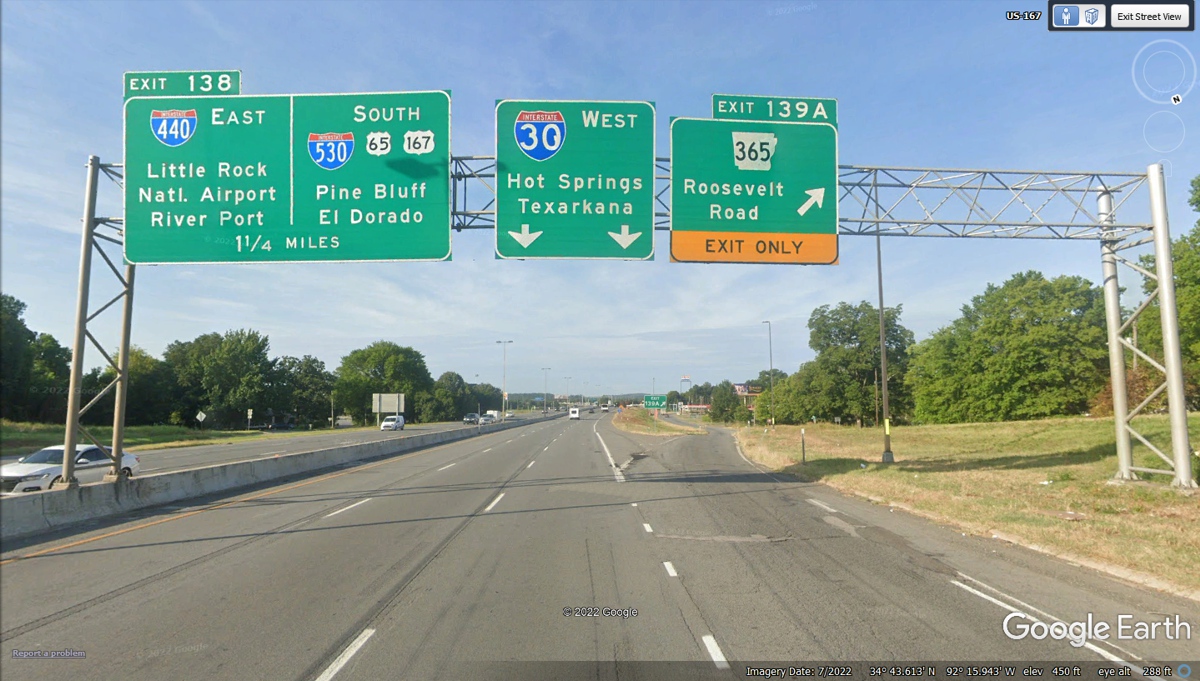
When we came this way, there was some traffic on I-30 that
prevented me from making this exit. I had to use my GPS-296 to navigate
the local streets to get to the Motel 6 near the airport.
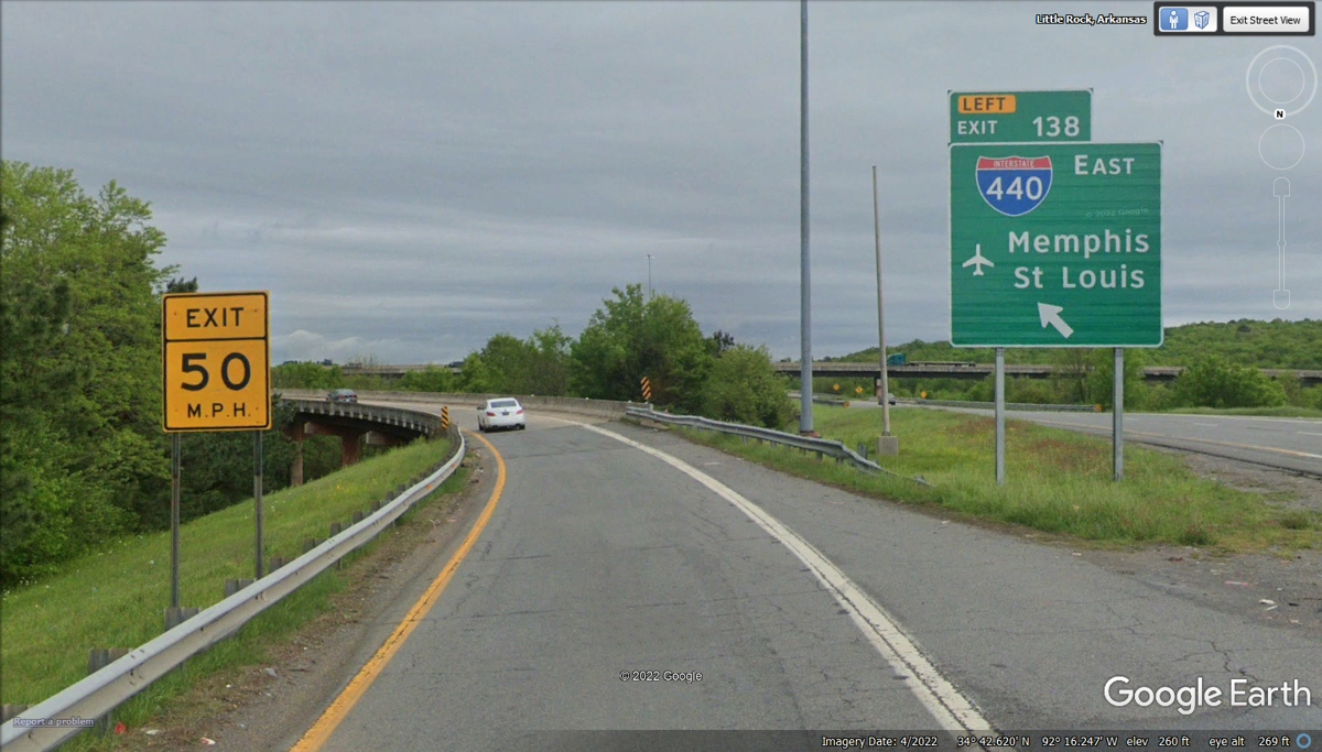
Since I missed the connection to I-440, I did not get off
at this exit. The motel is the first building on the right down on
Bankhead Drive.
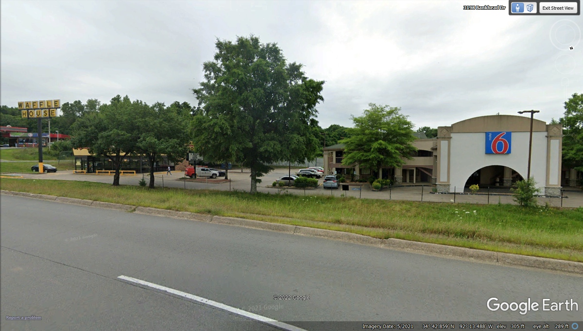
Motel 6 is indeed the closest building to Exit 3 from
I-440, but you have to drive down to enter to the Waffle House seen at the left
side of this image. When on that frontage road, the front desk is at the
arch with the RED 6 sign above it.
| East to Memphis, TN and Demopolis, Alabama - PAGE 54 | RETURN TO WESTERN TOUR INDEX PAGE |