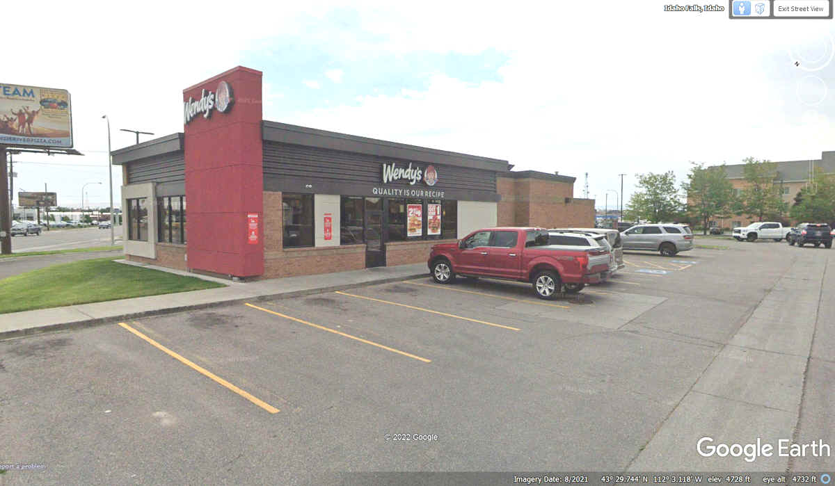
June 8, 2022: We only had to pass under I-15 to get to Wendy's for our breakfast sandwiches at 9:12 AM to start our day. We parked out front for this stop.
June 2022 Vacation Day 17, Idaho
Falls, Snake River, Alpine, Wyoming · · PAGE 41.
June 8, 2022: We only had to pass under
I-15 to get to Wendy's for our breakfast sandwiches at 9:12 AM to start our
day. We parked out front for this stop.
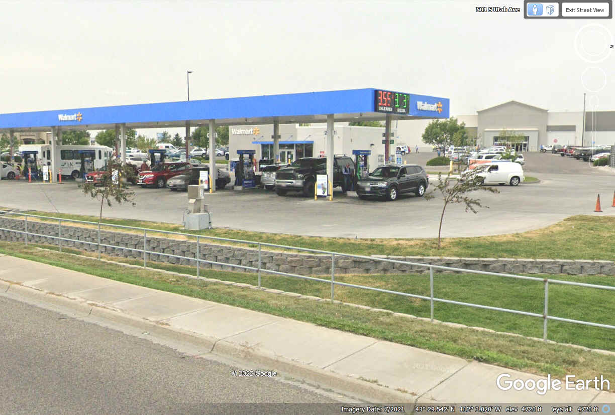
I had seen the back side of the Wal-Mart adjacent to the I-15 Exit ramp
last night as we got off here. This fuel stop was about 2 blocks from the
Wendy's where we stopped above. The receipt for the fuel was stamped at
9:34 AM as we started this day on the road toward Jackson, Wyoming and the
National Park tourist destinations beyond.
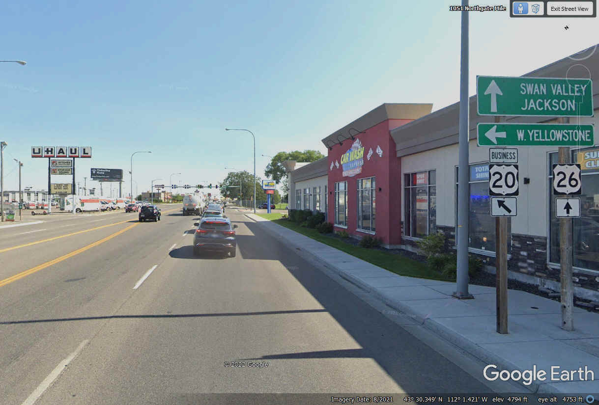
US 20 is the route that passed by our motel and Wendy's as Broadway Street
which comes across town to this intersection with Yellowstone Avenue where we
turn left to follow US 26 Eastbound.
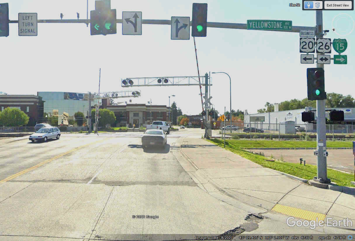
Yellowstone Avenue is heading northeast as it leaves the Idaho Falls
Business district on the west side of the street and residential areas on the
East side of the nearby railroad tracks.
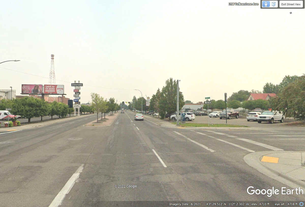
US 26 continues straight ahead at the next intersection. Jackson,
Wyoming is our next good-sized town on US 26. There is plenty of open
country and the Snake River along that route.
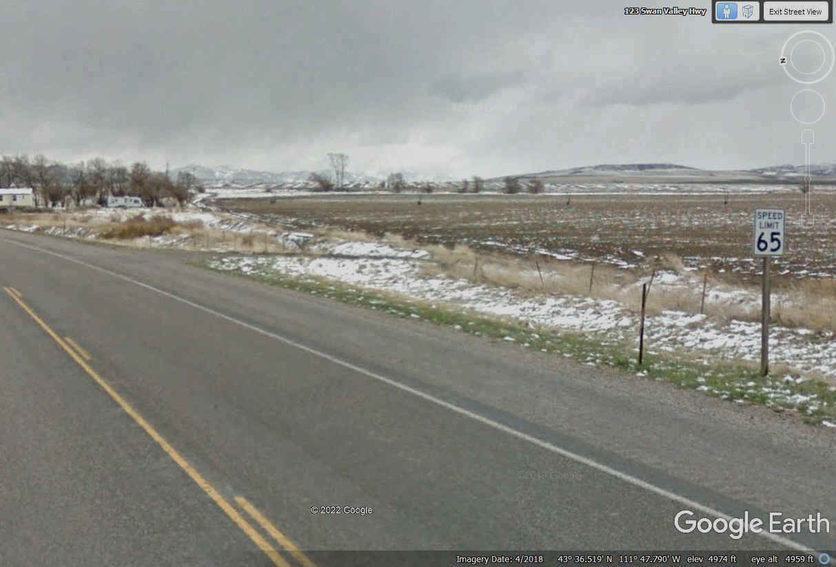
This image 15 miles northeast from Idaho Falls is farmland near Ririe,
Idaho showing the speed limit at 65 MPH heading East on US 26. This Google
Earth image is from April and shows snow on the ground.
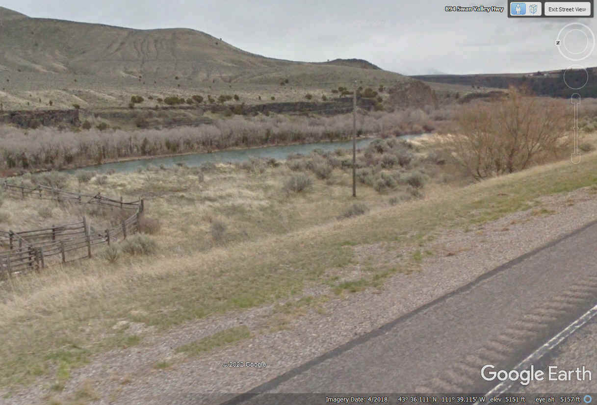
US 26 comes very close to the Snake River about 24 miles northeast from
the town of Idaho Falls where the river is flowing northwest parallel to US
26. It does not look like much here compared to other places along its
path to join the Columbia River over at Pasco, Washington.
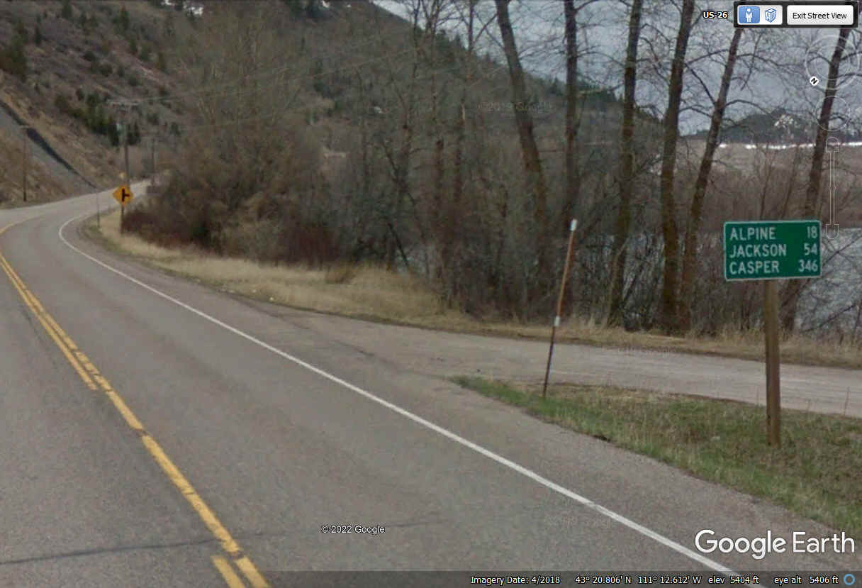
Finally a road sign with mileage on it. Jackson is the next major
city before heading up to see the Grand Teton National Park and Yellowstone
National Park today.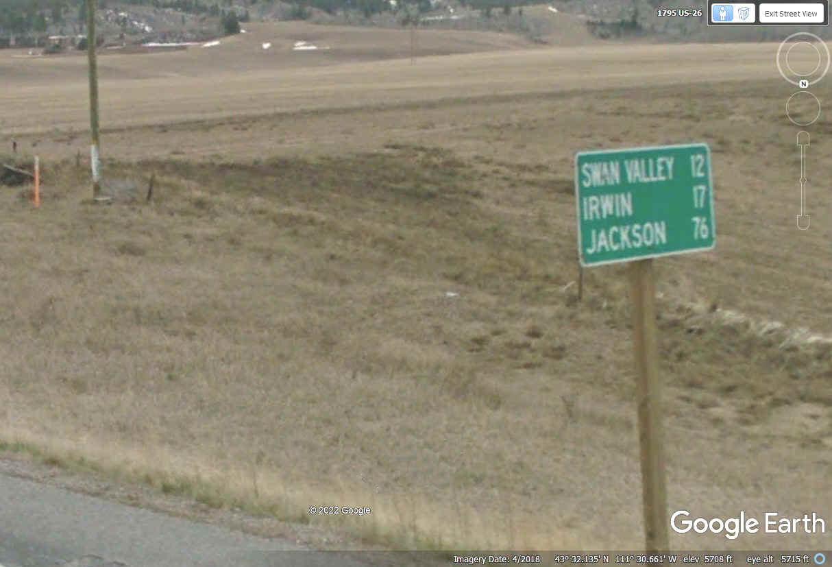
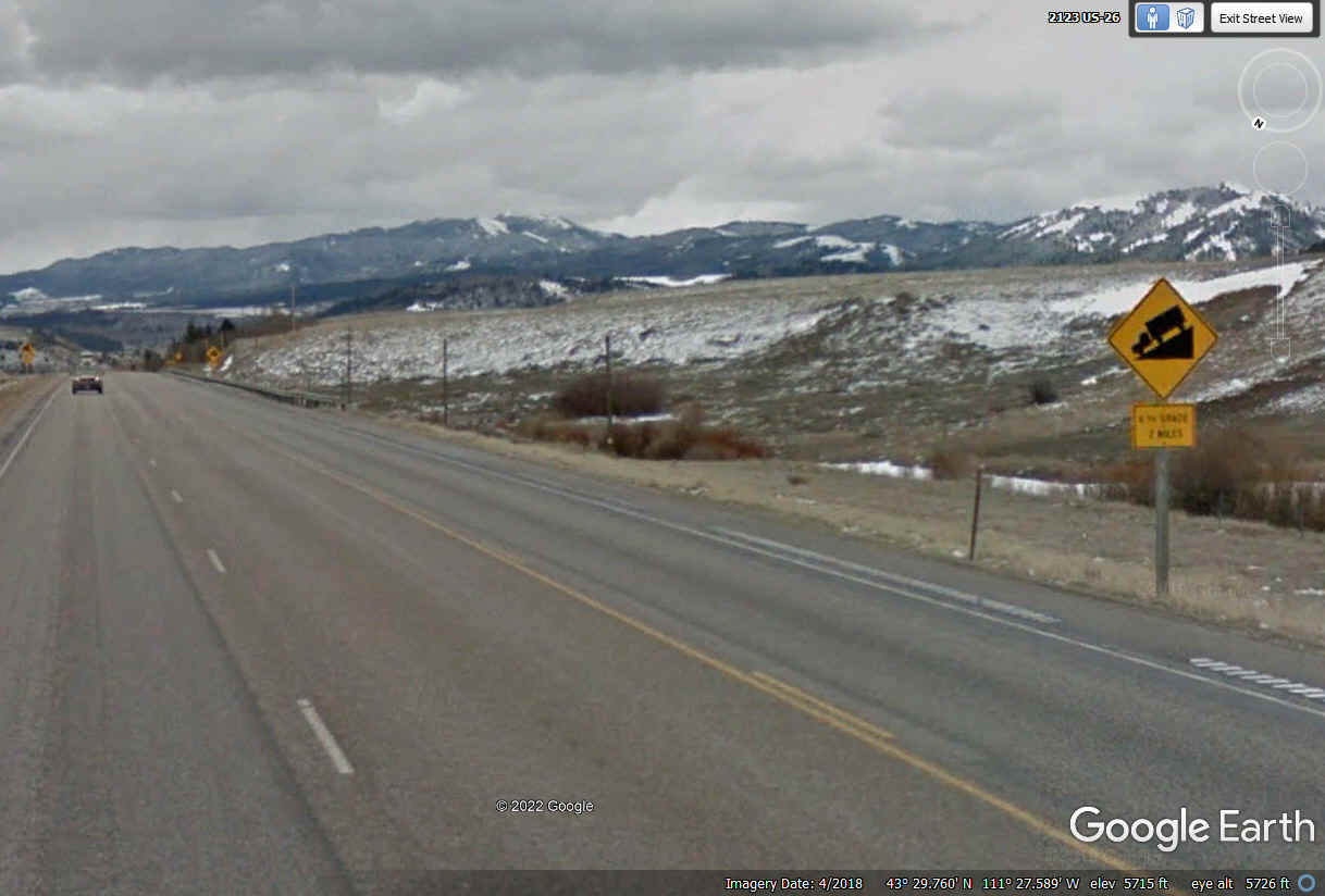
This is the beginning of the downhill grade of US 26 toward the Snake
River valley floor.
Here is the view looking south down on the lower level where the land is reasonably FLAT
close to the Snake River. 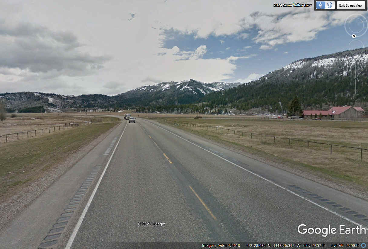
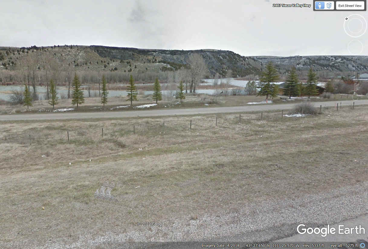
The Snake River turned left down here in the "FLAT LAND" and the
highway had to make the same LEFT turn as viewed from the southbound travel
lane. By the time the Snake River gets past Jackson, Wyoming the river
is coming south on the East side of the Grand Teton Mountains.
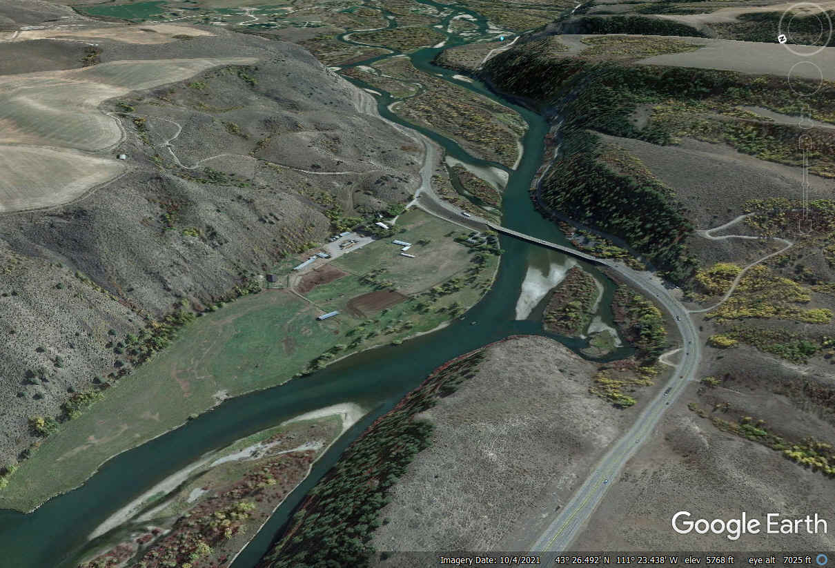
This aerial image from Google Earth shows how the Snake River and US 26
swap sides as both of them approach the town of Swan Valley.
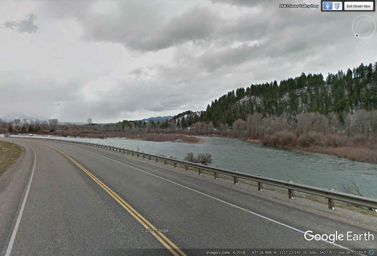
This image and the one seen above show the Snake River and US 26 have
reached their closest encounter as we drive south adjacent to the river that is
flowing north at this location.
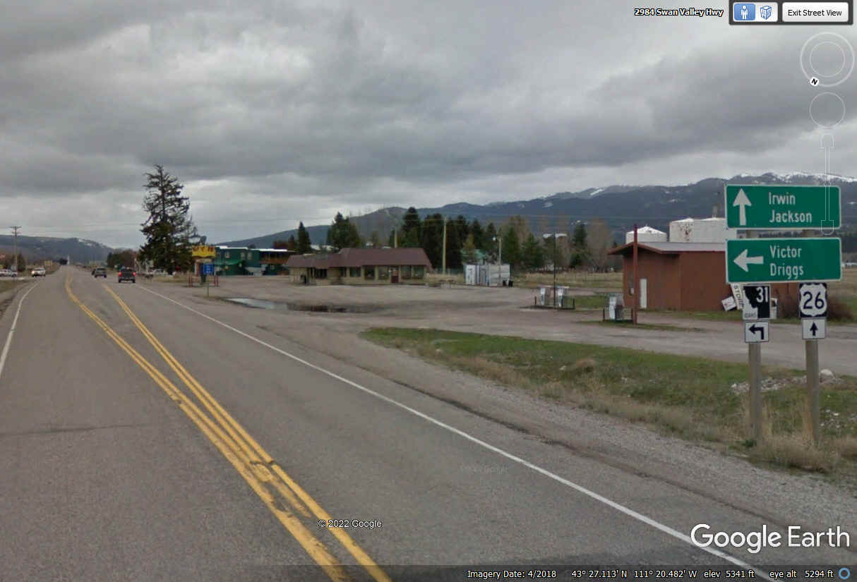
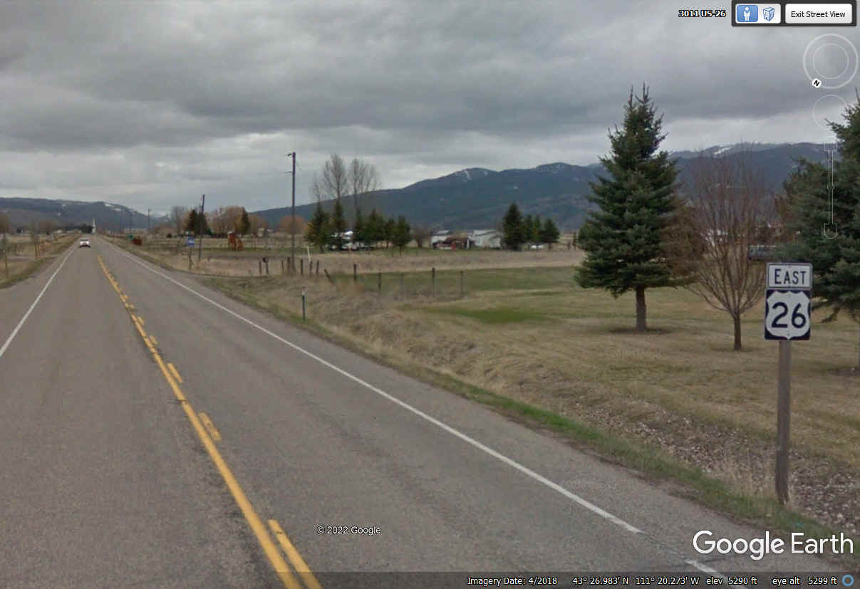
Here we are at "downtown" Swan Valley with the road signs without
mileage numbers on them. US 26 follows the Snake River valley all the way
to Jackson and then north to the national parks on the east side of he mountains.
Idaho state route 31 is subject to more road closures in cold weather snow
events. US 26 being a federal highway gets better winter weather
maintenance to keep it open for travel year-round.
The Snake River Roadhouse and the Exxon station across the road at the
intersection appear to be the center of activity here at Swan Valley, Idaho.
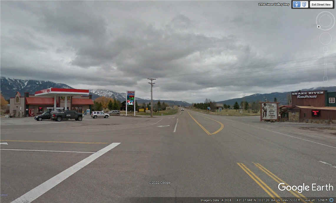
We have about 60 miles to go from here to Jackson, Wyoming.
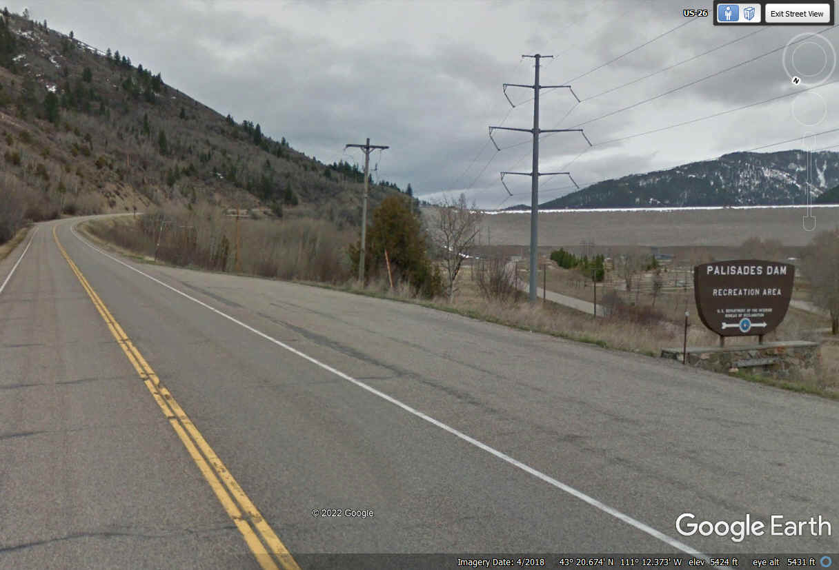
The Targhee National Forest sign is just before reaching the Palisades Dam across
the Snake River south of a residential area known as Palisades, Idaho.
This closer view of the Palisades Dam reveals it is an Earthfill dam 270
feet high with tons of stones to keep it safe. It was built in 1957.
The US Bureau of Reclamation is the operator of the dam. It has FOUR
turbines to generate electricity. The lake is the Palisades Reservoir that
goes down south as far as the town of Alpine, Wyoming.
US 26 is running East/West up near the dam and will turn southeast toward
the town of Alpine, Wyoming located just across the state line from Idaho.
This Google Earth image is on the high side of the dam.
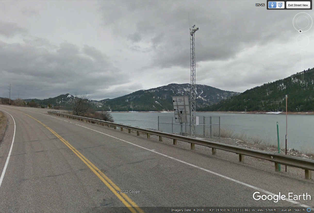
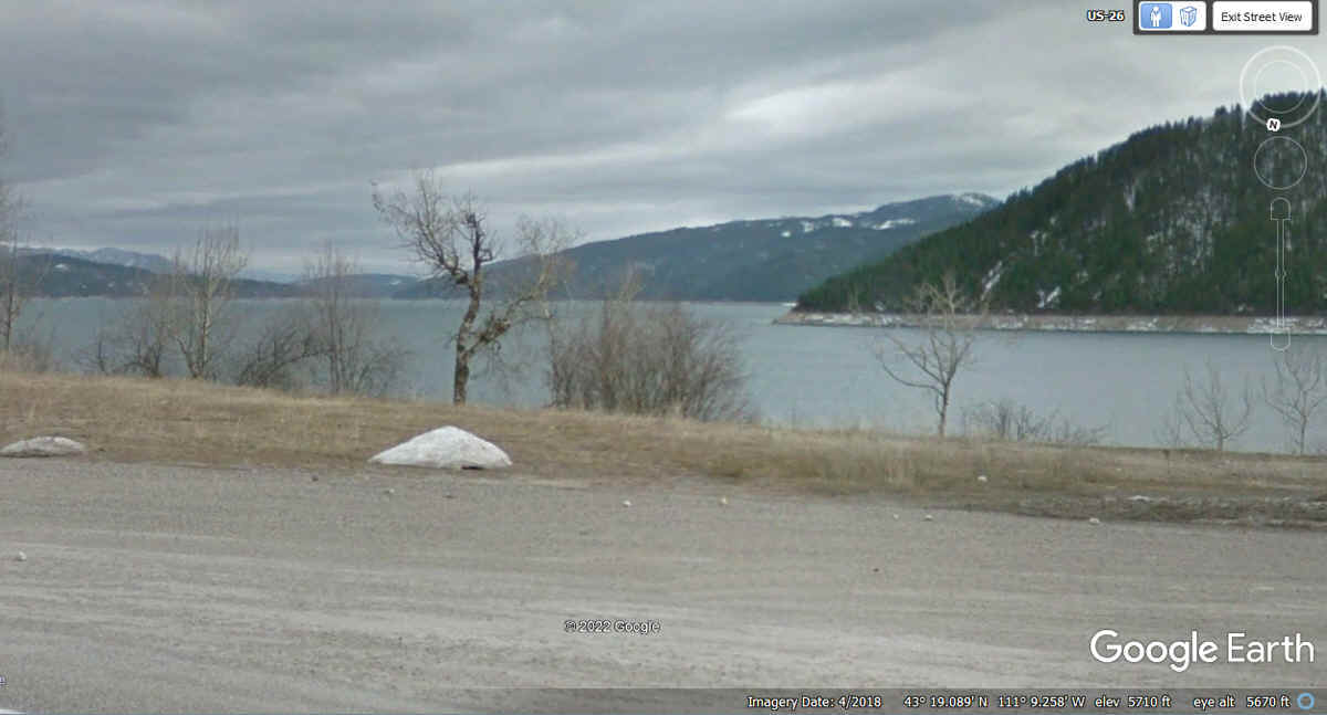
This is my photo taken at 11:06 AM Mountain time on June 8, 2022 from a roadside view point on US 26.
It is looking south across the Palisades Reservoir.
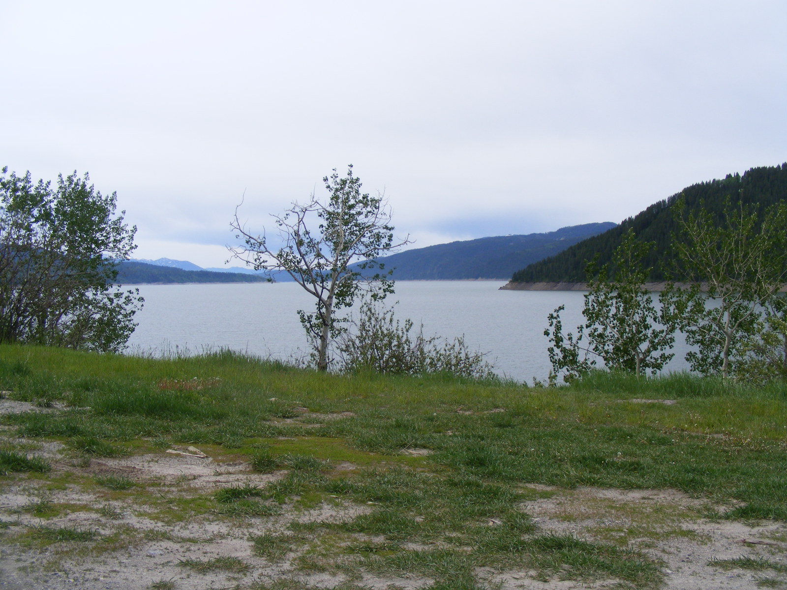
Here is the Google Earth image from April 2018 of the same area with a patch of
springtime snow.
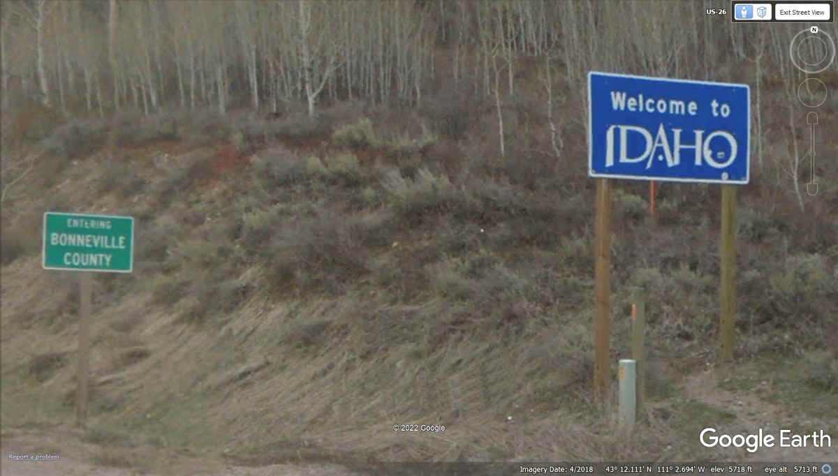
I had to look in the rear view mirror to see a state line sign for Idaho
as there has yet to be a sign for entering Wyoming. The green sign
says "Entering Bonneville County" seen by traffic heading west on US
26.
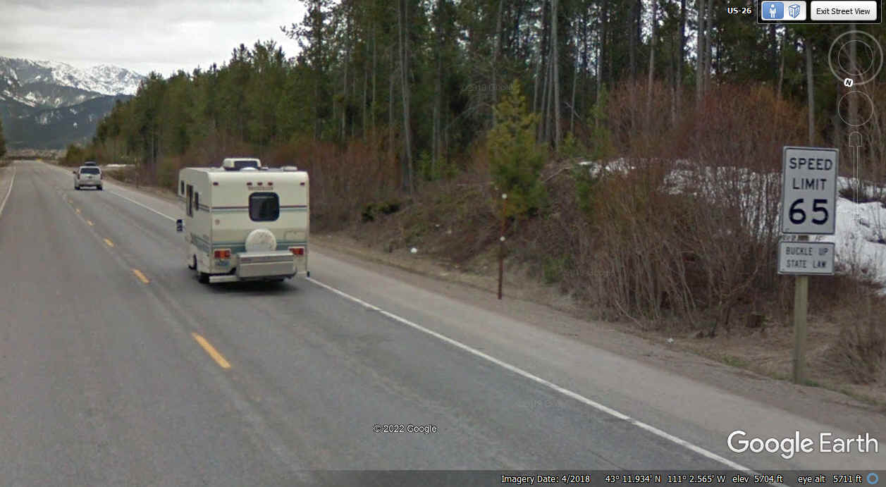
Going south again, the 65 MPH speed limit
sign has a small sign below it that says "BUCKLE UP, STATE LAW" with no
mention of it being for Wyoming.
With a bad sunlight angle, this Google Earth image does not have the
contrast to reveal the details of the official Wyoming state line sign seen
above the Google Earth logo down near the bottom right corner of this image.
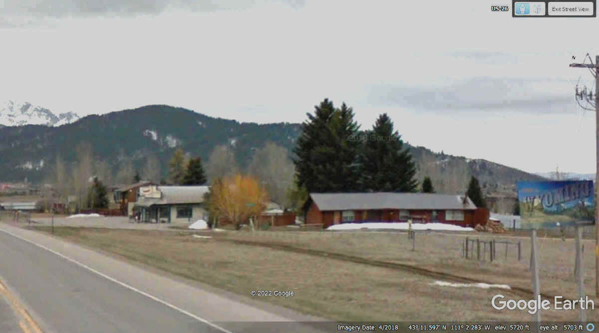
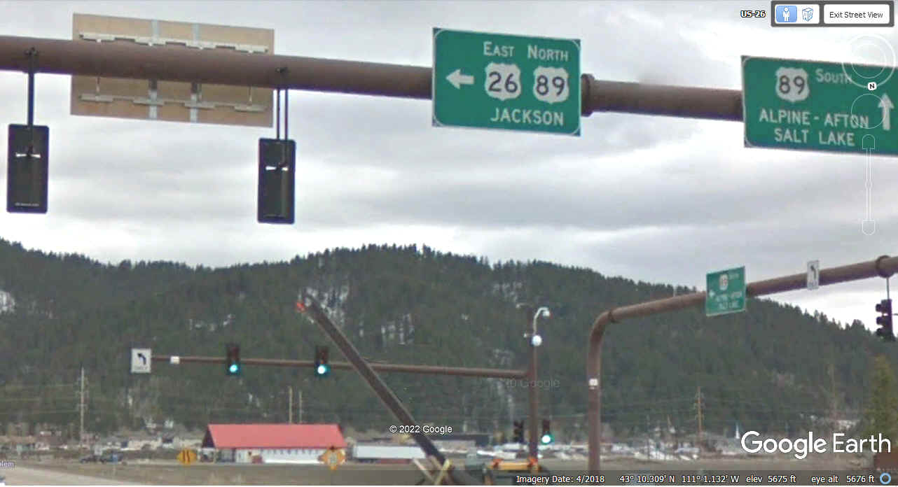
Here is the main intersection in Alpine, Wyoming where US 26 and US 89 turn East
for the ride to Jackson, Wyoming following the path of the Snake River.
The first time I came here a number of years ago, I was coming north from Salt Lake
City via US 89.
| HEADING SOUTH THEN EAST - PAGE 42 | RETURN TO WESTERN TOUR INDEX PAGE |