Going to Oshkosh 2004 - Page C
Thursday, July 29, 2004: I had a day to visit with
two of my cousins in northern Wisconsin yesterday. Traditional "Southern"
meals were served since we are all from the South. I got on the road this morning
and drove up to the northern end of US 41 to see the sights along the shore of Lake
Superior. I have traveled up and down US 41 for years, but this is the first time to
the northern end. There were many places along the way where cell phone service was
poor to non-existent. It got me away from my job for a few hours, but that was not
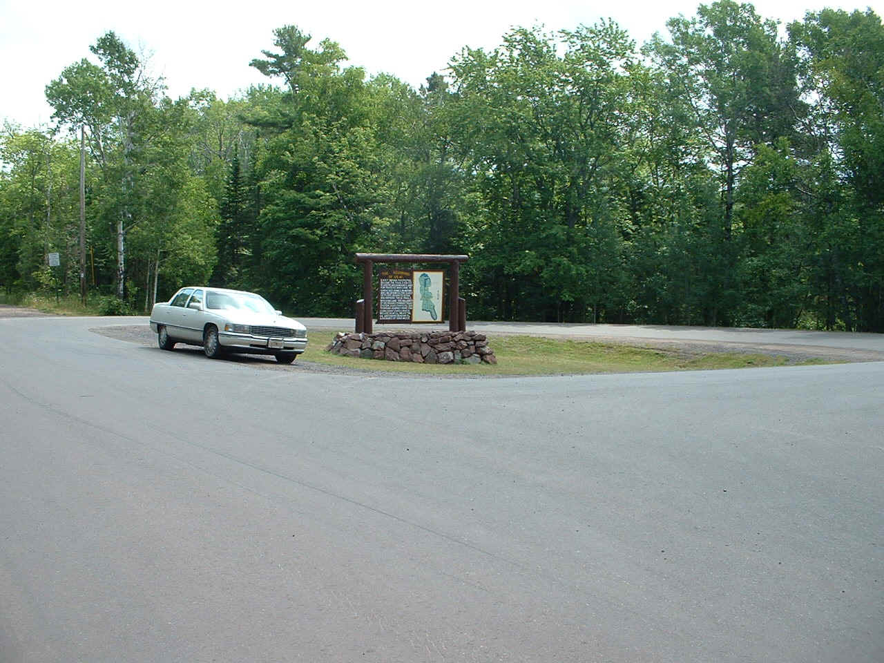
the plan. As you can see, the pavement ends at the left of the photo and there is
only this paved circle for traffic to turn around to head south again.
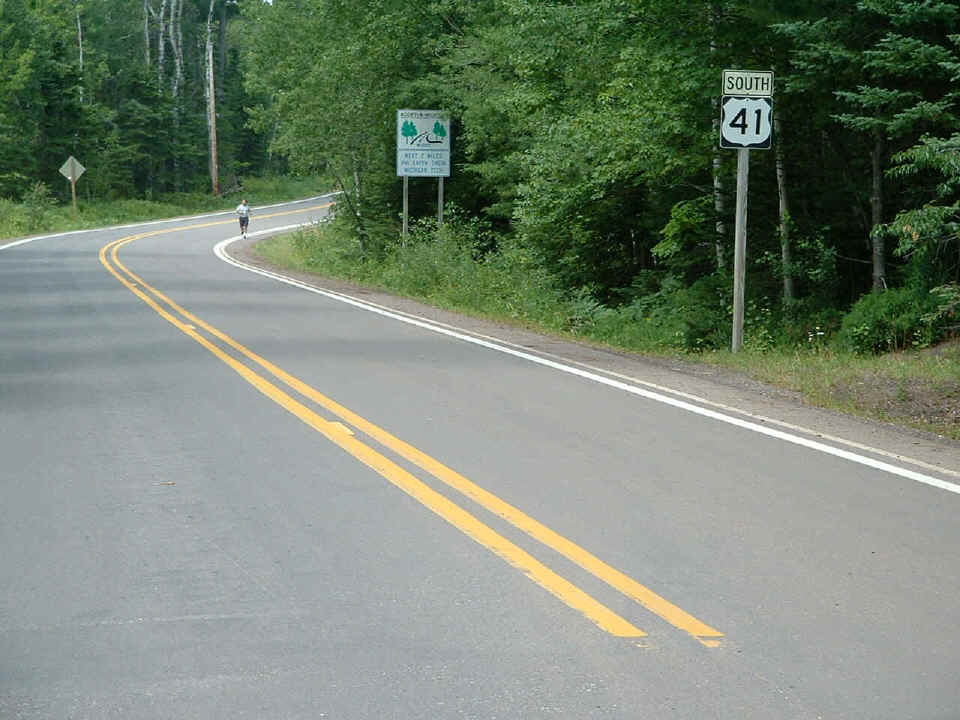
Speaking of heading south, here is what you see looking back down the road.
This is inside the Fort Wilkins State Park near Copper Harbor, Michigan.
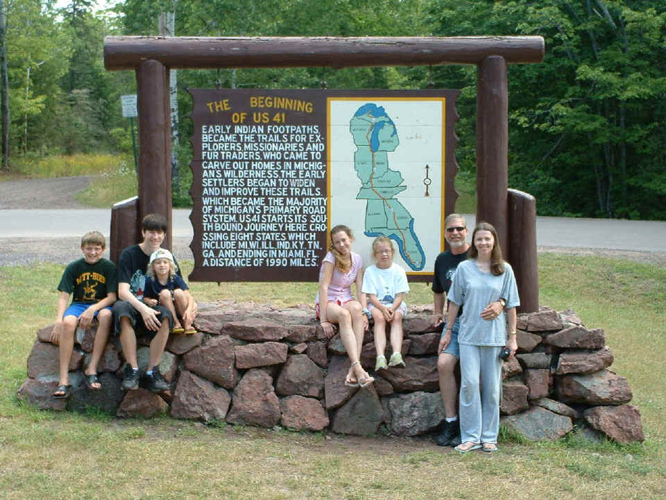
Right before I drove away, this family showed up and I realized that if I did
not take their film camera pictures, Dad would not be in them. The little girls got
a kick out of seeing this picture on the screen of my digital camera. I panned and
zoomed in on each of them on the camera's small screen.
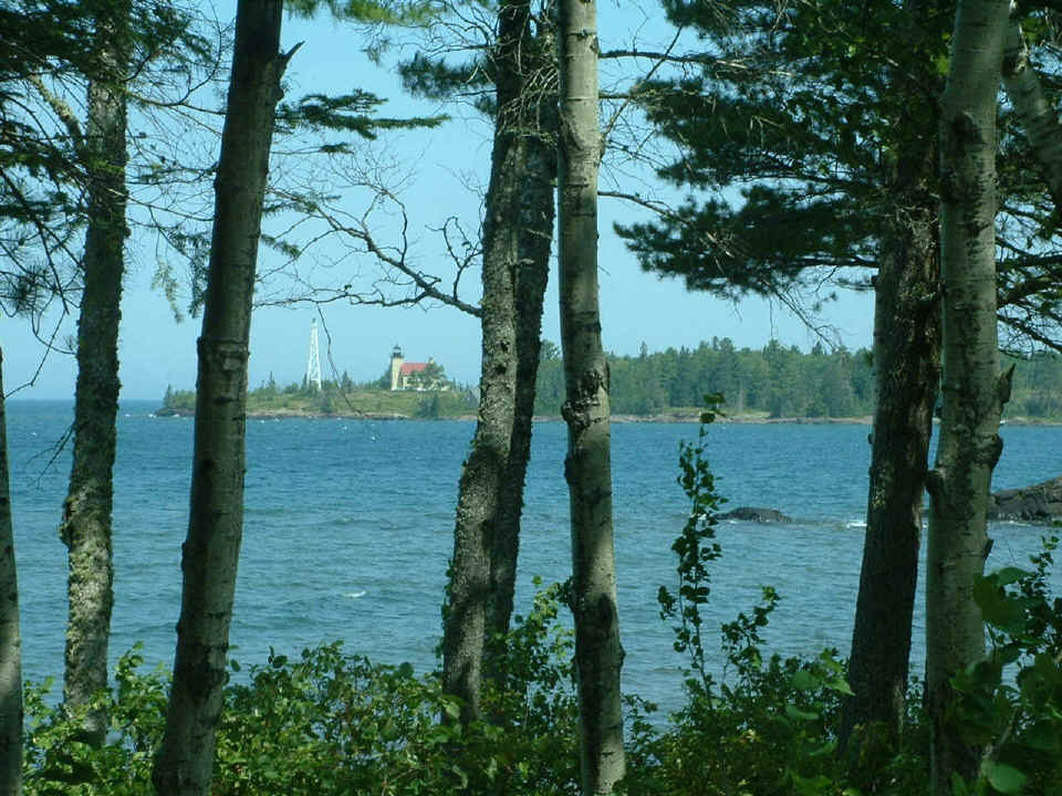
This is the view of the Copper Harbor Light House from the roadway looking LEFT
as you pass by the main gate of Fort Wilkins State Park on the RIGHT side of US 41.
No, I did not take a picture of the park ranger in the gate house. I did not want to
bore you that much!
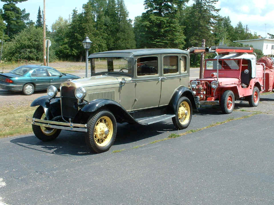
For you antique car fans, this well-restored Ford A model should make you
happy. A friend of mine in high school found a 1931 Ford Crown Victoria similar to
this one in a barn near Chatsworth, Georgia. He had it painted with similar colors during the restoration. This one
is seen in
front of a motel in Copper Harbor, Michigan.
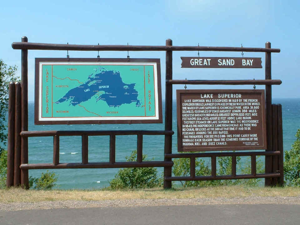
Here is a bit about the history of Lake Superior. I just noticed the name
of the French explorer Brule as I was posting this photo. I visited my older cousin near
the little town of Brule, Wisconsin. The Brule River came right by the back of her
house. On the way down to Green Bay, I crossed the Brule River again at a point
where it formed part of the state line between Wisconsin and the Upper Peninsula of Michigan.
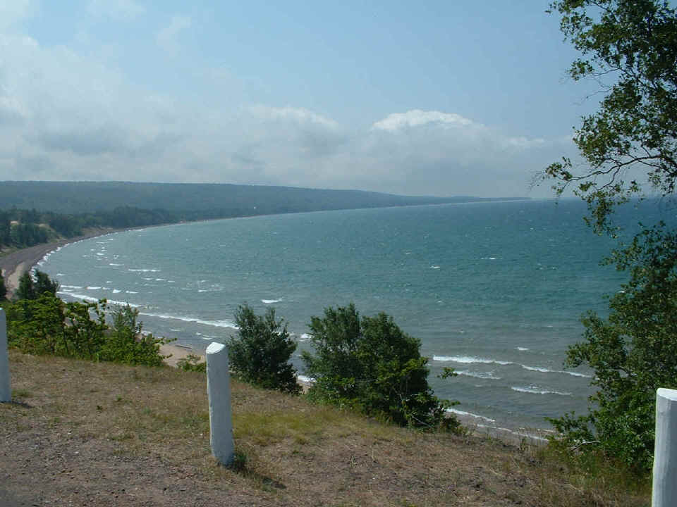
Here is the shoreline of Great Sand Bay.
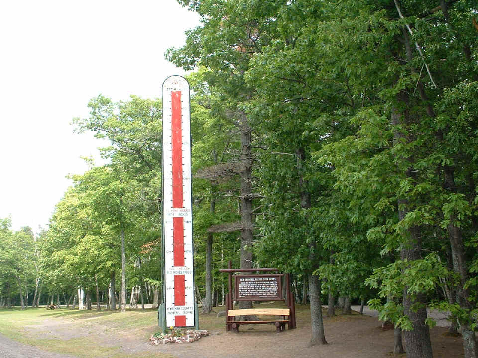
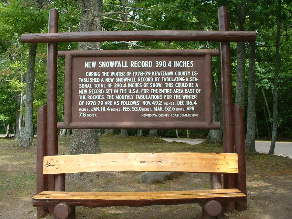
Since this is the northern-most county in Michigan, they have claimed to have
record snowfall amounts east of the Rocky Mountains. Here is how they drive home the
point.
Here is the close-up image of the sign from the photo
above.
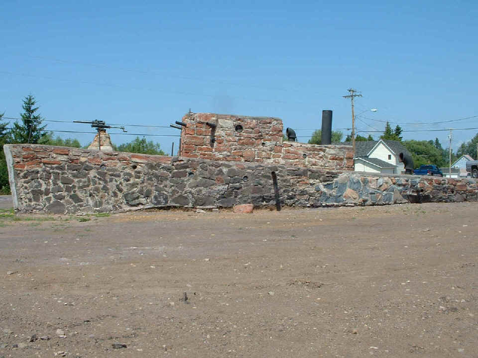
Luis, if you think the idea of gun boat diplomacy is dead, think again --
although this one is on the rocks. Or maybe I should say, IS MADE of rocks!
Some of the "guns" have been broken off from the sides. You can see one of
them remaining on this side of the "boat" by looking at the shadow
amidships. Most of the pipe guns were in place on the other side, but the sun angle
was best on this side to show the colors in the rocks.
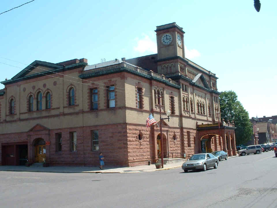
The last town going north toward the NORTH end of US 41 that has a Burger King and a
shopping center with bank, etc. is the "Village of Calumet, Michigan."
This is the town hall one block off of the one-way, cobble-stone main street with all the
classic old buildings on it.
| Tomorrow is OSHKOSH 2004 for me. | Return to Menu Page. |