October/November 2021 Vacation Day 14 · · PAGE 45.
November 8, 2021: Monday continues
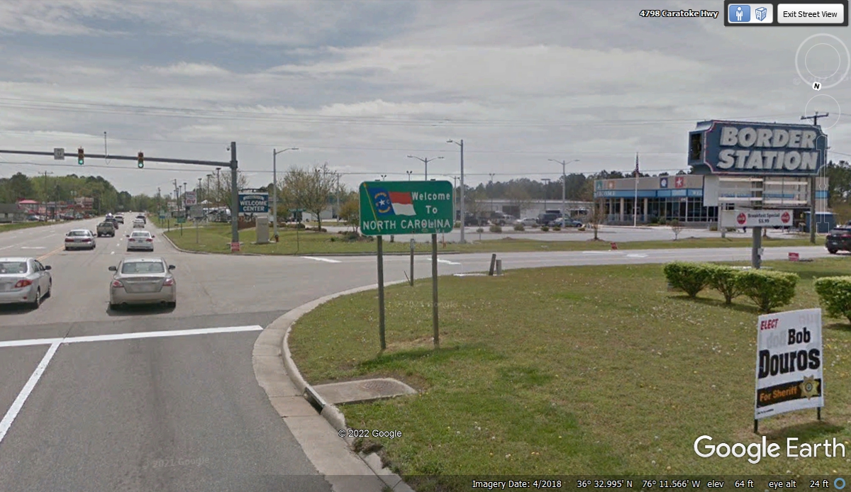
southbound into North Carolina on state route 168, the same highway
number used in Virginia. We crossed the state line at 11:53 AM. When
we passed this way I mentioned to Linda about a place called "South of the
Border" over on Interstate 95 just inside South Carolina. It is a
motel complex with some entertainment rides, etc. They have a lot of
highway billboards on I-95 in both states attracting tourists.
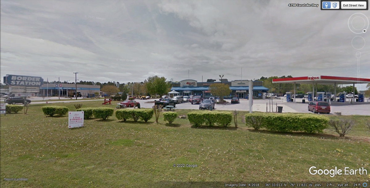
This place named Border Station is a fuel stop, restaurant, and souvenir
store. You can find a You Tube video from a guy who always stops here on his
way to the Outer Banks area south of here. He mentioned he drives eight
and a half hours from his home to get to this place.
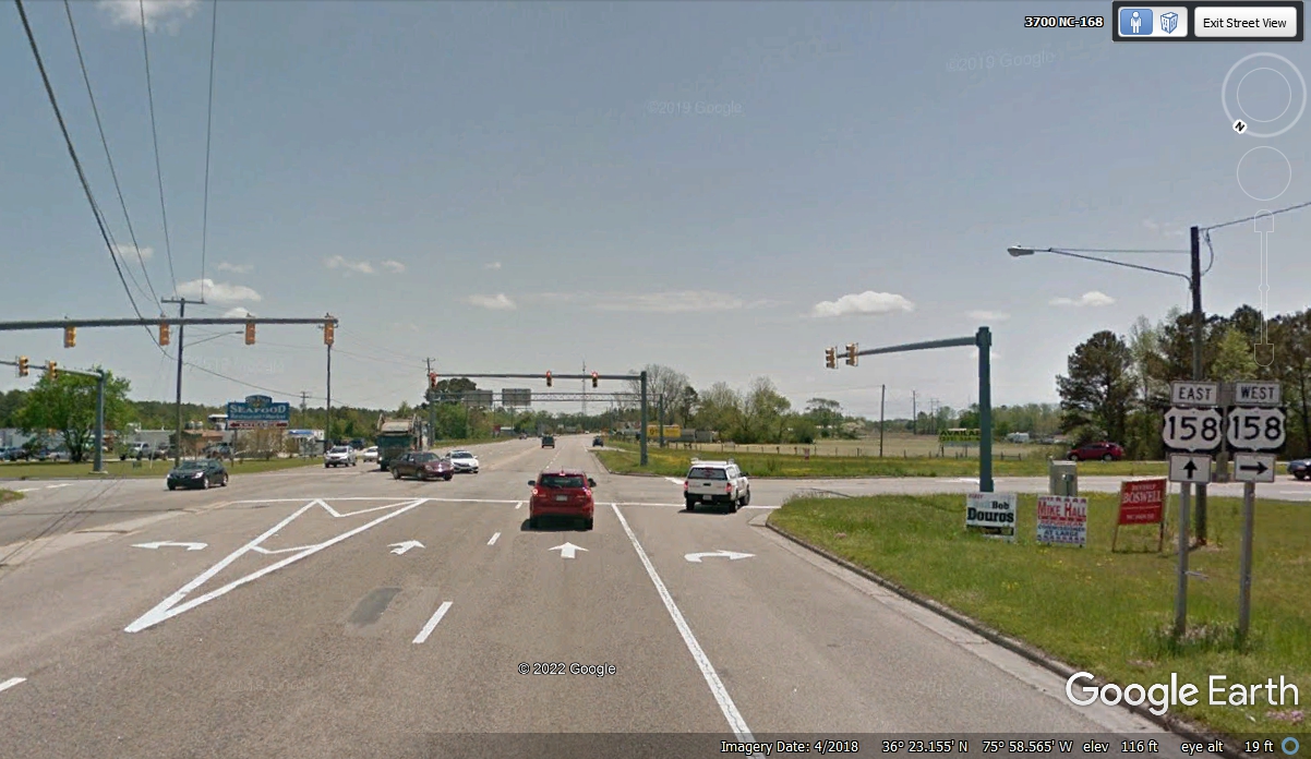
North Carolina route 168 ends at the intersection of US 158 coming to the
Outer Banks resort area just 18 miles inside North Carolina. US 158 exists
only in North Carolina and is 350 miles in length. We are going south on
US 158 from here until it ends in the Outer Banks at the eastern end of US 64
where we will head WEST. Traffic was moving well as we arrived at this
intersection at 12:13 PM.
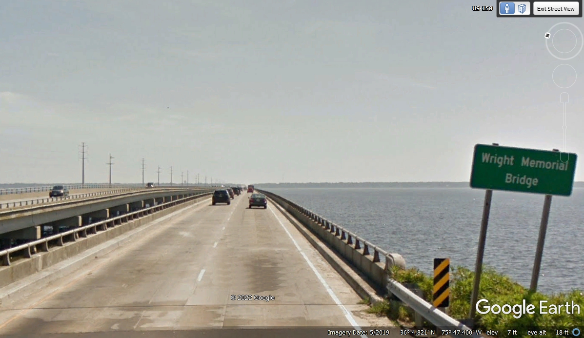
This bridge takes us from the mainland to the Outer Banks on US 158.
The Wright Brothers had their first airplane powered flights just over 10 miles
from here. This bridge named for them is just over 2.8 miles in length.
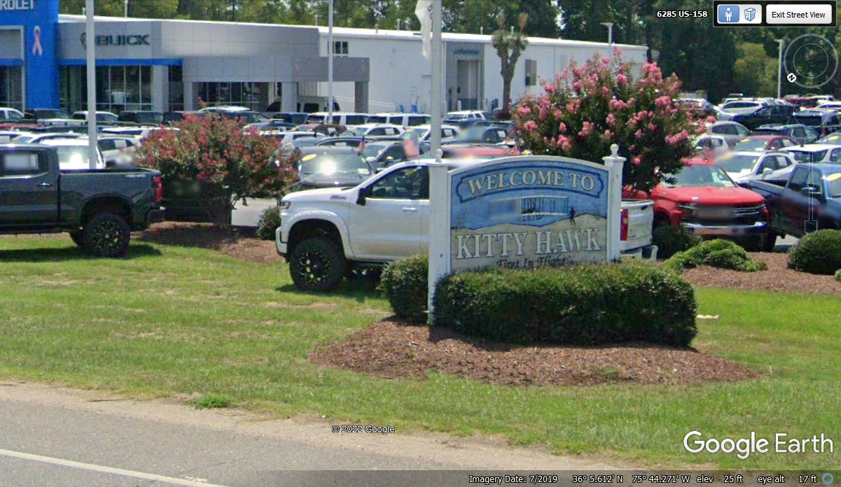
Here is the official sign welcoming tourists to Kitty Hawk, NC. We
passed this Chevy dealer at 12:44 PM.
We arrived at our tourist destination for today in Kitty Hawk, NC at 1:04
PM.
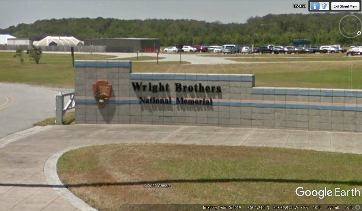
In the week before we began this trip I added my Veteran status to my
Florida drivers license and visited the gate to the Canaveral National Seashore
to get my Veteran's National Park annual pass. When I presented my pass to the US
National Park ranger at the entrance to the Wright Brothers National Memorial I
was greeted with the words "Thank you for your service" and granted
free entry. The exit road is on the left edge of this image below, but we
will get to that later.
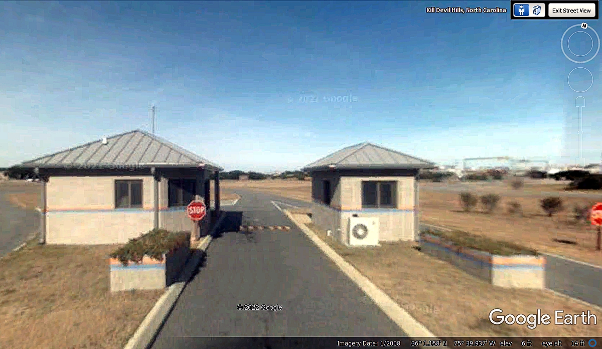
These Google Earth images from 2008 are of a lower resolution than the ones
from 2019 and newer. I did some post processing of this image to
"sharpen" it.
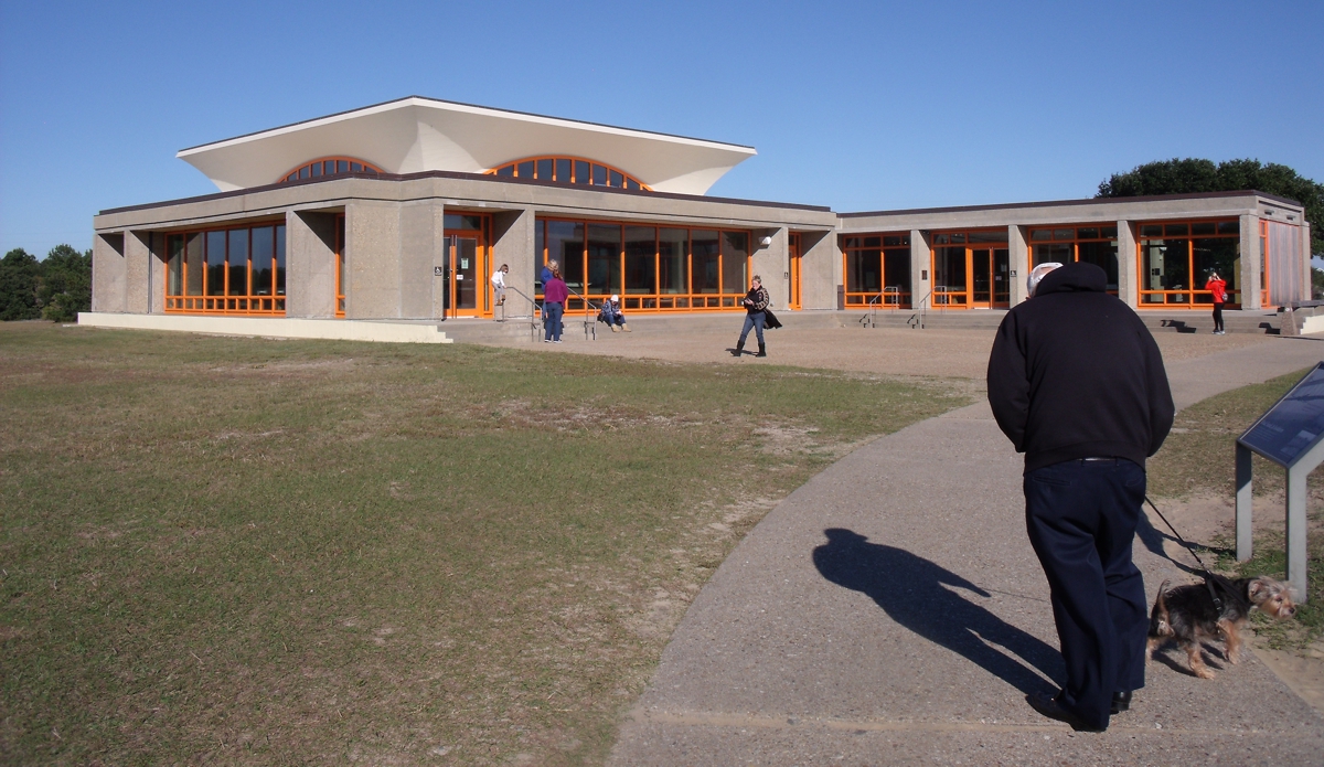
This is the Wright Brothers museum building as seen when walking back from
the outdoor exhibits. The time stamp on the image is 1:58 PM on November
8, 2021.
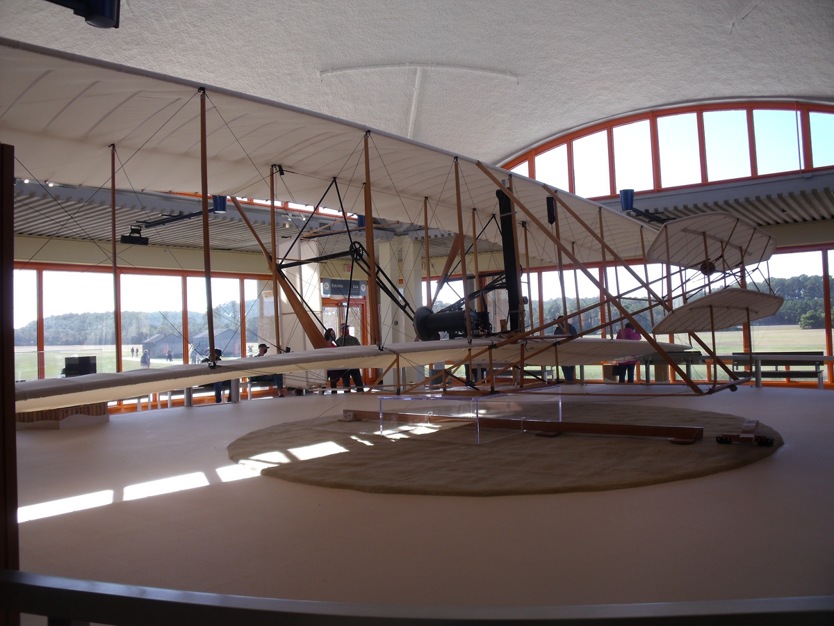
Linda got her chance to see what was inside the museum while I sat on a
bench outside with Chase on his leash. He watched all the folks coming and
going looking for his mom Linda. This photo has a time stamp of 1:22 PM
when she first went inside. It is a full scale replica of the original Wright
Flyer aircraft. November
8, 2021.
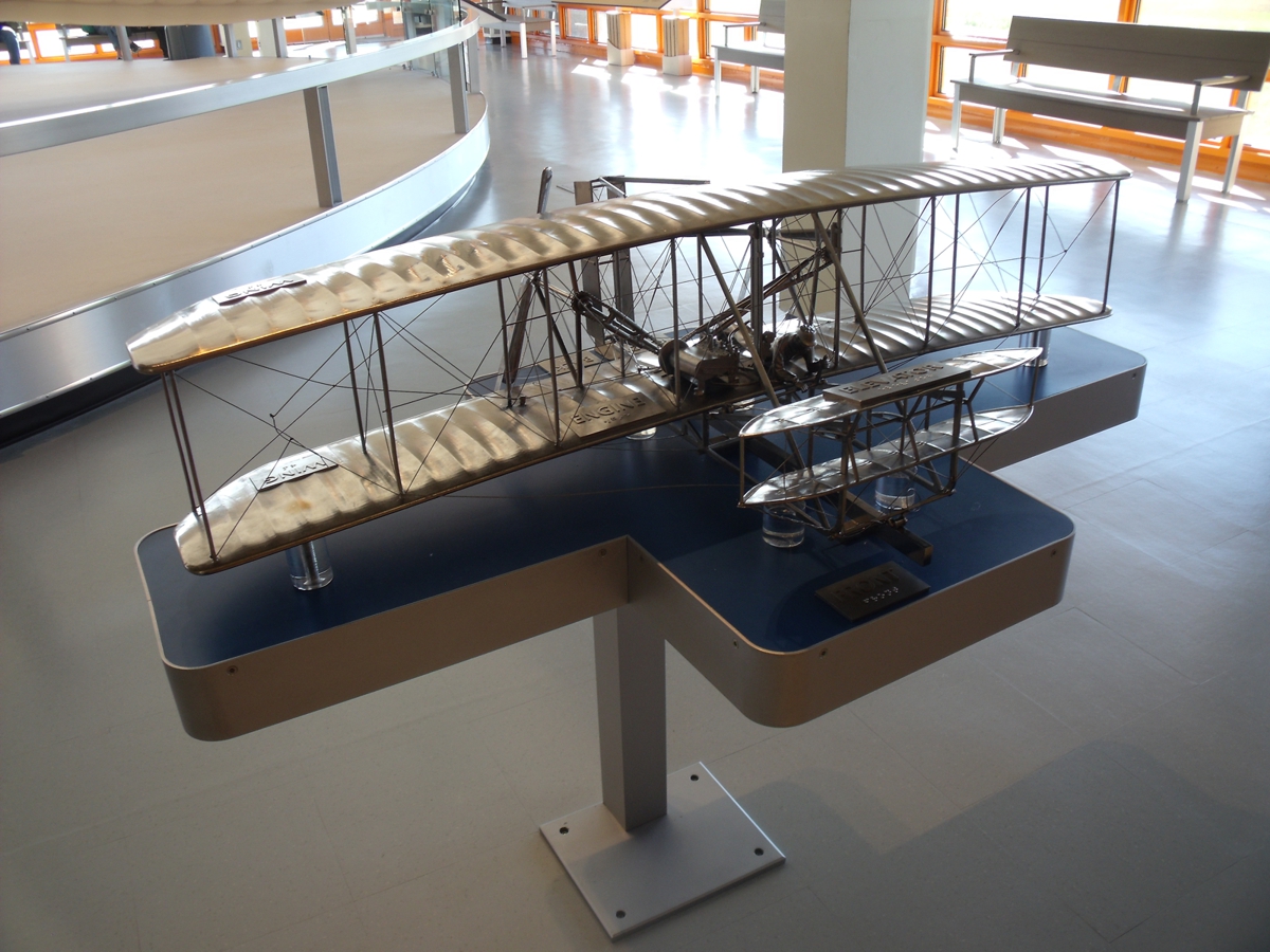
This photo was taken at 1:23 PM.
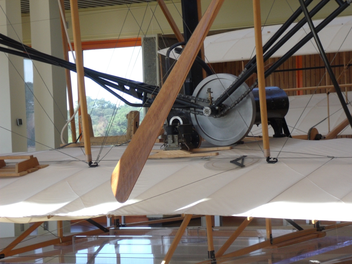
This image taken at 1:24 PM shows the chain drive connections to the
engine flywheel to turn both propellers in opposite directions. November
8, 2021.
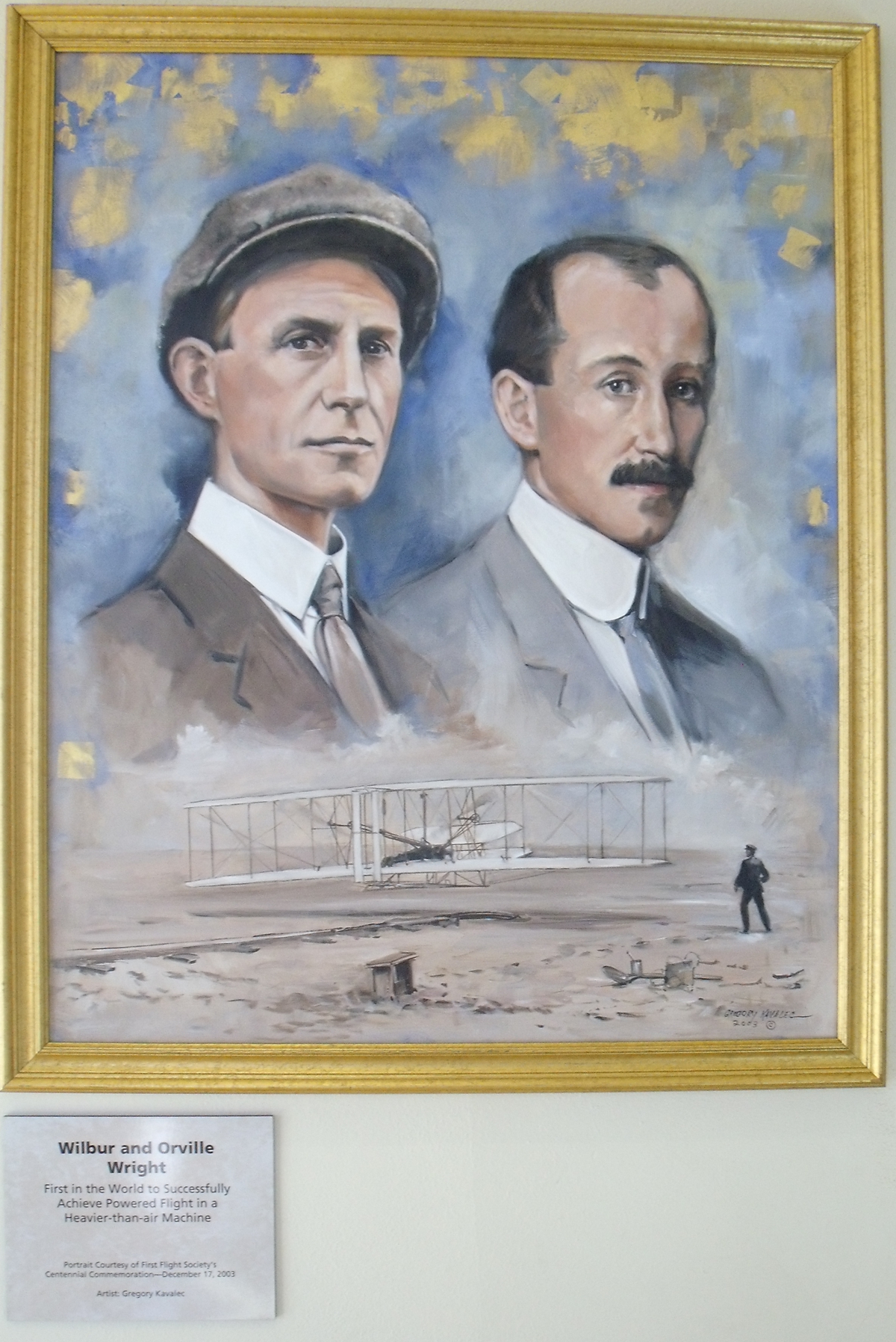
This is a wonderful painting of the Wright Brothers and their 1903 Wright
flyer first flight. November
8, 2021.
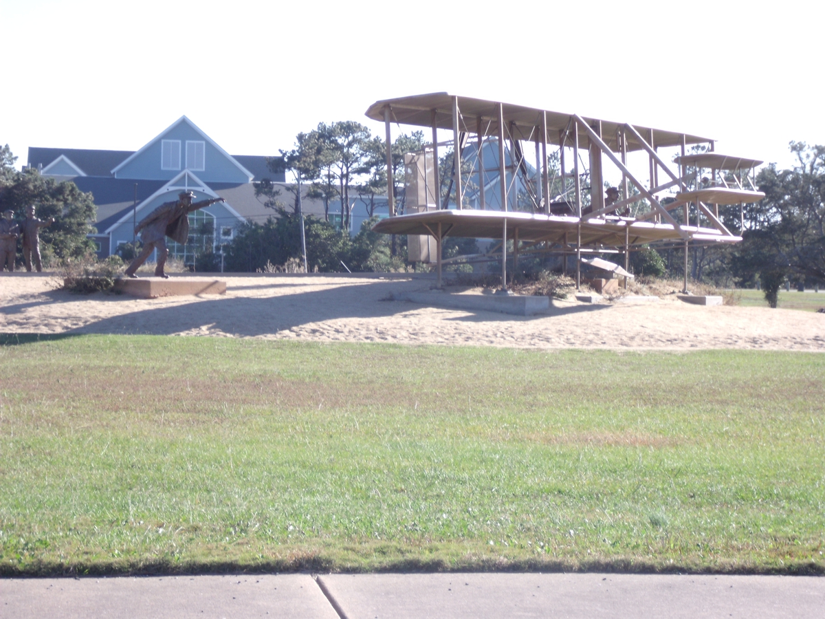
This outdoor replica of the first flight shows both brothers after the
aircraft takes flight. November
8, 2021.
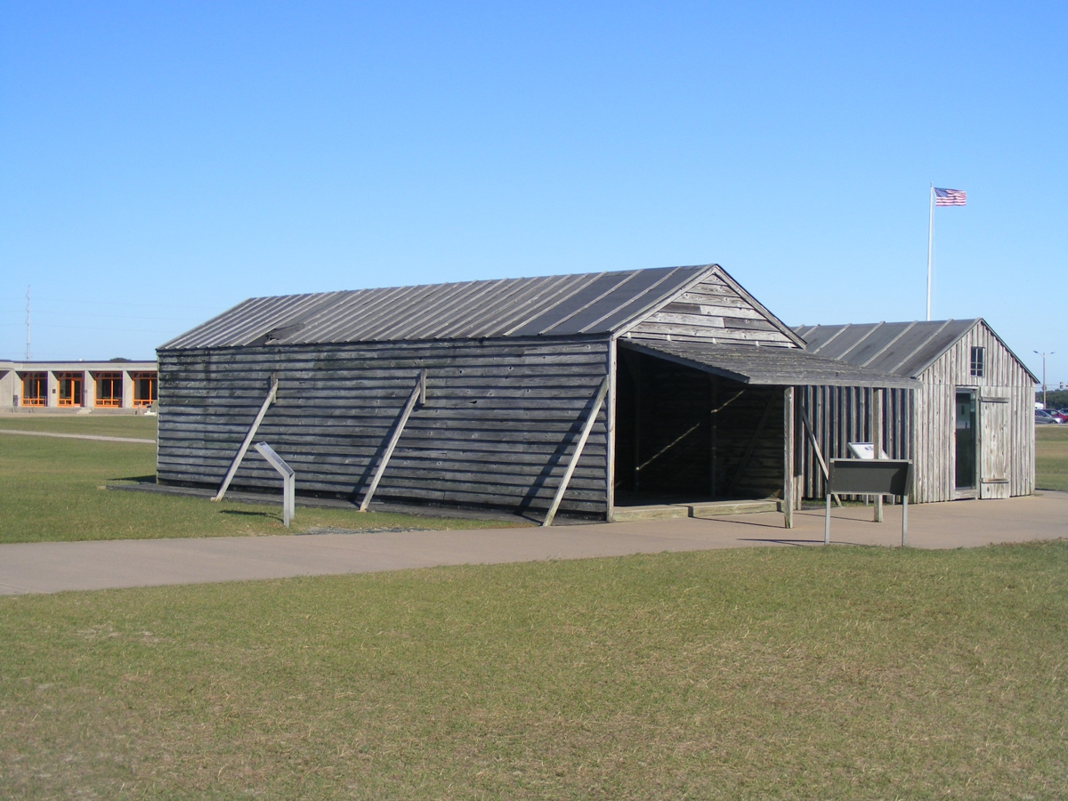
The Wright Brothers built two buildings when they came here to make their
historic flight. They built a hangar for their airplane and a hut to
shelter them from the cold December winds in 1903. The reason they chose
this place near the Atlantic Ocean was for the prevailing winds that would make
the takeoff safer. These two buildings are replicas of the original
buildings created by the National Park Service. The replicas are built on
the locations of the original structures. November
8, 2021.
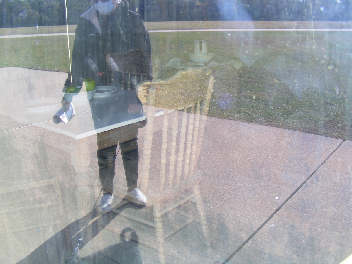
This is my first attempt to take a photo through the clear window that
protects the artifacts inside the living quarters building. This looks
like a double-exposure due to the reflectivity of the window and sun angle on
the building. There is a table and two chairs inside that are the desired image,
but the reflection has been asserted here from the sidewalk and Linda's presence
in front of the window. November
8, 2021.
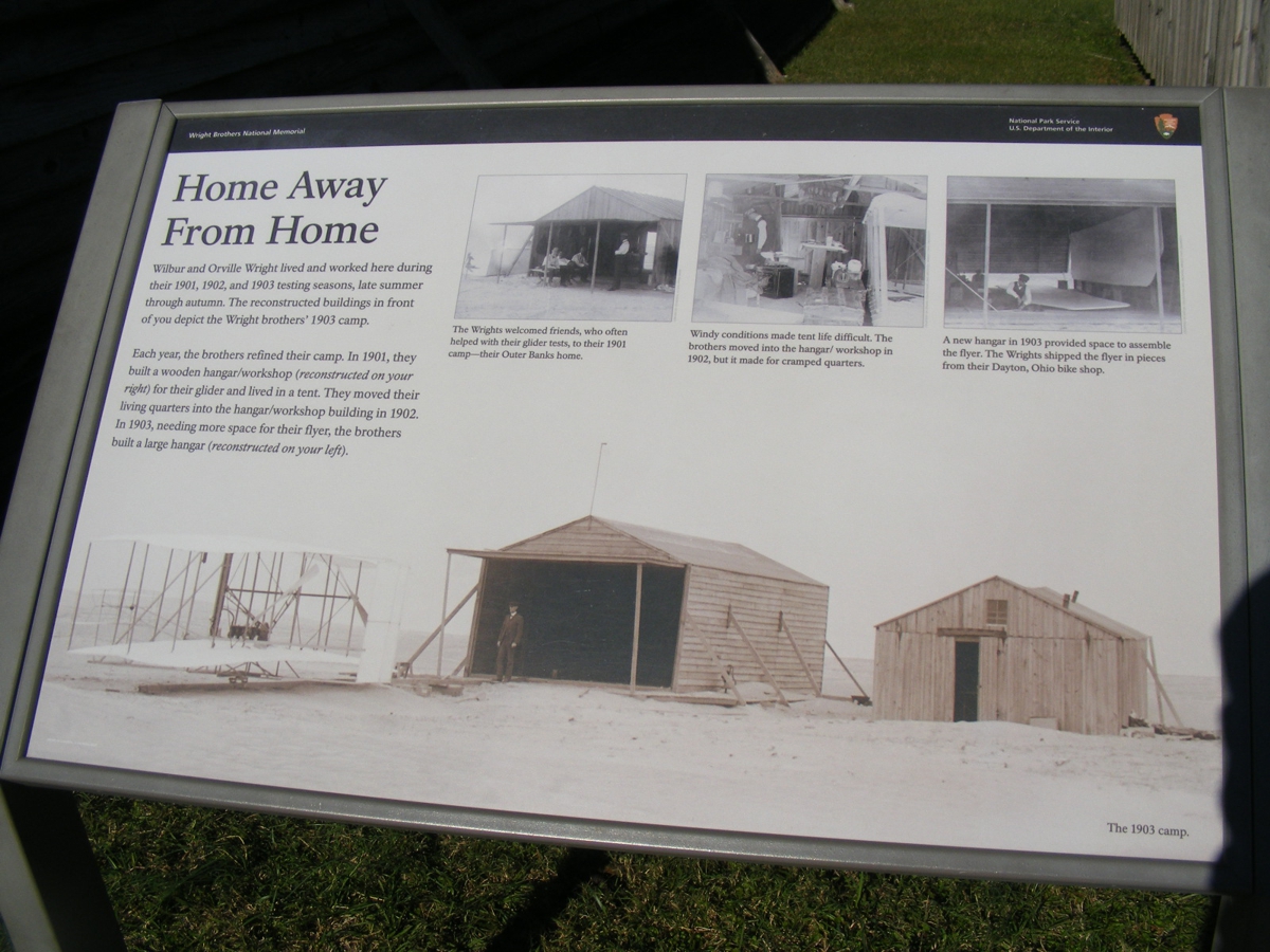
This information plaque tells of the three summer visits in 1901 and 1902
testing gliders, and the engine-powered 1903 flyer that put them into
the history books. November
8, 2021.
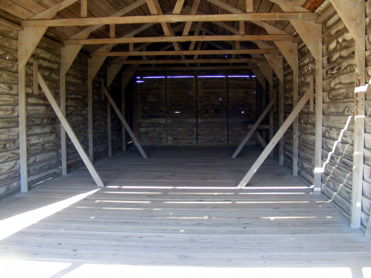
This is the inside of the hangar storage building. November
8, 2021.
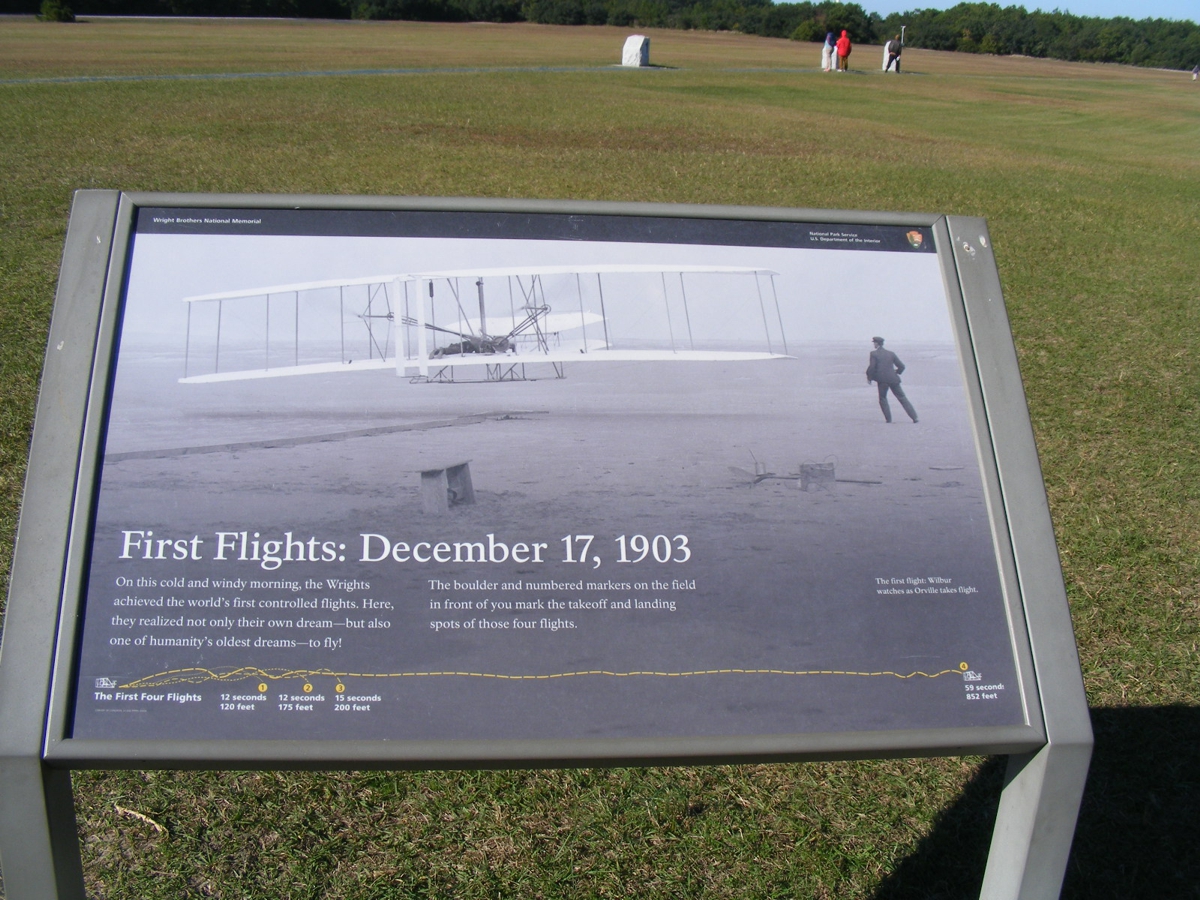
This image depicts their first powered flights in December 1903. Some
tourists are reading each of the markers showing the length of each flight.
November
8, 2021.
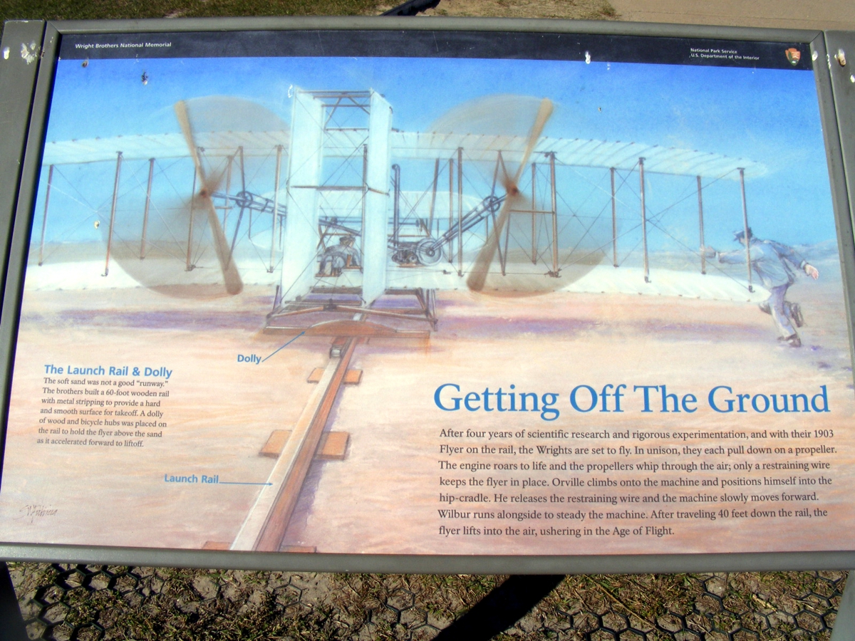
This display leaves little to the understanding of the first powered
flights. November
8, 2021.
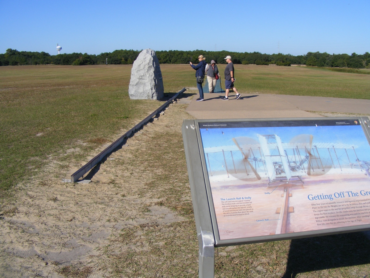
Many tourists take photos of the markers in the field just as I did
here. November
8, 2021.
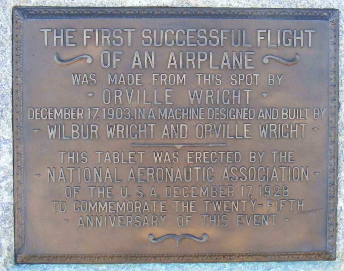
This plaque is mounted on a granite marker stone. November
8, 2021.
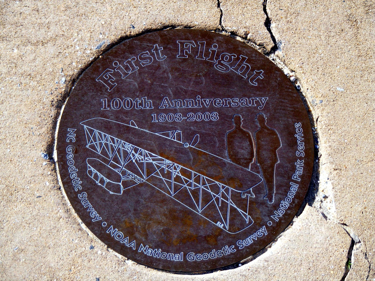
This medallion is embedded in the concrete in front of the plaque seen in
the image above. November
8, 2021.
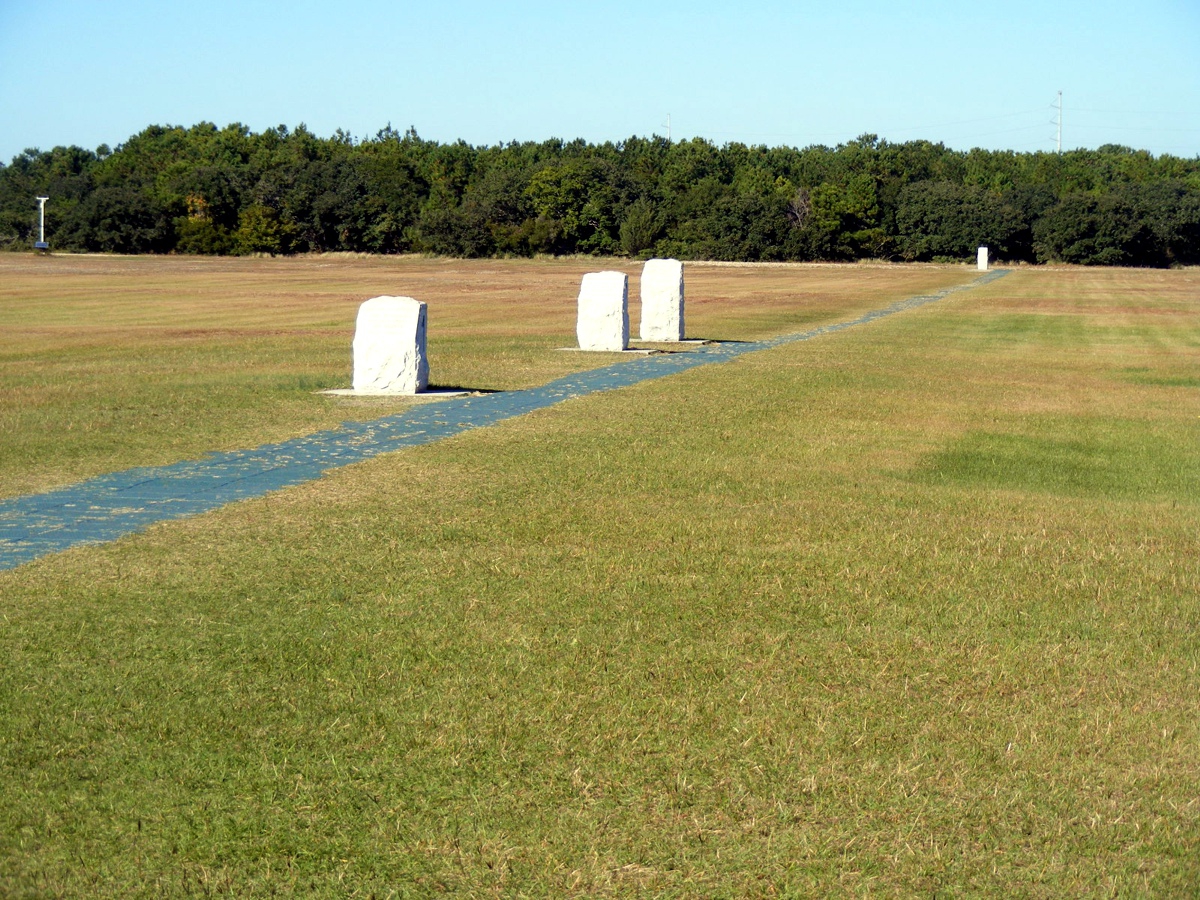
Here is my photo of all the landing spots from the flights in 2003. November
8, 2021.
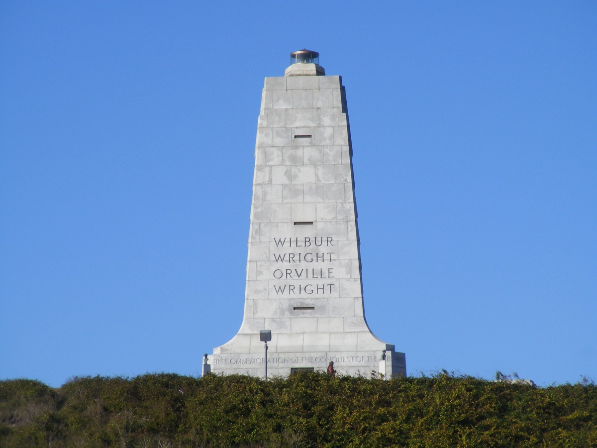
This monument is on the top of Kill Devil hill from which the glider
flights of 1901 and 1902 were launched. I used the zoom lens feature on my
camera to capture this image. I found the complete inscription from the
base of the monument online and quote it here. November
8, 2021.
" If
you've ever been to the top of hill, you'll notice there's an inscription at the
base. It says “In
commemoration of the conquest of the air by the brothers Wilbur and Orville
Wright, conceived by genius, achieved by dauntless resolution and unconquerable
faith.”
Apr
24, 2017"
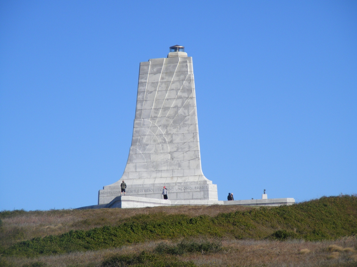
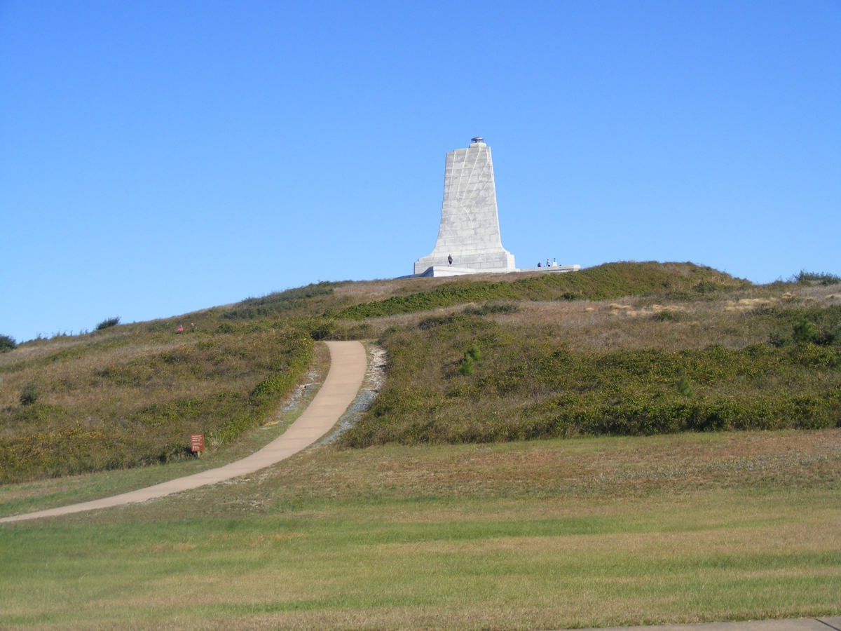
Here is the view of the monument without the zoom lens magnification. We started our slow drive around the park at 2:04 PM with the
first stop at this monument at 2:12 PM. We are looking EAST toward the
monument. November
8, 2021.
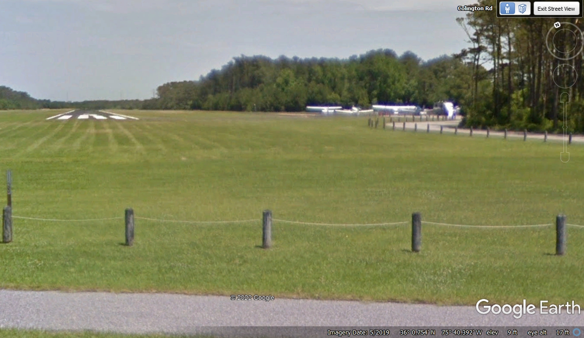
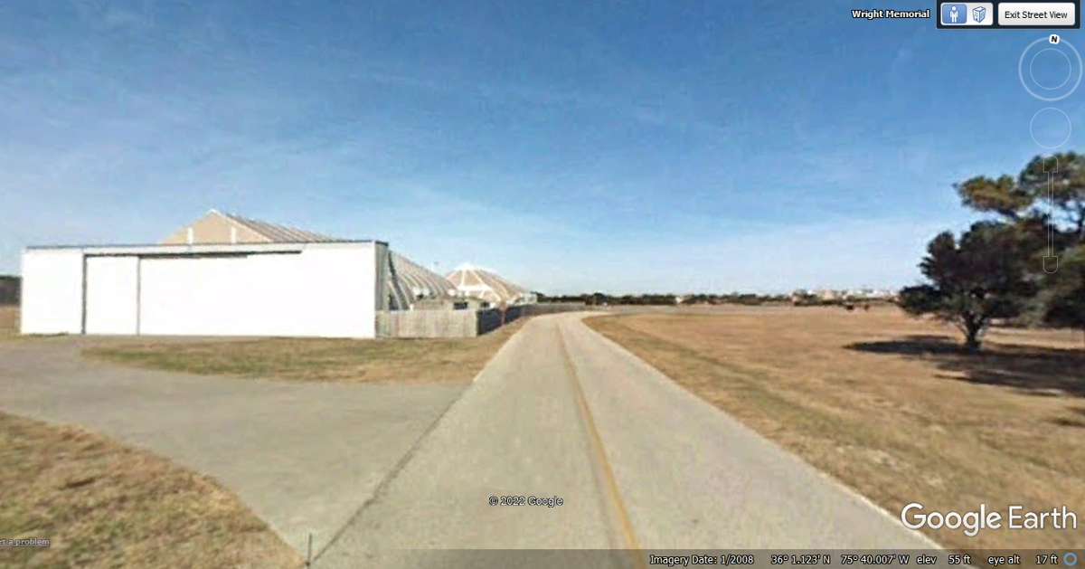
My camera position for the two photos above was at a location of a road to
the First Flight Airport. I captured this Google Earth image from a road just outside
the park south of the runway. It shows three airplanes at the parking ramp
for aircraft.
Here is the other side of the memorial inscribed with their names.
We stopped at a parking area at 2:17 PM to take this photo and give Chase a
break before we get back on the road. We pulled out of the parking area at
2:24 PM and headed toward the exit to US 158 at the main entrance. November
8, 2021.
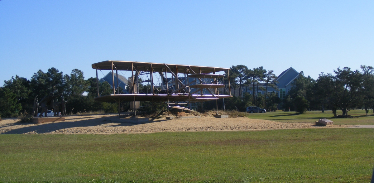
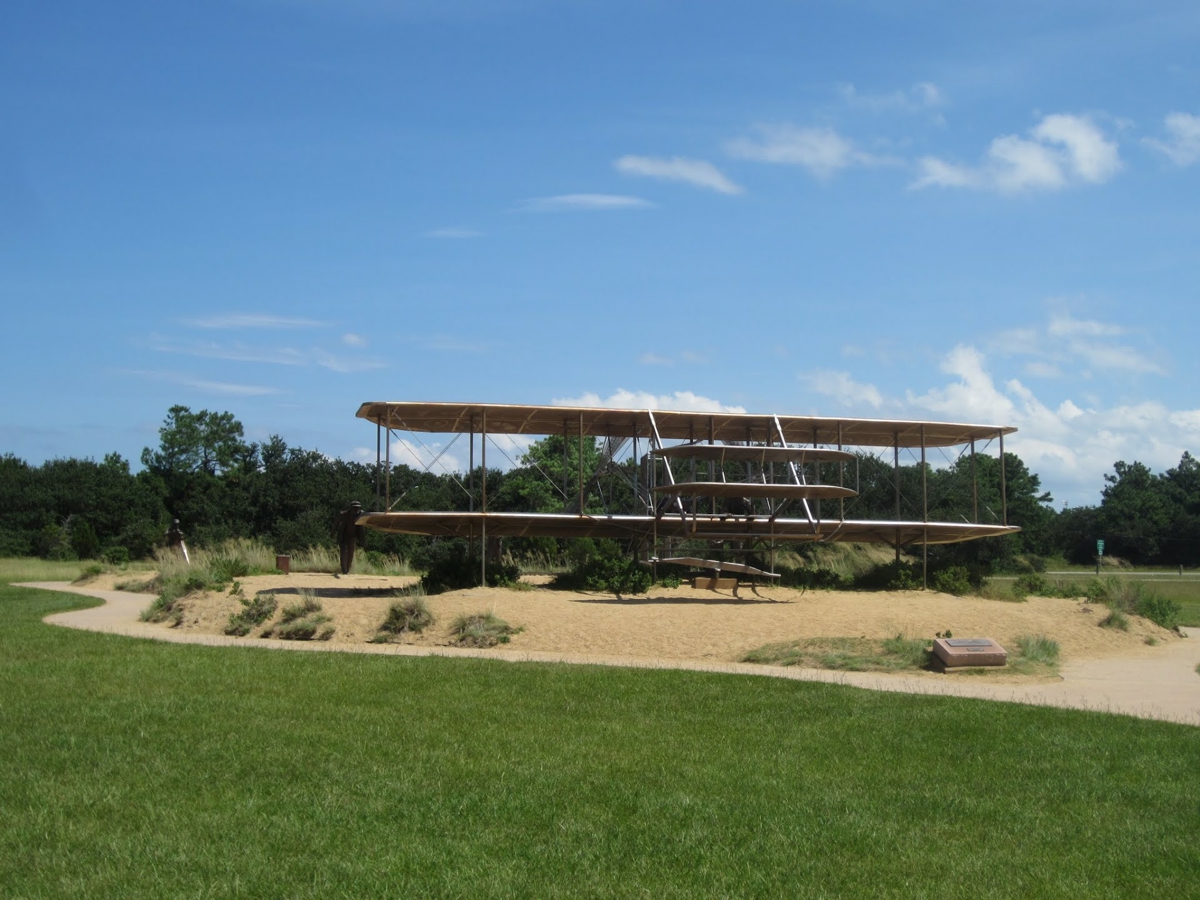
On the EAST side of the monument is this full scale model of the 2003
Wright Flyer adjacent to the road around the monument. I captured this
image with my camera shooting through the open passenger's window of the car.
November
8, 2021.
The image below is from Google Earth.
Departing the scenic drive heading for the exit are these buildings that
may be storage, but the one in this image has doors that look like hangar doors.
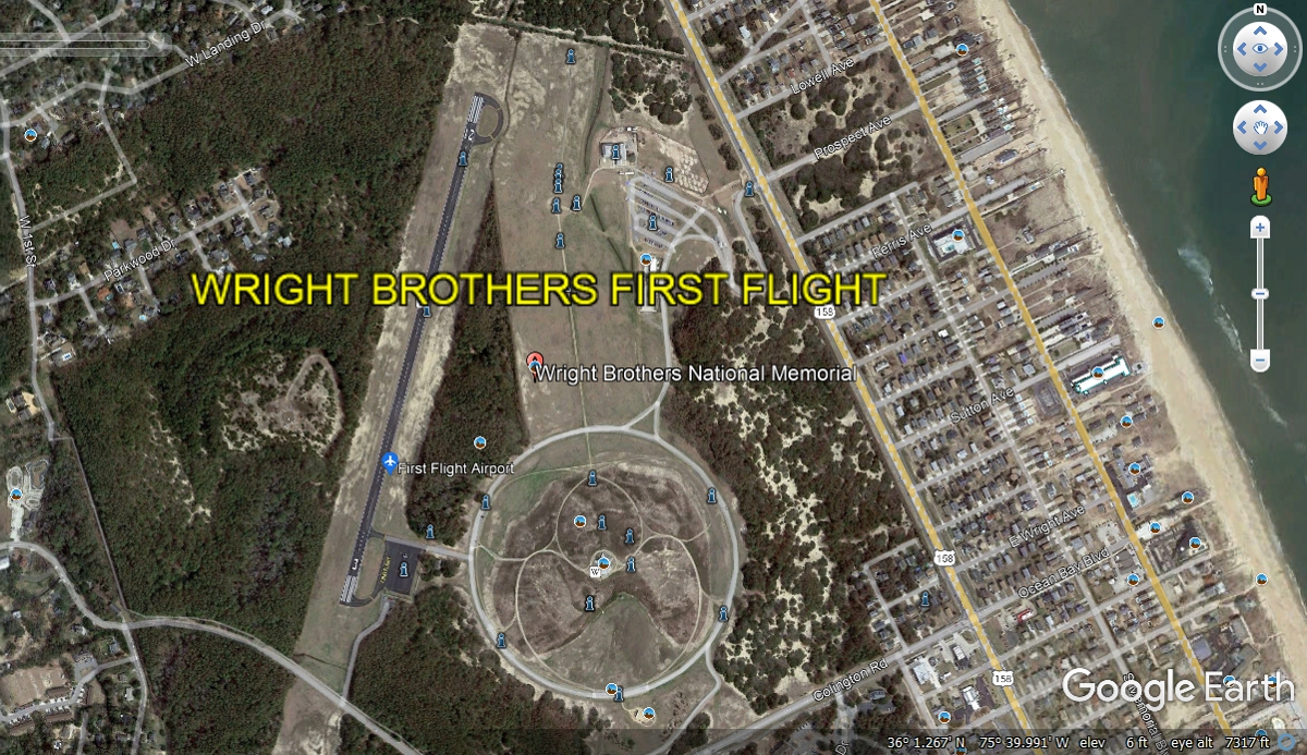
Here is the aerial view from Google Earth for the Wright Brothers National
Memorial site. There is a real airport on the site with aircraft parking
at the south end of the runway. The number 3 is at the south end and 15 at
the north end.
| RETURN TO 2021 VACATION MENU |