October/November 2021 Vacation Day 8 · · PAGE 27.
November 2, 2021: We were following GPS
guidance going to our next destination to see the Gloucester Fisherman
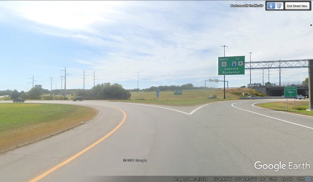
memorial. The US 1 bypass entered this traffic circle on the northeast
side at 10:15 AM. This is the same circle we used to get from US 4 on to I-95 North
when we left the motel this morning. The GPS indicates we will exit the
circle on the southeast side.
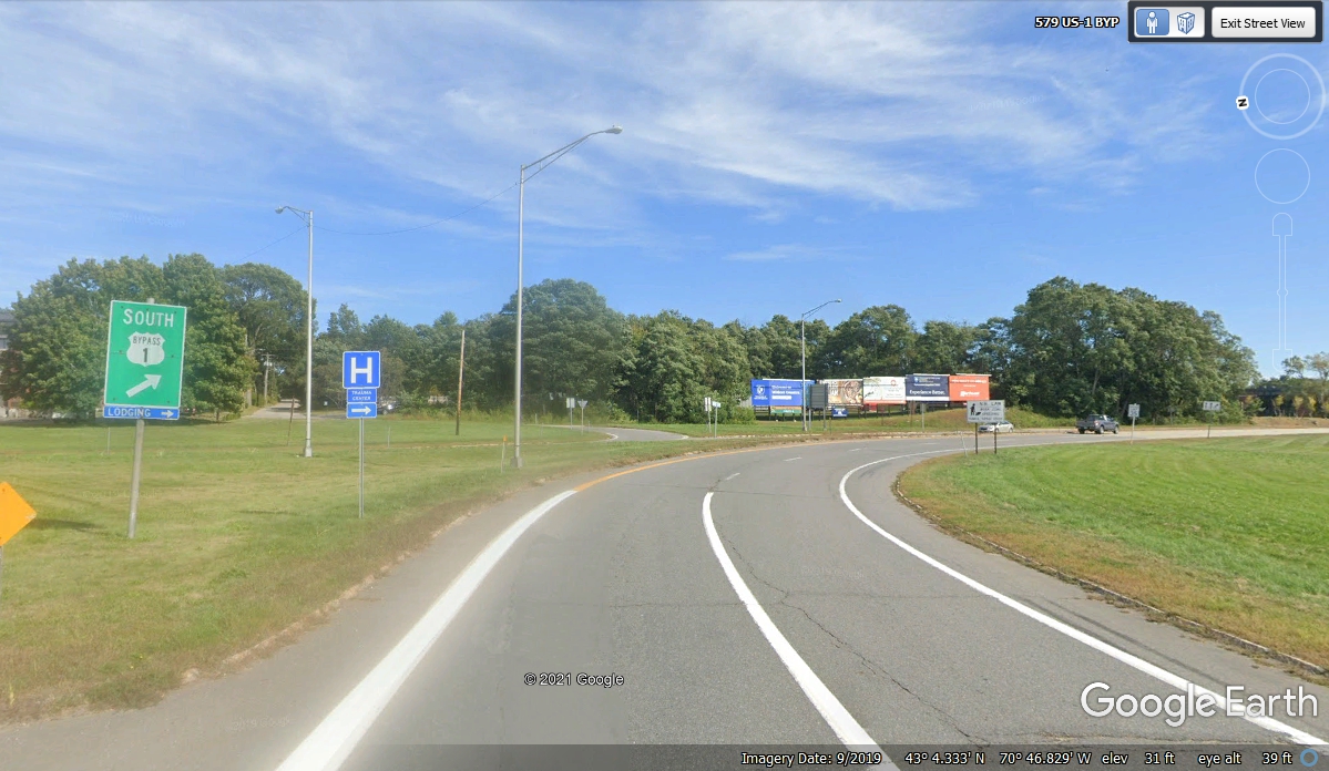
There are two small Bypass US 1 South signs around the circle. This
is the second one that points the way toward our next destination. My GPS
296 keeps me from going around in circles (for now).
The Bypass US 1 around the old city of Portsmouth joins the real US 1 going south for
our next segment of
travel.
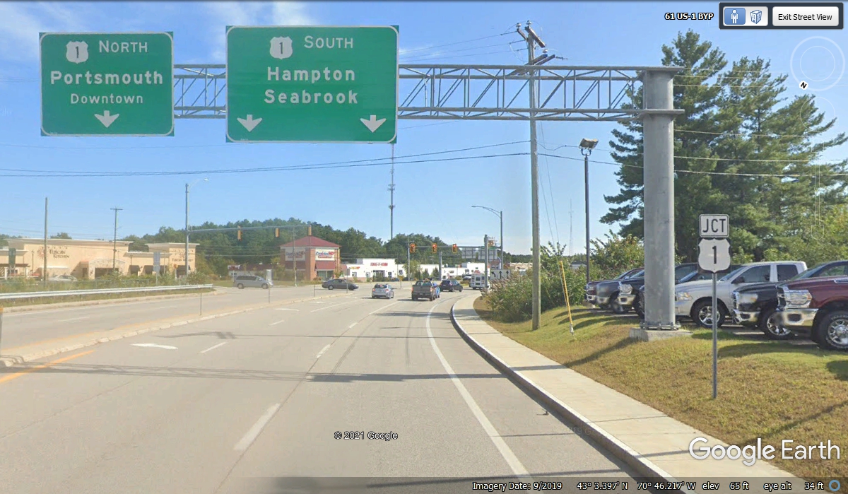
The next intersection for US 1 south is one I missed when driving here on
November 2, 2021. I had to double back on a side street to get back on
track.
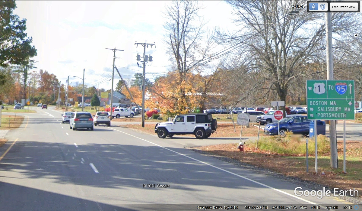
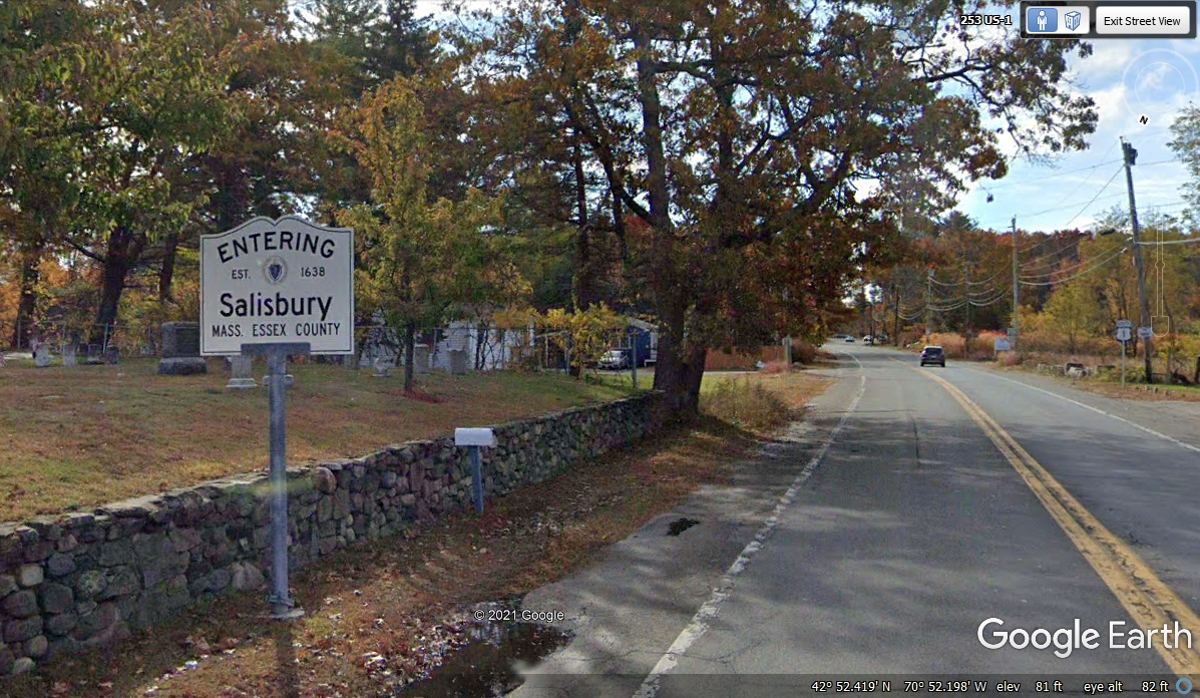
This sign is indicating entry into the state of Massachusetts and the town
of Salisbury. At the right side of this image is the official US 1 route
sign. We arrived here at 11:04 AM.
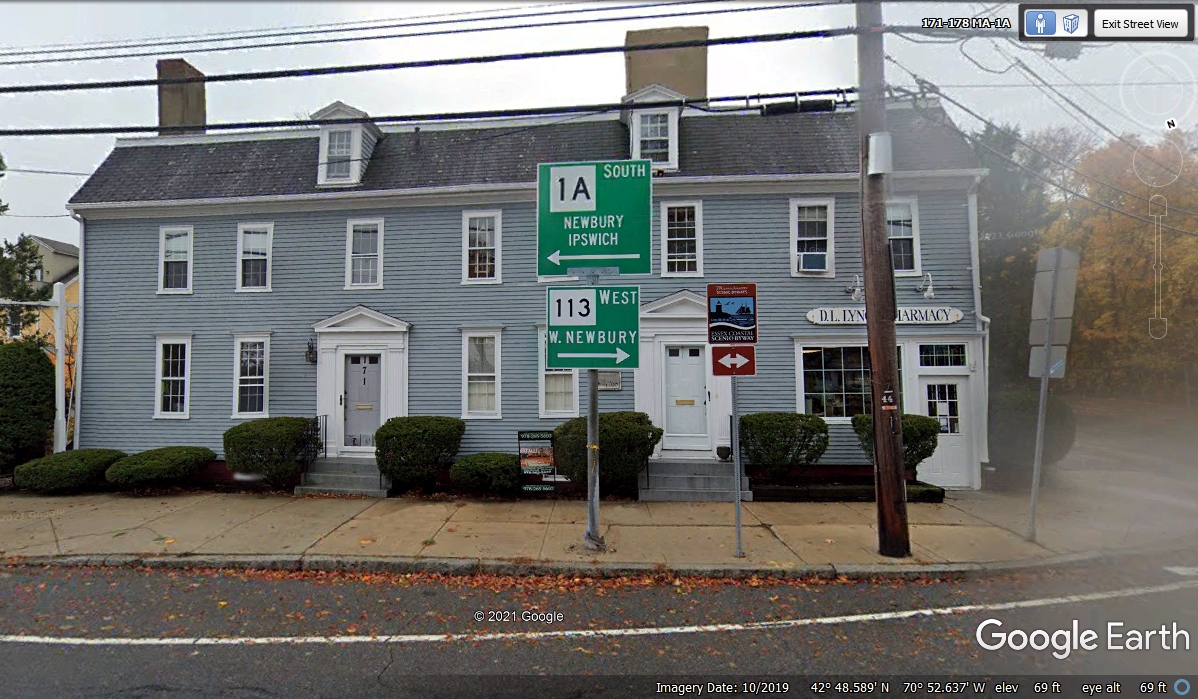
Following route 1A and route 133 leads through Ipswich down to the seaport
town of Gloucester, Massachusetts.
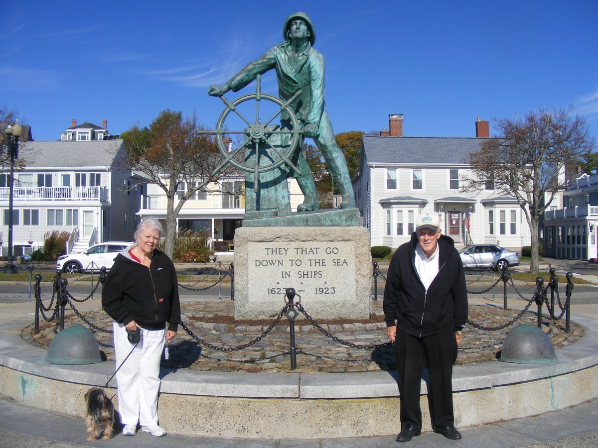
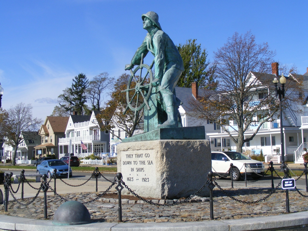
Here is our next stopping point as tourists in New England. My first
memories of this fisherman were on boxes of Gorton's Fish Sticks when I was a
child.
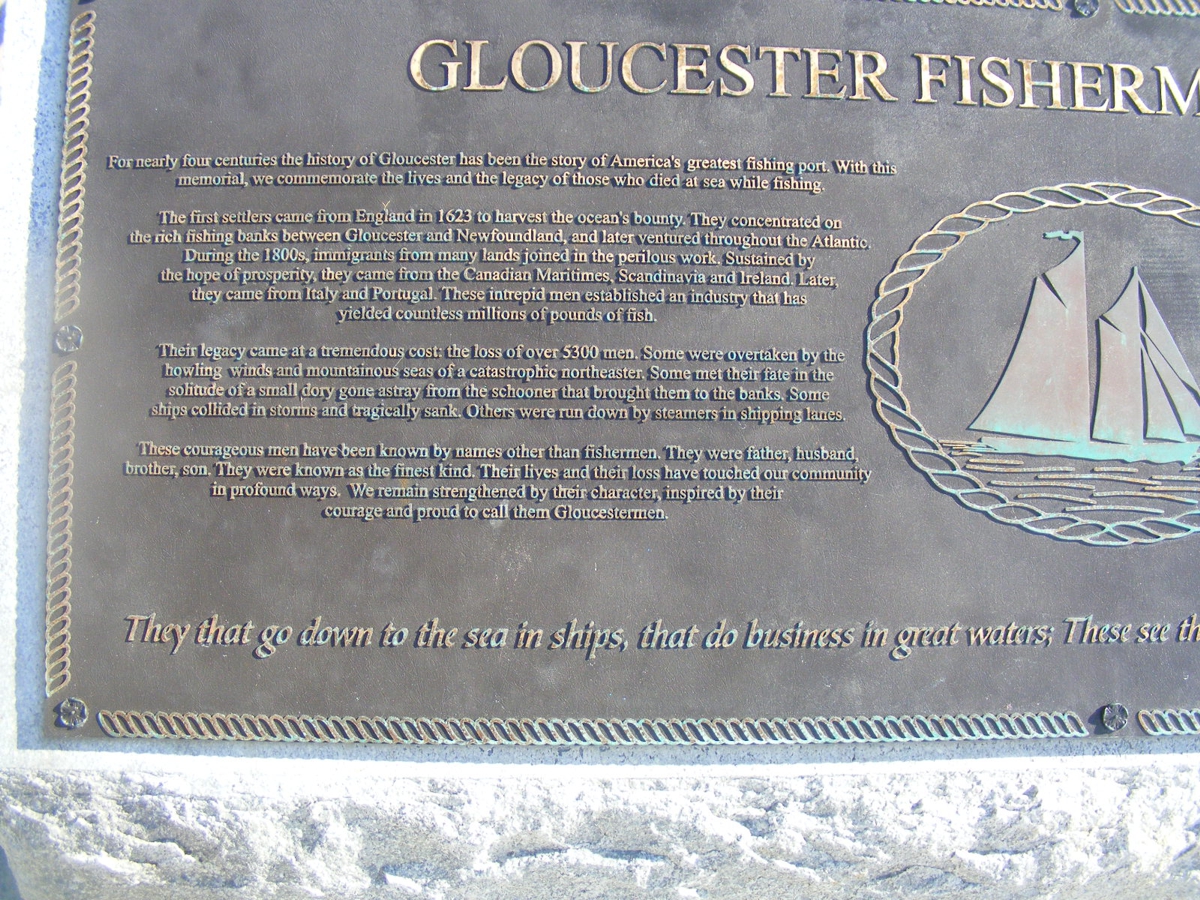
This plaque is adjacent to the memorial statue seen in the photo above.
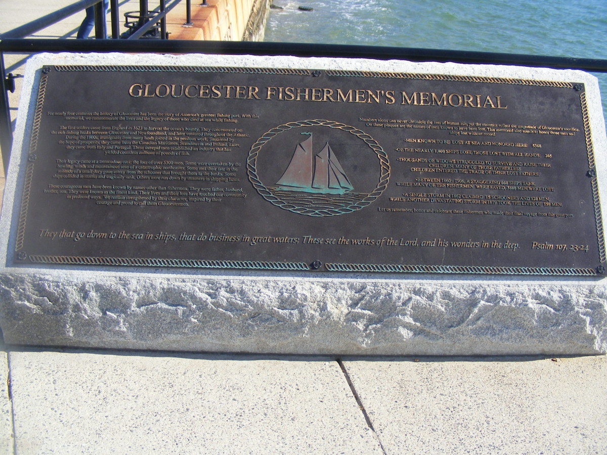
I knew I could do the processing of these images to make them
readable to those of you who may never get to this memorial site on the coast of
the Atlantic Ocean. This is the LEFT side of the photo above.
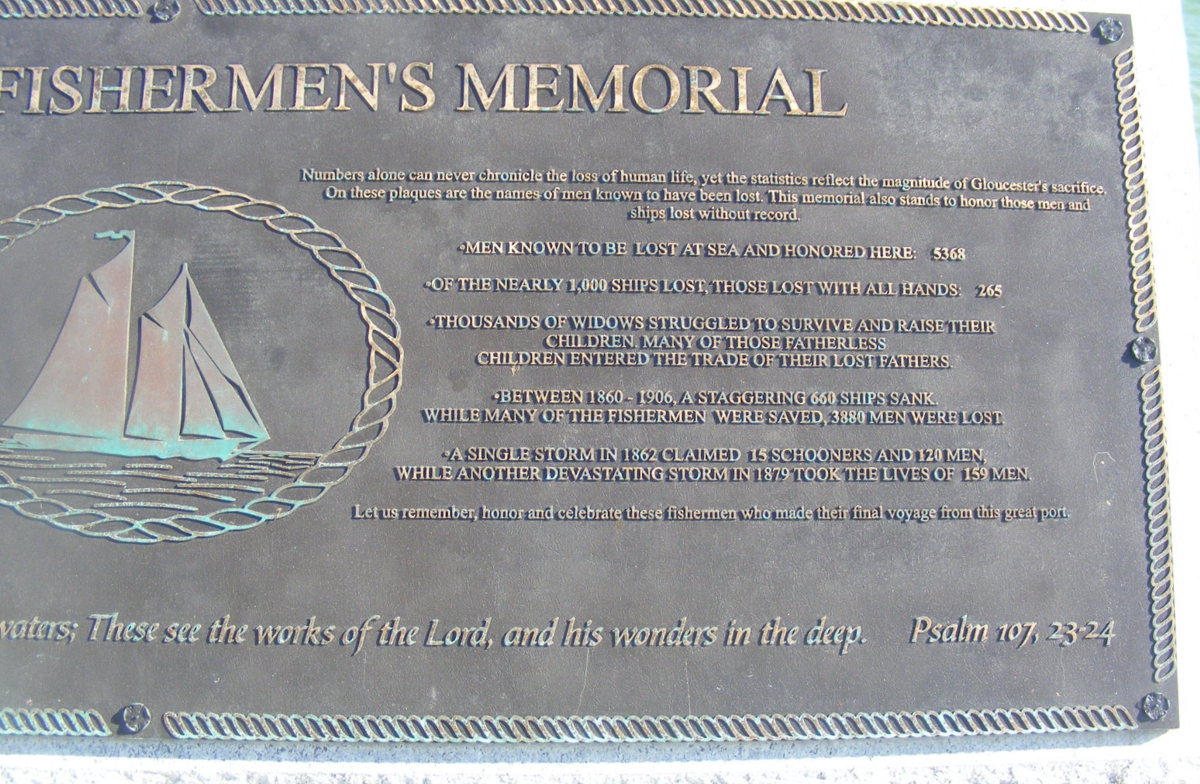
Here is the RIGHT side of the two images seen above.
I have the urge to always take one last photo before I leave a place like
this one. It shows more of the homes on the street behind the statue.
This plaque seen below is just north of the Gloucester Fisherman memorial
statue seen in the image above. This one faces the street.
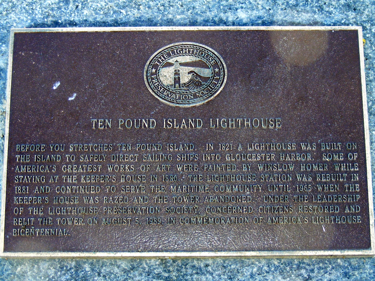
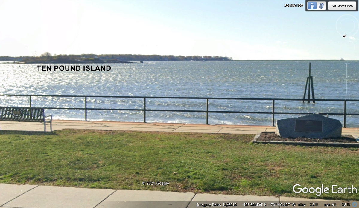
I captured a Google Earth image showing the location of Ten Pound Island
out in the Gloucester harbor. This side of the marker with the plaque is
facing the street and the Google Earth photo vehicle that passed this location
in November 2019.
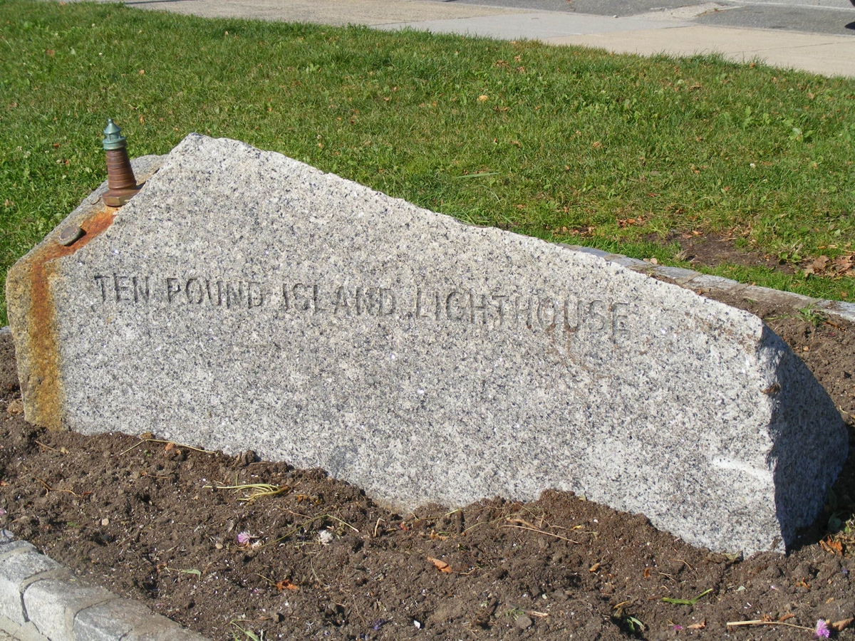
The side walk with the street is visible at the top of the image
below. The back side of the monument seen here is visible to anyone
walking on the sidewalk near the harbor. I took a close-up photo of the
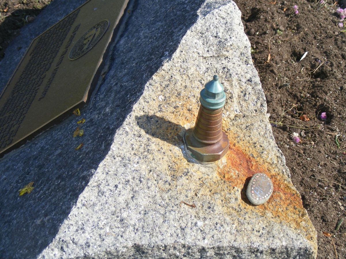
model light house seen in the image below this one.
The model of the light house is secured to the top of the granite marker
also seen in the image above.
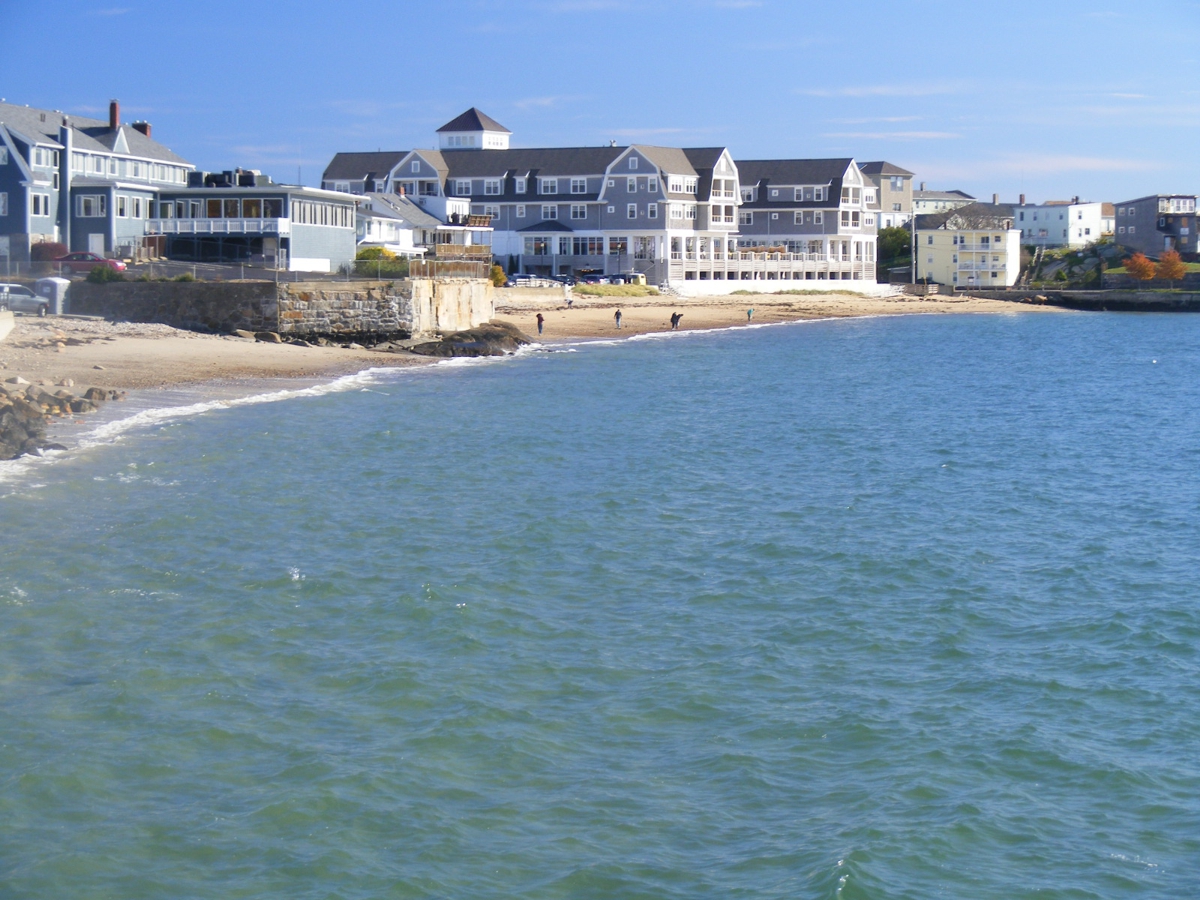
Here is what you see looking NORTHEAST from the Gloucester Fisherman
statue along the shore of the harbor.
We left Gloucester via state route 128 that goes down to the Boston area.
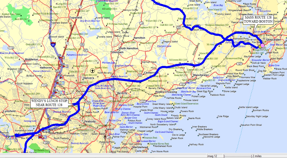
My GPS 296 had this Wendy's location listed in its data base. We
came here for lunch at 1:07 PM. 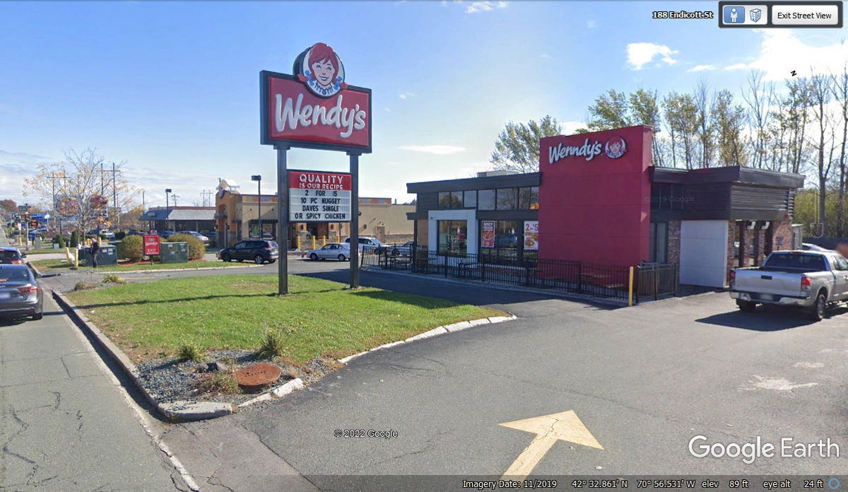
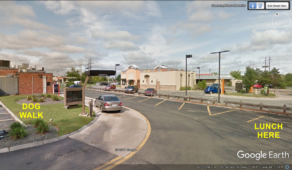
I was surprised to see Google Earth had pulled through the back parking
lot at this Wendy's location. I made sure Linda's dog Chase got relief
while she got our lunch. I marked the grass area by the drive-thru order
location. Her Chevy Equinox was parked at the space marked "LUNCH
HERE". We departed at 2:26 PM heading to our next tourist stop.
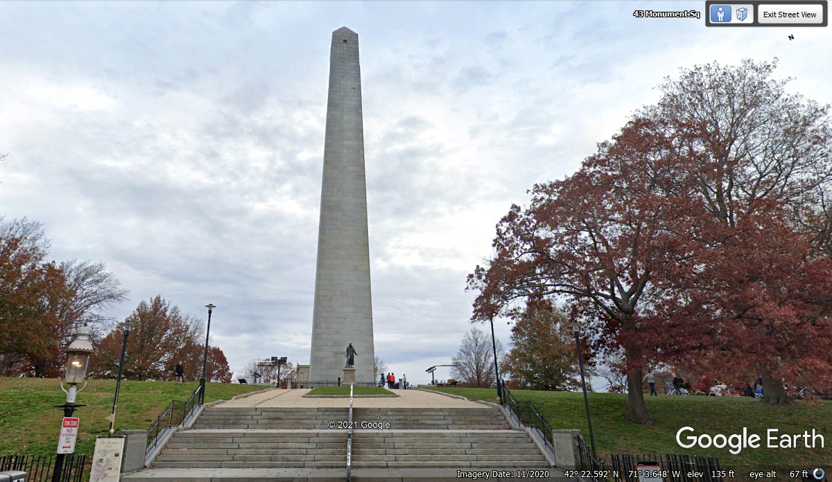
This obelisk marks the location many of us have heard about in history
class: BUNKER HILL. This is a location where you have to park on the street, if you are lucky
to find a space. We drove around the block at 3:55 PM with no luck getting
a parking spot. There were some street repairs with the usual barriers
blocking some of the parking spaces.
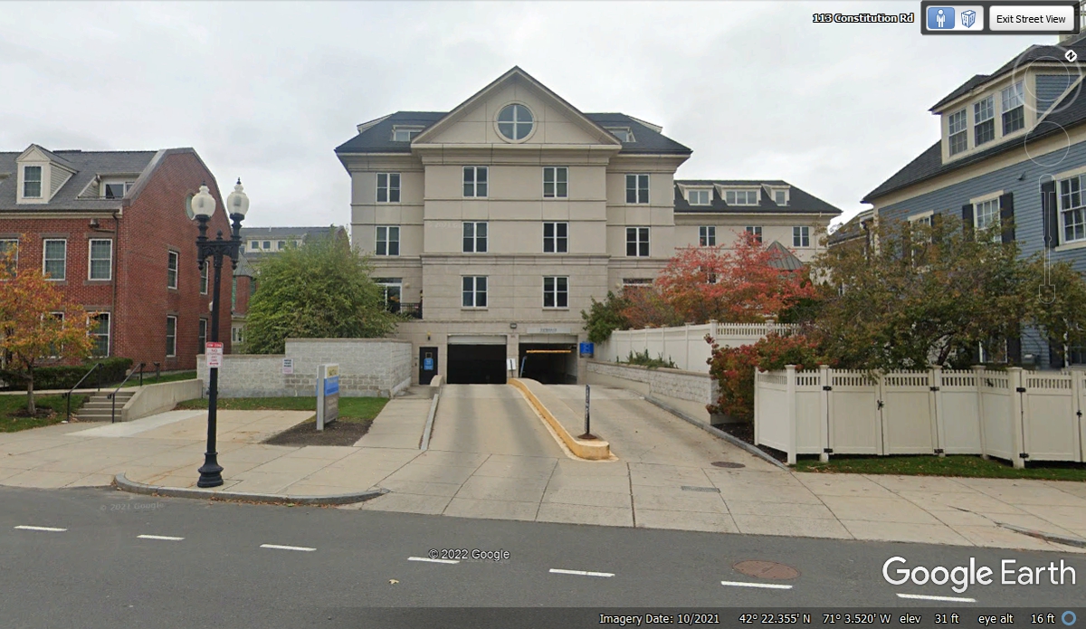
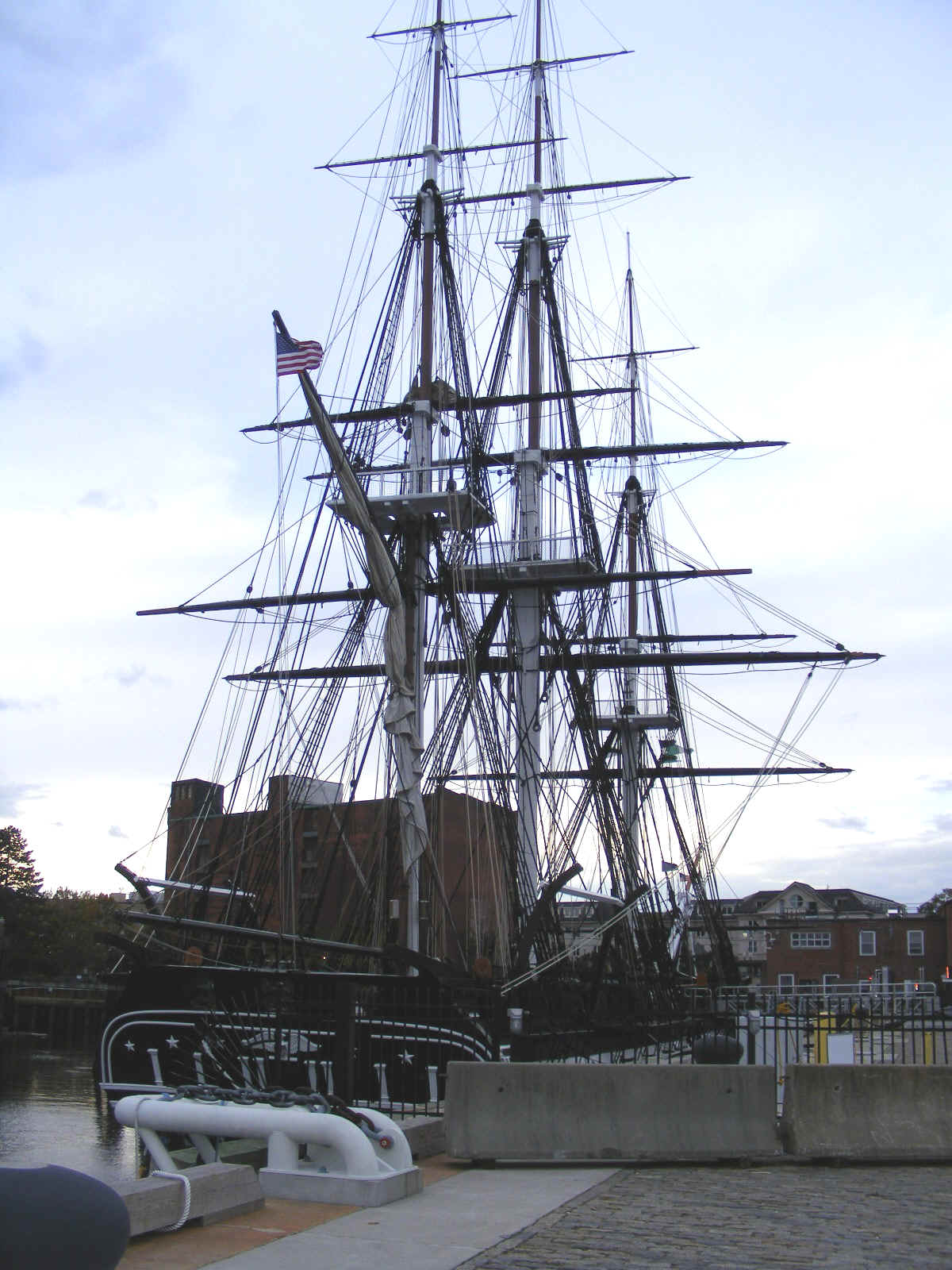
Our next stop was not far from Bunker Hill. The USS Constitution is
located at the Charlestown Navy yard located only one block from US 1. I
had some phone calls before we left on this journey with a young lady at the
gift shop about where to park. She told me about this underground parking
garage across from the Navy Yard.
Google Earth captured this image of the USS Constitution with full colors
as she is moored behind the entry gate which is usually locked.
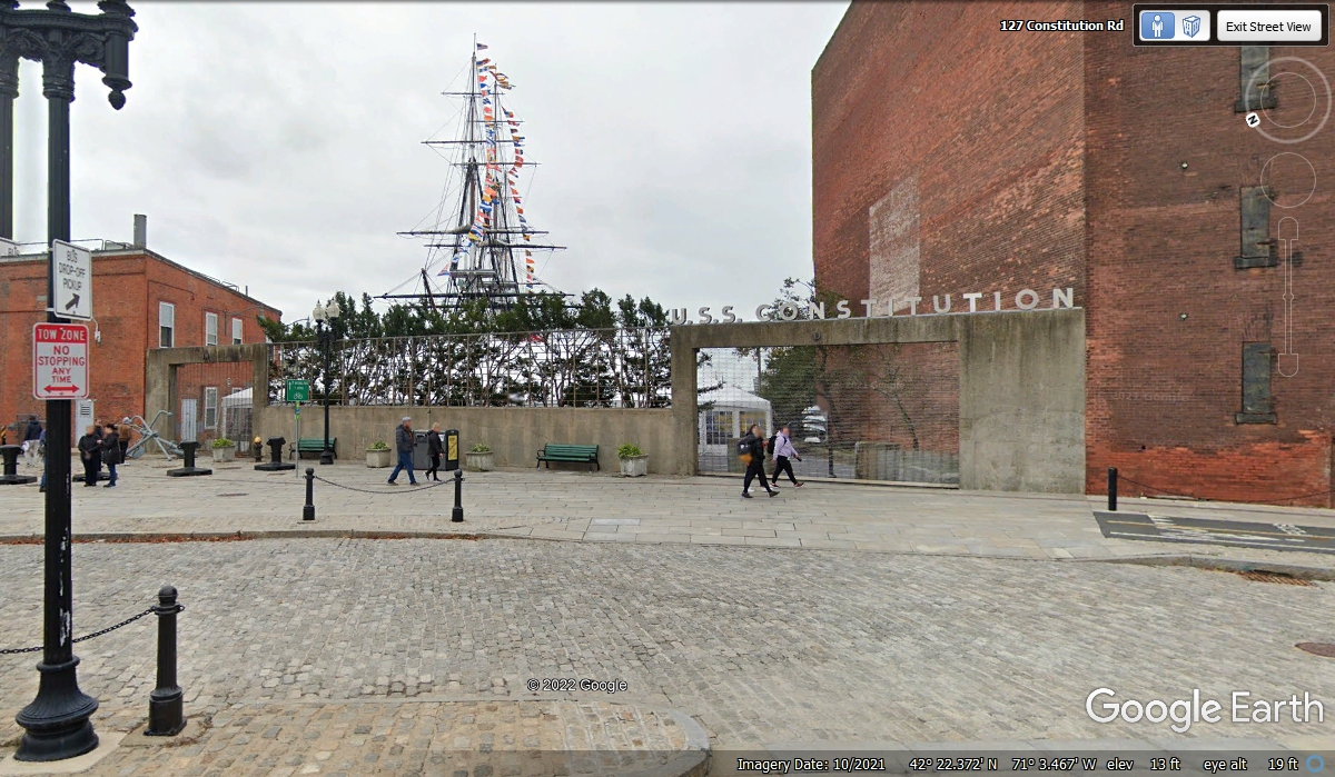
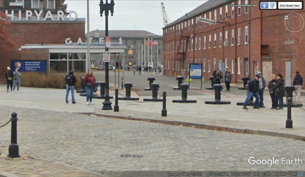
Gate 1 for the shipyard is the access route to the ship. Walk up
this way to the flags and turn right to get there.
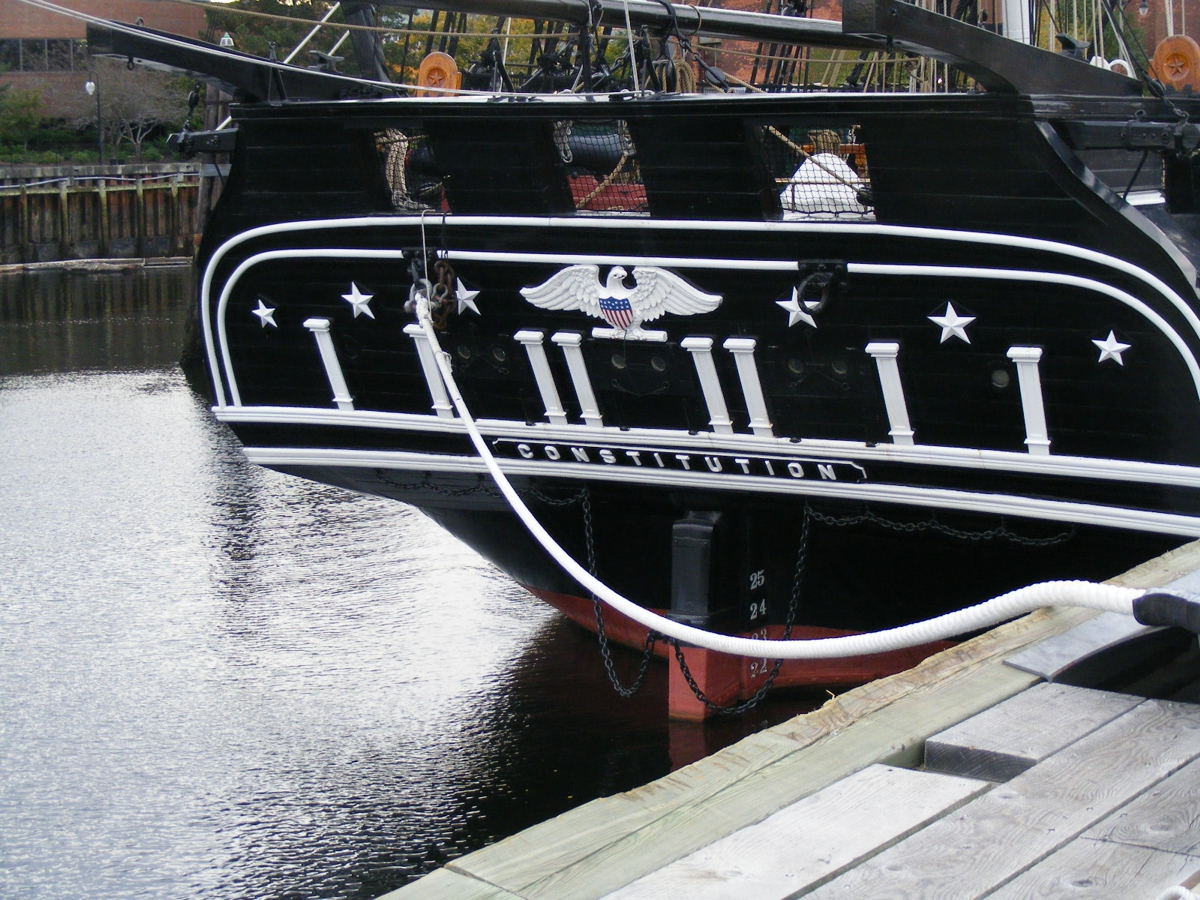
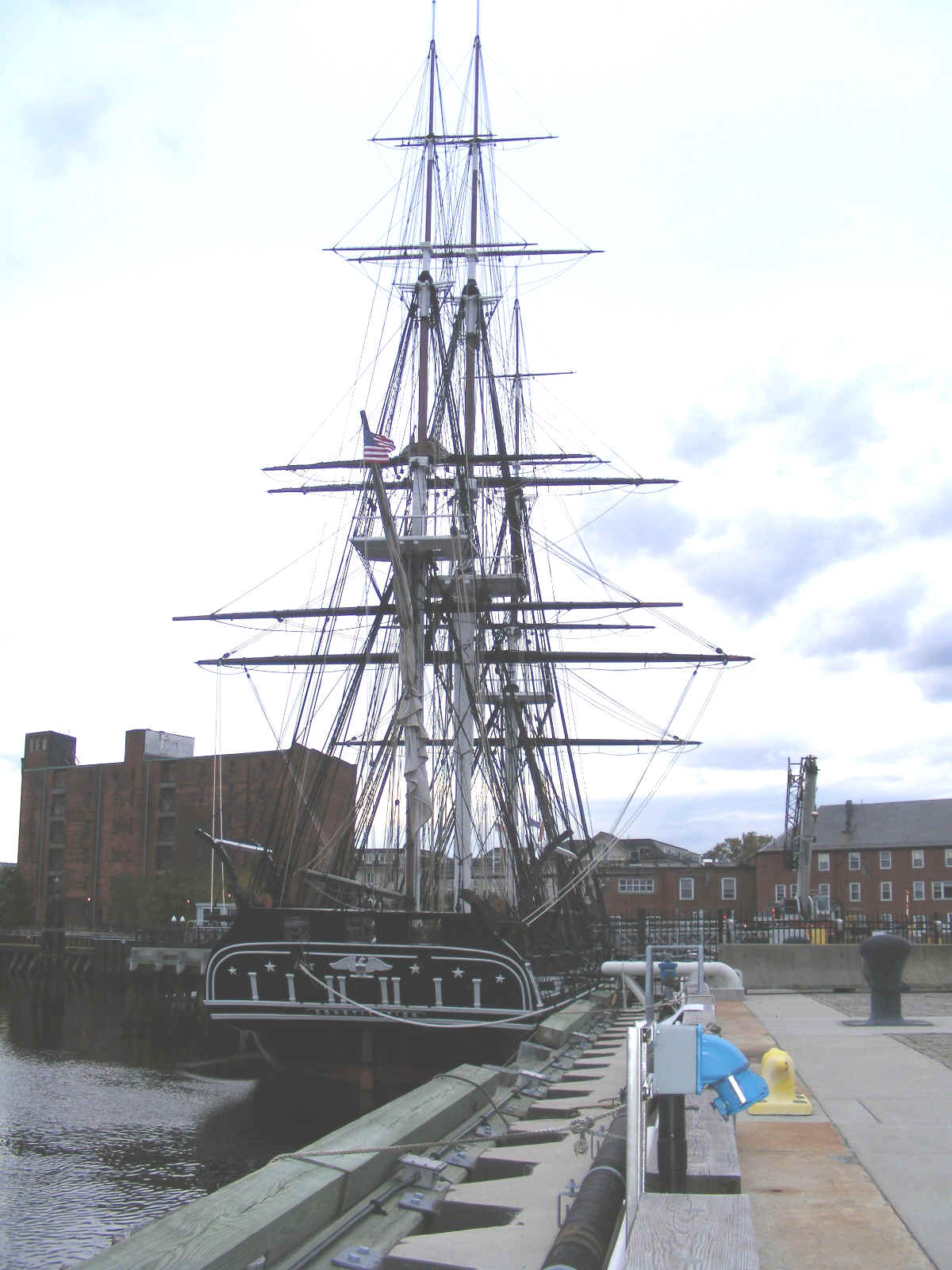
The stern of the ship has the name CONSTITUTION proudly displayed.
It is built from OAK trees and was known as "OLD IRON SIDES" as many
British cannon balls would bounce off her structure. The ship gets taken out
several times every year to train young Navy cadets from Annapolis about sailing
and the history of the US Navy.
"LEARNING THE ROPES" is a phrase that came from being a sailor
in the era before steam-powered ships took to the seas. The wind in her sails made
her faster than British ships she fought against during the Revolutionary War
with England.
This view shows a number of her cannons on the starboard side of the
ship. The bow of the ship is forward from here of course.
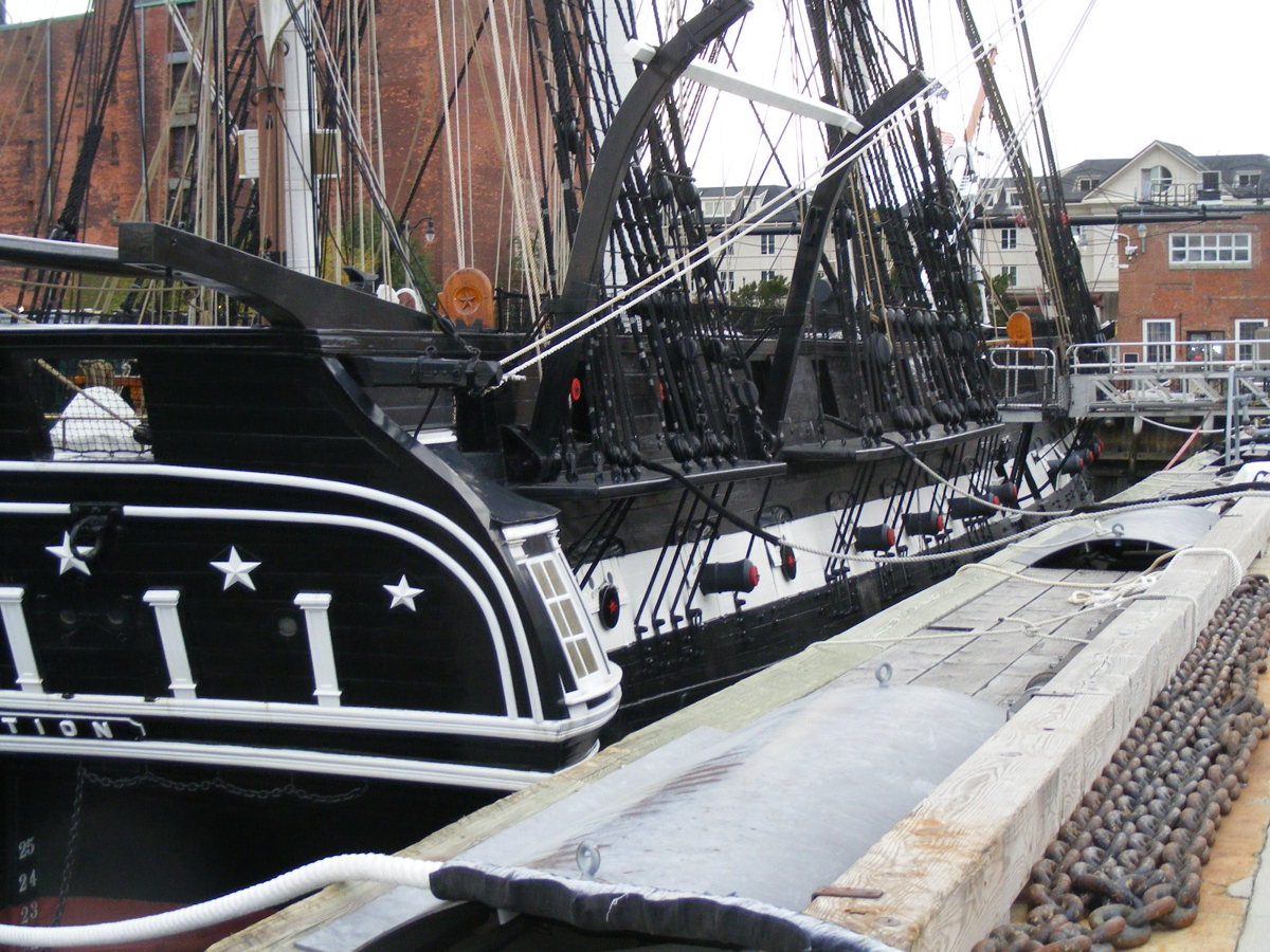
The main thing that gave this ship her speed is the number of sails that
can be deployed. Every cross arm can have a sail attached.
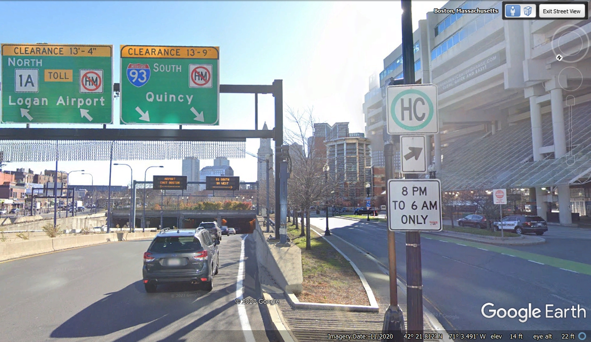
It is less than one mile from the parking garage near the Charlestown Navy
Yard to the entrance to the "BIG DIG" tunnel for Interstate 93.
The GPS signal was lost at 5:03 PM as we entered the tunnel. For those of
you who do not recognize the HC sign, it is about hazardous cargo must use
surface streets from 8 PM to 6 AM only. Hazardous cargo is prohibited from
tunnels most everywhere in the USA.
| RETURN TO 2021 VACATION MENU |