Arizona Trip for my day job July 6-9, 2016 · · PAGE 1.
July 6, 2016: This should have been a perfectly easy Wednesday trip to Arizona. The flight from Melbourne to Atlanta was to depart at 2:08 PM with an expected arrival in Atlanta at 3:50 PM for an easy connection. I would have time for a sit-down dinner in the "B concourse" before a scheduled departure for Tucson at 7:30 PM Eastern Time. That flight to Tucson was scheduled to arrive there at 8:24 PM MST or 11:24 PM Eastern Time. I would pick up a rental car and drive the 70 miles to Sierra Vista, Arizona just across the road from Fort Huachuca. I would be getting to sleep around my usual time of 1 AM Eastern Time.
Here is what really happened: The WEATHER across a lot of the country was NOT GOOD. Needless to say, when Atlanta has problems many Delta Airlines flights have a problem. Our flight from Melbourne was delayed waiting for the arrival of an airplane from Atlanta. It was after 4 PM when the airplane was ready for departure. I noticed when we reached the gate in Atlanta, the time was about 5:50 PM and I still had time for a dinner before beginning the long flight to Arizona. That dinner was not a sit-down event to be served in concourse B. I walked and used the moving sidewalk in the tunnel from concourse C to B and went up to the Chili's restaurant to see a long line waiting to get in, much less to be served. I moved on with another walk and ride to concourse A and went up to the food court where I got a sandwich from the Boar's Head deli. I had time to relax for a while and eat slowly for a change. I even had time for a conversation with another traveler sitting at the small table next to me.
With the evening meal consumed and my RED CUP full of ICE and water, I headed for my gate in the Atlanta Terminal Building. When I arrived at the gate, the departure time was posted as 7:55 PM. I presumed the weather was the cause as there was no aircraft at the gate. The plane finally arrived and everyone got off. The flight crew for our flight to Tucson was present, all except for the pilot and co-pilot. Their inbound flight to Atlanta was delayed. The end result of this, those two pilots "timed-out" for the length of their duty day. We had no one to FLY the airplane. The gate agent made the usual calls to dispatch and the on-call pilots should be here to get us on our way later, but at least it would be tonight as this was the last flight of the day going to the Tucson airport. The co-pilot arrived and did his usual pre-flight inspection of the airplane. The gate agent got all of us on board and all our baggage was loaded on to the airplane. Then we waited, and waited, and waited.
One lady from South Carolina had her carry-on bag with her and told her story of coming to Atlanta two days ago to catch a flight to Tucson and never made it due to the bad weather, cancelled flights, stand-by seats not available, etc. She was not having a good day. This was Wednesday evening and her return flight is the same one that I will take on Saturday morning, July 9 at 6 AM from Tucson. She got off the airplane to return to South Carolina as she would not have had the time she wanted to spend with her good friend in Tucson.
At 10:20 PM Eastern Time, the captain arrived and apologized for the delayed departure. The gate agent told us the guy was not answering his phone for two hours as this is his home base. When the plane pushed back from the gate, we were three hours late. I set my watch back by three hours to the time in Arizona. They do not observe daylight time in Arizona. I tried to nap during the flight. I did get some "rest time" before the descent into the Tucson area. I got off the airplane at 11:25 PM local time that night. The Avis rental car booth was still open when I showed up with my checked bag and my carry-on computer bag that was stuffed with some of my demo equipment for the seminar I an teaching on Thursday at Fort Huachuca.
The drive to Sierra Vista on Interstate 10 and Arizona route 90 (old US 90) was uneventful in the dark of the moon crossing the desert landscape. When I was about 20 miles north of the town, the city lights came into view when I was on higher ground heading south. I would get to see the route the next day on the way back to Tucson. I arrived at my hotel after 1 AM. The night clerk had been waiting for me. I went to bed as soon as I could get my bag unpacked. I would be up at 4:45 AM to get cleaned up and ready for breakfast when they start serving at 5:30 AM. I would need to be finished and do some email before check out with the same night clerk at the front desk.
July 7, 2016: Thursday morning I stopped at the security office at the main gate of Fort Huachuca at 7:07 AM local time Wednesday morning (verified by GPS track). I received a temporary I.D. card with my photo on it, and was at the designated building at 7:30 AM to meet my contact. We went upstairs to a class room where I set up all my fiber optic demo equipment and my computer. The hands-on fiber optic and CATV basic training class started around 8 AM with live fiber optic demonstrations, a computer slide show, photos, and white board drawings to explain some details that were not in my PowerPoint slides. I worked through lunch to be sure I could get in all the details needed and answer some final questions when the class returned. We had no live internet to provide online content. I did give out my business card with the company web site on it to allow the students to see product data sheets for the equipment I used in the classroom. It was all over by 3 PM local time. I packed up all my stuff and headed for Tucson.
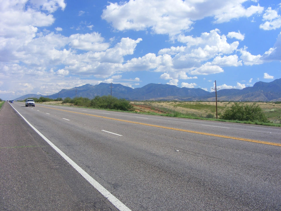
When I started north at 3:25 PM local time going back to Tucson, I made it a point
to pull off the road near the airport to take some photos at 3:41 PM. Those white
buildings are part of the local airport for military and civil aviation use just
north of Fort Huachuca. I wanted to make a record of the surroundings as I
am not likely to come this way again. Rugged and mostly BARE mountains are
normal around here. The mountains are all lush with green trees where I grew up in
North Georgia.
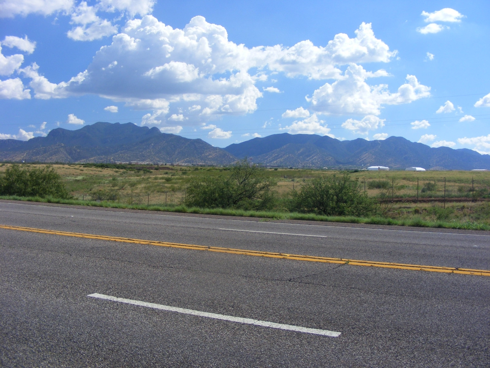
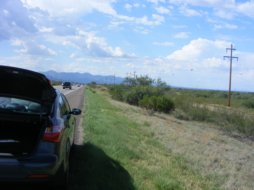
Here is the view looking south back toward town on this stretch of
four-lane road that is NOT a divided highway.
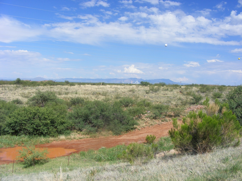
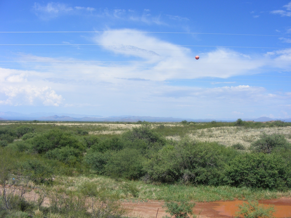
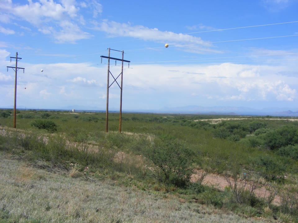
I looked East away from the airport to see the mountains across the valley
and of course, the balls on the power lines to warn low flying aircraft of
the hazard here. Several images were taken at this one location to
give a panoramic view. Take notice of the puddle of water in the ditch.
The lady at the Avis counter warned me about this time of year being their
monsoon season. I had been watching the national weather about flooding in
parts of Arizona. I mentioned to her that I have seen signs in Texas indicating
possible water DEPTH by the side of the road where flooding in the
rainy season is a problem.
The rental car from Avis was a Kia Forte and the air conditioner worked
very well. When I passed this way last night, the car indicated the outside
temperature was 69 degrees. This afternoon it was in the upper 90's.
I spent about four minutes taking these photos in the heat of the day and was
glad to be back inside the cool car.
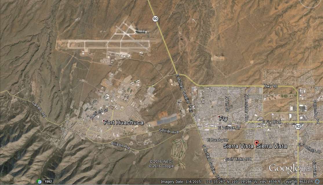
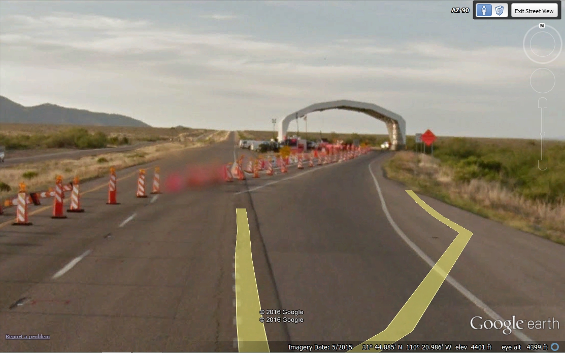
This Google Earth view looking down on the area puts things in
perspective. This is a high desert area of Arizona. The airport is
about 17 miles north of the U.S. / Mexico border.
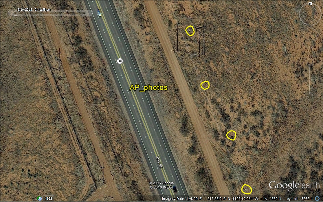
If you use Google Earth to look at this area close up just off the end of the runway, you can see the colored balls on the power lines across highway 90. I put my cursor on the spot where I parked the car to show the ground elevation there is 4,569 feet above sea level. I circled the balls on the power lines which are visible using Google Earth. The image below would be what you could see if you were flying over at 693 feet above the ground. I used the label "AP_photos" to indicate this is the approach area to the airport runway.
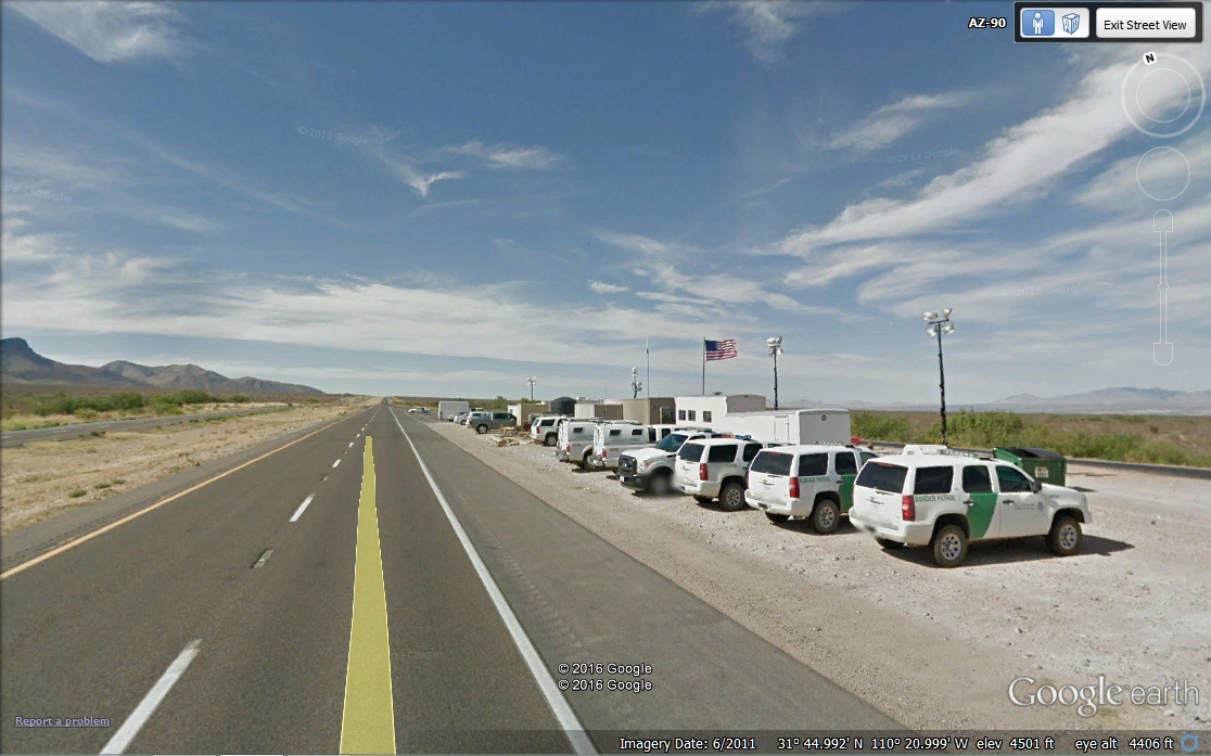
Less than 12 miles north of the airport is this U.S. Border Patrol check
point. The shadows in this Google Earth image show a late afternoon
"open" time for the check point.
The sun shelter was added in 2012 based on earlier Google Earth
images. This whole area was brightly lighted the night I came by here
heading south. All northbound traffic had to stop for inspection.
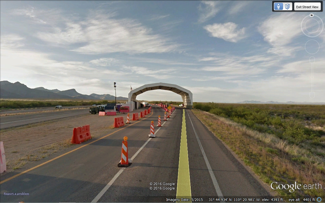
I passed by at 4 PM heading north at this border patrol location, the
orange cones were off the highway and all traffic was passing by at the normal
speed limit. This 2011 image shows the shelter has not yet been installed,
and the shadows indicate the time is just past local noon.
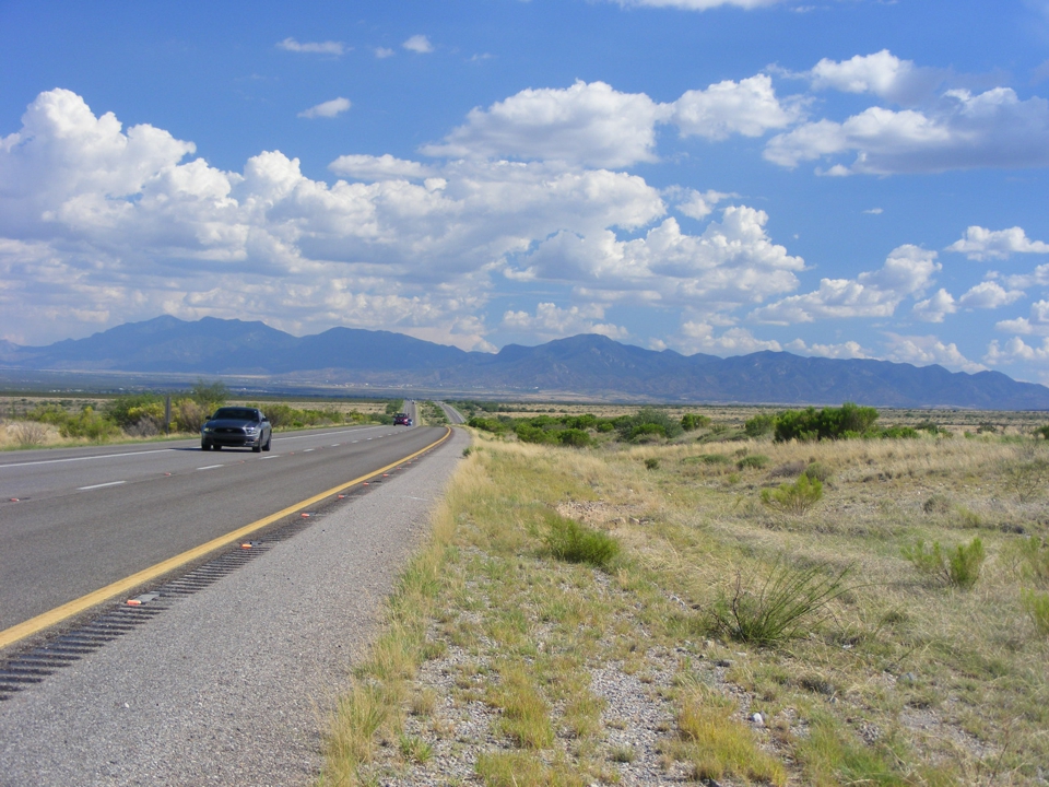
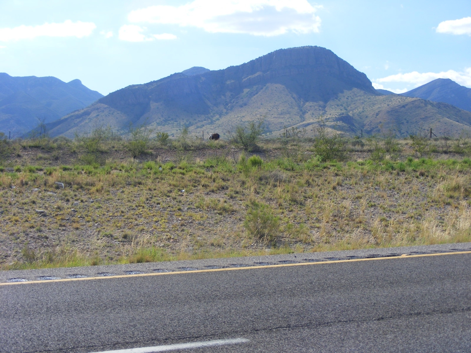
About 15 miles north of the airport, I found this place on route 90 which
seemed to match the view of the city lights from Wednesday night. I
stepped out of the car and looked back to the south. I decided I could get a
better photo if I moved across the pavement to the edge of the median of the
divided highway here. There was not much traffic to worry about. I
stepped off the asphalt of the northbound lanes and got this picture using my
polarizing filter to accent the blue sky and minimize the glare from the highway
oil sheen. I stood here to show the gentle curve in the road and
line up with the yellow line of the pavement warning track for the median.
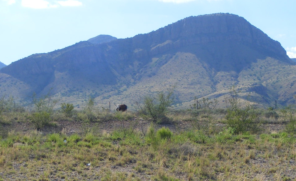
I walked back to the the cool air-conditioned car
and examined the photo above. As you can see, I was happy with what I could
see on the small LCD screen on the back of the camera. I started to put on
my seat belt to get back on the road when I noticed a cow across the freeway up
near the fence looking my way. I rolled down the window and took this
photo looking west. The sun was still high enough in the sky that it was
not a problem for the camera. Since I am sitting in the car with the
window down, I estimate my camera is not more than 4 or 5 feet above the
northbound part of the highway. Take notice that you cannot SEE the
asphalt pavement of the southbound lanes in this photo.
When I got back home to Florida and put these photos on the computer, I
cropped the image of the cow from the center of the bigger image above and this
is the result. If you are wondering how I could tell that I was 15 miles
north of the airport, the answer is in this image. What I did was to drive
this part of route 90 using the Google Earth camera car and compare my images
with theirs. Look above the cow and the first ridge to see the second peak
that has more of a blue tint. That peak is the top of another ridge behind
the closer one.
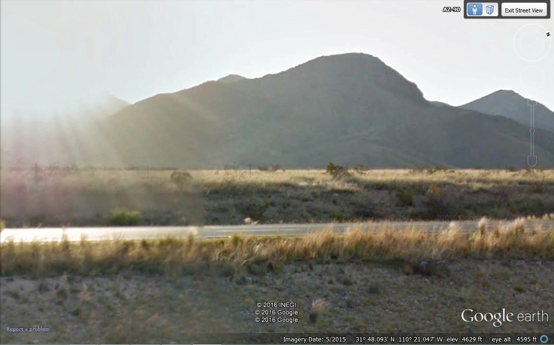
This is the Google Earth camera car image that convinced me I had found
the spot. Of course, I could also look at my GPS ground track.
Either way this is the spot as seen by Google Earth. With the Google Earth
camera about 10 feet above the roadway, it can see the asphalt in the
southbound lanes. Their camera vehicle passed this way later in the day compared
to the time I passed by. The glare from the sun almost washed out the
image below made in May 2015.
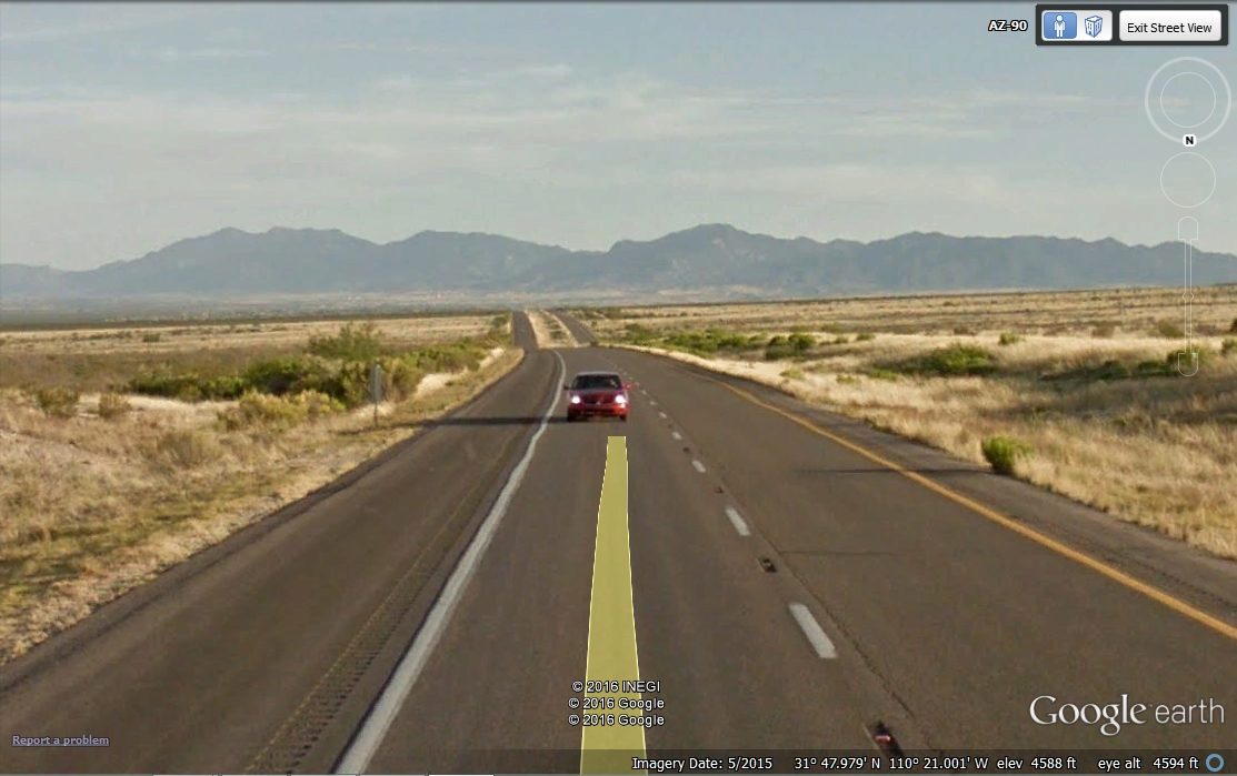
And here is the Google Earth view looking south from the northbound lanes
of route 90. Their vehicle is in motion in the slow lane as you can see by
their yellow ground track marker line in the image.
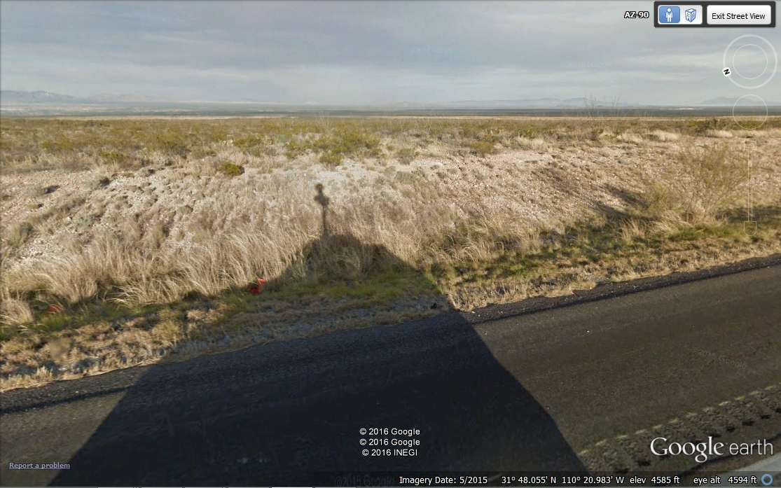
Here is a sight you may not have seen before, the shadow of the Google
Earth Camera Car. The cameras that take all their photos are at the top of
that "stalk" that is above the roof of the car. From images I
have seen when they pass cars on the freeways, the camera appears to be about 10
feet above the roadway.
Here is a reflection of a Google camera car that tours around in Florida
near where I live. This one is a car painted Green and White. The
camera stand is secured to the roof of the car and the camera "BALL"
is at the top. All the image files they collect with this thing are
stamped with GPS coordinates, date, and time.
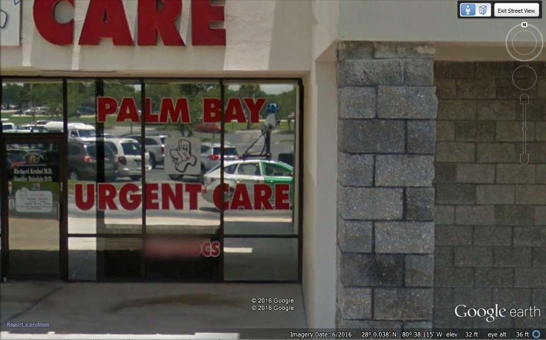
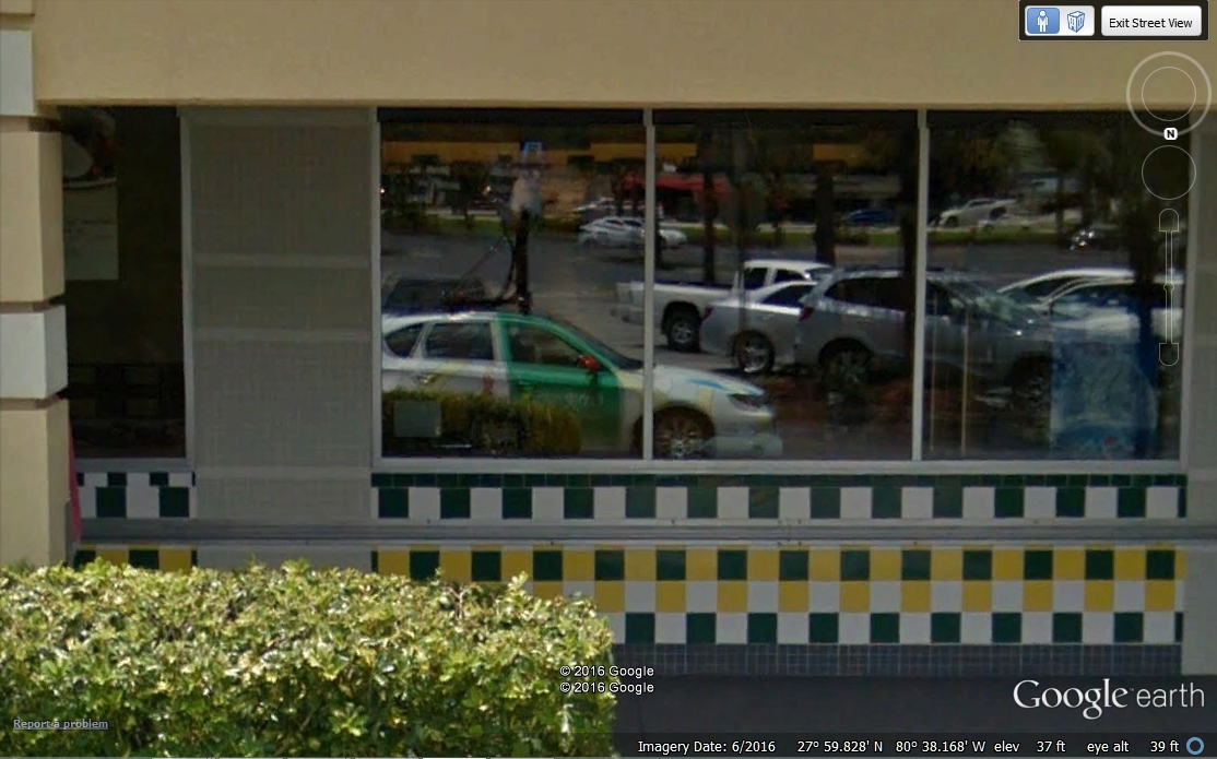
Here is the same car reflected from a store window on the other side of
Malabar Road here in Palm Bay, Florida.
That is enough about how Google Earth works. I did not stop to take any more photos on the way to Tucson. I reached my hotel at about 5:15 PM. I went to a nearby restaurant on the other side of the exit from Interstate 10 to have dinner at 6:30 PM. I had a relaxing meal in the cool environment. I left there at 7;20 PM and went to the office location of Graybar Electric which was nearby. I found the best back street to avoid daytime traffic. I chose this exit for my hotel since it is close to my Friday morning meeting location.
| Tucson 2016 Page 2 | Back to Other Travels Menu | RETURN to MAIN MEN |